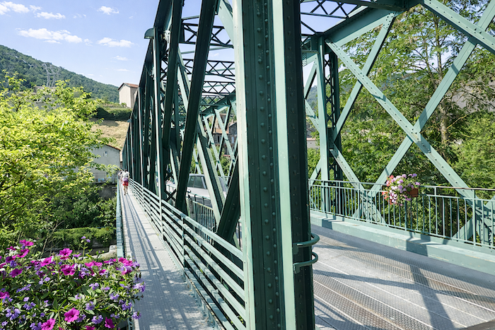
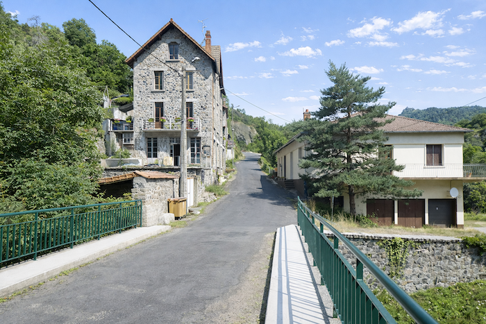
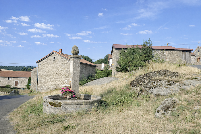
Under the Eiffel Bridge flows the Allier River
DIDIER HEUMANN, MILENA DALLA PIAZZA, ANDREAS PAPASAVVAS
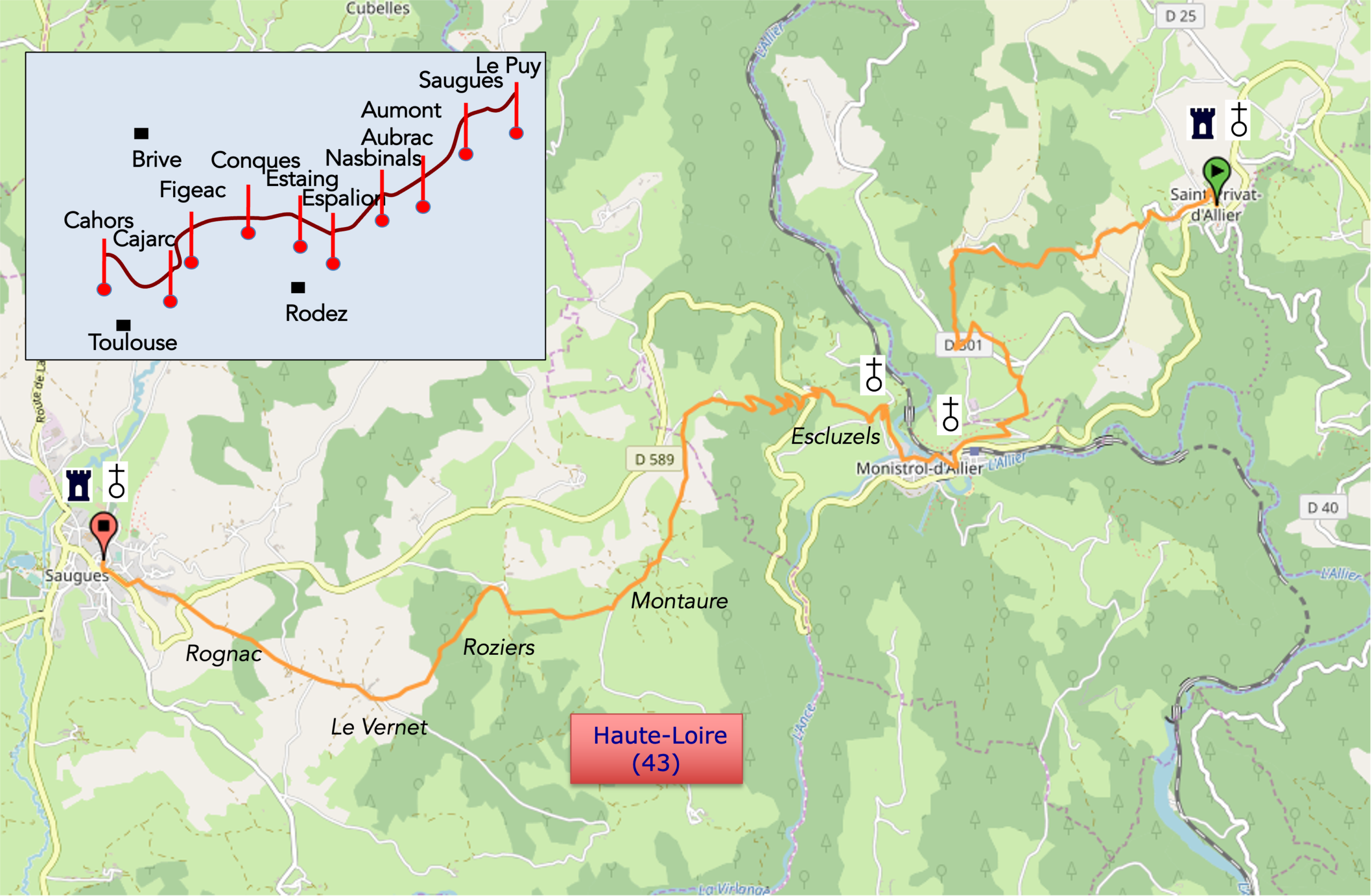
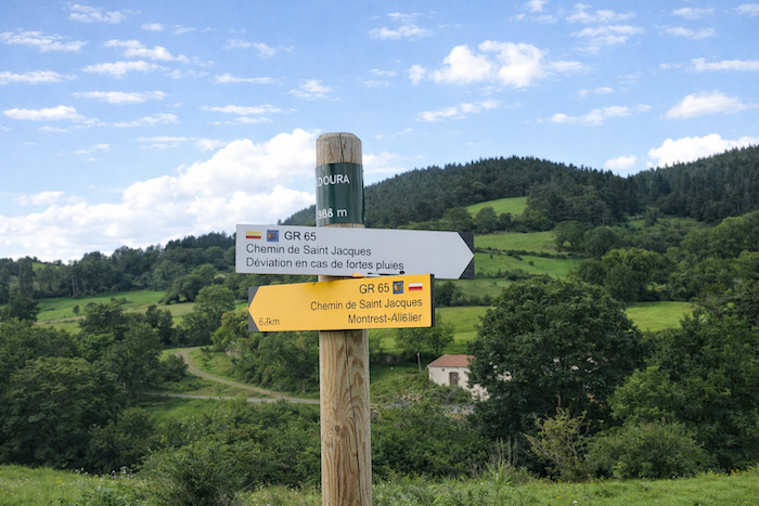
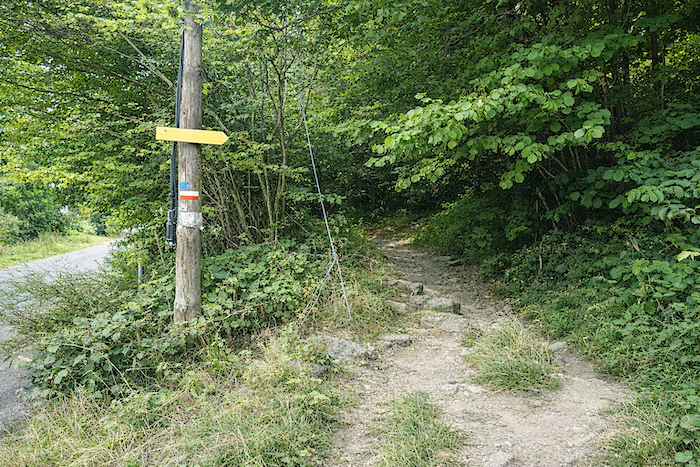
We divided the course into several sections to make it easier to see. For each section, the maps show the course, the slopes found on the course, and the state of the roads. The courses were drawn on the “Wikilocs” platform. Today, it is no longer necessary to walk around with detailed maps in your pocket or bag. If you have a mobile phone or tablet, you can easily follow routes live.
For this stage, here is the link:
https://fr.wikiloc.com/itineraires-randonnee/de-st-privat-dallier-a-saugues-par-le-gr65-29678071
| Not all pilgrims are necessarily comfortable using GPS devices or navigating with a smartphone, especially since there are still many areas without Internet access. That is why, to make your journey easier, a book dedicated to the Via Podiensis from Le Puy-en-Velay to Cahors is available on Amazon. Much more than a simple practical guide, this book accompanies you step by step, kilometer after kilometer, providing all the information you need for smooth planning and avoiding unpleasant surprises. Beyond its practical advice, it immerses you in the enchanting atmosphere of the Camino, capturing the beauty of the landscapes, the majesty of the trees, and the very essence of this spiritual adventure. Only the pictures are missing, everything else is there to transport you.
In addition, we have also published a second book which, with slightly fewer details but all the essential information, covers the entire route from Le Puy-en-Velay to Saint-Jean-Pied-de-Port. The choice of your journey is yours.
|
 |
 |
If you only want to consult lodging of the stage, go directly to the bottom of the page.
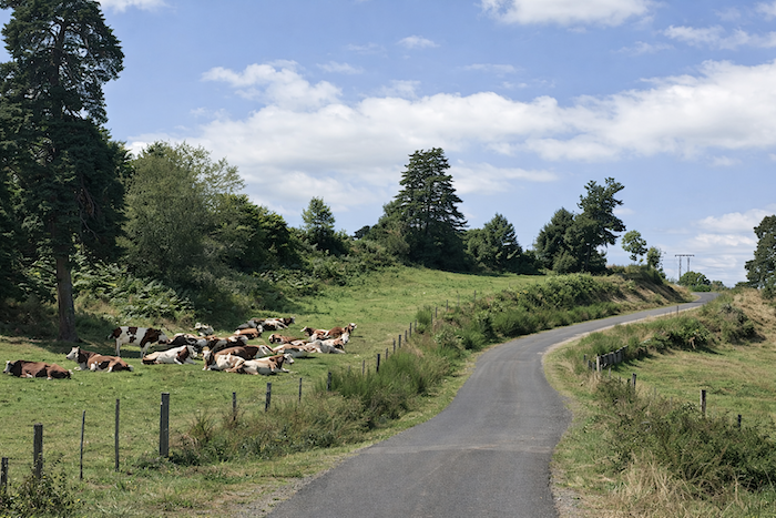
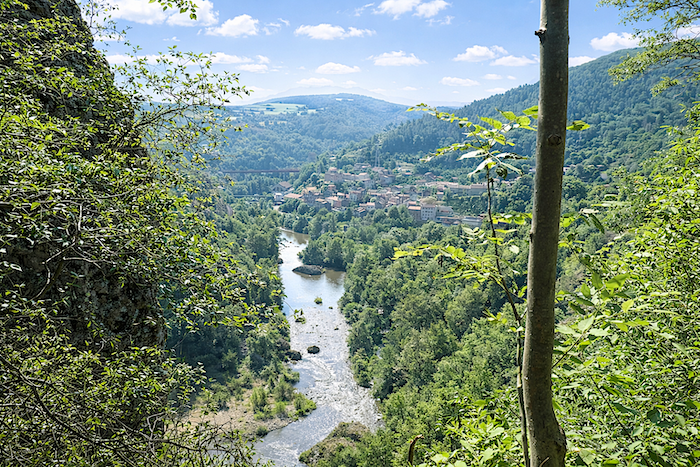
The Gorges of the Allier form the natural boundary between the dark basalt colors of the Devès to the east and the pale granite shades of the Margeride to the west. Today you are in the Haut-Allier, a land of transition between the mountains of the Velay and the Margeride. The Allier is a wild river whose gorges give the landscape a character both magnificent and vertiginous. The valley of the Haut-Allier unfolds through landscapes deeply carved by dramatic relief. Between the Loire and the Allier, on the slopes of Mont Devès, volcanoes spread their lava flows, altering the riverbeds. They shaped the landscape, sometimes creating deep cuts and very narrow valley bottoms, as at Monistrol-d’Allier. The Allier carved its way through the granite of the Margeride, among the oldest rocks of the Massif Central. The complex meanders of the Haut-Allier are the result of the river’s efforts to bypass the obstacles created by the volcanic flows of the Devès that blocked its bed. Thick forests of conifers and deciduous trees have grown on the less exposed slopes of the valleys. Scots pine and common oak are most common here, with willows and alders sometimes growing near the rivers. In places, the Allier is almost inaccessible. On the opposite sides of the valleys, meadows and heathlands of heather and broom cover the basalt cliffs and terraces, forming suspended balconies above the river where people were able to settle. The villages, small and isolated, seem to hesitate between dull basalt and shining granite. The railway also left its mark on the valley. The Paris to Marseille train, named the Cévenol in 1955, crosses Haute-Loire through the Gorges of the Allier.
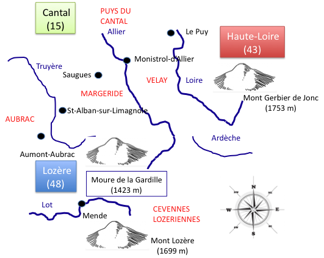
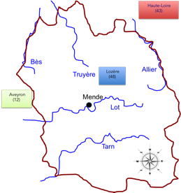
Before setting out on the road, a few words about geography. Are rivers not an integral part of the landscape encountered along the route? As we will follow or cross many of them, let us look a little more closely. From this region where the granite of the Massif Central confronts the basalt flows once vomited by volcanoes, several great French rivers were born. It is rather curious to note that some of the largest rivers in France have their sources in a region of modest mountains. The Loire, the Lot, the Allier and the Truyère all rise south of the Velay and in the Cévennes of Lozère near Mende. The Allier, where we are today, rises at the Moure de la Gardille, then flows northward through Brioude, Issoire, Clermont-Ferrand, Moulins and Vichy before joining the Loire near Nevers. It should also be noted that this region forms the watershed divide between the Atlantic and the Mediterranean. In fact, only the Ardèche reaches the Mediterranean basin. The Lot, Tarn and Allier, together with smaller rivers such as the Bès and the Truyère, all rise in Lozère. Only the Loire has its source slightly farther east.
|
.
|
 |
 |
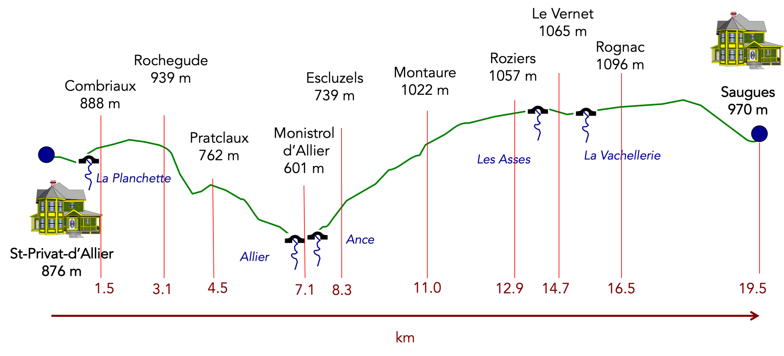
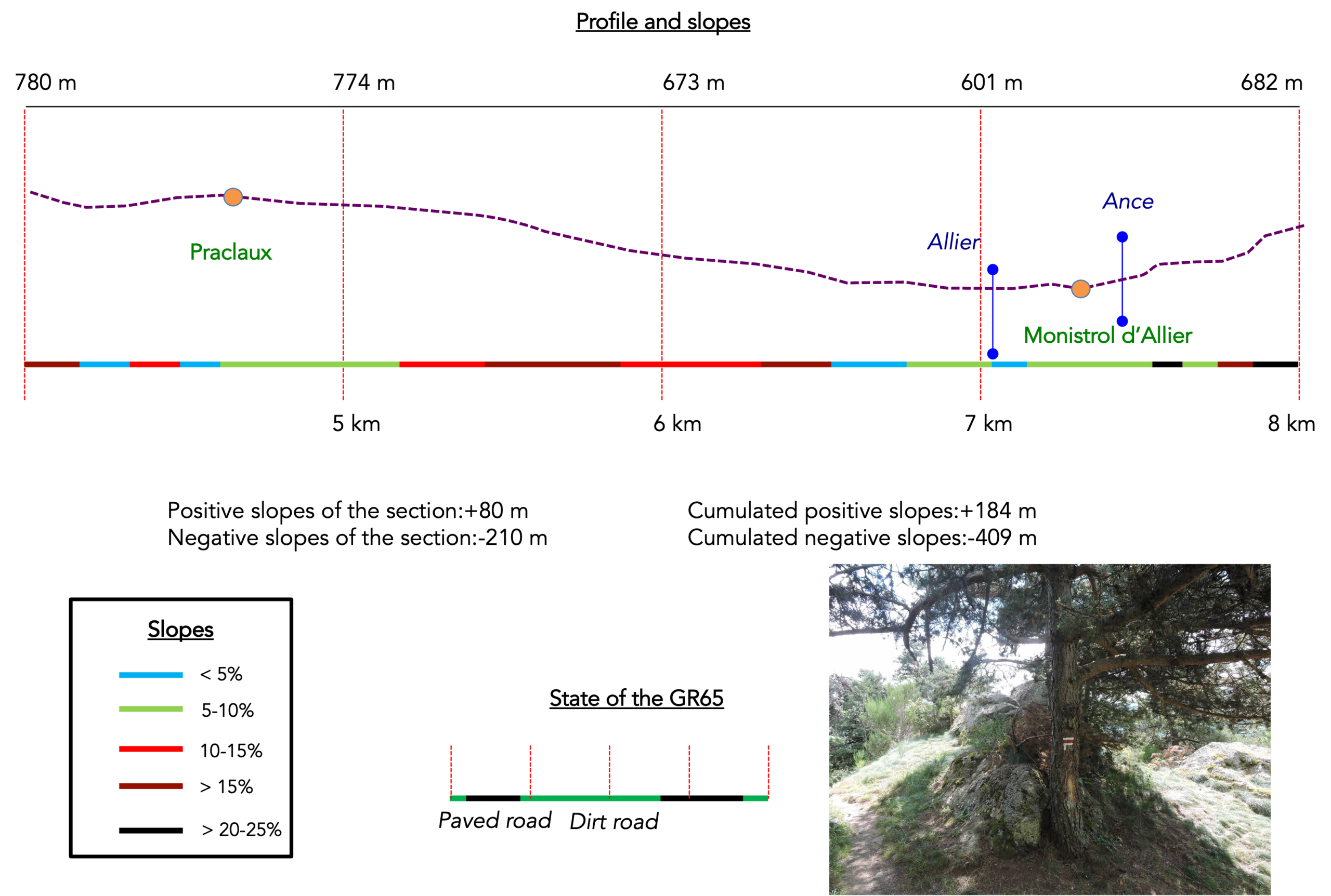
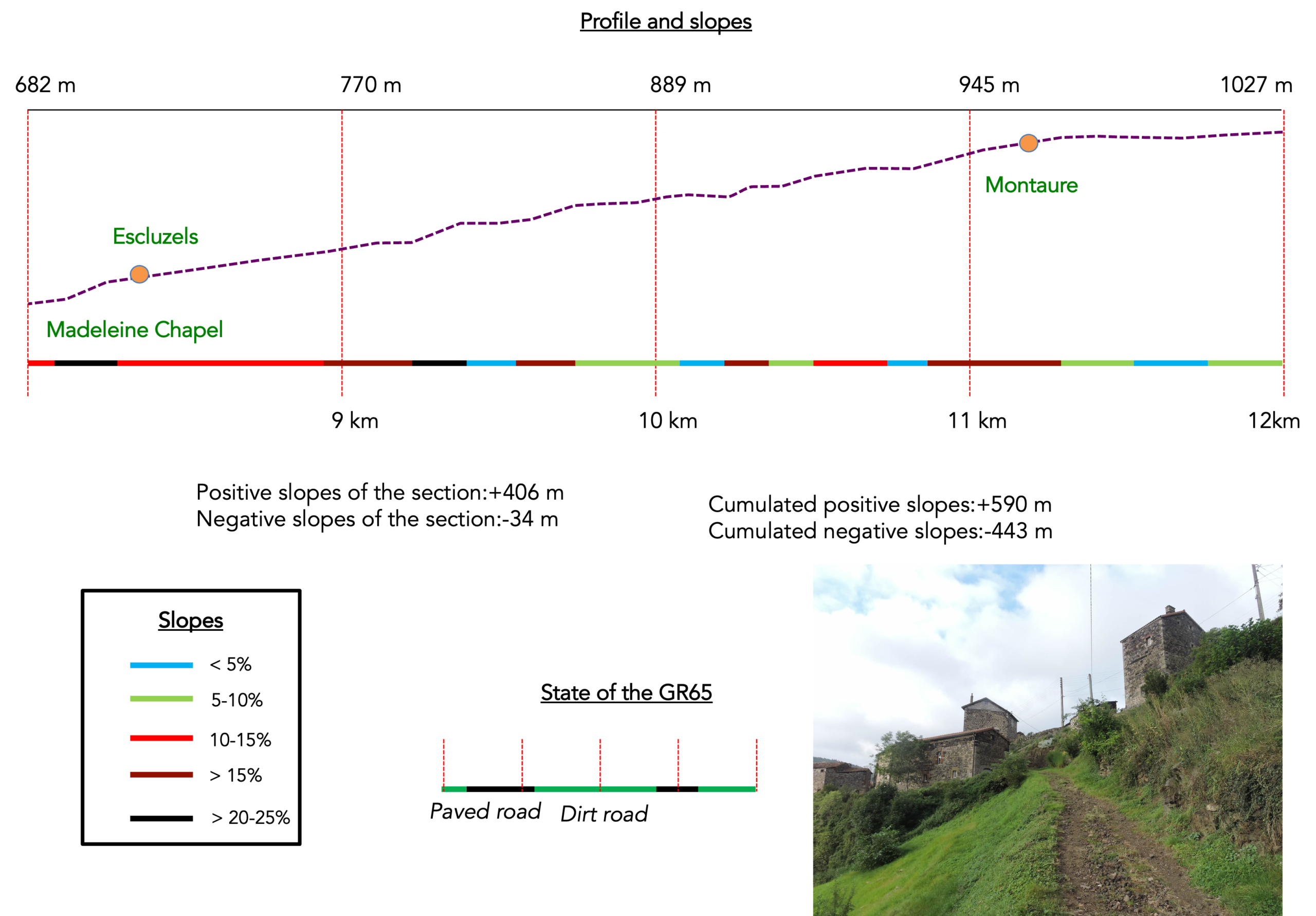
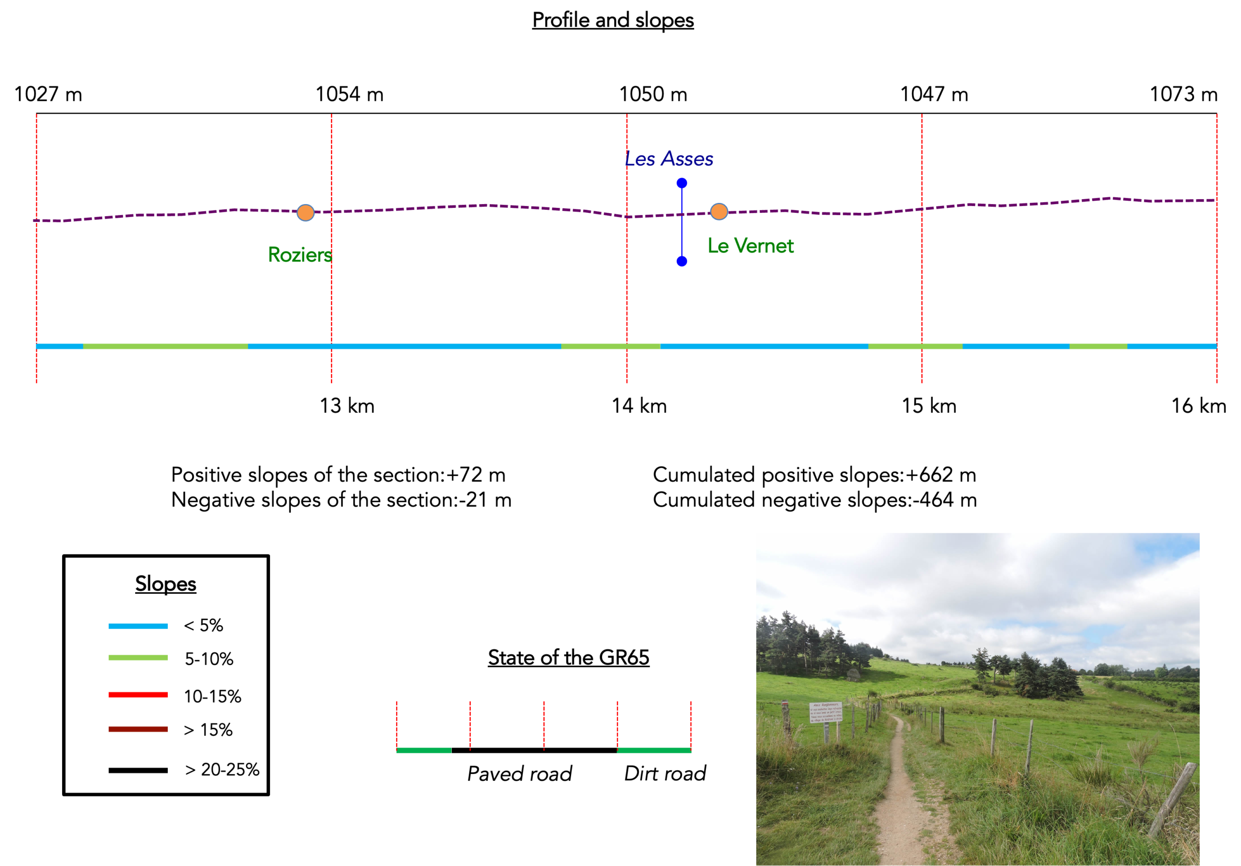
Difficulty level: The stage is short, yet demanding, with large slope variations (+678 meters/-606 meters) for a short track. The journey starts with a slight climb to Rochegude village. Below you can look out over the impressive fault of Haut-Allier deep valley. Beyond Rochegude, the track slopes steeply down on rocks and roots to Monistrol, where it crosses the Allier River. While sloping down to Monistrol, you cannot help seeing in front of you Escluzels overhanging the cliff. And it’s true! Some argue that the short climb to get there is one of the most challenging efforts of Camino de Santiago. Beyond Escluzels, the GR65 climbs to reach Montaure. Fairly soon, it flattens to enter Gevaudan, the “country of mysteries”, a Margeride region, long haunted by the terrible “Beast of Gevaudan”.
State of the GR65: Passages on paved road or hiking trails are broadly similar:
- Paved roads: 10.0 km
- Dirt roads: 9.2 km
Sometimes, for reasons of logistics or housing possibilities, these stages mix routes operated on different days, having passed several times on Via Podiensis. From then on, the skies, the rain, or the seasons can vary. But, generally this is not the case, and in fact this does not change the description of the course.
It is very difficult to specify with certainty the incline of the slopes, whatever the system you use.
For « real slopes », reread the mileage manual on the home page.

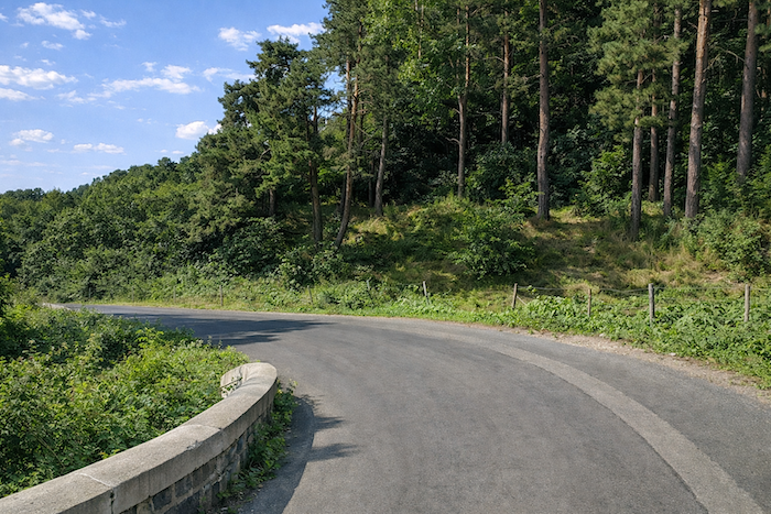
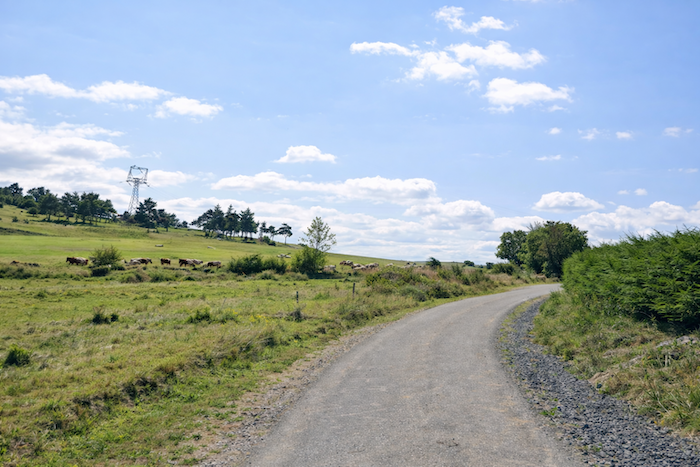
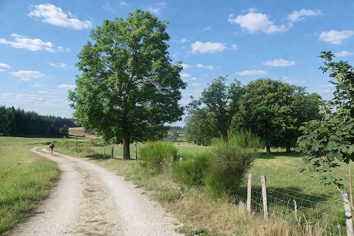
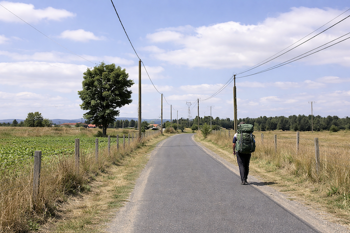
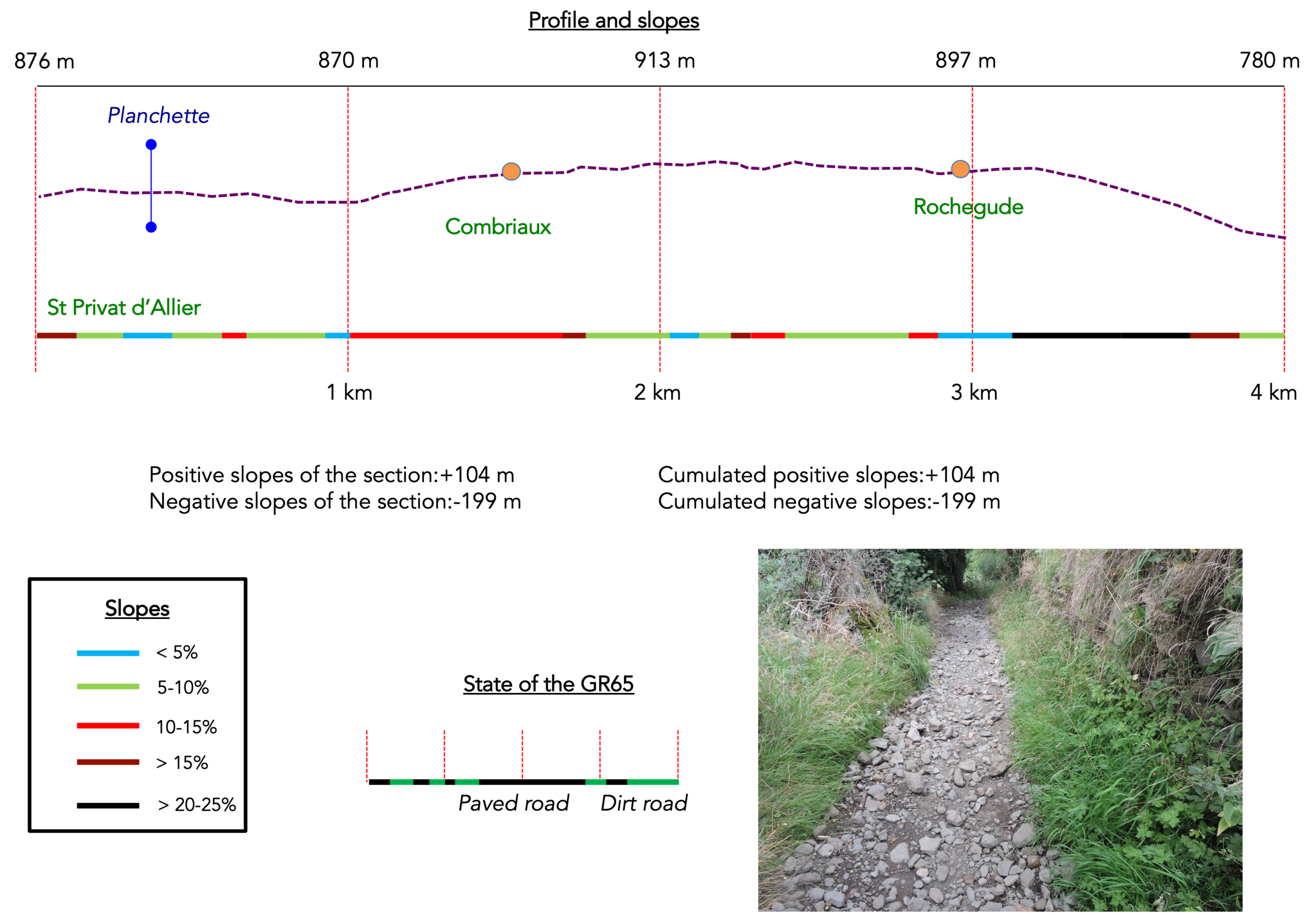
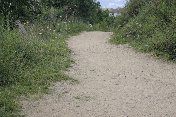
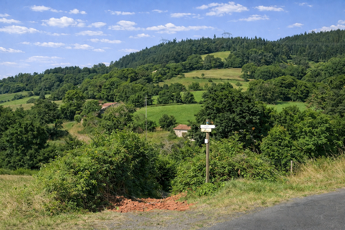
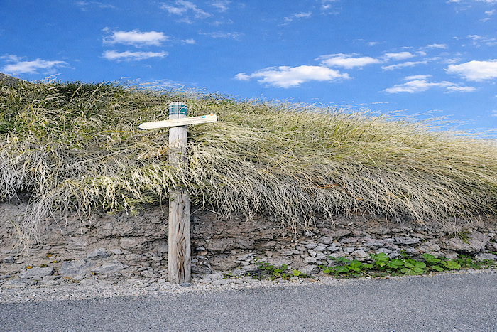
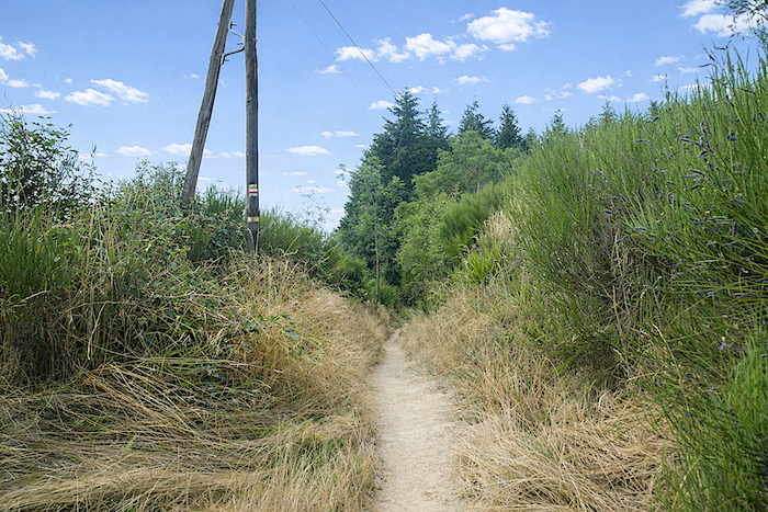
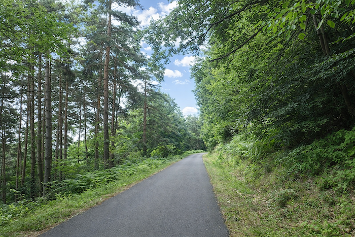
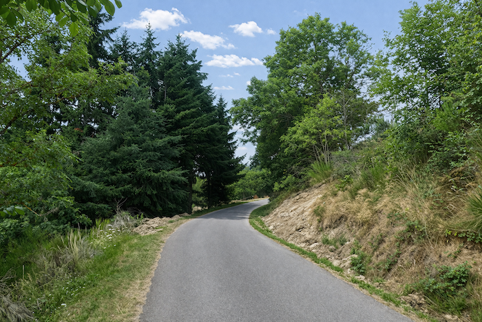
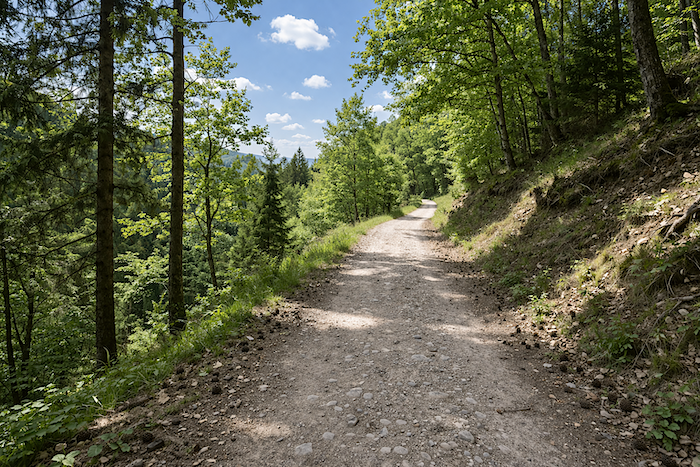
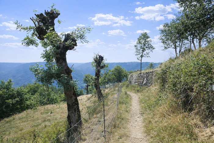
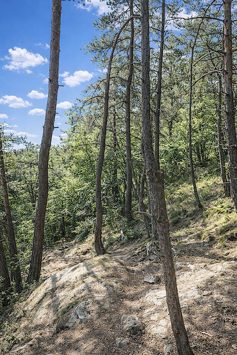
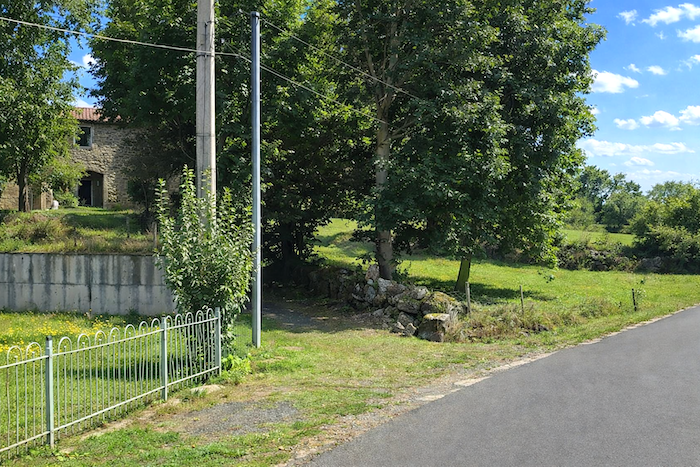
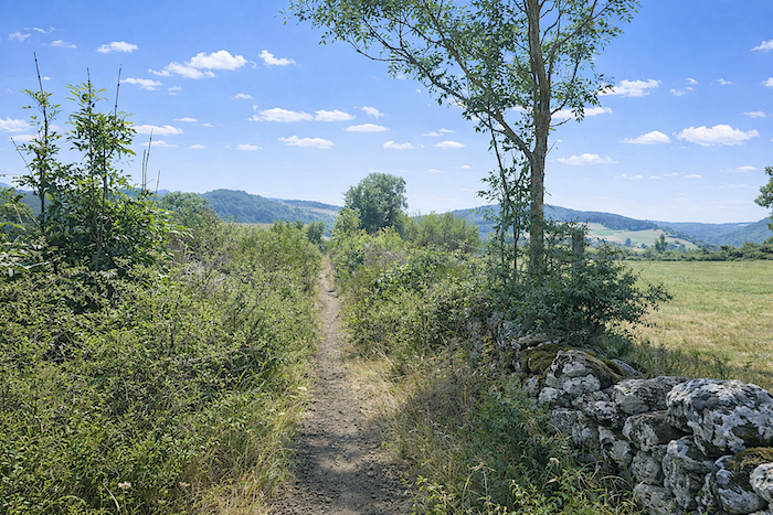
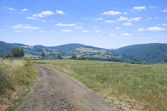
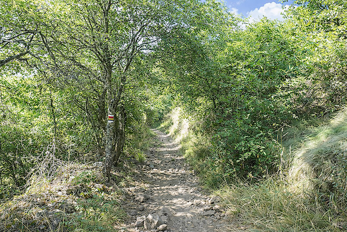
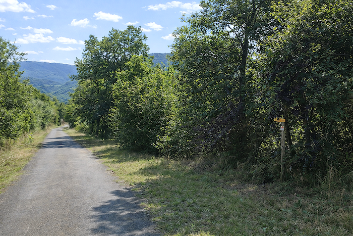
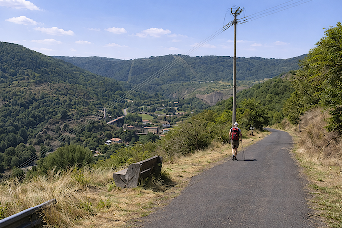
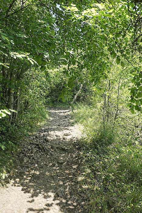
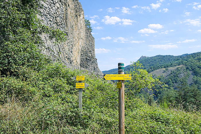
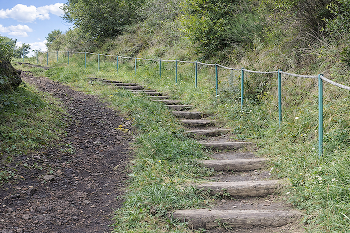
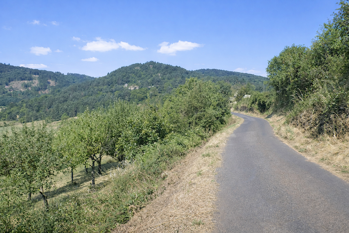
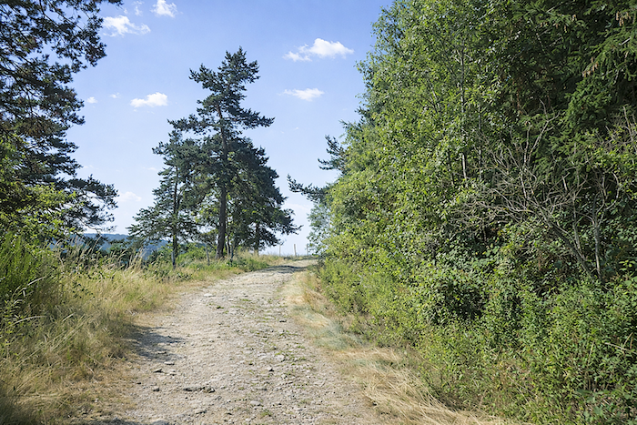
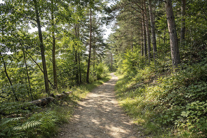
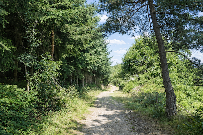
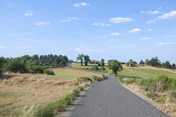
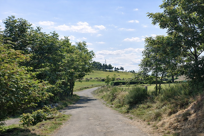
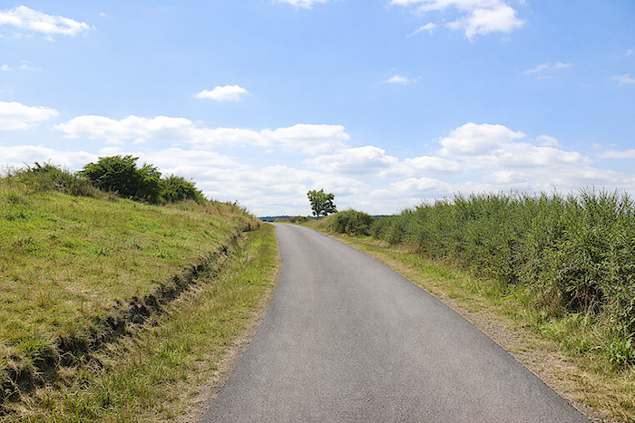
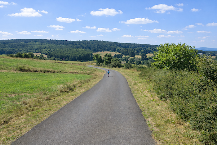
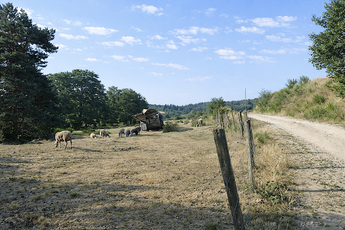
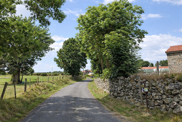
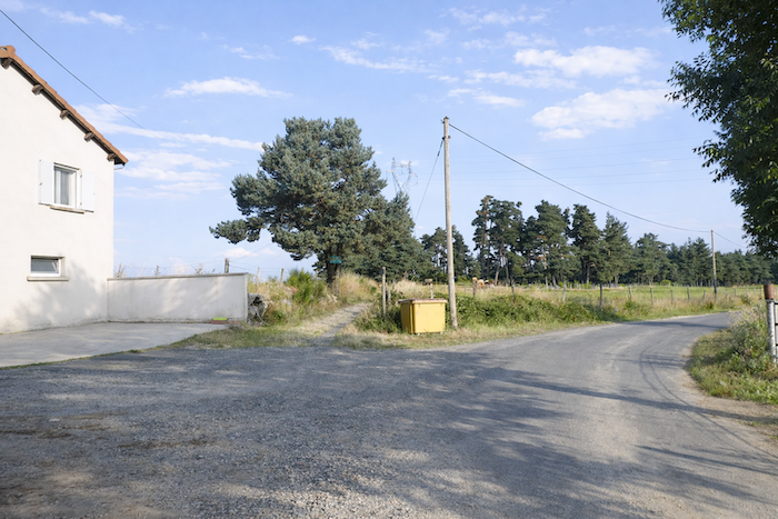
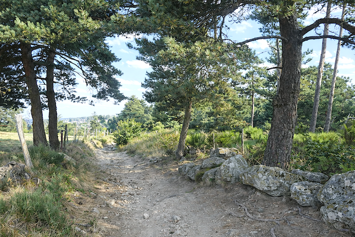
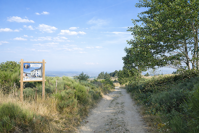
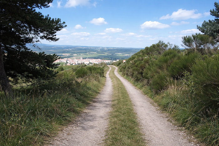
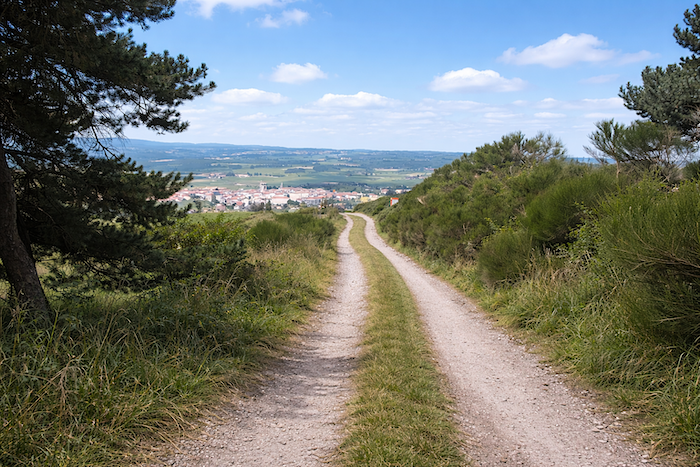
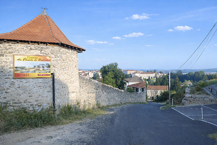
Section 1: Along the hillside before dropping down to the Allier River
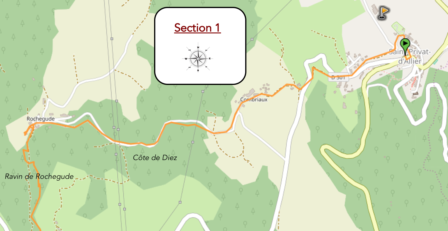
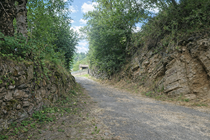
General overview of the route’s challenges: dthere are slopes everywhere here, first above St Privat, then intermittently on the way to Rochegude. This is where the severe descent toward Pratclaux begins.
|
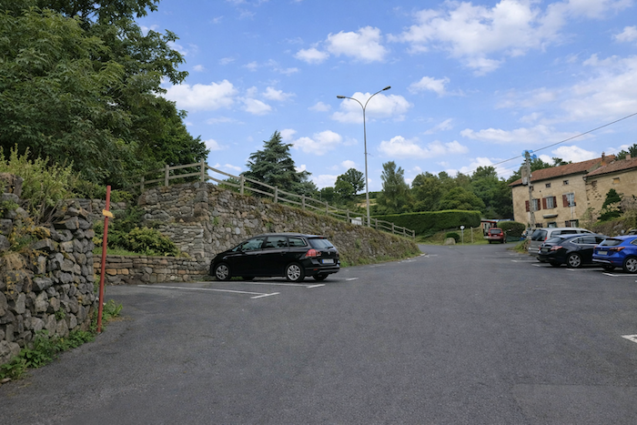
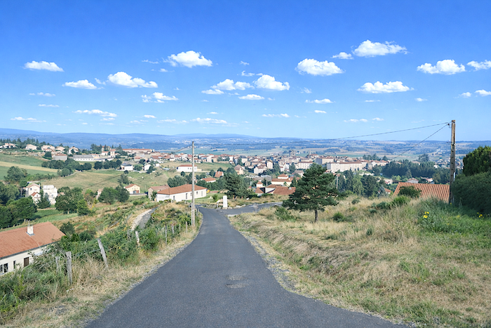
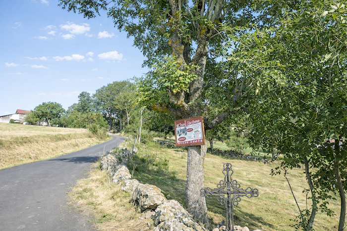
The GR65 leaves St Privat-d’Allier by climbing above the village, as though offering one final salute to the hilltop settlement and to the exuberant opening of the Upper Allier valley spreading out below.
|
 |
 |
|
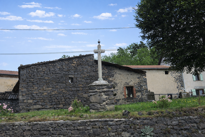
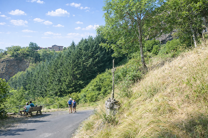
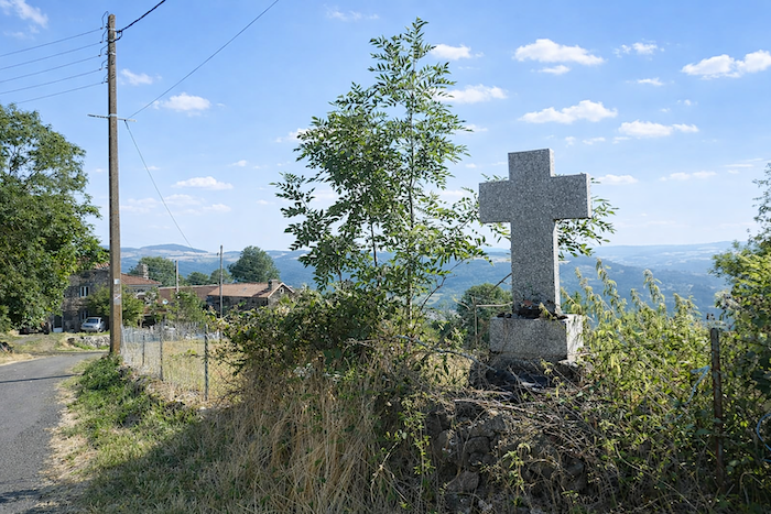
From the Calvary, the sweeping view over the village and the Allier valley far beneath is truly worth the detour: the rooftops cling to the hillside, the gorges open like an ancient wound, and suddenly the eye takes in the full depth of the landscape.
|
 |
 |
|
Yet, truth be told, this detour feels slightly like a mischievous trick. Barely have you reached the Calvary before you must almost immediately descend again to rejoin the D301 road, which leaves the village far more gently.
|
 |
 |
|
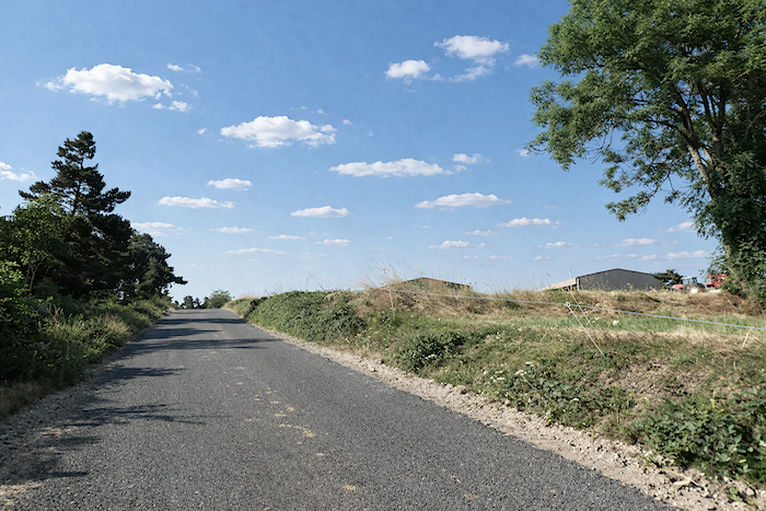
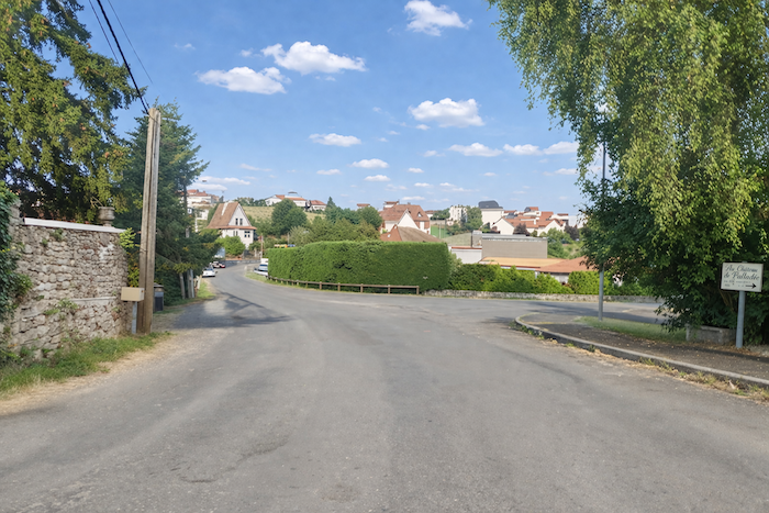
So, to make life easier for yourself and avoid a punishing climb first thing in the morning, you can simply leave the village by the road leading to the Chapel of Rochegude and rejoin the GR65 route farther on. This choice changes nothing essential: little by little, you are already leaving the Velay behind and entering another world, that of the Margeride and the Gévaudan, lands that are broader, harsher, and almost more secretive.
|
 |
 |
| The walk is no gentler for all that. One must get used to it: the Camino de Santiago thrives on contrasts, on repeated effort, on descents that immediately demand their revenge. A few hundred meters farther on, the same refrain returns. On leaving St Privat-d’Allier, the GR65 leaves the tarmac and plunges steeply down a rough path strewn with large stones, treacherously slippery when it rains. All this simply to dip your feet into the modest Planchette stream, before climbing straight back up a steep slope to regain the road. The Camino de Santiago sometimes has a taste for practical jokes. |
 |
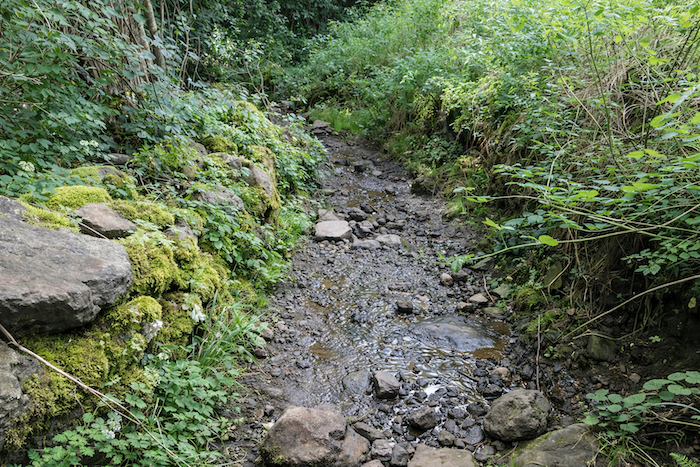 |
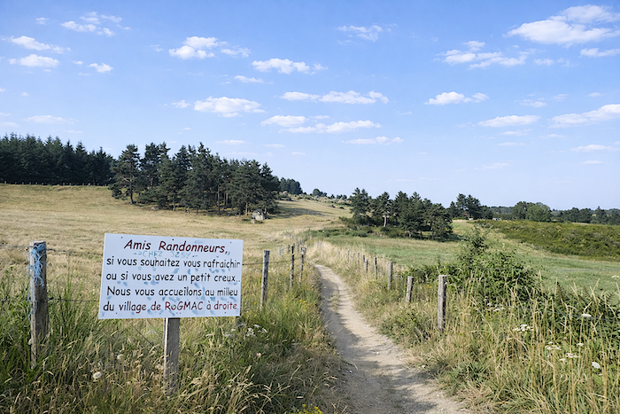
| A sign even warns you that it is wiser to avoid this little fantasy in wet weather. Here, the advice deserves to be followed without hesitation: take the road. Your route is not an act of bravery, and wisdom is also part of the journey. |
 |
 |
| Whether you chose the descent to the stream or the safer road, the GR65 eventually leaves the little paved lane anyway and climbs once more on a sustained slope toward Combriaux. Already, the rhythm of walking falls back into that old dialogue between fatigue, patience and horizon. |
 |
 |
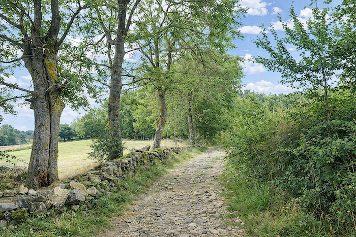
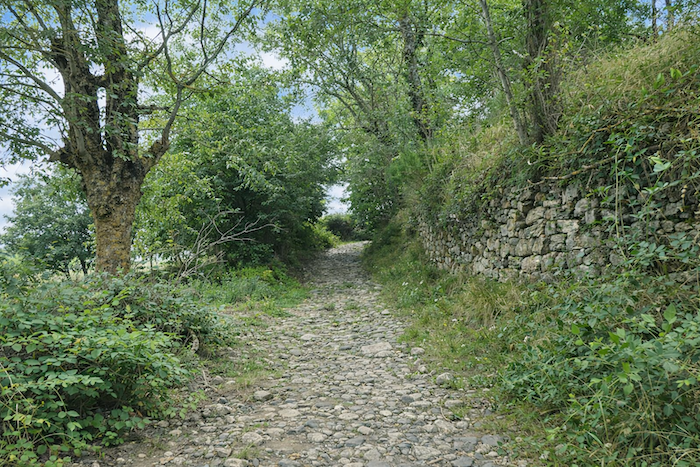
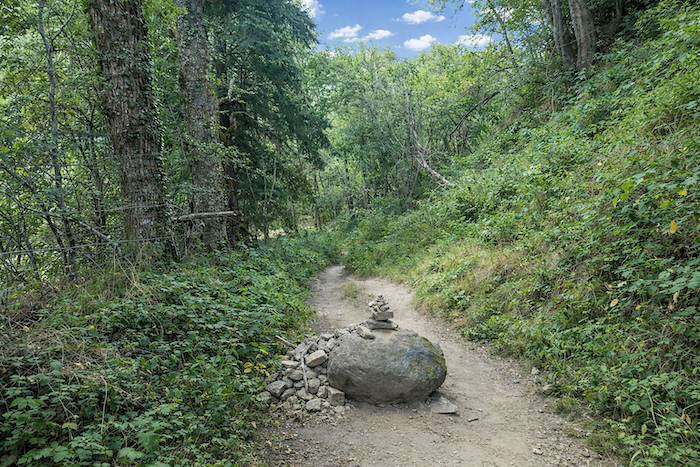
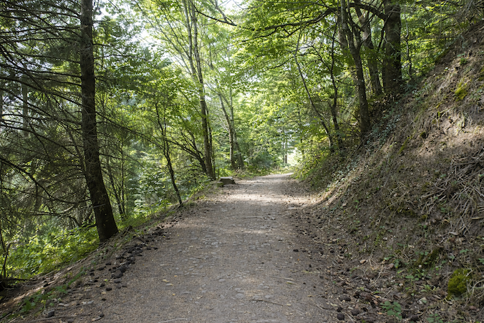
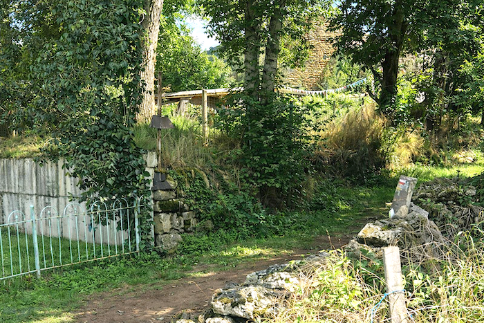
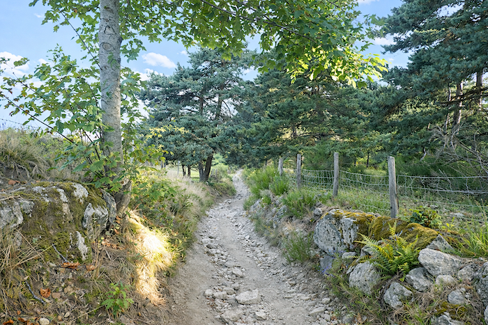
| A truly stony path awaits you here, beneath woodland dominated by beeches and hornbeam shoots. It winds alongside old stone walls, sometimes built to hold back the embankments, sometimes arranged so harmoniously that one might think they were placed there purely for the pleasure of the eye. At the end of this green tunnel, the path emerges into the hamlet of Combriaux. |
 |
 |
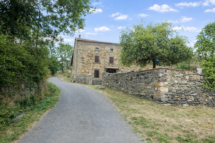
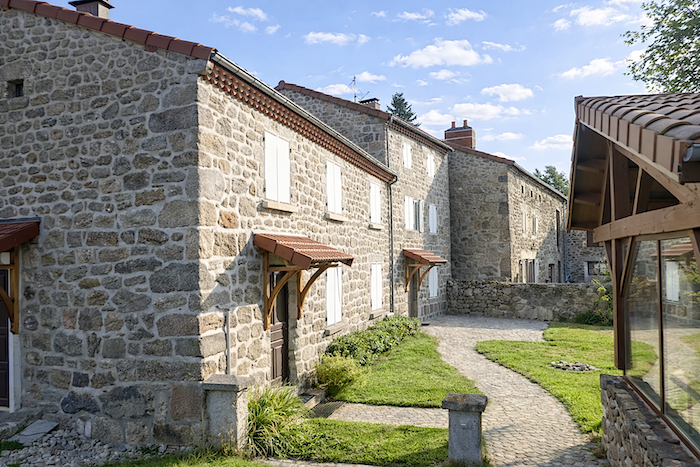
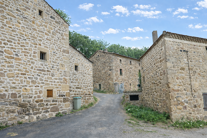
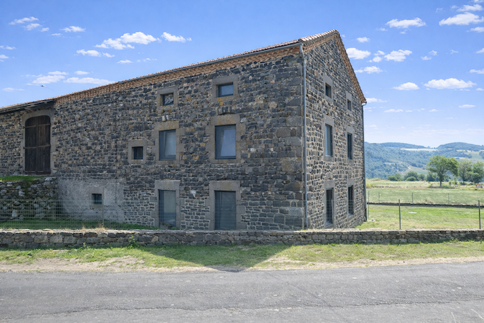
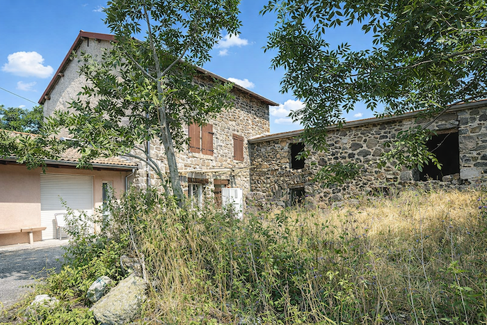
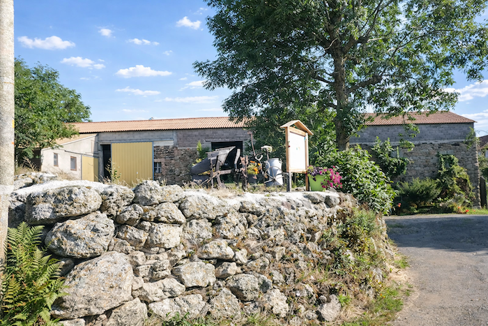
| Combriaux is little more than a handful of solid houses, built from volcanic stone as though they were meant to endure forever. When volcanic rock is mentioned, the imagination immediately conjures the blackness of basalt. That is true, but it is also rather reductive. Even basalt comes in many shades, and the volcanism of the Velay has left behind many other colors here. Tuffs, dacites and trachytes, these lighter rocks mingle with the darker stones in the façades and walls, giving the houses unexpected tones. From a distance, some buildings could almost be mistaken for limestone, so far do their colors depart from the usual image one has of hardened lava. |
 |
 |
| Behind the last houses of this almost deserted hamlet, the trail resumes its climb through slightly untamed woodland, among bushes, hazel trees and hornbeam groves. The path slips through it all as though moving through vegetation that has preserved something wild and untamed. |
 |
 |
| At the top of the climb, as conifers become more numerous, the trail joins the little road leading to Rochegude, among broom and tall wild grasses. |
 |
 |
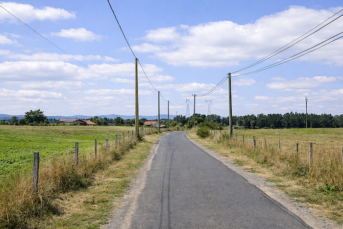
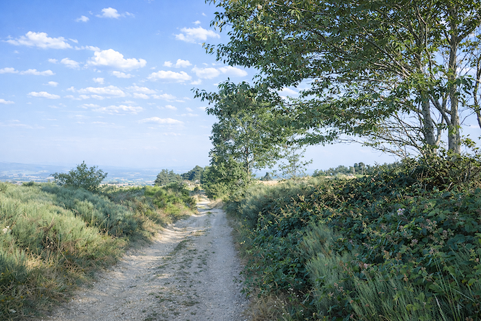
| Always the same refrain at the beginning of this stage: the road rises gently toward Rochegude, almost deserted apart from a few mushroom gatherers wandering through the woods. Yet the route, faithful to its playful temperament, cannot resist multiplying detours, sometimes above the road, sometimes below it, sometimes along its edge. If you enjoy the exercise, follow the trail; otherwise, the road leads to exactly the same destination, and a broad grassy strip even allows you to avoid the tarmac. To each walker their own pace, to each their own pleasure. |
 |
 |
| Whatever choice you make, you will soon rejoin a short stretch of road. Then, without warning, the GR65 decides to climb back above the road again, as though reminding you that it likes to remain in command of the landscape. So let us follow it and see where it leads. |
 |
 |
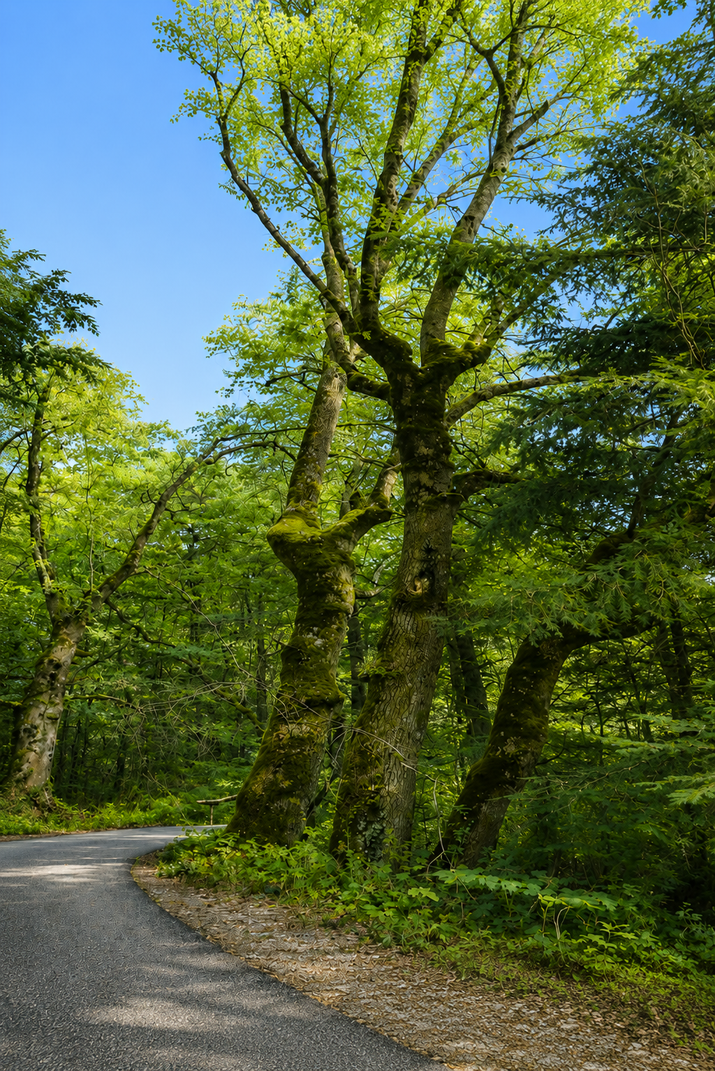
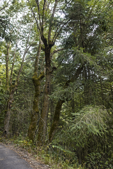
| Path or road, it is the forest that accompanies you throughout. Haute-Loire is one of the most heavily wooded departments in France: nearly 40% of its territory is covered by forest. There are some 75,000 forest owners here, and 90% of the woodland is privately owned, to the point that some people are not even aware they possess a few parcels. Here, the forest is dense, almost sovereign. |
 |
 |
| And soon it is once again a little tarmac, then earth again, this time below the road. The route seems to take mischievous pleasure in playing with the topography. |
 |
 |
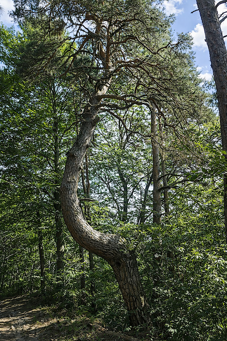
| The forest grows denser still. Tall beeches compete in height with oaks, pines and spruces. Many people confuse hornbeam and beech, and it must be admitted that their silhouettes sometimes resemble one another. Yet for those who know how to look, the leaves reveal their differences far more clearly than the trunks. Here, both species coexist, although along the Camino de Santiago the beeches generally dominate. Hornbeams are mostly found as modest groves, far humbler than the great beech trunks. The same applies to spruces and firs: from afar they appear similar, but the pine cones scattered on the ground quickly reveal the truth. Here, spruces dominate above all else, while large silver firs and Douglas firs are rarer. And this whole people of trees lives in conversation with mosses, great ferns and wild grasses. A dream kingdom for mushrooms, and for walkers who still know how to marvel. |
 |
 |
| Shortly afterwards, the path leaves the forest |
 |
 |
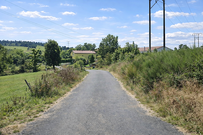
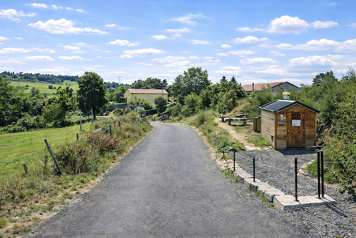
| It emerges near a picnic area and a discreet dry toilet at the entrance to Rochegude. After the woodland and the jagged climbs, this pause almost feels like an airlock between two worlds. |
 |
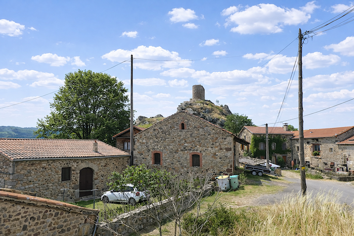 |
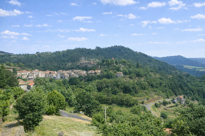
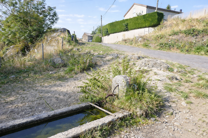
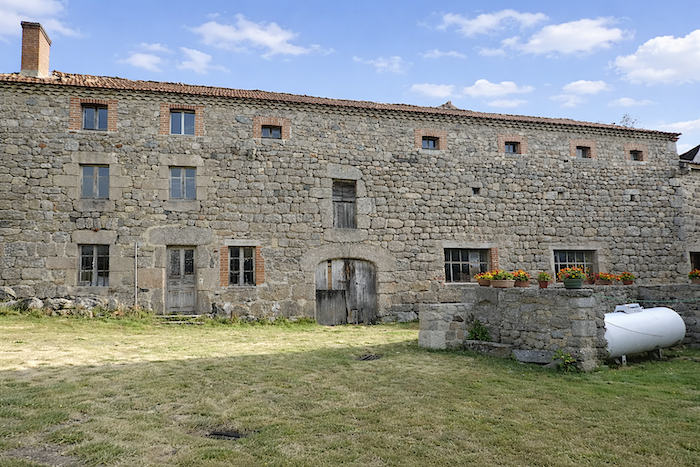
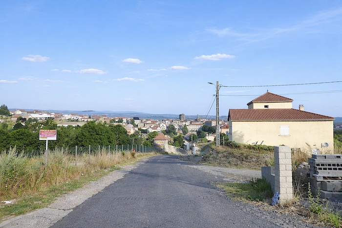
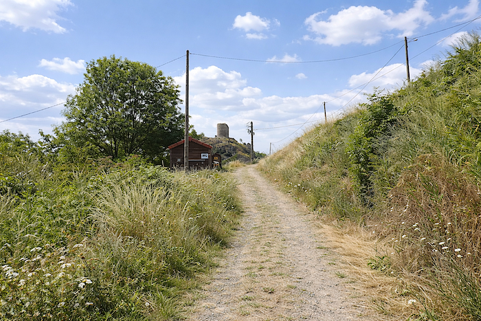
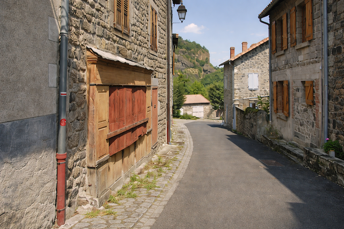
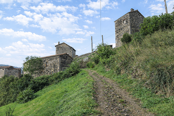
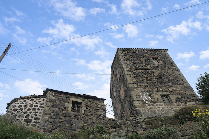
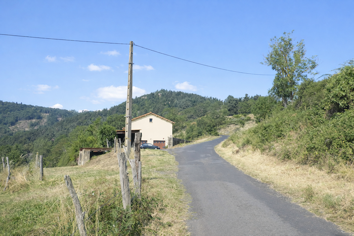
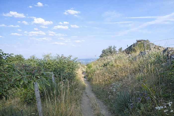
| Rochegude lies just ahead: an old fortified village that long stood watch over the passages coming from the Gévaudan. Today, the hamlet consists of only a few stone houses leaning against the mountainside, huddled tightly together as though to better withstand the passing of time. You may wander freely among half-open barns, peering behind a window, into a garden or through a gate, hoping to catch some sign of life. Yet more often than not, it is silence and absence that answer you. A thick, almost mineral silence hangs above the rooftops, disturbed only by the murmur of a fountain whose water is not always drinkable. You are far more likely to encounter other pilgrims there, backpacks resting on the ground as they stop for lunch, than actual inhabitants. The village seems abandoned, as though the mountain towering above it had gradually absorbed it into its own solitude.
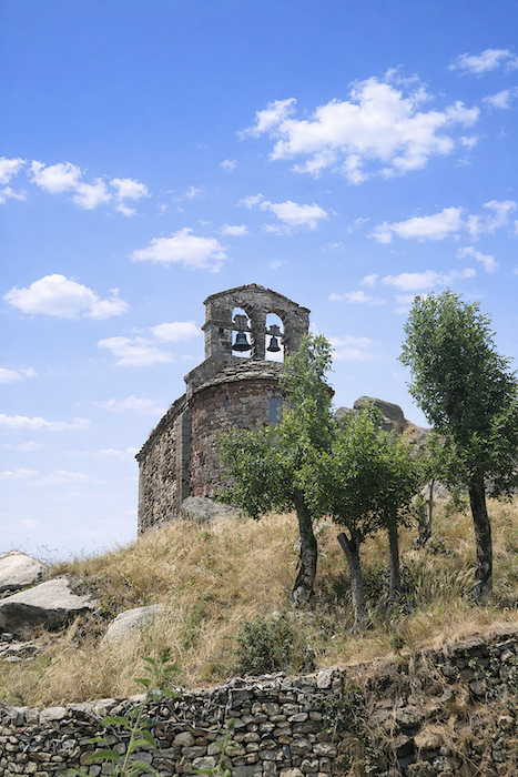
And yet there was once a time when Rochegude must have teemed with life, when it fulfilled its role as an advanced sentinel. Its name is said to come from “roca aguda”, the sharp rock. From the 13th century onward, its keep belonged to the powerful Montlaur family. Of the castle, only a tower remains, the sole survivor of a past devoted to watchfulness and passage. It still rises today, both proud and fragile, upon its rocky spur overlooking the Allier gorges. Nearby, a small Romanesque chapel dedicated to Saint James, built at the beginning of the 14th century, also keeps watch from its promontory. These places were once a precious halt for medieval pilgrims. Even today, the spirit of the Camino seems to linger there. One should nevertheless remain cautious: the precipices bordering the site are a reminder that the beauty of such places is never entirely innocent. Yet the panorama more than justifies lingering awhile. |
 |
 |
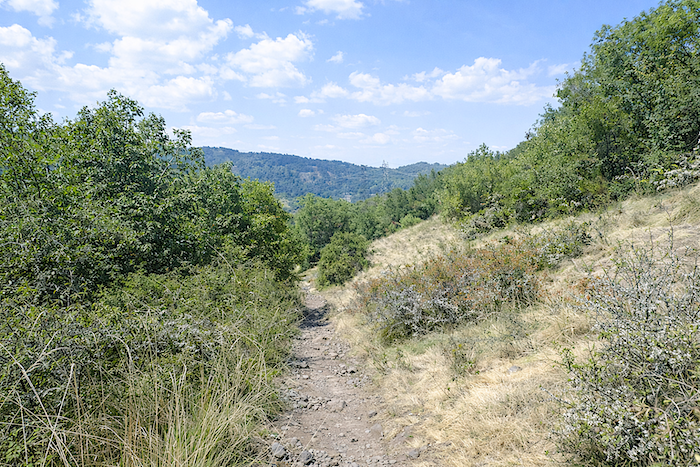
| The view over the Upper Allier is striking. The horizon closes in beneath endless forests, while the Allier valley opens like a deep wound between the cliffs. Before you, the river corridor shapes a harsh, almost solemn landscape. And already you understand that sooner or later it will be necessary to climb back up the opposite side to escape this wild gorge. . |
 |
 |
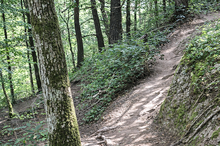
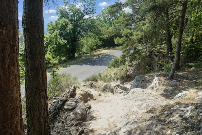
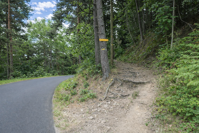
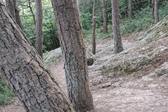
| From Rochegude onward, a trail plunges downward without mercy. More than one hundred meters of decloine must be lost on a steep, rocky, root-covered trail. At first, it leaves the hamlet by slipping between bushes, ash trees, brambles and old stone walls. |
 |
 |
| Then pines, oaks and beeches appear as the trail approaches the most vertiginous section of the descent. Some stretches clearly exceed 40% gradient. There is no real danger, yet every step demands attention, balance and confidence. |
 |
 |
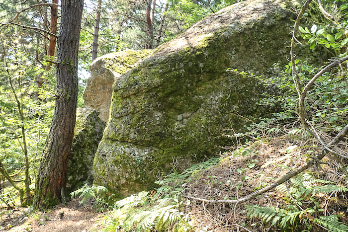
| The forest then becomes magnificent, terrifying some would say. The valley narrows until it becomes a gorge, at times almost an abyss. The trail winds through scenery of fierce beauty: sturdy pines shaken by the wind, carrying the air of ancient patriarchs, immense granite slabs covered in moss. Even maples and chestnut trees, rarer in this region, seem determined to join this gathering of trees. All around, the undergrowth grows dense, almost impenetrable. |
 |
 |
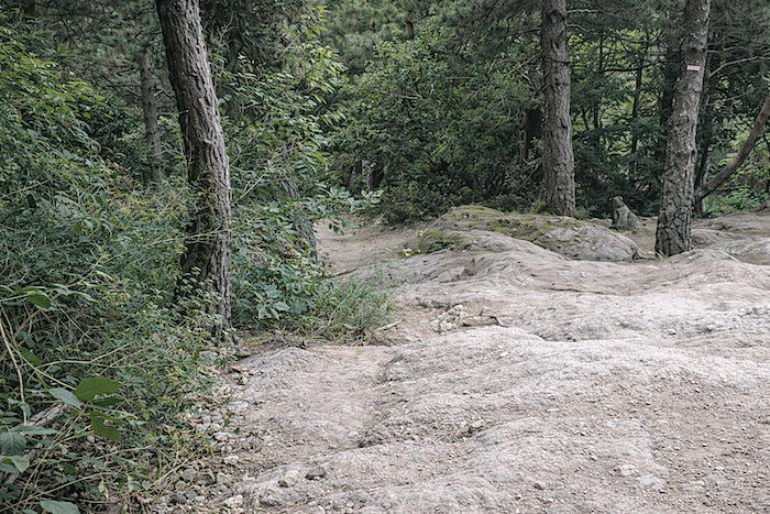
| At times, you might believe the pines have grown directly out of the tortured granite slabs themselves, so naturally do they seem to emerge from the bare stone. You may encounter a few mountain bikers here, lovers of strong sensations and demanding terrain. For them as for walkers, this trail sometimes feels like a ridgeline between exhilaration and caution. Pure happiness, provided one keeps a steady footing. |
 |
 |
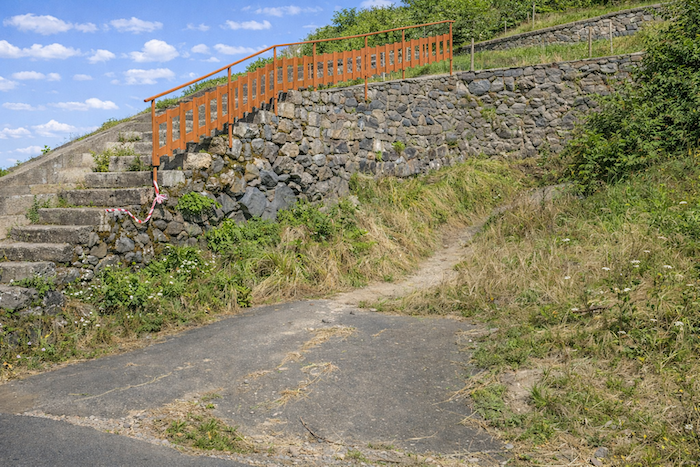
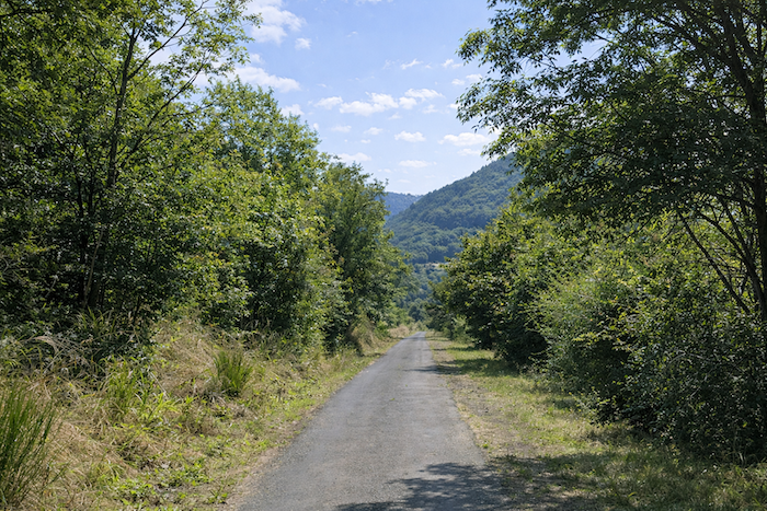
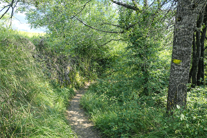
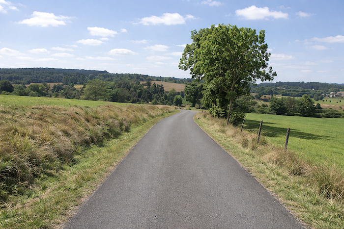
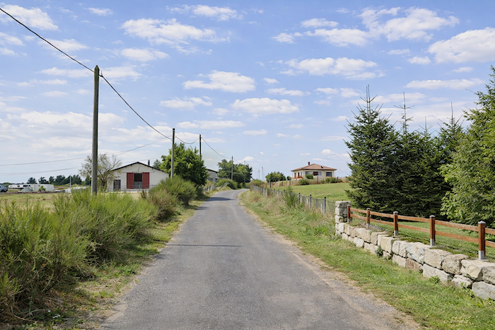
Section 2: Monistrol-d’Allier, between exhausting descent and climb
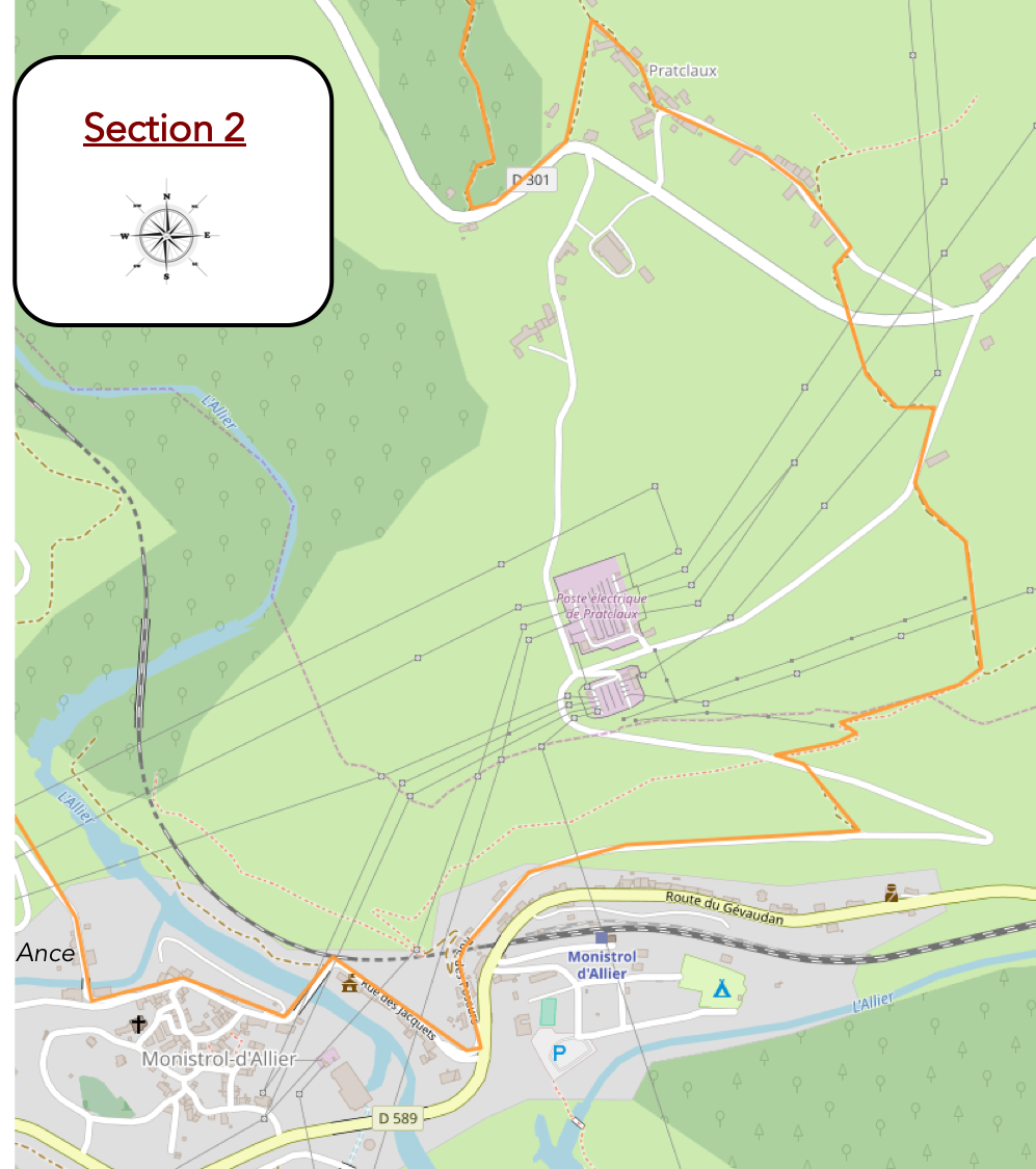
General overview of the route’s challenges: at the bottom of the difficult descent, there are a few easy undulations, then the slope becomes steeper again as Monistrol-d’Allier approaches. As soon as you leave the village, the arduous climb toward Escluzels begins.
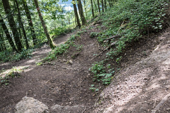
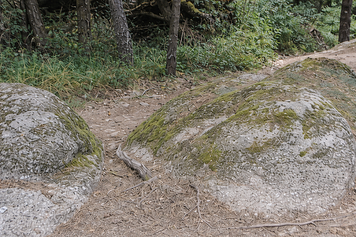
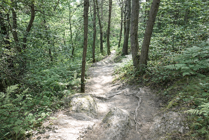
| At times, the slope seems willing to ease, but only with almost mocking restraint. The trail continues downward, sometimes along a narrow path twisting with a kind of wild voluptuousness, leaping from one granite slab to another as though hesitating between playfulness and vertigo. |
 |
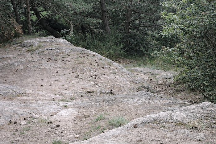 |
| At moments, you may even feel that the pines were born from the rock itself, so tightly do their roots seem entwined with the stone. They do not grow upon the granite; they appear to emanate from it. |
 |
 |
| Sometimes at last, the trail agrees to grow gentler, allowing itself to be softened by the ferns lining its edges and tempering its harshness. |
 |
 |
| You then arrive at the end of the pleasure, or at least at what feels like its final outburst. Many pilgrims let out a deep sigh here on catching sight of one last granite ramp, steep and rugged, which seems to open onto a broader horizon and the little road passing below. One final grimace from the path before deliverance. |
 |
 |
| At Pratclaux, you are still only halfway down to the valley floor. But this time, the hardest part seems behind you: the slope becomes gentler, the rocks gradually fade away, and the landscape opens onto more peaceful countryside. The GR65 first continues briefly along the tarmac, without lingering. |
 |
 |
| Then it chooses to climb up to visit the hamlet, following an avenue lined with tall ash trees and majestic maples. Here again, if you are in a hurry, the road allows you to save time, and you will rejoin the main route farther on. Yet doing so would mean depriving yourself of one of those detours that give the journey its true value. |
 |
 |
| For you would miss these massive houses where the volcanic stones seem to catch fire beneath the light. A path slips behind the buildings, constructed like ramparts, solid and silent, as though they had been raised to defy time itself. |
 |
 |
| At first glance, nobody seems to live here. The shuttered windows, thick façades and discreet courtyards give the hamlet a suspended atmosphere, as though frozen in another age. These houses breathe of the past, of long winters, patient reserves, jars of jam forgotten upon a cool shelf. There is something almost sacred in this silence. |
 |
 |
| And yet, is it really true that nobody still lives here, judging by the cars parked now and then? Modernity sometimes leaves behind more questionable traces. Some people have taken to erecting strange artistic assemblages by the roadside, somewhat at odds with the harmony of the place. In such a beautiful village, the contrast surprises and irritates. |
 |
 |
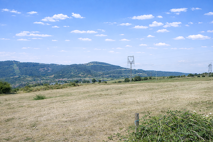
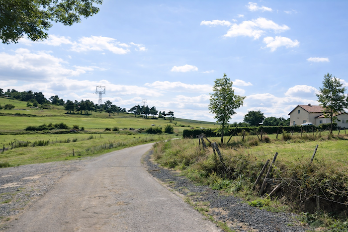
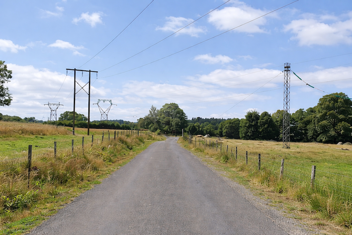
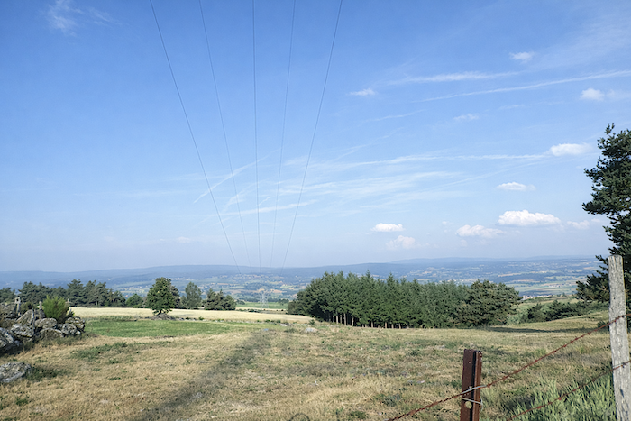
| Leaving the hamlet, the GR65 rejoins farther below the road it had abandoned earlier. Here, cultivation becomes scarce in countryside crossed by tall pylons, metallic silhouettes far less poetic than the trees they replace. |
 |
 |
| Then comes a narrow trail threading through tall grasses, a section that can become difficult in bad weather. The great trees have almost disappeared, leaving only a few isolated ash trees, as though forgotten there by the landscape itself. Fortunately, this stretch is short, and the path soon rejoins the road descending from Pratclaux toward Monistrol-d’Allier. |
 |
 |
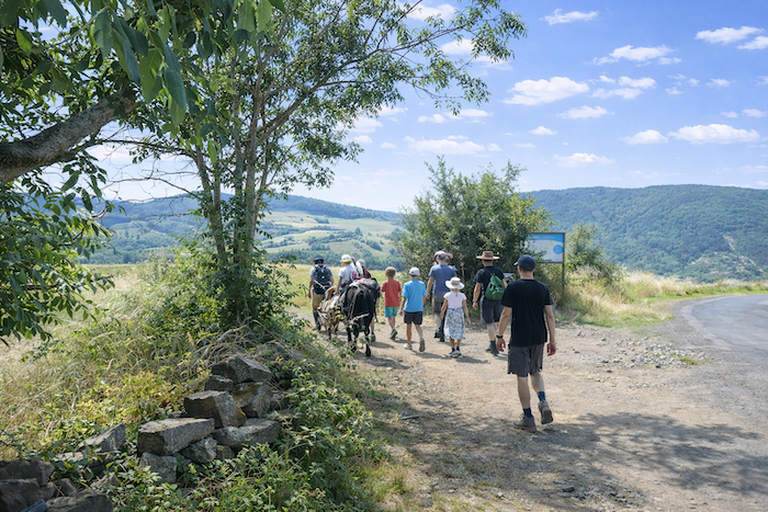
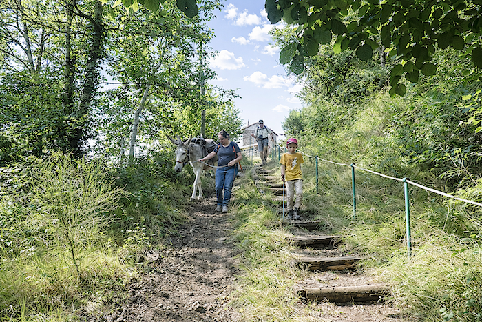
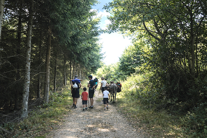
| A few dozen meters farther along the tarmac, beside a majestic stone farmhouse, the GR65 escapes once again toward a path. Here, a small family is enjoying a fragment of Compostela: the stoic donkey has no doubt already suffered through the tall grasses. The youngest child sits proudly upon the pack saddle with the seriousness of happy children, while the others walk on, jaws clenched and legs determined, perhaps silently dreaming of their own turn upon the animal’s back. |
 |
 |
| A broad dirt path then crosses the plateau in a moment of peaceful breathing space. The eye finds a brief rest there, between sky and countryside, before little by little the fields begin to shrink and fray, as though the landscape itself were already announcing the rupture to come. |
 |
 |
| At the edge of the plateau, the path plunges once more toward the valley floor. From here onward, the slope becomes severe again, sometimes exceeding 20%. The trail turns harsh: large stones, unstable ground, dense bushes, a descent demanding as much attention as breath. |
 |
 |
| On these poor soils, where loose stone reigns without rival, only small stunted oaks manage to cling on. The ash trees have disappeared, erased by the mineral austerity of the place. The landscape strips itself bare as altitude is lost. |
 |
 |
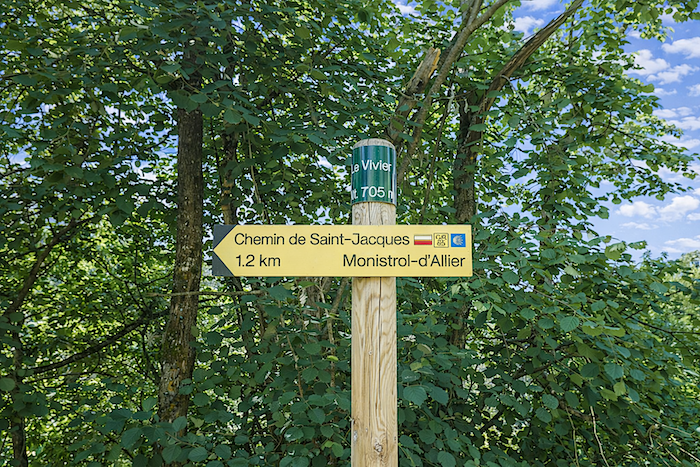
| Farther down, the steep trail rejoins the Pratclaux road at the place known as Le Vivier, less than one kilometer from Monistrol-d’Allier. After so many stones and sloping sections, the tarmac feels almost like a concession to fatigue. |
 |
 |
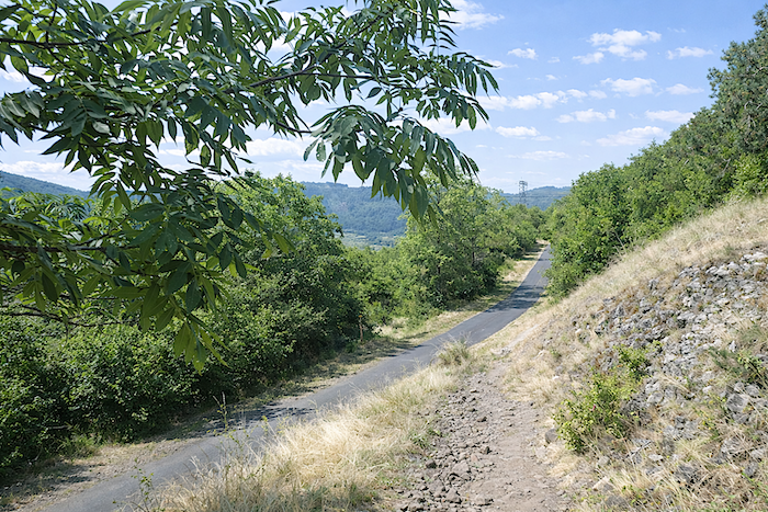
| The GR65 then follows this straight road, where broadleaf trees have reclaimed their place. The conifers have vanished, as though the mountain, opening outward, had become more hospitable again. Oaks and beeches now accompany the walker with softer, broader shade. |
 |
 |
| Farther down still, the road bends sharply, and suddenly the village appears below. Monistrol-d’Allier lies hidden beside the river, nestled at the entrance to a deep gorge, like a refuge long concealed from view. |
 |
 |
| All that remains is to follow the road running straight beneath the oaks and beeches: the village awaits you there, poised between water, stone and the silence of the surrounding relief. |
 |
 |
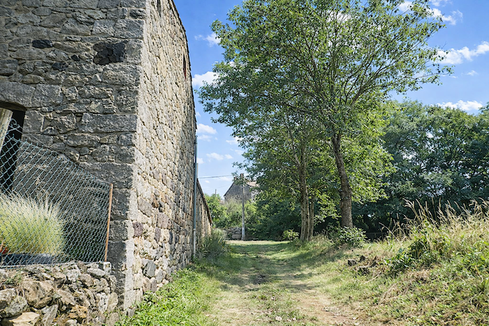
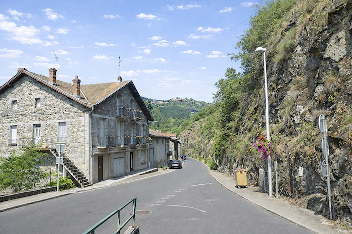
| The sloping road soon reaches the first houses of the village. And it comes as almost no surprise: here, everything seems built from those large blocks of dark volcanic stone that give the façades a quiet strength, as though the whole village had been born from the mountain itself. |
 |
 |
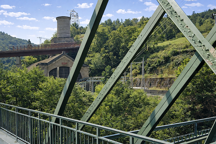
| Below, one catches sight of the railway line. Surprising as it may seem in such a remote gorge landscape, it is indeed possible to take the train here. The Cévennes railway line, linking Clermont-Ferrand to Nîmes, runs through Monistrol-d’Allier, adding an unexpected touch to the place. |
 |
 |
| The road runs before the town hall before descending toward the river. Up above, on the heights, Escluzels is already visible. Its name announces the next climb, the one that must inevitably be faced after rest. |
 |
 |
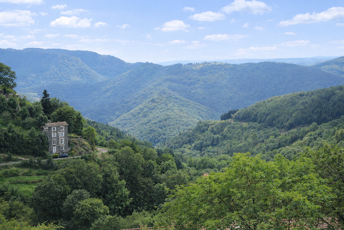
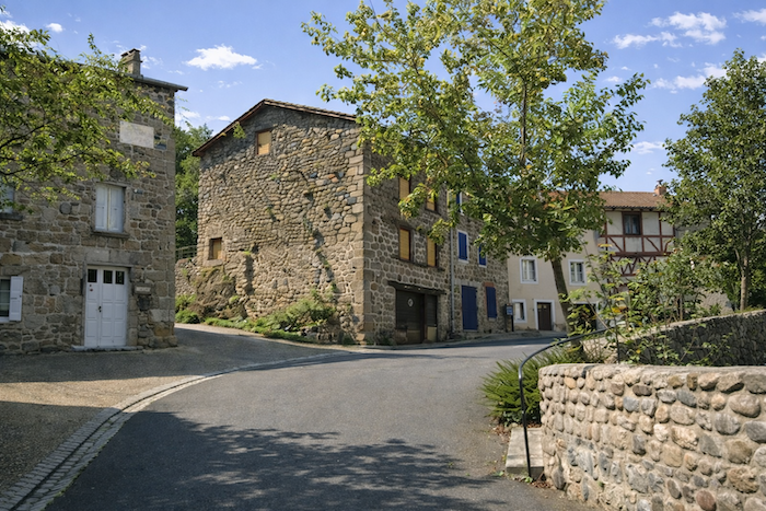
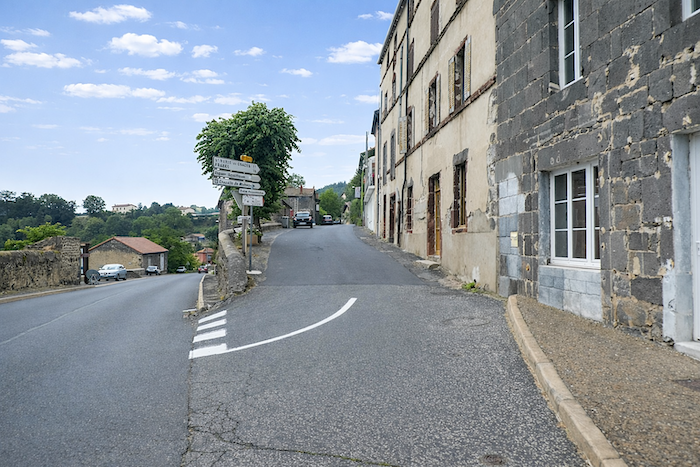
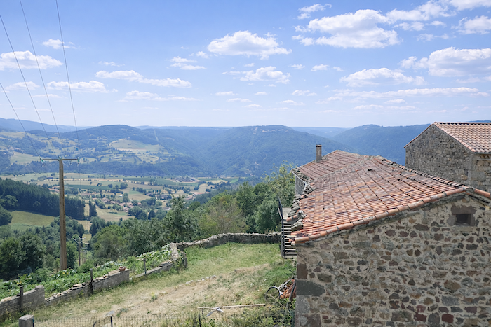
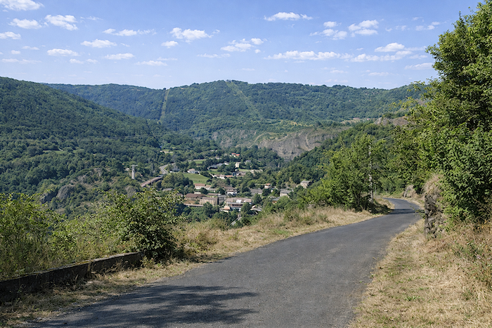
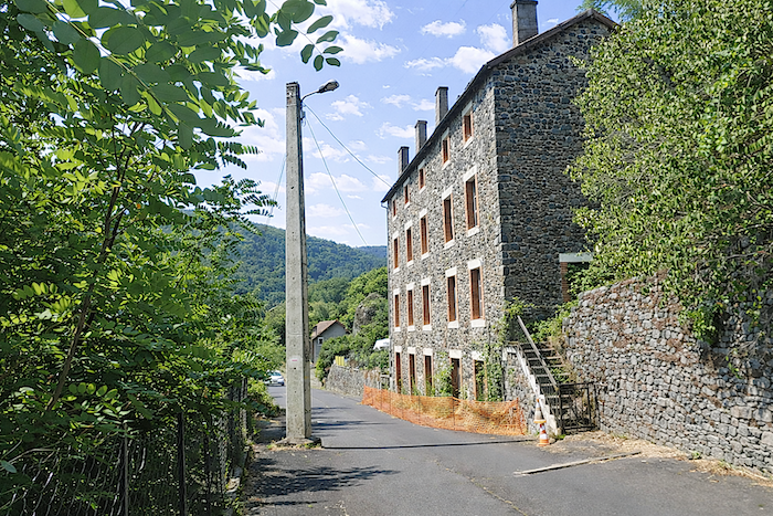
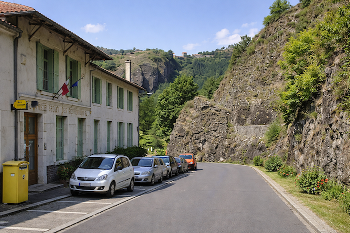
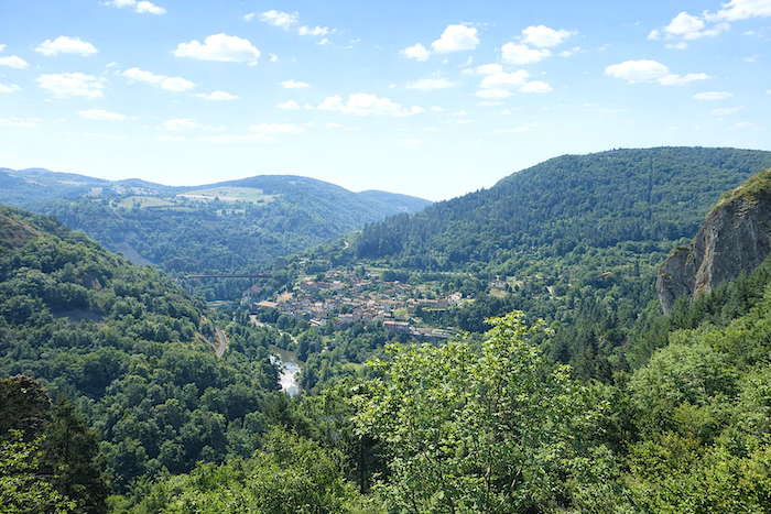
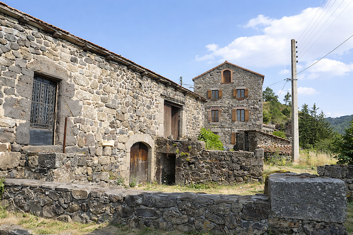
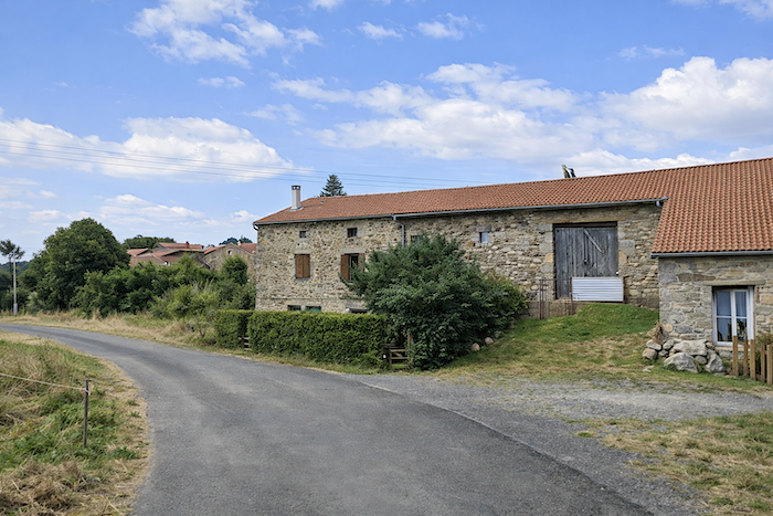
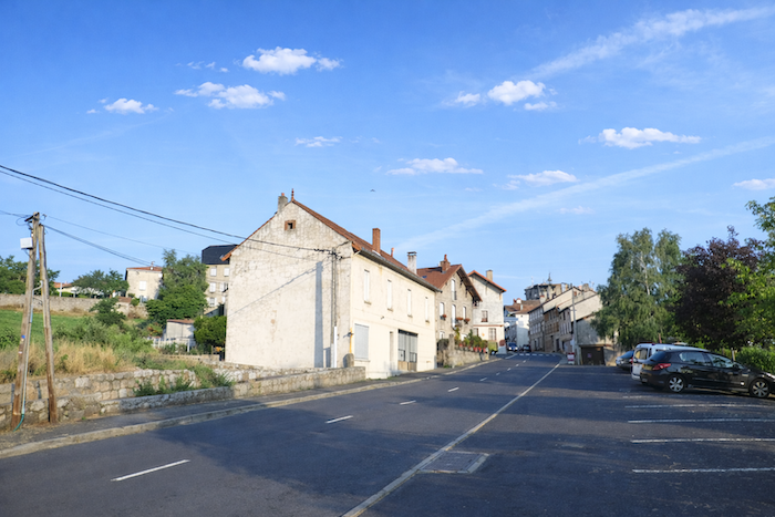
| Monistrol-d’Allier is a little jewel of a village, straddling the Allier River. Certainly, a dam and a hydroelectric power station remind visitors of modernity’s presence here, yet they take nothing away from the profound charm of the place. Surrounded by vertiginous gorges and long difficult to access, the village stretches beside the water within a setting of steep cliffs. Here, road, railway and river meet together, as though every route through the landscape had ultimately converged here.
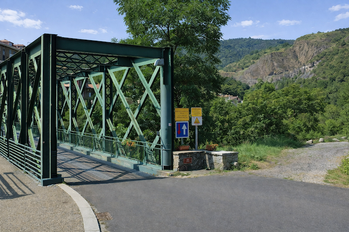
The D589 road itself does not pass through the village: it crosses the Allier on a recent bridge high above. Another bridge leads into the heart of the settlement. And what a bridge it is: as early as 1887, one year before the Eiffel Tower, Gustave Eiffel built here an elegant green metal bridge, a delicate lacework of iron suspended above the current. |
 |
 |
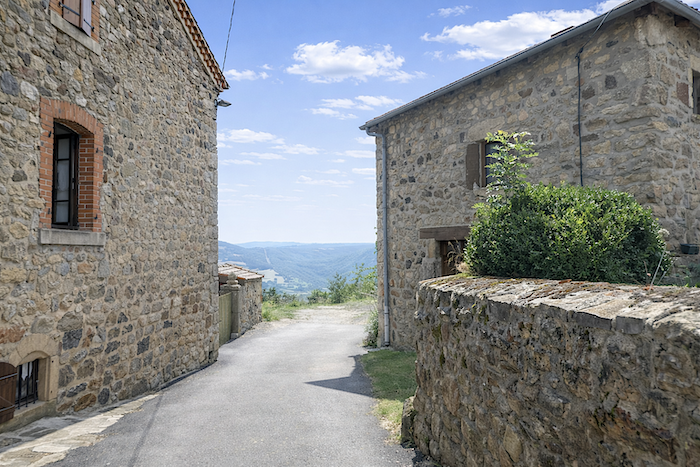
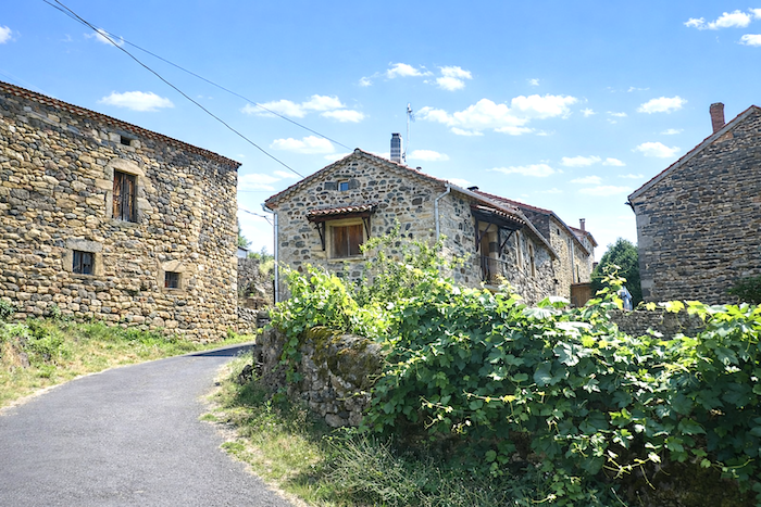
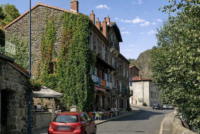
| The village, home to barely more than two hundred inhabitants, nestles among beautiful stone houses at the foot of the cliffs and along the river. Wandering through its winding lanes means accepting a delightful little labyrinth, a gymkhana of alleyways, staircases and narrow passages where time itself seems to move more slowly. |
 |
 |
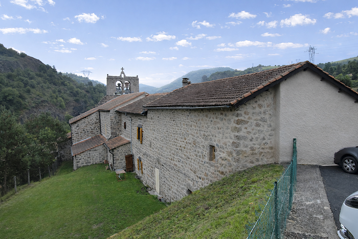
| This stroll will lead you, among other places, to the parish church, built in pure Romanesque Auvergne style, discreet and solid like everything here that seems to have been made to endure. |
 |
 |
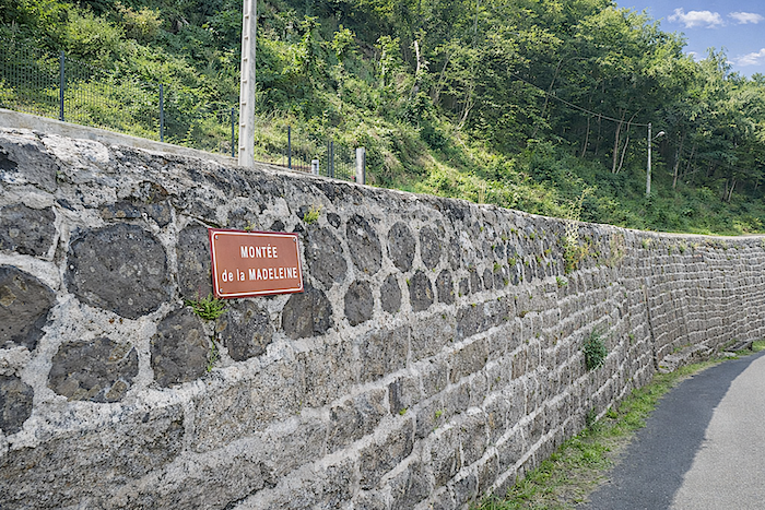
| The route leaves the village by following the river, then slips close beside the departmental road into a lane bearing an almost biblical name: the “Montée de la Madeleine”. |
 |
 |
Shortly afterwards, you cross the Ance, a modest fast-flowing river that joins the Allier here.
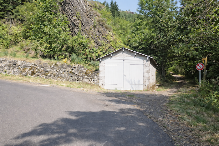
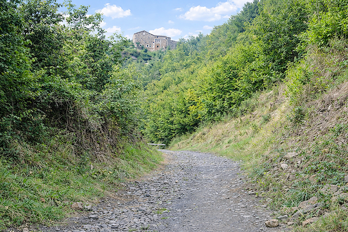
| From Monistrol onward, it is an almost uninterrupted six-kilometer climb to Montaure. The ascent out of the valley is considered one of the most formidable, and most memorable, ordeals of the Via Podiensis. A promise of effort, but also of joy. To begin with, there are more than one hundred and fifty meters of elevation gain over the first kilometer to Escluzels, with slopes in places that severely test the legs, especially when age has made the stride heavier. Here, there is no respite, no gentle undulation, only a relentless climb, first on tarmac, then along a rocky path clinging to the sides of the gorge. And yet at the beginning, nothing suggests the harshness that lies ahead. The itinerary first offers something like an amuse-bouche: a nearly deserted tarmac ramp climbing patiently toward a solitary shed standing beside the road. |
 |
 |
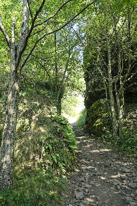
| Then the true adventure begins. A trail starts winding in tight switchbacks along the steep cliffside, among large treacherous stones rolling beneath the sole. You progress through dense and untamed vegetation: tangled bushes, stunted oaks, slender ash trees, silent beeches and young chestnut shoots reclaiming the slope. |
 |
 |
| And yet, despite the sensation of vertigo, there is no real danger here, only the exhilarating feeling of walking beside the void in exuberant, almost untamed nature, with the appearance of wild hair blowing freely. |
 |
 |
As a reward, the eye embraces a striking panorama: the valley opens endlessly before you, the village nestles below with its stone bridges, the Allier glitters at the bottom of the gorge, and on the opposite slope immense forests raise their dark rampart.
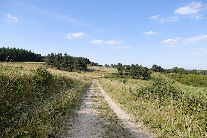
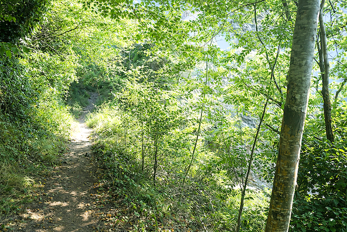
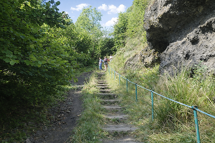
Section 3: Through one of the most demanding parts of the Camino de Santiago
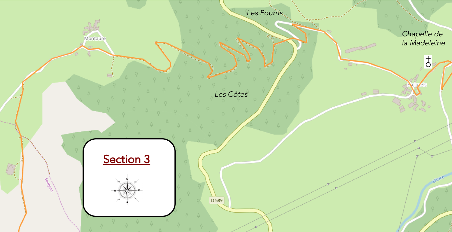
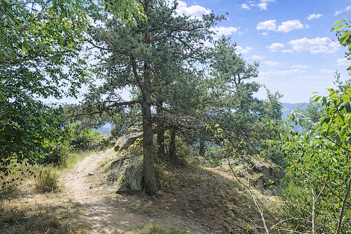
General overview of the route’s challenges: pure pleasure, with slopes sometimes reaching nearly 30% to 40% near Escluzels. One must pass Montaure before truly catching one’s breath.
|
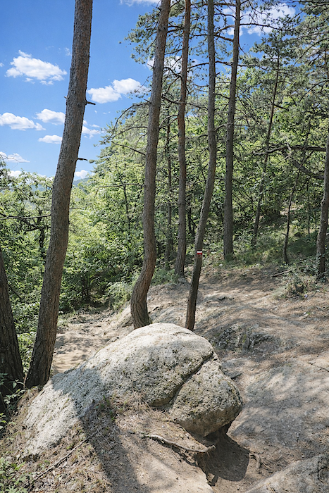
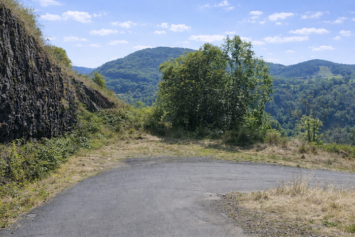
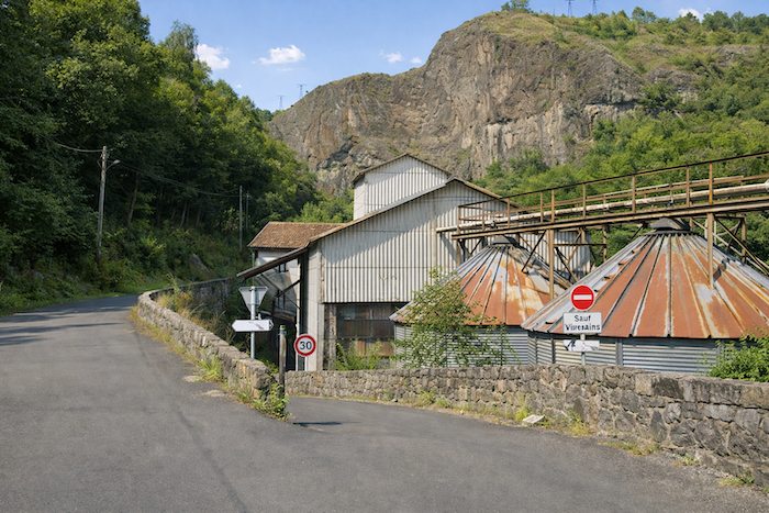
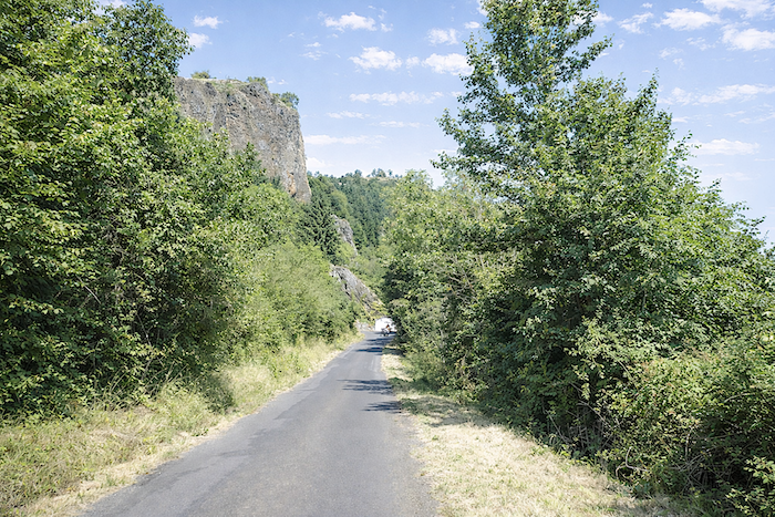
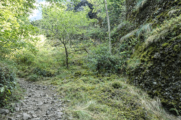
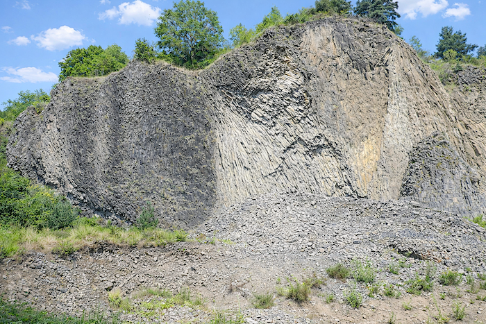
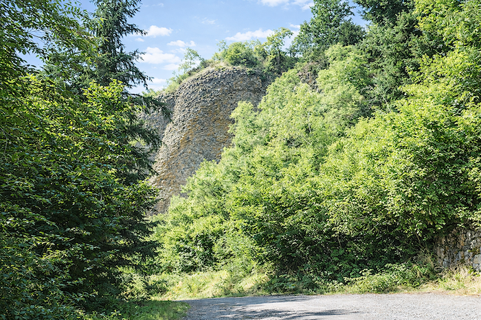
The trail climbs through a mineral maze where rock breaks through at every step. Beneath the soles, stones roll and crunch; all around, the slope tightens within a setting of wild greenery. Moss-covered embankments, tall grasses and young trees create a landscape of almost secret freshness, as though the mountain itself were holding its breath here, in a nature both harsh and welcoming. Then suddenly the landscape reveals its full geological power: a basalt cliff rises into view, monumental, lifting its dark organ pipes toward the sky. The frozen lava columns, streaked by time, form a raw and almost sacred architecture where one seems to read the memory of ancient fire. Here, beauty is born from the union of wilderness and silence.
|
 |
 |
|
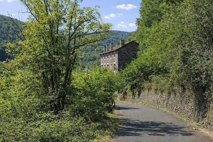
Then the path changes direction, continuing its ascent between two embankments overrun with greenery, as though plunging into a vegetal corridor carved directly into the hillside. The ground, scattered with stones and gravel, retains the memory of passing seasons and demands careful footing. High above, dominating this sea of foliage, a large stone house appears, set upon its promontory like an unmoving watchman. Its austere yet reassuring silhouette seems to offer the walker both a landmark and a promise, that of an ending, a refuge or a well-earned halt. In this landscape of patient ascent, the house suspended above becomes almost a horizon in itself, a silent invitation to continue the effort.
|
 |
 |
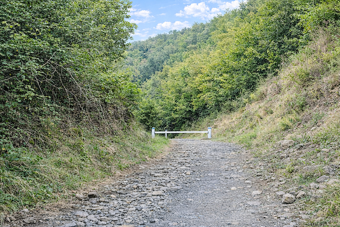
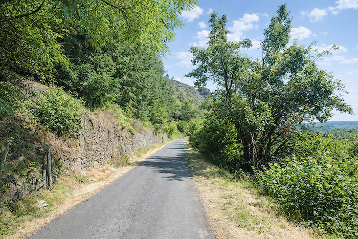
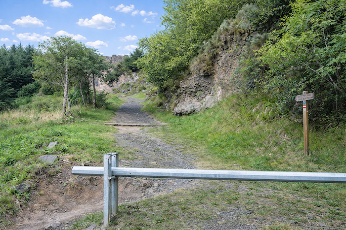
| A barrier, almost absurd in its modesty, seems to have been placed there to contain a traffic existing mostly in human imagination. For here, the route joins a modest tarmac road curled beneath fresh basalt organ pipes, powerful and overflowing with presence, like stone cathedrals worn by time and sculpted by the centuries. |
 |
 |
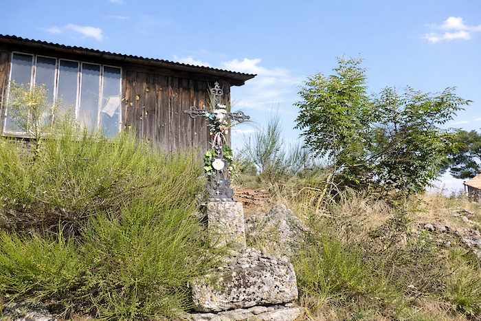
| Then the slope steepens once more. The road rears upward beneath oaks, spruces, young beeches and chestnut shoots, in a relentless climb that tests the breath as much as the legs. At last, an iron cross appears upon the embankment, a sober sentinel, like a sign of perseverance and rest. |
 |
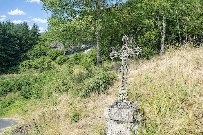 |
| Here, hikers and pilgrims gladly stop to recover their breath and let their gaze wander. From this point, the view still opens over Monistrol-d’Allier nestled deep within the valley. Higher up, Escluzels already reveals itself, appearing so close that one might think it within reach. But do not trust the illusion: the mountain delights in playing with distance, and the summit still has to be earned. |
 |
 |
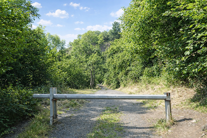
| From there, the route continues along a broad track of basalt gravel, in a landscape of black stone and pale dust. Another small barrier crossed almost mechanically, and the GR65 abandons the road to regain a broad path climbing toward the Chapel of La Madeleine, suspended above the gorges. In this harsh landscape, shaped by ancient fire and the patience of centuries, effort reasserts its rights: soon the slopes flirt with gradients of 30% to 40%, reminding the walker that the mountain never gives itself freely. |
 |
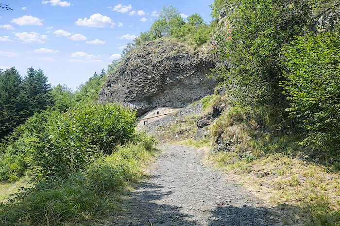 |
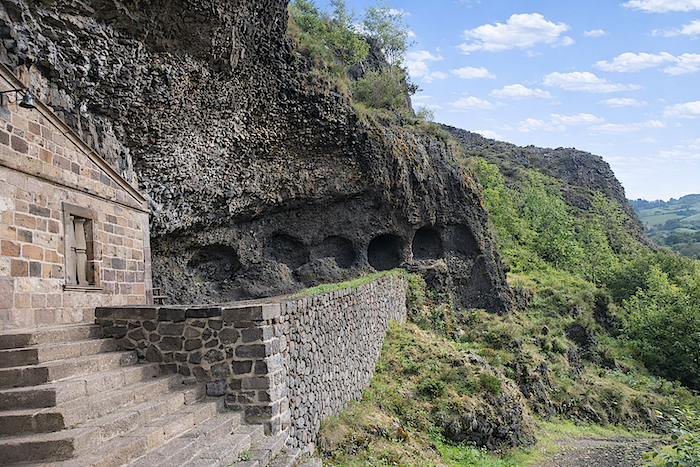
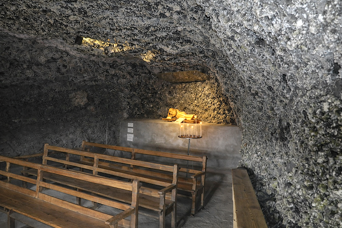
| Then, after a brutal effort, almost a struggle against the slope, comes at last the easing of breath: the path reaches the troglodyte Chapel of La Madeleine. A chapel dedicated to Saint Mary Magdalene is already mentioned in a text dating from 1312. Was it here, within this fissure in the rock, that a Celtic dwelling once sheltered? The question remains suspended between history and legend. In the 17th century, a façade was erected to close the natural opening and transform this cavity into a sanctuary. From that moment onward, the chapel rapidly gained renown. Dominated by towering basalt columns and leaning against the mountain like a protective wall, it seems born from the rock itself. Placed here along the pilgrims’ way, it offers the traveler far more than a halt: a refuge of silence, coolness and peace after the harsh conquest of the climb. |
 |
 |
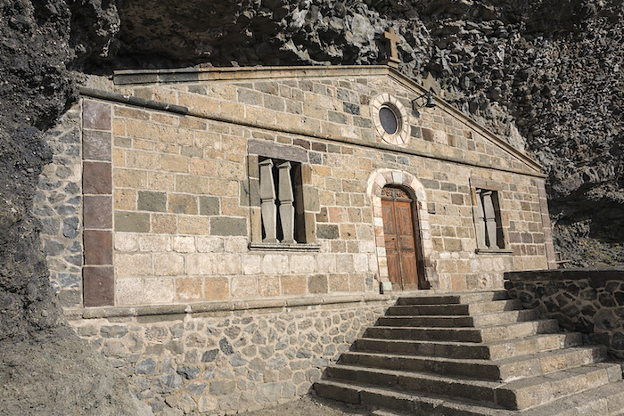
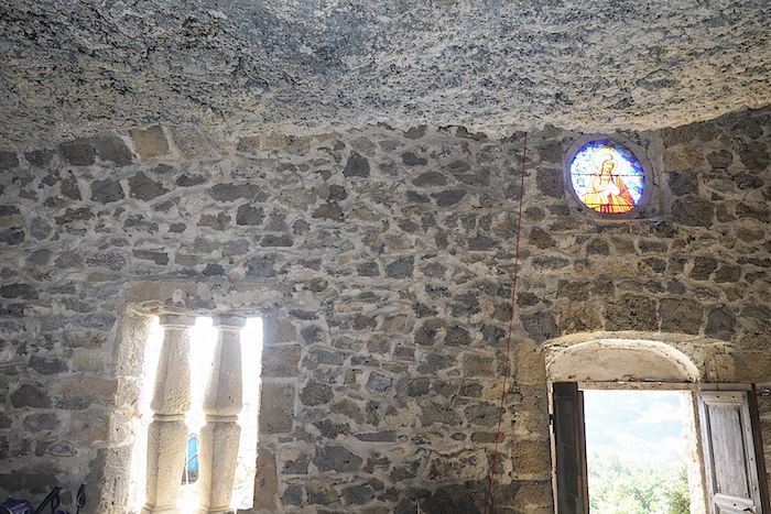
| The chapel surprises by its austere simplicity, almost monastic in spirit. The bare stone walls, assembled without ornament, preserve the coolness and gravity of ancient places. Light enters sparingly, filtered through tiny openings of silence. Inside, everything invites contemplation. The low, rough ceiling seems to prolong the rock itself, as though the chapel had been hollowed from the mountain’s very belly. Simple wooden benches face a stripped-down altar where a reclining statue rests in gentle light. A few candles flicker there, bearing the prayers and weariness of all those who paused before continuing their route. |
 |
 |
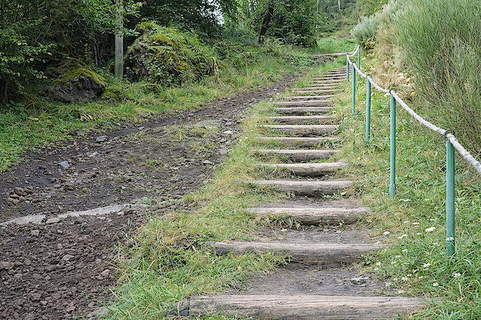
| From here to Escluzels, the path offers a particular kind of happiness, the kind won only through effort. For the slope steepens yet again, without the slightest mercy. At times the gradient exceeds 40%, over crude wooden steps that resemble less a trail than a ladder laid against the mountainside. Step by step, the walker rises toward the hamlet of Escluzels in a patient struggle with the slope itself. |
 |
 |
| Above, the stone houses stand at the edge of the gorge, as though suspended over emptiness. One easily imagines how much more adventurous the climb, or the descent, for all depends upon the direction of travel, must once have been, especially when a donkey loaded with bundles, provisions or harvests had to pass this way. Today’s pilgrims travelling with donkeys no doubt experience the same difficulties. |
 |
 |
| Escluzels possesses remarkable houses built from every shade of volcanic stone. Like an eagle’s nest firmly anchored to its promontory, the hamlet coils proudly around the rocky spur. Seeing it suspended above the void, one almost wonders by what miracle it still holds there, defying centuries, wind and abyss alike. |
 |
 |
| No one could say how many lives once passed through this place, or still do today. The houses seem to have sprung directly from the volcanic earth itself, so completely do they blend into the landscape. Their dark walls, made of basalt pebbles and rough blocks, silently carry the memory of wind, winters, evening vigils and generations long gone. The narrow road winds around the buildings before vanishing behind them, like a secret revealed only to those willing to climb this far. Here, nothing seeks to seduce: everything speaks of patience, labor and rootedness. These houses do not strive to impress; they simply endure. And in their humble obstinacy, they speak better than long speeches of humanity’s fidelity to the land and of the quiet beauty of places that have learned to last. |
 |
 |
| Within the hamlet, the GR65 bends its course and rejoins the road. The slope, without becoming gentle, grows less relentless, winding among orchards and walnut trees in a deceptive softness that briefly suggests the ordeal may be ending. Yet after Escluzels, the mountain has not spoken its final word: the climb continues stubbornly, like a discreet reminder that the summit must be earned to the very end. |
 |
 |
| Little by little, the road approaches the forest edge. Great ash trees reappear beside the route, casting their light shade like a silent procession accompanying the walker’s steps. |
 |
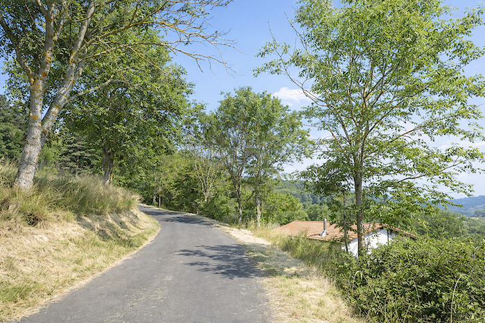 |
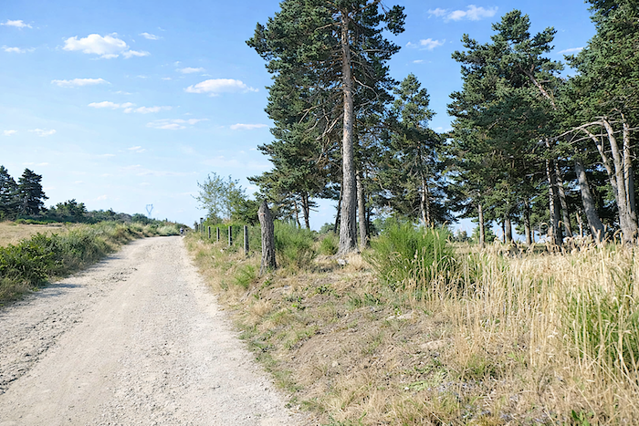
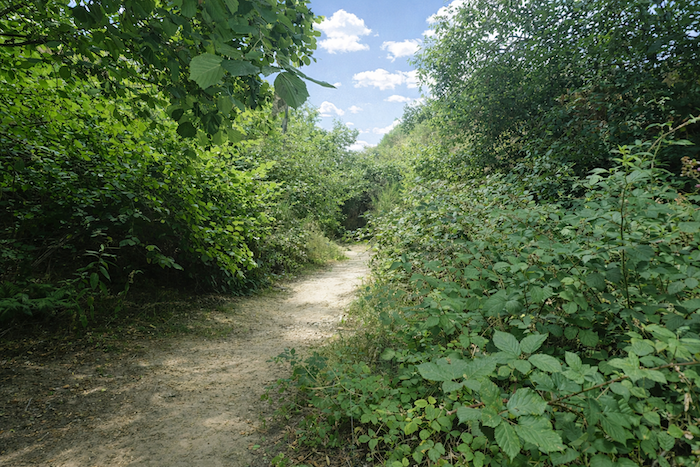
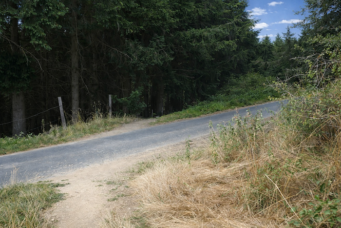
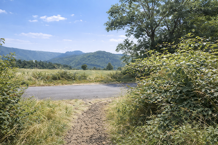
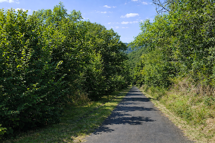
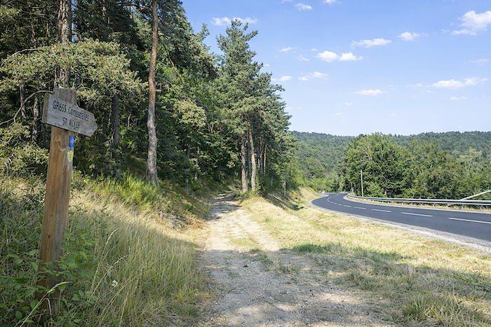
At the place known as Les Varennes, around ten kilometers from Saugues, the GR65 finally abandons the ribbon of asphalt to rediscover dirt, the kind that softens footsteps and reconciles the body with effort.
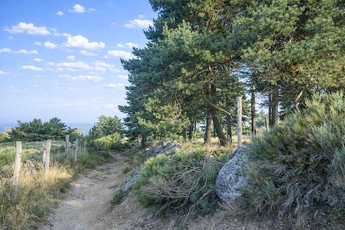
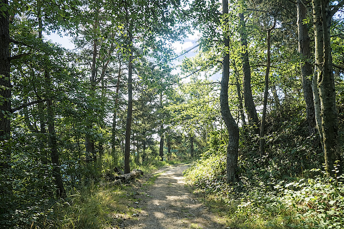
| Then the conifers return, especially the pines, their slender silhouettes once again lining the broad winding path. The path draws its curves beneath their tranquil watch, sometimes open to the light, sometimes enclosed within the cool shade of the woods. |
 |
 |
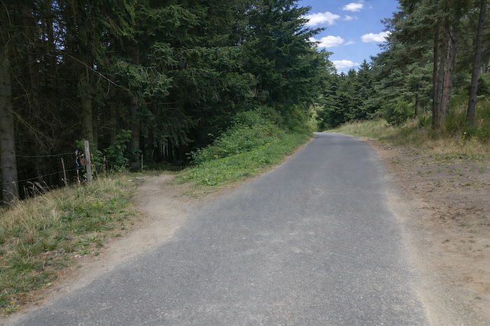
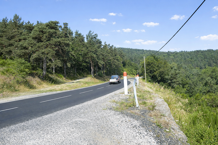
| After a great switchback in the forest, then the crossing of a small road, the path joins the large departmental road D589. It too seems to yield to the whims of the relief, winding almost as stubbornly as the path itself on the way to Saugues. The path then crosses to the other side of the road. |
 |
 |
| Then begins the kingdom of forest switchbacks. The path multiplies its bends beneath the trees in a patient and stubborn ascent. One must still count a good kilometer before reaching Montaure, a kilometer that, in the slope and silence of the woods, often feels far longer. |
 |
 |
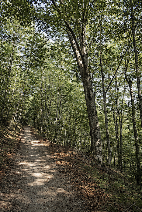
| Here, the slope becomes demanding, often exceeding 15%, yet the forest compensates for everything. Pines rise there, sometimes straight as spears, sometimes twisted like wooden serpents searching for light. The darker spruces reign in silence, while a few rare silver firs hide within the thickness of the forest stands. Yet this woodland is not monolithic: ash trees remain abundant, maples venture here and there, and the great beeches, peaceful sovereigns, raise their leafy vaults with tranquil majesty. |
 |
 |
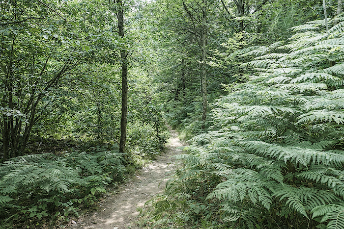
| The path traces countless zigzags through the forest, sometimes emerging into rare clearings where ferns, nearly as tall as young trees, unfurl their wild lacework. |
 |
 |
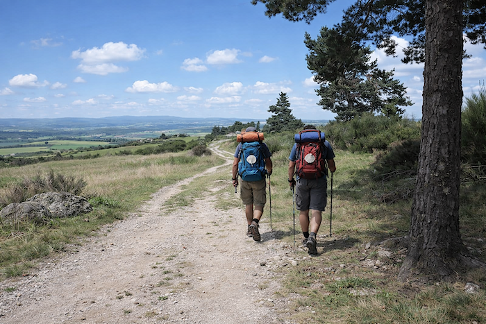
| Here, the Upper Allier possesses nothing brutal or heroic. This is not a mountain seeking to impress: it envelops, it gently tests, it wears one down without violence. In places, light struggles to penetrate the thickness of the branches, so tightly do the spruces crowd together like a silent army. The path hides beneath their guard. Families with donkeys are still encountered here; one of them, relieved of part of its load, carries the youngest child asleep in its pack saddle. In this slow summer procession, one senses that donkey renters await the fine season much as farmers await a harvest. |
 |
 |
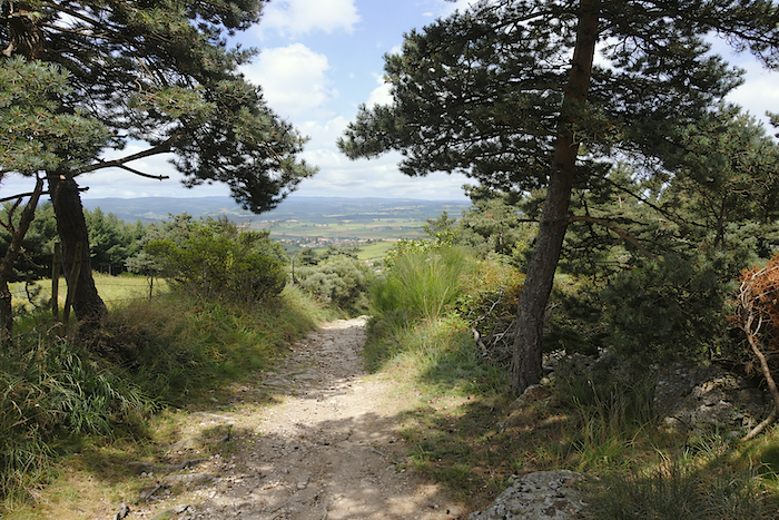
| Soon, however, the forest begins to open. The eye rediscovers a brighter hillside where a few sparse pastures and scattered fields turn green. These clearings carry something of a happy announcement within them: they already whisper the approach of Montaure. |
 |
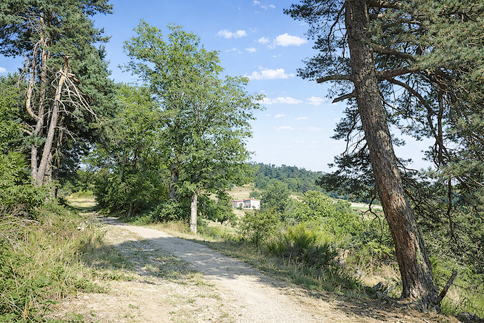 |
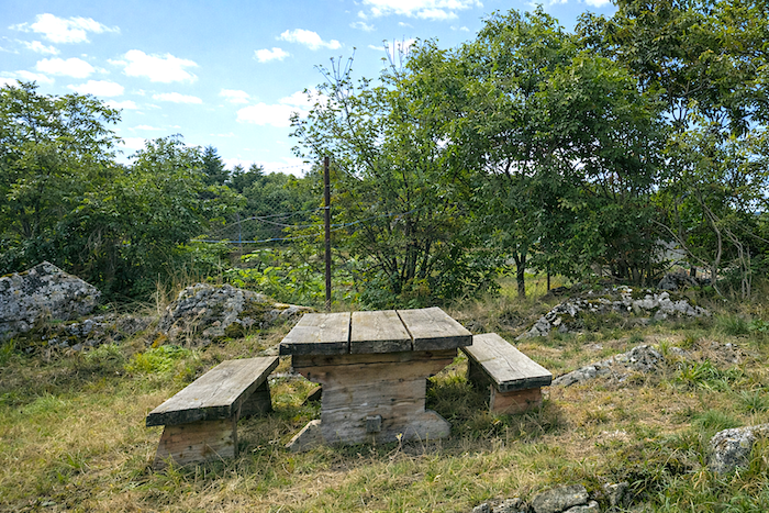
| Then the route returns to the tarmac. The climb was harsh, at times excessive, and upon certain steep embankments the foot may have hesitated, searching for support, doubting for a moment. This ascent leaves its mark upon the legs, and one easily understands why the hamlets along the way gradually saw the appearance of picnic tables, improvised refreshment stands and welcome resting places. Already, a few signs promise nearby happiness, and the pilgrim almost begins to savor it in advance. |
 |
 |
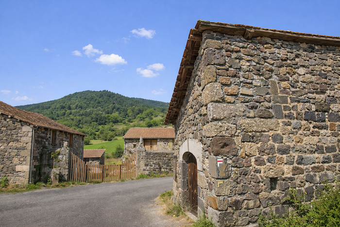
| Long ago, a refreshment stand welcomed travelers here; today it is closed, yet the spirit of the place remains. At Montaure, pilgrims still gladly stop to wipe away sweat and recover their breath after a climb some will consider endless. The hamlet is little more than a handful of old houses standing beside the path. Volcanic stone still reigns here, an austere yet familiar reign soon to be challenged by the granite of the Margeride appearing farther ahead. |
 |
 |
| At the exit of the hamlet, a tall stone cross keeps watch, an unmoving sentinel turned toward the valley, while the road escapes between the fields like a thread cast toward the horizon. From here onward, the land rises in vast rolling swells of sleeping earth: a supple geometry of broad curves and discreet folds, like a breath held beneath the skin of the landscape. |
 |
 |
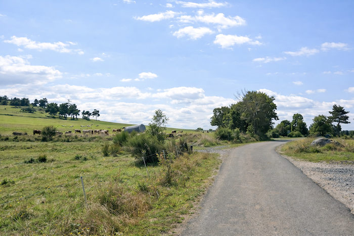
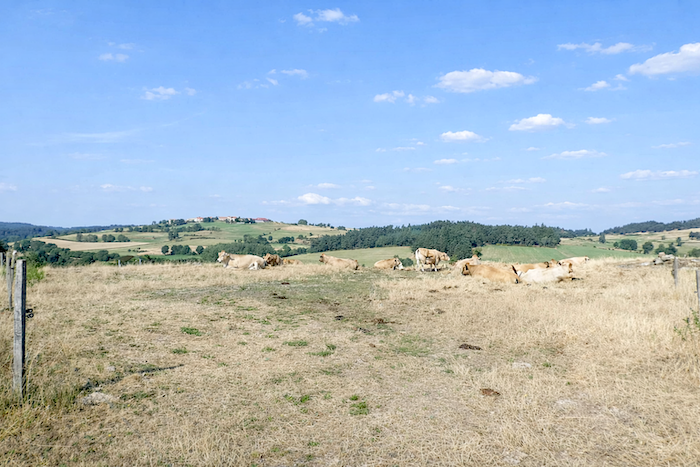
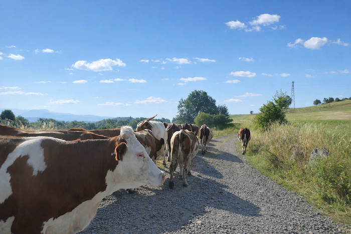
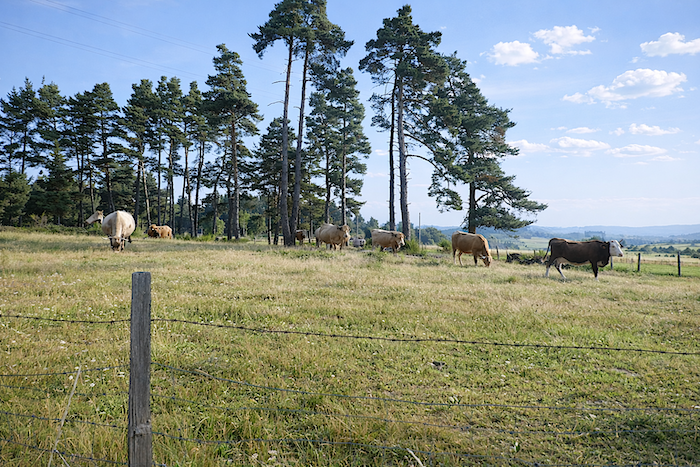
| From Montaure onward, the slope softens and yields without resistance through opulent meadows scattered with farms, sometimes seeming alone in the world. On this high plateau brushing one thousand meters in altitude, livestock farming is not merely an occupation: it is a way of inhabiting both time and land. Superb Aubrac cattle, draped in their tawny coats, raise their great eyes toward you. |
 |
 |
| Without one truly noticing, the landscape transforms itself within only a few kilometers. The austere granite of the Margeride gradually takes over from the dark basalt of the Devès. Here there are no jagged peaks nor spectacular abysses: the relief prefers the gentleness of vast pastures crowned by tall forests tracing the line of the ridges. These broad and peaceful hills are crossed without harshness; passing through them feels like a quiet reward for the effort accepted earlier. |
 |
 |
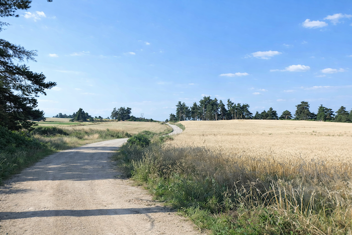
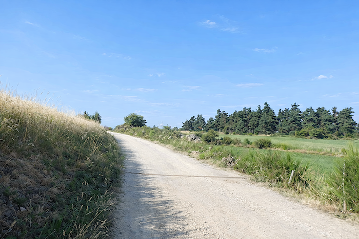
| Soon the tarmac gives way to a broad dirt track, generous in width. Here and there, clusters of pines and solitary ash trees raise their silhouettes like vegetal parasols. Then appear the great rye fields, discreet pride of the Margeride, or fields of triticale, that cereal born of human hands from the union of wheat and rye, destined mainly to feed livestock. On this harsh and ungenerous land, it is almost the only abundance one may hope for. |
 |
 |
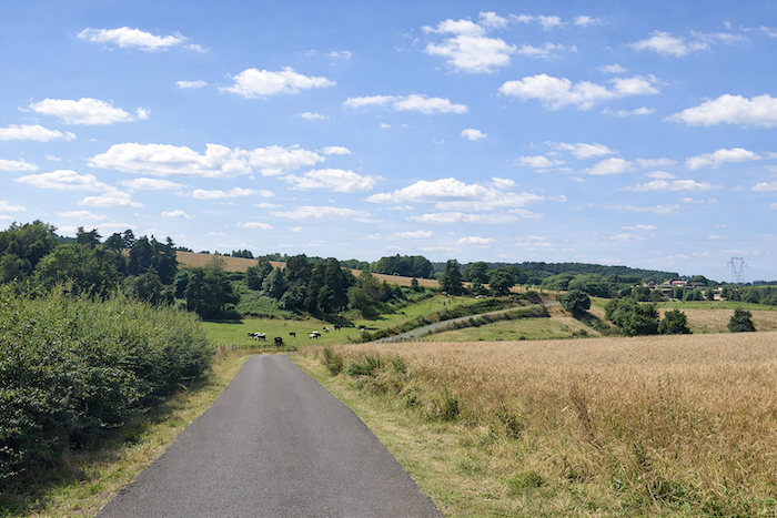
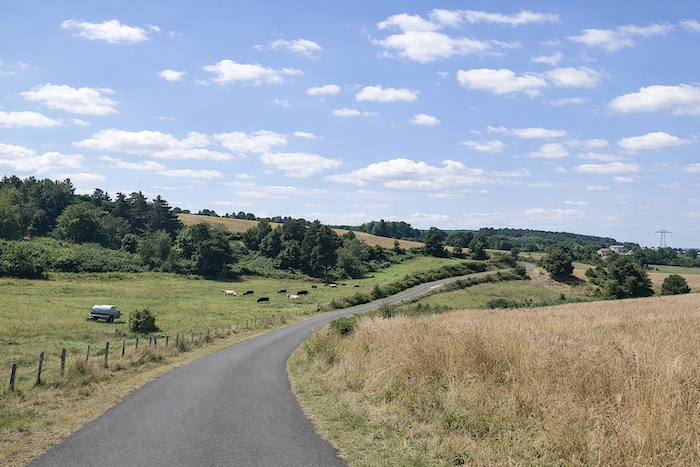
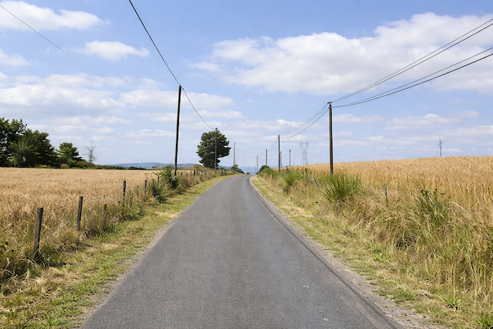
Section 4: Gentle undulations through the pastures
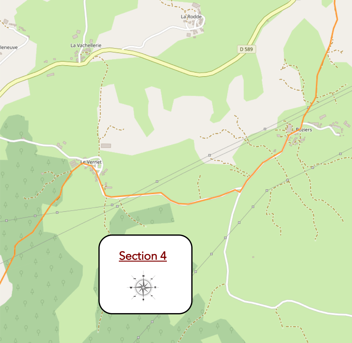
General overview of the route’s challenge: : an easy route after the ordeal.
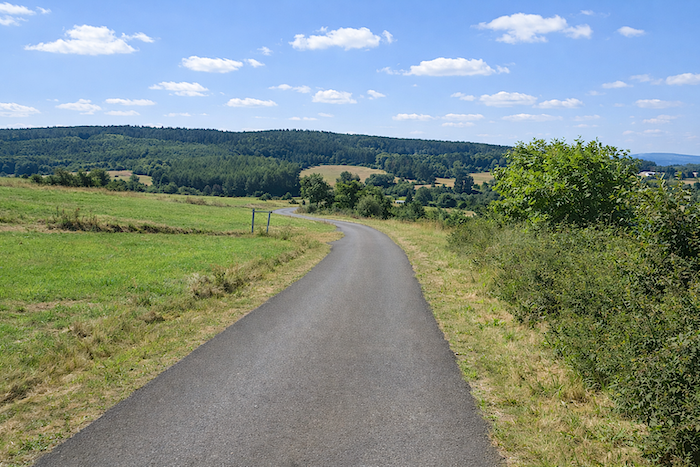
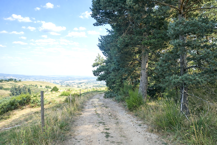
| What strikes one most in today’s stage is the power of contrasts. You have left behind the deep entrails of the gorges carved by the Allier, abandoned the harsh slopes and severe reliefs, and now entered the kingdom of peaceful hills. And yet, beneath this apparent gentleness, it is still the same land of character revealing itself, that rugged country long winters know how to test. In places, large granite blocks line the path like natural boundary stones: they speak plainly of the nature of the soil and announce the entrance into the Margeride. Soon, the dirt track draws near the hamlet of Roziers. |
 |
 |
| The path then crosses Roziers in an almost untouched tranquility. Clear water sings at the fountain; a fresh promise offered to the walker. Yet one may also continue as far as the Arche du Bonheur, a welcome halt where cold drinks are gladly accompanied by conversation. |
 |
 |
| All around, a few farms and handsome granite houses, more prosperous in appearance, line up their façades neatly along the road, as though the hamlet had chosen to stand there in quiet dignity. |
 |
 |
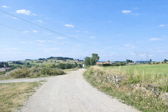
| From Roziers, the GR65 gently gains height once again along the ribbon of tarmac winding through the peaceful countryside. |
 |
 |
| A herd of Montbéliarde cows then advances at an unhurried pace, as though drawn onward by the promise of more tender grass farther ahead. Their owner tells us they are excellent dairy cows, sturdy and courageous. The only drawback in this rustic picture lies in their occasionally fragile feet. |
 |
 |
| The road continues its ascent without abruptness, gliding beneath the ash trees until the summit of the hill where a crossroads opens. |
 |
 |
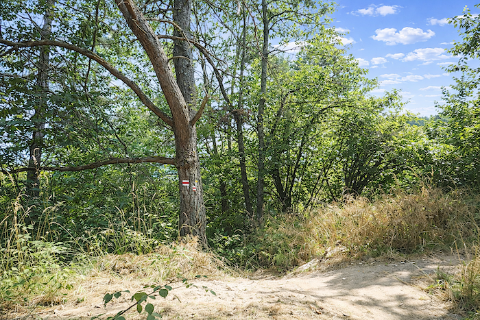
| As always along the GR65, the waymarking faithfully watches over the traveler’s steps. The route then turns to the right and yields itself to a gentle descent toward Le Vernet. |
 |
 |
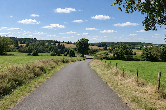
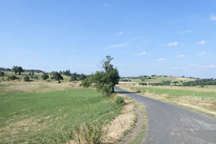
| The road stretches ahead like a ribbon of slate unfurled across the countryside, winding gracefully among meadows and the soft undulations of the plateau. On either side, deep green pastures spread in calm expanses. In the distance, the hills follow one another in peaceful waves, alternating between open grazing land, dense groves and the dark edges of forests softly closing the horizon. Here, nothing is hurried. |
 |
 |
| All around, the eye encounters only generous and peaceful countryside: vast grasslands, great trees with protective silhouettes, a few plots of rye, and everywhere the tranquil presence of cattle. In spring, these meadows burst into an almost insolent green worthy of Irish landscapes; when summer arrives, the light softens them. |
 |
 |
| Little by little, the road draws closer to Le Vernet. |
 |
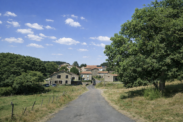 |
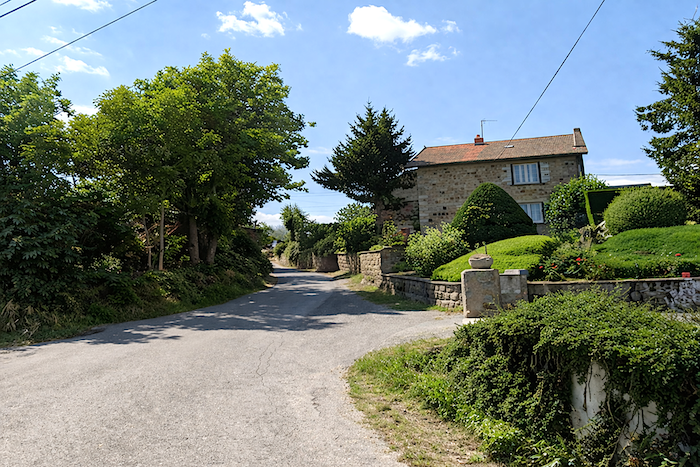
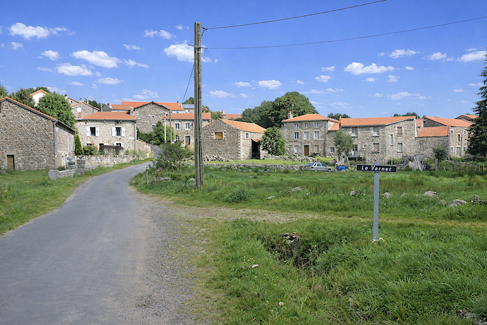
| In this region, villages like to perch upon the hillsides, as though to better watch over the surrounding land. In Le Vernet, granite has definitively replaced volcanic stone: here it is the raw material of everything built to endure, houses, crosses and fountains alike. The dwellings, arranged in tiers along the slope, resemble one another somewhat, united by the same pearl-grey stone that gives the village its coherence and discreet nobility. This patient and robust granite has already endured seasons and centuries; it will continue to withstand time. For although the altitude of these hamlets remains modest, winter grants no concessions here: the climate can prove harsh, austere and almost hostile. |
 |
 |
 |
 |
| The GR65 crosses Le Vernet before escaping uphill, skirting a picnic area placed there like a kindly resting place. Behind a cross raised upon its granite base, a henhouse hides half out of sight: there, a peacock struts proudly, displaying himself among busy hens, cautious pheasants and placid turkeys. |
 |
 |
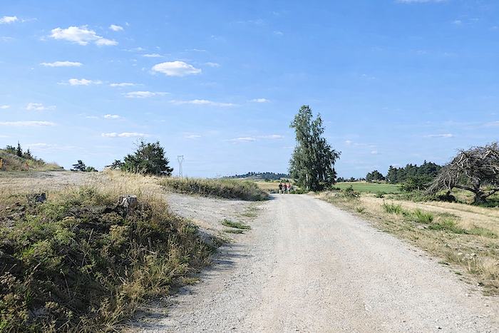
| A broad dirt path runs level through the meadows, as though it had deliberately chosen to take its time. Here and there, a few maples and ash trees punctuate the landscape with their tranquil silhouettes, offering islands of shade in the immensity of the grasslands. Farther on, conifer forests raise their dark edges upon the horizon, like a counterpoint to the softness of the fields. Such is the charm of this simple and soothing countryside, the kind that loosens thoughts and lightens the step. |
 |
 |
| Here, nature seems to have preserved its original face: calm, untouched and unadorned. Sunken lanes, hedgerows and broad wind-swept plateaus compose a landscape of profound serenity. And everywhere, the discreet yet eloquent traces of rural life, goat droppings and cow pats, remind the traveler that this high plateau still lives according to the patient rhythm of livestock farming, in silent fidelity to the land. |
 |
 |
| Farther on, as you approach Rognac, the path narrows and seems to invite a more intimate relationship with the landscape. The surrounding meadows possess an almost irresistible softness: their gentle slopes, thick grass and welcoming silence make one long to lie down there for a moment, for a stolen nap along the journey. |
 |
 |
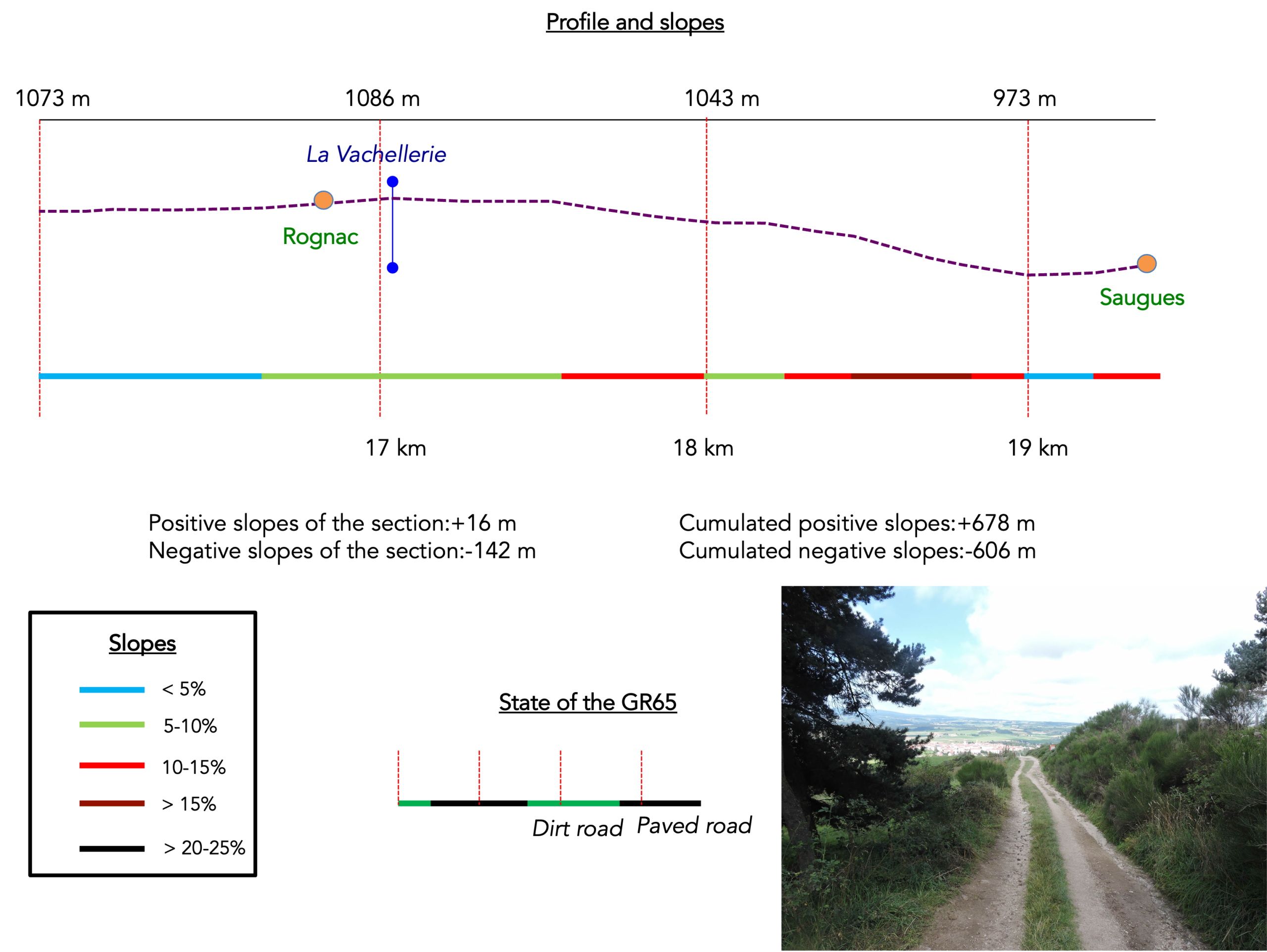
Section 5: Descending toward Saugues
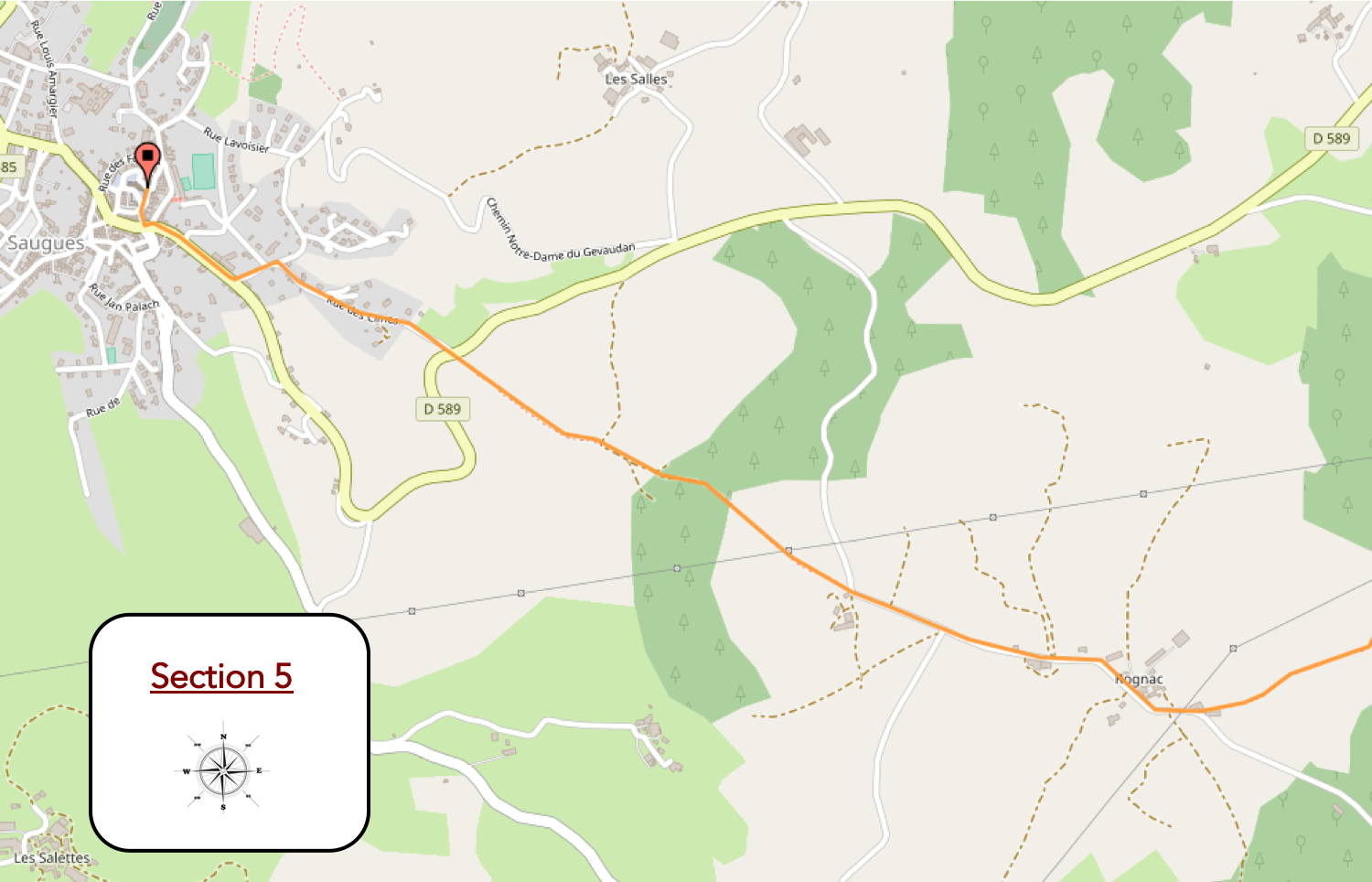
General overview of the route’s challenges: sno real difficulty, apart from a few very steep sections approaching Saugues.
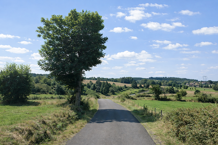
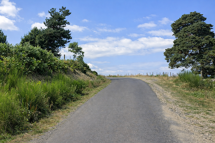
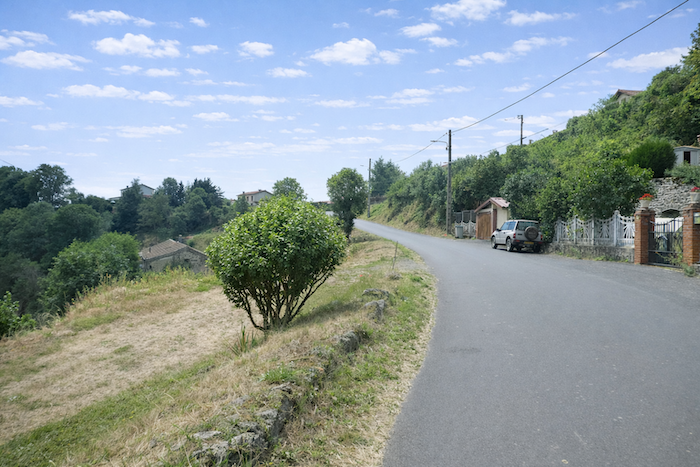
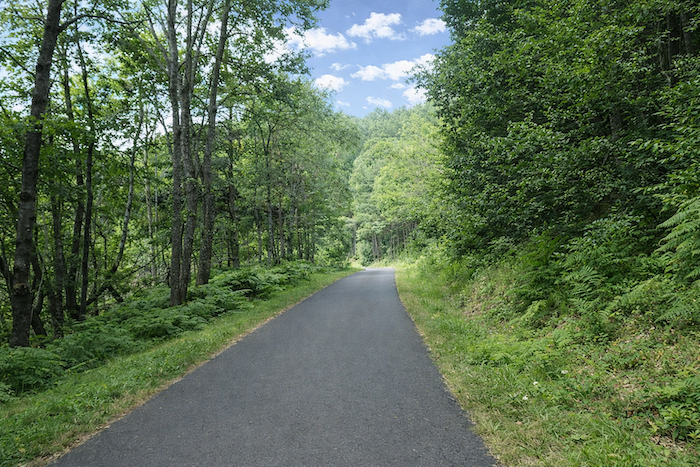
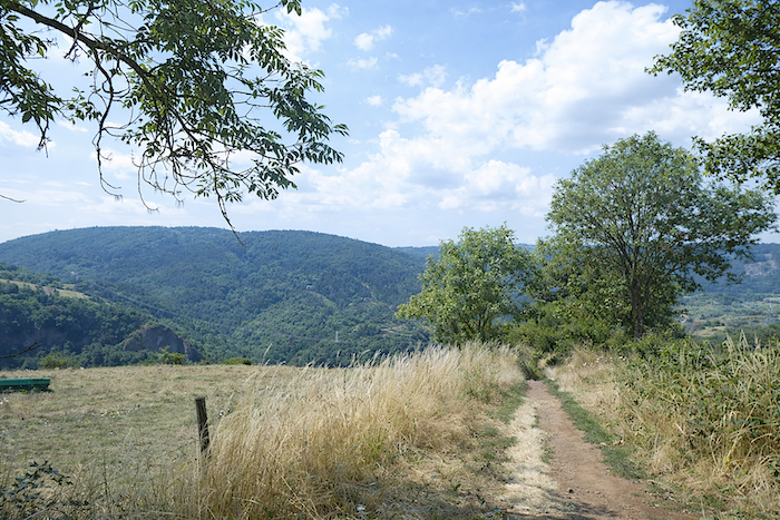
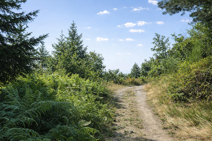
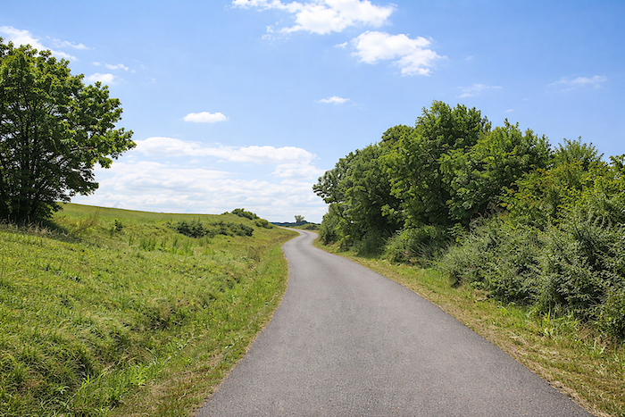
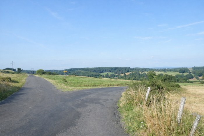
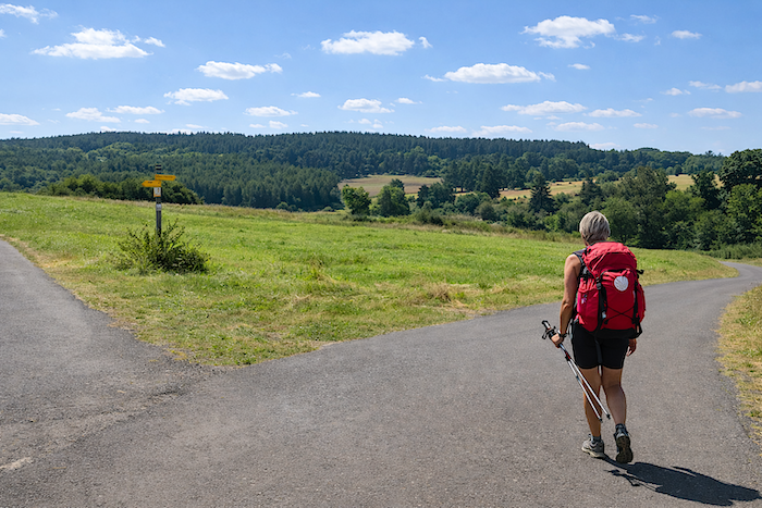
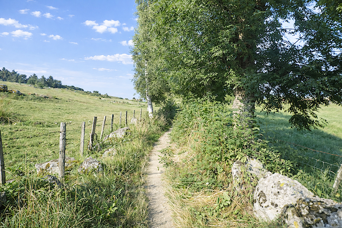
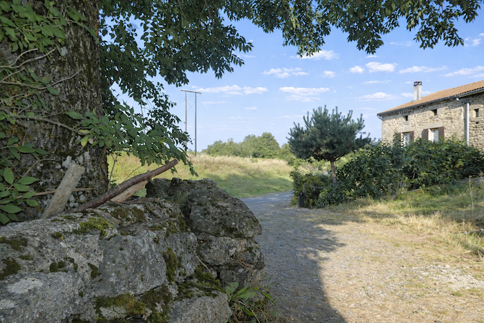
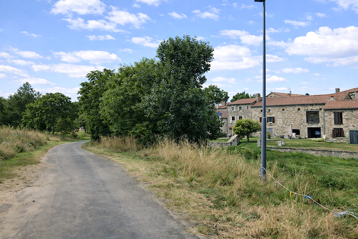
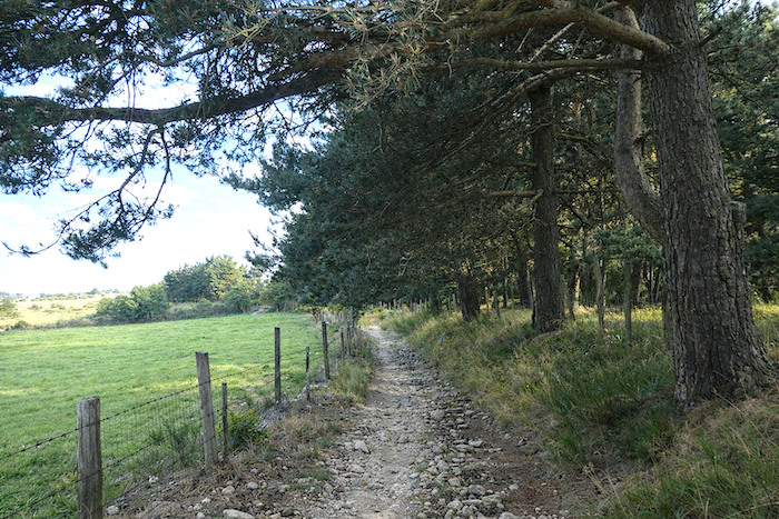
| The GR65 continues for some time through open countryside, gliding along a narrow path beneath the watch of pines and ash trees. Then, without abruptness, it rejoins the tarmac at the entrance to Rognac, nestled at 1,100 meters above sea level, the highest point of the stage. You are now deep in the Gévaudan, at the gateway to the Margeride, that massif of medium-height mountains whose highest summit, the Signal de Randon, rises to 1,551 meters. Here, the land does not merely nourish livestock: it also offers its treasures to gatherers. Mushrooms, blueberries, lichens and narcissi are among the patient riches harvested by the inhabitants of Saugues with genuine skill. Many will tell you, not without a hint of mischief, that this gathering amounts to a thirteenth month’s salary. The sale of dried or sliced mushrooms, especially porcini, remains a lively tradition during the autumn fairs of Saugues. As for lichens and narcissi, they even find their way into the world of perfumery. |
 |
 |
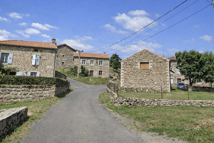
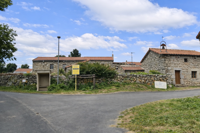
| Rognac belongs to that family of villages of the Gévaudan and the Margeride whose unity forms their beauty: the same solid houses, the same carefully jointed granite stones, the same impression of quiet permanence. Here, everything seems built to withstand wind, frost and time. The little bell tower catching the eye does not belong to a chapel, but to the village assembly house, the modest beating heart of the community. |
 |
 |
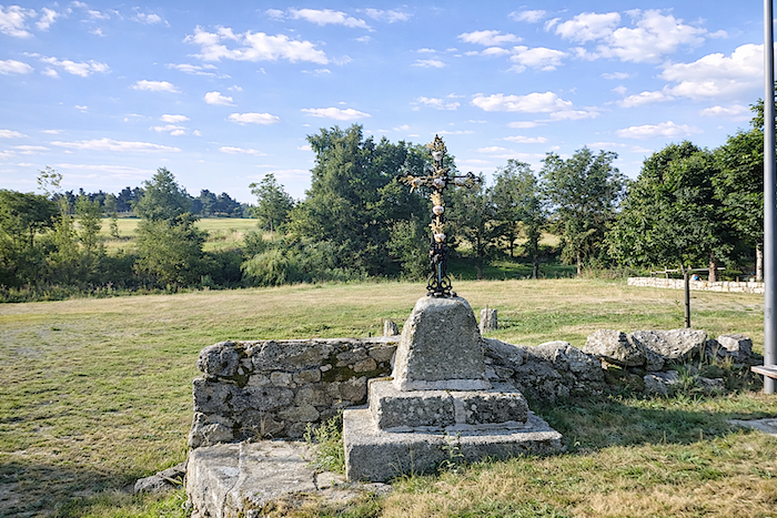
| The road then leaves Rognac by passing behind a remarkable wrought-iron cross, gracefully set upon its granite base like a final salute from the village to the traveler. |
 |
 |
| Beyond Rognac, the GR65 continues its ascent for a while longer, gently and without difficulty, along the tarmac road running straight through the open countryside. |
 |
 |
| The road gains a little more height before reaching a crossroads where a dirt path reappears. It is there that the route finally begins its descent toward Saugues, as though the landscape, after raising you onto its peaceful ridges, were now willing to guide you back down toward the valley. |
 |
 |
| Below, the landscape suddenly opens onto the gentle hills surrounding Saugues, as though the country, after long allowing itself only to be guessed at, finally agreed to reveal itself. The peaceful undulations of the relief, the terraced meadows and the wooded edges compose a scene of soothing harmony, bathed in that clear light peculiar to the high plateaus. |
 |
 |
| A path then slips among the pines like a corridor of freshness and silence. Hollowed by footsteps and scarred by rainwater, it winds among pale stones and exposed roots with the familiar harshness of trails that have witnessed generations of walkers. On either side, old granite walls half collapsed and covered in moss and lichen border the track like remnants of an unchanging rural world. . |
 |
 |
| Beneath the great pines with their twisted trunks, light filters through in shifting veils, playing among shadows and foliage. A few maples and ash trees soften the setting with their lighter leaves, bringing a touch of airy grace to this woodland austerity. The landscape possesses here something profoundly untouched: a simple beauty without artifice, made of silence, rock, light and wind. Far away, between two trunks, an opening reveals glimpses of the open countryside. It is the landscape of a secret and preserved world, where the path invites less to move forward than to slow down and savor the peace of the place. |
 |
 |
 |
 |
| The path, at times stonier, continues its relentless descent over rock and beaten earth. Sometimes it crosses open spaces, almost steppe-like, where the wind seems to reign supreme; at others, it slips beneath the more benevolent cover of the woods, where shade softens the harshness of the slope. At every turn, the path plays with the relief, following the folds of the terrain, becoming more intimate or wilder according to the mood of the landscape. |
 |
 |
| Little by little, upon the approaching horizon, Saugues begins to reveal its red roofs nestled among the hills. The town first appears like a promise, a glimmer of tiles in the light, before gradually taking shape within the landscape. If you pass here after springtime, the flowering broom will add still more magic to the place, scattering flashes of vivid gold across the slopes. |
 |
 |
 |
 |
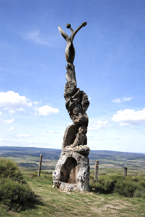
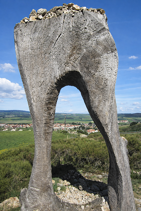
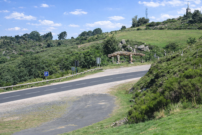
It is then that strange wooden sculptures suddenly appear upon the plateau, as though reminding the traveler that the Gévaudan is not merely a land of silence and pastures, but also a country of dark tales and buried memories. They seem to stand watch over the hills like guardians of mystery, raised there to revive the ancient legend of the Beast of Gévaudan. Long ago, it is said, the creature appeared without warning, striking with senseless savagery and spreading terror through villages and even along the most familiar paths. Then the slightest rustle in the bushes, the crack of a branch or the breath of wind through the undergrowth became omens of tragedy. The whole region lived in anxious expectation of the invisible threat.
| These fantastic figures, carved from single tree trunks, express at once the harshness of the land and the shadow dwelling within it. Rising upon the ridge like apparitions, halfway between artwork, totem and dream, they stand facing the wind and the immensity of the landscape as though in dialogue with both sky and earth. Their raw material, solid wood hollowed, scarred and polished in places, preserves the veins, knots and wounds of the original tree, as though nature itself had begun the work before the artist’s hand revealed its final form. |
 |
 |
Even the Beast of Gévaudan itself seems still to watch you from the roadside, lurking within the stories and shadows of the land. Then the GR65 rejoins the departmental road, like a gradual return to the inhabited world after the moorlands, woods and legends.
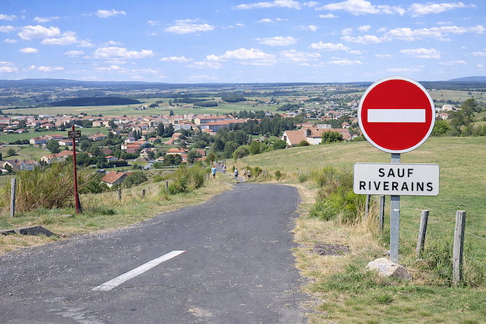
| A small steep and winding tarmac road then draws you down toward the village. The slope becomes sharp; the eye already plunges toward the rooftops and alleyways while the legs begin to feel the weight of the descent. |
 |
 |
| The road then twists among the houses, slips through narrow lanes and finally leads you, by a kind of slow unveiling, into the heart of Saugues itself. |
 |
 |
 |
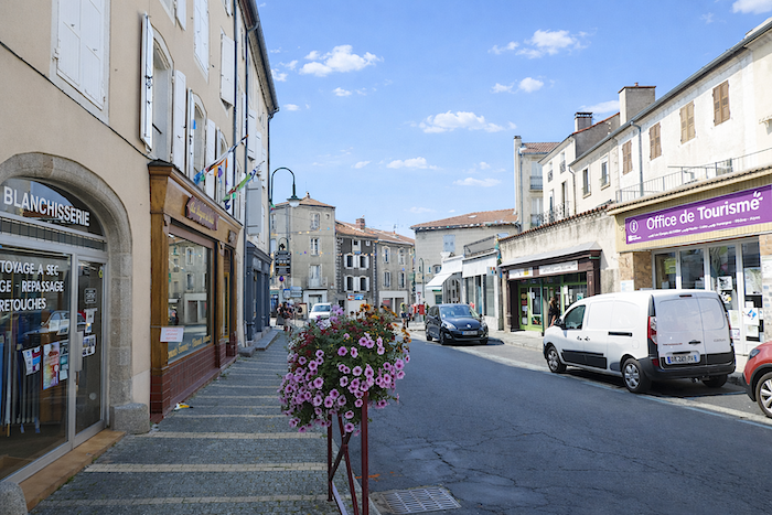 |
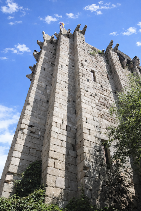
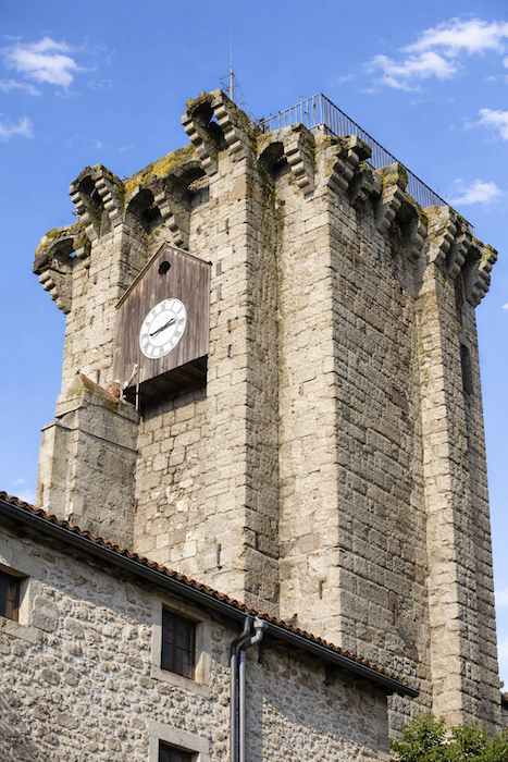
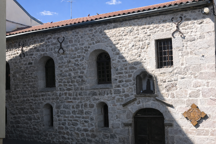
| Saugues, with its population of around two thousand inhabitants, is a small town of character whose name resonates far beyond the Margeride. It is known for the legend of the Beast of Gévaudan, for its mushrooms and wooden clogs, but also for its role as an essential market town throughout the region. Here, livestock remains a living wealth: the cattle market animates Mondays, the sheep market Fridays, and more than one hundred thousand animals pass through each year. Yet Saugues cannot be reduced merely to its fairs and traditions: it is a land steeped in history. Long before the arrival of the Romans, the region belonged to the Gabales, a proud and fierce people living amid immense forests covering almost the entire territory. Julius Caesar referred to this country under the name Salgacum. After the fall of the Roman Empire in 476, the region passed under Frankish domination. In the 8th century, raids by Saracens and Moors left behind traces of fire and ruin. In the 12th century, Saugues came under the authority of the Mercœur family, a powerful Auvergne lineage also established in St Privat-d’Allier. It was during this period that most of the town’s fortifications and the famous English Tower were constructed. At that time, the region enjoyed remarkable prosperity: hundreds of parishes and thousands of families lived there, evidence of a dense and thriving territory. Then came the long turmoil of the Hundred Years’ War. Between 1337 and 1453, the region endured its share of violence, sieges and pillaging. In 1380, Charles V sent troops to retake the town from those called the “English”. In reality, these were mostly mercenaries left unpaid and turned brigands after the Treaty of Brétigny. It was they who gave their name to the tower still visible today. The end of the conflict did not immediately calm fears. Throughout the Gévaudan, castles and walls were reinforced; at the time, around thirty fortified places existed in the region. Yet another disaster struck Saugues in 1788: the fire of the communal oven. Within a few hours, flames devastated almost the entire town without sparing a single street. From this catastrophe, only one great survivor remained standing: the English Tower. The only tower of the castle to resist the flames, it became the witness to both the disaster and the rebirth of the town. The inhabitants rebuilt Saugues using the stones of the former castle itself. Even today, this tower standing at the heart of the town watches over the rooftops and marks the rhythm of local life with its clock, like a link between centuries. |
 |
 |
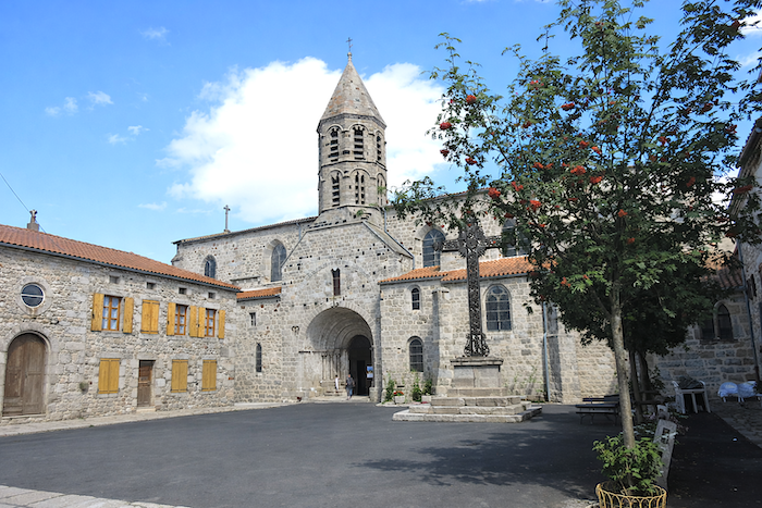
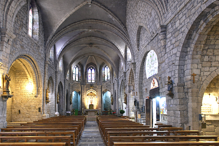
| The collegiate church of St Médard preserves its original octagonal tower dating from the 13th century. The church was partially destroyed in the 16th century before being progressively restored. It contains the relics of Brother Bénilde, a local saint first beatified and more recently canonized. |
 |
 |
| The Brotherhood of the Penitents was founded in Saugues in 1652. The brotherhood belongs to those Catholic confraternities whose statutes prescribe acts of penance such as fasting and assistance to the sick and the dead. They are classified according to the colour of the robes worn during processions or penitential duties. Here in Saugues, the robe is white. In the 19th century, the community numbered around two hundred members. Today, about forty remain. The Holy Thursday procession with hooded penitents is an exceptional event. The Penitents’ Chapel, which may be visited upon request, was erected in 1681. It burned in 1788 and was later restored.
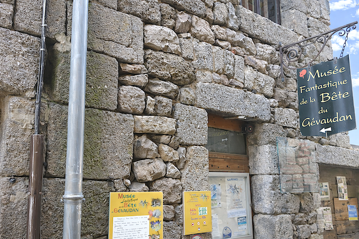
Lucien Gires (1937–2002), a local artist, became one of the principal artistic figures of the town. He was responsible for the restoration of the English Tower, the illustration of the life of Saint Bénilde, and the development of the Museum of the Beast of Gévaudan. The museum opened in 1989. It retraces the mysteries surrounding the terrible mythical beast that killed more than one hundred people in the region. For further details, see the next stage: From Saugues to St Alban-sur-Limagnole. |
 |
 |
Accommodation on Via Podiensis
• Gîte L’Estaou, Dominique Mulliez (pèlerine), Combrieux; 04 71 09 58 91/06 66 40 60 31; Gîte, dinner, breakfast
• Gîte de Rochegude, Nathalie et Franck Pascal, Rochegude; 06 33 70 48 10; Gîte, dinner, breakfast, cuisine
• Gîte La Ribeyre***, Christelle et Stéphane Robert, Praclaux; 06 63 46 37 09/; Gîte, dinner, breakfast
• Chambres d’hôtes Aldon, Géraldine Aldon, Praclaux; 06 61 51 71 10; Guestroom and tents, dinner, breakfast
• Camping municipal Le Vivier***, Rue du Pain de Sucre, Monistrol d’Allier; 04 71 57 24 14; tents, breakfast, cuisine
• Gîte Au Ricochet, Magali Perrony, Monistrol d’Allier; 06 59 07 70 66; Gîte, dinner, breakfast
• Gîte La Tsabonne, Patrick Fourquet et Myriam, Montée des deux Chiens, Monistrol d’Allier; 04 71 06 17 23/06 15 15 38 39; Gîte, dinner, breakfast
• Gîte du Pont Eiffel, André Solakian, Monistrol d’Allier; 06 44 72 81 95/04 71 06 17 74; Gîte, dinner, breakfast
• Gîte Chez Martin, 89 Rue des Jacquets, Monistrol d’Allier; 07 66 93 20 61; Gîte, breakfast, cuisine
• Chambres d’hôtes Les Terrasses du Verger, 424 Route de Gévaudan, Monistrol d’Allier; 06 40 50 30 22; Guestroom, dinner, breakfast
• Le Repos du Pèlerin, 365 Rue des Jacquets, Monistrol d’Allier; 06 18 33 30 73; Bar, Gîte and Guestroom, dinner, breakfast
• Gîte Le Pain de Sucre, Peter Joyce, Le Vivier, Monistrol d’Allier; 07 88 21 29 53; Hotel, dinner, breakfast
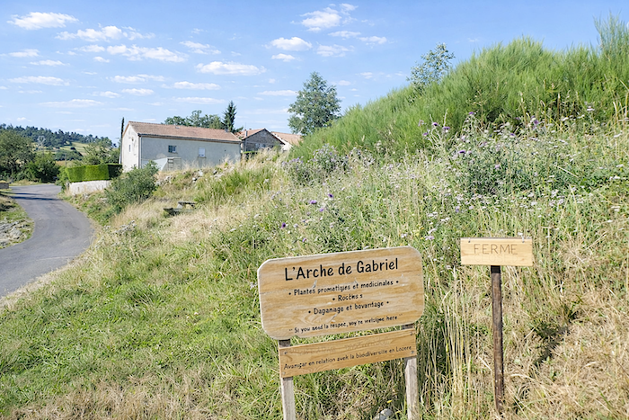
• Gîte L’Arche de Gabriel, Roziers; 07 45 17 22 60/04 71 77 85 78; gîte, dinner, breakfast
• Gîte de la Remise, Rognac; Gîte, dinner, breakfast
• Gîte communal, 8 Rue de la Margeride, Saugues; 04 71 77 80 62/06 65 15 04 32; Gîte, cuisine
• Centre d’accueil de la Margeride, Cyril et Sonia, Saugues; 04 71 77 60 97; Gîte, dinner, breakfast
• Gîte à la Ferme Itiers-Martins, 65 Chemin des Noisetiers, Saugues; 04 71 77 83 45/06 72 75 46 48; Gîte, dinner, breakfast
• Gîte le Par’Ici, Barbara Sulas, 445 Avenue Lucien Gires, Saugues; 07 65 68 71 44; Gîte, dinner, breakfast
• Gîte La Dentelle du Camino, 48 Rue de la Margeride, Saugues; 07 84 76 92 27/04 71 77 38 03; Gîte, dinner, breakfast
• Gîte Le Chalet du Pèlerin, Jean-Claude et Maria Decoster, 70 Rue des Cimes, Saugues; 06 09 60 09 65; Gîte, dinner, breakfast
• Gîte D’Ici et Ailleurs, 46 Rue de la Margeride, Saugues; 06 33 60 53 02; Gîte, dinner, breakfast
• Gite A L’Instant, 345 Rue des Cimes, Saugues; 04 71 77 68 60 /06 19 19 29 45; Gîte, dinner, breakfast
• Gîte Au Bon Moment, 1 Rue des Prés, Saugues; 06 41 54 44 67; Gîte, dinner, breakfast
• Gîte Margeride et Gévaudan, 3 Rue de Espeisse, Saugues; 07 44 26 99 18; Gîte, cuisine.
• Les Gabales, Éveline et Pascal (pèlerins), 70 Avenue Lucien Gires, Saugues; 04 71 77 86 92; Guestroom, dinner, breakfast
• La Flore, Régis et Florence (pèlerins), 230 Avenue Lucien Gires, Saugues; 06 50 28 43 11; Guestroom, dinner, breakfast
• Auberge Chez Virginie, 2 Rue des Carmélies, Saugues; 06 27 55 89 66; Restaurant, Guestroom, dinner, breakfast
• Les Terrasses, 11 Cours Gervais, Saugues; 04 71 77 83 10; Hotel**, dinner, breakfast
Year after year, the Camino de Santiago changes and reinvents itself with the seasons and the footsteps of pilgrims. Some accommodations close their doors, while others, modest or unexpected, come into being. It would therefore be unrealistic to claim to provide a fixed and exhaustive list. This guide includes only accommodations located directly on the route or within one kilometer of it. The selection was updated in 2026 and should therefore not undergo any major changes in the coming years. For those wishing to go further, one publication stands out as the essential reference: Miam Miam Dodo, easily available online. The main strength of this guide lies in its yearly updates. It not only lists accommodations located directly on the route, but also addresses slightly off the route, a valuable resource when heavy pilgrim traffic makes overnight stops more uncertain. It also contains a wealth of practical information: welcoming bars, restaurants along the way, and providential bakeries, all of which punctuate the journey. Alongside these traditional resources, another presence has become unavoidable: Airbnb. The platform has established itself as a major reference in the tourism landscape, even in the most discreet or less developed regions. However, as everyone knows, exact addresses are not displayed directly, which requires a degree of anticipation. On the Camino, finding a bed at the last minute can sometimes depend on sheer luck. But luck, by its very nature, cannot be considered a strategy. Booking ahead is therefore strongly recommended. Finally, when making arrangements, be sure to inquire about dinner and breakfast options. These details, seemingly minor, can greatly soften the hardships of a stage.
If one takes stock of accommodation capacity, there are around 185 beds available before reaching Saugues, suggesting that many pilgrims choose to stop earlier along the route, particularly in Monistrol. In Saugues itself, the offer expands to nearly 190 available beds. Since the Via Podiensis generally sees between 100 and 200 walkers, this stage should not present any particular difficulty in terms of accommodation. Nevertheless, booking in advance remains a wise precaution.
These routes, winding through often sparsely populated territories, offer few shops. Restaurants are rare, as are grocery stores, which frequently take the form of modest bread depots offering a few vegetables and dairy products. However, it is possible to find food and refreshments in Monistrol and Montaure, welcome stops in these more isolated stretches. Water points, on the other hand, are fairly regular along the route: they can be found at Rochegude, Pratclaux, Monistrol, Escluzels, Montaure, Roziers, and Le Vernet. They are often accompanied by sanitary facilities, usually dry toilets, particularly at Rochegude, Monistrol, and Roziers. Upon arrival, Saugues offers all the comforts of a small town with the full range of necessary shops and services. Lastly, many companies provide luggage transport or return-transfer services to the starting point. Among them, one stands out as an essential reference: La Malle Postale.
Feel free to add comments. This is often how you move up the Google hierarchy, and how more pilgrims will have access to the site.
|
 |
Next stage : Stage 3: From Saugues to Le Sauvage |
|
 |
Back to menu |