Pay attention to the beast of Gevaudan
DIDIER HEUMANN, MILENA DALLA PIAZZA, ANDREAS PAPASAVVAS
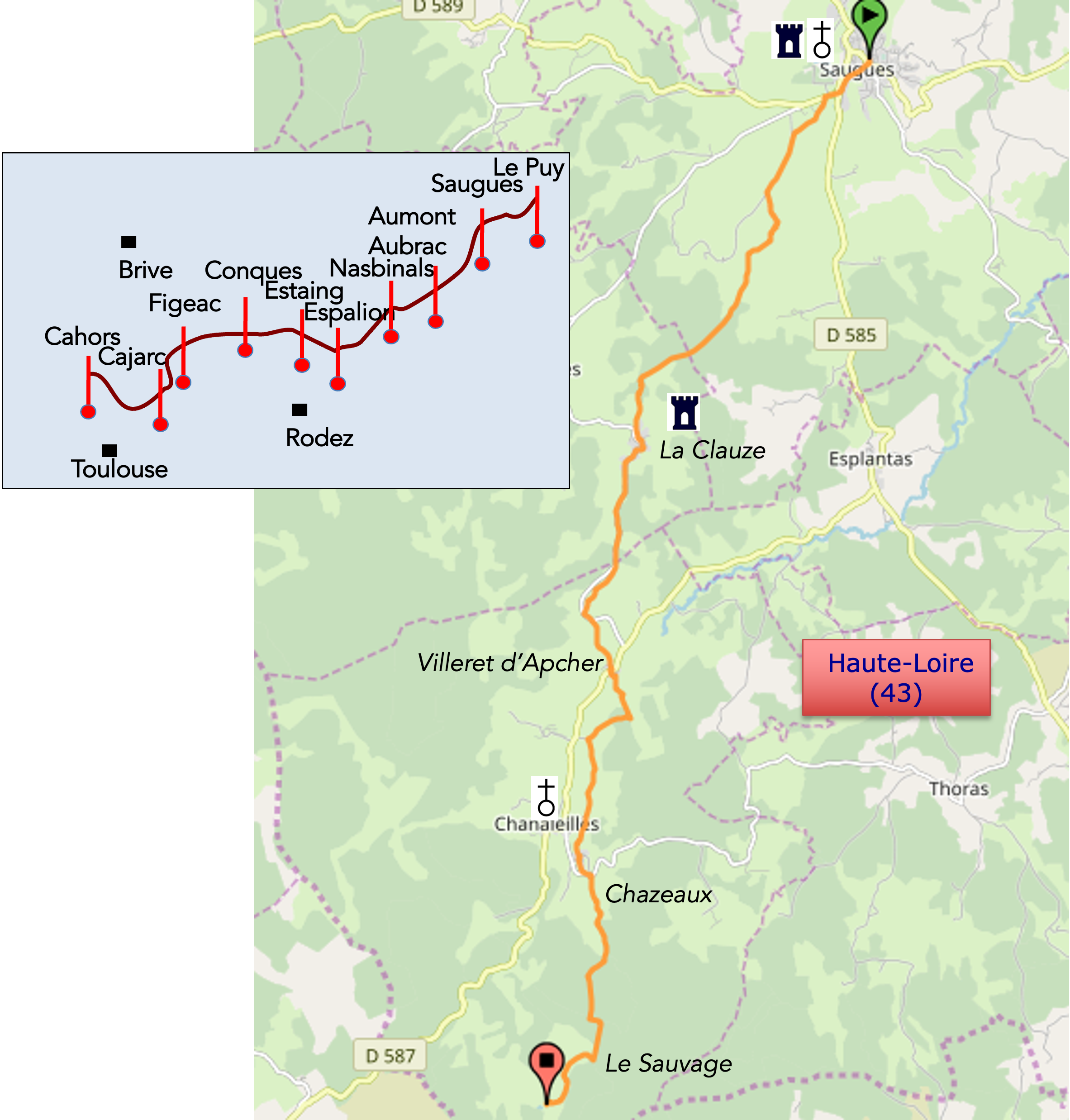
We divided the course into several sections to make it easier to see. For each section, the maps show the course, the slopes found on the course, and the state of the roads. The courses were drawn on the “Wikilocs” platform. Today, it is no longer necessary to walk around with detailed maps in your pocket or bag. If you have a mobile phone or tablet, you can easily follow routes live.
For this stage, here is the link:
https://fr.wikiloc.com/itineraires-randonnee/de-sauges-au-sauvage-par-le-gr65-29726048
|
Not all pilgrims are necessarily comfortable using GPS devices or navigating with a smartphone, especially since there are still many areas without Internet access. That is why, to make your journey easier, a book dedicated to the Via Podiensis from Le Puy-en-Velay to Cahors is available on Amazon. Much more than a simple practical guide, this book accompanies you step by step, kilometer after kilometer, providing all the information you need for smooth planning and avoiding unpleasant surprises. Beyond its practical advice, it immerses you in the enchanting atmosphere of the Camino, capturing the beauty of the landscapes, the majesty of the trees, and the very essence of this spiritual adventure. Only the pictures are missing, everything else is there to transport you.
In addition, we have also published a second book which, with slightly fewer details but all the essential information, covers the entire route from Le Puy-en-Velay to Saint-Jean-Pied-de-Port. The choice of your journey is yours.
. |
 |
 |
If you only want to consult lodging of the stage, go directly to the bottom of the page.
Today, the route crosses a large part of Gévaudan, a world apart where forests stand beside granite blocks, where the landscape sometimes opens and sometimes closes again near isolated hamlets, in the middle of forests and pastures enclosed behind stone walls and barbed wire fences, the trademark of Margeride and Aubrac. The route heads almost due south beyond the Allier basin. It is a slow transition toward Margeride, then toward the Aubrac plateau. The region you are crossing is clearly different from Haut Allier and the Devès that you have just visited. Here, the relief comes from the decomposition of the granite of the Massif Central. It is a low mountain massif, rounded in shape and drained by the tributaries of the Allier and the Truyère. These are harsh lands, covered with fairly dense fir forests, pine trees and beeches, known locally as fayards, small beeches, along with broom shrubs. Scots pine is the dominant species, growing among moorlands covered with bilberries and broom. The transitions between open spaces and forests are gentle. On the slopes, erosion has exposed veins and small granite blocks. Since granite is the defining stone of the region, the buildings are made from it. The surroundings of the villages occupy small areas in the most accessible parts of the valleys. The plots are often separated by ash trees, stone walls, or barbed wire attached to small granite blocks. The soil is poor and acidic because of the granite bedrock of the region. As a result, grazing remains the main resource. Forestry, mushroom gathering, and lichen harvesting complete the range of activities of the local farmer.
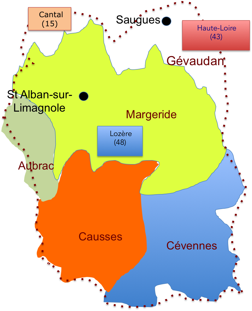
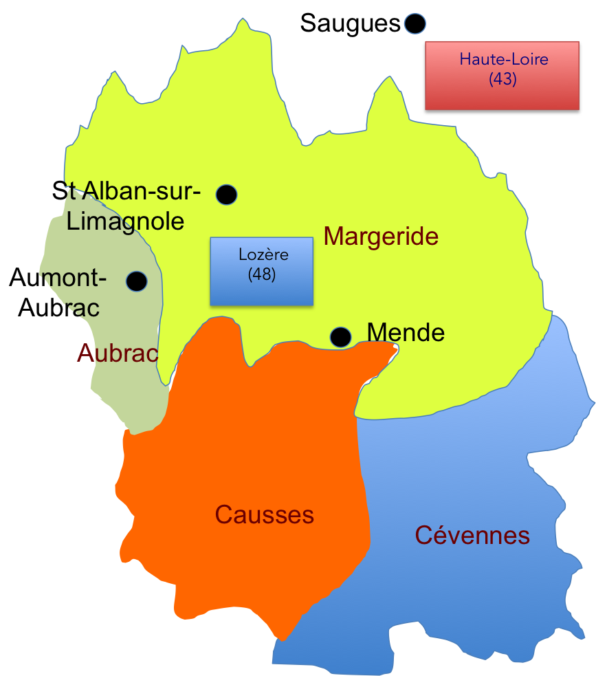
There is often some confusion between Gévaudan, Margeride, and Lozère. In reality, they are fairly similar, at least in terms of landscape. In the past, there was a large province here called Gévaudan, which included Margeride, Aubrac, part of the Cévennes to the south, and part of Cantal to the north. Modern surveyors reshaped this vast territory to create a department, Lozère. Gévaudan is therefore slightly larger, since it also includes part of southern Haute Loire, which we are crossing today. In any case, the Beast of Gévaudan certainly knew the geography perfectly well, having worn down its sharp claws across this immense territory. Sauvage 02b/c
Today’s stage remains entirely within Haute Loire. Nature feels less rugged today. During the first part of the day, the landscape is pastoral, with meadows marked by granite posts and houses built from the same material. In the second part, the scenery changes as the route enters thick forests, largely made up of spruce and pine trees, before reaching the majestic site of Le Sauvage, the end of the stage.
|
.
|
 |
 |
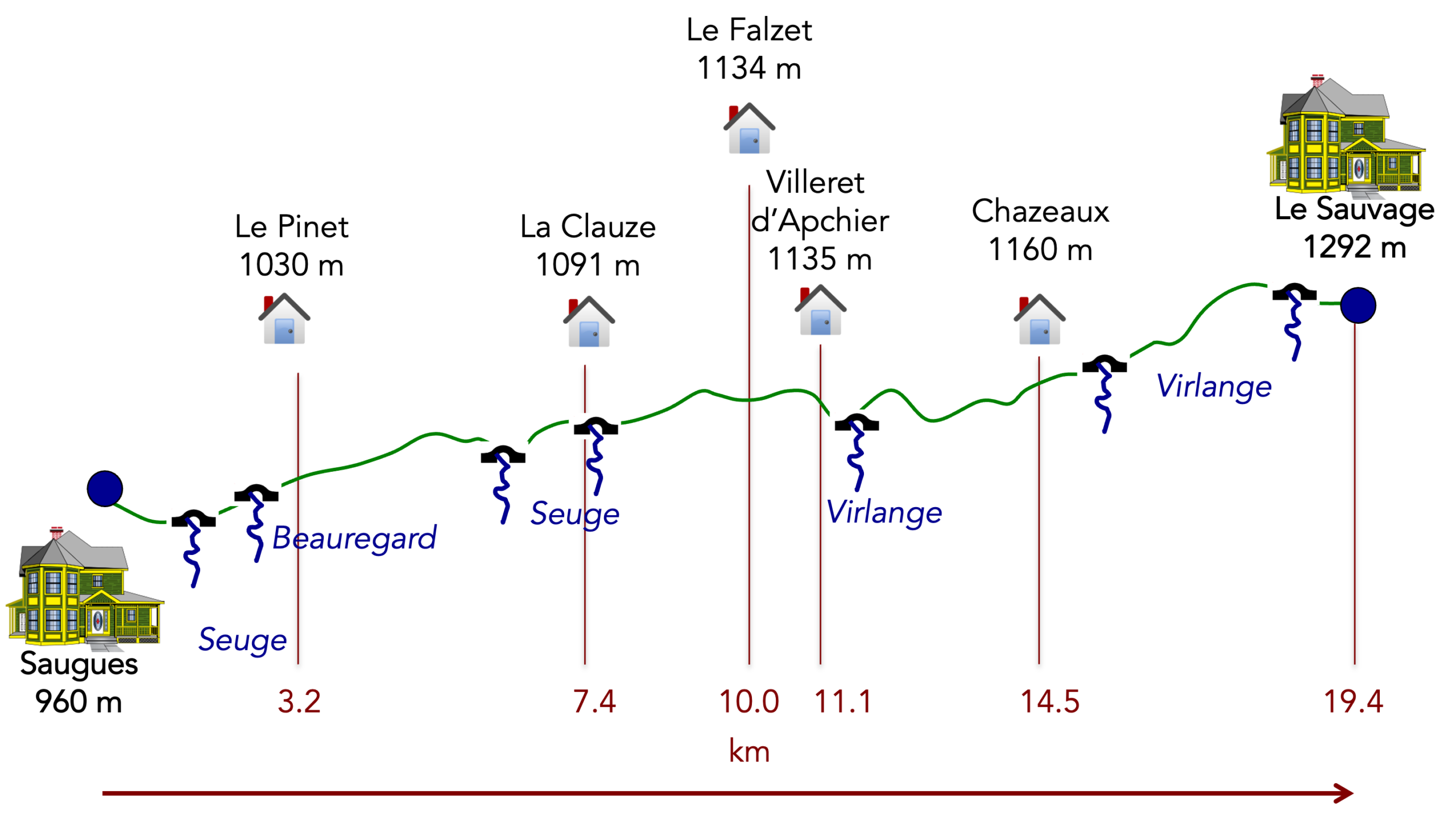
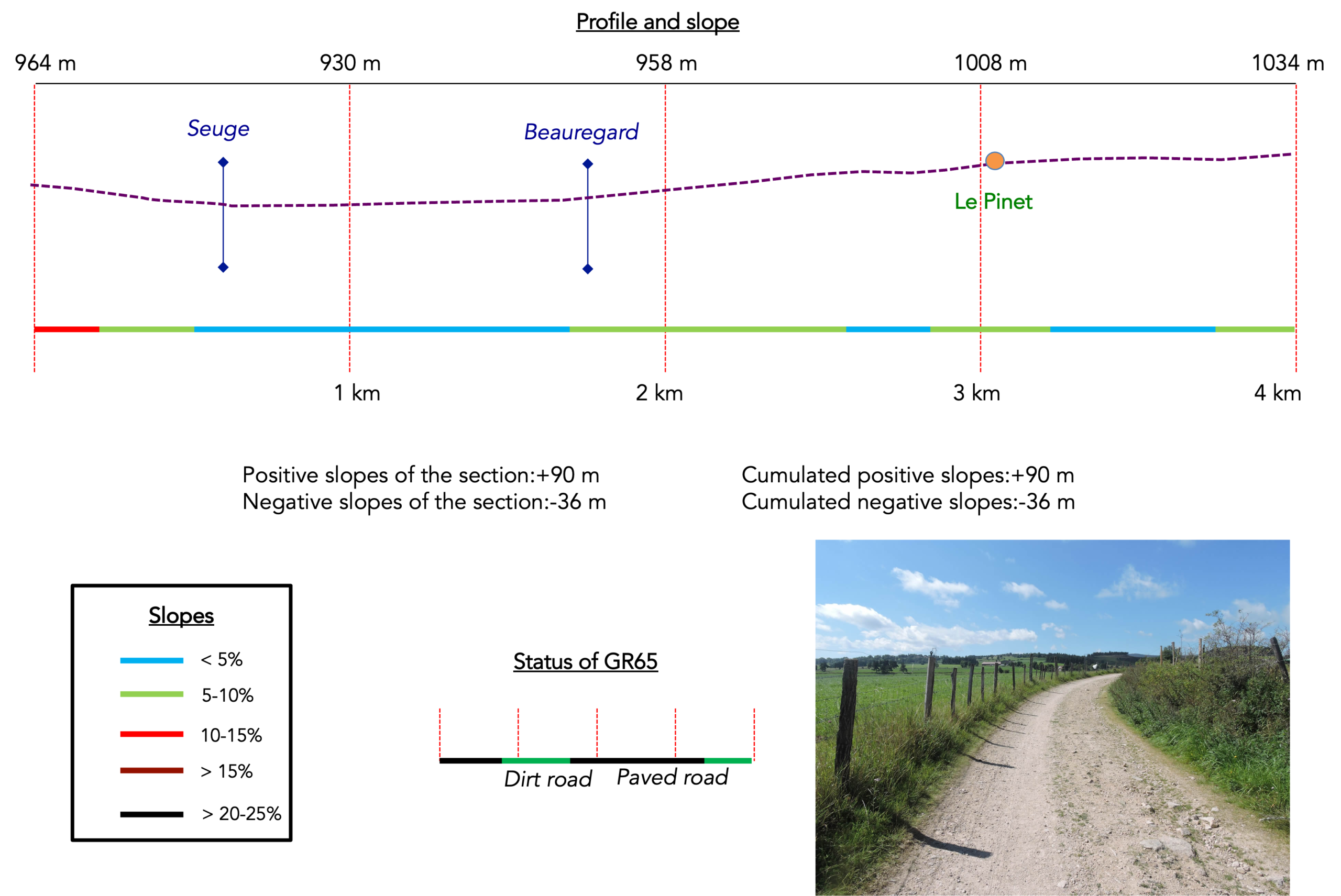
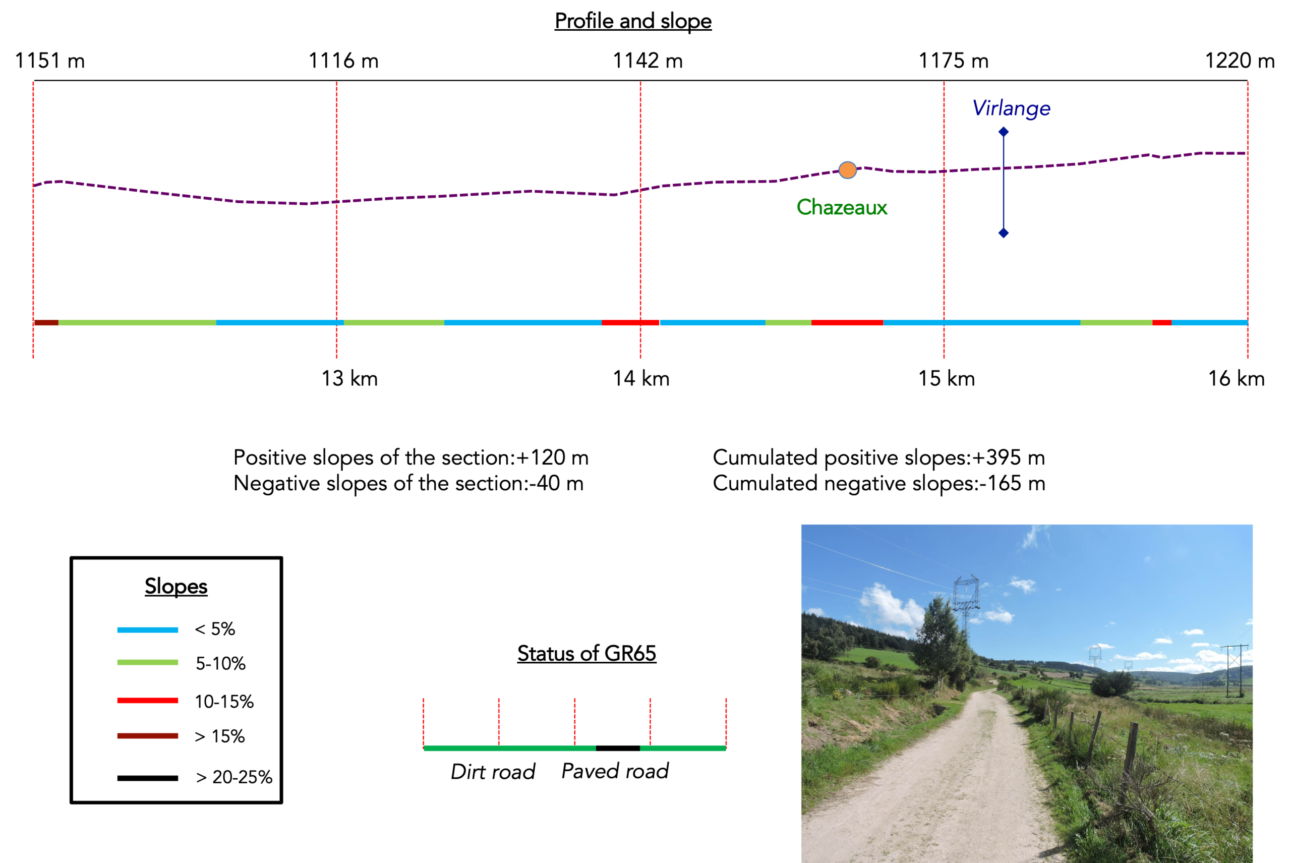
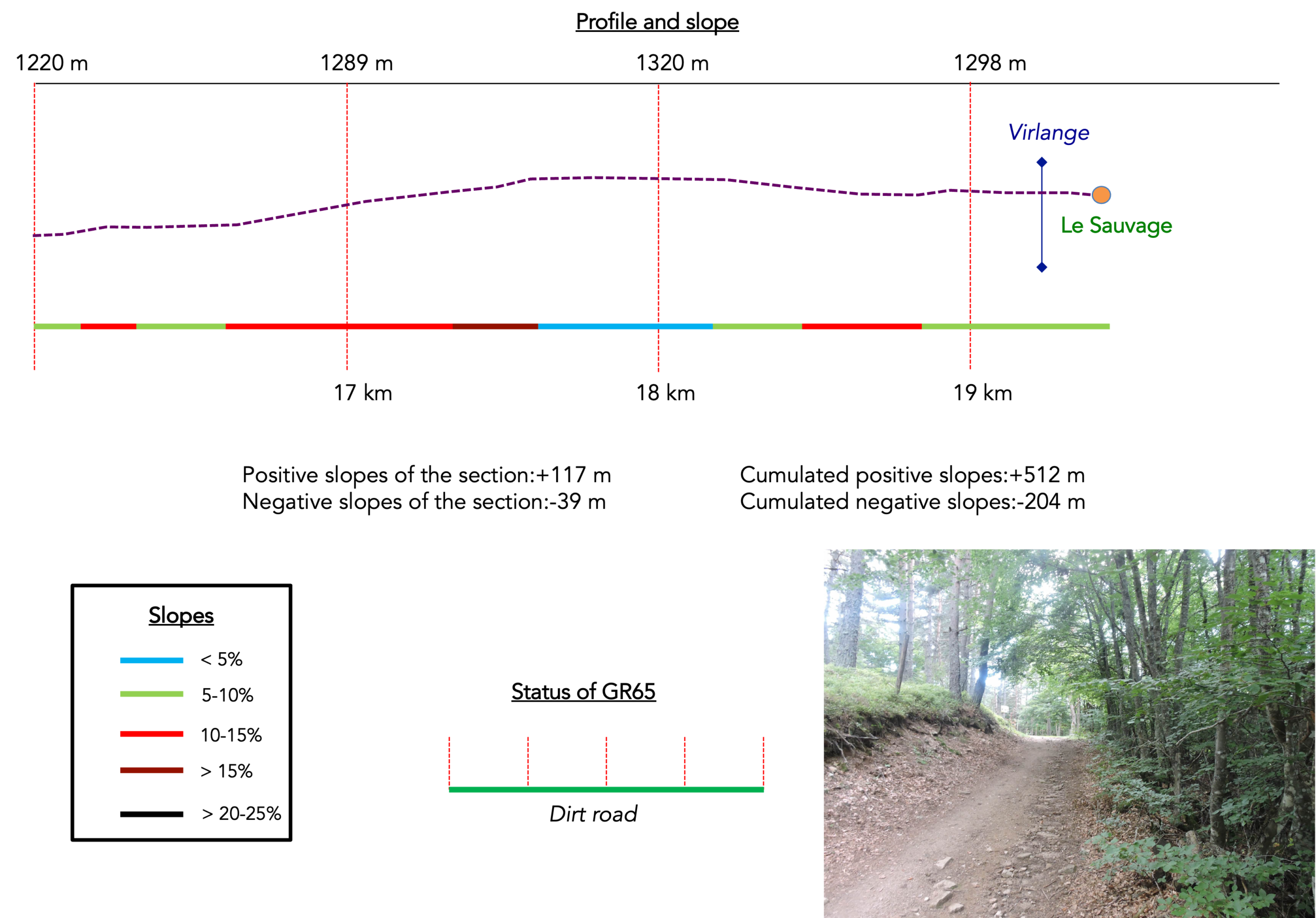
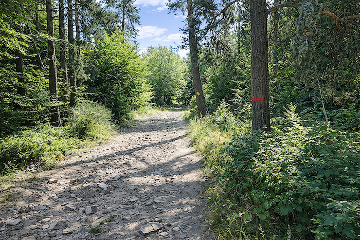
Difficulty of the course: The stage is short, 20 km, with continuous, yet moderate sloping (+512 meters/-204 meters). It is worth remembering that the inexperienced walker must “buy” the trip and shorten the stages at the beginning of the track. By the way, if the journey is short, it is also because many pilgrims want to spend the night at Le Sauvage (“The Savage”) at any cost. However, be careful, the site can only accommodate 41 people. As a result, many walkers continue farther to Lajo or St Alban-sur-Limagnole. The day begins with an easy climb through the countryside to the Le Pinet hamlet before reaching La Clauze, a village dominated by a tower located on top of a granite block. Then ups and downs follow each other to cross Virlange brook. Beyond Chazeaux, you enter the mysterious forests of Gevaudan, a Margeride region long haunted by “the Beast of Gevaudan.”
State of the GR65: Today, the routes clearly favor paths:
- Paved roads: 6.4 km
- Dirt roads:12.8 km
Sometimes, for reasons of logistics or housing possibilities, these stages mix routes operated on different days, having passed several times on Via Podiensis. From then on, the skies, the rain, or the seasons can vary. But, generally this is not the case, and in fact this does not change the description of the course.
It is very difficult to specify with certainty the incline of the slopes, whatever the system you use.
For « real slopes », reread the mileage manual on the home page.

Section 1 : Along the hillside in the countryside around Saugues
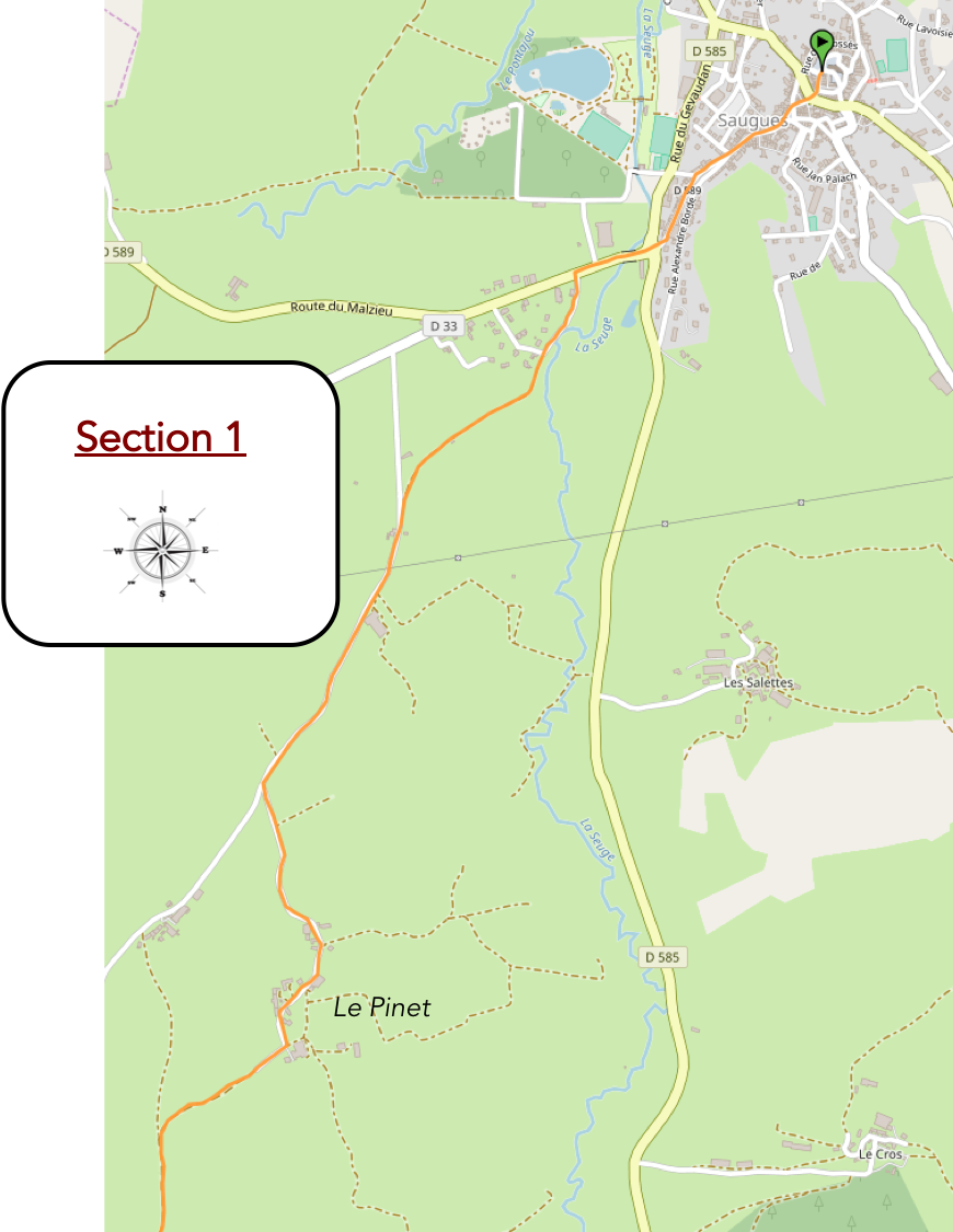
General overview of the route’s challenges: gentle slopes throughout this section.
|
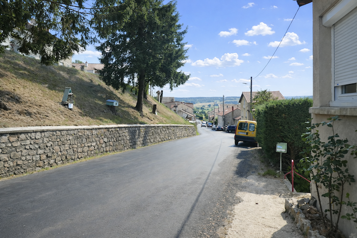
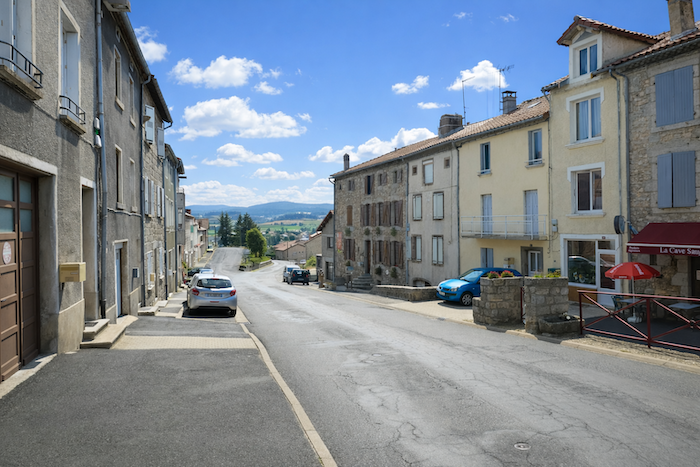
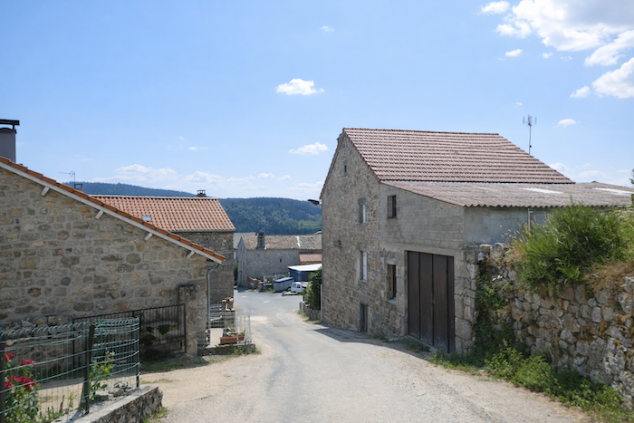
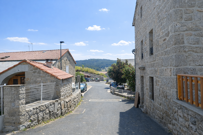
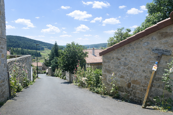
Saugues stands on its hill like a watchful village, poised between sky and earth. From the heart of the village, the GR65 slips gently downhill toward the plain, as though it were gliding away from the walls of an old dream.
|
 |
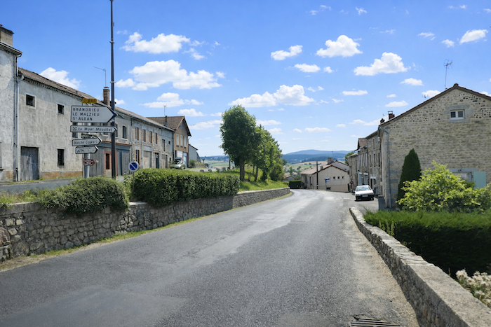 |
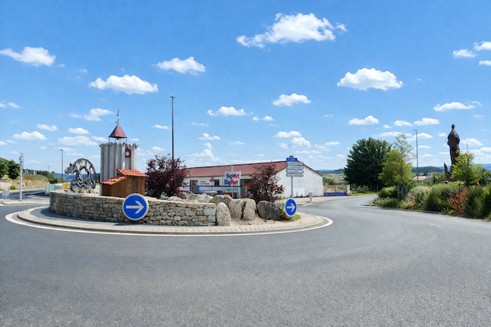
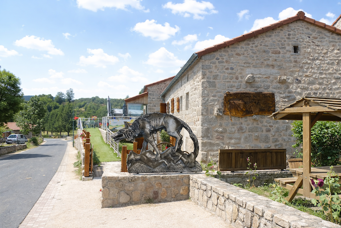
A little farther down, at the bend of a roundabout, a wolf made of metal or stone suddenly appears, a creature more curious than truly majestic, whose grace one would hesitate to praise, yet which still keeps watch over the passing travelers.
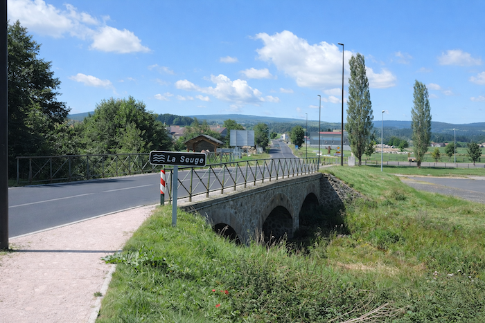
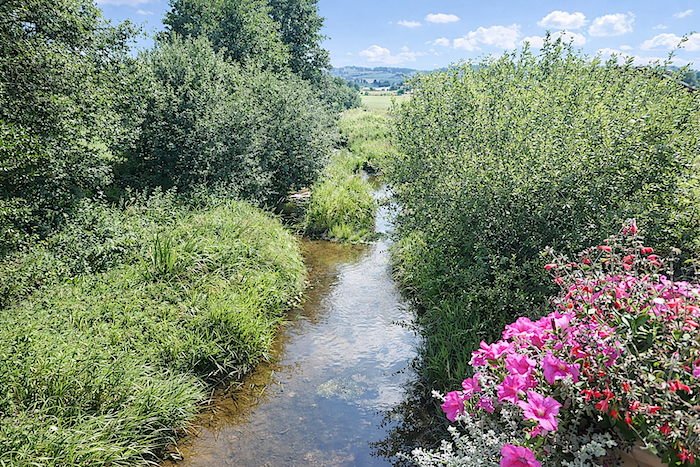
| Leaving Saugues behind, the GR65 crosses the Seuge, a river discreet in appearance, though its sudden floods during heavy rains remind travellers that water here still knows how to reclaim its rights. You will meet it again farther ahead, a faithful companion of the route. Today, however, it flows peacefully, calm as a picture. |
 |
 |
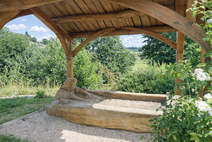
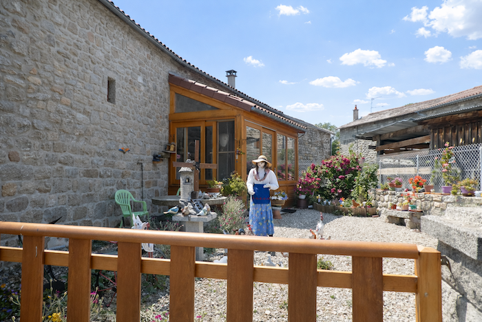
| In these silent landscapes, strange wooden sculptures seem to stand guard, like mute echoes of the mysteries of Gévaudan. Yet this one has nothing sinister about it. It is a washerwoman bending over her laundry, a humble and familiar figure placed beside a bed of flowers. |
 |
 |
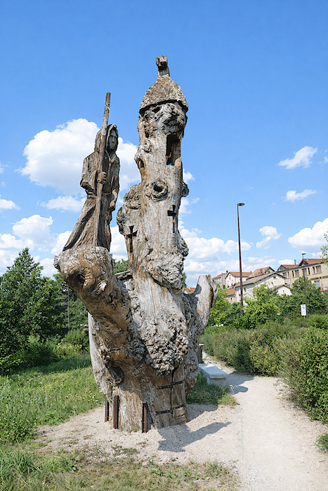
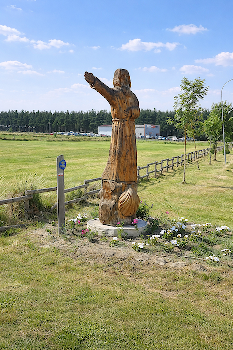
| Other figures, however, carry a darker gravity, almost a diffuse threat, as though the memory of ancient terrors still lingered across these legendary lands. Here, stories have never entirely left the stones nor the forests. Fortunately, the reassuring presence of the saint watches over the traveler and calms the shadows. |
 |
 |
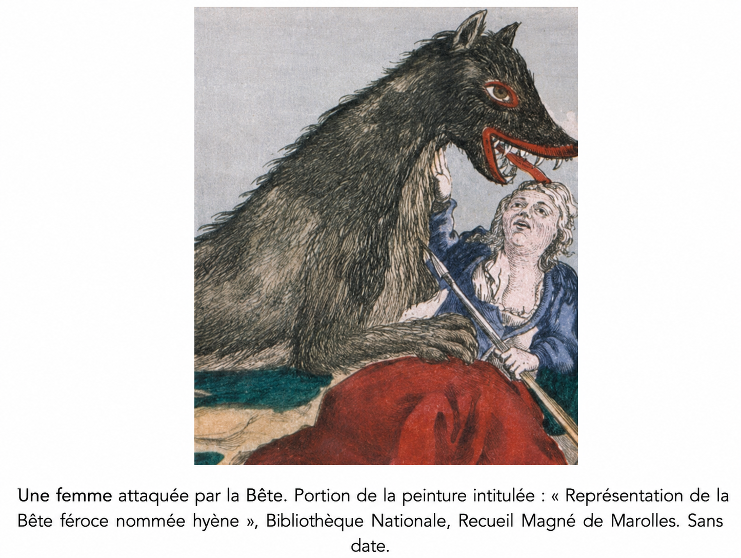
You enjoy stories. Here is one that is neither fiction nor legend, but established fact. A Beast killed 15 women, 68 children and 6 men, while injuring many more. The names and details of nearly all the victims are known, from July 1764 to June 1767, in northern Gévaudan, around Saugues, St Alban, Aumont, Le Malzieu and Langogne, and in Auvergne around Pinols and Ruynes.
Here lay the hunting grounds of the Beast. (Sanguinez: Wikimedia Creative Commons License)
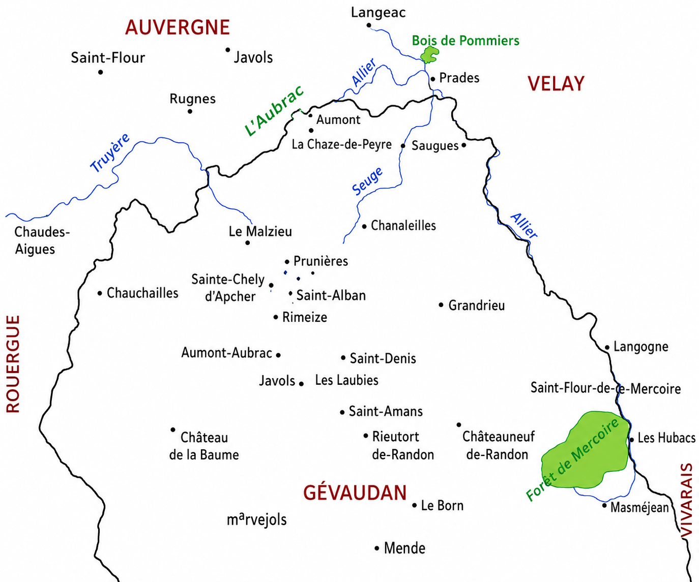
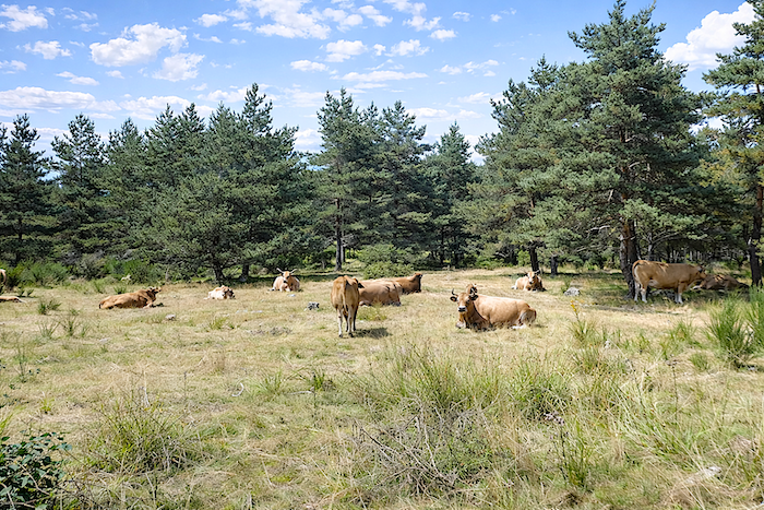
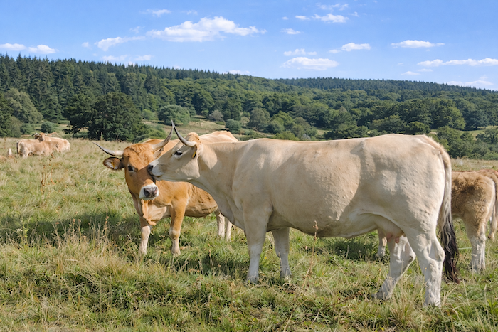
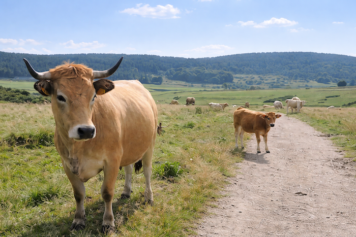
The story began in the forest of Mercoire near Langogne, along the Allier River. A young shepherdess was watching her cows when the Beast charged. The girl’s dogs fled, but the shepherdess was saved by the horns of her cows, which drove the intruder away. She escaped with only a few scratches. She described the monster as an animal the size of a cow, with an enormous neck, small upright ears, and a very long thin tail. A broad black stripe ran along its spine from head to tail. People concluded that it was some kind of gigantic and unusual wolf.
Jeanne Boulet, the first official victim, was killed in July 1764 at Les Hubacs near Langogne. She was buried “without sacraments” because she had not had time to confess. A second victim was recorded in August 1764. She was a fourteen-year-old girl living near Puy Laurent. The first two victims both lived in the Allier valley. During the following months, the Beast attacked women and children, but also isolated men watching over livestock. Many were devoured or torn to pieces, with limbs scattered nearby. In October 1764, two hunters fired several shots at the Beast. Each time, the Beast collapsed, then rose again and continued on its way, apparently unharmed. Captain Duhamel, stationed at Langogne with his sixty dragoons, was entrusted with hunting the monster. He organized many hunts through the forests without ever once catching sight of it. It was probably because of these hunts that the Beast moved northward in October 1764, toward the borders of Margeride and Aubrac. Shortly afterward, a young girl was killed in the village of Apcher Prunières near the Aubrac plateau. Her head was not found until eight days later. The Beast then attacked repeatedly and killed many people in the region of Prinsuéjols. On another occasion, it attacked a young cowherd. Fortunately for him, his cows saved him. Hunters saw the Beast prowling around the boy and fired at the animal in vain before it escaped once more. During this period, the Beast continued its slaughter farther south. François Antoine during the hunt at Les Chazes.
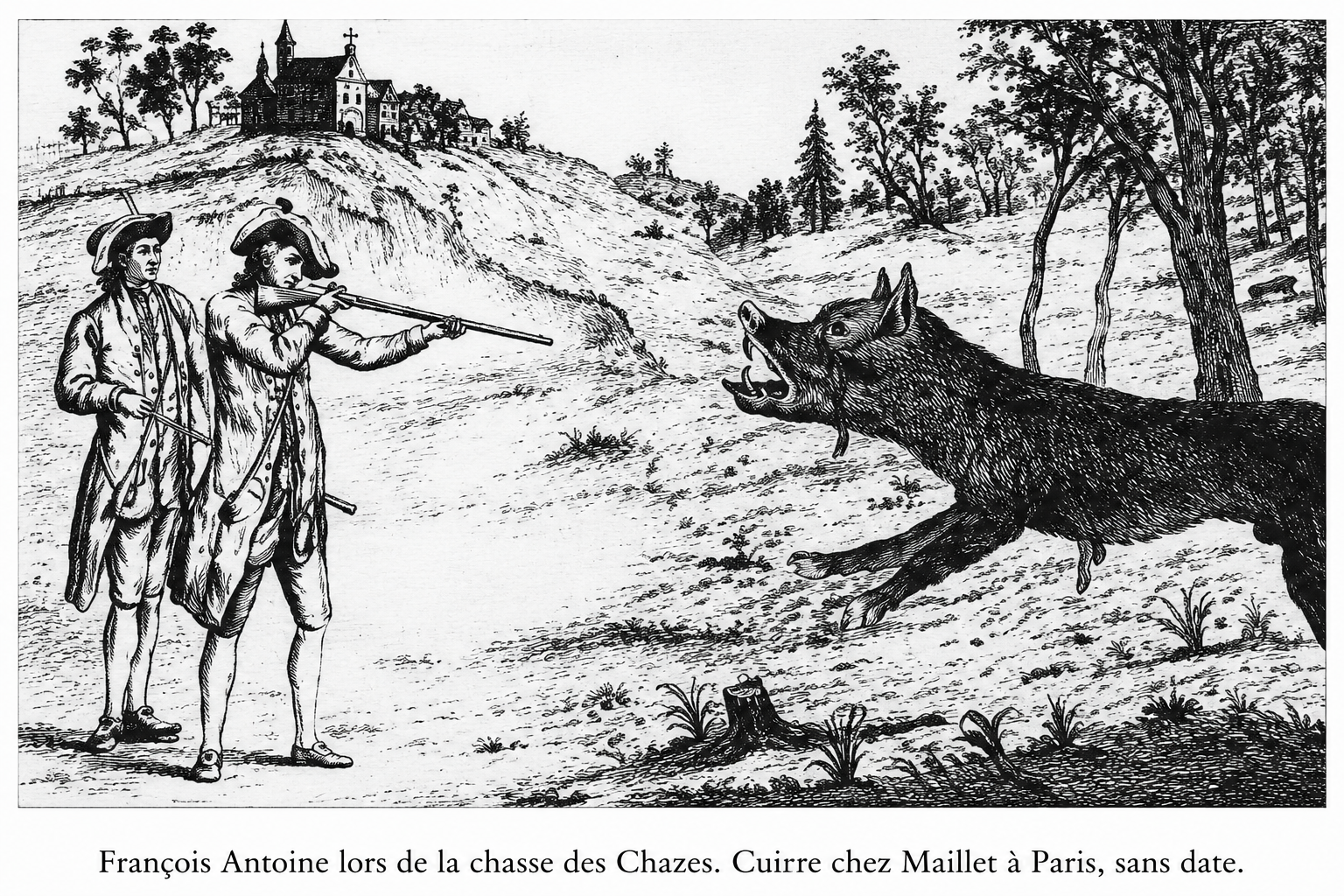
In November 1764, Duhamel and his dragoons left Langogne and settled at St Chély farther north. In January 1765, the Beast attacked Jacques Portefaix and seven of his companions while they were guarding cattle near Chanaleilles, a small hamlet crossed by the GR65. The resistance of the children was heroic. They even managed to strike the animal in the eyes. Their courage attracted the attention of Louis XV, who granted a pension of 300 livres to Portefaix and another of 250 livres to the rest of the group. The king began taking the matter seriously and sent professional wolf hunters into the region. Accompanied by eight dogs, the Denneval father and son arrived in February 1765. For months they killed numerous wolves, yet the attacks continued. In June 1765, François Antoine, the king’s arquebus bearer, together with Lieutenant de Beauterne, replaced the Dennevals. They arrived at Le Malzieu. In September 1765, François Antoine was informed that an enormous wolf was roaming the woods of the Abbey of Les Chazes. The Beast had never before appeared in this part of the Allier region. With the help of forty hunters from Langeac, François Antoine killed the animal. It was merely a large wolf weighing 130 pounds. Survivors identified the animal as the cause of their suffering. Monsieur Baker, the surgeon of Saugues, dissected and stuffed the animal. It was sent to Versailles, where it was displayed in the king’s gardens. François Antoine became a national hero. Officially, “the Beast of Gévaudan”, now known as “the Wolf of Les Chazes”, had been killed. But then, in December 1765, another Beast appeared in the region, injuring two men. Many deaths followed. It was Jean Chastel who finally killed the animal in June 1767. Numerous controversies surround this new episode. Boulanger, a surgeon from Saugues, dissected and stuffed the animal. It was displayed for some time at the Château de Besque before being sent to Versailles. By the time it reached Paris, the carcass was already badly decomposed. The king refused to see it. Officially, the Beast of Gévaudan remained the Wolf of Les Chazes, for there was much politics behind the affair. The great Buffon, who examined the animal, concluded that it was a large wolf. No trace remains of what Buffon may have written about the Beast. The animal was buried in a garden without any record being preserved. According to tradition, the animal killed by Chastel was the true Beast of Gévaudan, because from that day onward the slaughter ceased immediately.
Many mysteries still surround this story. The distances covered by the animal were considerable, more than fifty kilometers per day. This led to the theory that there may have been more than one killer animal, although this was never proven. The creature was described as wolf like, yet it was not a true wolf, with its striped back, shaggy tail and gigantic jaws. The animal devoured its victims, crushing their skulls and feeding on their entrails. Baboon, leopard, bear, wolverine and striped hyena have all been suggested as explanations. Others even imagined a werewolf, a creature born of fantasy. What is certain is that the animal delighted in human flesh while ignoring sheep and goats. It also seemed resistant to bullets, although firearms of the period were hardly modern. This mysterious story still fascinates people today, more than two centuries after these extraordinary events. So, keep your eyes wide open in the forests near Le Sauvage. Fortunately, the good saint still watches over you.
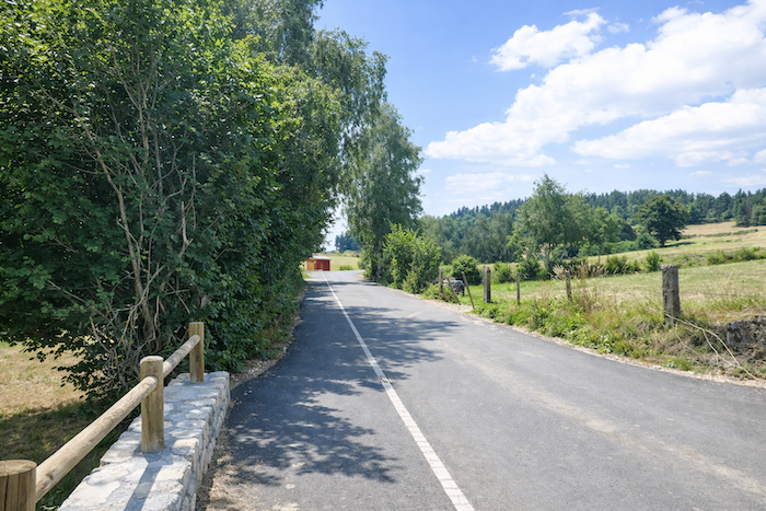
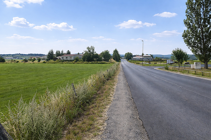
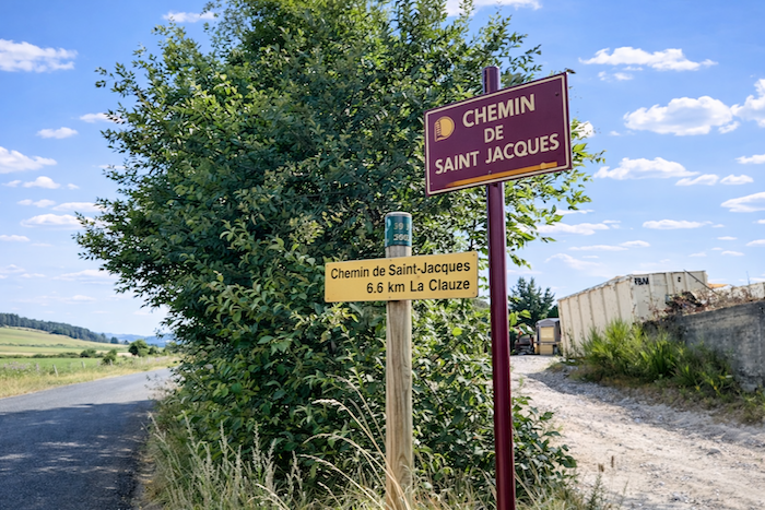
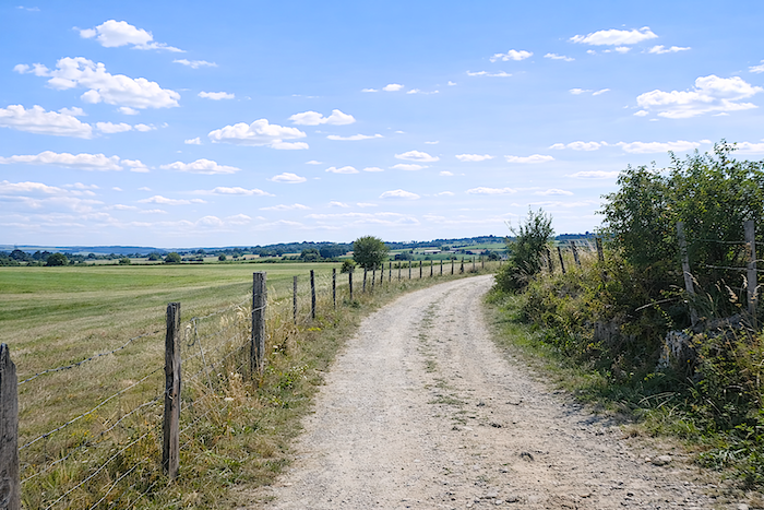
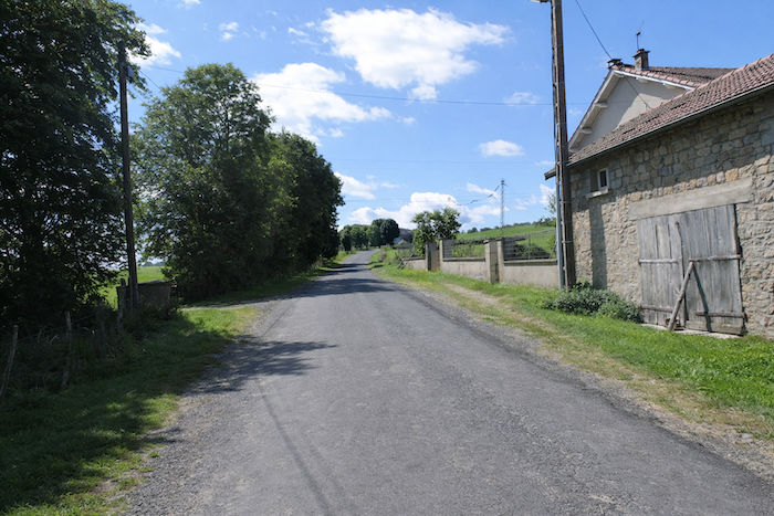
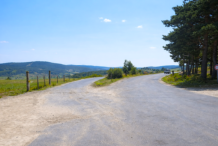
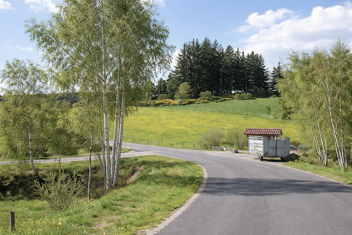
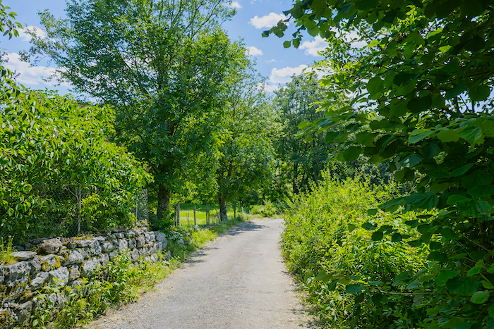
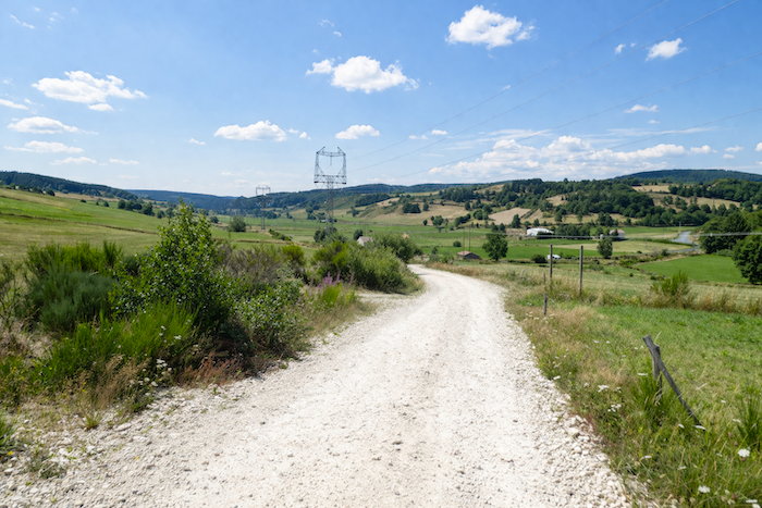
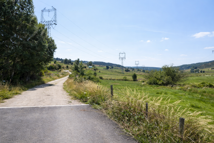
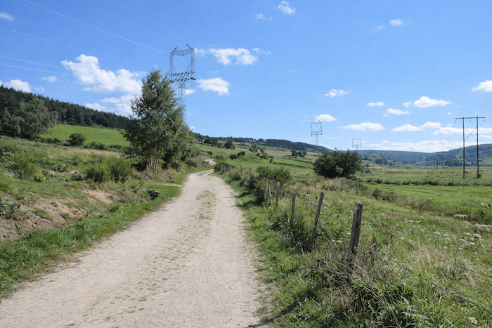
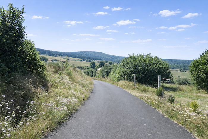
| Very quickly, after a brief passage along the departmental road, the GR65 regains momentum and climbs gently toward Le Pinet, immediately rediscovering the broad breathing space of the countryside. |
 |
 |
La Clauze lies only 6.6 kilometers away, like a discreet promise resting on the horizon.
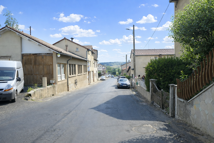
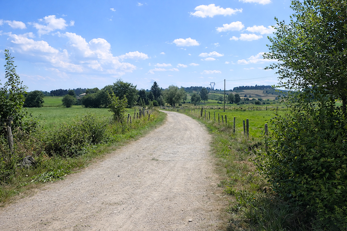
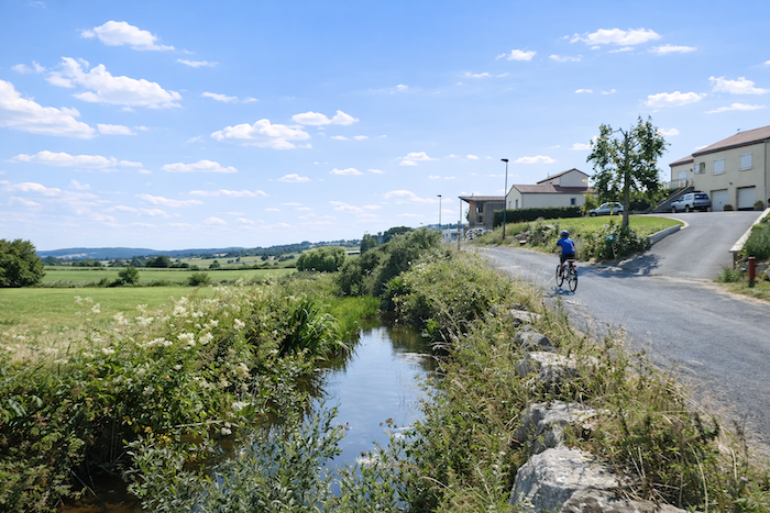
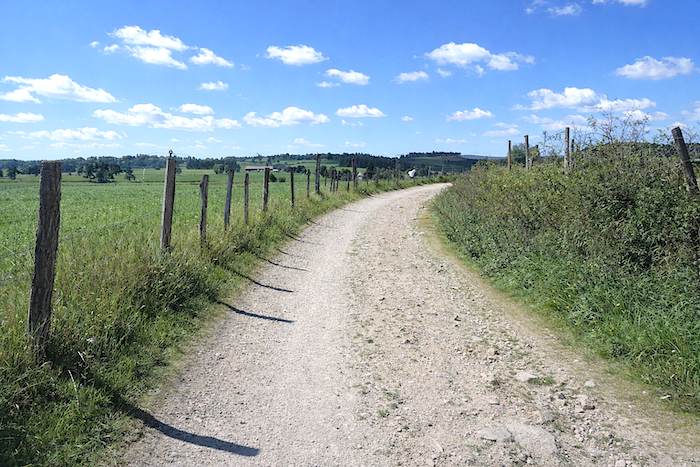
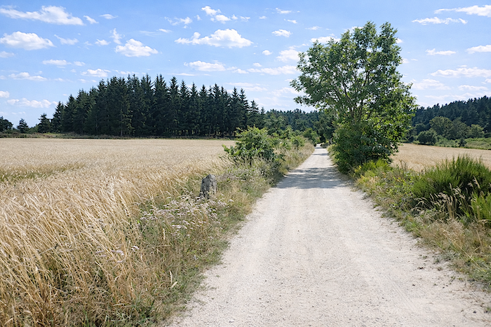
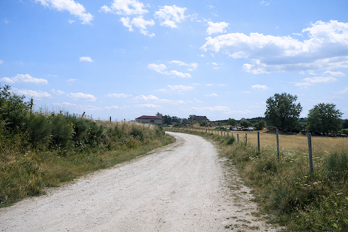
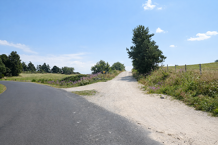
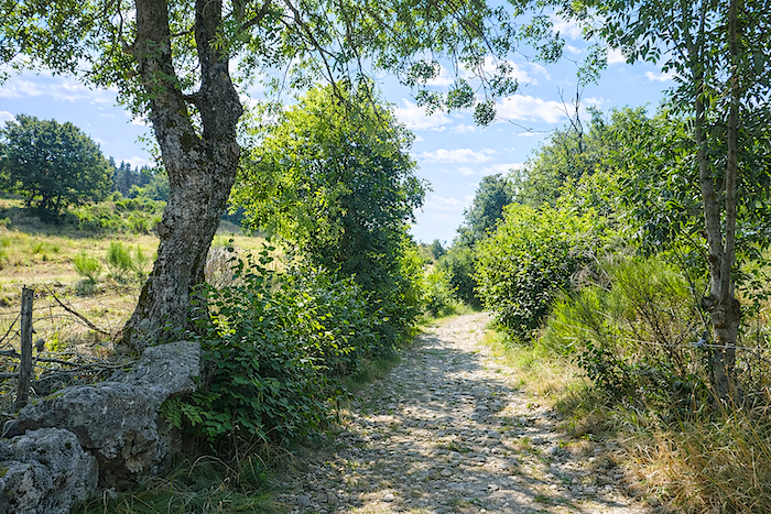
| The route first follows the road winding between recent housing developments established beside the river, then soon leaves it behind to join a broad dirt path, more open, freer, and more faithful to the spirit of the journey. |
 |
 |
| Here begins the true face of the land, a place without pretense, where rural life reveals itself as it truly is, harsh, simple and enduring. The people here seem to have inherited something from the granite used to build their houses: solidity, reserve, and a form of silent dignity. |
 |
 |
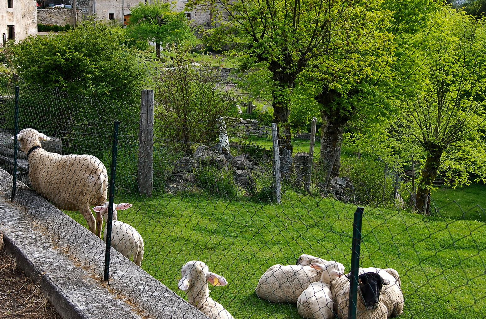
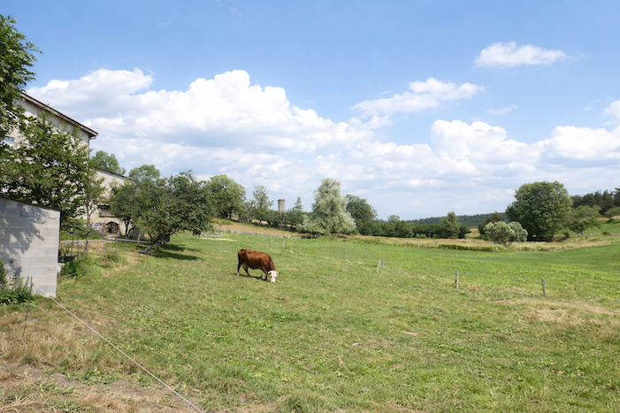
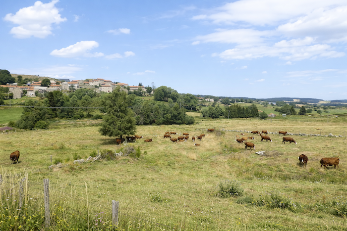
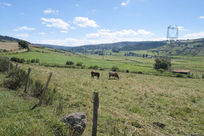
Fortunately, the livestock bring a peaceful presence that softens the landscape. For generations, the Saugues region has earned an enviable reputation in the world of livestock breeding, and the market of Saugues remains its living emblem. In the meadows, flocks of sheep scatter moving white patches across the grass. The Blanche du Massif Central reigns here as mistress of the fields: an elegant silhouette with a fine pale head, no horns, long slightly drooping ears, and an immaculate fleece leaving the head, upper neck and part of the belly uncovered. Rarer Bizet sheep attract attention with their black heads crossed by a white stripe along the muzzle, like a distinctive mark inherited from another age.
Yet it is above all the dairy cows that inhabit these pastures. The Montbéliarde is the breed most commonly encountered, robust and generous, appreciated here as in the eastern regions for its remarkable milk producing qualities. The Abondance breed, originating from the Savoy mountains, brings with it something of the soul of alpine pastures: a mahogany coat, a pale head, and eyes framed by the famous reddish markings that give it an expression both gentle and proud. Then there remain the great beef breeds, Aubrac, Limousine, Charolaise and Salers, powerful animals raised less for milk than for the nobility of their meat.
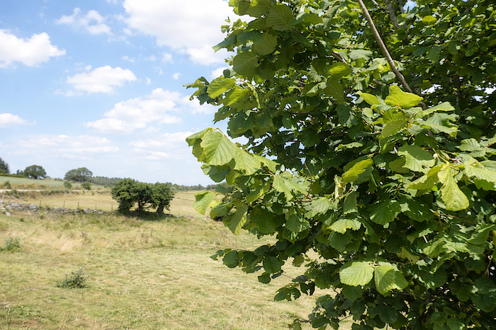
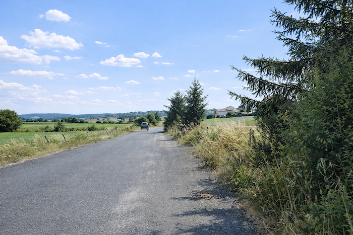
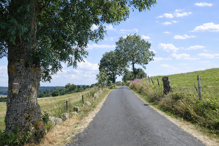
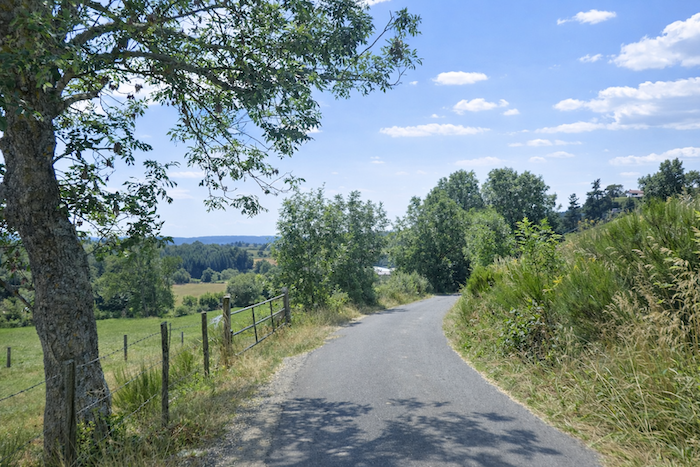
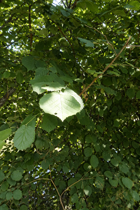
| Little by little, the dirt track begins climbing once more through the open countryside toward a first junction. Yet the ascent remains gentle, as though it still wished to spare the walker’s strength. Ash trees are numerous in these meadows, familiar silhouettes standing here and there. Their presence is no accident. In the past, their fruits served as valuable fodder supplements for livestock, and they were planted everywhere. Today, they have mainly retained their role as elegant sentinels of the landscape. And it must be admitted that few trees combine grace and simplicity as naturally as they do. |
 |
 |
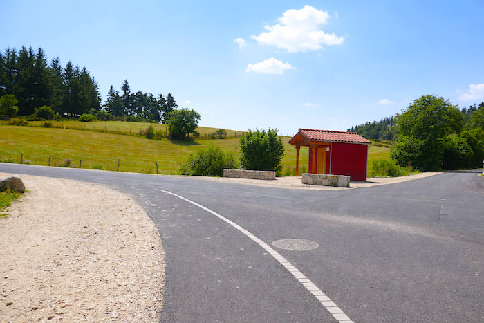
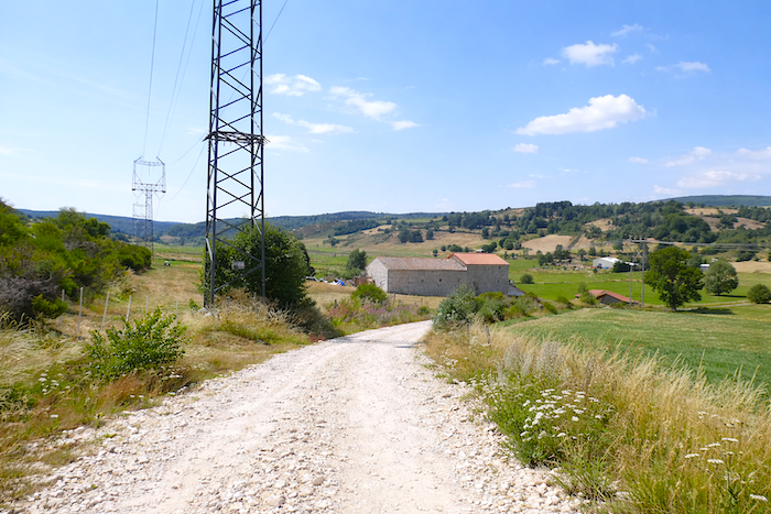
| Then the tarmac returns, unrolling its ribbon beside a few scattered farms spread across the hillside, as though placed there slowly, according to the patient rhythm of the land itself. |
 |
 |
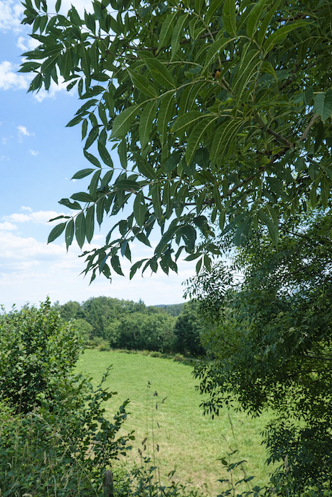
| Here, the ash trees finally offer a little shade, light and welcome. |
 |
 |
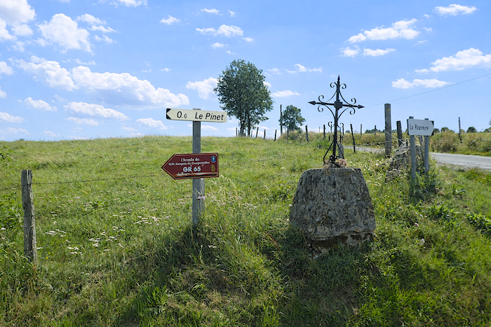
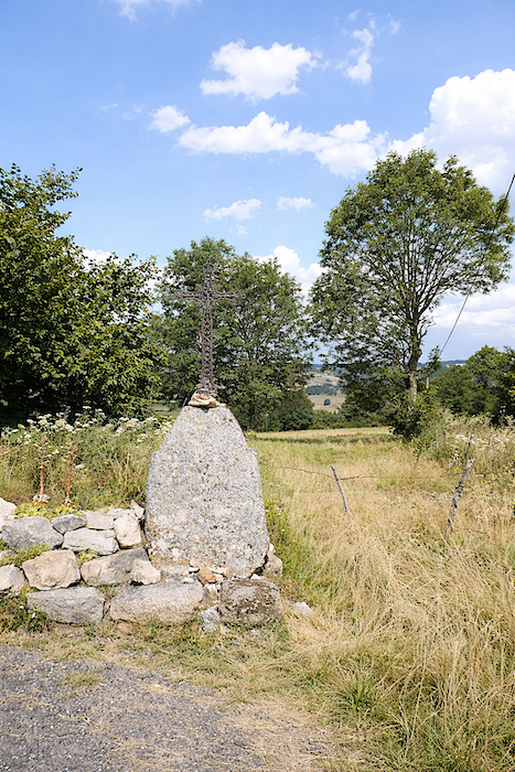
| Farther up, a junction appears, marked by an iron cross planted into the granite. These crosses, standing throughout the countryside like beacons in a storm, mark the land and reassure the pilgrim. They are the silent guardians of the path, the modest sentinels of an ancient world. Here, the road turns toward Le Pinet through a soft and peaceful countryside where herds graze freely in the broad breathing space of the meadows. |
 |
 |
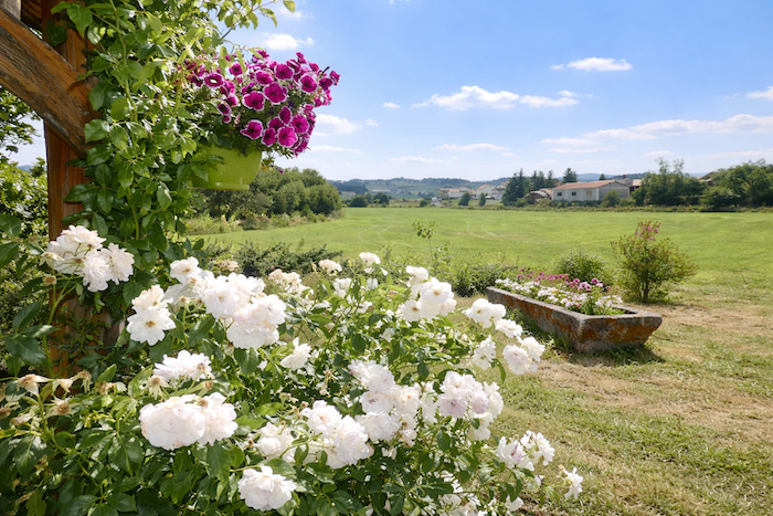
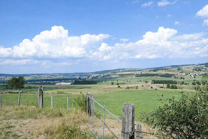
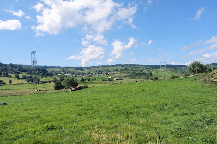
Before you, the countryside around Saugues stretches out with slow, almost solemn grace, like a vast sheet of light laid gently across the undulations of the landscape. .
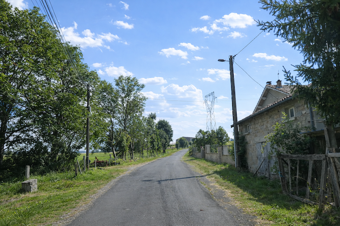
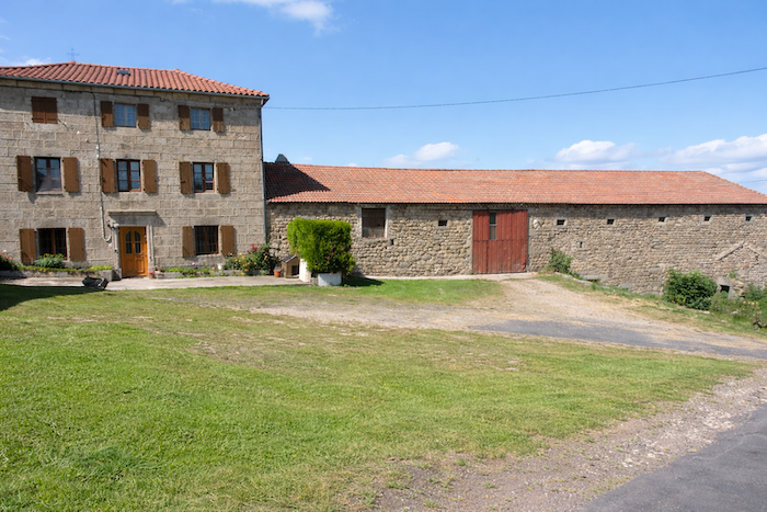
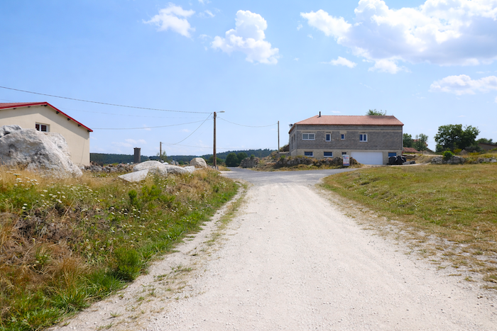
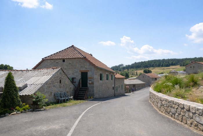
| Soon afterward, the road reaches the first farms of Le Pinet. The volcanic stones of the Devès now lie far behind. Here begins the reign of the granite of Margeride. Yet the majesty remains, only transformed in appearance, perhaps less dark, but just as powerful and deeply rooted. |
 |
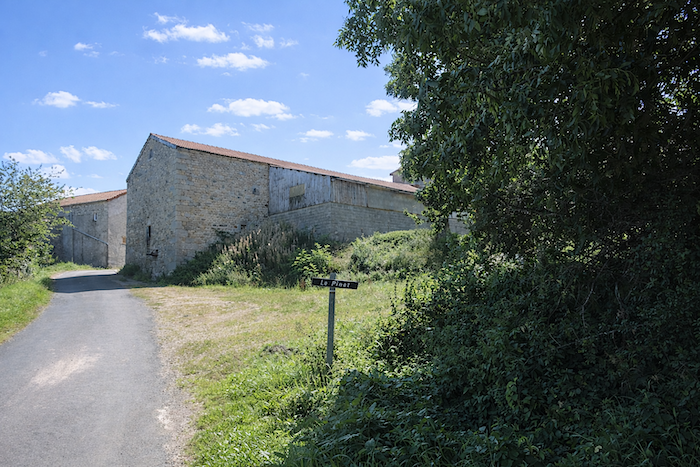 |
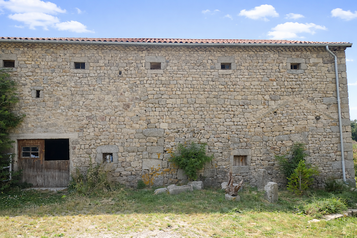
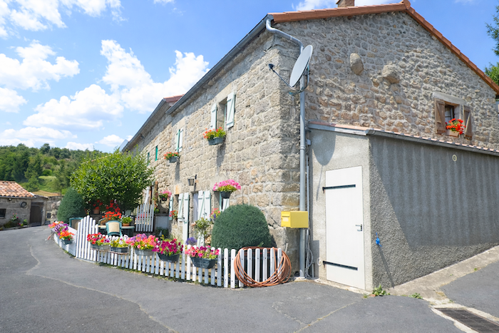
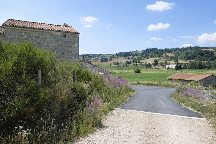
| These farms and barns seem to have risen from the soil itself, as though the earth, weary of guarding its secrets, had finally allowed its memory to emerge. Their thick walls, assembled stone by stone with the patience of generations, bear the colors of the seasons and the passing years. Nothing here seeks to charm. Everything speaks of solidity, labor and endurance. The small openings cut into the façades say enough about the harsh winters, the winds of the plateaus, and the necessity of holding firm |
 |
 |
| Another cross appears, followed by a beautiful avenue of ash trees announcing a hamlet stretching modestly along the slope, as though seeking to follow the shape of the land itself. |
 |
 |
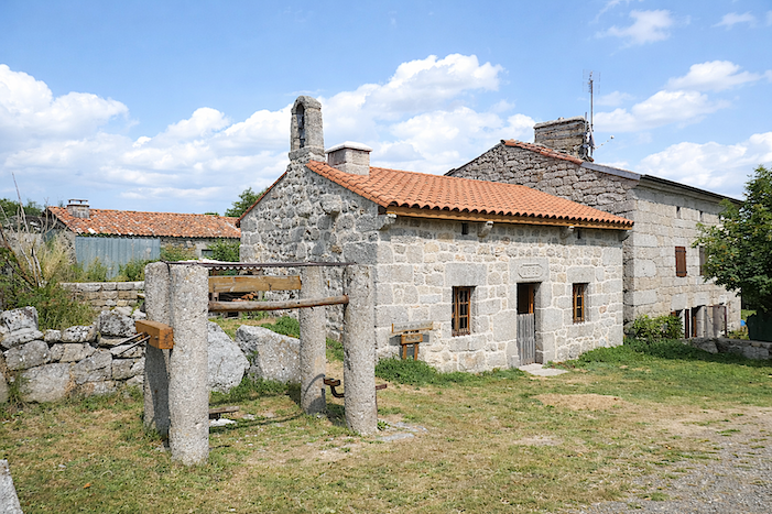
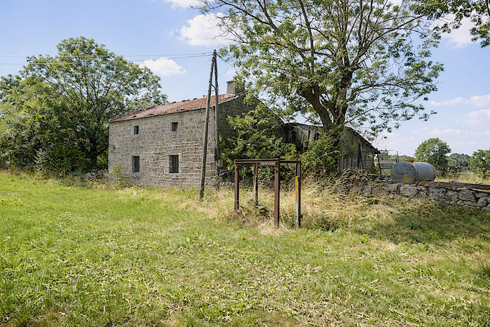
| In these stone villages, you still find the traditional cattle shoeing frame, the “travail”, a humble wooden or iron structure, silent today, yet one of the most precious witnesses to the rural heritage of the region. By itself, it tells of seasons of labor, the strength of animals, and the skill of the gestures of former times. |
 |
 |
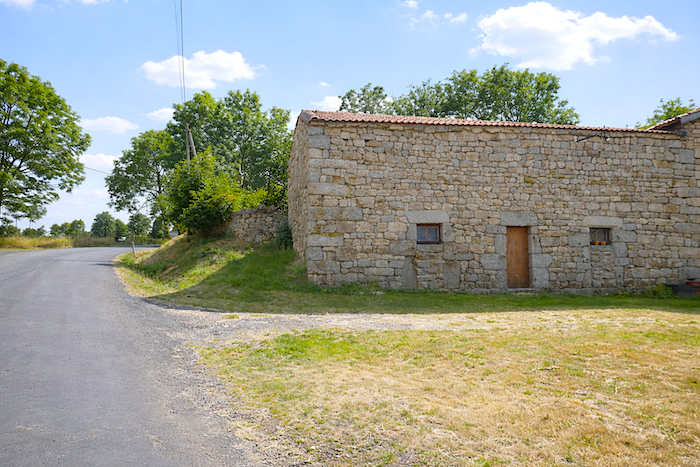
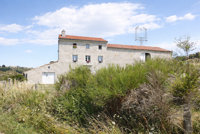
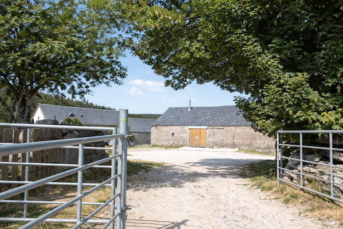
| Then the road crosses the heart of the hamlet, a handful of vast farms carved as though with a chisel into the side of the purest granite. Within this compact, hard and almost eternal stone, the farm buildings still exhale something of the earth and the livestock, an ancient scent of hay, sweat and harvests. |
 |
 |
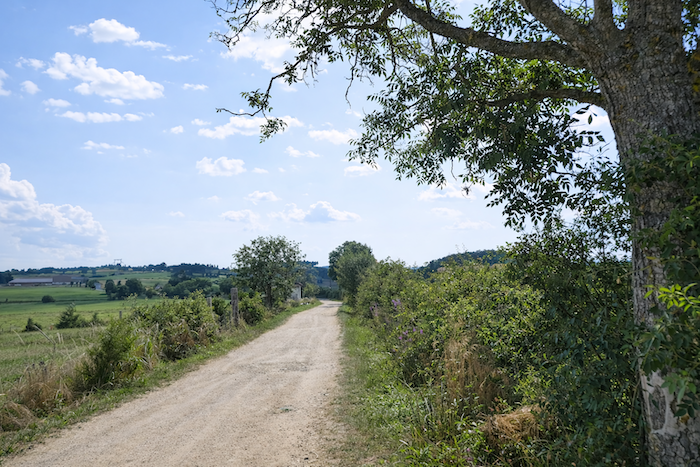
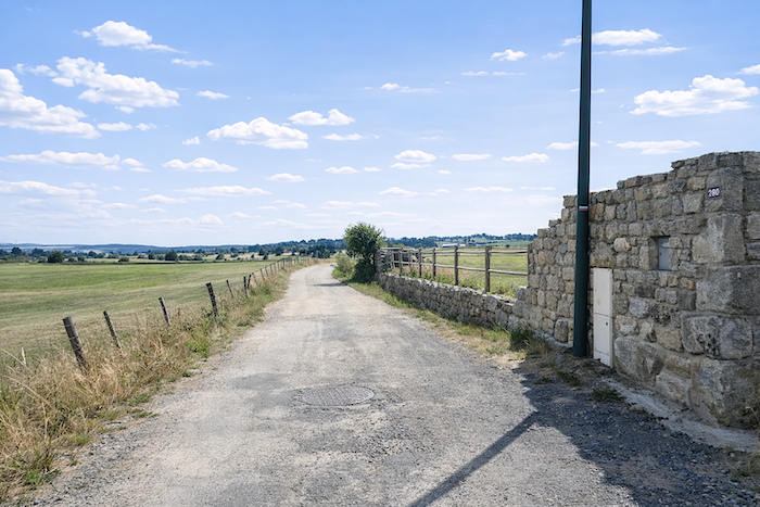
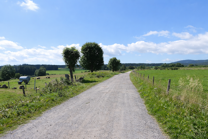
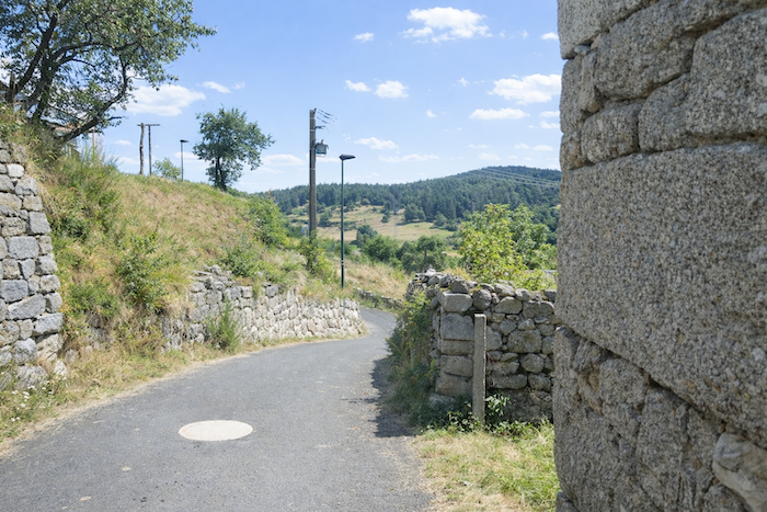
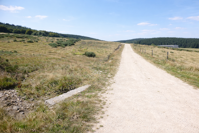
| Leaving Le Pinet, a broad dirt road stretches lazily across the meadows, as though taking pleasure in wandering through this open landscape. Here and there, clusters of ash trees cast light patches of shade, while solitary maples punctuate the horizon with their calm silhouettes. Along the embankments, broom and brambles create a living disorder. |
 |
 |
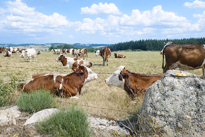
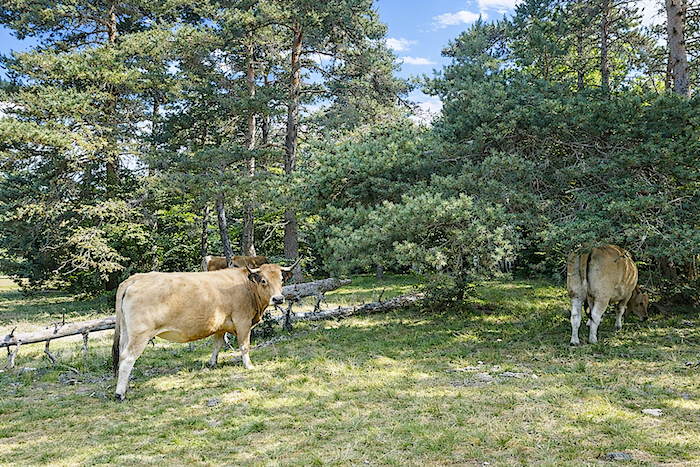
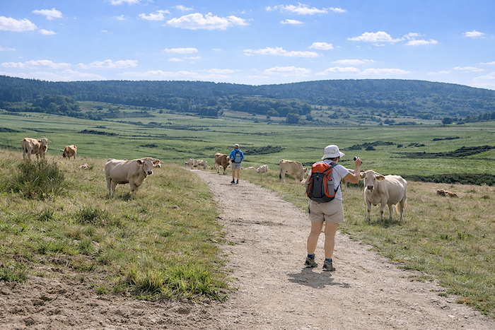
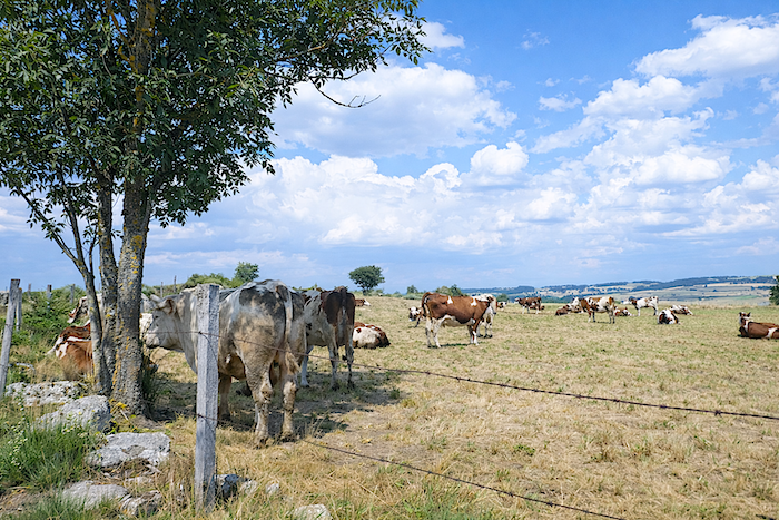
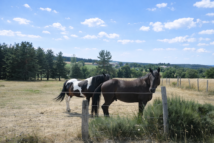
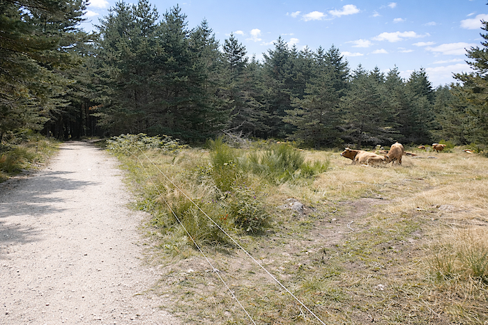
| Sometimes the cattle raise their heads as pilgrims pass and watch them with placid, almost curious eyes. Sometimes they barely glance up at all, as though indifferent to this daily procession. After seeing so many walkers pass by, the cows have no doubt come to accept the pilgrimage as part of the ordinary theatre of the seasons. |
 |
 |
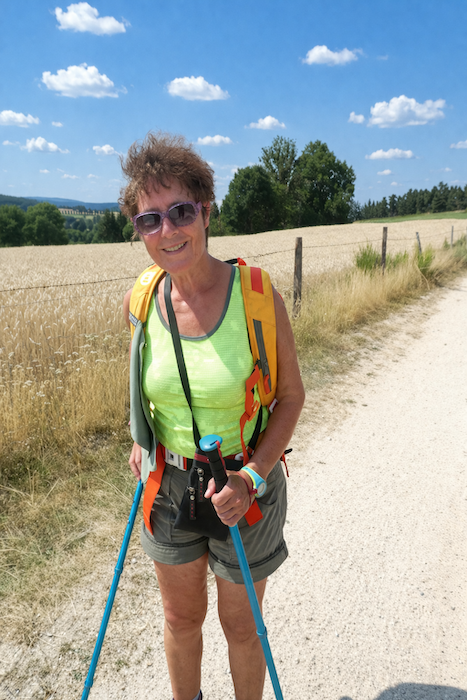
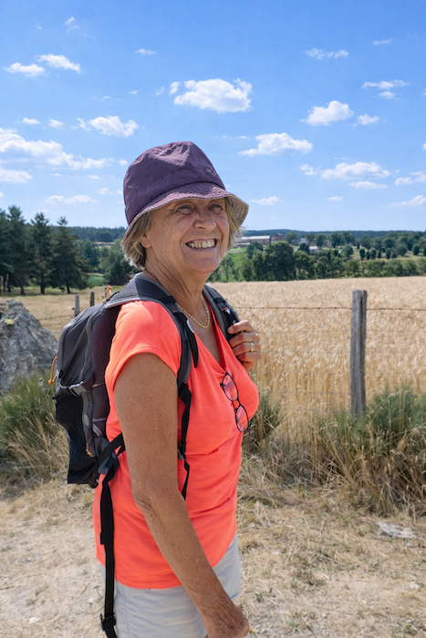
| Here, two women pilgrims amused themselves by noticing that one could spend more time photographing cows than immortalizing the walkers themselves. Perhaps one day they will be surprised to recognize themselves while reading these lines, during a pause along the route or through the return of a distant memory. Let them find here the sincere thanks left along the path for their spontaneous smiles, as radiant as the sky on that day. |
 |
 |
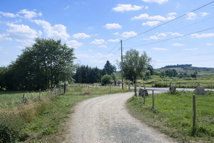
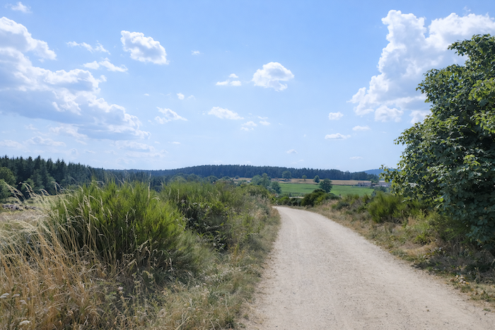
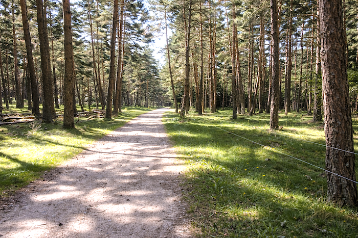
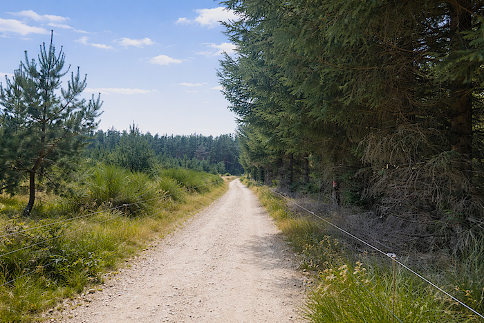
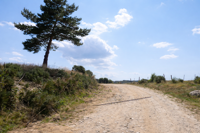
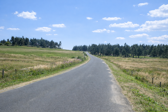
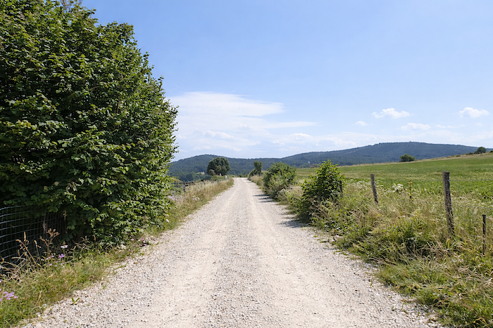
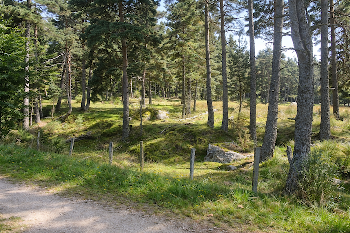
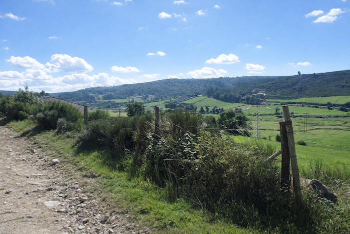
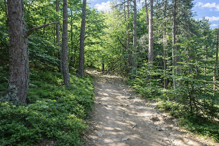
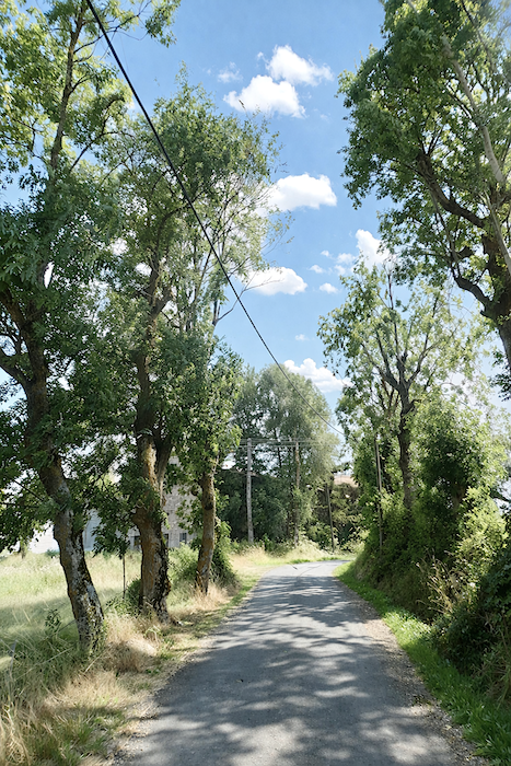
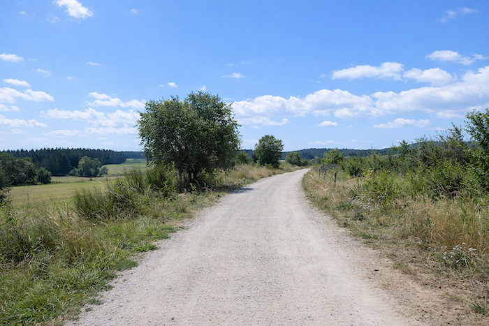
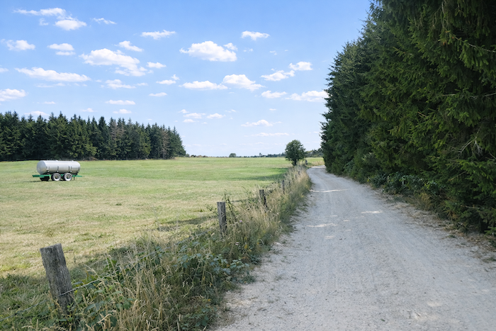
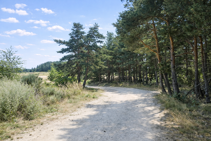
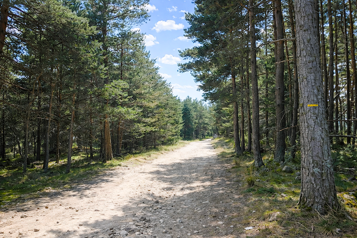
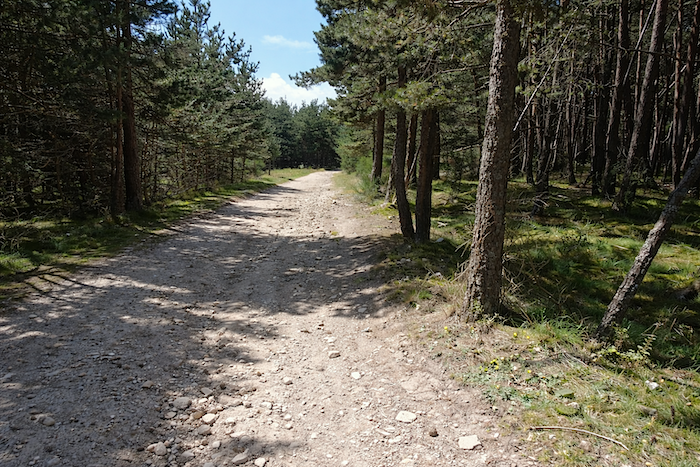
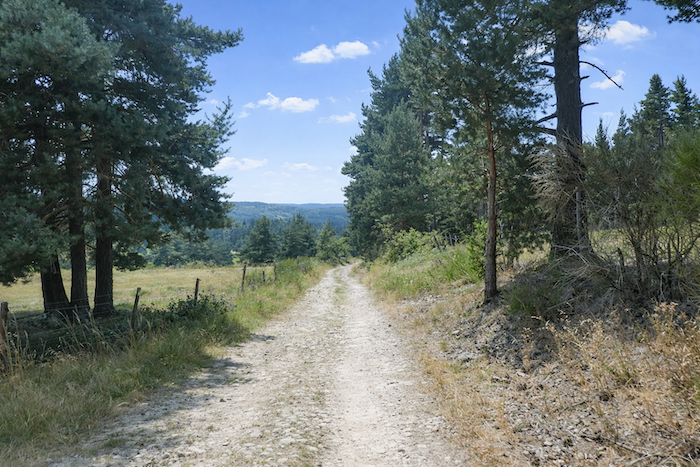
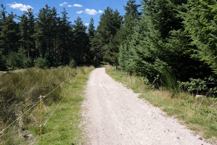
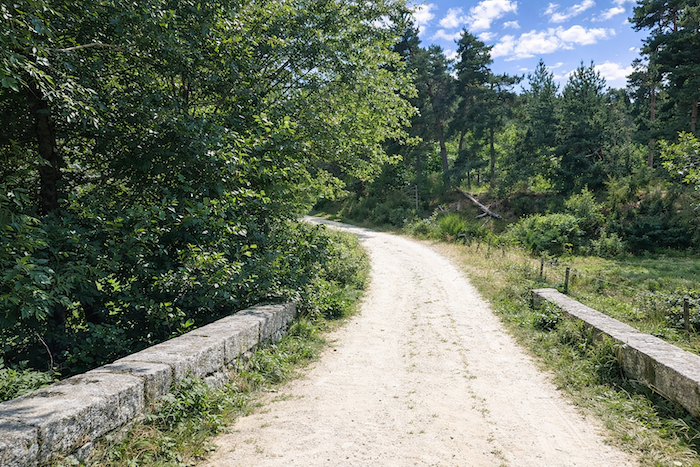
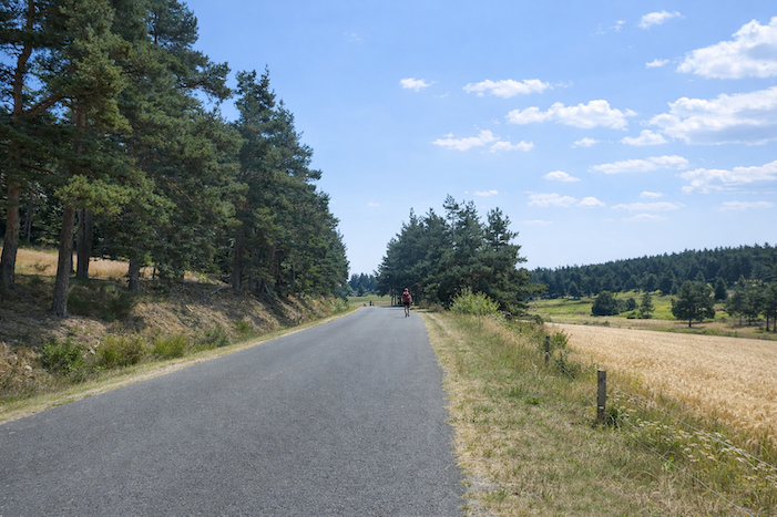
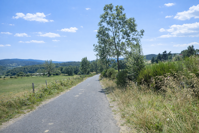
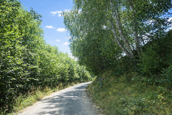
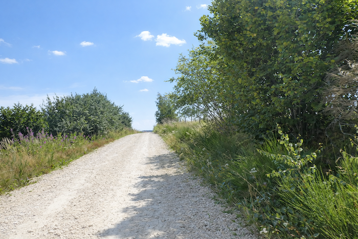
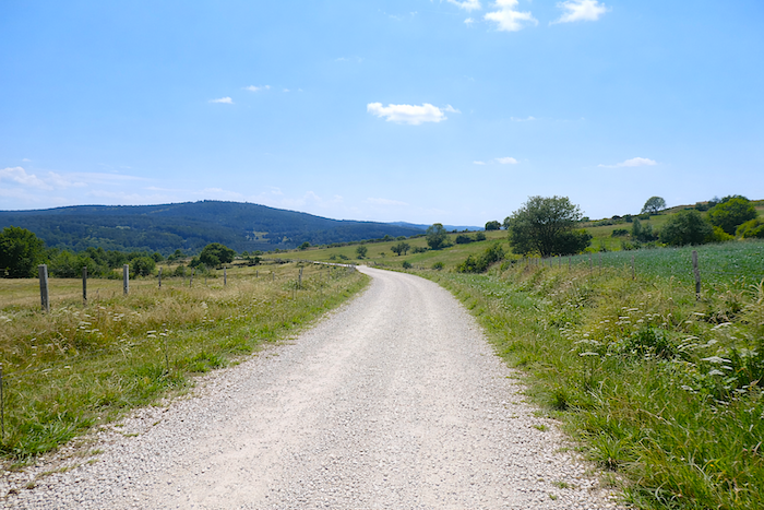
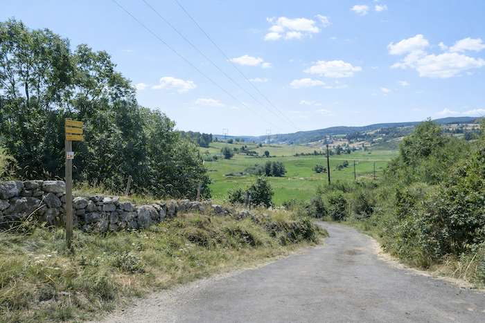
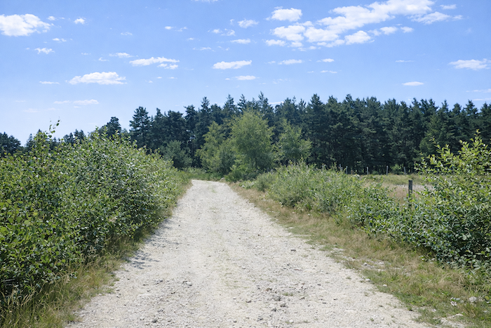
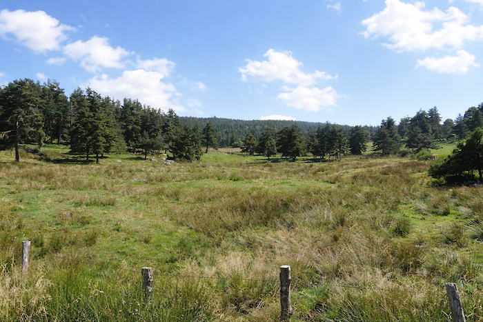
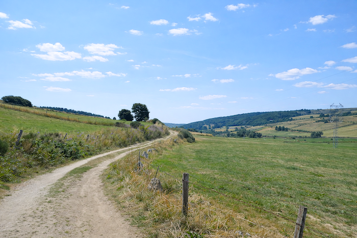
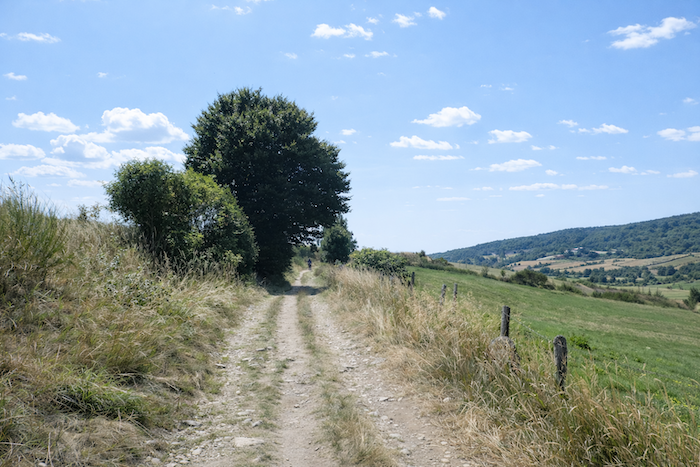
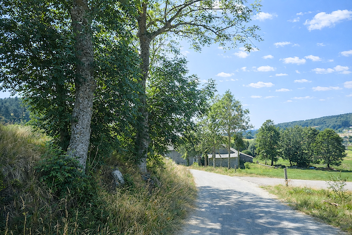
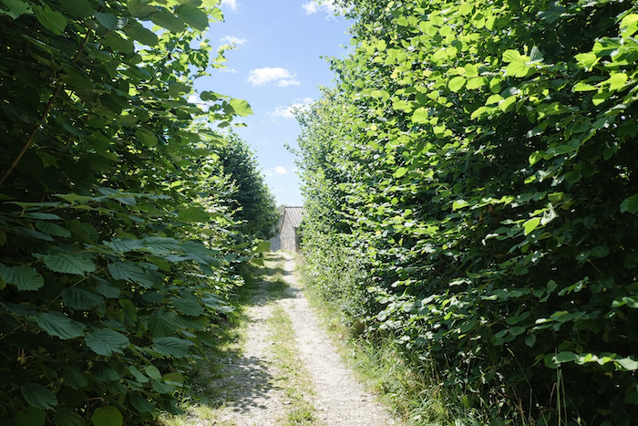
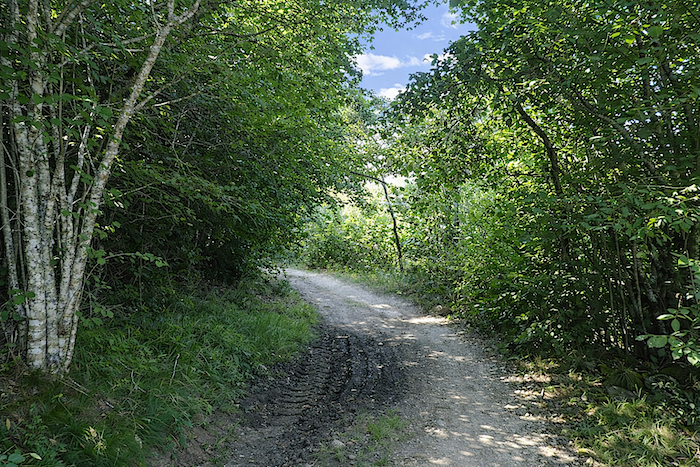
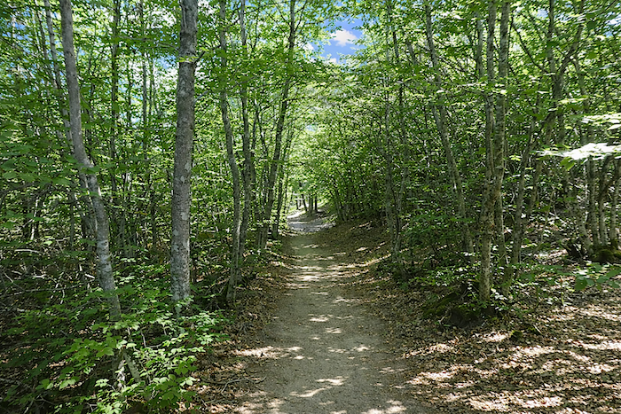
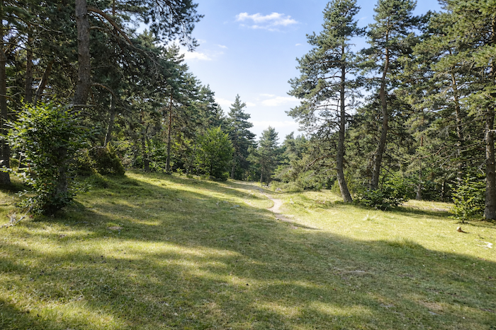
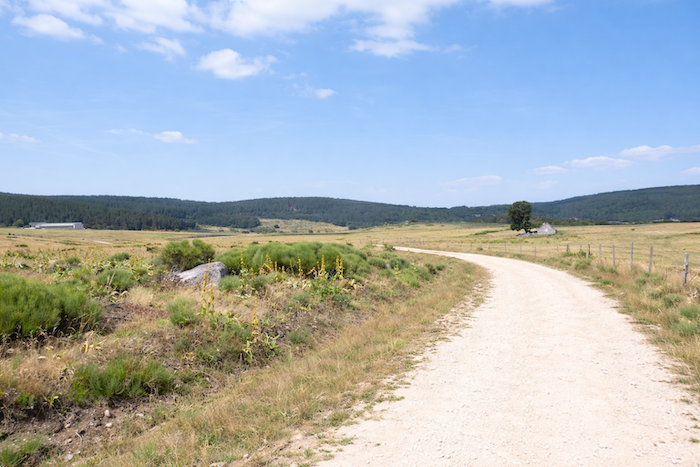
| The path continues wandering for a long while between meadows and the edges of pine woods, brushing past the forests without ever truly entering them, as though it still preferred full light and open space to the shadow of the undergrowth. |
 |
 |
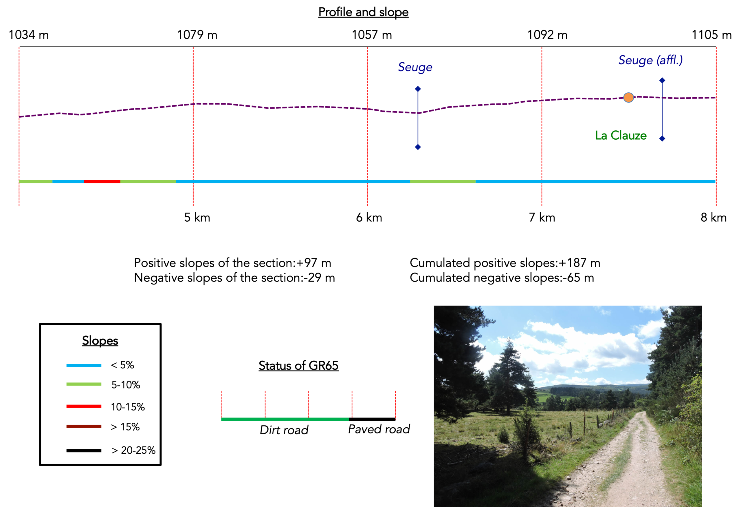
Section 2: Gentle ups and downs through the forest
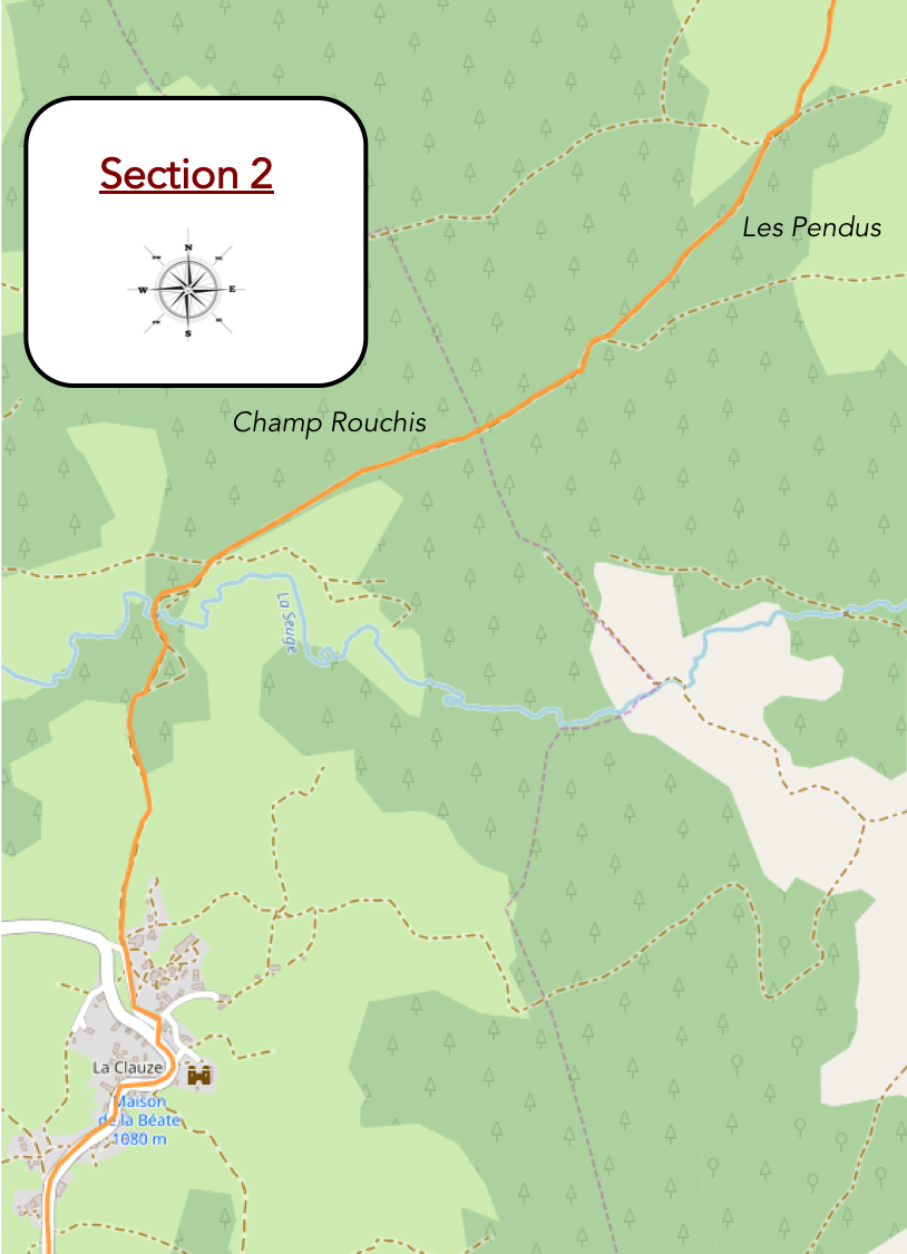
AGeneral overview of the route’s challenges: gentle slopes throughout, except around the crossing of the Seuge.
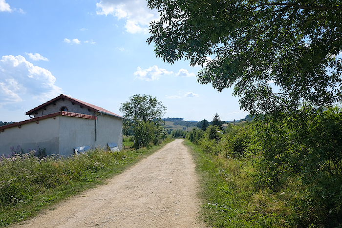
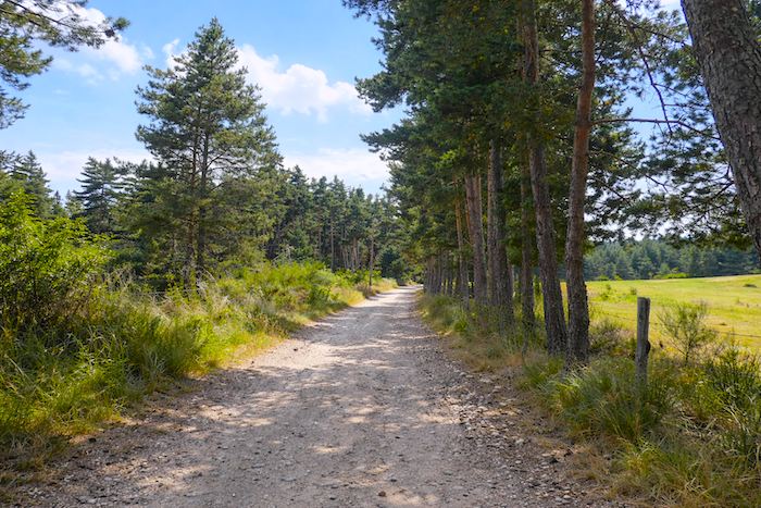
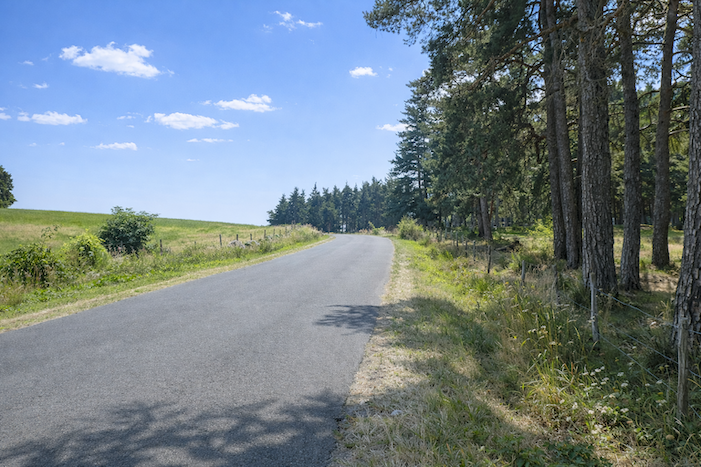
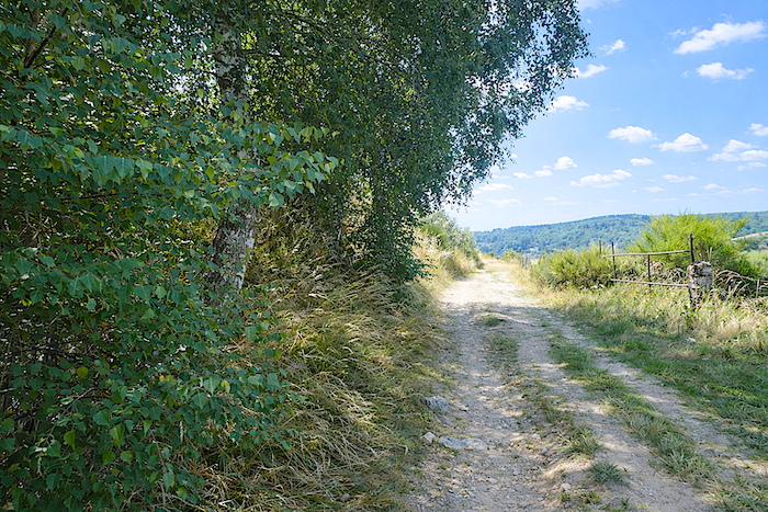
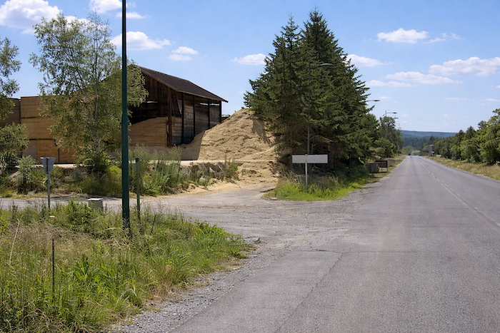
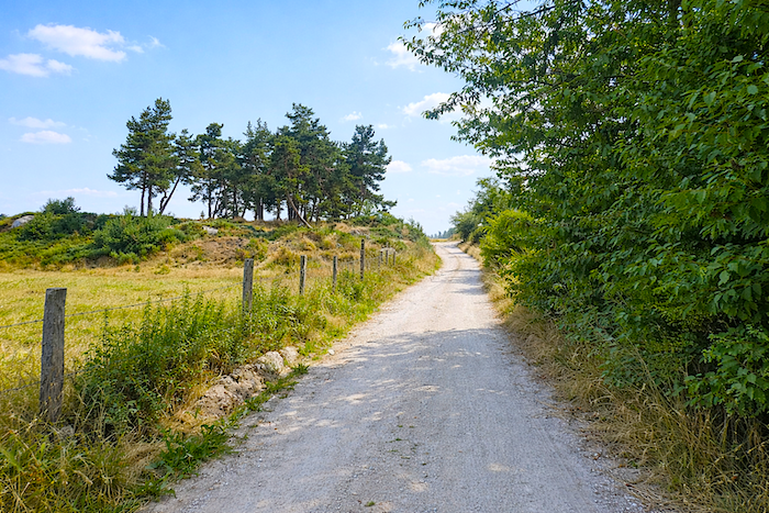
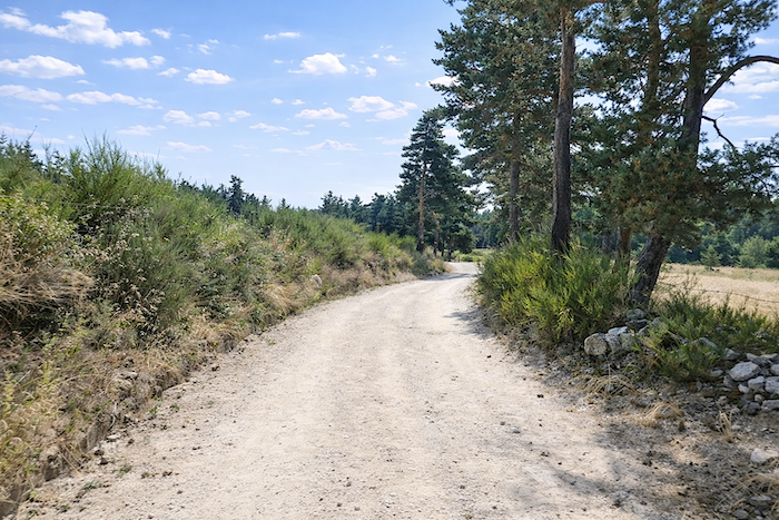
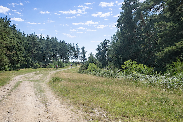
| Farther ahead, the meadows open onto modest rye fields nestled at the foot of spruce and pine trees. Here, rye has always been the grain of Saugues, the cereal of high lands and harsh seasons. Yet these plots remain small, almost secretive. Clusters of trees divide the landscape and leave the farmer only just enough land to wrest a living from it. Little by little, the tall pines gain ground, replacing the shrubs, while the soil takes on that soft brown color typical of forest undergrowth. |
 |
 |
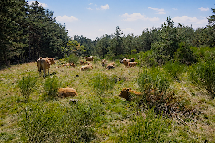
| Then the countryside slowly gives way to the forest around Les Pendus and Champ Roucis. Conifers dominate here, and above all Scots pines, which gradually take possession of the landscape. The trail follows small dry-stone walls and sometimes runs beside barbed wire fences behind which peaceful herds of cattle and sheep graze. Even at the edge of the woods, man and beast still share the land with a kind of ancestral familiarity. |
 |
 |
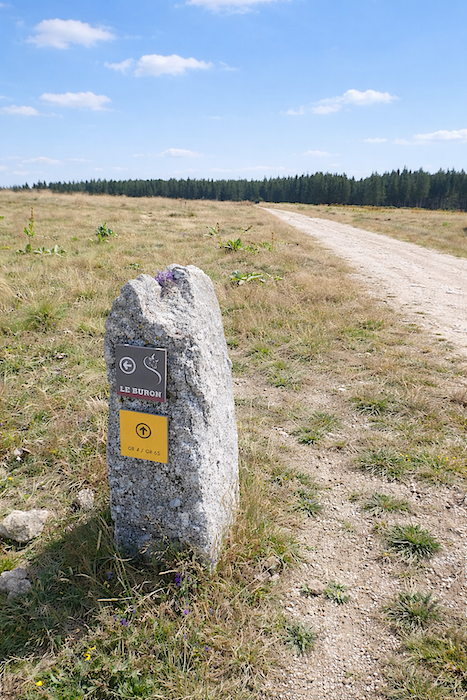
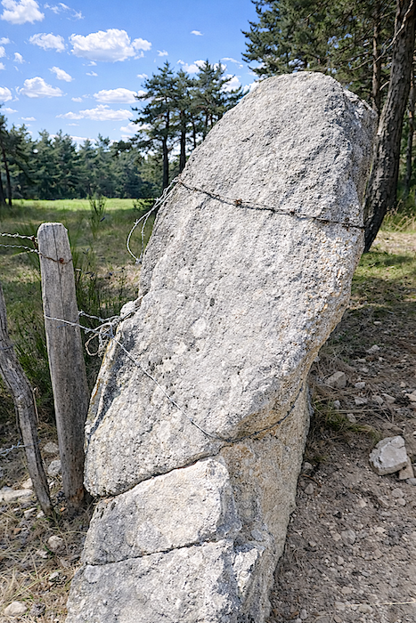
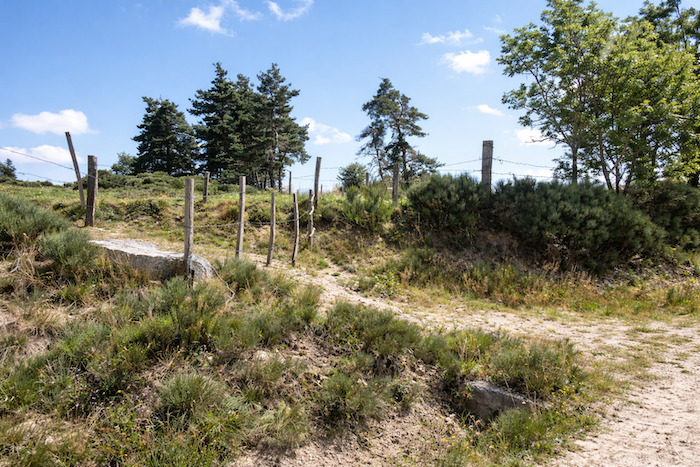
| Sometimes even the menhirs themselves seem to have been domesticated, transformed into obedient boundary posts beside the pastures, as though the ancient mysteries too had finally yielded to the patience of the centuries. |
 |
 |
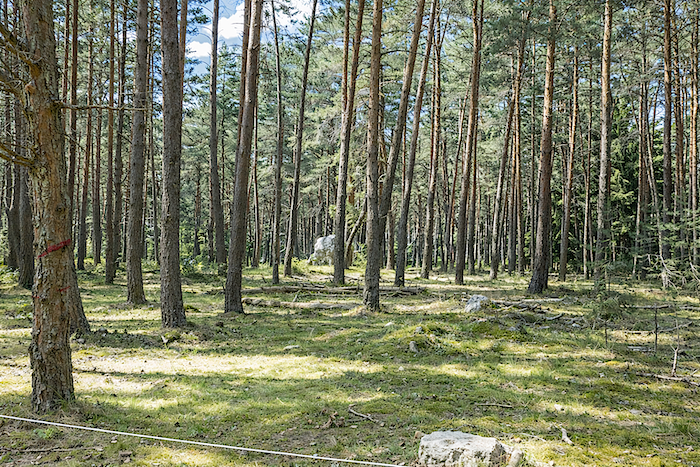
| Here, peace reigns with silent authority. The grass grows thick, and the trees close protectively around their secret clearings where wild plants and fertile disorder thrive. The hillside curls into soft curves and rounded valleys, offering its slopes in turn to sunlight or drizzle. In these cathedrals of greenery, even the Aubrac cows, usually so curious and warm spirited, sometimes appear indifferent to the passing pilgrim. And when a light breeze moves through the branches, the whole forest seems to rise in a slow breath, like the deep respiration of a sleeping being. |
 |
 |
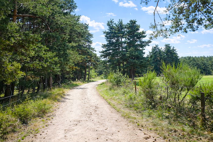
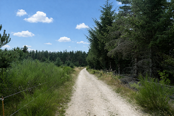
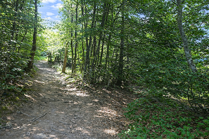
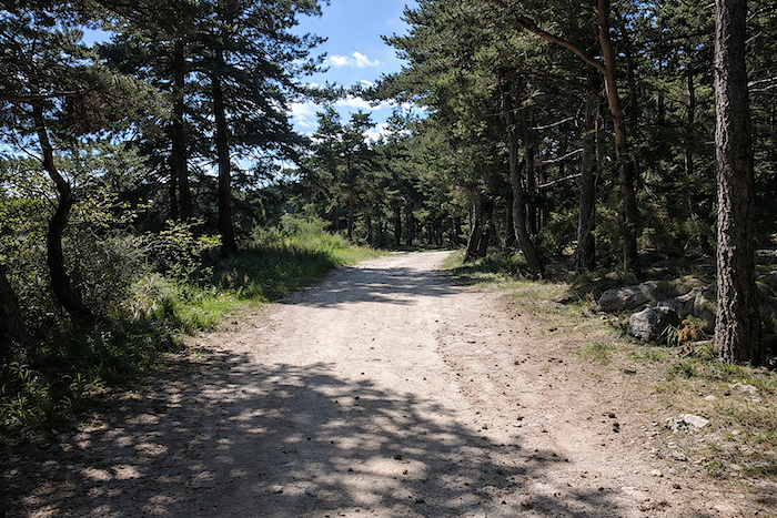
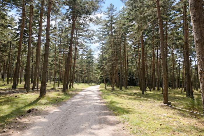
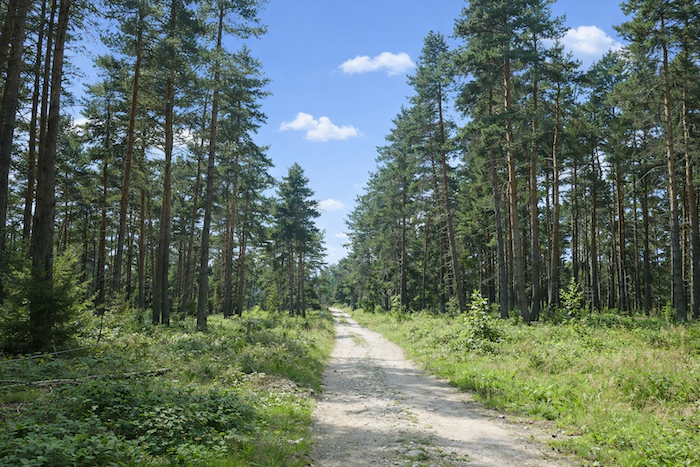
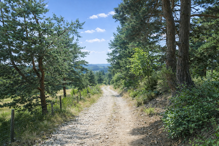
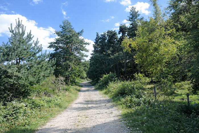
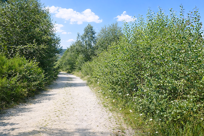
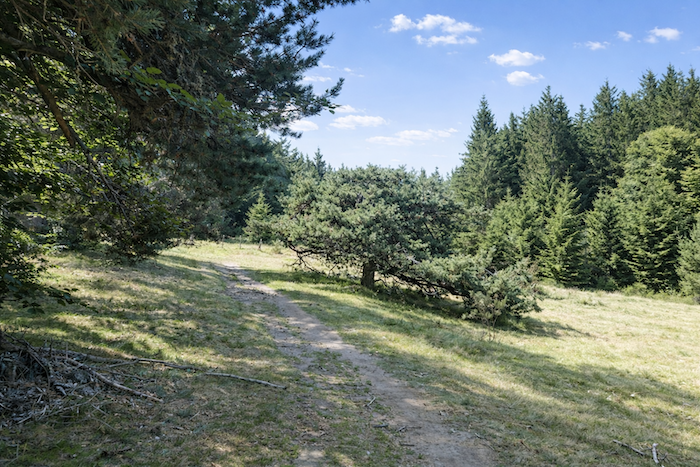
| The broad dirt path undulates gently, leaving the pine woods for a moment to cross clearings flooded with light before once again surrendering to the cool shade of the forest farther on. Everywhere, the trunks rise tall, slender and straight, like patient columns stretching toward the sky. |
 |
 |
| The path runs along the edge of an ancient mystery buried for centuries within these woods, the mystery of wolves, witches and forgotten gods whose presence still seems to drift among the trees. |
 |
 |
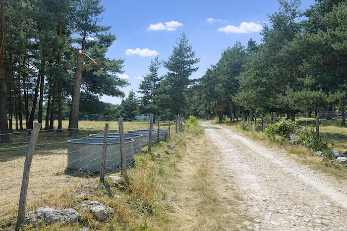
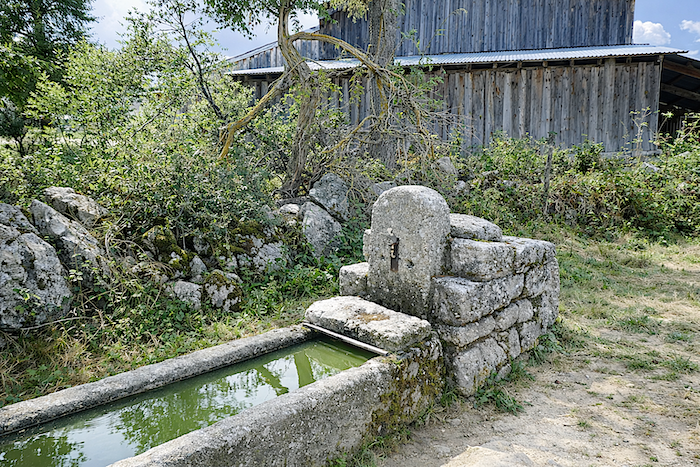
| Yet here, even in this landscape steeped in legend, living creatures are never abandoned to thirst. Man still watches over his animals, mastering water, gathering it, guiding it and sharing it. |
 |
 |
| Without the walker truly noticing it, the GR65 has gradually climbed more than a kilometer on gentle slopes before slowly bending toward the Seuge. Underfoot, pine cones sometimes crack sharply beneath each step, while bilberry bushes spread their dark touches across the ground. |
 |
 |
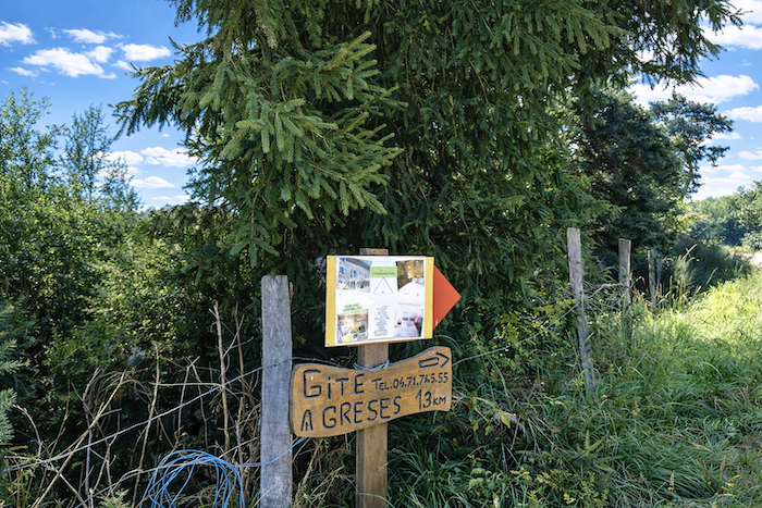
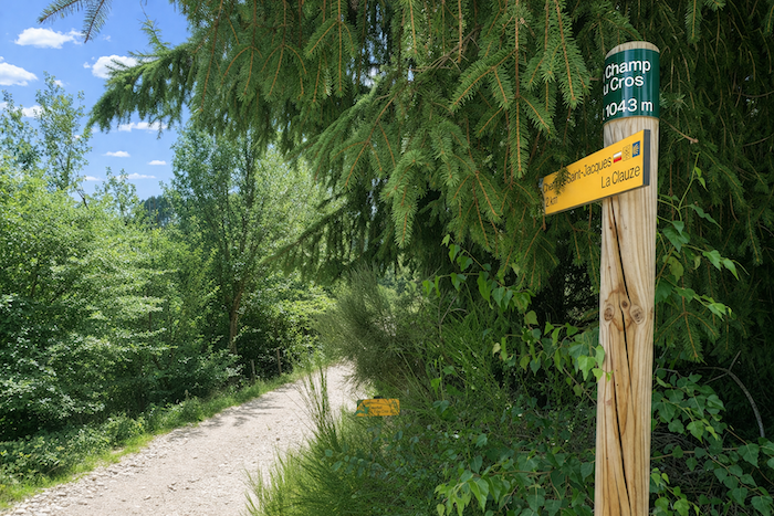
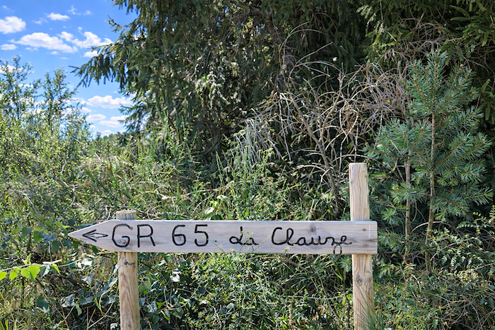
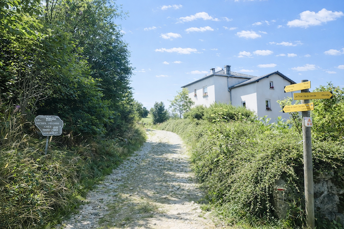
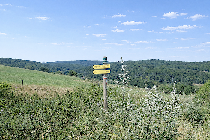
| Then, little by little, the path escapes from the grip of the pines. Ash trees and maples reappear. The path reaches the place called Champ du Cros, where a sign points toward a hostel located one and a half kilometers from the path, a promise of rest in one of those small local hamlets as discreet and peaceful as the surrounding woods. |
 |
 |
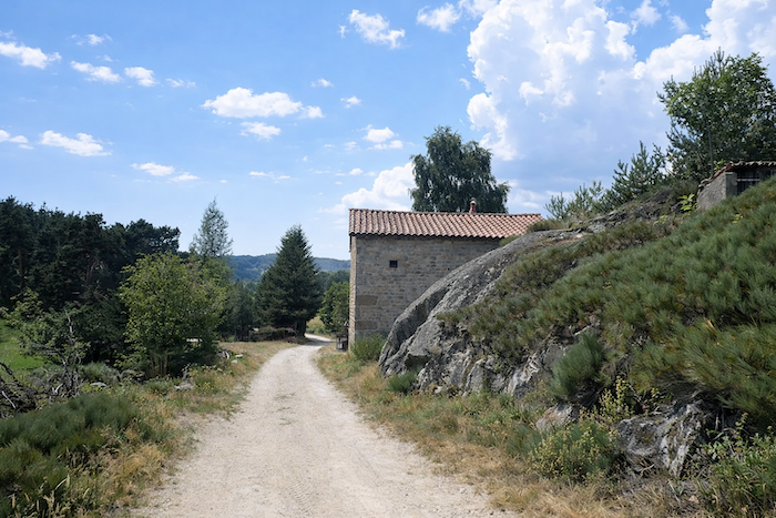
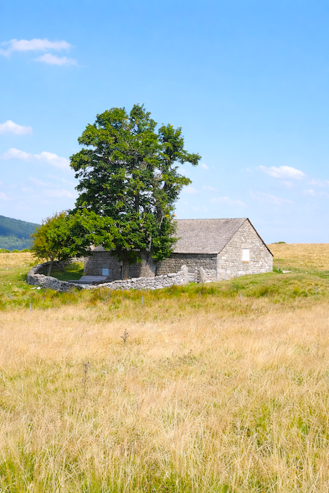
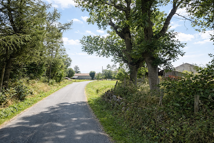
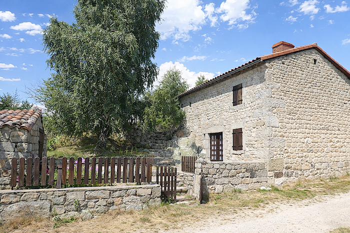
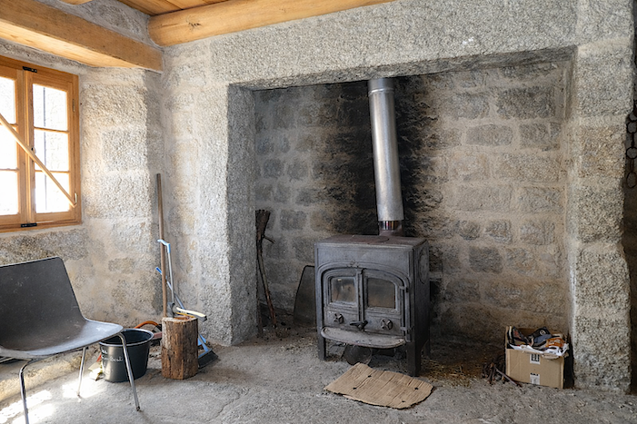
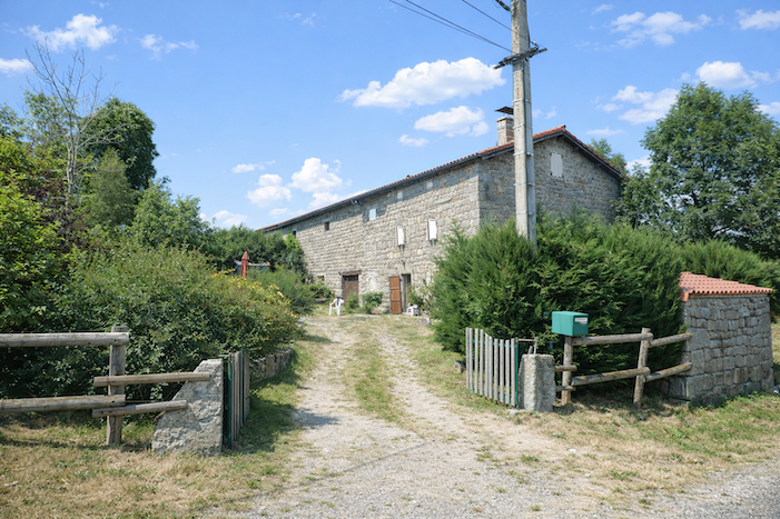
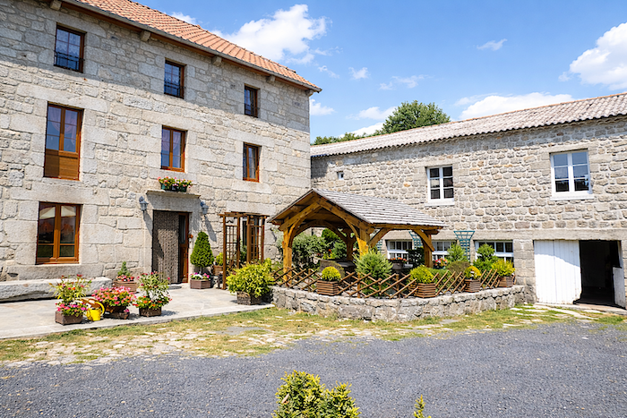
| Along the way, another granite house appears, massive and serene. In these regions where time sometimes seems suspended, it is difficult to know whether these beautiful homes still live according to the rhythm of the seasons or awaken only during the summer months. In every case, they retain the same silent presence and the same rustic nobility. From here onward, the direction is La Clauze, no longer as distant as it seemed this morning. |
 |
 |
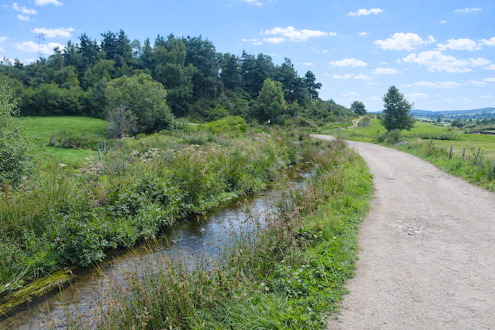
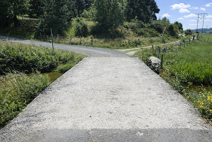
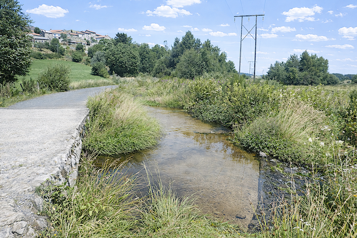
| There, the GR65 meets the Seuge again and crosses it once more. You must almost bend down, straining both ear and eye, to notice the thin stream slipping quietly between the stones. |
 |
 |
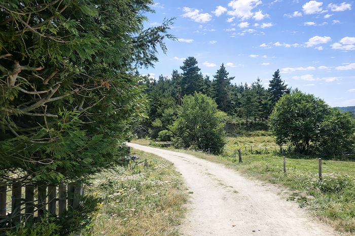
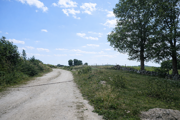
| Beyond the stream, the path climbs slightly once again over packed earth through a large clearing and then through the countryside toward La Clauze. Here and there, strands of barbed wire fixed to stone walls punctuate the meadows beneath the ash trees. |
 |
 |
| Soon, the first signs of the village appear. |
 |
 |
| As the hamlet approaches, the tarmac once again asserts itself. It is always the same story. Tractors, unlike pilgrims, do not enjoy sinking into the mud. |
 |
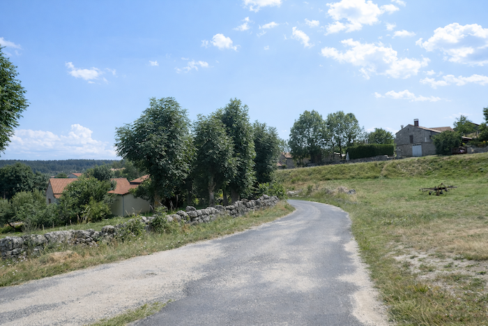 |
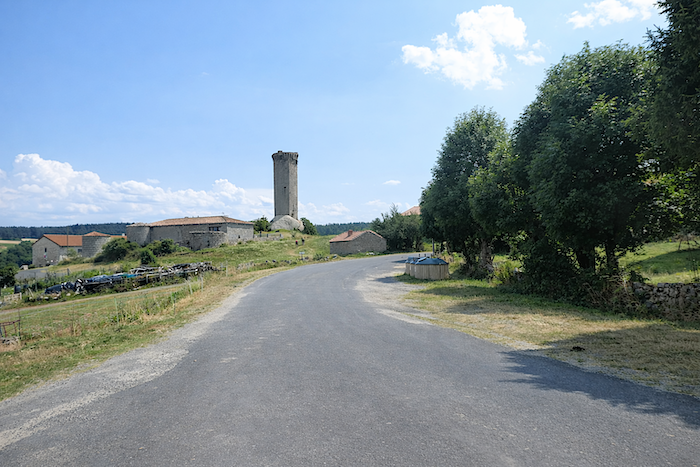
| The granite hill of La Clauze carries a proud heptagonal tower, reflecting the authority of the seigneurial power that once ruled here. A ladder was required to reach the machicolations and the high arrow slits. Castles, fortresses and keeps, old Auvergne lacked none of them, for this was once a land of small local lords with, it must be said, rather warlike temperaments. All these prestigious signs of a vanished past, these supposedly impregnable castles, still stand upon their mounds in ruins, witnesses to a vanity buried forever. |
 |
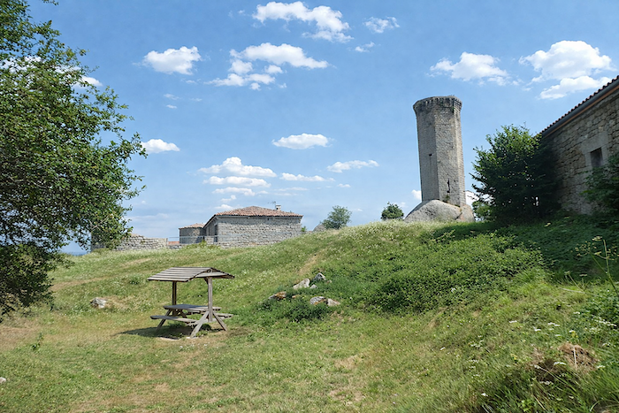 |
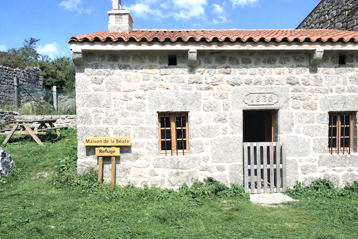
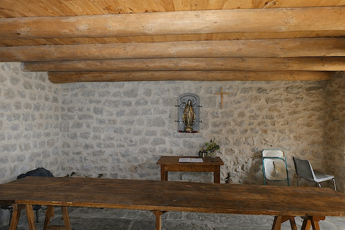
| At La Clauze, granite reigns supreme. It is everywhere: in the proud twelfth century tower still watching over the village, in the discreet refuge of the Maison Béate, in the massive façades of the houses, in the fountain, and even in the magnificent cattle shoeing frame, an admirable witness to a peasant world whose memory remains preserved in stone. |
 |
 |
| The “Béates” belonged to a lay institution founded during the seventeenth century. These women were at once catechists, nurses, helpers in daily life and companions to the dying, humbly watching over village communities. They comforted, cared for and accompanied the weakest members of society. Today, only a stone house remains among the others to recall their presence. Yet the place has never ceased to provide shelter. These former refuges still welcome pilgrims, often young and sometimes of modest means, happy to find for one night a free roof, a little warmth, and even, the ultimate luxury on the path, a small kitchen. |
 |
 |
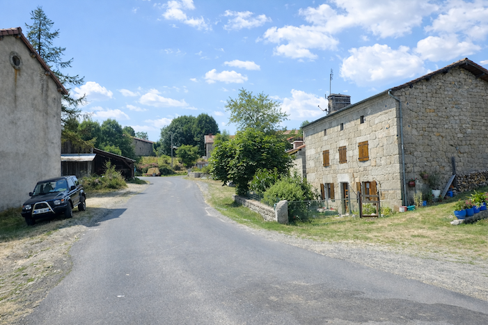
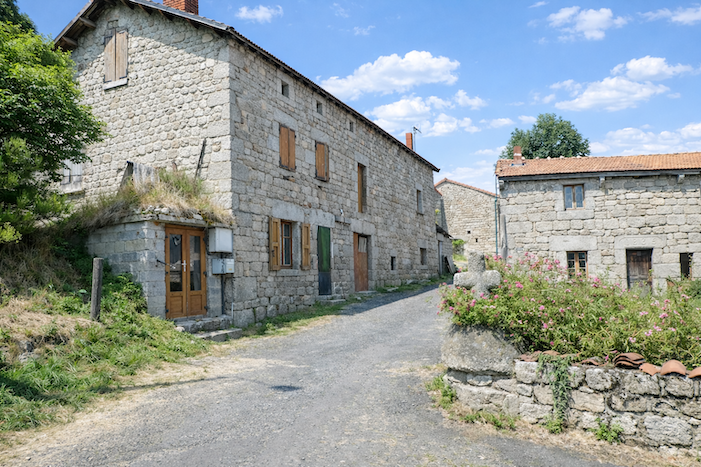
| Within the village, the buildings still impose their stature. Built to withstand winds, winters and time itself, their pale granite walls give La Clauze an austere nobility. Yet villages, like castles, also bear their wounds. Here as elsewhere, deep rural France slowly fades away. Many houses lie in ruins, abandoned as though life itself had quietly withdrawn. And yet the stone remains everywhere, faithful and omnipresent, the stubborn guardian of former days.
In Gévaudan, a large part of the land once belonged to communal property shared among the peasants according to ancient customs. That organization gradually disappeared over time, but sometimes the shadow of a “couderc” still remains, an open communal space at the heart of the village where daily life once unfolded around the communal house, the bread oven, the washhouse and of course the famous cattle shoeing frame. These places tell far better than books the story of a civilization built upon mutual aid, sharing and necessity. |
 |
 |
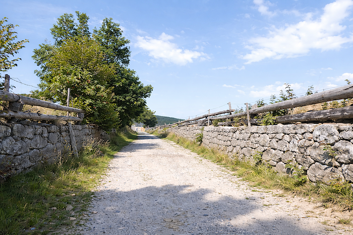
| Leaving La Clauze, the GR65 rejoins the road. For a long while, the walker follows the edge of the tarmac. From time to time, collapsed walls appear, still supported as best they can by old beams blackened by weather and time. Moss slowly spreads across what remains of these former lives, like a slow writing of time upon the ruins. It is often the France of humble people that disappears first, the France of poor peasants, simple gestures and houses built to endure. Ahead of you, the horizon gradually opens toward the dark forests rising in the distance, like the still unknown continuation of the journey. |
 |
 |
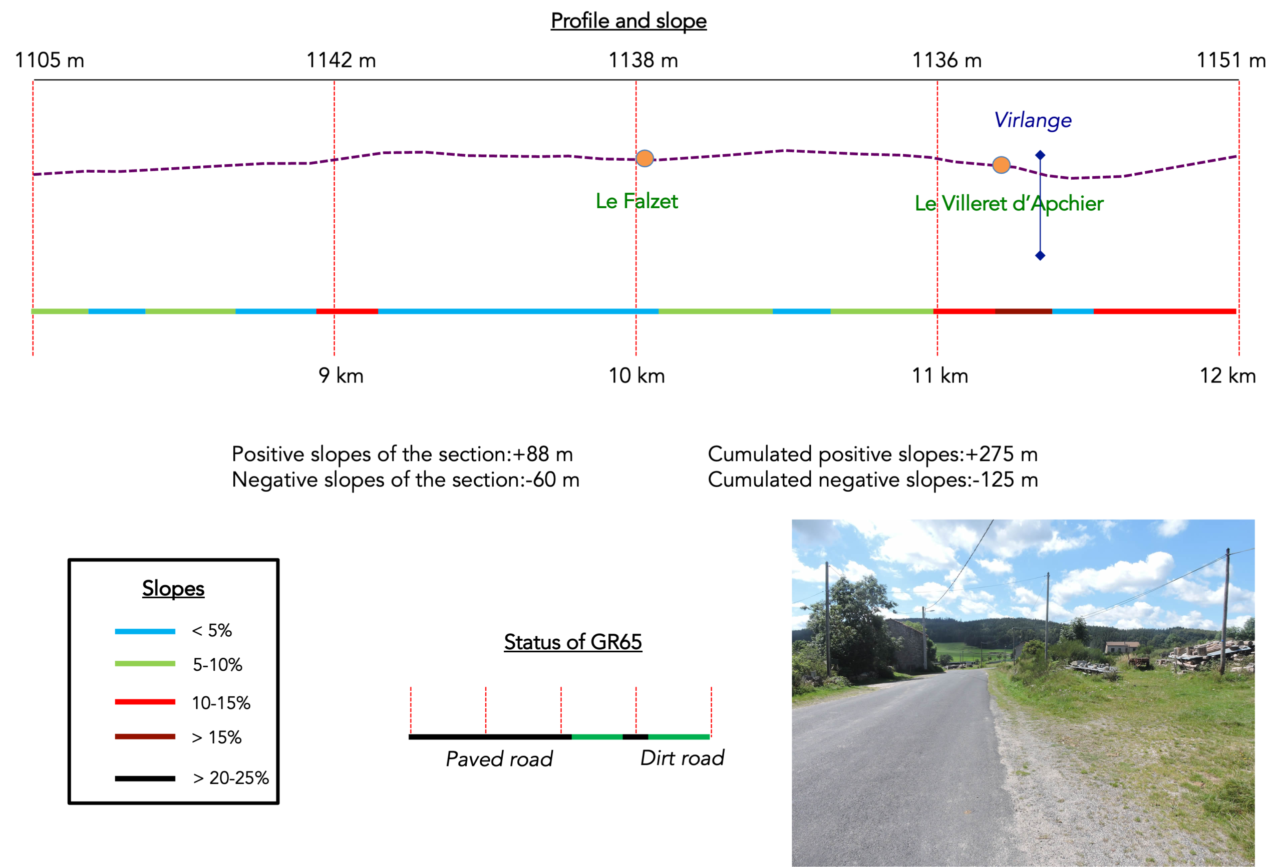
Section 3: Following the tracks of the Beast of Gévaudan
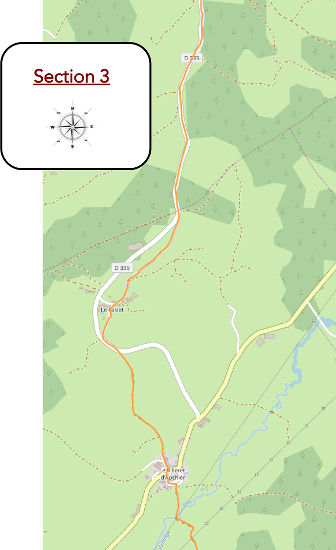
General overview of the route’s challenges: generally gentle slopes, apart from a few short climbs near Le Villeret d’Apcher.
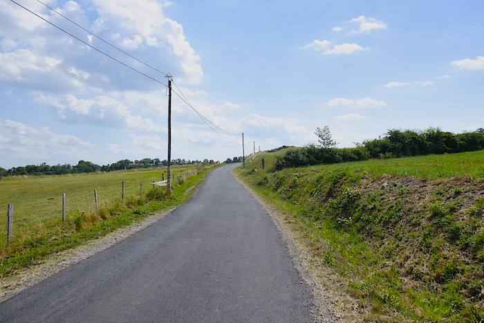
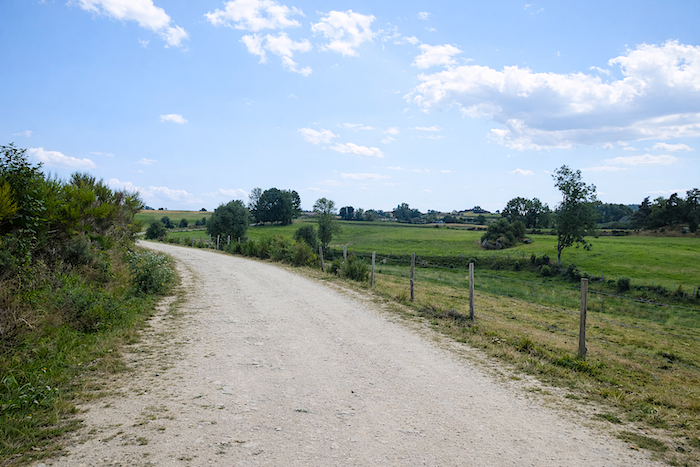
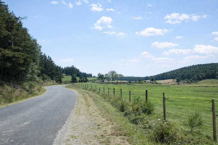
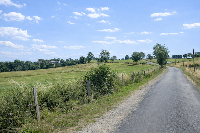
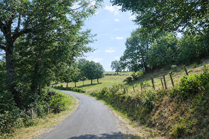
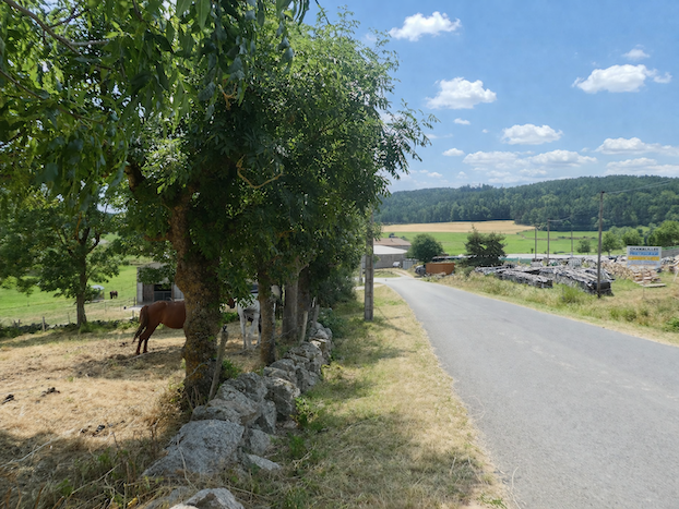
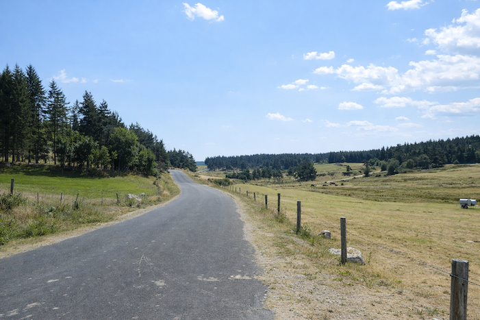
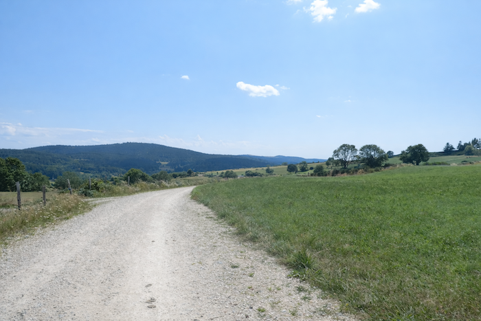
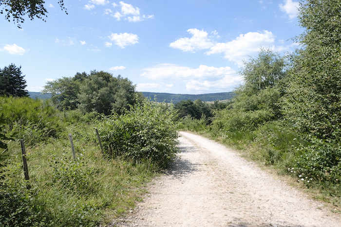
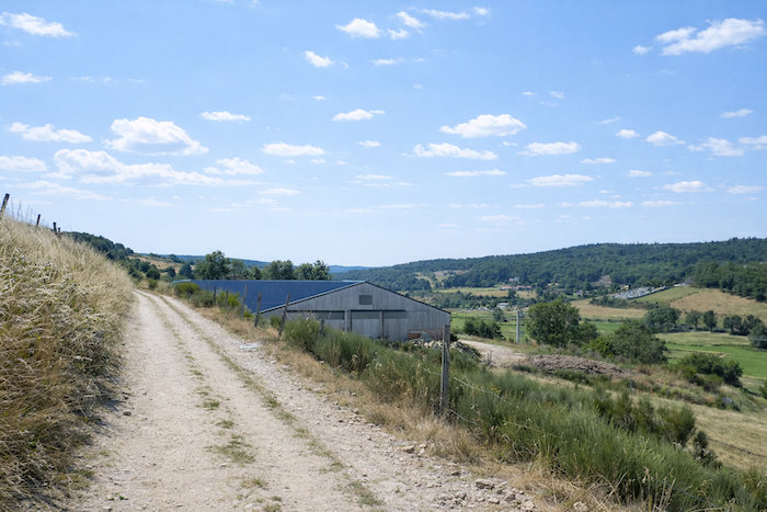
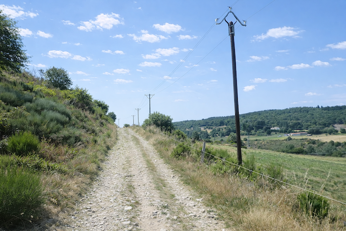
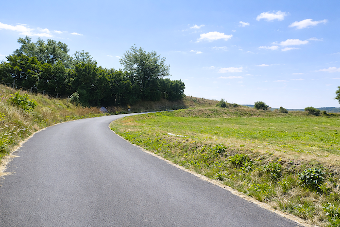
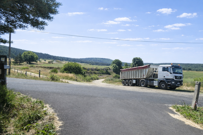
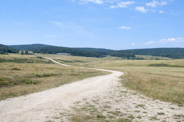
| Here, the route is probably not the most spectacular part of the stage, for the GR65 follows the road for a while. Yet the pilgrim hardly suffers from it. Traffic is rare, almost nonexistent, and one walks through open countryside far from any turmoil. This crossing even possesses its own form of beauty: the beauty of vast silent spaces, open hillsides, tiny farms lost in the distance, a rye field glimpsed between two embankments, and a few peaceful herds scattered across the meadows like touches of quiet life. |
 |
 |
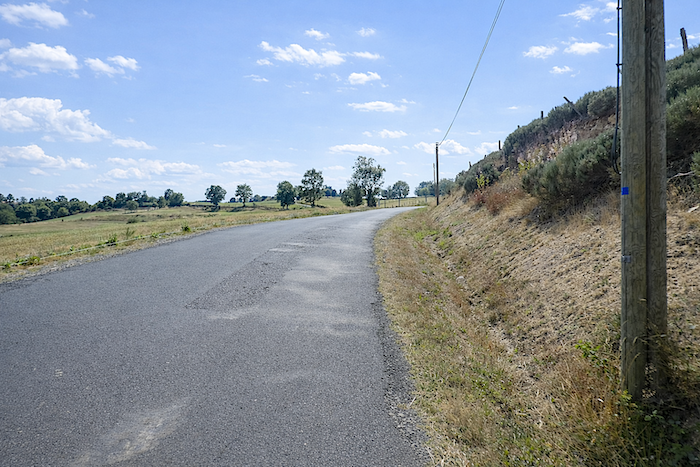
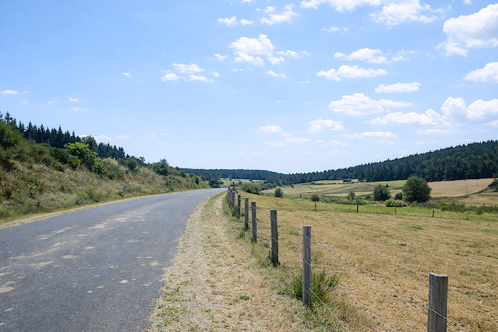
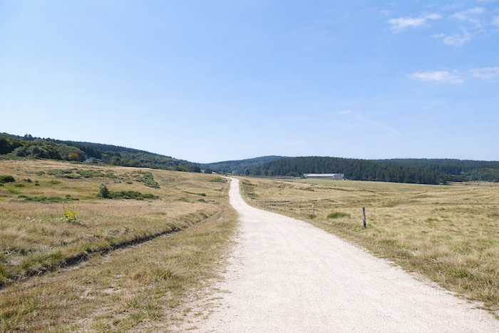
| The road undulates gently along the wooded hillside before rising for a few hundred meters. The slope becomes a little more noticeable, though never demanding. It is in these solitary stretches, when the landscape seems suspended and the rhythm of walking settles naturally, that the pilgrim, absorbed in thought, sometimes raises his head to measure both the distance already travelled and the distance still left to offer to the day. |
 |
 |
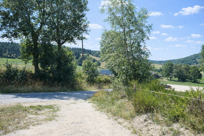
| At the top of the hill, the GR65 finally leaves the main road, where the occasional distracted vehicle passes from time to time, and joins a smaller, more intimate road descending gently toward Le Falzet. |
 |
 |
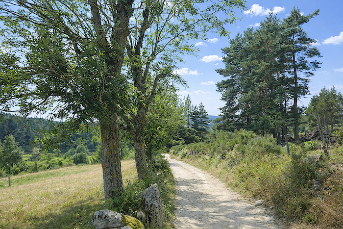
| The descent then begins among broom shrubs beneath the light company of ash trees and maples. |
 |
 |
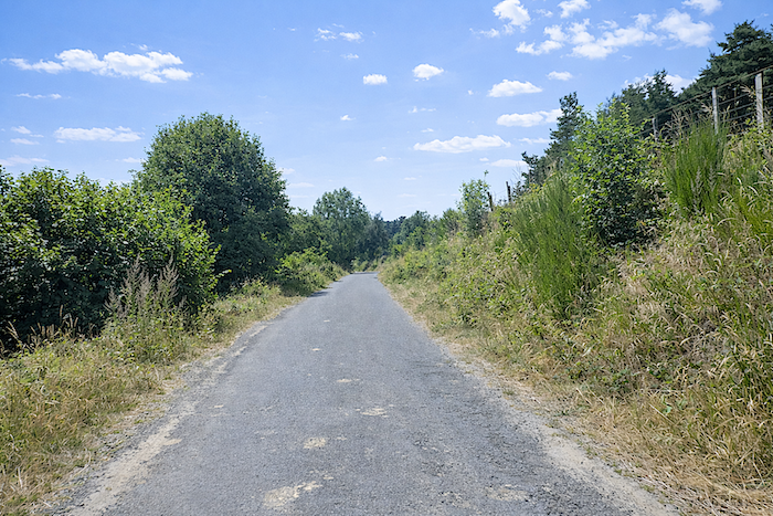
| Little by little, as the route sinks deeper into the dale, the vegetation thickens. Alongside the familiar trees now appear tall hornbeams, beeches and even a few walnut trees announcing the approach of a more sheltered and inhabited place. |
 |
 |
| Le Falzet appears almost without warning, just beyond the grove, like a secret protected by the slope and the trees. |
 |
 |
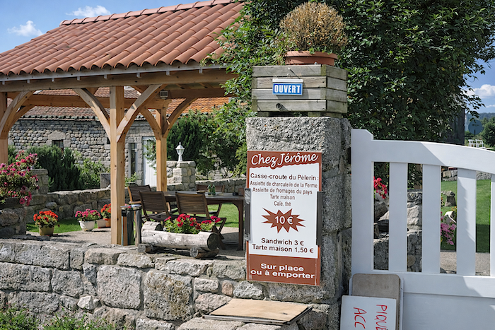
| At Le Falzet, a “happy farm” serves as a refreshment stop offering local products from the farm itself. There is something deeply comforting in these simple and generous pauses. After hours of walking, fatigue, sunshine or wind, such improvised refuges become true oases: a bench in the shade, a shared drink, a smile exchanged, and suddenly the road feels less long. The pilgrim recovers a little strength there, but above all that precious feeling of being welcomed, if only for a moment, at the heart of the journey. |
 |
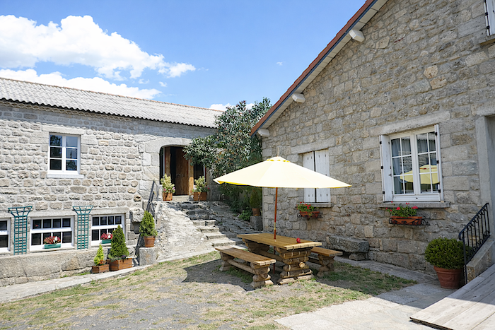 |
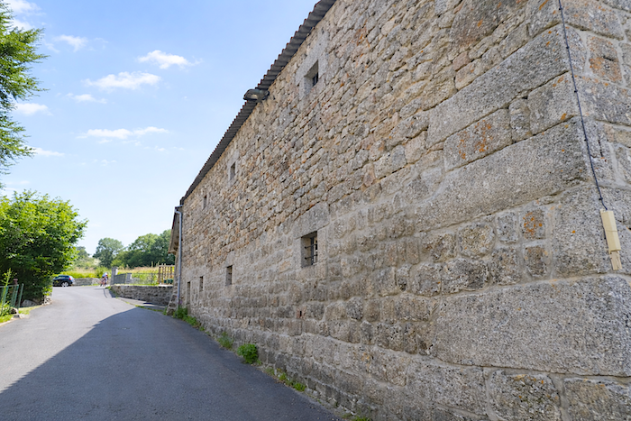
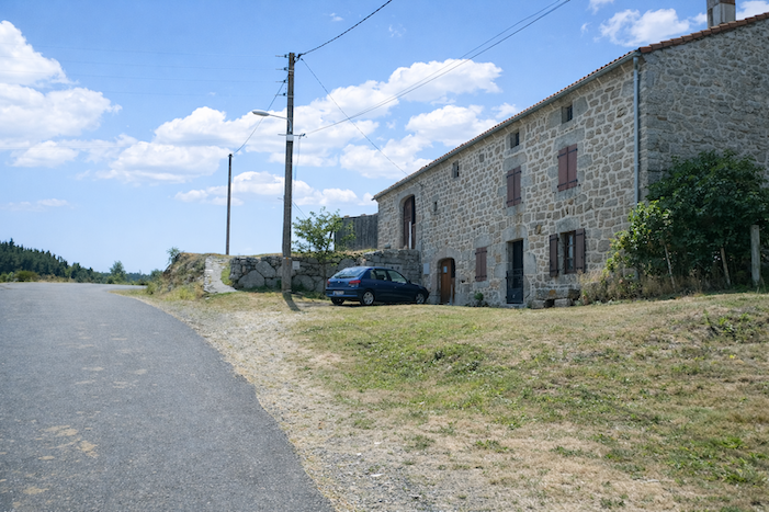
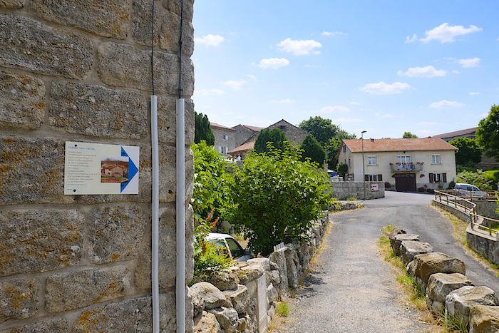
| Within the village, everything breathes restrained splendor, quiet solidity and the timeless charm of pale granite. The houses, walls and fountains all seem carved from the same mineral light, as though the stone itself had imposed its nobility upon the entire landscape. |
 |
 |
| Leaving the village, the GR65 continues for a few hundred meters along the secondary road before briefly rejoining the deserted main road. |
 |
 |
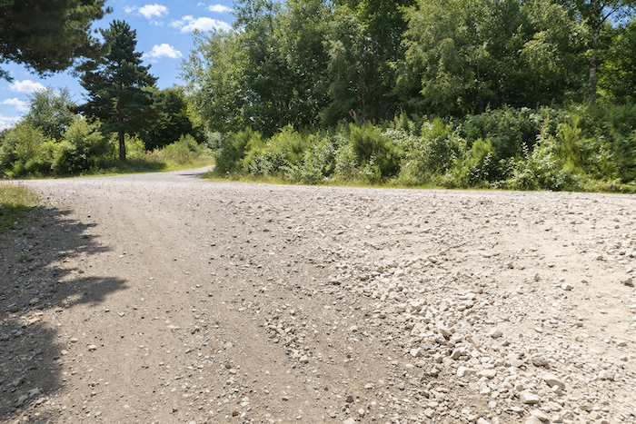
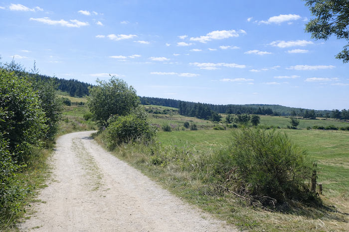
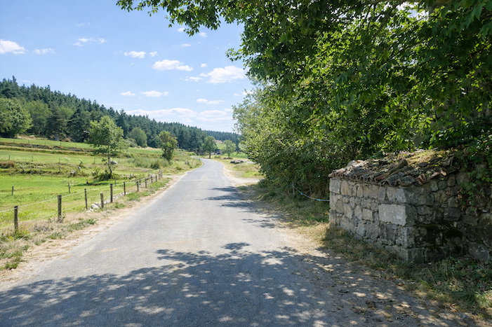
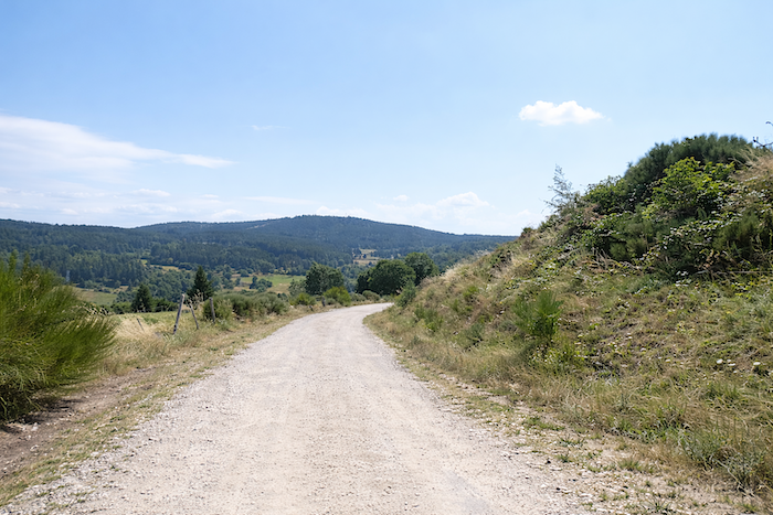
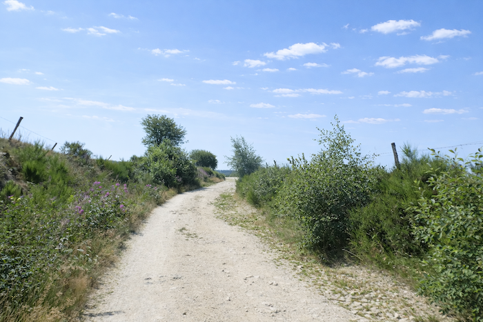
| But the route lingers little on the asphalt. Very quickly, a broad dirt path opens before the walker at the foot of the hill rising toward Le Villeret d’Apcher. As always, the route seems to prefer the pale dust of rural tracks to the smooth ribbon of overly civilized roads. |
 |
 |
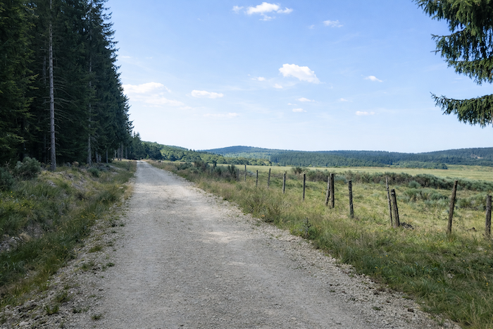
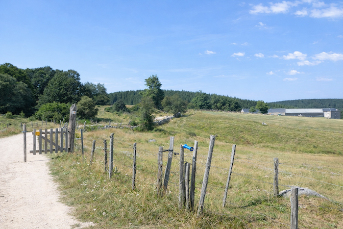
| Then the countryside reappears in all its untouched simplicity. The meadows stretch outward, enclosed by barbed wire fences holding back the livestock, and punctuated here and there by ash trees, maples or solitary hornbeams standing like familiar presences across the gentle immensity of the pastures. Here, nothing is hurried. The landscape reveals itself slowly, with that sovereign simplicity characteristic of livestock country. |
 |
 |
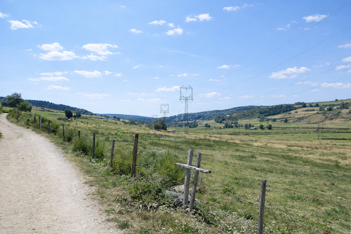
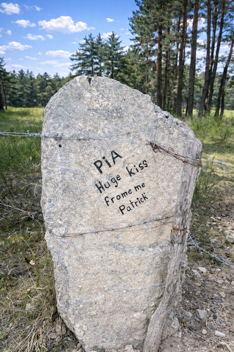
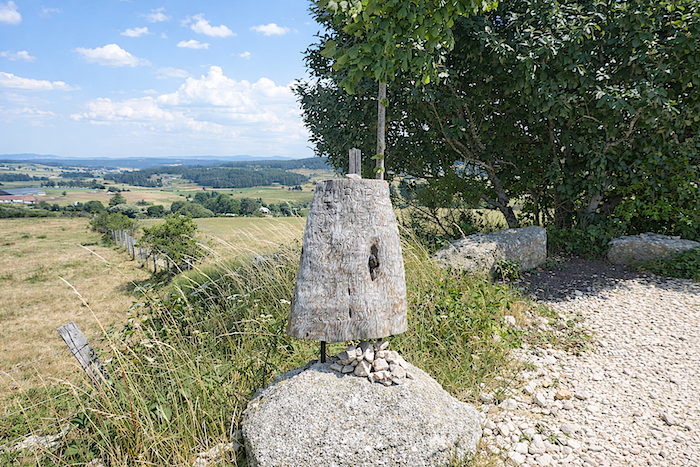
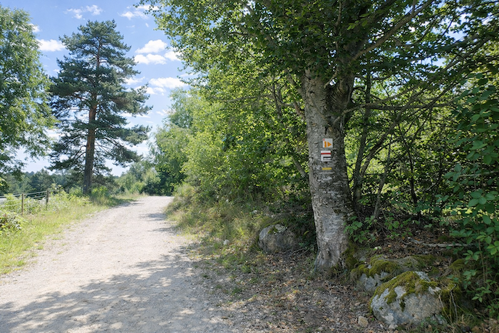
| Along the path, a small mystery suddenly appears beside the trail. It resembles a rustic marker, a votive object or some humble totem standing there in silence. In this landscape of open paths and vast pastures, the object becomes a poetic landmark: a piece of folk art, a sign left for passing walkers, or perhaps a discreet tribute to the pilgrims who travel here. It says nothing, yet it accompanies the pilgrim. |
 |
 |
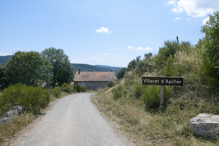
| At the top of the short hill, the path slopes gently toward Le Villeret d’Apcher, a village linked to the memory of Jacques Portefaix, the young boy whose courage saved his sister from a terrible death during an attack by the Beast of Gévaudan. Here, history and legend still brush against one another, as though the land itself had never entirely forgotten. |
 |
 |
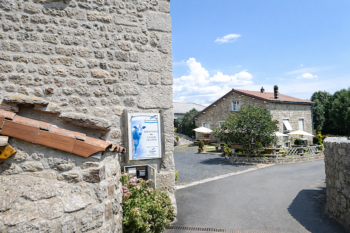
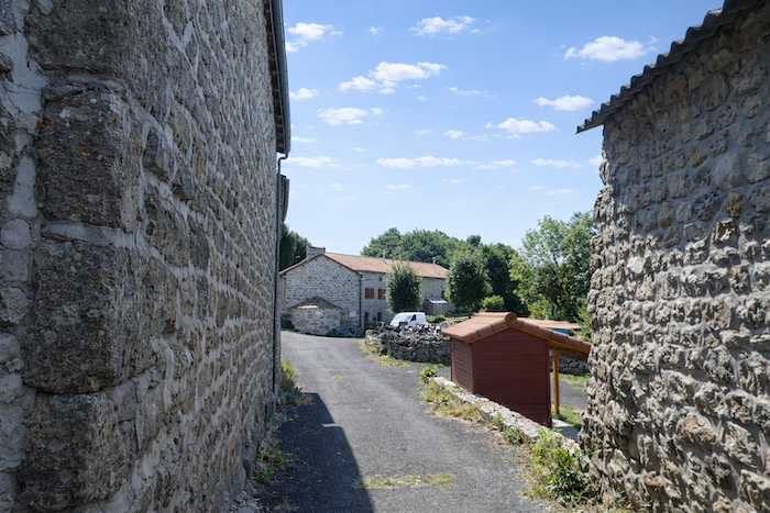
| In these granite villages, you sometimes experience the strange feeling of being expected. The houses seem to watch you pass, silent yet full of presence, as though preparing to reveal the secret of their stones joined with lime or mortar. They give the impression of having always stood there, unchanging, rooted more deeply than the people themselves, |
 |
 |
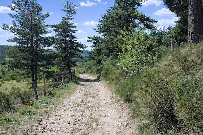
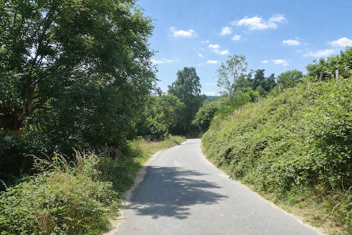
| Leaving the village, beyond a few winding lanes, the GR65 plunges into a steep descent, more than 15% in places along the tarmac, toward the Virlange stream winding below the hillside. The Camino possesses this taste for contrasts: it often descends toward a river only to climb again afterward, as though reminding the walker that nothing is gained without detours. Yet today the relief remains gentle, with neither exhausting descents nor harsh climbs to fear, only a few kilometers of rolling countryside and cool woodland. |
 |
 |
| The slope nevertheless becomes quite sharp beside the granite walls down to the bottom of the village. There, people once said that a spring flowed below, reputed to heal the sick. It must have relieved many sufferers, for today it seems to have withdrawn from the world, dried up, hidden away, or simply forgotten. The passing pilgrim no longer finds any trace of it. If your steps bring you here, perhaps you will feel tempted to solve this small mystery left beside the path. |
 |
 |
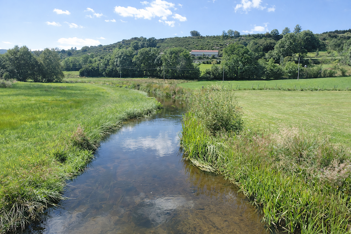
| The GR65 continues for a few more steps along the tarmac across a small plain before reaching the Virlange stream. |
 |
 |
| There at last, the water reveals itself, modest yet truly present, faithful to its course. The path crosses it with simple ease. |
 |
 |
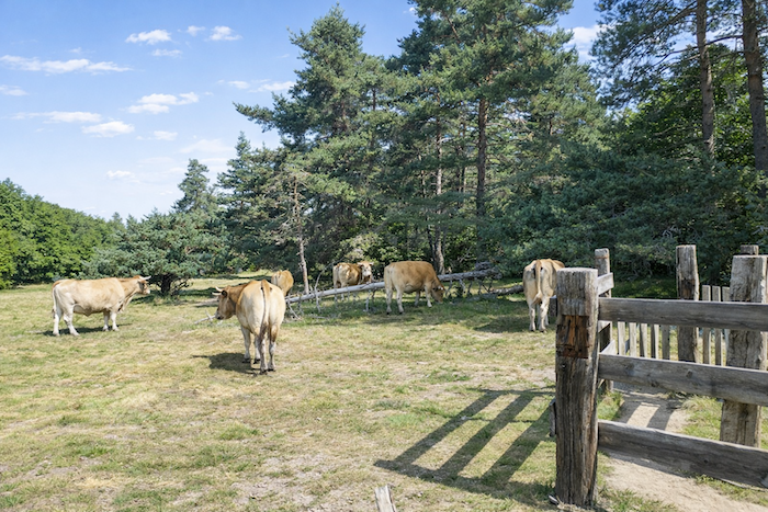
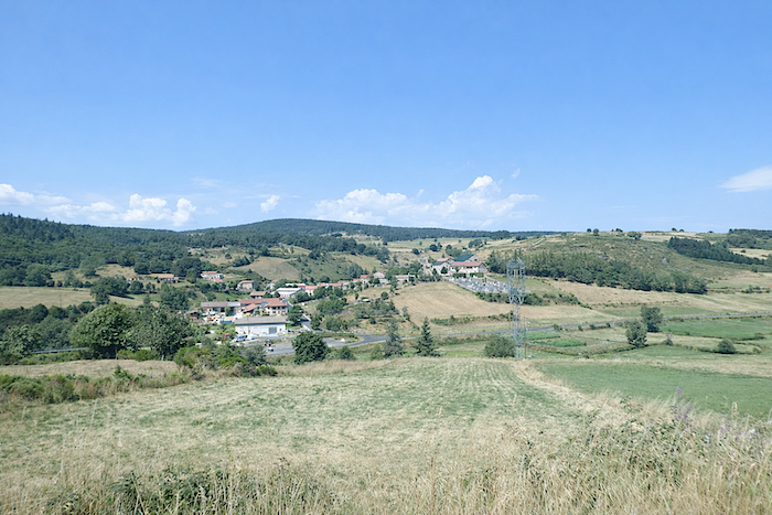
| Turning back, beyond the Abondance cows grazing in the meadows, you may still savor the charm of these stone villages clinging to the hillsides. |
 |
 |
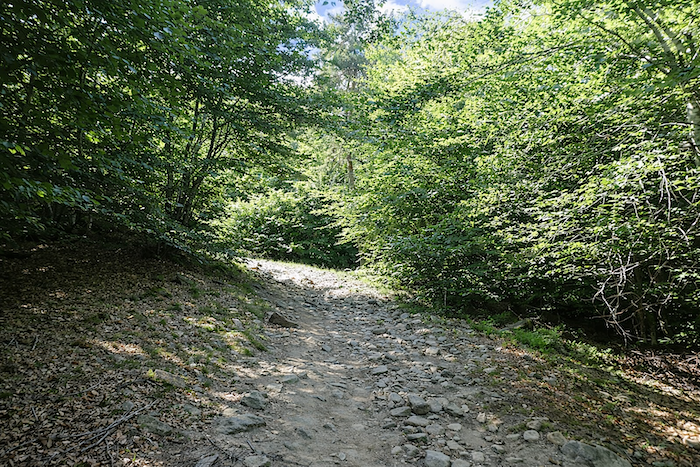
| But very quickly beyond the stream, the GR65 regains momentum and climbs once more with firmer steps along a broad dirt track. The slope steepens, a discreet reminder that the path never grants rest for very long without demanding something in return. |
 |
 |
Section 4: Along the mountainside toward Le Sauvage
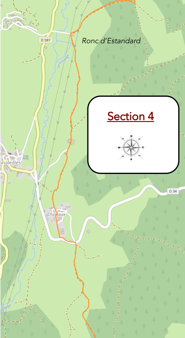
General overview of the route’s challenges: generally, fairly gentle slopes, with here and there a few steeper rises, though always very short.
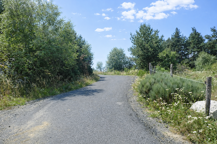
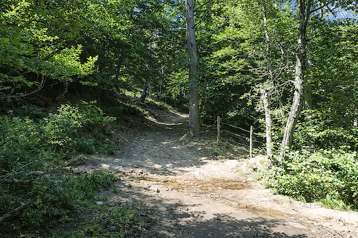
| In the woods of Ronc d’Estandard, there is a short but lively climb winding its way between deciduous trees, conifers and brushwood, as though the forest itself wished to test the walker before granting passage. |
 |
 |
| The climb, though not endless, immediately asserts its character. The path lingers briefly along the ridgeline, then, high above, suddenly bends sharply to the right. Here, you must pay close attention and resist the deceptive temptation of the path continuing straight ahead. |
 |
 |
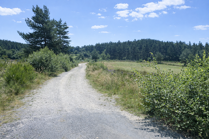
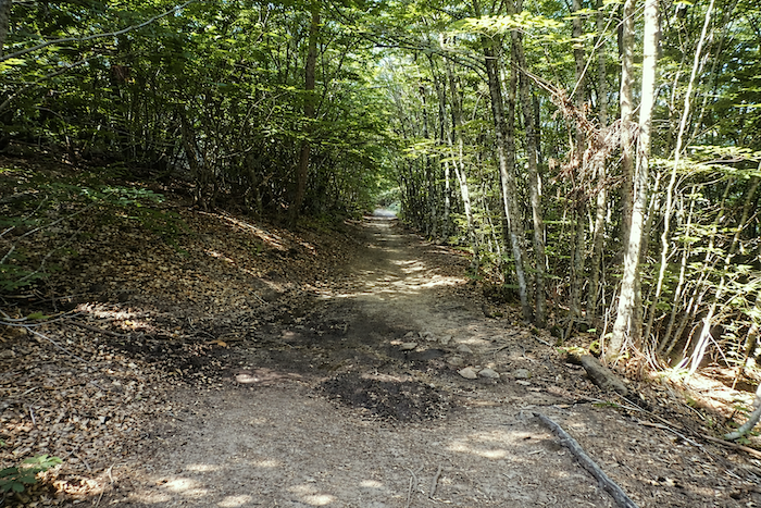
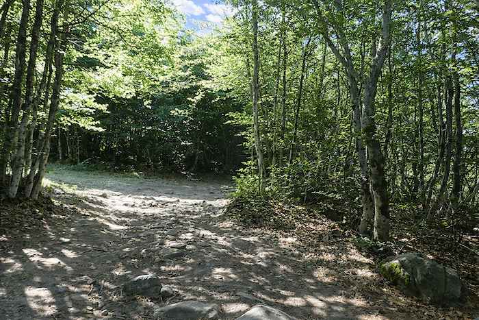
| Beyond this point, the ground, bristling with stones, becomes rougher underfoot before eventually giving way to a gentler descent along the hillside. |
 |
 |
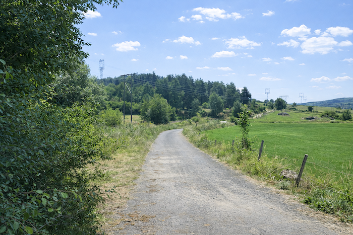
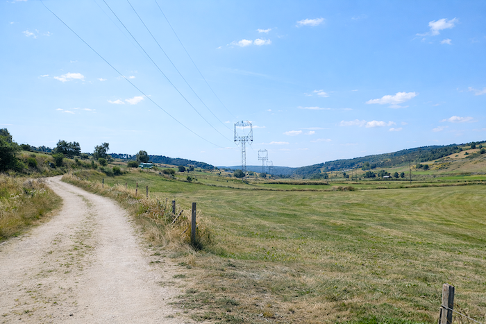
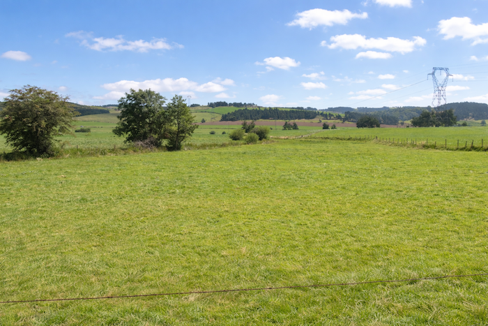
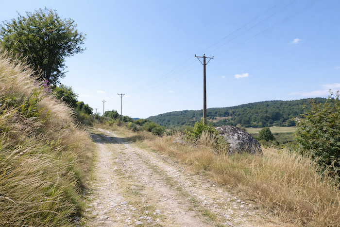
| Across the countryside, great metal giants raise their awkward silhouettes, scattering their lines across the landscape like familiar markers. Their disappearance is not for tomorrow. France has neither the means nor perhaps the determination to bury these high voltage arteries underground. Since their presence must be accepted, there is little point in cursing them forever. For the pilgrim, they almost become travelling companions, faithful landmarks within the immensity of the landscape. The last pylon standing upon the heights rises near Le Sauvage itself, exactly where the walker is expected. |
 |
 |
| The path then reaches the bottom of the descent and arrives at the place called Moulin du Pin after a very brief stretch along the tarmac. . |
 |
 |
| Then a broad track regains momentum and climbs the hillside with quiet confidence. |
 |
 |
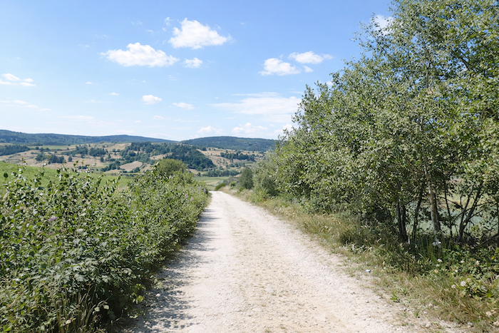
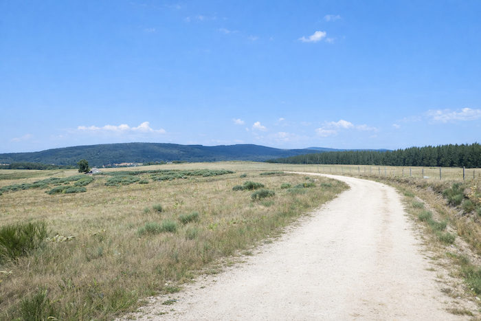
| For nearly a kilometer, the dirt path slopes up gently toward the depths of the high plateau through widely open countryside where shade is scarce. Here there are few, if any, cultivated fields, only the peaceful undulation of meadows. |
 |
 |
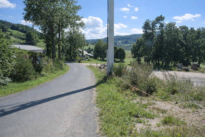
| On the right, Chanaleilles gradually comes closer, overlooking the departmental road D589 linking Saugues to St Alban sur Limagnole. |
 |
 |
| The path then begins a slight descent. To the right, the cemetery of Chanaleilles already becomes clearly visible, like a first announcement of the village. |
 |
 |
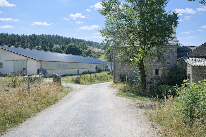
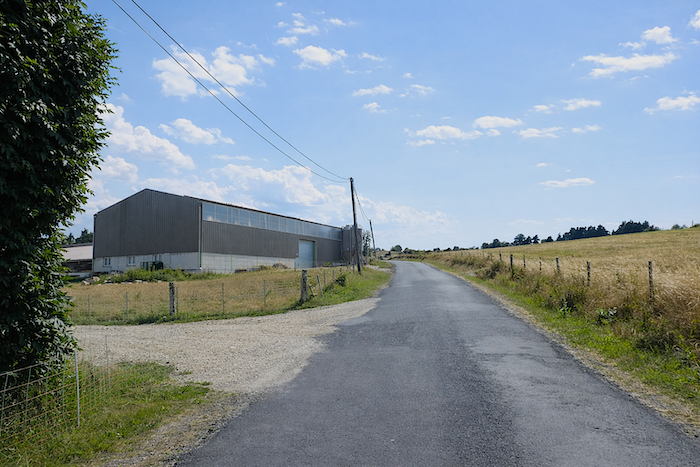
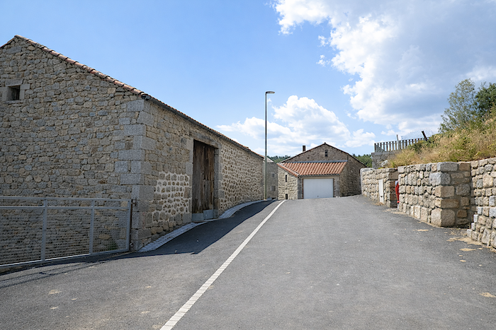
| At the bottom of the slope, the GR65 reaches the place called Contaldès along the tarmac road. Here, the farms have gradually abandoned their old stone masonry in favor of more modern, simpler and more functional lines. |
 |
 |
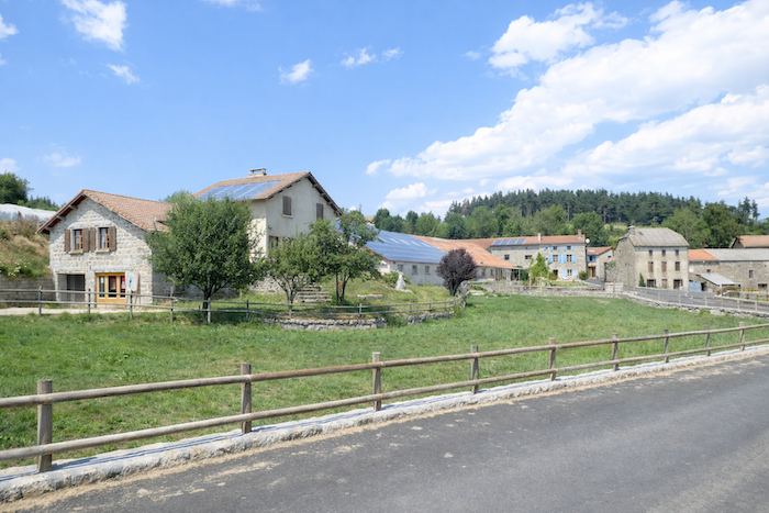
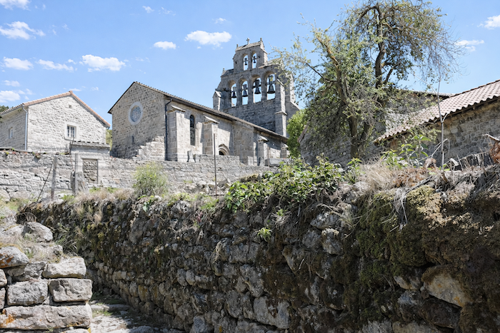
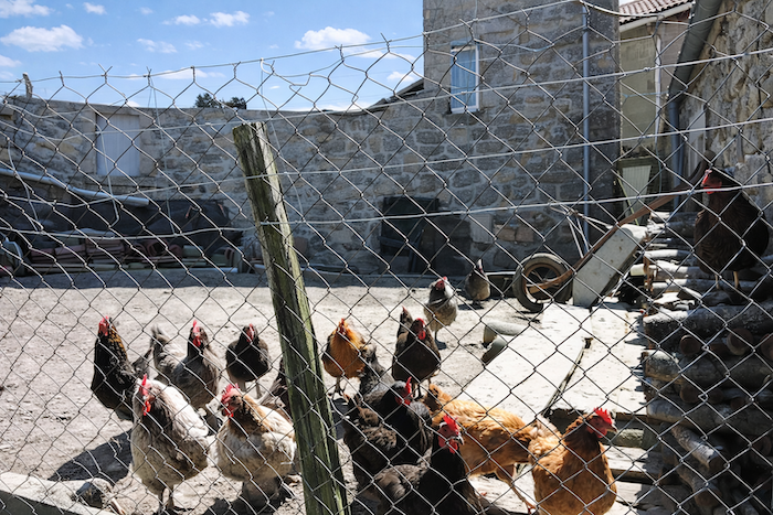
| The village of Chanaleilles lies only a short distance away. While the eye is long drawn toward its cemetery standing apart from the village, the detour is above all worthwhile for the stops it offers: a welcome grocery shop and a bar. The church, with its remarkable bell gable, is itself worth the visit. This bell gable, formed from a single wall pierced with openings for the bells, gives them a strange nobility. What a pleasure it is to encounter in these villages of solid stone houses little squadrons of chickens wandering freely about! |
 |
 |
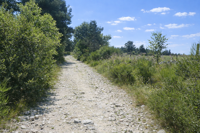
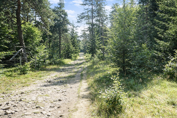
| From Contaldès onward, the path reasserts itself. It narrows, grows stonier, and climbs beneath ash trees between hornbeam hedges and broom shrubs, as though gradually rediscovering its true nature. |
 |
 |
| In places, the slope becomes more demanding. The walker then progresses above Chanaleilles and its cemetery, both slowly receding into the landscape and already slipping into the softness of memory. |
 |
 |
| Farther up, the path reaches the village of Chazeaux. |
 |
 |
| Chazeaux is one of those stone hamlets for which the region is renowned: modest, harmonious and firmly rooted in its land. Many pilgrims stop here to catch their breath and eat before tackling the final climb toward Le Sauvage. Within the simple peace of a carefully restored house, in this unpretentious hospitality, the walker often finds far more than mere rest: a sense of fullness. What more could one ask for on the route? |
 |
 |
| A road, steep and direct, then leaves the village and climbs above the last houses. |
 |
 |
| Shortly afterward, it reaches the place called La Sagne at an altitude of 1,170 meters, while nearly five kilometers still remain before reaching Le Sauvage. |
 |
 |
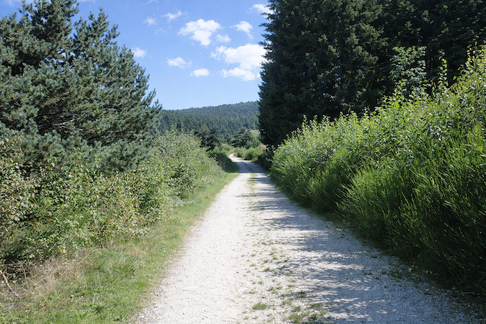
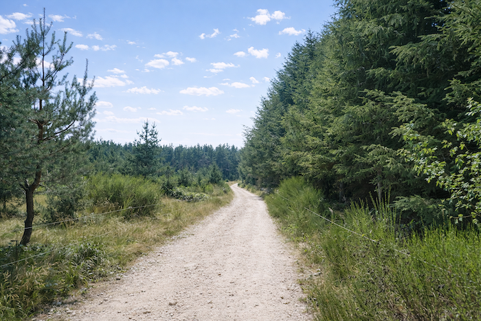
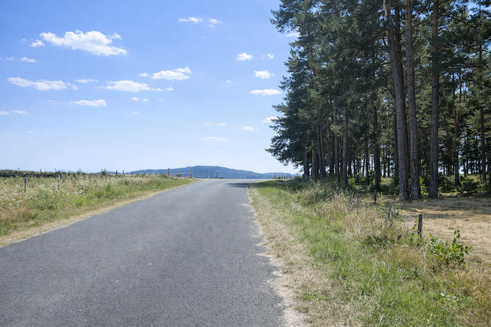
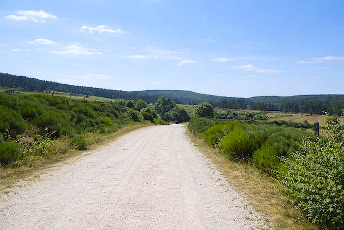
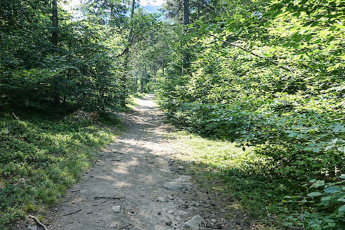
| A broad dirt track, gentle and almost welcoming, then takes over. It stretches along a gentle slope among broom shrubs toward the forest of Les Narcettes. Here, the countryside unfolds with soothing softness: a few scattered pines, sparse beeches, the rough flowering of broom, the low tones of heather, and close to the ground, the discreet promise of bilberries. |
 |
 |
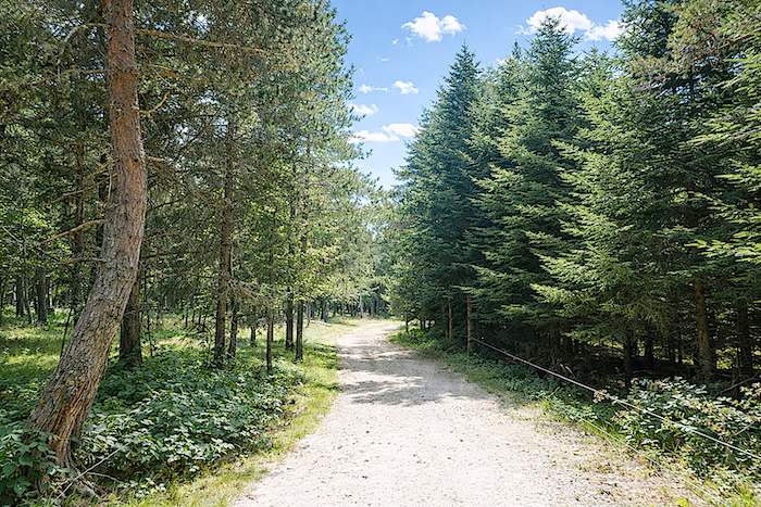
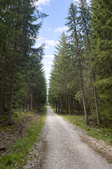
| Little by little, the path approaches the edge of the forest. The landscape then changes character. It gains in harshness, silence and grandeur. The country becomes wilder, almost alpine, while the spruces of the forest draw closer together and seem to call the walker toward sterner heights. |
 |
 |
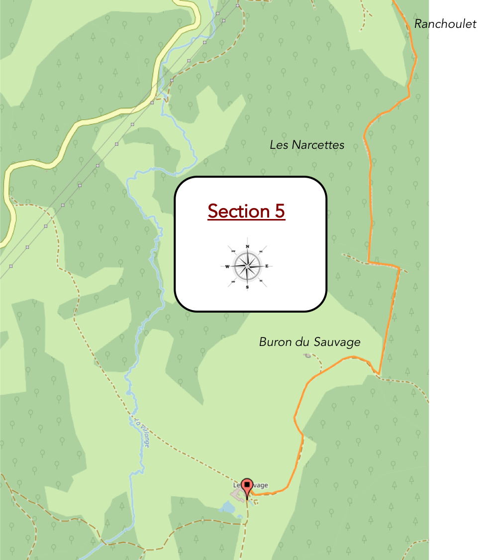
Section 5: High above, at Le Sauvage, a place worthy of Its name
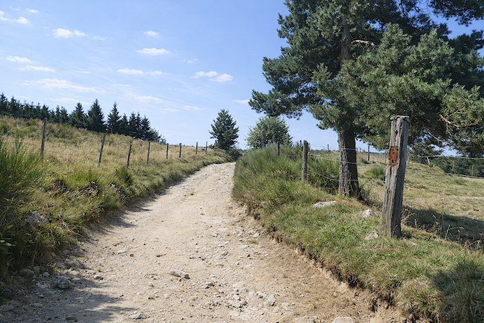
General overview of the route’s challenges: for a stage leading toward the mountains, the climb to Le Sauvage presents few real difficulties, apart from a few steeper ramps around Ranchoulet.
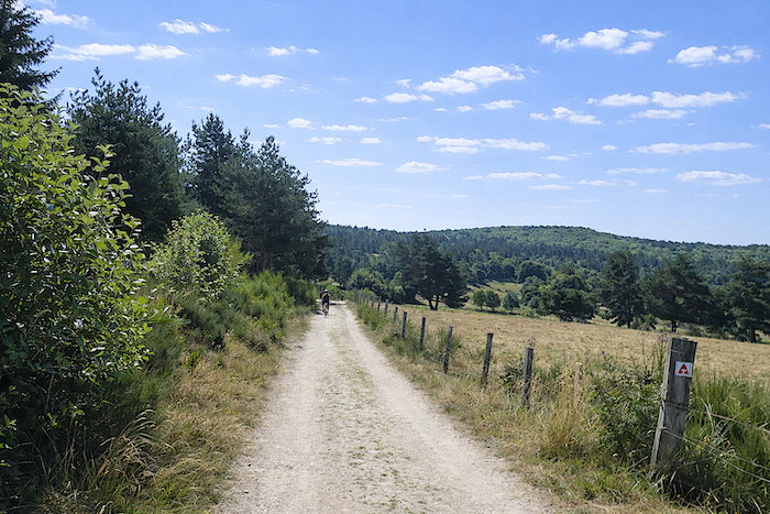
| Little by little, the tender green of the meadows fades away, as though absorbed by the darker shades of the fir forests closing the horizon and announcing another world. |
 |
 |
| At the place called Ranchoulet, the path truly enters the forest. It leaves the broad dirt track behind and becomes a trail, narrower and more secretive, winding along the ridge between beeches and conifers. Then it descends into the shadow of another wooded valley. There, it zigzags among pines, beeches and low vegetation. The trees, pressed tightly together like a living hedge, leave only a narrow passage. The hiker runs through an inhabited half-light along this winding ribbon gradually leading toward the plateau. |
 |
 |
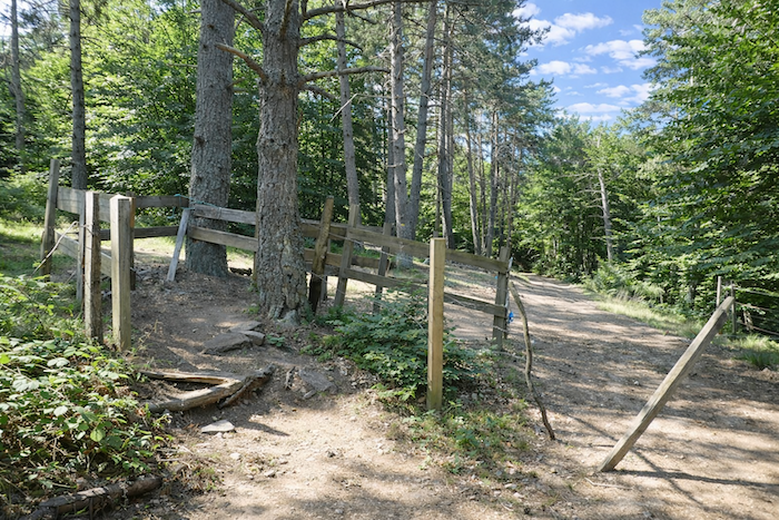
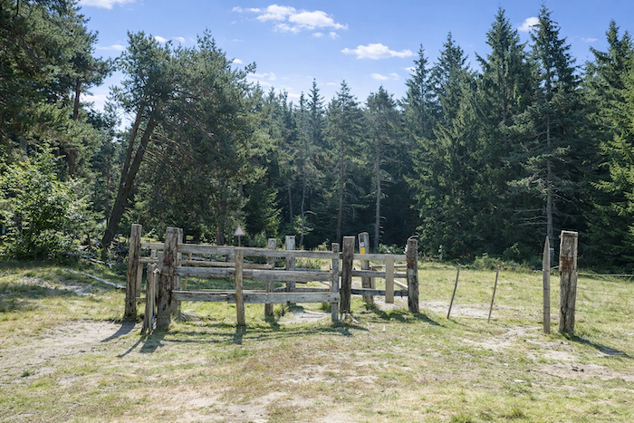
| At the edge of the woods appears a first gate erected to contain the ever-present livestock of these highlands, the first reminder that here man shares the mountain with the herds. |
 |
 |
| In the end, the slope remains quite reasonable for a route with a semi alpine character. The forest is mainly composed of beeches, hornbeams, spruces and pines whose tightly packed silhouettes create thick, almost protective edges. |
 |
 |
| The trail, sometimes stony yet never hostile, twists beneath the trees toward the Buron du Sauvage. It progresses with calm wisdom, sparing the walker’s effort, even if a few steeper stretches occasionally remind one that altitude must be gained step by step. |
 |
 |
| Higher up, the slope softens once more. Clearings then open like shafts of light within the dark mass of the woods, creating peaceful havens of silence and serenity among the clusters of pines. |
 |
 |
| A second gate soon blocks the path. Here more than anywhere else, one must take care to close it behind oneself. Livestock reign supreme upon these heights, and the beautiful Aubrac cows, with their tawny coats and black ringed eyes, seem almost to embody the very soul of this land. |
 |
 |
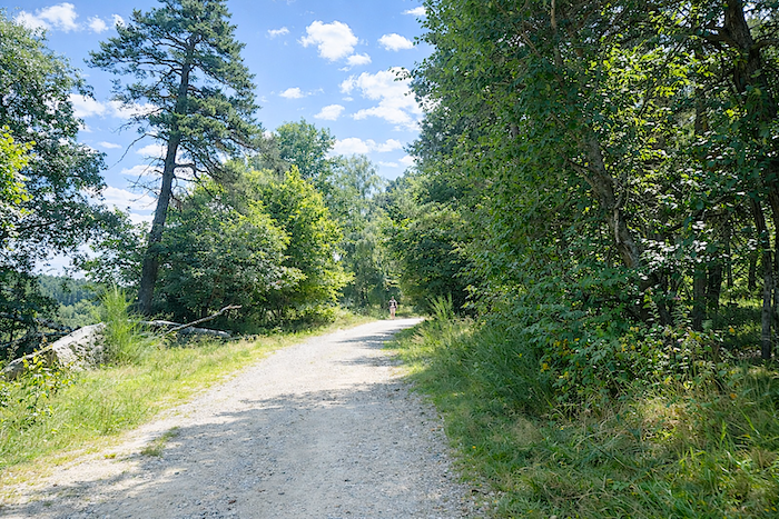
| Soon afterward, the trail widens slightly while becoming stonier. Bordered by pines twisted by the wind, it seems to carve its way through soil of uncertain shades, somewhere between deep brown and faded ochre. It continues climbing in bends through a magnificent forest, first mixed with deciduous and coniferous trees, then becoming denser and denser as the pines intertwine with the spruces. . |
 |
 |
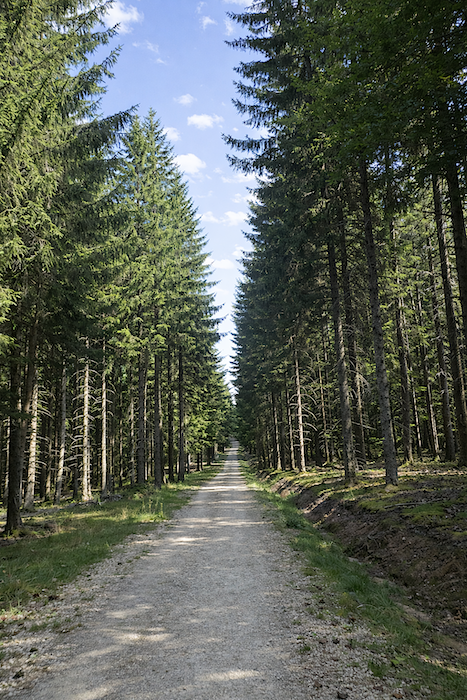
| You have now reached that altitude where spruces find their kingdom. Here they rise with striking vigor, crowded tightly together, straight as masts, throwing their crowns toward dizzying heights. In these places, the forest possesses an almost solemn beauty. One might think the trees themselves are engaged in a silent race toward the light. |
 |
 |
| Soon, the path leaves the shadow of the woods. It suddenly opens onto the high plateau like a window abruptly thrown open upon the summit of the mountain. There, in all its grandeur, the domain of Le Sauvage reveals itself, its majestic presence already visible scarcely one kilometer farther ahead. |
 |
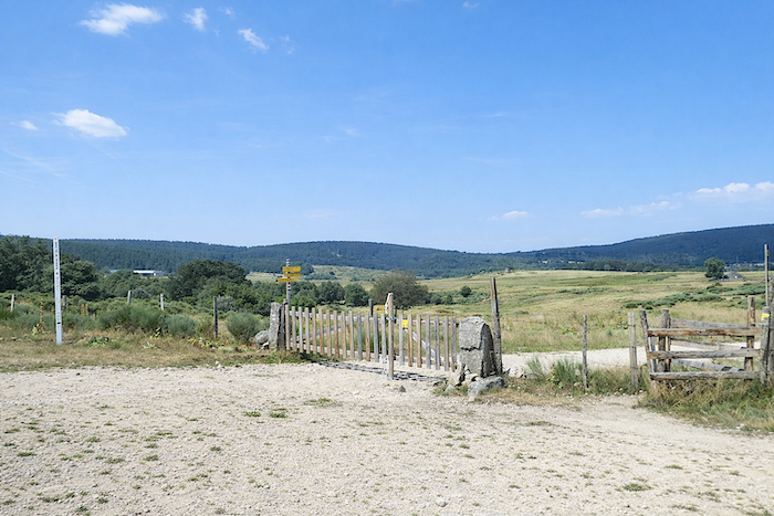 |
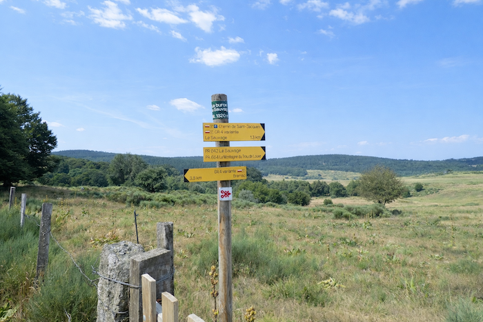
| You have now reached the place called Buron du Sauvage at an altitude of 1,320 metres, the highest point of the stage. There, beneath the vast light of the plateau, Le Sauvage still appears far away, merely a point resting upon the horizon, lost within an immense clearing of pastureland. |
 |
 |
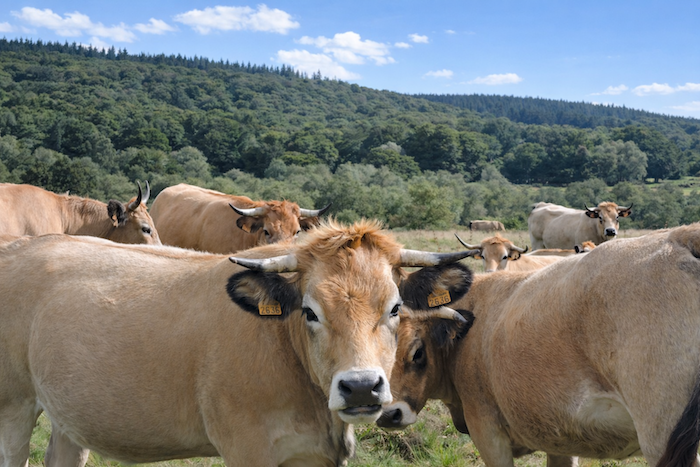
| Around you stretch endless grasslands, vast as a motionless sea, where the Aubrac cattle graze. Unafraid and long accustomed to the passage of pilgrims, they greet walkers with calm curiosity. How beautiful these cows are… With their warm colored coats, elegant horns and sovereign calm, they almost seem to play with those crossing their lands, some perhaps for the first time in their lives among a herd. |
 |
 |
| The broad dirt path then crosses this immense pasture and passes beside the “buron”. These “burons”, traditional stone shepherd huts typical of the region, now remain above all as magnificent landmarks scattered across the landscape, the final witnesses of an unchanging pastoral world. |
 |
 |
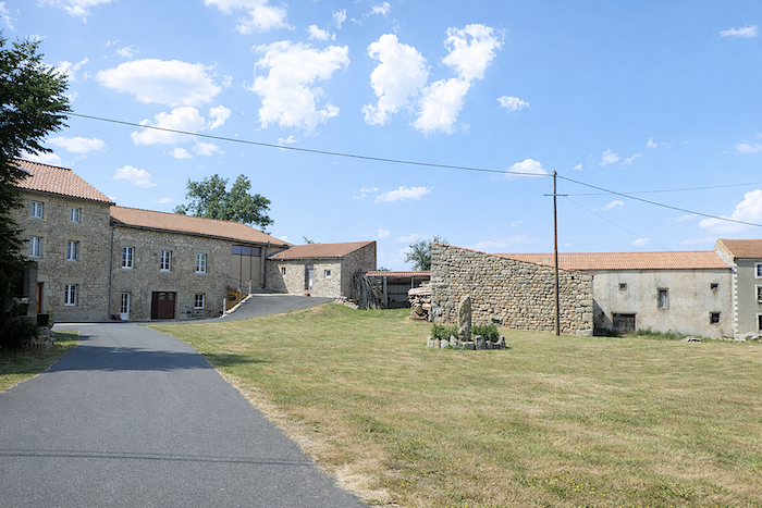
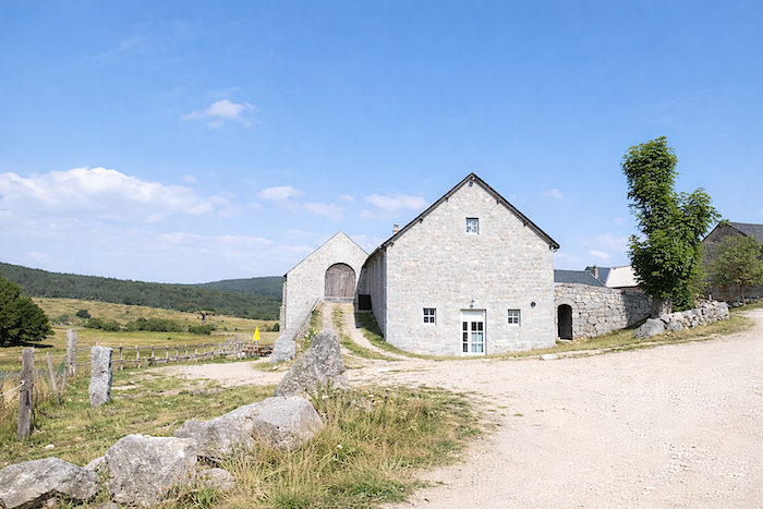
| The tiny point glimpsed on the horizon quickly grows larger. Little by little, a massive cluster of stone buildings takes shape. From afar, it could be mistaken for a simple farm. Up close, it resembles almost a fortress. Rarely has a place carried its name so well. Le Sauvage rises like the island of a castaway in the middle of nowhere, surrounded by the immensity of pastures and the silence of forests. It is indeed a fortress, but a peasant fortress, the only human presence for kilometers around. And yet one must not be deceived: apart from its name, there is nothing savage about this domain. Its soul is entirely warmth, comfort and hospitality. |
 |
 |
| A few hundred more meters along the dirt path and at last you reach Le Sauvage. |
 |
 |
| The domain of Le Sauvage lies within the granite massif of Margeride, between the Signal de Randon and Mont Mouchet. Here, granite is the sovereign stone, the material that has built for centuries the houses of Cantal, Lozère and Haute Loire. The farm extends across more than 800 hectares. Once used by the Templars as a hospital, it has passed through many hands over the centuries. The present buildings date from the eighteenth and nineteenth centuries. Long threatened with ruin, they regained life thanks to those who operate the estate today. Around the gîte stand farm buildings, ramps and a vast square courtyard, together forming an ensemble both austere and majestic. |
 |
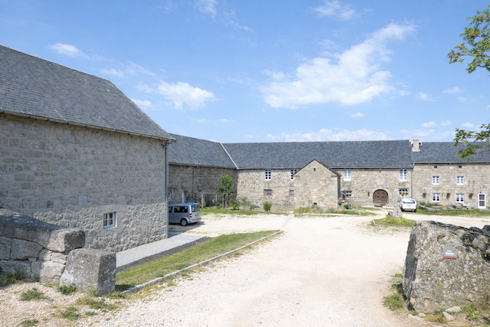 |
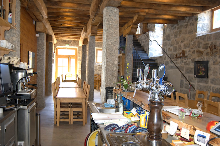
Here, you eat and drink the products of the farm in a magnificent common hall that may once have served as the reception room of the Templars. The estate has always welcomed pilgrims and passing travelers. Even today, it offers the walker one of those precious halts that are never forgotten. Yes, you truly should stop here, provided you has had the wisdom to book in advance. s.
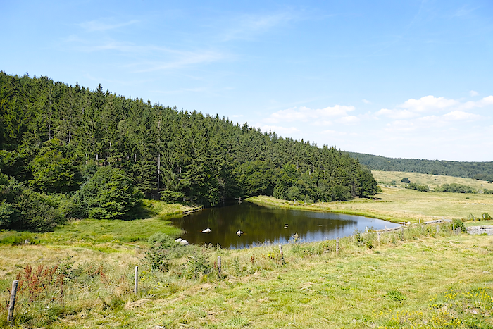
| Just below the reception area, ducks paddle upon a small lake of unexpected grace. Farther away, the dogs in the enclosure bark every morning as though saluting the departure of pilgrims into the mist. And you find yourself asking, while leaving this place of solitude and light, whether one day you might return to Le Sauvage? |
 |
 |
Accommodation on Via Podiensis
• Au Repos d’Antan, Sonia et Michel Vidal, La Clause; 06 66 47 67 18; Gîte, dinner, breakfast
• Refuge des Pèlerins de Margeride, La Clause; 06 81 20 66 08; Gîte, dinner, breakfast
• Refuge de la Maison de la Béate; La Clause; open, free, without comfort
• La Ferme aux Fromages, Le Falzet; 04 71 74 44 79; tents
• L’Auberge des 2 Pèlerins, Marie et David, Le Villeret d’Apchier; 06 30 66 88 45; Gîte and Guestroom, dinner, breakfast
• Studio Le Tilleul, Le Villeret d’Apchier; 06 66 12 92 25; Guestroom, dinner, breakfast
• Gîte du Pont, Chanaleilles (500 m off GR); 06 58 19 69 51; Gîte, dinner, breakfast
• Gîte Lou Granjo, Patrice Garcin, Chanaleilles (500 m off GR); 06 16 75 3377/06 70 62 20 28; Gîte, dinner, breakfast
• Chambre d’hôtes Au Bord du Ruisseau, Evelyne Lomonaco, Chanaleilles (500 m off GR); 06 51 22 64 29; Guestroom, dinner, breakfast
• Gîte des Noisetiers, Tanguy Lahondes, Chazeaux; 06 70 48 69 49; Gîte and Guestroom, dinner, breakfast
• Gîte de la Virlange, Elodie Lemmonier, Chazeaux; 06 32 67 63 54; Gîte and Guestroom, dinner, breakfast
• Chambre d’hôtes Le 1828, Jean-Michel Dussart, Chazeaux; 06 52 73 69 49; Guestroom, dinner, breakfast
• Gîte-auberge Le Sauvage, Le Sauvage; 04 71 74 40 30; Gîte, dinner, breakfast
Year after year, the Camino de Santiago changes and reinvents itself with the seasons and the footsteps of pilgrims. Some accommodations close their doors, while others, modest or unexpected, come into being. It would therefore be unrealistic to claim to provide a fixed and exhaustive list. This guide includes only accommodations located directly on the route or within one kilometer of it. The selection was updated in 2026 and should therefore not undergo any major changes in the coming years. For those wishing to go further, one publication stands out as the essential reference: Miam Miam Dodo, easily available online. The main strength of this guide lies in its yearly updates. It not only lists accommodations located directly on the route, but also addresses slightly off the route, a valuable resource when heavy pilgrim traffic makes overnight stops more uncertain. It also contains a wealth of practical information: welcoming bars, restaurants along the way, and providential bakeries, all of which punctuate the journey. Alongside these traditional resources, another presence has become unavoidable: Airbnb. The platform has established itself as a major reference in the tourism landscape, even in the most discreet or less developed regions. However, as everyone knows, exact addresses are not displayed directly, which requires a degree of anticipation. On the Camino, finding a bed at the last minute can sometimes depend on sheer luck. But luck, by its very nature, cannot be considered a strategy. Booking ahead is therefore strongly recommended. Finally, when making arrangements, be sure to inquire about dinner and breakfast options. These details, seemingly minor, can greatly soften the hardships of a stage.
If one takes stock of the accommodation capacity, there are around 110 beds available before reaching Chazeaux. Le Sauvage itself has only 41 places, and it is almost always fully booked. It is therefore essential to reserve well in advance at Le Sauvage. Otherwise, finding a place is largely a matter of luck, if not impossible. In the event of failure, you are left with two options: either stop earlier, or continue farther on. Yet beyond this point, accommodation options are not plentiful either. The number of walkers on the Via Podiensis generally fluctuates between 100 and 200 people; under such conditions, this stage can present serious difficulties without prior planning.
These routes, winding through often sparsely populated areas, offer very few shops. Restaurants are rare, as are grocery stores, which are often little more than small bread depots selling a few vegetables and dairy products. On this particular stage, there are in fact no real restaurants or grocery stores; instead, there are welcoming places offering local products or sandwiches in Le Falzet and Chazeaux. Water points can be found at Le Pinet, Le Falzet, Le Villeret d’Apcher, and Chazeaux. They are sometimes accompanied by sanitary facilities, often dry toilets, particularly at Le Falzet and Le Villeret d’Apcher. Finally, many companies offer luggage transport services or transfers back to the starting point. Among them, one stands out as an essential reference: La Malle Postale.
Feel free to add comments. This is often how you move up the Google hierarchy, and how more pilgrims will have access to the site.
|
 |
Next stage : Stage 4: From Le Sauvage to St Alban-sur-Limagnole |
|
 |
Back to menu |