In the majestic beauty of the forests of Margeride
DIDIER HEUMANN, MILENA DALLA PIAZZA, ANDREAS PAPASAVVAS

We divided the course into several sections to make it easier to see. For each section, the maps show the course, the slopes found on the course, and the state of the roads. The courses were drawn on the « Wikilocs » platform. Today, it is no longer necessary to walk around with detailed maps in your pocket or bag. If you have a mobile phone or tablet, you can easily follow routes live.
For this stage, here is the link:
https://fr.wikiloc.com/itineraires-randonnee/du-sauvage-a-aumont-aubrac-par-le-gr65-29749447
It is obviously not the case for all pilgrims to be comfortable with reading GPS and routes on a laptop, and there are still many places in France without an Internet connection. Therefore, you can find a book on Amazon that deals with this course. Click on the book title to open Amazon.
If you only want to consult lodging of the stage, go directly to the bottom of the page.
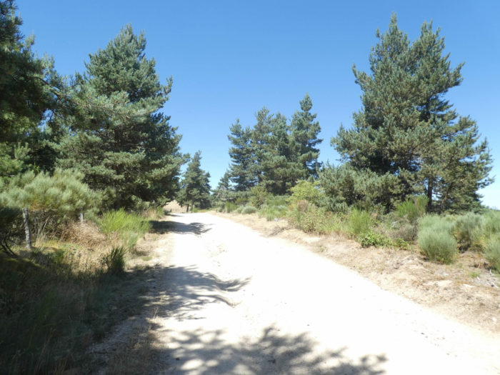
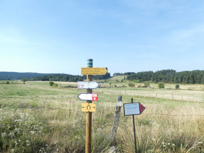
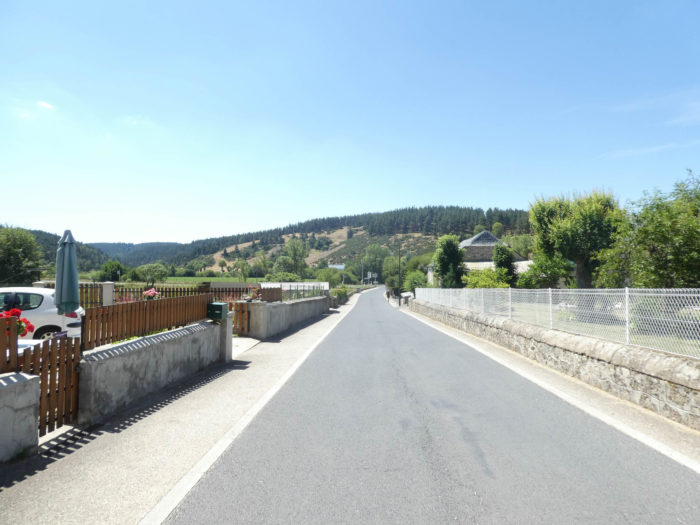
You’ll enter Lozère, more particularly Margeride, on the other side of the forest. You’ll run down, then back up for a slow transition to Aubrac plateau. In the country, granite is everywhere, in the architecture of the massive square farms, in the fountains and the crosses. The old granite houses with their slate roofs are scattered in remote hamlets. They challenge the most extreme winter conditions, tell the story of the inhabitants here, a country that once belonged to the county of Gevaudan. The region is among the least populated in Europe. Yet, it’s a place of great natural beauty. The track heads again southwest in a rural landscape dotted with wooded hills. It leaves Haute-Loire to Lozère. The limit is near St Roch Chapel. It then follows Limagnole Valley, where a small river runs, passing near St Alban-sur-Limagnole, before emptying into the Truyère River. Beyond the bridge over Truyère, at Les Estrets village, you’ll reach Aubrac area, close to A75 (E11) the highway that connects Clermont-Ferrand to the Mediterranean.
Lozère is the least populated department in France, with less than 80’000 inhabitants, the poorest also, if not very poor. Rare industries have developed there, not touching landscapes of rare beauty, where it is good to fish for trouts. To the north, on the “causses” (arid limestones plateaus) and rounded hills of Aubrac and Margeride, to the south on the slopes of the Cevennes, at sunset, when the cows lie by the barbed wire, the soul wanders with Virgil. Lozère, as it was specified in the preceding stage, is in fact the old Gevaudan, and, going back in time even further, the country of the Gabales, fierce enemies of the Romans, who had their capital in Gabalum, now a small quiet village in the centre of the department under the name of Javols.
The climate is as harsh as the people who live here. As in all areas where life is difficult, the sense of hospitality and atavistic attachment to the native soil are the rules for the inhabitants, who are above all peasants proud of their land. For the traveller and for the pilgrim, Lozère is a kind of treasure hunt to be put nose to nose with the Beast of Gevaudan who passed from life to death one day of June of the year 1767. But how many of them do not expect to see the beast arise again, when they cross the dirt roads, in the undergrowth, at twilight?
| Lozère department is named according the main mountain located on the south, Mount Lozère. It is constituted from the territories of the former Pays de Gevaudan, but also from regions belonging to the old dioceses of Uzès and Alès, in Languedoc. GR path does not travel in the south of the department. Lozère presents a relief made up of hills and mountains, including the Cévennes in the south, and the high hills of Margeride and Aubrac in the north. |
 |
 |
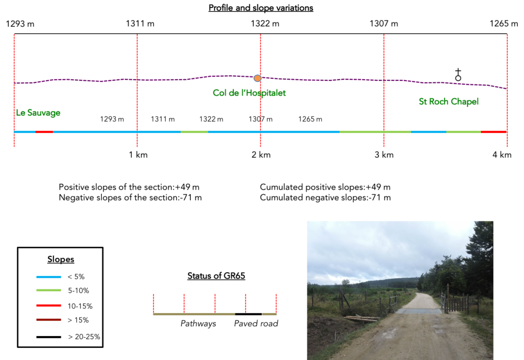
Difficulty of the course : The journey is not free from difficulty, although slope variations (+423 meters/-683 meters) are not so elevated for such a long stage. Over kilometres, the route slopes gently downhill on high plateaus covered by green meadows and moors of broom and heather, spotted with small forests. Later on, on the track, two bumps nonetheless deserve attention. The first is just beyond St Alban-sur-Limagnole, when the track makes a detour to Grazières-Mages. The second one follows shortly after when the route gets back to the high plateau near Chabannes. After sloping down rather steadily to Les Estrets village, the route slopes up again to reach Aumont-Aubrac village, at the edge of Aubrac plateau.

Today, it is a stage that pilgrims enjoy. Very little paved roads, which is quite rare, it must be said:
- Paved roads: 7.5 km
- Dirt roads: 21.3 km
Sometimes, for reasons of logistics or housing possibilities, these stages mix routes operated on different days, having passed several times on Via Podiensis. From then on, the skies, the rain, or the seasons can vary. But, generally this is not the case, and in fact this does not change the description of the course.
It is very difficult to specify with certainty the incline of the slopes, whatever the system you use.
For « real slopes », reread the mileage manual on the home page.

Section 1: On your way to Hospitalet Pass.
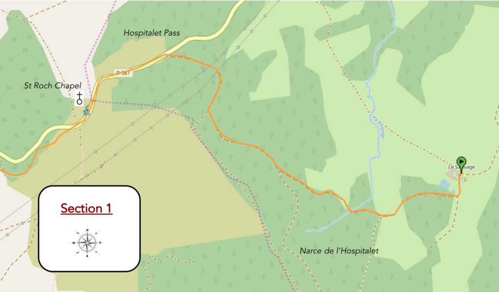
General overview of the difficulties of the route: course without any difficulty.
|
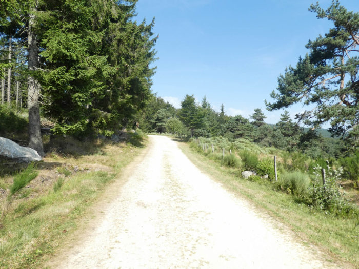
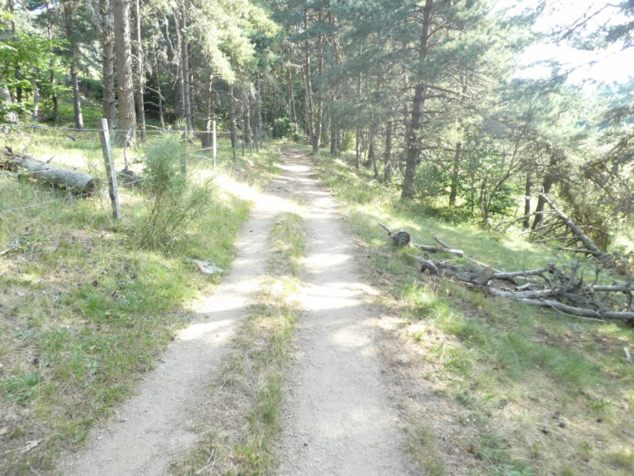
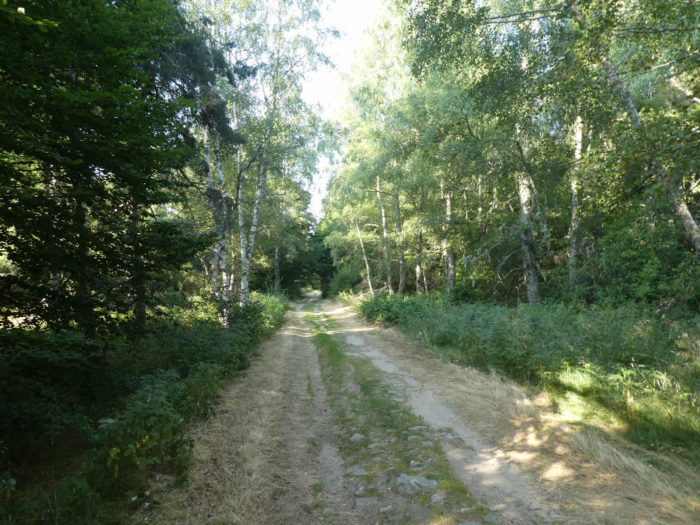
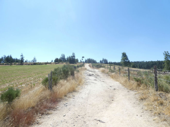
It is often in the early morning that the pilgrim leaves the majestic Sauvage and its small lake to flatten in the forest. It is a beautiful and wide dirt road that runs to join the D589 departmental road to the Hospitalet Pass, 1304 meters above sea level.
|
 |
 |
| The area is covered with beautiful spruces, sown with beautiful pasture clearings. The intense charm of this calm and simple site and the freshness of the track where the mosses and coniferous needles often strew the ground must be emphasized.
Christmas tree or spruce? Just saying “Christmas spruce” breaks the charm, right? And yet! Even if today, the trend is the return of the fir, the Nordmann fir, an exotic species planted for this purpose. But what the general public calls fir is actually spruce, by far the most abundant in our forests. It is easy to distinguish the two species. The spruce has drooping cones. The fir cones are raised to the sky. You will never see fir apples lying on the ground. The cones of firs are content to lose their scales on the branches. Only the spruce apples fall to the ground. In fir, the horizontal branches sometimes straighten up. On the other hand, the branches of the spruce hang down, taking the shape of a spaniel tail. All this to tell you that the forest here is essentially made of spruce. |
 |
 |
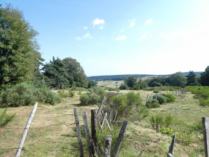
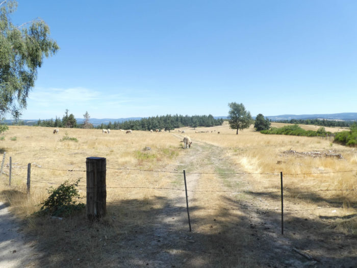
| Further on, the pathway runs for a moment out of the forest, amid the pastures of the Sauvage domain. A fence stands on the way to contain livestock. In these pastures, cows live in freedom. They are oxen or young cows that are not milked and require no real supervision. |
 |
 |
| When the forest is less dense spruce, generous, let pines, beeches, and some maples grow among the brooms. |
 |
 |
| Further ahead, the dirt road runs back to the forest and flattens to a place known as Narces de l’Hospitalet. |
 |
 |
| It still remains a little in the forest before finding a new barrier. |
 |
 |
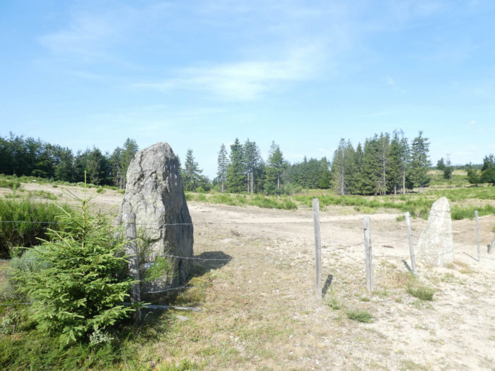
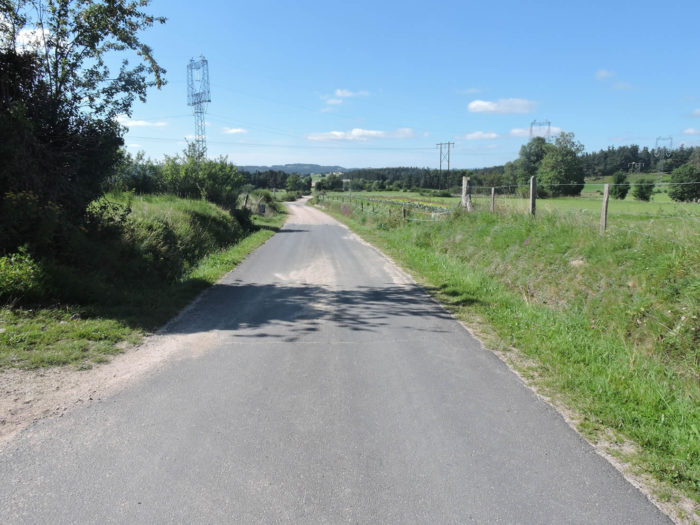
| Soon, the route comes out of the wood and passes under the high-voltage line, which you saw the day before climbing to the mountain. Here large blocks of granite play the menhirs. |
 |
 |
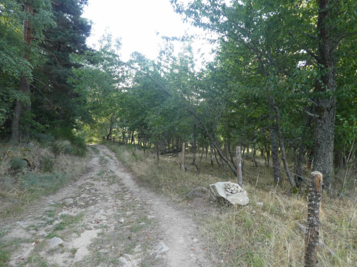
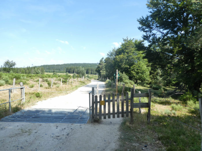
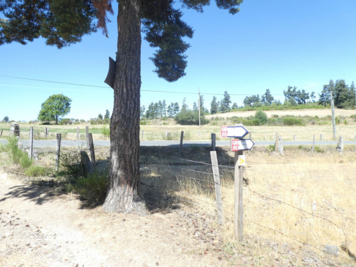
| Still some spruces for the pleasure of the eyes, and the dirt road joins the D589 departmental road at Hospitalet Pass, nothing but a small bump in the middle of other bumps, as is everywhere the Santiago track. The pass commands access to the valley of Limagnole. At L’Hospitalet, there was a 13th century oratory and a hospital for pilgrims, which fell into ruins during the 16th century. According to tradition, the hospital was built by the people of Chanaleilles in 1198. It was originally dedicated to St Jacques to welcome the pilgrims of the road.
Here the GR65 will follow a few hundred meters the paved road. |
 |
 |
A small oratory is nestled near the road. There flows a small source of remarkable freshness, which is believed to be beneficial for many patients. The truth always flows from spring water.

| A few hundred meters further, on the D589 road, just before St Roch, it is the limit between the departments of Haute-Loire and Lozère. Lozère has often been relegated to the last rank of the French departments. For hundreds of years it has been a land cursed by Heaven and avoided by civilized men. Go through here. You will see that it is not so. It’s just wonderful. |
 |
 |
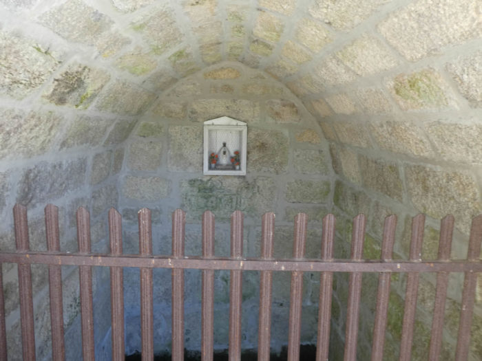
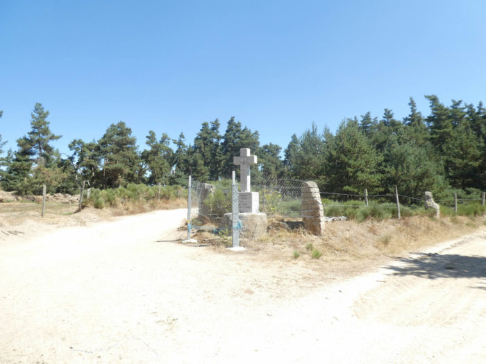
| At the edge of the two departments stands the small St Roch chapel. Today, the chapel, also known as the St Roch Chapel of L’Hospitalet, was dedicated to St Roch, who passed through here after the wars of religion (1562-1598). The chapel, in turn, fell into ruins in 1610. The stones of the oratory were used to build a new church in Lajo, close to here. A new chapel was built in the late 19th century, ravaged by a cyclone in 1897.
The chapel today dates from 1901. A grid allows to see the statue of St Roch and his dog on the altar. The chapel is unfortunately closed. The saint with a look of sweetness seems the melancholy guide to the future of the humans who transit here. |
 |
 |
| Next to the chapel, the door of a gîte is still open for lost pilgrims. The statistics do not reveal the number of poor pilgrims who sleep here the hard way.
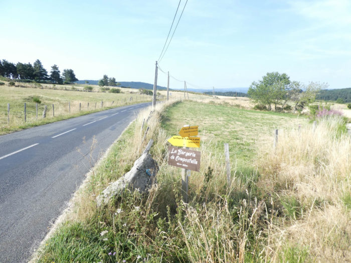
From here a road leaves for Lajo. Accommodation is available in Lajo, about 3 kilometres off GR. Many pilgrims who have not found a place at Le Sauvage go there, as well to La Roche further down the road. |
 |
 |
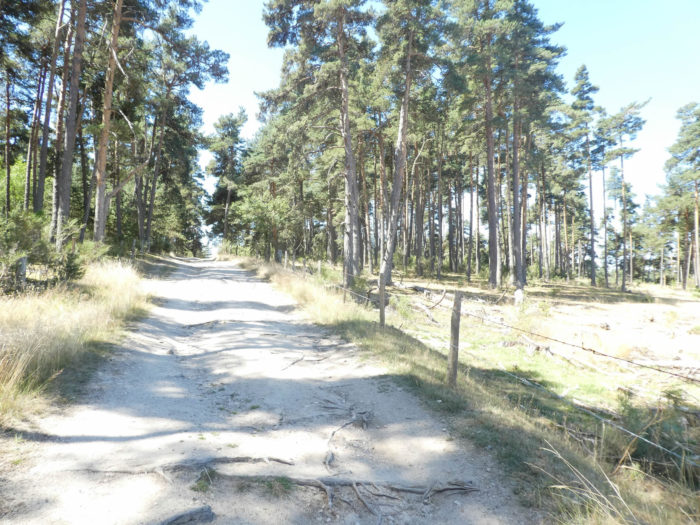
| Beyond the chapel, the GR65 abandons the D589 road to slightly slopes down on a small dirt track in the undergrowth of pines. |
 |
 |
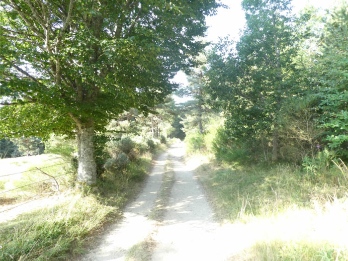
| The trip to St Alban-sur-Limagnole is easy, the track descending gently almost all the time. In a few minutes, the pathway sinks first into the often-shady undergrowth, where a few frail beeches are lost among the pines. |
 |
 |
Section 2: Some ups and downs in the forest and the Margeride countryside.
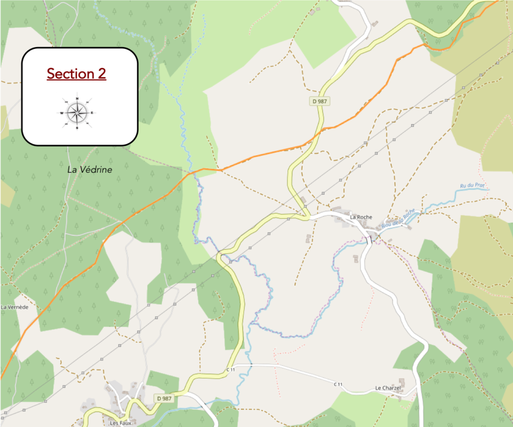
General overview of the difficulties of the route: some slopes a little more pronounced, but so short.

| Further down, the pathway comes out of the wood and runs through the meadow, in all its immensity and its wild nudity. The edges are pegged here and there with bunches of broom, arranged as if for the parade, forming a carpet of dark green. |
 |
 |
| People have always praised the beauty of the brooms that burn the meadows with their golden spots in the spring. But who will say the charm of these magnificent green broomsticks, which summer transformed into their simplest expression, scattered like a morning of the world that one would have forgotten there by chance? |
 |
 |
| Here colonization will probably never be born. Everywhere, the eye strolls, without being able to fix itself anywhere, on an immense hillside, barely hilly, with a rare grass, with here and there a pine, an ash tree or a maple. |
 |
 |
| Further down, the pathway joins the departmental road, near La Roche hamlet. |
 |
 |
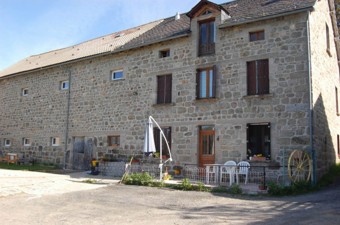
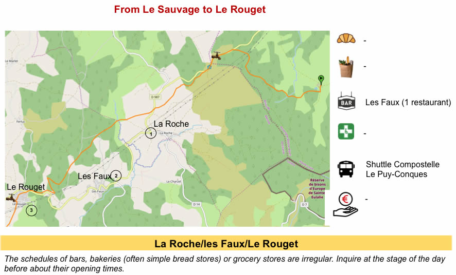
| In La Roche, you’ll find lodging, for those who have not found a place in Le Sauvage and who find that St Alban is still too far. La Roche is still one of those hamlets of beautiful granite farms, sometimes inlaid with lichen, which suggest that behind the thick walls and slate roofs live peasants filled with reserve. You will rarely see them coming out of their homes, unless you stop for a few moments to look at their hundred-year-old walls. |
 |
 |
| The GR65 does not head to La Roche. It crosses the departmental road, slopes down in the meadows to a place called Bories, where also the GR4 runs. |
 |
 |
| The pathway again approaches the forest and smoothly descends gently in the vale to cross Limagnole River, which is here just a large brook. Water is present throughout the country, often with the presence of stone water troughs. The water that comes out is deliciously fresh. |
 |
 |
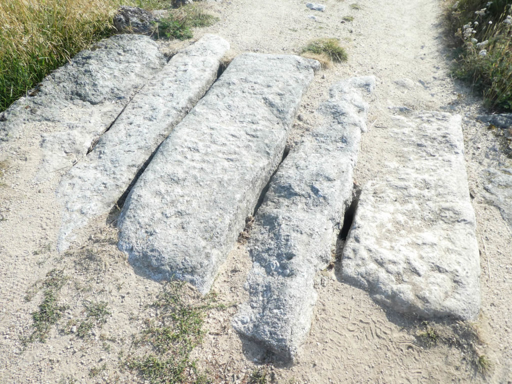
Nobody can tell you here if the big stones thrown here by way of bridge were deposited by the Romans or the Gabales. In rainy weather, the road is sometimes dug with big ruts. Tractors use the track as much as pilgrims. You’ll meet oxen and horses in meadows covered with flowers in spring, in a country where life seems to flow gently.
| The pathway then leaves the meadows to sink a little into the undergrowth of Vedrine. It steeply climbs a little to reach then a kind of crossroads, where you can reach lodging in Les Faux, near D589 road. From there, you can find your way back to Le Rouget, a little further down the road. |
 |
 |
| The route then plays the ups and downs smoothly, alternating between the dirt ground and the stony lane. It ripples for miles in the open countryside or undergrowth most often. There is no soul alive here. Only a few quiet cows sleep or graze near the trees. |
 |
 |
| Santiago, at 1474 kilometers, you progress, right? The forest is not dense here, among endless pines, birches, hornbeam shoots and beeches. |
 |
 |
Section 3: Downhill to St Alban, between undergrowth and countryside.

General overview of the difficulties of the route: downhill almost constant, sometimes with sections a little more sloping, with pebbles on the way.

Historians claim that in Roman times the beech (fagus) was the king of Margeride and Gevaudan. Open spaces were a small part of the game, and intense deforestation was needed to generalize the nascent pastoralism. The rye was then seen around the pastures where the sheep were bleating. Deforestation has intensified over the centuries. Pines and chestnuts, which need more space to live took over the beeches. The cows gradually replaced the sheep. Ploughed land and mowing fields gained ground. But there! Today, the mountain farmer has only his eyes to weep. Then the heath with broom and the pines become in turn kings of Margeride, gained their war against the work of old farmers. But who can say that the beech, which has never completely disappeared, will not find a second wind in future?
In any event, the landscape remains of a singular beauty, incontestable. How not to remain wide-eyed and open-mouthed in front of so much simple beauty, when the trees make like hair to the hills?
| Further afield, the wide pathway flattens on the dirt. The pebbles are still discreet. |
 |
 |
| Further afield, gradually, the scenario changes to a deeper forest and the slope will increase, between 10% and 15%. |
 |
 |
| In the wood, birches and beeches are also progressively taking precedence over pines and spruces. |
 |
 |
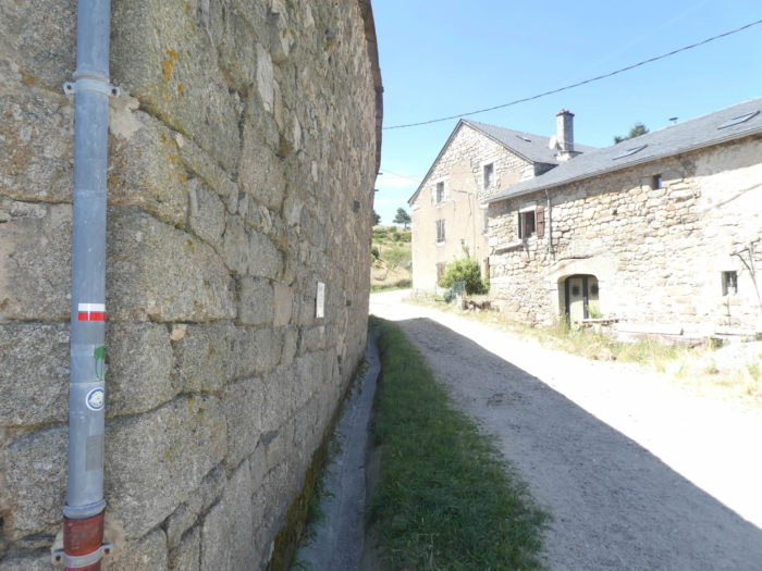
| Sometimes a beautiful stone-wall encrusted with lichen or cairns line the pathway. The stones are also more present when the track is taken down more frankly to Le Rouget village. |
 |
 |
| Further down, the pathway narrows and runs just above the departmental road in the middle of the weeds. |
 |
 |
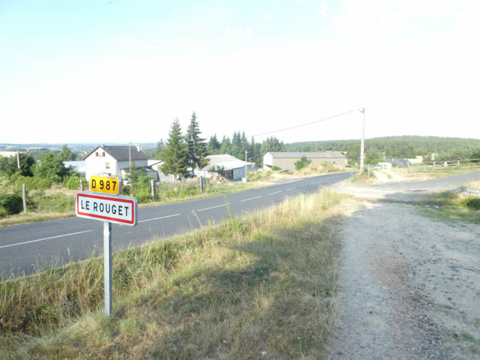
| A few more bends in the wood and you’ll see the roofs covered with slates of Le Rouget village underneath. |
 |
 |
| On the clay, the pathway reaches Le Rouget. |
 |
 |
| Le Rouget takes its name from the arkose, a red stone found at the edge of the granite and gneiss massifs, a kind of sandstone resulting from the alteration with time and the elements of these original stones. The arkose can be tinged with many shades of the palette of the rainbow, including rosé, which gave the name of the village here. The arkose has no equal to adorn the buildings, providing an elegant contrast to the black basalts. Arkose quarries were all over the area. They have become rare or closed. Who moreover would still want to build his house with carved stones? |
 |
 |
| The GR65 gently slopes down on the paved road, crossing the village. Formerly, the gîte of the Cross of Plô was in a big farm at the exit of the village. For our happiness some resist the trivialization of the present constructions. Here,the owner of the Farm of the Cross of the Plô, has retouched a stone house of the most beautiful effect. |
 |
 |
| At the exit of Rouget, the walk is easy. A small asphalt road comes out of the village. It is at the end of the road, now a dirt road, near the magnificent cross that stands the gigantic farm of the Cross of Plô. |
 |
 |
| The wide dirt road will then hesitate between pine groves and the open countryside, even sloping up a bit steeply for a moment. |
 |
 |
Section 4: A plain, then a bump, only for pleasure.

General overview of the difficulties of the route: leg-breaking course near Grazières-Mages.

| Still a few light ups and downs in the quiet countryside… |
 |
 |
| … before diving on the D589 road in the middle of recent houses of St Alban-sur-Limagnole below. |
 |
 |
| The entrance to the small city is not the most pleasant that you can imagine. The GR65 likes to make a great detour in the suburbs. The organizers of the track do not like to see the pilgrims walking on the departmental roads, even if the traffic is not frantic. |
 |
 |
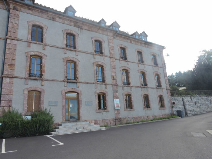
| So, start on the paved road, under the ash trees and spruces for the newer pavilions, which cut with the granite of the city. There is reason for that. A gigantic psychiatric hospital has developed here, occupying the entire top of the city. Should not the staff be housed?
If you are in a hurry, do not follow the signs of the GR65. Just follow the D589 road. You will arrive at the same place. |
 |
 |
 |
 |
| Hilarion Tissot, brother of St. Jean-de-Dieu congregation, founded in 1821 an asylum for men suffering in their sanity, using the stones of a castle that existed here formerly. The asylum quickly gained notoriety to accommodate patients from the region and the entire department. In 1869, the administrative building was inaugurated. New pavilions were erected between 1895 and 1900.
François Toquelle, a French doctor, born and educated in Spain, was forced to leave Spain after the defeat of the Republicans during the Spanish Civil War. Toquelle was the head of the psychiatric medicine of the republican army. He settled in St Alban in 1940. The psychiatric hospital quickly became an avant-garde centre in the treatment of severe patients, based on a psychodynamic perspective. Toquelle was the pioneer of so-called institutional psychoanalysis, which was trying to overthrow the dogma of the time of treating the mentally insane as prisoners. In his approach, the institution should also be part of the treatment, not just a place to house patients. Toquelle created communities of patients, encouraged resocialization, thus rejecting their isolation. The hospital counted up to 600 patients in 1970. At that time, you could cross seriously ill patients in the streets of the city. Occupational therapy, art brut, even poetry were the rule. The very famous Paul Eluard, Tristan or Tsara attended the institution as refugees during the Second World War. Today the number of patients has melted, but you may still encounter sick people walking freely in the village. Psychotherapy has also evolved. |
 |
 |
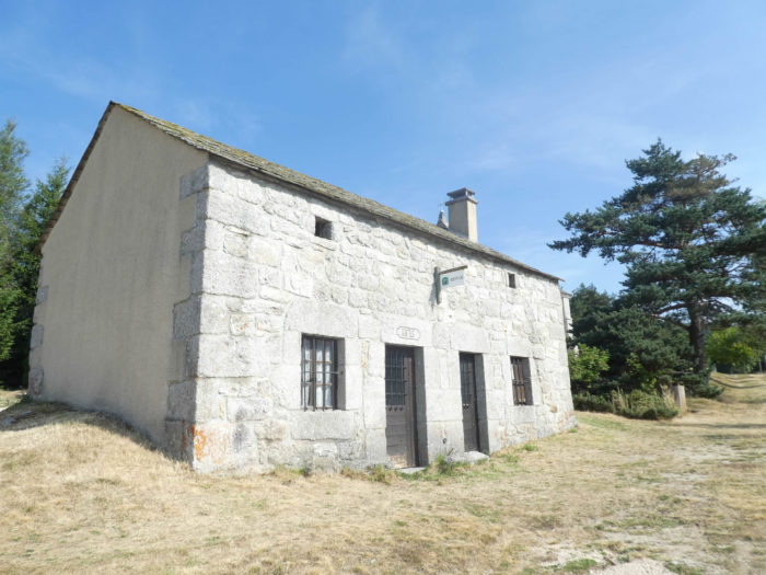
| The hospital is still in operation, albeit with more modest dimensions than before. The buildings of the past century, some of which are being restored, deserve attention. Here is the administrative building made of Rouget stones and its slate roof. Nearby are parallel pavilions that house the patients. |
 |
 |
| The GR65 leaves the hospital, running in front of the castle. There was here a castle dependent on the barony of the Marquis d’Apchier, in the 12th century. The castle was modified over the centuries, until the 16th century, then gradually transformed into a psychiatric asylum. Here too, the Rouget stone dominates. |
 |
 |
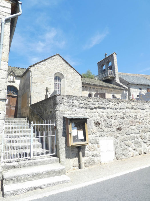
| Through a steep street and stairs, the GR65 arrives on the main street at the church and shops. Nothing is known about the history of the church until the 14th century. Since that period, it had been dependent on a monastic hospital for pilgrims. The church was enlarged at the beginning of the 19th century. Its wall tower, in comb, with its openings for the bells, is characteristic of the region. |
 |
 |
| The GR65 then slopes down to the bottom of the village. |
 |
 |
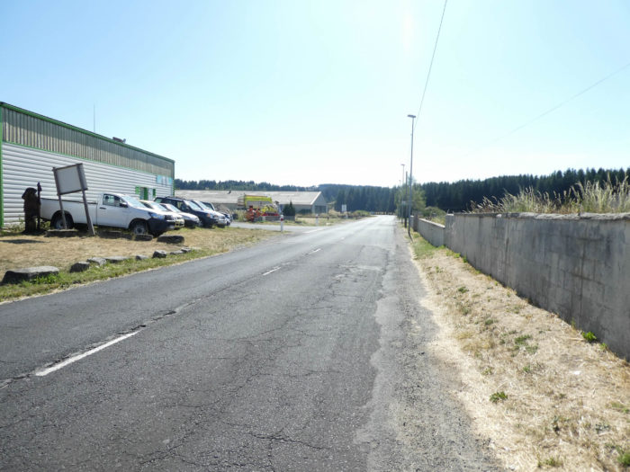
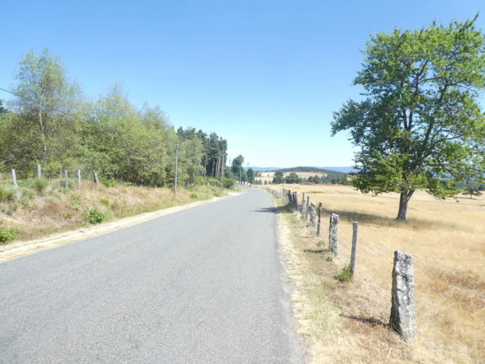
| It leaves St Alban sur-Limagnole on the paved road of the D987 departmental road. As it is often used, the GR65 leaves the towns on the asphalt road. |
 |
 |
| The road flattens to a small park where spruce trees grow. |
 |
 |
| Here is another joke for you. The track will slope uphill to descend after and join the same road further.
Quickly, it forks on a small paved road that slightly climbs between undergrowth and countryside. Halfway up the hill, the paved road becomes dirty road running up steeply to the top of the ridge. Behind curtains of greenery, the eye is on the broad plateau of St Alban. |
 |
 |
Up there on the hill …
Wait for the video to load.
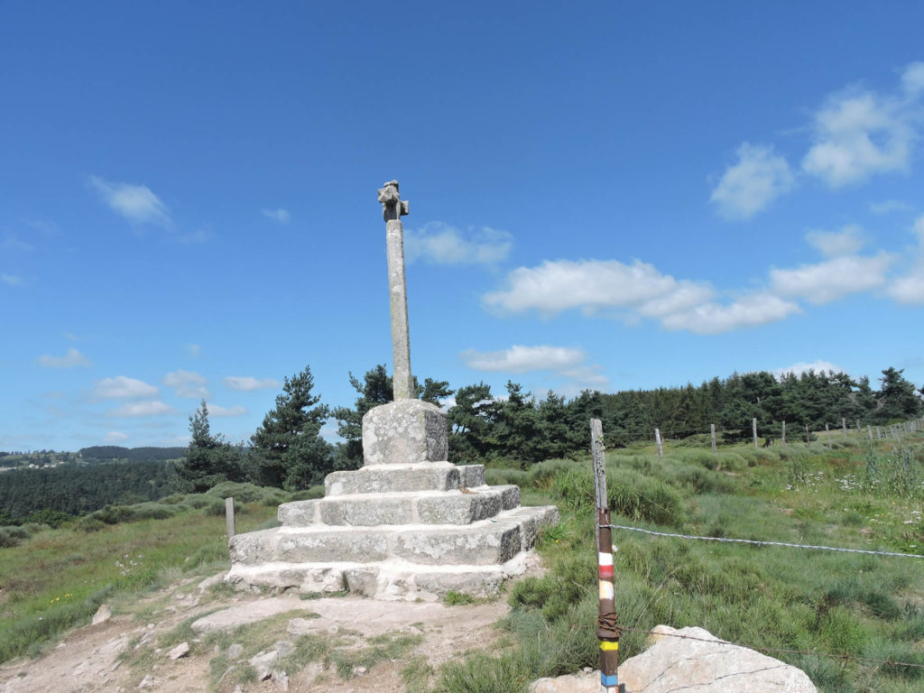
At the top of the ridge, the panorama over the valley is quite spectacular. Thanks to the organizers for this point. They will tell you that detours are there to avoid the departmental roads. Certainly, but here the detour requires serious efforts. It is often that in these places that are erected the most beautiful crosses. The pilgrim thus gains his paradise on climbing, meditates a moment at the foot of the cross, then expiates his faults during the descent.
| Beyond the cross, the dirt road slopes steeply downward to Grazières-Mages. Opposite is the forest where you must climb thereafter. Because, as it is often of rule, after the descent, it is inevitably climbing. |
 |
 |
| At the exit of Grazières-Mages hamlet, the route crosses the Limagnole River, hardly bigger than a large brook, and then reaches the D589 road again. |
 |
 |
Section 5: In the last jumps of Margeride.

General overview of the difficulties of the route: ua somewhat more difficult section of the course, with climbing in the forest to Chabanes, then course without any problem.

| Immediately, on the other side of the departmental road, here is a lane that is worth it. A narrow forest pathway severely runs up, carved out of granite, topped with deep ruts and winding between pine roots. The ruts are so deep that it is easy to imagine what should be the passage in case of heavy rains. In extreme cases, most of the steep tracks of Santiago turn into real streams. You have to find the right stones to save your shoes and socks! |
 |
 |
| At the moment you’ll start climbing, you’ll enter the shade that throws the trees under which scrub reigns. After a nice bump at more than 30% of slope, the lane becomes a little softer. But it does not last long as well. |
 |
 |
| Further up, the slope is again very tough, at nearly 15%. It is sometimes bare rock, sometimes real slides of hard ground, among pines, oaks and beeches. |
 |
 |
Soon after, groves spread sweet smells. The forest is magical here, opening the door to all dreams. The light plays with the vault of the cradle of trees. Sometimes, in the silence, there is the feeling of elves appearing behind the pines, in the chaos of the roots of tortured pines that invade the track.

| Again, a serious effort in the roots, then on the slipping pebbles, and you can soon catch your breath back. |
 |
 |
| At the hilltop, on a wide plateau, the pathway then opens on the clearings, amid the broom and pine trees that flood the landscape. |
 |
 |
| On the plateau the cereals grow, among hardwoods, including ash and beech, along the way. |
 |
 |
| To tell you that fresh water flows in the place of picnic at the entrance of Chabannes-planes will not seem superfluous. |
 |
 |
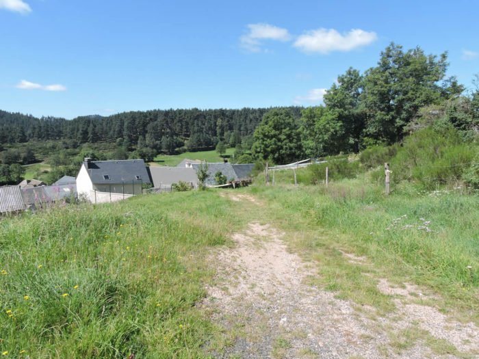
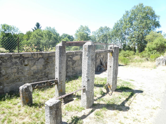
| The hamlet is an island of tranquility where the stone houses seem to be the landscape of always. Granite is everywhere in the houses, some of which have died forever, in the late device to shoe oxen, in the old fountain where water has dried up for eternity. And yet, this world that seems dead still breathes real life, with cattle brightening up the meadows. |
 |
 |
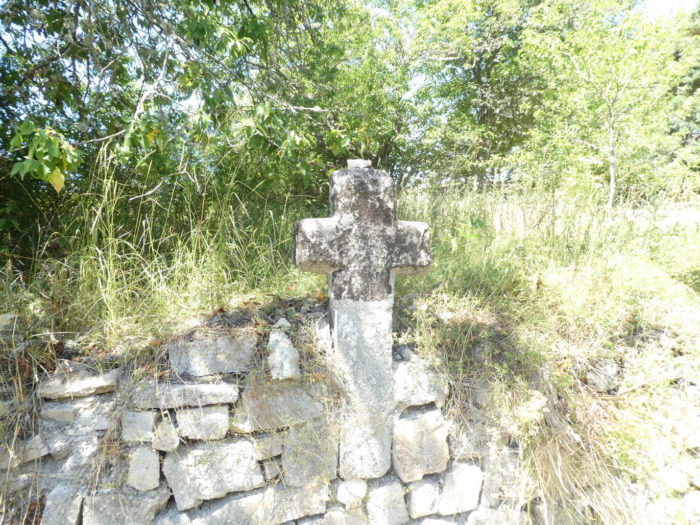
And always, these beautiful crosses of stone, where small pebbles deposited by the pilgrims pile up, which mark out the way.

| At the end of the hamlet, the GR65 flattens on a paved road in the meadows. |
 |
 |
| Further up, at the level of a new granite cross, it leaves the paved road to the sweetness of the dirt road. |
 |
 |
| The pathway then flattens on the high plateau, in the pines, the beeches and the ash trees. Here and there, the woods are interrupted by cultivated enclosures. But it is easy to understand, when the glance plunges further, that the more distant hills that crown the whole are mostly uncultivated, covered with thickets and undergrowth. |
 |
 |
| A little further, the GR65 runs on the plateau through the pines, straight and tight as matches. On broad dirt roads, the pines make a bulwark in these places of solitude. It is a continuous mass of trees, which one can imagine dark, rarely hostile. Sometimes, when the pathway climbs a small hillock, a greenish summit peppered with clearings looms in the mottled whiteness of the forest. |
 |
 |
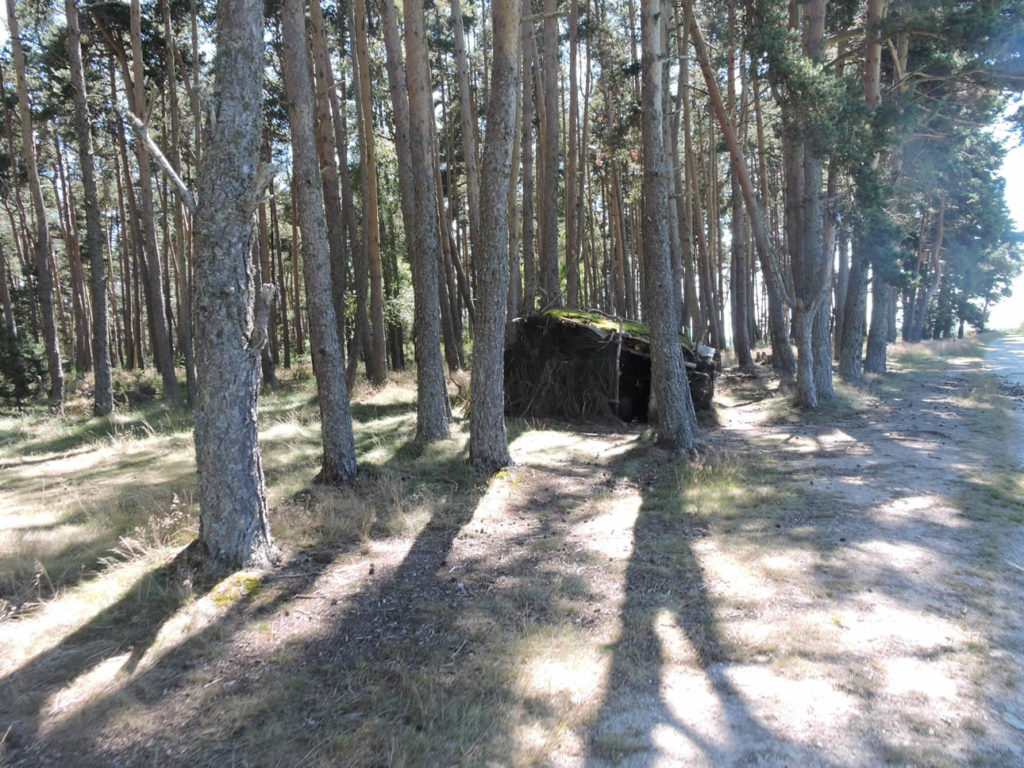
In the forest of Chabannes, a pilgrim has probably built this to spend the night! Alas, no, these huts are just made for wood pigeon hunting.
| Then the dirt road leaves the forest, but the pines and ash trees are like big umbrellas that breathe serenity, calm and peace. Nature here is solar, so bright. |
 |
 |
Section 6: From Margeride to Aubrac.

General overview of the difficulties of the route: a difficult course here, with first the painful descent to Les Estrets, in a bumpy lane, and then climbing to Bigose. Sometimes slopes are greater than 15%.

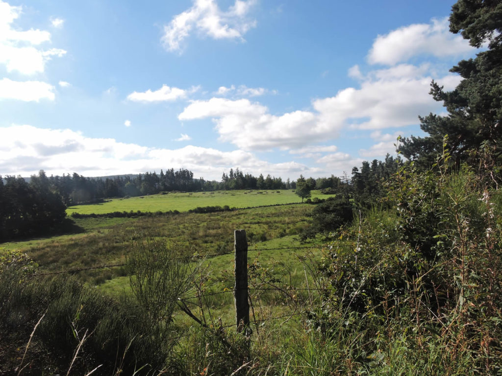
| The pathway still dawdles beneath the pines and ashes in the midst of the beautiful Aubrac cows, that pretend to ignore the passing pilgrim. |
 |
 |

| At the end of the plateau, the forest is back and the GR65 toughly slopes back on a broad, muddy pathway in the middle of the pines, where granite sometimes outcrops. Long live painless knees and ankles! |
 |
 |
Almost a nap before a terrible descent …
Wait for the video to load.
| At the exit of the wood, you’ll see Les Estrets at the bottom of the valley. It is not difficult to imagine the difficulty that must be the descent into the ruts in rainy weather, with more than 30% slope. |
 |
 |
| The Estrets, with its beautiful houses of gray granite and its roofs covered with glossy lauzes (stone slates), is a village which was built thanks to a ford on the Truyère River. It is difficult to approach the church, as it is embedded in the houses of the village. |
 |
 |
| The GR65 leaves Les Estrets on the tar, joins the D2 road, crosses it to head to Pont des Estrets, where the Truyère River flows. |
 |
 |
| Here once stood a commandery of the order of St John of Jerusalem, which collected a toll to cross the river. It is in the hamlet of La Truyère, at a rifle range of the Estrets that the river flows. You cannot say that here water flows freely. Yet sometimes it buzzes. Small stream born in Margeride, the river will however grow, collecting the water of most streams and small rivers of the region, before throwing itself a little lower in the Lot, his lord and master, on the side of Entraygues-sur-Truyère. |
 |
 |
| At the corner of some stone houses, the GR65, which likes to take some altitude, will toughly climb on a bad lane to Bigose hamlet. |
 |
 |
| The pathway looks like a “draille”, these cattle tracks of Aubrac area, muddy and stony to perfection, difficult to the feet that slip. the route then enters Aubrac, following the ancient Roman road, the Via Agrippa which led from Lyon to Toulouse. |
 |
 |
| Further up, the slope diminishes, still in the midst of brooms and pines. |
 |
 |
| The dirt road soon reaches Bigose, a handful of stone houses, where you can also find accommodation and meals. |
 |
 |

| Beyond Bigose, a dirt road dawdles a little in the pasture. It will do so for a good kilometer on soft ripples. |
 |
 |
| This is not real campaign. They are rather meagre heaths where the herds graze, beautiful moors more and more silent, at the edge of dense coniferous forests. |
 |
 |
| Shortly after, the pathway toughly climbs on the pebbles. |
 |
 |
| If you walk here in rainy weather, you will walk on big ruts in a dripping stream. In the past, there was an avenue of majestic Scots pine trees with a skeletal appearance that gave the sky what was left of their heads. They were slender, like immense telegraph poles, above the wild nature. Today, the landscape looks phantasmagorical, amid the scraps of cut trunks and brooms. |
 |
 |
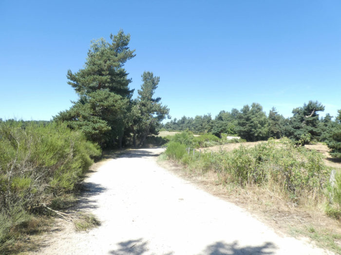
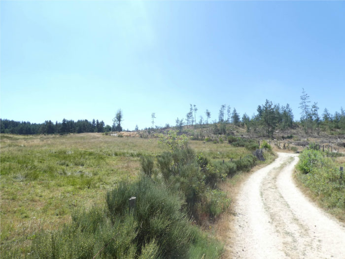
| At the top of the ridge, in this magnificent uniform landscape, the dirt road stabilizes, to flatten for many kilometers. Here Aubrac cows are back to work. |
 |
 |
| Along the way, the pines throw their light spindles to the sky, imperial, slender, straight. They sometimes look like ancient columns. Beeches, oaks and ash trees, plumper, do not want to be left behind. |
 |
 |
Section 7: The door of Aubrac.

General overview of the difficulties of the route: course without any difficulty.

| The dirt road then runs in the middle of guards of honor that form the pines. The interior of the forest is not very dark. The forest is not dense, scattered with rare coppices and shrubs of all kinds. Pines often suffocate their shrubs, which have had the misfortune to grow beside them. |
 |
 |
| These are now very long crossings between countryside and undergrowth in the foothills of Aubrac. The dirt road is wide and requires no effort. It is only to slip one step after another. As the effort is light, the eye lingers on the brooms along the road or on an iron cross planted on a pile of granite. |
 |
 |
| You could have walked for hours in this great bliss, but now that good things always have an end, the exercise lasts until reaching a small asphalt road. |
 |
 |
| The GR65 then returns back for a hundred meters on the paved road, before finding a new dirt road. |
 |
 |
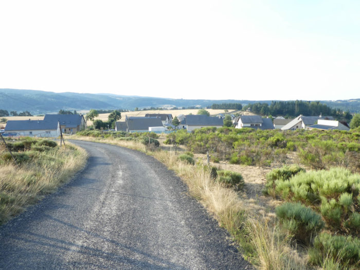
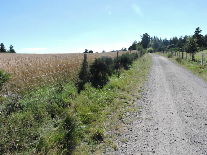
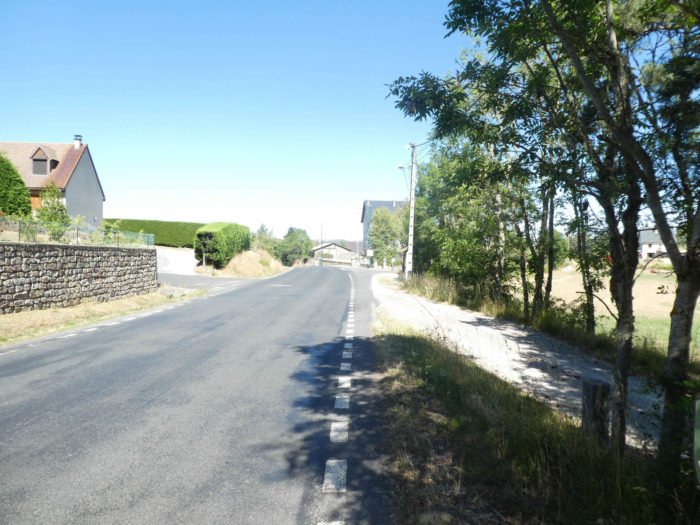
| It then smoothens on a gravel road at the edge of the crops. From there, nature is less beautiful. Pastures often give way to crops. The elegant pines disappear from the side of the road to let insignificant bushes and wild grasses grow. Even the clay is going to want to adorn gravel. Because, you are getting closer again to civilization. Should the farmers not produce flour to feed the people of Aumont-Aubrac? |
 |
 |
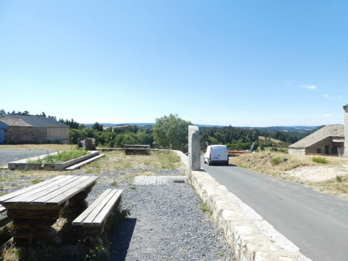
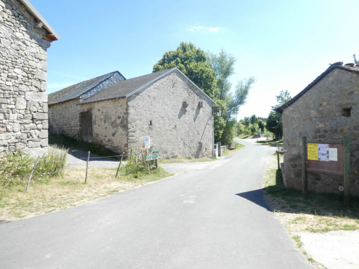
| At the end of the pathway, it is Aumont-Aubrac, the gate of Aubrac. The route then heads to the village under an alley of maples, beeches, ash trees and oaks. |
 |
 |
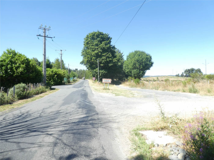
| Further afield, the GR65 joins a road that leads to the center of the small town. |
 |
 |
| Aumont-Aubrac is a place of a thousand inhabitants, very close to the A75 motorway which crosses central France from north to south. Because of the proximity of the highway and the pilgrimage to Compostela, it is a stopover where pilgrims and tourists meet.
St Stephen’s Church was part of a 12th century Benedictine monastery. The building has retained a Romanesque part despite numerous transformations. Inside, everything is modern. The city is not very rich in monuments to visit. There is still a small medieval center with stone houses built in the 16th and 17th centuries. The old Priory House serves as a tourist office. |
 |
 |
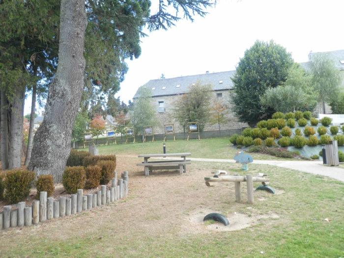
| There is a very pleasant little park in the center of the village. |
 |
 |
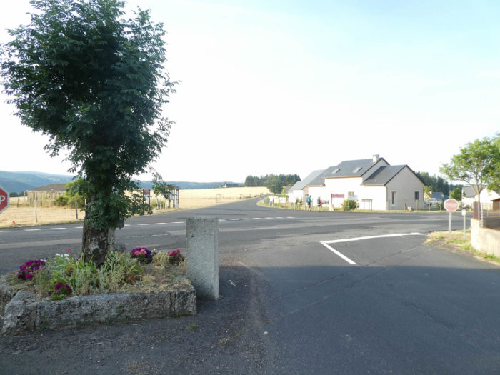
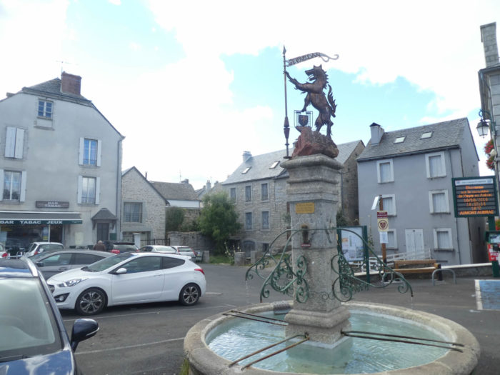
| Overall, it is not the most beautiful locality in the region, with a fairly busy road and a fairly crowded center. In the square, it is also the statue that stands to remind the “Beast of Gévaudan” who terrorized the region. These are also the signs of Compostela, which are often found. |
 |
 |
Local gastronomy
Aligot, Margeride and Aubrac are inextricably linked. Like any original recipe that respects itself, the aligot has its legend, coming from the Merovingian period. In 590, King Eulalius was very disappointed. He already had seventeen girls. His wife and his mistresses gave birth only to girls. He then asked the bishops of Auvergne, Rouergue and Gevaudan for advice. The three ecclesiastics obeyed the order of the king and decided to meet on the Aubrac plateau. The bishop of Auvergne had brought potatoes with him. At this time, each one had always some kilos of this precious tubercle with him. The bishop of Rouergue had with him cheese, cream and butter. Gevaudan’s bishop was empty-handed, but had obtained a little salt and garlic for a good price. The bishops were hungry but did not know how to cook. They were saved by a “buronnier”who threw potatoes, cheese, cream, garlic and butter into a pot on the fire. The aligot was created. Regarding the king, he still had six daughters and his dynasty disappeared from the ranks of royalty. The “Cross of 3 Bishops”, the junction of 3 French departments is near Aubrac (two stages further on the track). So, geography is also associated with the legend.
Here is the traditional recipe of aligot, that you will not miss to consume on the way. There are, of course, some variants. But they are all alike. Let’s cook, say, for 4 people. Take 1 kg of flour potatoes, 400 grams of fresh Laguiole, (1-3 days), 200 grams of heavy cream, 1 to 2 cloves of garlic, salt and pepper. Peel and boil the potatoes in salted water with the garlic, until they are tender. Cut the cheese into small cubes. Remove the garlic from the potatoes, squeeze and pass to the mashed potato. In a skillet, place the mashed potatoes on low heat. Mix the cream with a wooden spoon. Gradually add the cheese, by handfuls, one at a time. Mix well to smooth and air the preparation. You are supposed to make eight in the dish! The success of the recipe is years brewing, aeration and quality of cheese. The Swiss Fondue experts know exactly how to succeed! The overall result is something that is between warm, satiety and flavour. Aligot is often served with sausages.
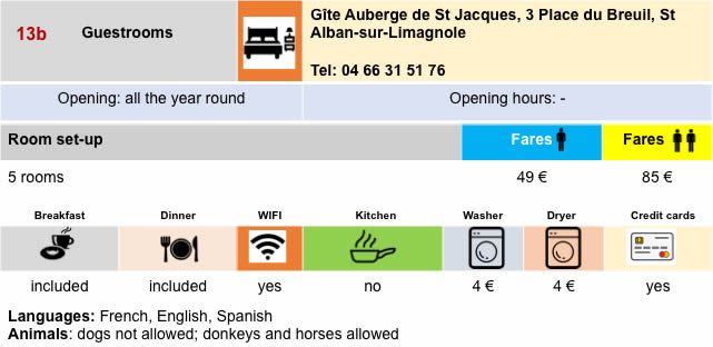
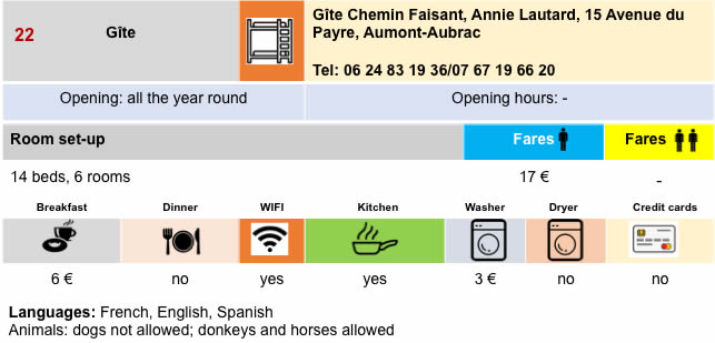
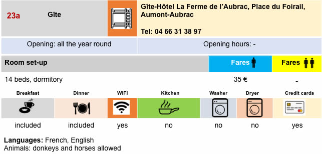
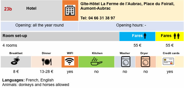
Lodging


Feel free to add comments. This is often how you move up the Google hierarchy, and how more pilgrims will have access to the site.
|
 |
Next stage : Stage 5: From Aumont-Aubrac to Nasbinals |
|
 |
Back to menu |