
The splendor of an old bastide at the end of the road
DIDIER HEUMANN, MILENA DELLA PIAZZA, ANDREAS PAPASAVVAS
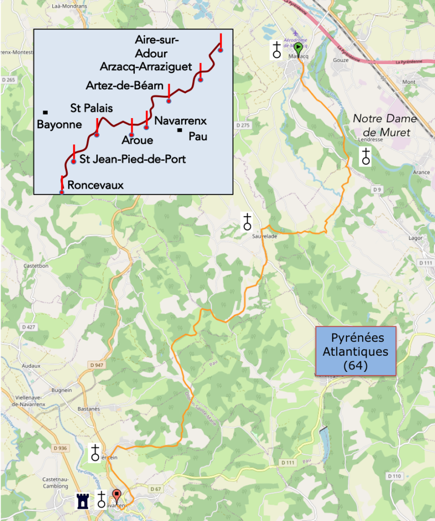
We divided the course into several sections to make it easier to see. For each section, the maps show the course, the slopes found on the course, and the state of the roads. The courses were drawn on the « Wikilocs » platform. Today, it is no longer necessary to walk around with detailed maps in your pocket or bag. If you have a mobile phone or tablet, you can easily follow routes live.
For this stage, here is the link:
https://fr.wikiloc.com/itineraires-randonnee/de-maslacq-a-navarrenx-par-le-gr65-59308791
It is obviously not the case for all pilgrims to be comfortable with reading GPS and routes on a laptop, and there are still many places in France without an Internet connection. Therefore, you can find a book on Amazon that deals with this course. Click on the book title to open Amazon.
 |
The Camino de Santiago in France. VI. From Cahors to St Jean-Pied-de-Port (Via Podiensis) on GR65 track |
If you only want to consult lodging of the stage, go directly to the bottom of the page.
Today, you’ll cross the North of Béarn, towards Navarrenx, at the limit of Béarn. You walk in the country of the two largest mountain streams in the Pyrenees. Yesterday it was the Gave de Pau, today it will be the Gave d’Oléron.

And it is precisely at the foot of the Gave d’Oléron that the stage ends. Navarrenx has always occupied a strategic position with regard to France and Spain. Its status as a bastide dates back to the dawn of time, in the 12th century. The bastides all have a fairly precise architecture, in particular large squares from which the main and secondary streets start at right angles, with regular subdivisions of houses. Navarrenx is remarkable in this sense. Navarrenx controlled in the Middle Ages the axis of pilgrimages to Santiago in France. It quickly became a large fortress, with powerful ramparts, still present today. Navarrenx retained its military vocation until the 19th century with the construction of barracks and an arsenal. But today, it is no more than a major agricultural center of Béarn, a city where many tourists and pilgrims to Santiago meet. It is a very beautiful stage, despite the presence of tar, with very varied landscapes.
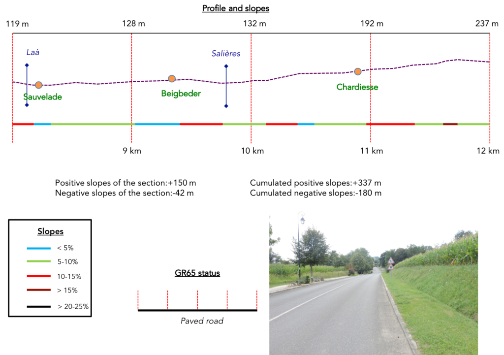
Difficulty of the course: This is a stage with unspectacular slope variations (+457 meters/-412 meters). Yet, it is a difficult stage, hiding all the same some difficulties. First there is a long, fairly steep climb to the Muret Chapel. Then an endless bump precedes such a steep descent to the abbey church of Sauvelade. Furter on, the route climbs and descends constantly with steep gradients of the order of well over 15%, before calming down in the forest of Méritein, as you approach Navarrenx and its suburbs.

Today is a tarmac day, even if it’s just small back roads. The routecrosses this entire region between Orthez and Pau:
- Paved roads: 18.8 km
- Dirt roads: 3.3 km
Sometimes, for reasons of logistics or housing possibilities, these stages mix routes operated on different days, having passed several times on Via Podiensis. From then on, the skies, the rain, or the seasons can vary. But, generally this is not the case, and in fact this does not change the description of the course.
It is very difficult to specify with certainty the incline of the slopes, whatever the system you use.
For « real slopes », reread the mileage manual on the home page.

Section 1: More corn until the oratory of Notre Dame du Muret.
 General overview of the difficulties of the route: course without any difficulty, except for the climb to the oratory.

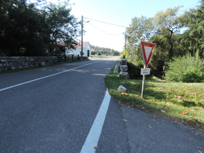
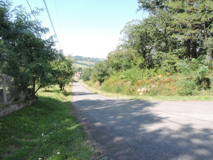
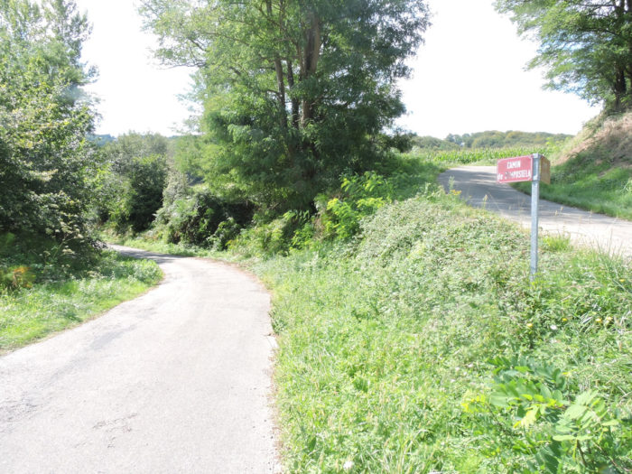
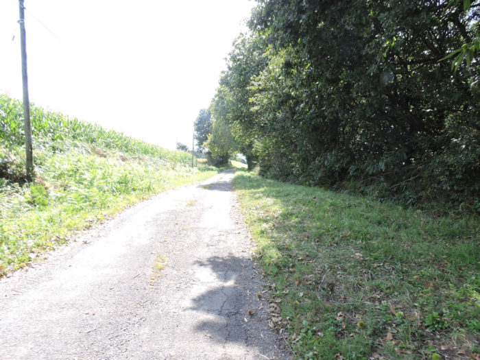
The GR65 quickly leaves Maslacq, in a very clean and well-appointed suburb, near a sports complex and a park.
 |
 |
 |
 |
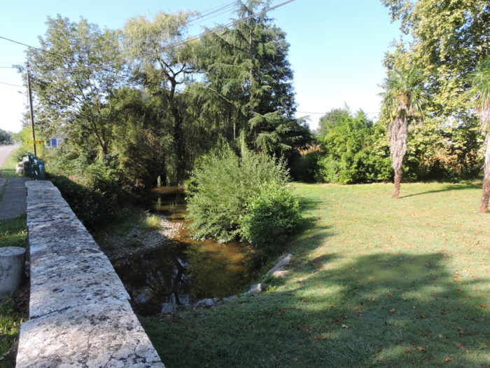
| Quite quickly, at Moulin Simon, it crosses the small Geü brook. The rivers in the country have charming names, Occitan names. Here the waters finally became clear in the streams. | |
 |
 |
Shortly after, the GR65 leaves the main axis to cross a tiny industrial zone and reach the Gave du Pau plain.
 |
 |
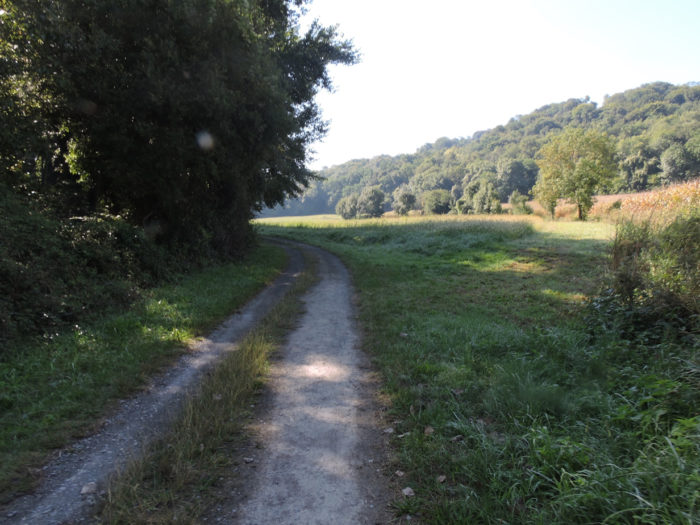
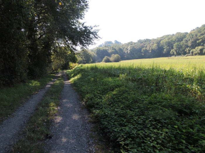
| Did you forget the cornfields? They haven’t forgotten you. Here you will be thrilled, flattening for a long kilometer along a wide dirt track. The Gave du Pau flows a few hundred meters from the road. A blessing for yellow gold. | |
 |
 |
| Along the way, the sanctuary of Notre Dame de Muret is announced. Is it really useful, because the majority of pilgrims do not make the detour? On the plain, in season the farmers also grow wheat. | |
 |
 |
| Then the landscape changes when the pathway runs alongside the Gave de Pau. The undergrowth of oaks and poplars takes over the crops. | |
 |
 |
The Gave de Pau flows majestically behind the leafy trees on the track. Pyrenees Atlantiques are fortunate to have very beautiful rivers, which was not the case before in Gers department.

| Further on, the pathway begins to climb up the hill. | |
 |
 |
At the foot of the coast, a beautiful ruin, made of pebbles from the river, still displays what remains of its grandeur, eaten up by years, ivy and brushwood.

| Near the house in ruins, the climb to the chapel of Notre Dame du Muret begins on a fairly stony pathway. Here you will appreciate it, it is for granted. The climb is constant, almost 15% slope, in the middle of oaks, small hornbeam and chestnut trees. | |
 |
 |
 |
 |
It’s worth its share of sweat…
Wait for the video to load.
| At the top of the tough climb, the pathway soon comes to an intersection: on the right GR path, on the left Muret Sanctuary. | |
 |
 |
| Most pilgrims ignore the chapel. One more detour! Some pilgrims are riveted on the red and white marks of the GR. They would see a 500 Euro bill next to them, which they wouldn’t have time to bend down to pick it up. Yet, they are wrong. The sanctuary is nestled a few hundred meters away in a bucolic setting.
It is still a place of pilgrimage in September today. In the 11th century, the Bishop of Gascony had a church erected. It was a famous place of pilgrimage for 500 years until the time of the Reformation, when the site was vandalized. Nothing remains of the early church. |
|
 |
 |
| If you fall into the category of people in a hurry, then at the intersection, turn directly to the right, to rediscover the charm of Béarn countryside. | |
 |
 |
| The dirt road climbs a little further, beyond the fork in the chapel. The meadows compete here for land with corn. Below is the heavily populated plain, washed by the Gave de Pau. | |
 |
 |
| At the top of the hill, the GR65 finds the tar back near Mercé hamlet. | |
 |
 |
| A dirt road cuts behind a stone house to slope up to the top of the hill. | |
 |
 |
| From the top, an asphalt road descends from the hill. Here a goat asks the pilgrims in vain to free it from its ties so that it can go for a run in the mountains. | |
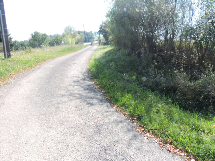 |
 |
Section 2: Over hill and dale in Béarn countryside.
 General overview of the difficulties of the route: some very steep slopes, both downhill and uphill, sometimes close to 15%.

| The road then gradually slopes down towards Geü brook. It heads to the small hamlet of Saubade and its stone pebble farms. Admittedly, these are not luxury residences, but all the heart of Béarn beats in these residences, however modest they may be. | |
 |
 |
| Béarn area is charming here. There is of course still corn, but above all meadows with White Aquitaine cows. | |
 |
 |
|
The road slopes down again. The slopes are never excessive, rarely at 15%. At the bottom of the descent, the route Geü brook again, hidden under the weeds. |
|
 |
 |
 |
 |
|
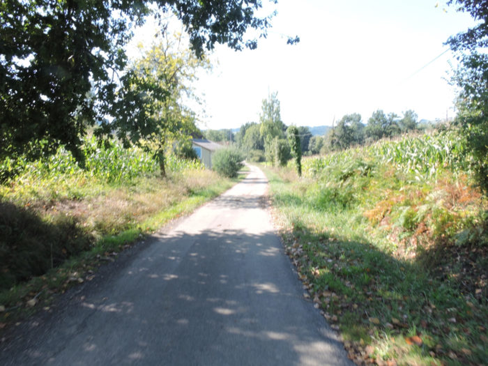
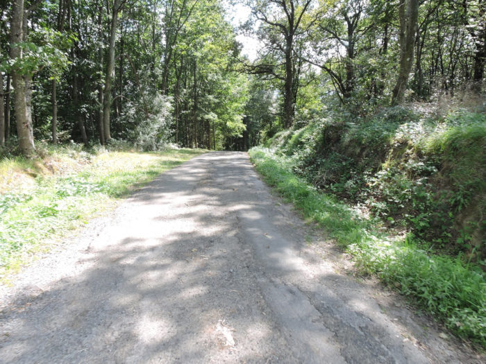
Beyond the brook, the asphalt road climbs gently up through the oaks towards Lacoume hamlet. |
|
 |
 |
 |
 |
|
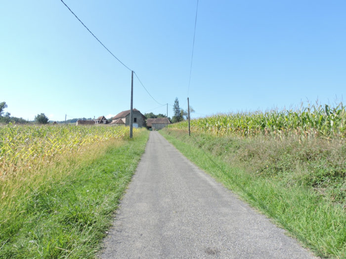
In Lacoume, where corn is found in abundance, the GR65 finds a dirt and grass lane that weaves its way between corn and undergrowth. |
|
 |
 |
|
You have often been told that the Camino de Santiago cannot ignore the presence of a stream, however modest it may be. it’s always the same song. You have to slope down to climb back up again. So, according to the pre-established scenario, but here there is no steep descent, the GR65 will descend slightly into the undergrowth until it crosses the small Soularau brook. |
|
 |
 |
|
Beyond the stream, it’s a road that slopes up through the corn. |
|
 |
 |
|
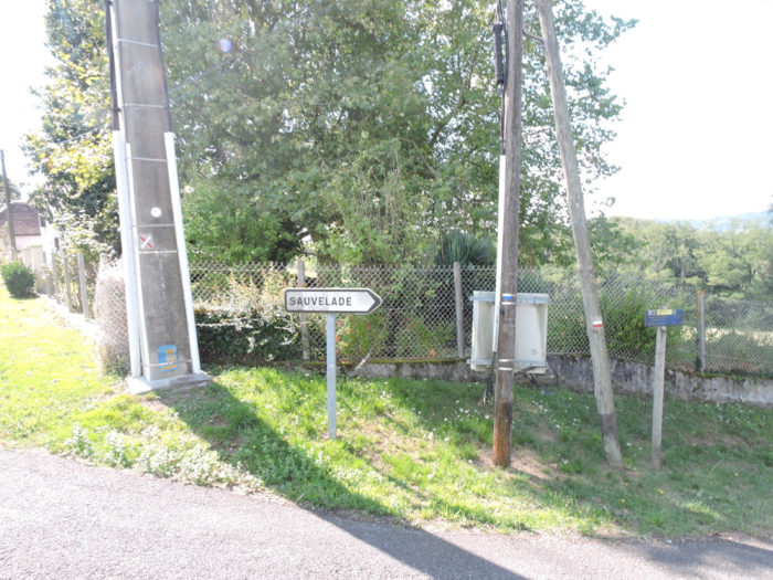
Further afield, near Larqué hamlet, a road lightly climbs to reach a small crossroads where Sauvelade is announced with a lot of publicity. Pilgrims are often comforted by these advertising inserts. This always proves that they are on the right track and that their sometimes-dry throats or heavy legs will soon regain a taste for existence. Yet, it is still half an hour to reach Sauvelade Abbey and 4 hours to Navarrenx. A trifle, right! And immediately, the road begins to climb. |
|
 |
 |
|
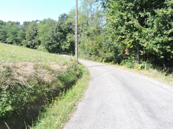
Because courage, it will take to face the next quarter of an hour, especially since in front of you a severe climb looms. You can see the road zigzagging across the meadow up there on the hill. You will enjoy the climb ahead. The average slope is 10%. Reasonable, right? But some sections go up to 20% for less than a kilometer. |
|
 |
 |
|
In the meadows, the beautiful White Aquitaine cows bask under oaks, chestnuts and ash trees. This is the bewitching charm of Béarn area. |
|
 |
 |
 |
 |
To enjoy as an aperitif or for dessert…
Wait for the video to load.
|
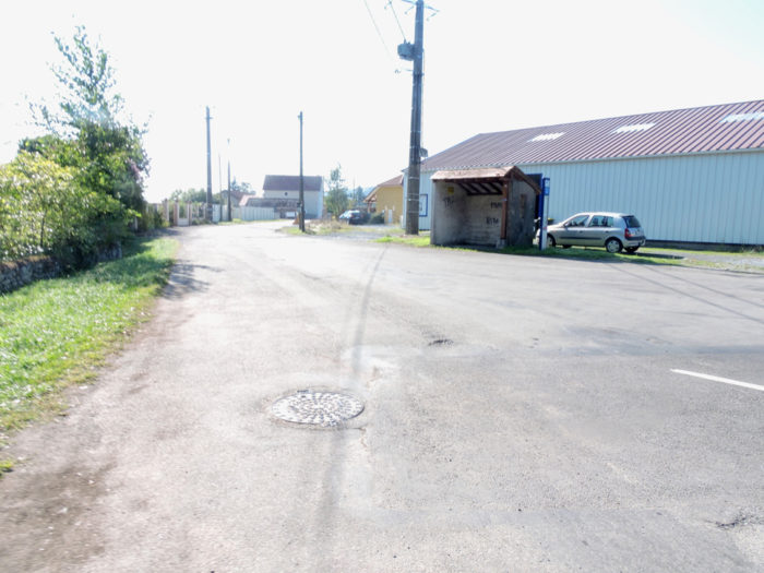
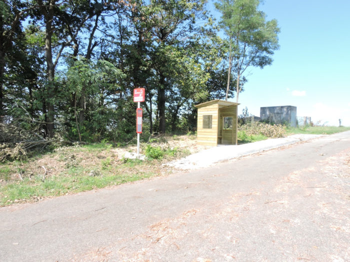
When you’ll see the little wooden cabin by the side of the road, know that deliverance is near! Here, there is a bus stop, and the bus does not run every hour. But there is a bus, which is remarkable for France. |
|
 |
 |
|
Finally, deliverance may not be the right word. Because the descent to Sauvelade is even steeper, sometimes up to 25% decline. But, this is descent! For sore knees, it is often even more painful. |
|
 |
 |
|
At the bottom of the dale, the slope eases into the gentle countryside. |
|
 |
 |
|
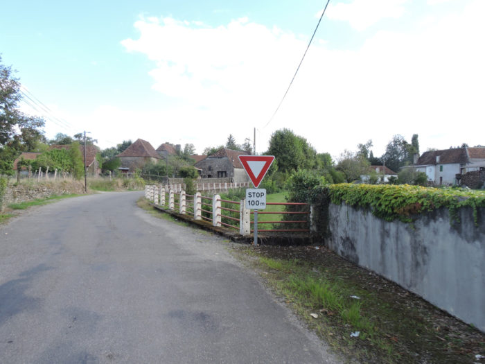
The road then arrives at a strategic crossroads. Either you slope down the stony lane towards the Roman bridge, or you follow the road towards the abbey. Bed and breakfast advertisers invite you to follow their point of view. Choose. If you prefer the Roman bridge, you won’t see the abbey church. It will be said all the same that it would be a shame to miss the site of the abbey, even if it has lost the grandeur of its past. For the Roman bridge, you can also see it by making a very small detour at the exit of Sauvelade. |
|
 |
 |
|
If you follow the road, it continues to descend towards Sauvelade along the undergrowth and corn. |
|
 |
 |
Section 3: Passing through Sauvelade, which has lost its splendor.
![]() General overview of the difficulties of the route: course with steep slopes.
General overview of the difficulties of the route: course with steep slopes.
|
At the bottom of the dale flows the Laâ brook, just before the abbey. |
|
 |
 |
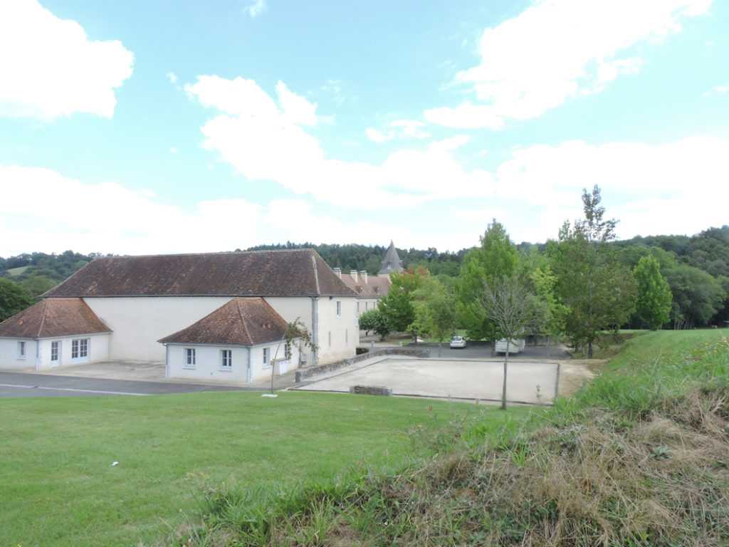
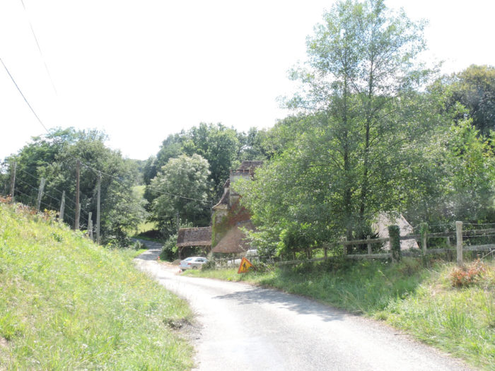
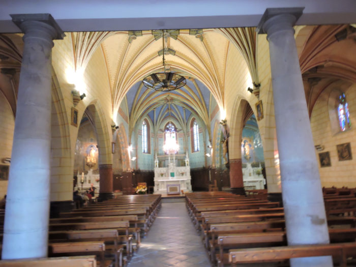
The church of Sauvelade, the old abbey chapel built by the monks, is the only vestige of the abbey, destroyed during the Wars of Religion. The Benedictine abbey was founded in 1128 by Gaston IV the Crusader, Viscount of Béarn, on the verge of taking part in the crusade, and became a major pilgrimage site to Santiago de Compostela. When it was later taken over by the Cistercians, its influence waned, for these monks were not relic fanatics. The Protestants destroyed the abbey in 1569, preserved the church which became a place of Protestant worship. During the Revolution, the church became a parish church. The surrounding buildings were recently restored to make them administrative or cultural buildings. When we passed here the church was under restoration.

|
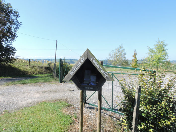
Austere walls overlook the road where th GR65 runs. Sauvelade is a welcome and popular stopover for pilgrims, even if not much of the old atmosphere remains. You can eat and stay here, but also in the outskirts. Miam Miam Dodo makes the directory of the lodgings a little far from the track. |
|
 |
 |
 |
 |
This is what the site looks like today. It will take years for the site to regain the fervor described a long time ago.
|
Beyond Sauvelade GR path flattens on the D10 small departmental road. |
|
 |
 |
 |
 |
|
It will do so until leaving the departmental road in a place known as Beigbeder. |
|
 |
 |
|
A road will climb in levels, steeply but rarely excessive, for miles. At the start, it passes through the undergrowth dominated by oaks, crossing Salières brook. |
|
 |
 |
 |
 |
|
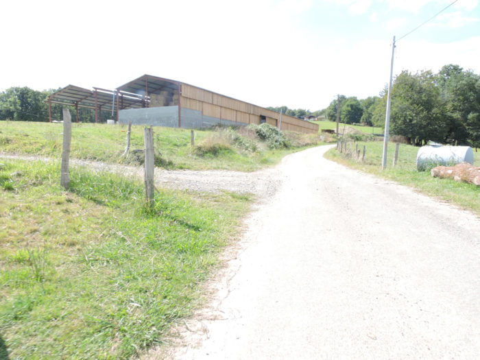
Further afield, the road leaves the undergrowth for the meadows. No sign of civilization on the road before reaching a few houses in Plaâ and Chardiesse. |
|
 |
 |
 |
 |
|
Cattle are ubiquitous in the meadows. They are above all White Aquitaine cows as everywhere in the department, surveying the green meadows or the Pyrenean slopes. |
|
 |
 |
 |
 |
Some would say that these cows lack the beauty and gentleness of Aubrac cows. Actually, they are not young maidens, but large cows, recognizable by their fine dress, by their pink mucous membranes. In any case, these cows have nothing in common with Holstein cows and their hanging udders.

|
Further up, the road then heads to the hamlet of Chardiesse. There is no organized village here, only isolated farms along the road. |
|
 |
 |
 |
 |
|
In Chardiesse, the climb is not over. Sometimes you will have the feeling that you will never reach the top of the hill. It is from here that the slope is most demanding, sometimes even up to 20%, in the clumps of holm oaks. |
|
 |
 |
 |
 |
|
At the top of the hill, the road joins a small plateau near a secluded farmhouse nestled in the trees. |
|
 |
 |
|
You reached a place called Le Hameau de Bugnein and Navarrenx is at 2h30 from here. |
|
 |
 |
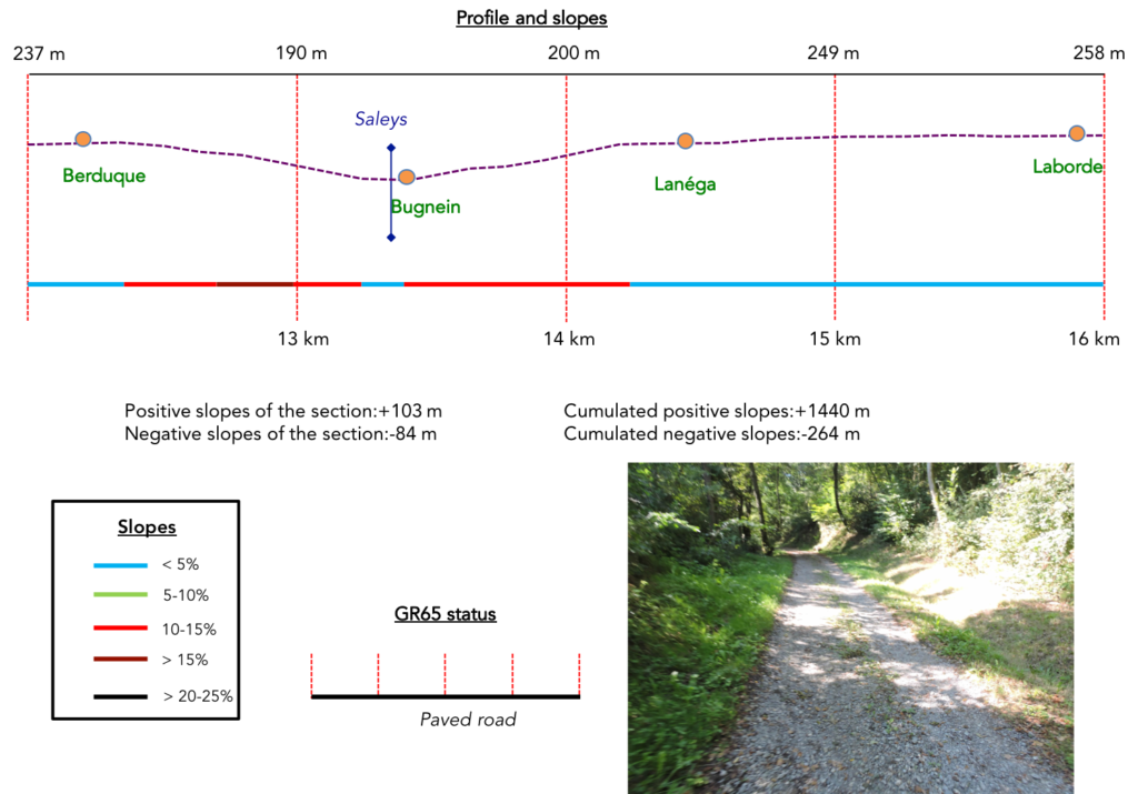
Section 4: Consistent ups and downs between undergrowth and countryside.
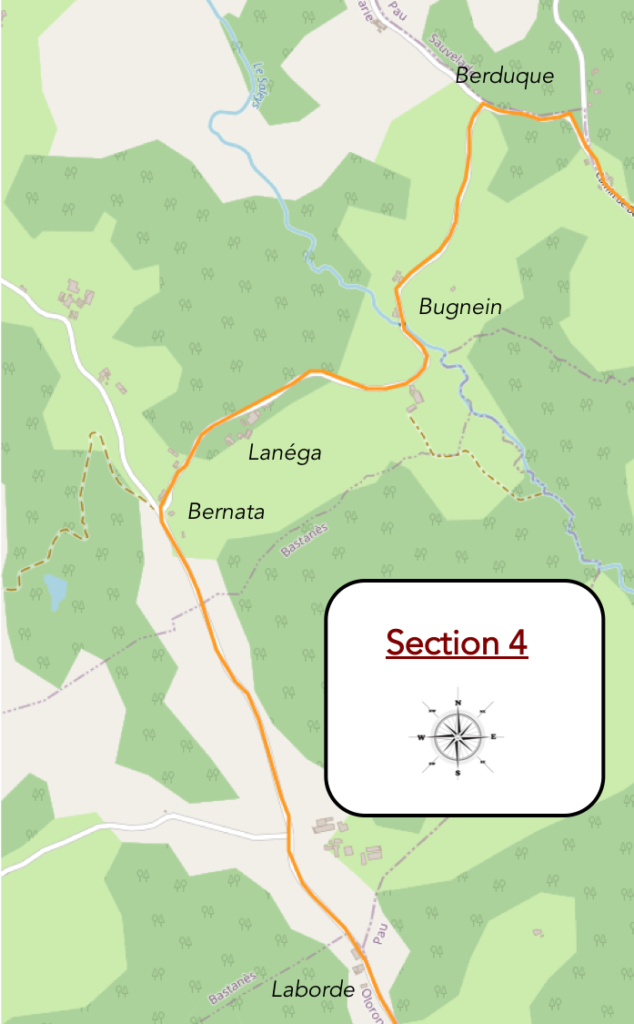
General overview of the difficulties of the route: leg- breaking route, with slope, sometimes very tough.
|
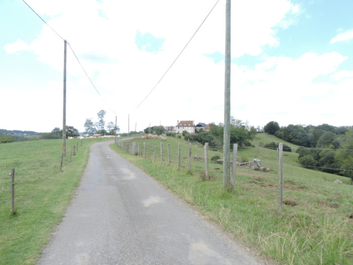
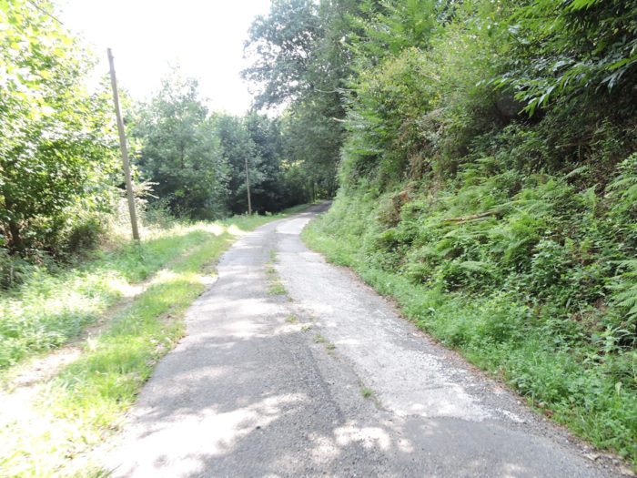
The road then wanders under the oaks and ash trees on the top of the hill, in the direction of Berduque. |
|
 |
 |
|
Berduque is a bit like the quintessence of Béarn area, with its herds scattered in beautiful nature. They are White or Blond Aquitaine cows, which is the same definition. |
|
 |
 |
In the Middle Ages, these hardy cows were used for traction above all, but also for milk. They come from three branches that have since been grouped together under the name “Blondes d’Aqutaine”. Today they are primarily selected for meat production. Most often, you will see their white coat. But, they can wear a dress ranging from creamy white to wheat, like here and clear mucous membranes. They have white horns with a dark to black tip, short or lyre-shaped. These are the larger size French cows, weighing around 1500 kg for males and 1000 kg for females. They have a very interesting feature. They know how to vibrate their skin to scare away flies.

|
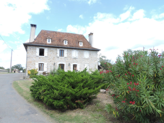
The serenity of the farmers reigns in these places. A welcome stop is available for pilgrims. The people here know that the climb has been demanding and that it is not yet the end of the stage. |
|
 |
 |
|
Beyond Berduque, the road descends towards Bugnein/Mathieu in the smiling countryside. |
|
 |
 |
|
The descent is severe, often around 20% gradient. When you glance at the horizon, you salivate in advance, because you already imagine that you will have to climb up the side of the hill in front of you. |
|
 |
 |
For your pleasure…
Wait for the video to load.
|
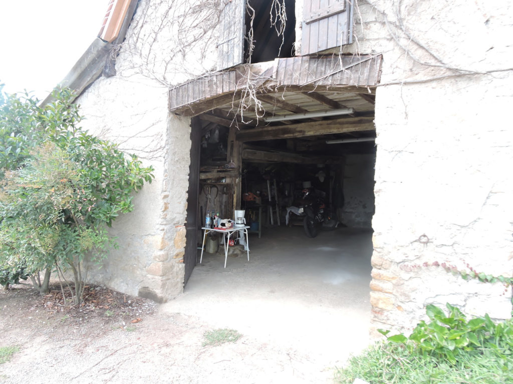
At the bottom of the descent nestles a magnificent house which serves as accommodation and which sings by the water’s edge under the large willow tree. |
|
 |
 |
Here the road crosses the Saleys stream.
 |
 |
|
Unsurprisingly, as expected, the road slopes up the other side of the hill. |
|
 |
 |
|
The slope is almost 15% between meadows and undergrowth, along the farms. |
|
 |
 |
 |
 |
|
We have said it often, it is in these places, when the journey is more tough, that you’ll see pilgrims stranded on the way. |
|
 |
 |
|
The climb up the dale is demanding up to Lanéga hamlet. |
|
 |
 |
|
Beyond the place called Bernata, it is the holidays. You’ll leave behind the climbs, the descents to flatten relax. Alas still on the tar. |
|
 |
 |
However, may be to your delight, you sometimes find corn that you thought you had definitely buried.
 |
 |
|
The languid cows in the meadows are probably wondering why all these strange animals are agitated with a bag on their back. |
|
 |
 |
|
Shortly after, the GR65 reaches a crossroads near Boussaque hamlet. |
|
 |
 |
|
There is not much to immerse your soul in contemplation. You just have to move on, sometimes have a look at a farm by the side of the road or a little further. The routine of pilgrims, in a way, without mystery. |
|
 |
 |
Section 5: Walk in the countryside and the woods of Navarrenx.
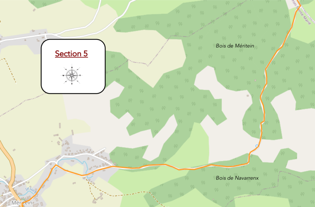 General overview of the difficulties of the route: course without any difficulty.
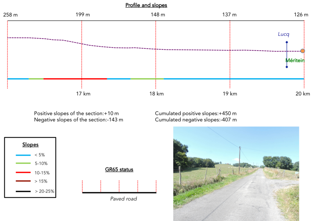
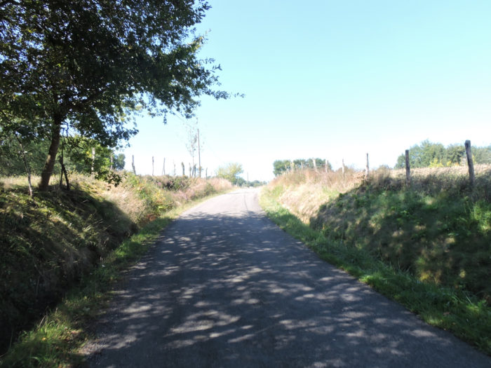
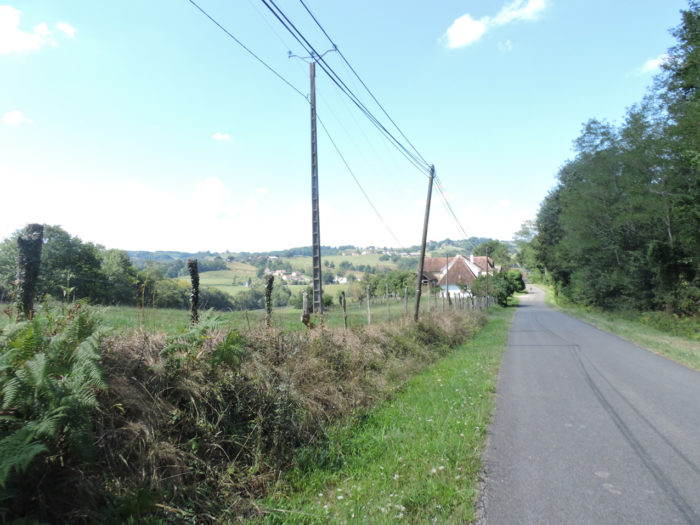
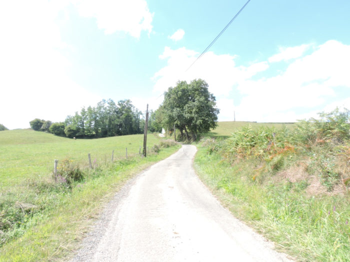
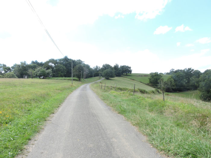
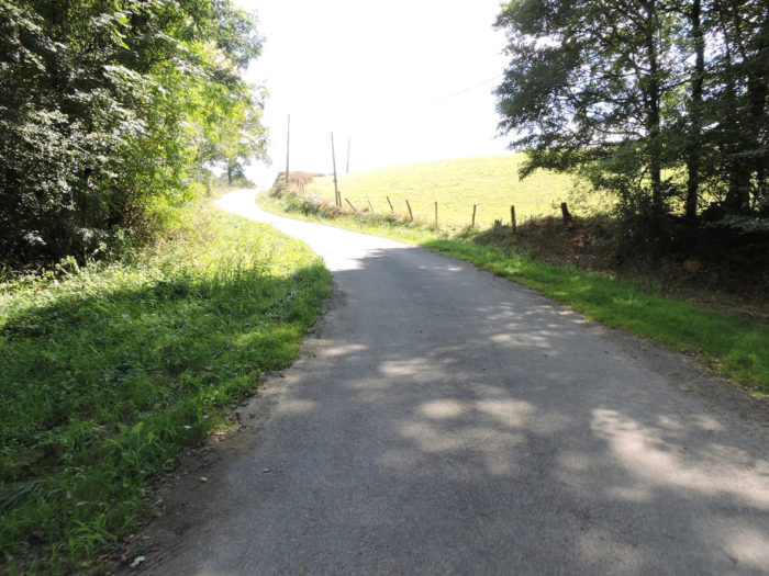
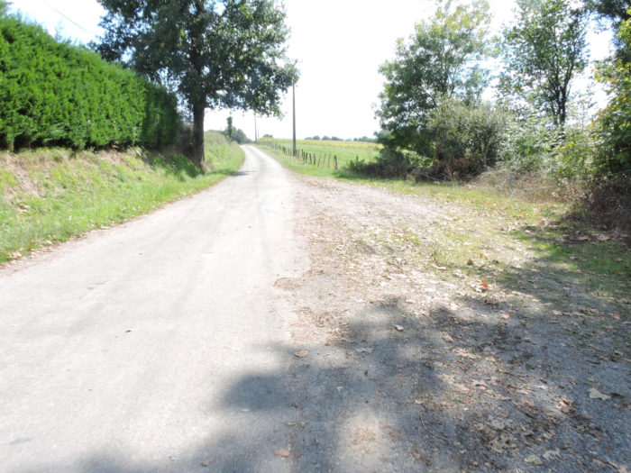
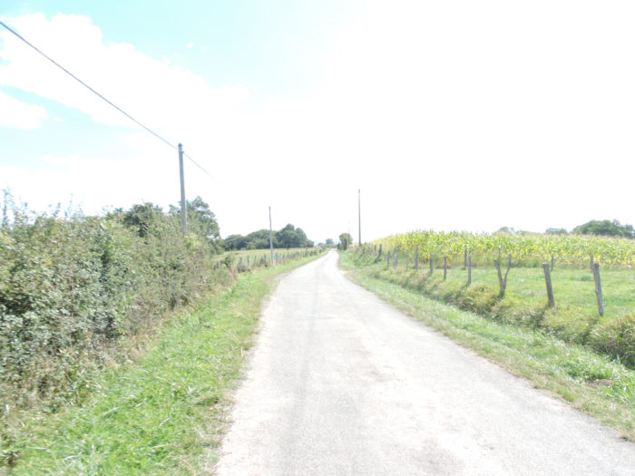
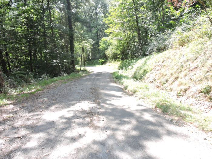
The road takes a long walk through the countryside, towards Méritein. Further on, the landscape becomes a little wilder, more disorderly, which is not to displease many pilgrims.
 |
 |
|
The bad asphalt road gradually approaches the forest of Navarrenx, in the middle of oaks and chestnuts. |
|
 |
 |
|
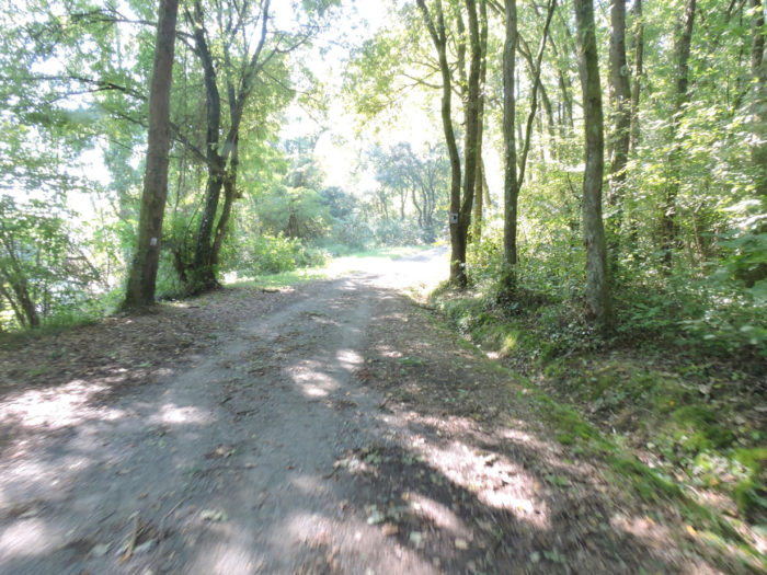
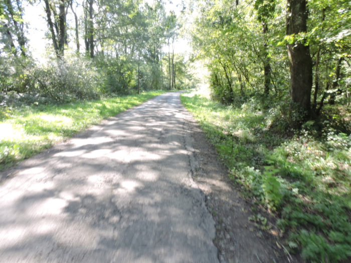
Further on, the road then enters the beautiful forest of Méritein, under large oaks with gnarled arms, like an ocean of peaks caressed by the wind. |
|
 |
 |
|
The small bad road, rather a wide dirt road, then slopes down between 10% and 15% gradient into the forest. |
|
 |
 |
It slopes down to a water point at the bottom of the dale. In the past, a sect had taken up residence in the region of Navarrenx. We cannot tell you if it is still active. People here say that members came to the edge of the fountain to offer food and lodging to pilgrims. We know the speech of these benefactors of humanity!
 |
 |
It is then a beautiful and long walk on the wide avenue of dirt under the oaks, chestnuts, hornbeams and maples. The step advances effortlessly in the wild nature.
 |
 |
 |
 |
At the exit of the wood, the road reaches the first houses of Méritein.
 |
 |
|
Further afield, you’ll sometimes find a little corn, but so little. |
|
 |
 |
|
Further on, GR path finds the real tar again. Here the country opens up and the little Lucq stream winds its way through the plain. |
|
 |
 |
The pathway makes a little company with the stream, in the direction of the village.
 |
 |
|
Further ahead, you will end up abandoning the stream to its fate, to arrive at Méritein, a small village with no particular character, with its St Jean Baptiste church built in the 19th century. |
|
 |
 |
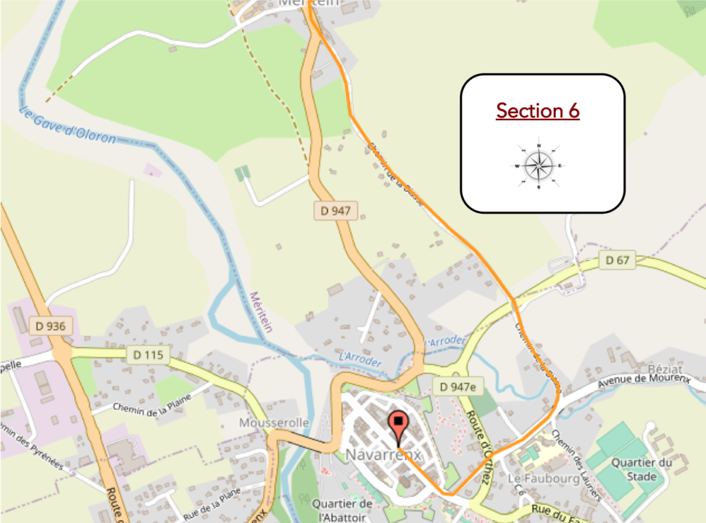
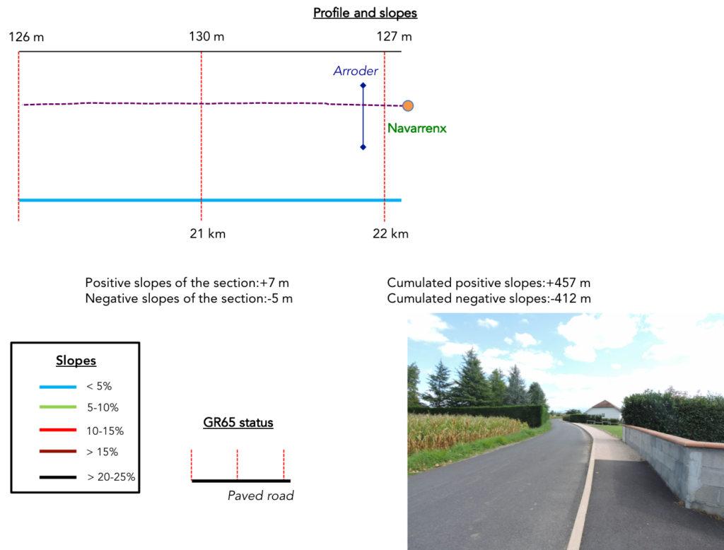
Section 6: On the way to the fortress of Navarrenx.
 General overview of the difficulties of the route: course without any difficulty.
|
The journey from Méritein to Navarrenx will not go down in history. It is almost two kilometers along villas without much character, the lot of small towns and villages today. When it’s small, the advantage is that you avoid industrial and commercial areas. |
|
 |
 |
|
There won’t be much suspense in telling you that you will find the corn fields back. |
|
 |
 |
|
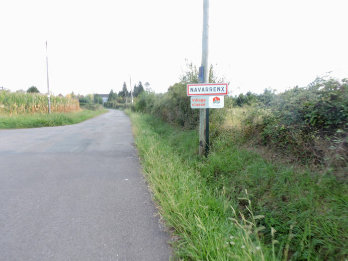
Entering Navarrenx on this side does not really announce a listed village. |
|
 |
 |
|
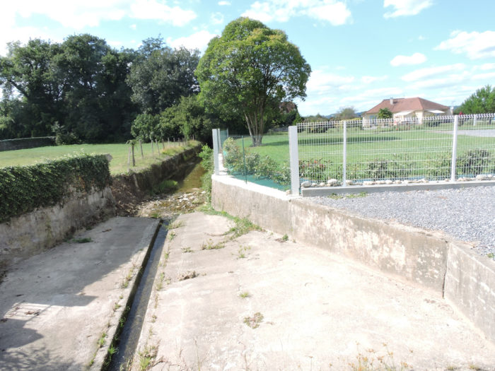
In the suburb, the road will then cross Arroder, a small stream that flows into the Gave d’Oléron. |
|
 |
 |
Further ahead, it gradually approaches the citadel of Navarrenx.
 |
 |
Soon you find yourself in front of the so-called impregnable fortress. At first glance, it doesn’t seem that impressive to you. At least on this side!

|
Navarrenx is a bastide, and like all bastides, there is a central street where shops are gathered, and many alleys, much quieter, which start at a right angle to the main street. |
|
 |
 |
|
The layout of the houses and the uniformity of the roofs are remarkable. |
|
 |
 |
|
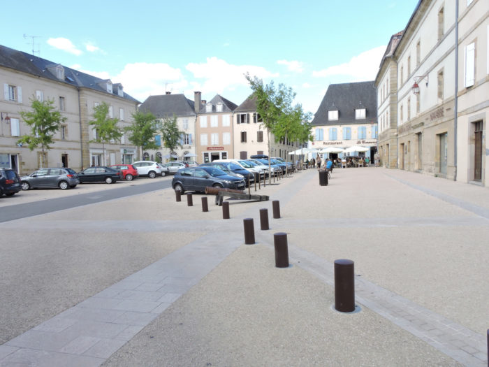
Navarrenx (1,000 inhabitants) is one of the most beautiful villages in France. And with good reason. The bastion, surrounded by fortresses, was erected from 1538 on the order of Henry II, King of Navarre. Most of the fortifications have been preserved from the outset. Surrounded by walls from the XIVth century, the city retains beautiful remains such as the Saint-Antoine gate, rebuilt in 1645, the Powder Tower, the Place des Casernes, the military fountain, as well as Gothic houses and, on the square from the town hall, a XVIIth century arsenal built on the ruins of the house of the kings of Navarre. From the top of the fortifications, the view is lovely over the Gave d’Oléron and the stone bridge which dates back to the XIIIth century. It is said that pilgrims before this time crossed the river on boats. |
|
 |
 |
|
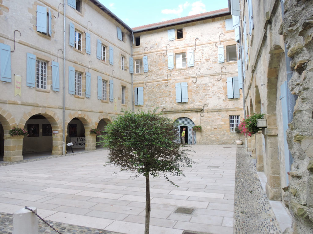
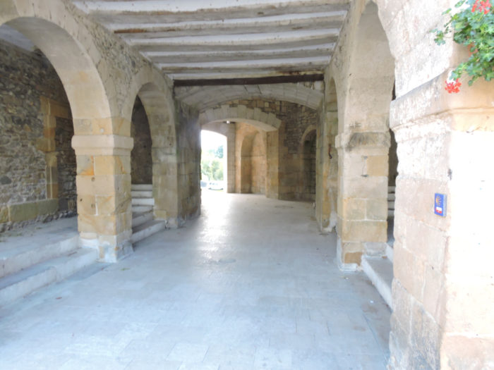
Along the ramparts stands the square Poudrière tower. Two beautiful squares, Place l’Arsenal and Place des Casernes occupy the center of the small town. It was at the 17th century that the Arsenal was rebuilt on the ruins of the houses of the King of Navarre, where food and ammunition were kept. The whole complex today serves as a place of exhibition and lodging for pilgrims. It’s beautiful, timeless. |
|
 |
 |
|
The church of St Germain in Auxerre dates from the 16th century. It is very colorful, very busy. |
|
 |
 |
|
It is at the level of the complex formed by the two military squares, of these arcades, that the heart of this beautiful city beats. |
|
 |
 |
Let’s also say that people organize a round of the World Salmon Fishing Championship here every year, and that people play Basque pelota, in the Basque Country as in Béarn, and we will have toured the strong points of this beautiful place.
 |
 |
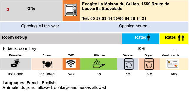
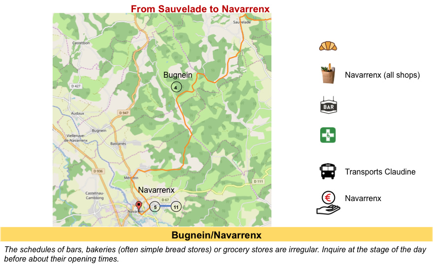
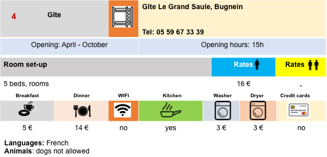
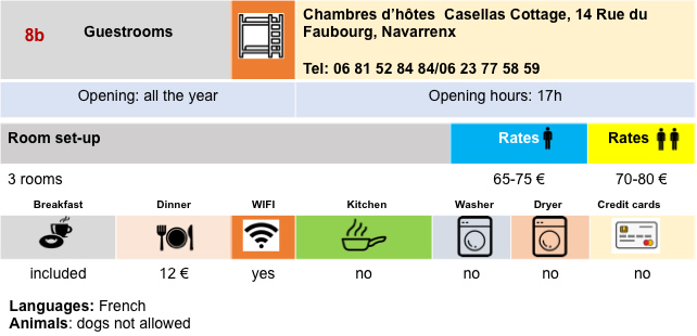
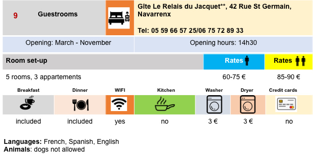
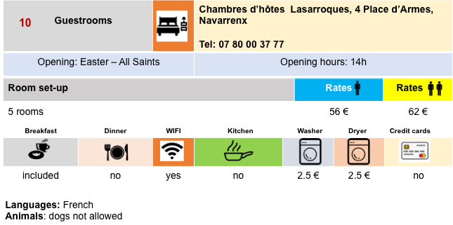
Lodging


 |
 |
 |
 |
 |
 |
 |
 |
 |
 |
 |
 |
Feel free to add comments. This is often how you move up the Google hierarchy, and how more pilgrims will have access to the site.
 |
Next stage : Stage 34: From Navarrenx to Aroue |
 |
Back to menu |