
Between wheat and vines, before the railway line which has already breathed its last
DIDIER HEUMANN, MILENA DALLA PIAZZA, ANDREAS PAPASAVVAS
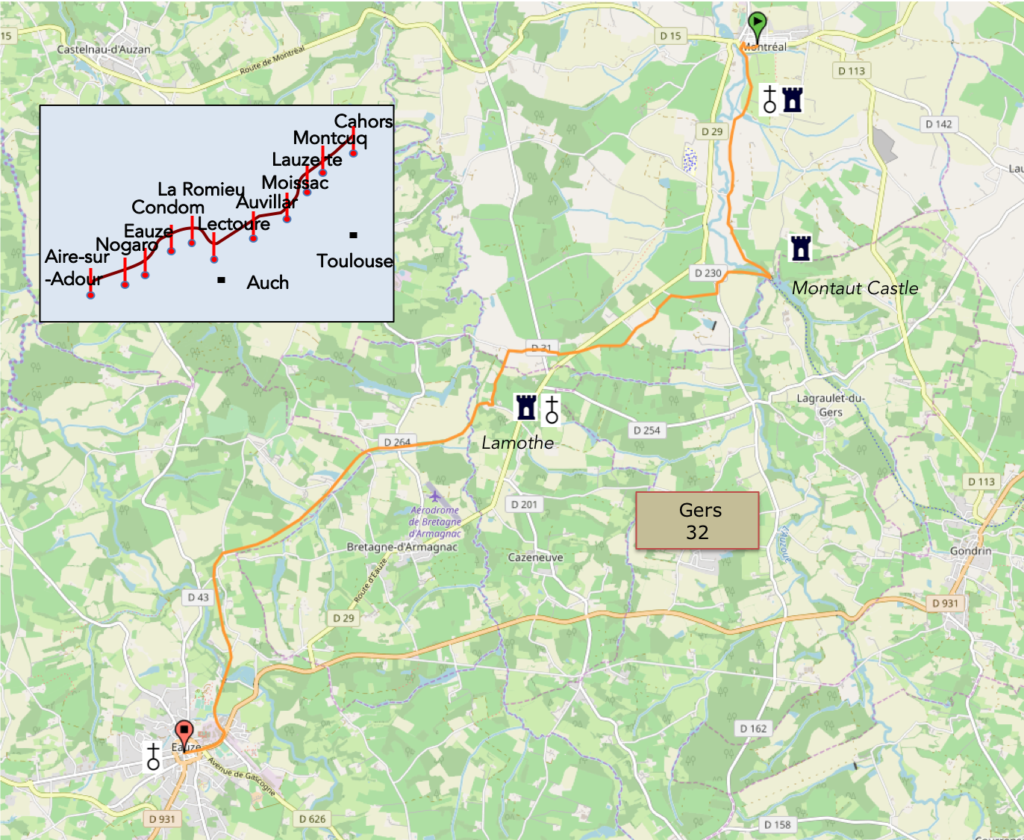
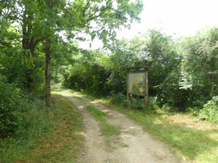
We divided the course into several sections to make it easier to see. For each section, the maps show the course, the slopes found on the course, and the state of the roads. The courses were drawn on the « Wikilocs » platform. Today, it is no longer necessary to walk around with detailed maps in your pocket or bag. If you have a mobile phone or tablet, you can easily follow routes live.
For this stage, here is the link:
https://fr.wikiloc.com/itineraires-randonnee/de-montreal-de-gers-a-eauze-par-le-gr65-30738574
It is obviously not the case for all pilgrims to be comfortable with reading GPS and routes on a laptop, and there are still many places in France without an Internet connection. Therefore, you can find a book on Amazon that deals with this course. Click on the book title to open Amazon.
 |
The Camino de Santiago in France. VI. From Cahors to St Jean-Pied-de-Port (Via Podiensis) on GR65 track |
If you only want to consult lodging of the stage, go directly to the bottom of the page.
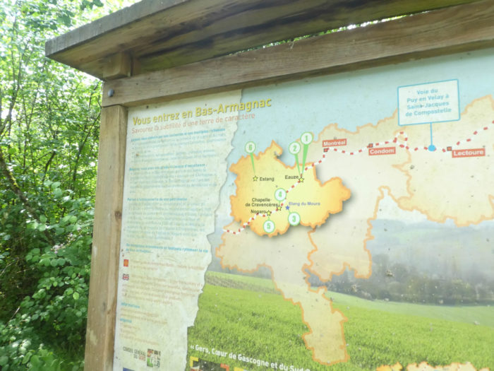
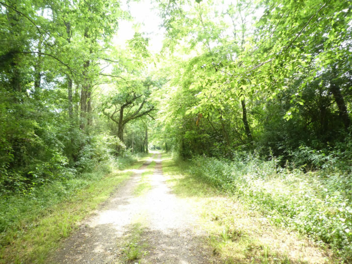
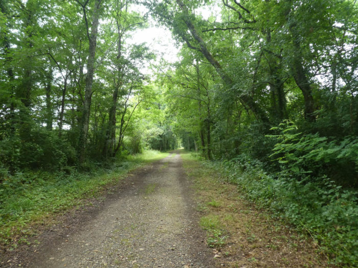
Today’s stage starts from Montreal-de-Gers, capital of Ténarèze, to reach Bas Armagnac. Bas Armagnac is of course the place of Armagnac liqueur. The vines will therefore extend over a large part of the course. From time to time, a little wheat, a few corn, little undergrowth, before the stage ends flat on the old railway line.

The old railway line linked here Auch, the capital of Gers, to Eauze, via Montreal. This old single-track line was abandoned and eliminated in 1954. The department of Gers remains the most disadvantaged department in Occitanie in terms of links with neighboring departments, which also explains the region’s difficulties. However, the disappearance of the railway lines is not unique to Gers. All the way through the Camino de Compostela in France, the train has disappeared, probably forever. 10,000 km have already been eliminated since 1945, and there are plans to eliminate another 6,000 km. Why run trains twice a day, with a handful of travelers? Everyone has their car, right? And the train costs too much. Replacing a train with a bus would allow more frequencies, for less. This was the idea that President Macron supported. But now, Macron buses run on the same axes as the trains. It’s just competition. You may want to inquire. You will not find any Macron coach on the Camino de Santiago route in Gers, nor on the rest of the way. If you walk for small stages on the track, and you think of going home by train, there is often only one solution: stop at an SNCF station. From there, either go to Paris or descend to Marseille, to find your starting point, if there is a train station near you. This is the joy of public transport in France.
Today the route heads south-west.
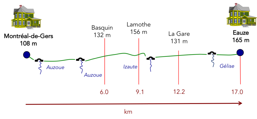
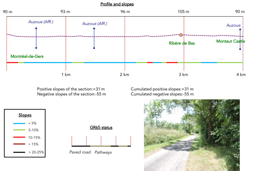
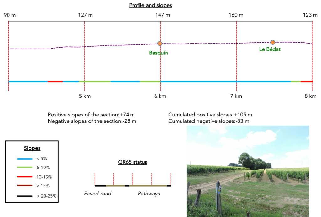
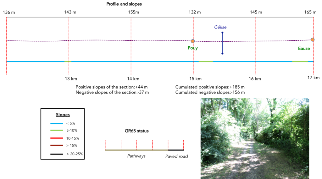
Difficulty of the course: Slope variations (+185 meters/-156 meters) are very low here. On the course, there is no difficulty on very light ups and downs.
In this stage, passages on pathways clearly predominate. Well done!:
- Paved roads: 4.9 km
- Dirt roads: 12.1 km
Sometimes, for reasons of logistics or housing possibilities, these stages mix routes operated on different days, having passed several times on Via Podiensis. From then on, the skies, the rain, or the seasons can vary. But, generally this is not the case, and in fact this does not change the description of the course.
It is very difficult to specify with certainty the incline of the slopes, whatever the system you use.
For « real slopes », reread the mileage manual on the home page.

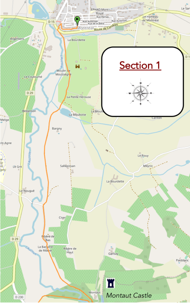
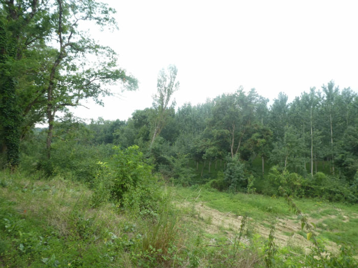
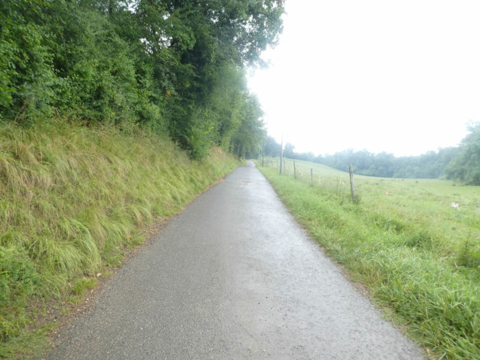
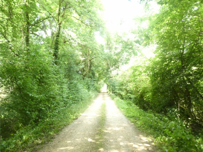
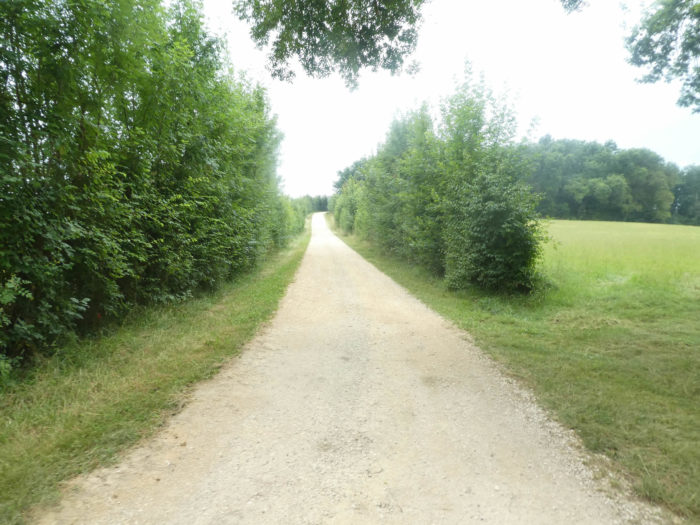
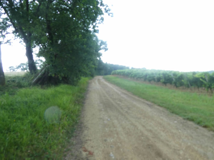
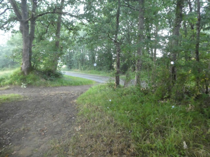
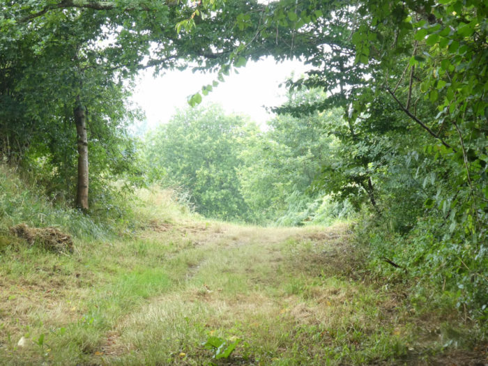
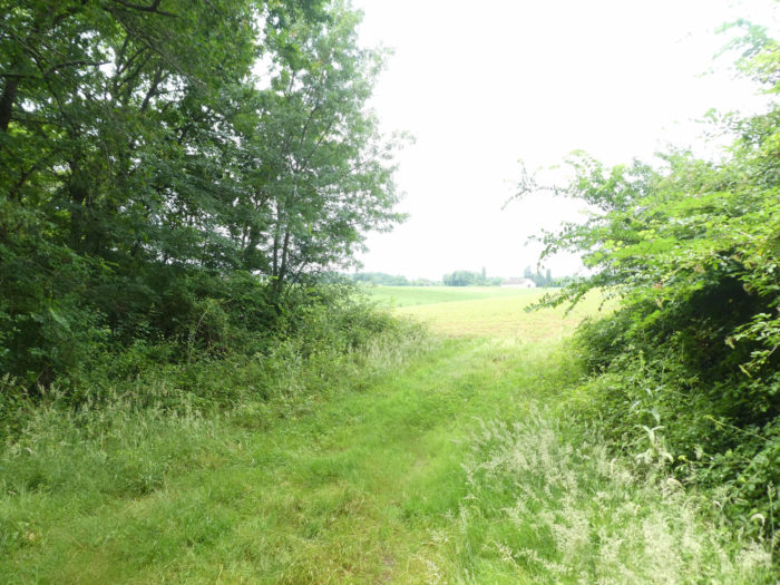
Section 1: In the undergrowth, near the banks of the Auzoue brook.
General overview of the difficulties of the route: course without any difficulty.
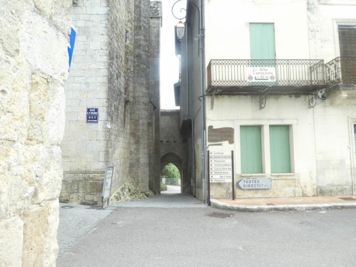
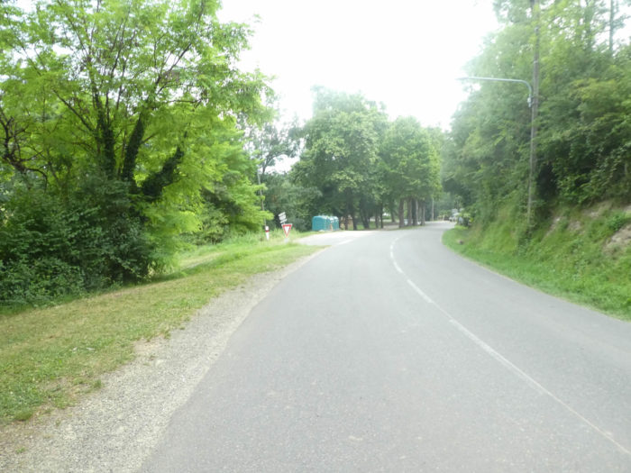
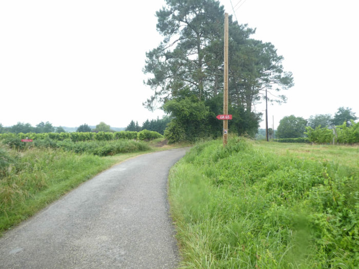
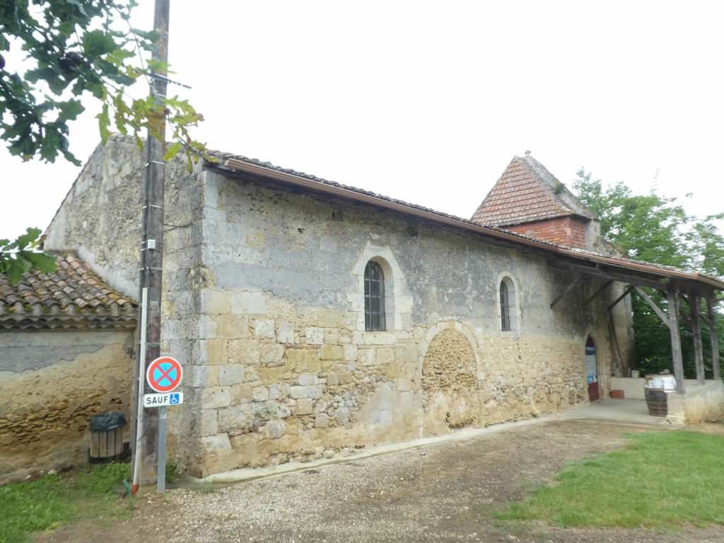
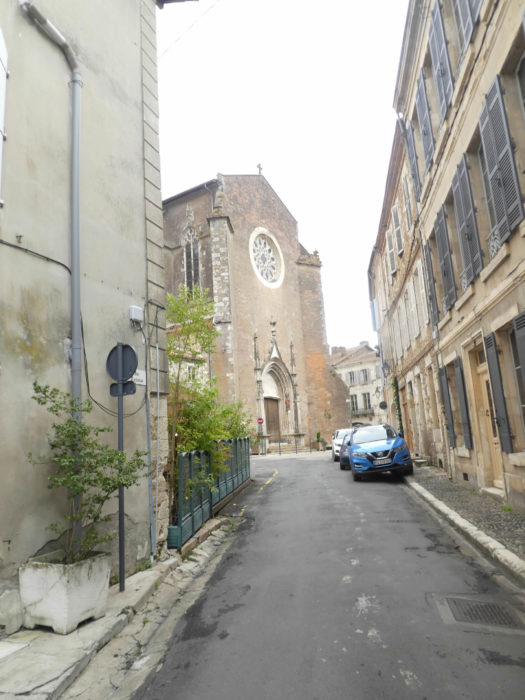
| The GR65 leaves Montreal crossing the rampart, which is still quite present on this side of the bastide. | |
 |
 |
| It runs along the road downhill along the high walls. | |
 |
 |
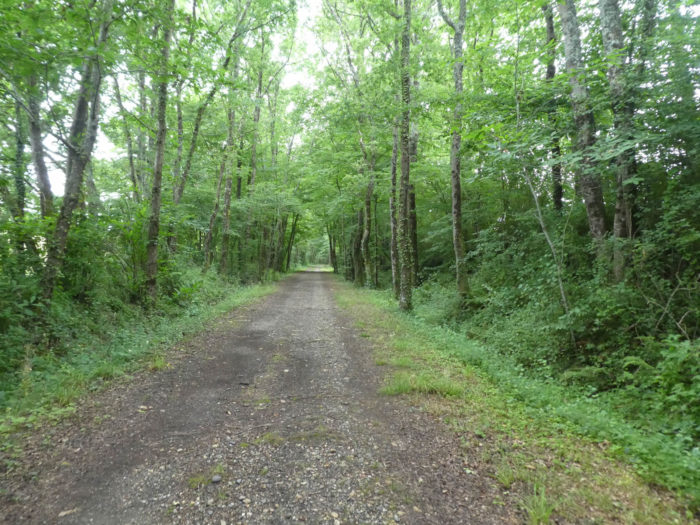
| The slope becomes tougher when GR path leaves the citadel. | |
 |
 |
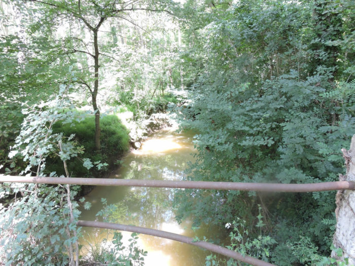
At the exit of the city, after having transited for a short time on the departmental road, the GR65 engages on a small road which heads towards the small dale where a tributary of the Auzoue flows, a small peaceful river, which is said to be rich in fish, and which flows a little further into the Gélise River, before finding the Baïse River back.
 |
 |
| Shortly after, the road crosses the stream and heads to the deciduous undergrowth. | |
 |
 |
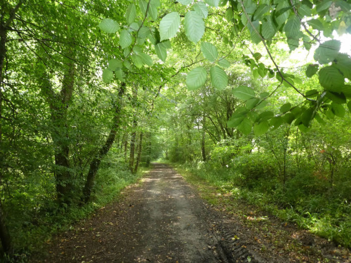
| The vegetation is exuberant here, in the oaks and the hornbeam shoots. There are fewer maples here and very few wild chestnuts. | |
 |
 |
| There are even real plantations of young ash trees. | |
 |
 |
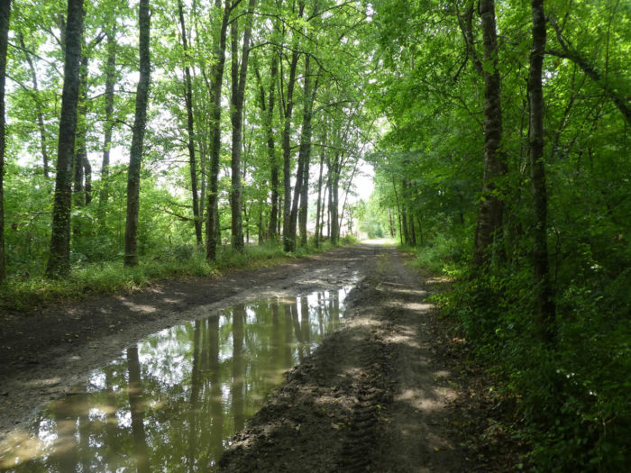
| We’re having a heavy downpour here today, so here are some pictures to illustrate the course taken at another time. Further on, the paved road gives way to a dirt track. | |
 |
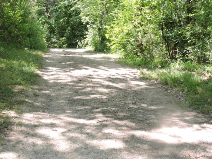 |
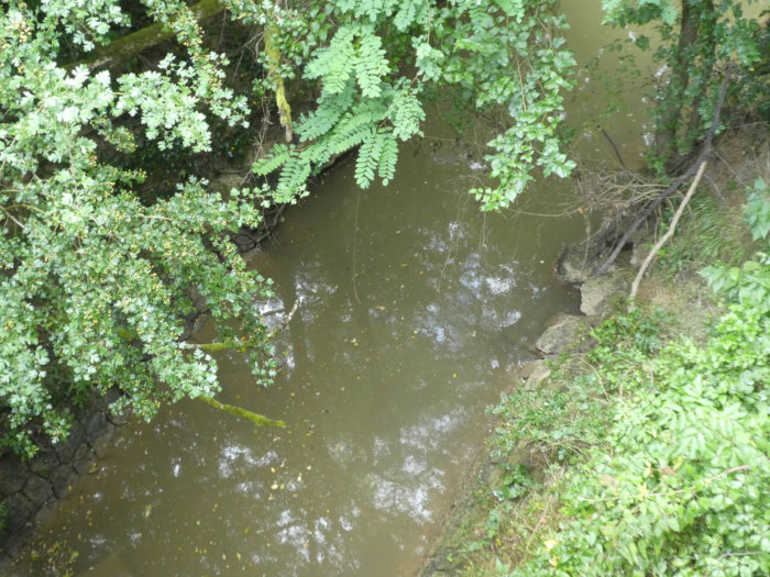
| Further afield, the pathway takes pleasure in sloping down again to touch the river, whose turbidity does not allow to detect the presence of trout, before getting out along the corn fields under the oaks and the hornbeams of the undergrowth. | |
 |
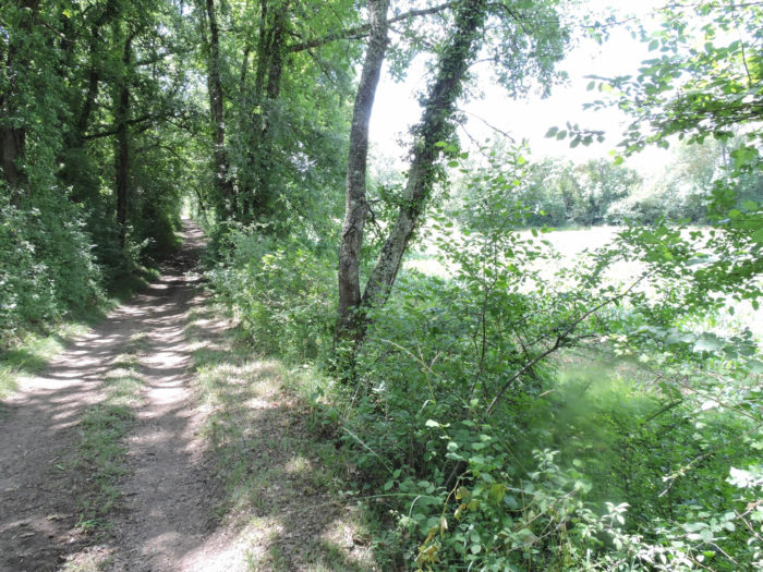 |
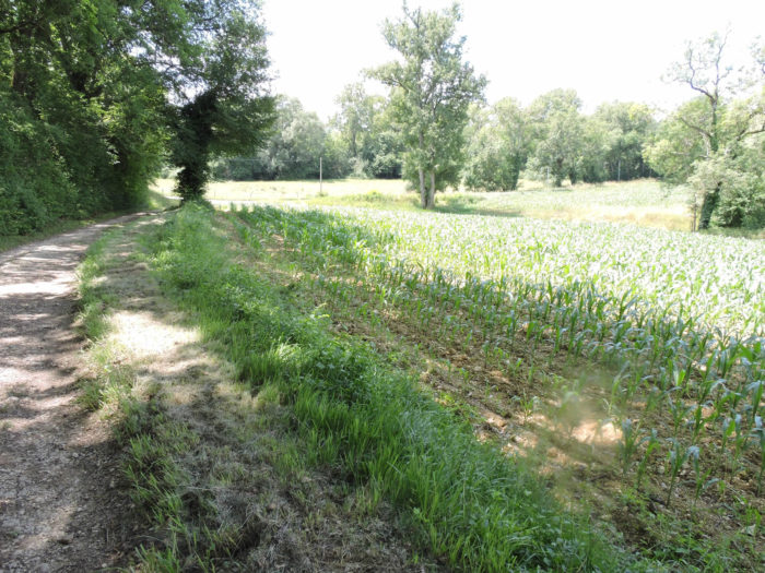
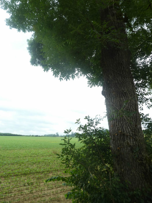
| When the pathway comes out of the undergrowth, you’ll mostly see fields of corn. The presence of streams, and therefore humidity, always favors this type of culture. At the end of the undergrowth, the pathway gives way to a paved road. | |
 |
 |
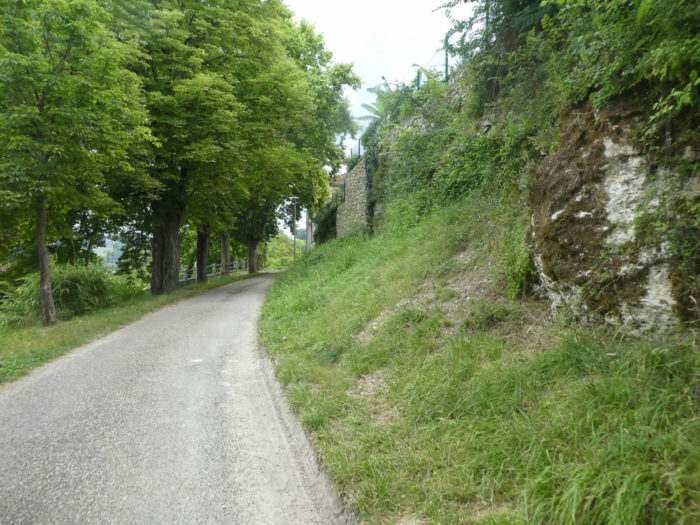
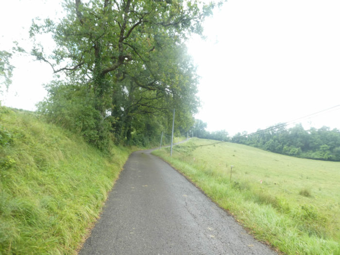
| For us today, the first storm has gone and the camera is back to working order. Here a road climbs through the meadows along the undergrowth. | |
 |
 |
| The slope is tough enough to reach up there, at the top of the ridge, the magnificent isolated stone houses of Ribère Le Bas. | |
 |
 |
| But GR path does not linger on the heights, and immediately slopes down into the dale. | |
 |
 |
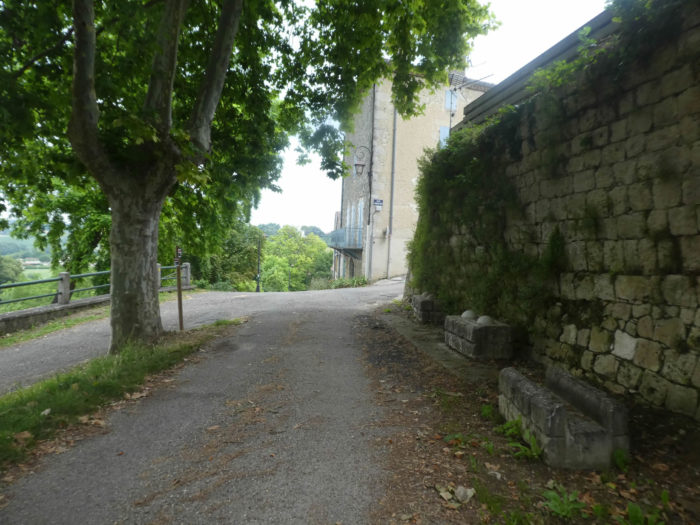
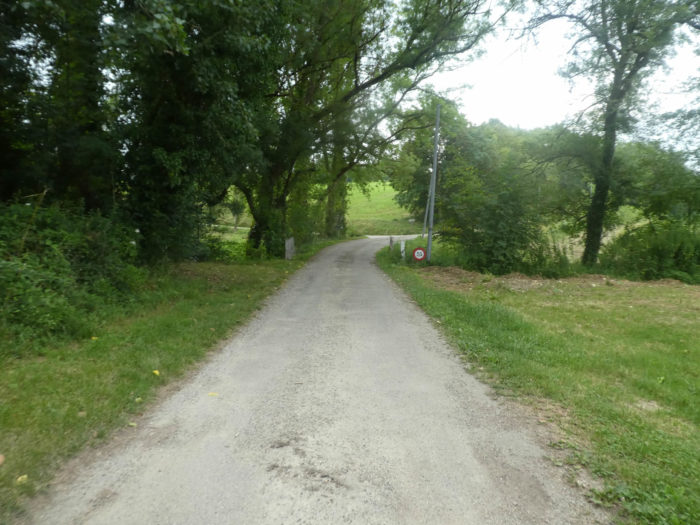
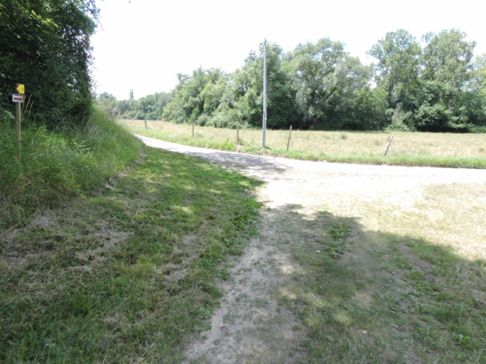
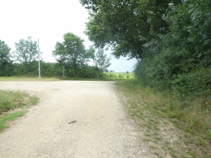
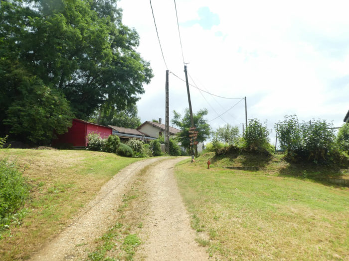
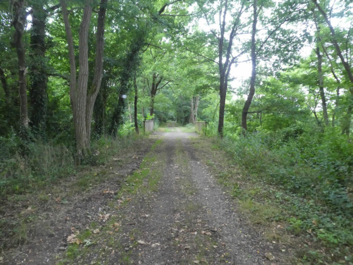
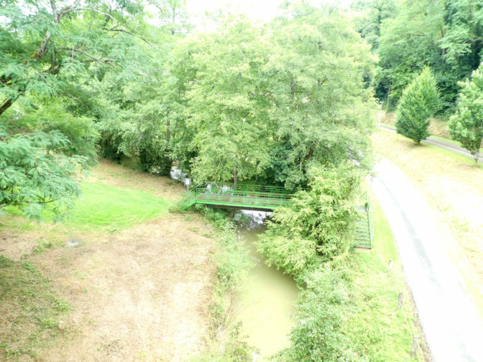
| Just below is Barrière de Ribère, where the route has since been altered, since now the track will follow the Green Way for a while, which returns from Gondrin and ends momentarily here. | |
 |
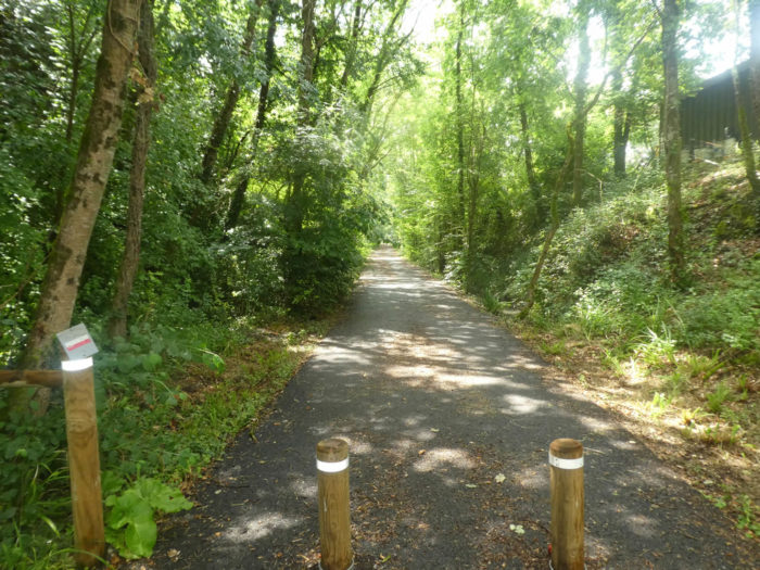 |
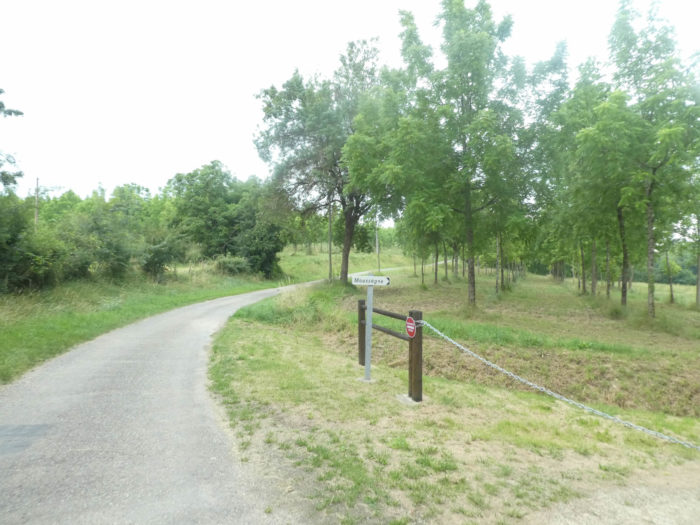
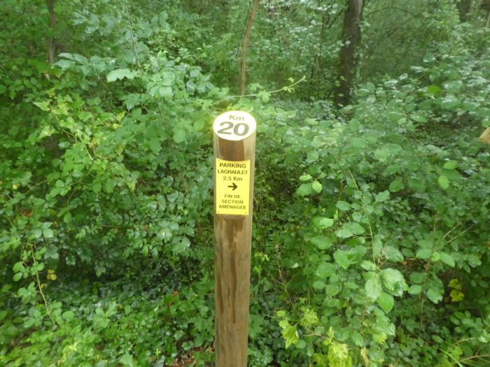
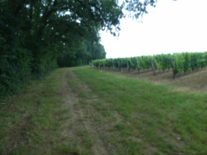
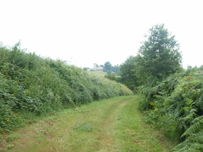
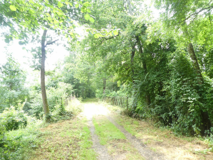
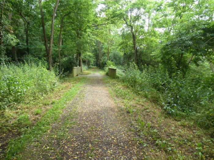
From Condom to here, the Voie Verte (Green Way) is 20 kilometers. It will be extended to Eauze, with a total length of 34 kilometers. It is therefore the same distance as on the Camino de Santiago. So, you could have come from Condom here by the Greenway, but you would not have gone to Montreal. As the route is that of the old railway line, you will not have suffered the hills and dales of GR path. When the Green Lane opens up to Eauze, you can bet that many pilgrims will walk through here, perhaps the GR track as well. Who knows?

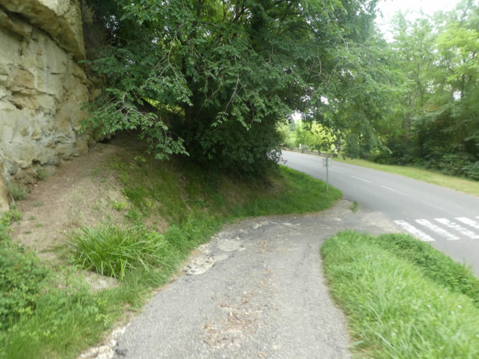
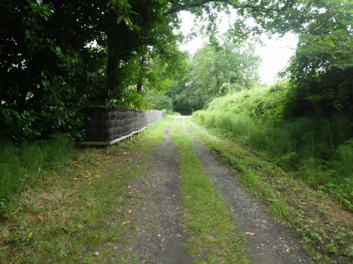
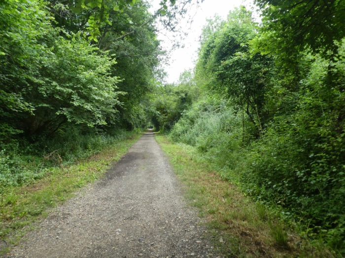
| This is what the Voie Verte looks like, a strip of asphalt among the trees. As we have practiced part of this route before Larressingle, here is some useful information if you think of going there one day. The way does not cross a village, but on the whole route you have the mileage and the parking places. Do not be fooled here, even if you think you are going in the wrong direction, as the lane is two-way, and you will not get to the advertised parking lot. You will leave the Green Way just a little further. | |
 |
 |
| When we passed here, calm reigned under oaks, hornbeams shoots and chestnut trees. Cyclists may have woken up late in the morning in Condom, in today’s gloomy weather. | |
 |
 |
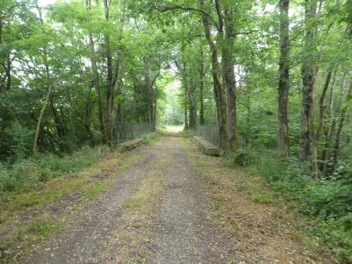
| There are artworks along the Green Way, works remaining from the old railway line. | |
 |
 |
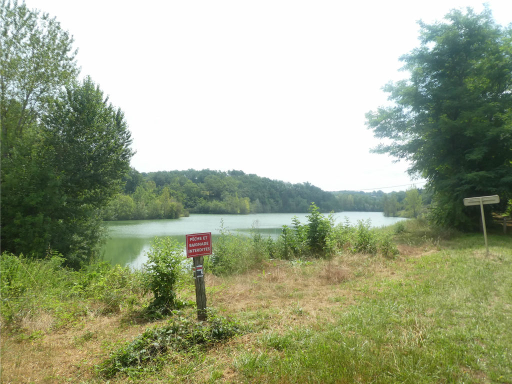
The pathway then arrives towards a small lake near the Château de Montaut, where GR path does not pass. The setting is peaceful and refreshing, but you can neither swim nor fish. This is also where you leave the Green Way, which returns to Condom.
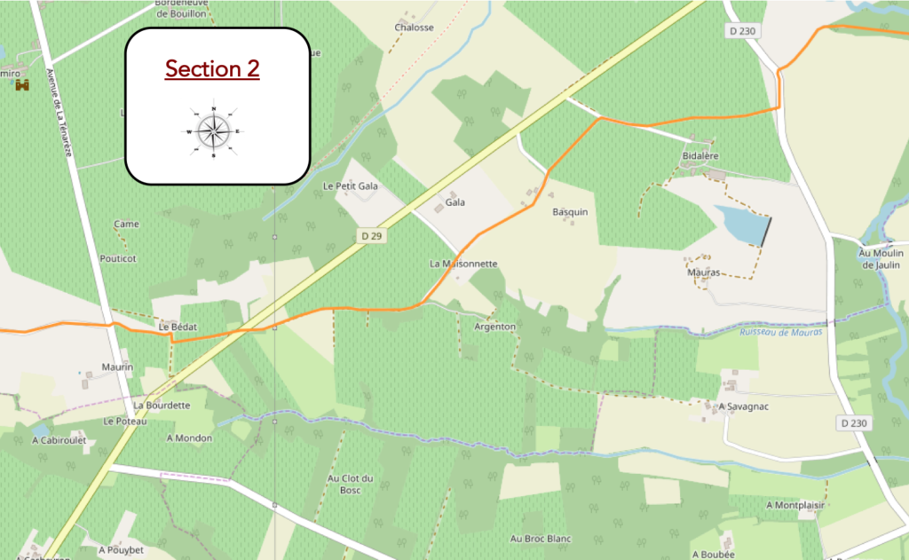
Section 2: Back to the sunflowers and the vineyard.
General overview of the difficulties of the route: course without any difficulty.
The GR65 crosses the stream again, or the river (it depends on the geographers!), before going away for a moment in a large pathway lined with hardwoods.
 |
 |
|
Huge, centuries-old ash trees accompany you on the dirty, as if you were going to enter a castle alley. |
|
 |
 |
| Farmers use the big means to water the fields. No doubt river water is used to do this. | |
 |
 |
|
At the end of the dirt road, the GR65 turns at a right angle on a tarmac road and climbs up from the small plain where the small river flows peacefully. |
|
 |
 |
|
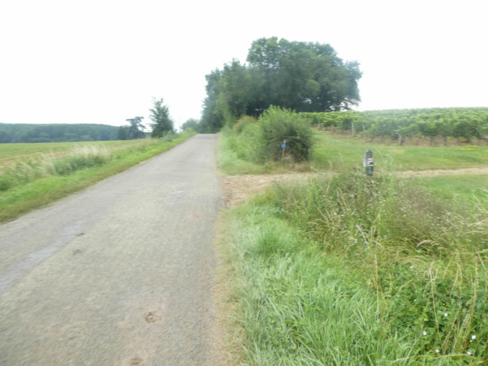
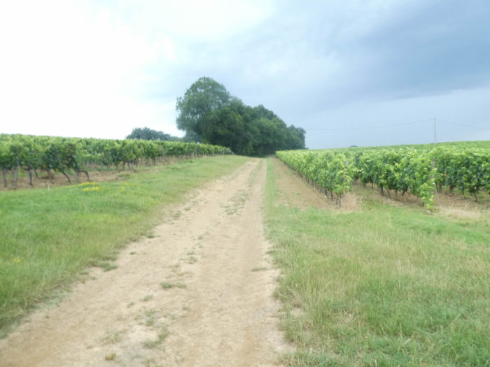
Further ahead, you’ll leave the tar to run resolutely into the land of vines along the hedges, where the pathway will dawdle for a while. |
|
 |
 |
|
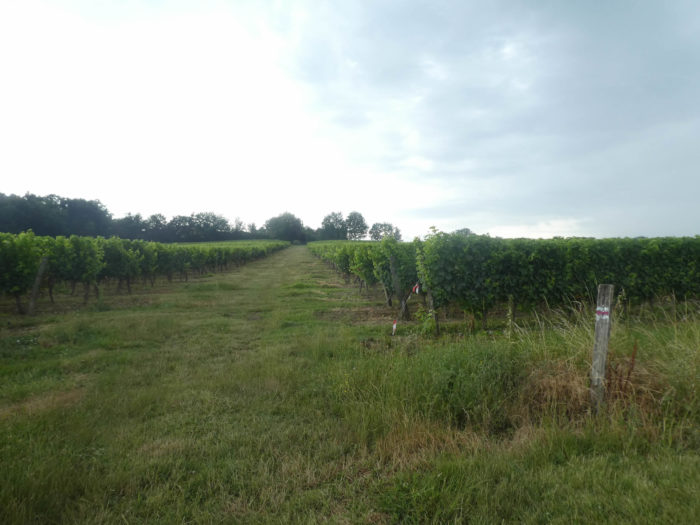
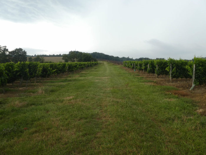
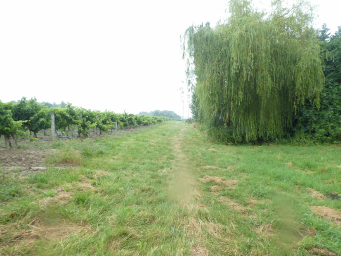
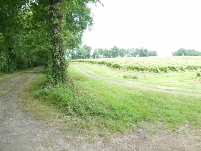
The vineyard is extensive here, and the pathway pleasant. A little further, the GR65 finds a small road again, still in the vineyards. |
|
 |
 |
|
What a pleasure to see these vines running on the hillside, to discover these vineyards, symbols of a thousand-year-old anchoring of know-how and a certain vision of elegance and beauty. |
|
 |
 |
|
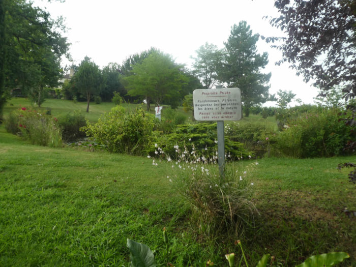
At a place called Basquin, the pathway even allows you to cross a private property, its small pond lined with water lilies. |
|
 |
 |
 |
 |
|
But now, the weather turns to rain and storm again. The pathway continues through the vineyard until you find a small dirt road. |
|
 |
 |
|
Now it is raining heavily, and water is flooding the dirt road, in the vineyard that has suddenly turned gray. These moments when nature is unleashed often pose logistical problems for the pilgrim. When he sees the sky take on big clouds, he often goes to dig at the bottom of the bag to find the saving cape. But sometimes he is taken aback. So, it’s the absolute urgency to have something dry to put on at the end of the stage. |
|
 |
 |
|
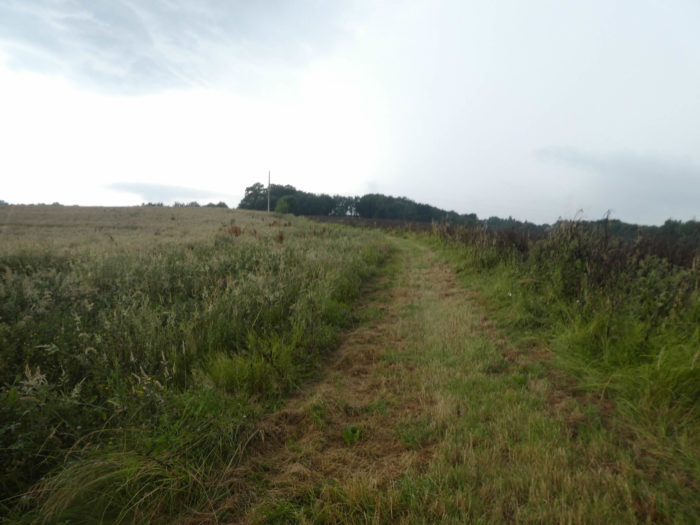
Fortunately, today the storm stops, as it appeared, the watering can almost empty, as it continues to drizzle. So, there is new thought for the pilgrim, to keep or to leave his distress uniform. Most of the time, the pilgrim keeps his cape on, before definitely seeing the sun rise. So, you walk, first again in the vineyard, then in the fallows, on a grass that has become soft sponge. |
|
 |
 |
|
Shortly after, the GR65 finds an asphalt road near an undergrowth. |
|
 |
 |
|
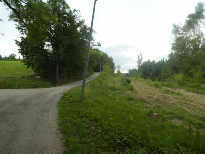
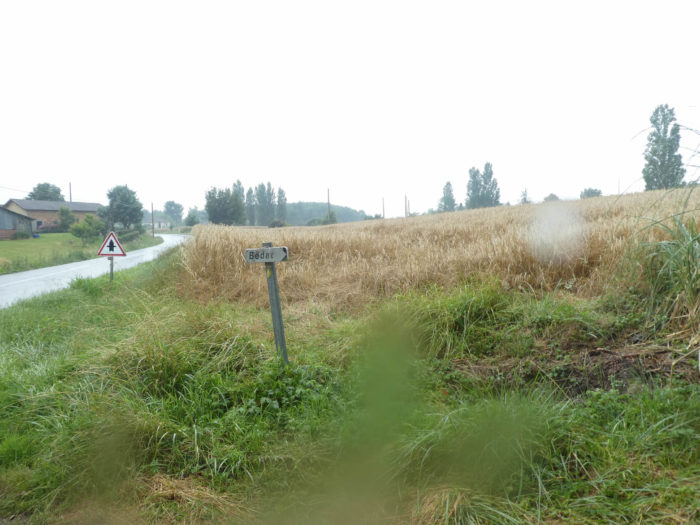
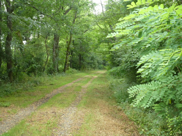
It runs parallel to the now washed-out road, before quickly finding a fork that heads towards Bédat, where cereals sometimes compete with the vines. You will hardly come across any head of cattle in Gers, or so rarely. |
|
 |
 |
|
Bédat is two or three houses under willows and cedars. No living soul in the area! But, we know that the track was designed to avoid humans as much as possible. When you walk around the many trails of Santiago track, you never know if the shutters are closed to protect from the gaze of pilgrims or if they are permanently drawn for eternity. Not here, can’t we see a car, a sign of life? |
|
 |
 |
|
Another little tour in the vineyards, and the GR65 returns to the asphalt road. |
|
 |
 |
|
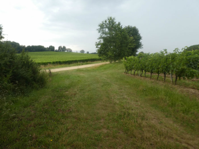
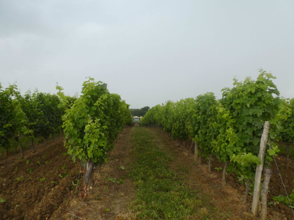
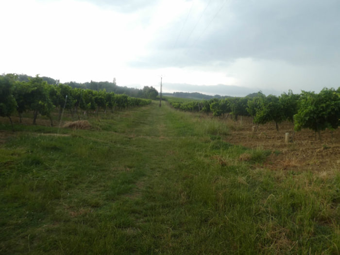
It then runs along the vineyards. When you see the vines here, which grow on flat ground, you understand that this is not a favorable region for the blossoming of great wines, but it is well suited to producing small country wines or even Armagnac. |
|
 |
 |
Section 3: A short stop at Lamothe, before the railroad?
 General overview of the difficulties of the route: course without any difficulty.

|
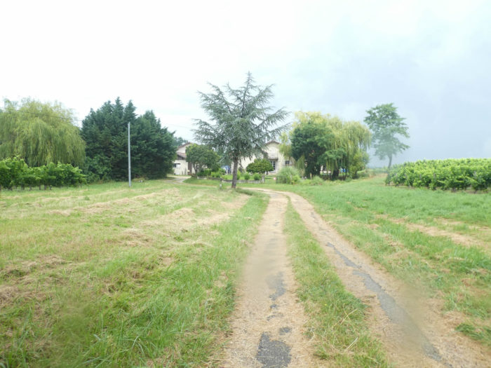
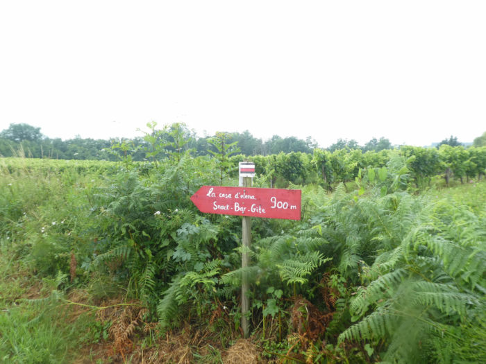
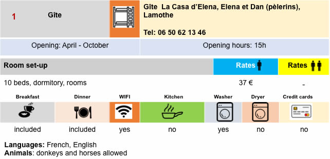
At the end of a long straight line, the GR65 leaves the vineyards to reach a pathway that runs along the fallows and the undergrowth. Here is announced Elena’s gîte, Lamothe’s halt, whose castle you can quickly guess in front of you. |
|
 |
 |
 |
 |
|
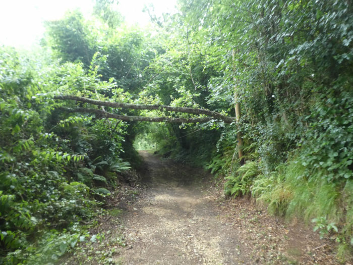
It is a pathway that nods between open spaces and undergrowth dominated by oaks, hornbeams and chestnut trees. The region is humid here, amid tall ferns and weeds. |
|
 |
 |
|
In the lush vegetation, the castle grows visibly. |
|
 |
 |
|
The slope is quite steep on a wide dirt road to climb to Lamothe. |
|
 |
 |
 |
 |
|
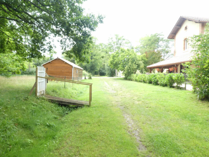
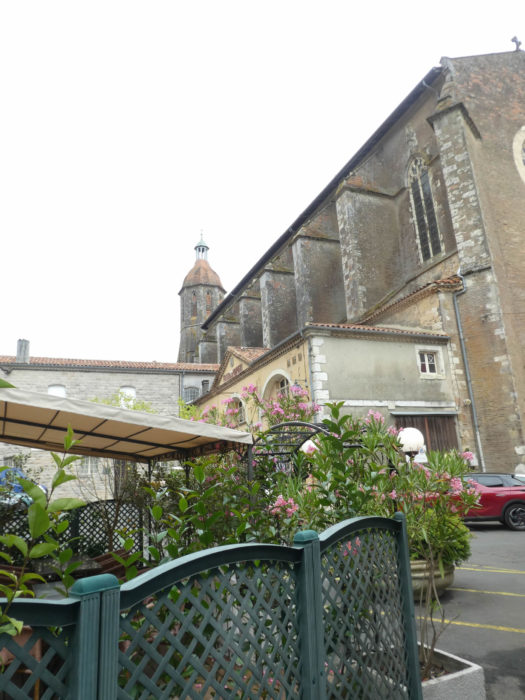
Fortunately, a gîte has a refreshment bar, an adorable bar with a very large choice. The pilgrim stops with pleasure and satisfaction. Here it will be announced to the harassed pilgrim who walks from Condom, without stopping in Montreal, that to reach Eauze, it is only happiness: 7 kilometers flat, in the shade, along the “royal alley”. So, the pilgrim even forgets to go to visit the tower of Lamothe on the hill, a 12th century lookout which dominates Izeute Valley, with the river which forms the border between Ténarèze and Bas-Armagnac. |
|
 |
 |
|
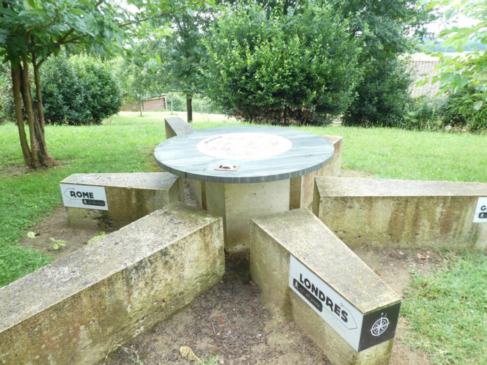
Coming down from the hill, the road passes by a small planisphere, where from now on you will no longer be allowed to lose the north. |
|
 |
 |
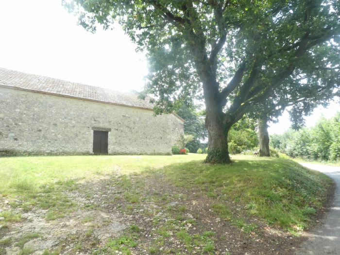
Nearby stands the beautiful little Romanesque chapel of Lamothe. The chapel which dates from the 11th century, little modified over the centuries, is today dedicated to St Vincent, patron saint of winegrowers.
|
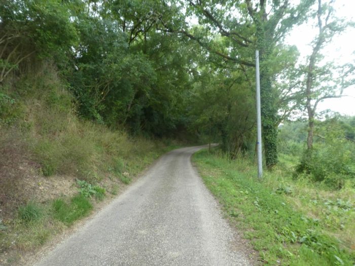
From here a wide dirt track descends into the undergrowth, steeply sloping. |
|
 |
 |
|
Here you leave Ténarèze for Bas-Armagnac. Cheers! |
|
 |
 |
|
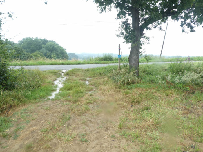
The pathway rejoins the plain, when it crosses the Izeute River, muddy and dark like all the rivers we have encountered in Gers. |
|
 |
 |
|
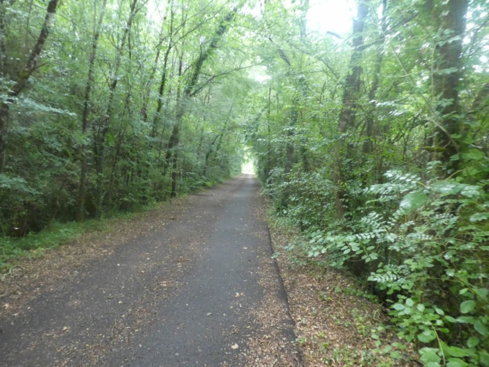
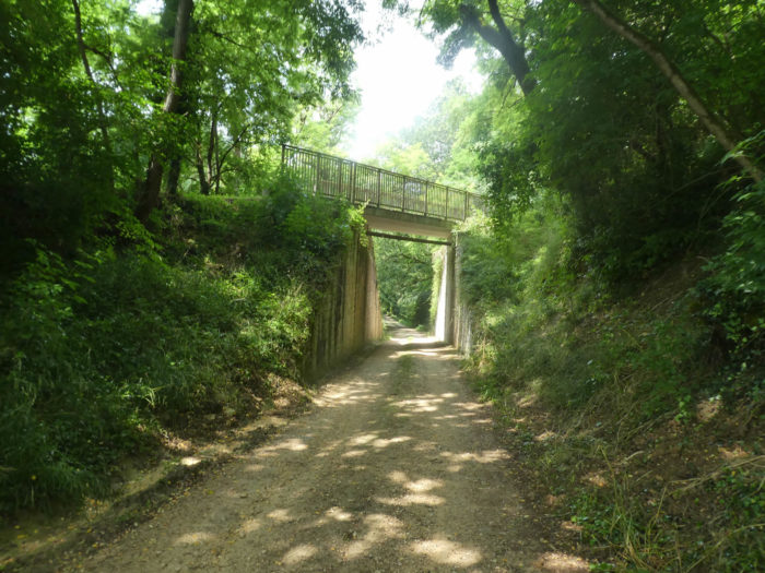
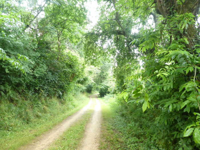
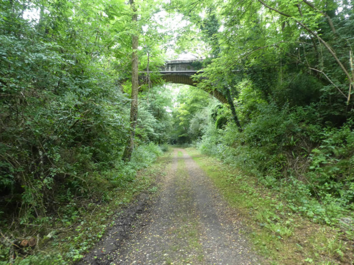
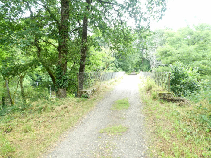
From here you will quickly understand your happiness. You have arrived on the old railway line. Rare works of art allowing the transit above and below the track remind you at leisure. So, let’s go to the Royal Alley, as they say here, to Eauze. |
|
 |
 |
|
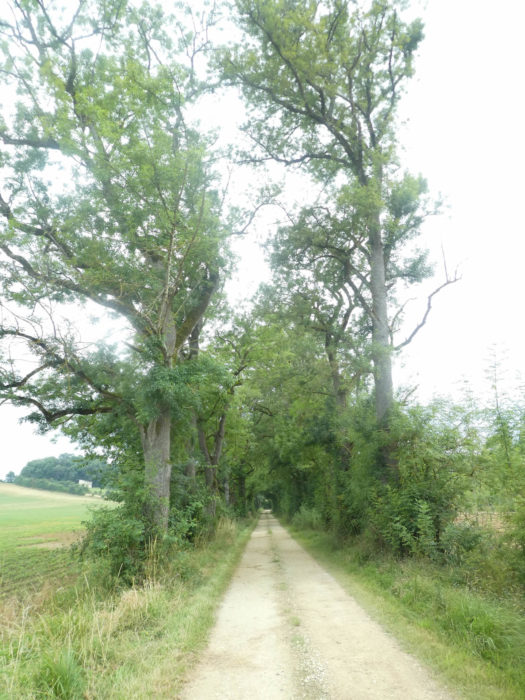
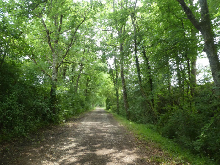
It is wide, calm, restful to the soul, and magnificent, along the leafy trees, straight as obelisks, which cast their shadow on you. |
|
 |
 |
|
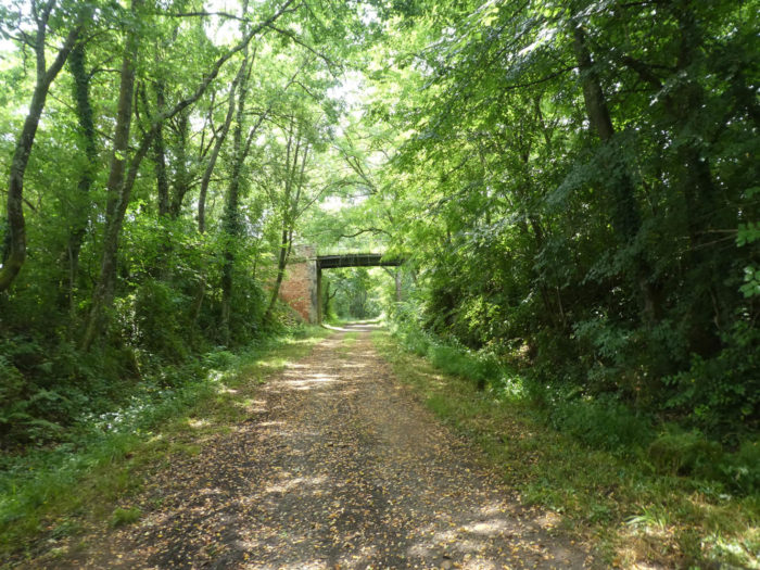
Rare holes in the trees allow you to take in a peek into the surrounding countryside. In fact, it is an artificial wood created from scratch to enclose the train in its universe. Sometimes the terrain shows some relics from past showers. |
|
 |
 |
|
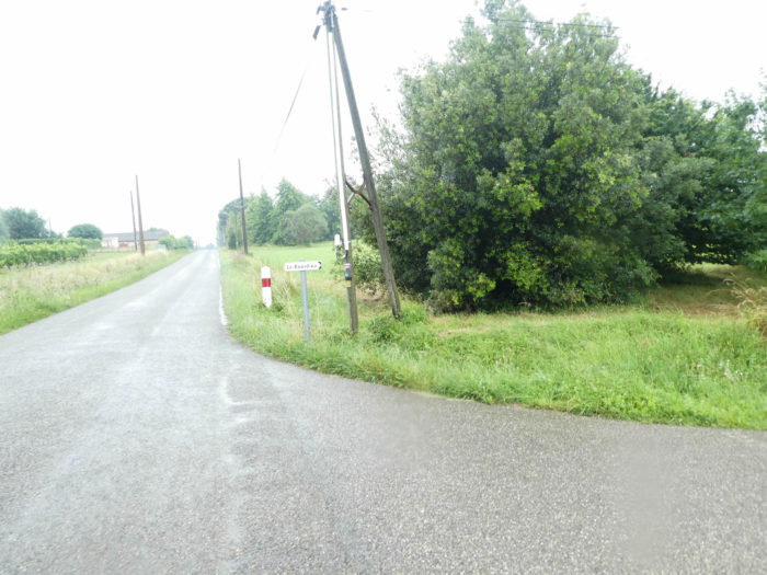
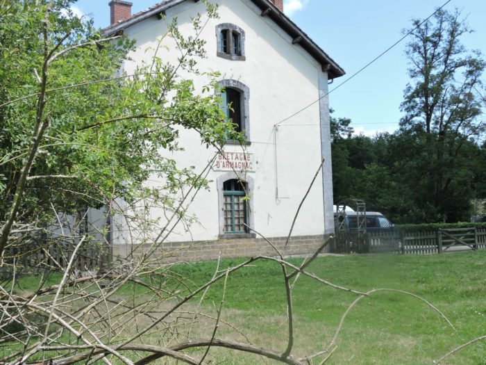
So, let’s dream a little more. Fairly quickly, the train arrives at Bretagne d´Armagnac station. Bretagne-Armagnac, everyone out! |
|
 |
 |
|
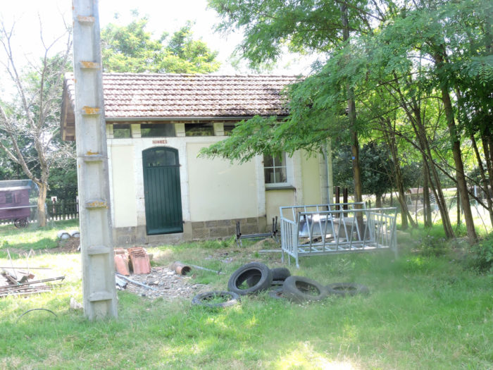
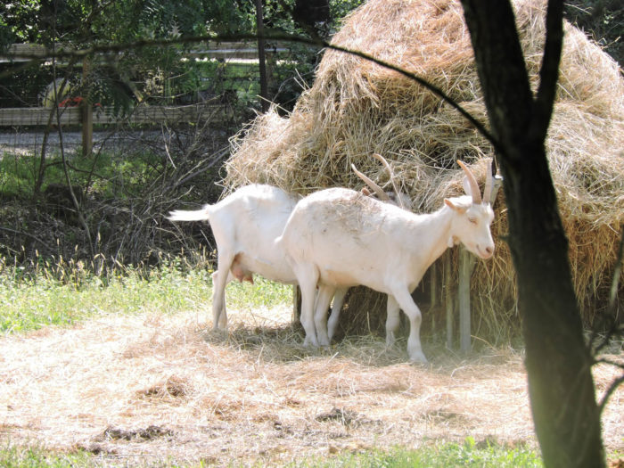
Not long ago, the goats were holding a meeting in the middle of the old tires in front of the men’s urinal. Today, ironically, it is an Englishman who bought the station and who understands only a few words of French. It was a single-track line, 56 kilometers long, connecting Auch to Eauze, passing through Condom and Montreal. Commissioned in 1909, it was definitively closed, and since eliminated, in 1954. Ah, the poor fate of the railway in France! The Camino de Santiago is used to crossing these wrecks. Some lines still have their old rusty rails, others are completely toothless. In France, there is Paris and the rest of France. But yes … Yet there are claims here and there that one day they will rehabilitate the old lines. But, certainly not here, the Englishman swore it to us. |
|
 |
 |
|
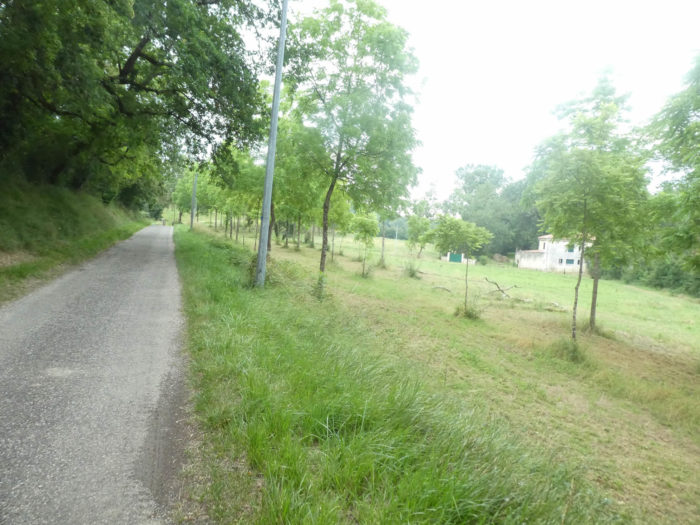
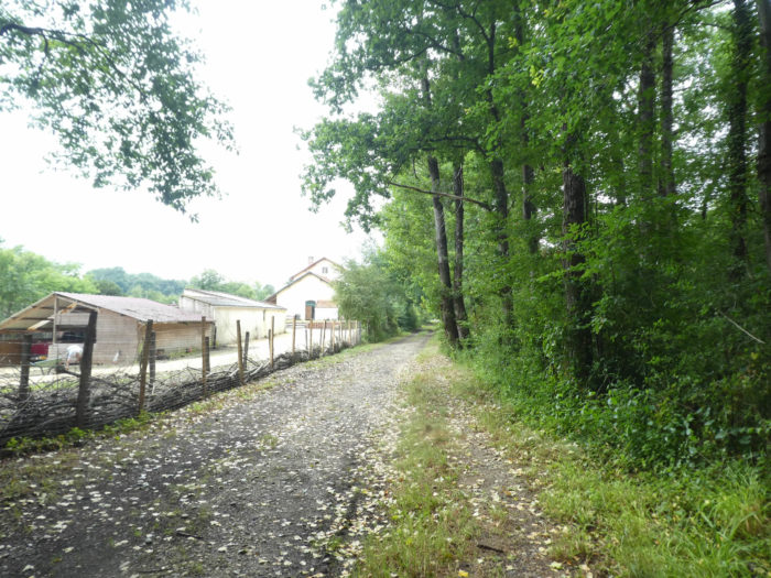
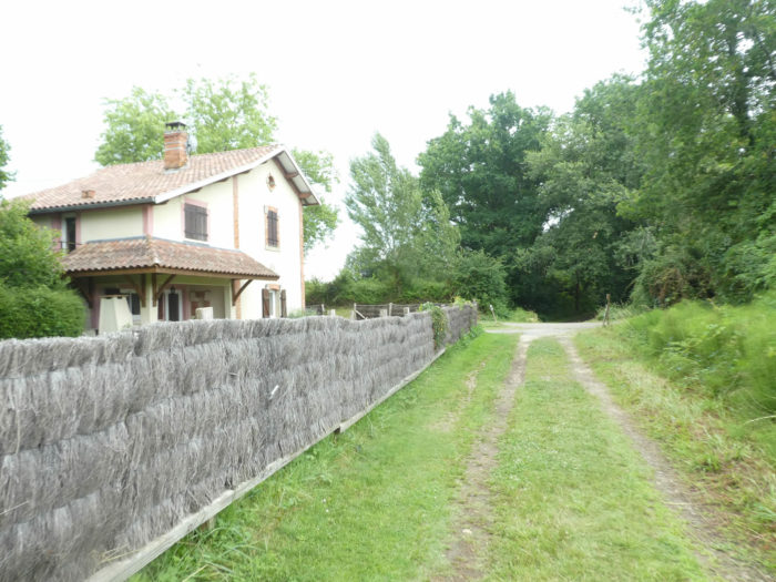
A stone’s throw from the station, there is a small road where you can escape for a little more distinguished accommodation off the road. The pilgrims, for the most part, are connected to the Internet, and when there is a network, which sometimes happens in France in remote lands, you can then join this type of accommodation, if the purchasing power allows it. |
|
 |
 |
|
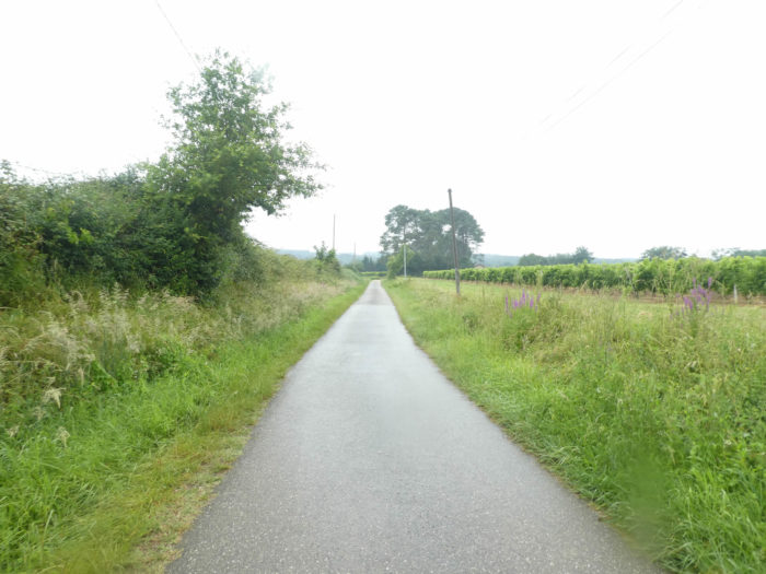
On this great avenue, the trees are all of great majesty. Oaks are not alone. There are many ash trees, but also hornbeams and sometimes sycamore maples. Here is the proof. |
|
 |
 |
|
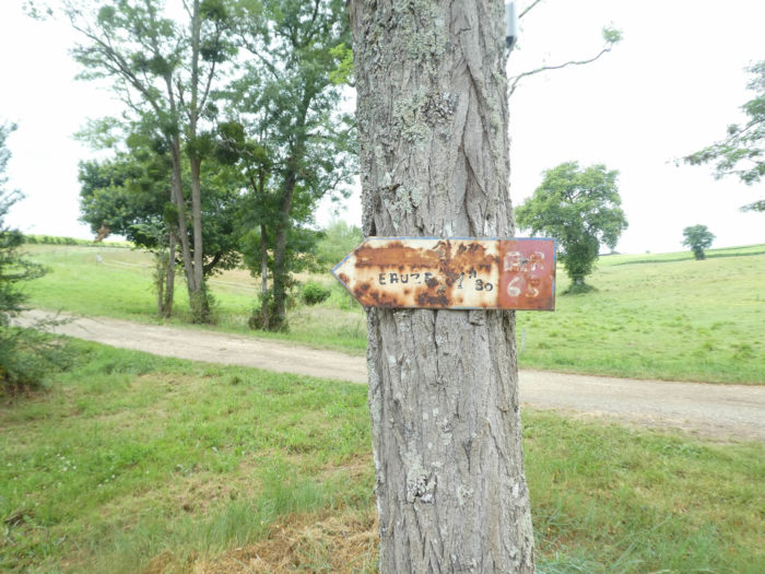
Don’t imagine that no one lived along this route once. Not all the houses were assigned to receive station masters. However, the sign indicating the direction must date from the era of the railroad, rusted for eternity. |
|
 |
 |
|
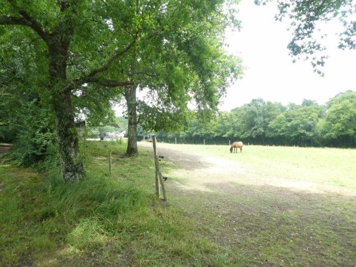
When it is possible to take a look out of the leafy alleys, you can see vines, in the middle of the meadows. Anyway, you walk in Bas-Armagnac. |
|
 |
 |
|
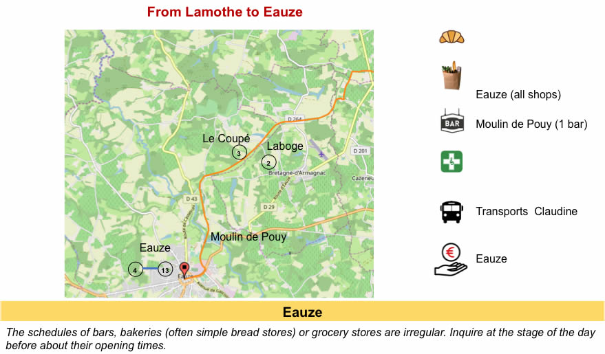
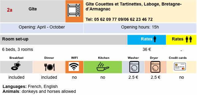
There are not many accommodations on this part of the track, but when they are present, they are signposted as here when the pathway runs near Le Coupé. |
|
 |
 |
Section 4: Eauze, a small quiet town, at the end of the railway line.
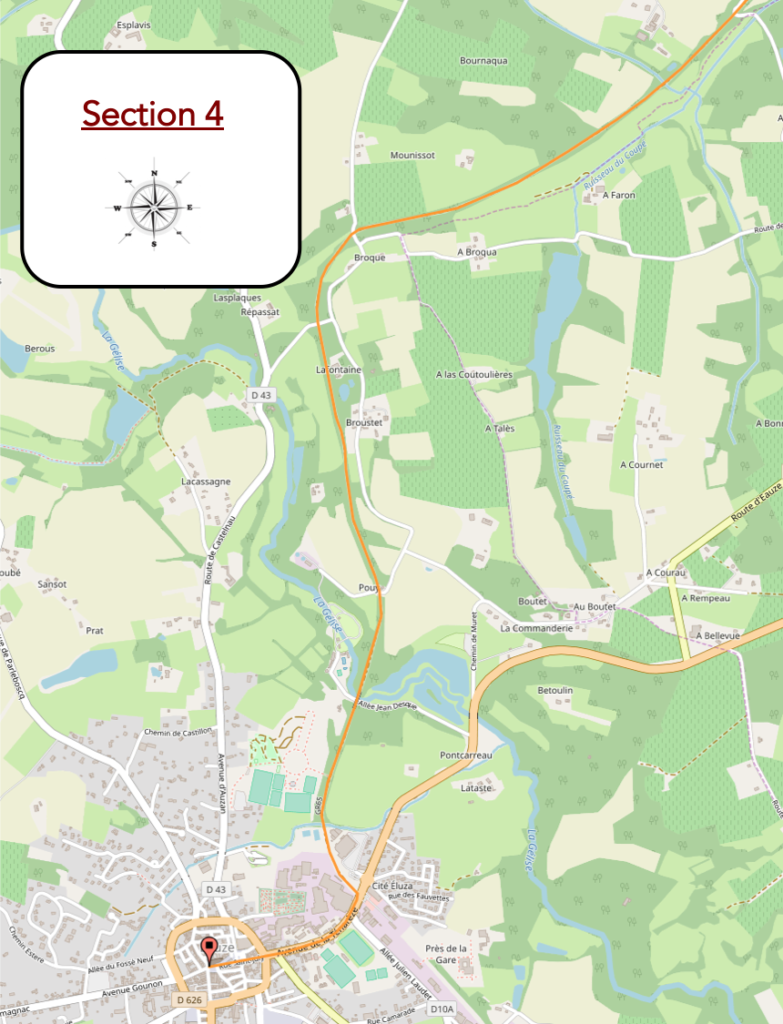
General overview of the difficulties of the route: course without any difficulty.
|
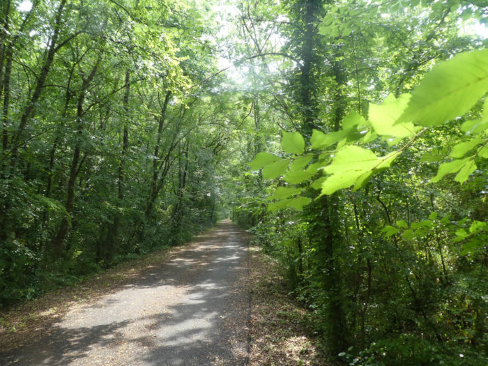
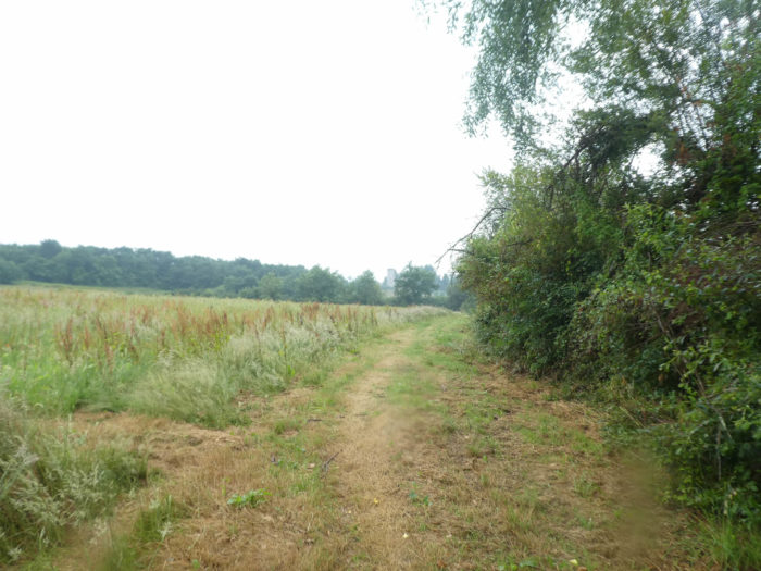
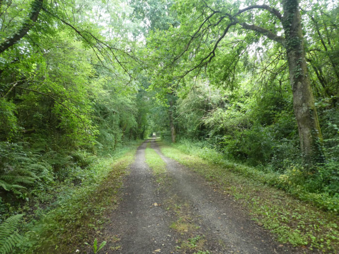
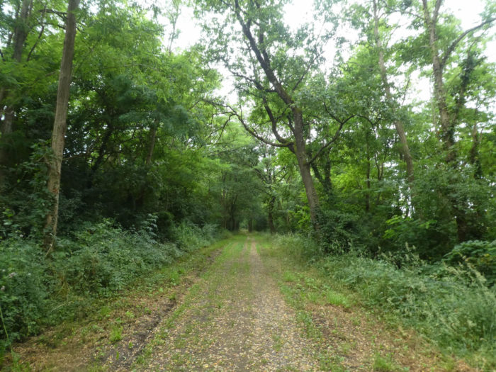
And the landscape repeats itself over and over. Here is the world of silence. Alas, there is hardly any song of birds in our forests, except the whisper of the wind caressing the leaves of the trees. |
|
 |
 |
|
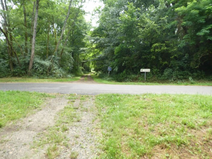
It is very likely that for those who will pass by here in the coming years (but when?), you will no longer be able to walk on dirt, but on asphalt, because the Greenway is programmed to head to Eauze. On the other hand, the structures of the old railway line will undoubtedly remain immutable, allowing small roads to pass through, which for you lead nowhere, but not for the locals. |
|
 |
 |
|
Is it really necessary to tell you that here you are walking through a small area where the chestnut trees have taken over? But it doesn’t last. |
|
 |
 |
|
Further on, the artworks are more present. Would you get closer to civilization again? |
|
 |
 |
 |
 |
|
You are indeed getting closer to Eauze. Here is a house by the side of the road. No doubt, an old station. But for whom? There are no homes all around. |
|
 |
 |
|
Approaching Eauze, near Moulin du Puy campsite, the dirt road crosses the Gélise River. |
|
 |
 |
|
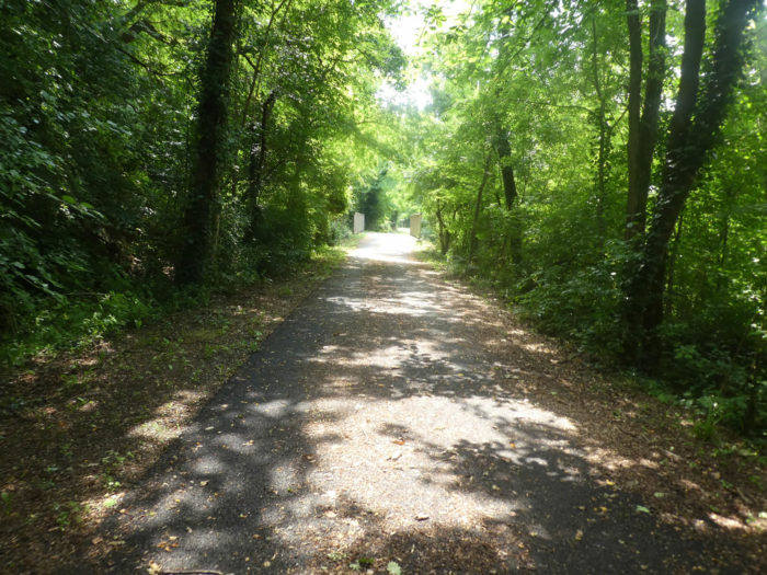
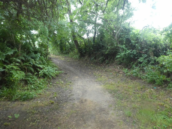
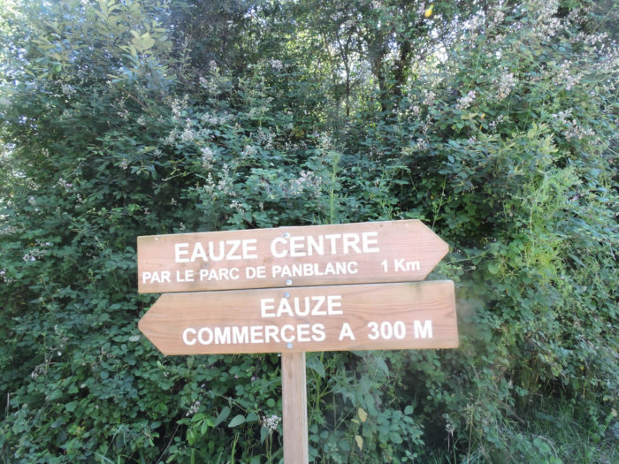
After another short passage in the forest, the pathway arrives near the city. At your choice to get there. Towards the shops, near the industrial zone, or across the park. |
|
 |
 |
|
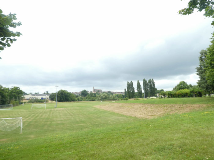
By giving up shops, the route crosses a large park, near the sports complex. From here you can see the church. |
|
 |
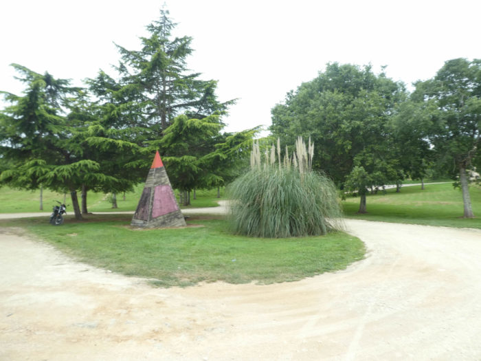 |
|
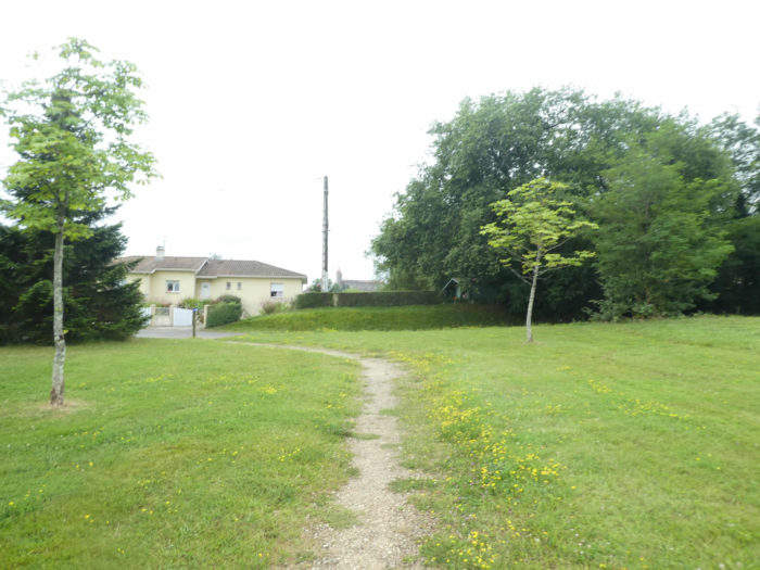
On leaving the park, the route crosses the suburbs for a long time … |
|
 |
 |
 |
 |
|
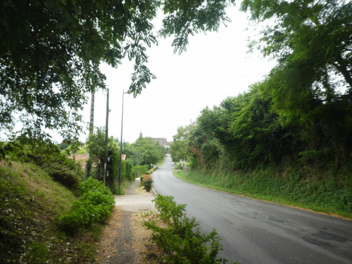
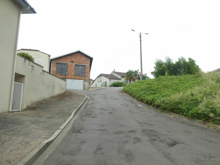
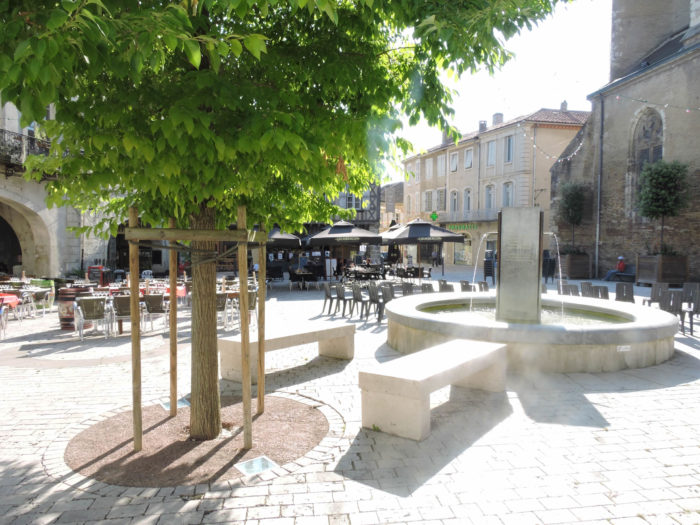
… before arriving through narrow streets in the city center. City, finally, so to say, Eauze has only 4,000 inhabitants. But it is the capital of Armagnac. |
|
 |
 |
|
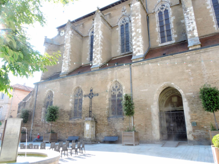
Eauze, former Elusa, capital of the Elusates, former Basque people, became Roman, a flourishing city in the High Middle Ages. It was later destroyed. In the 10th century, the city developed again around a monastery dedicated to St Luperc. The medieval city experienced later a new development, protecting itself behind ramparts and ditches, of which only few traces remain today, having been cut down by order of Richelieu in the 17th century, during the Wars of Religion. The church, dedicated to St Luperc, is a former bishopric, now a cathedral, built at the beginning of the 16th century, in Gothic style. Life is mostly concentrated around the church square, under the arcades of the Armagnac square. |
|
 |
 |
It was there that Jeanne d´Albret, mother of Henri IV, owned a beautiful half-timbered house, which has now become the Café de France. Moreover, Henri III of Navarre, the future Henri IV, stayed here with his wife, Queen Margot, in his mother’s house.

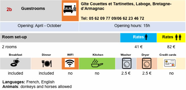
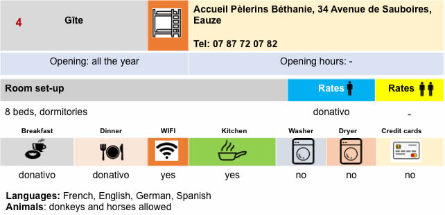
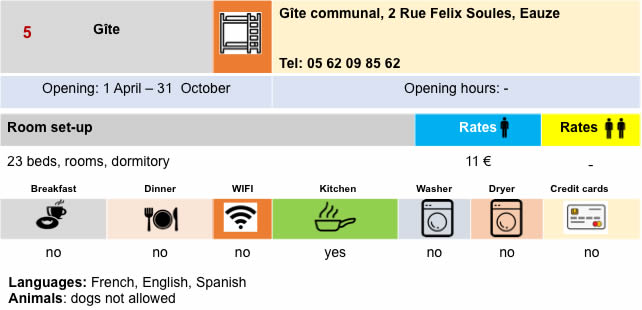
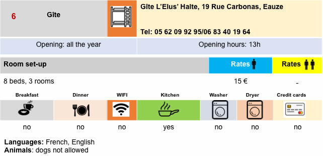
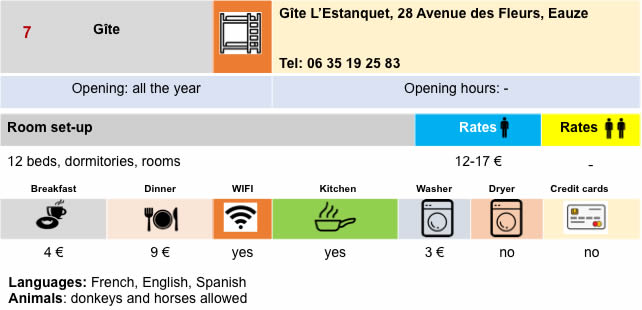
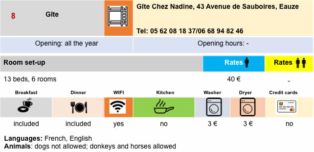
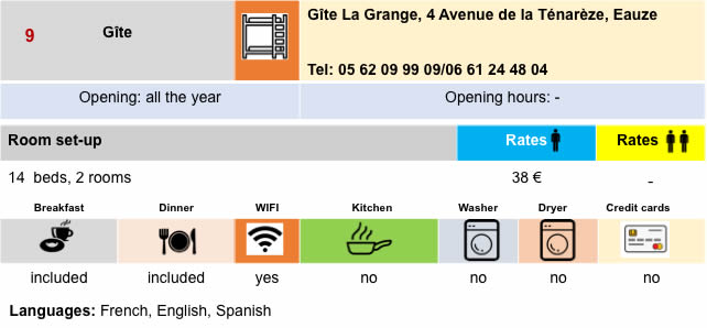
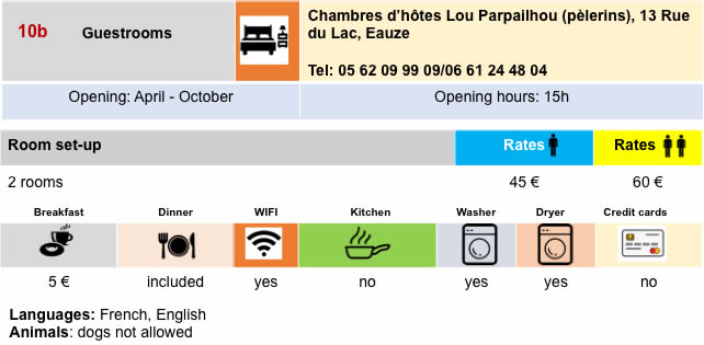
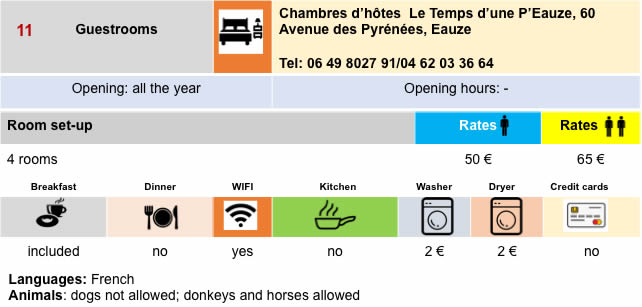
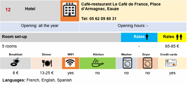
Lodging

 |
 |
 |
 |
 |
 |
 |
 |
 |
 |
 |
 |
 |
 |
Feel free to add comments. This is often how you move up the Google hierarchy, and how more pilgrims will have access to the site.
 |
Next stage : Stage 27: From Eauze to Nogaro |
 |
Back to menu |