
A little bit of floc or Armagnac to make “vroom-vroom”
DIDIER HEUMANN, MILENA DALLA PIAZZA, ANDREAS PAPASAVVAS

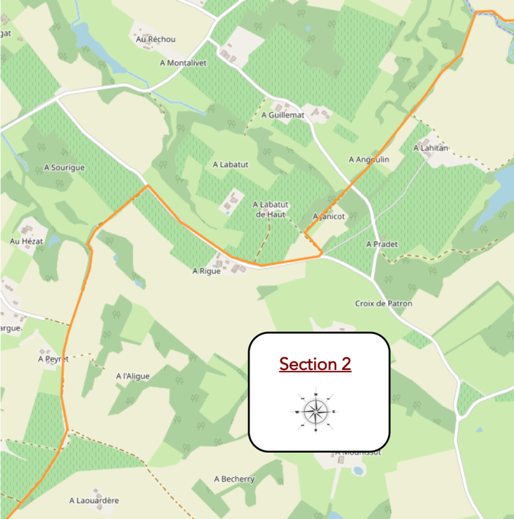
We divided the course into several sections to make it easier to see. For each section, the maps show the course, the slopes found on the course, and the state of the roads. The courses were drawn on the « Wikilocs » platform. Today, it is no longer necessary to walk around with detailed maps in your pocket or bag. If you have a mobile phone or tablet, you can easily follow routes live.
For this stage, here is the link:
https://fr.wikiloc.com/itineraires-randonnee/de-eauze-a-nogaro-par-le-gr65-30854621
It is obviously not the case for all pilgrims to be comfortable with reading GPS and routes on a laptop, and there are still many places in France without an Internet connection. Therefore, you can find a book on Amazon that deals with this course. Click on the book title to open Amazon.
 |
The Camino de Santiago in France. VI. From Cahors to St Jean-Pied-de-Port (Via Podiensis) on GR65 track |
If you only want to consult lodging of the stage, go directly to the bottom of the page.
Today you are walking in Bas Armagnac and the route is still heading south-west.

Who says Bas-Armagnac also says Armagnac, therefore liqueur. In 2011, of the 12,000 hectares devoted to making Armagnac, most came from Gers, the rest from Landes or Lot-et-Garonne. These areas are much less than the 80,000 hectares used for the production of Cognac. A large part of these wine-growing areas provides production that is sold directly in the form of local or table wine, the Côtes de Gascogne in particular. You will come across a number of these regional appellations on the route, in particular the domain of St Mont or the Côtes-de-Gascogne.
Obviously, the flavor and subtlety of Armagnac has a lot to do with the terroir of their origin. At least, it is believed. The subtlest of the Armagnacs is that of Bas-Armagnac or Black Armagnac. It is quite wooded, produced straddling the west of the Gers (around Nogaro and Eauze) and the south-east of the Landes (Villeneuve-de-Marsan). The land is made up of gently sloping hillsides, cut by Douze and Midour rivers, which flow north-west to flow into Adour River. The subsoil is made up of a thick layer of clay and ferruginous sands. The terraces and valley bottoms, formed by molasses, are not cultivated for vines. Long live the clay, which produces fine, fruity and complex liqueurs! In Ténarèze and Condomois, Armagnacs are also made, straddling the north of the Gers (around Condom) and the south of Lot-et-Garonne. Here the landscape is cut by the valleys of Gélise, Auzoue, Osse and Baïse, all rivers that flow northward to empty into Garonne River. Here limestone clearly dominates over the clay. This basement is shallower than at the bottom of Armagnac and the Armagnacs are more full-bodied, more apt to age. Do not conclude anything from this gibberish. The vine is much subtler than all that. Of course, the great Pétrus bathes his feet in clay, but the great Burgundy wines are all produced on limestone.
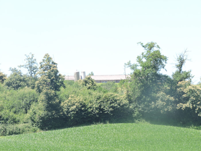
In Haut Armagnac, to the east of the appellation, Armagnac is called White Armagnac because of the hills made up of marls, molasses and pebbles. Why is Armagnac less famous here? Go figure it out, mystery … But before tasting Armagnac, if you feel like it, you will no doubt eat duck, and nothing but duck in all its forms, everywhere in guest rooms and the restaurants. And yet, on the way, you may not meet any. And yet they are there, locked inside. A silo near a farm signals the presence of birds. And to feed your birds, you need a lot of corn. Corn, here is not what is missing. It took the place of wheat.
At the end of the stage, you will arrive in Nogaro, a small town which makes “vroom-vroom” at the end of Gers department.
Difficulty of the course: Slope variations today are minimal (+226 meters/-285 meters). The stage is not long, without any difficulty. The slopes are sometimes a little steeper as you walk down and up from one stream to another.

One more stage, it has become a habit, where you’ll walk as much on tar as on dirt or grass pathways:
- Paved roads: 10.2 km
- Dirt roads: 10.5 km
Sometimes, for reasons of logistics or housing possibilities, these stages mix routes operated on different days, having passed several times on Via Podiensis. From then on, the skies, the rain, or the seasons can vary. But, generally this is not the case, and in fact this does not change the description of the course.
It is very difficult to specify with certainty the incline of the slopes, whatever the system you use.
For « real slopes », reread the mileage manual on the home page.

Section 1: On your way to the first ducks on Santiago track.

General overview of the difficulties of the route: course without any difficulty.
| Let’s change the period today and describe the route taken on a beautiful day in mid-June. The GR65 leaves Eauze up the national road, along the Avenue des Pyrénées, in the southern suburbs. | |
 |
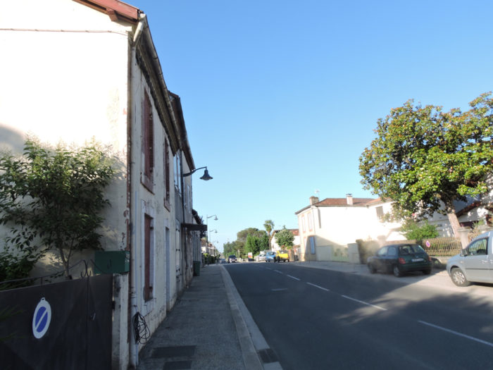 |
| Then it leaves the main road for a smaller road in the middle of the scattered villas. | |
 |
 |
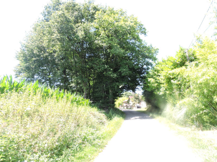
| Quite quickly, behind the last houses of the borough, you’ll find yourself in the countryside. | |
 |
 |
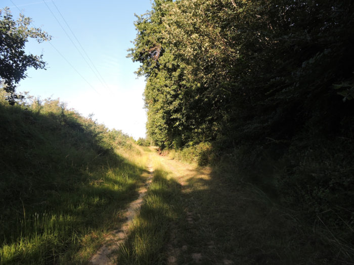
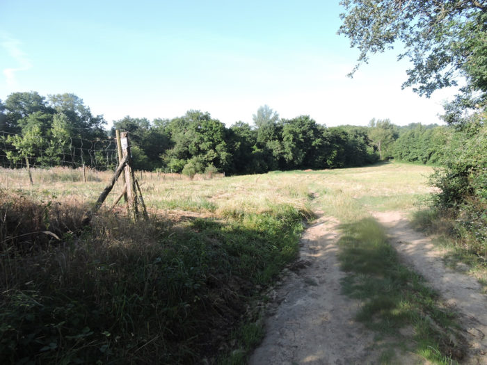
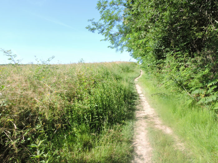
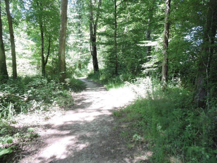
| The road is a dead end and then a pathway takes over and gently climbs in the undergrowth in the middle of tall grass and bushes. Here again oaks still rule. | |
 |
 |
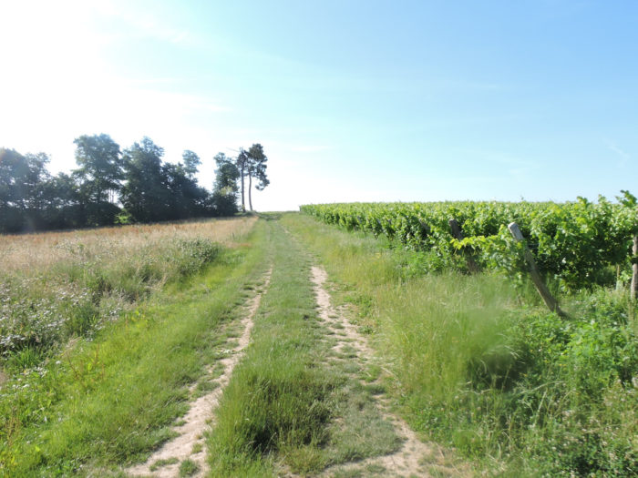
| Further up, the track finds a road, at the height of the vineyard, on the side of Monplaisir locality. | |
 |
 |
| Here, you are told that you are entering the areas of the Côtes de Gascogne. But you were already there in the previous stages. While the borders of Gascony have evolved over the centuries, this cultural entity can be found today in the departments of Gers, Landes and Hautes Pyrénées. While in the southwest, red wine is produced first, the Côtes de Gascogne prefer white, dry or sweet wines. The vineyard is mainly located in Gers, much less in Landes. These are wines that go largely for export. A significant quantity is reserved for the production of Armagnac.
The GR65 does not linger on the road. it crosses it to immediately enter the vineyard. |
|
 |
 |
| There are vines, but soon they will disappear in favor of other crops, especially corn, but also soybeans and beets, which are barely growing. | |
 |
 |
 |
 |
The pathway slopes up gently in this beautiful hillside where the cultures are very diversified and the peasant houses are quite present. Further up, the pathway joins a paved road.
 |
 |
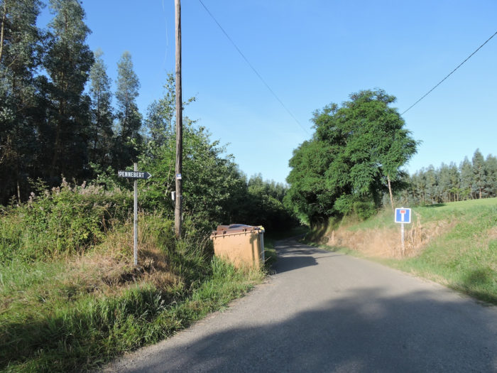
| Further afield, the road slopes up in the countryside towards Pénebert hamlet, in the middle of oaks and ash trees. | |
 |
 |
 |
 |
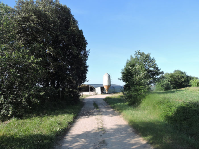
| The silos are not there to store grape harvest! You are here in front of the first silo encountered on the way. But you will see others. They are an integral part of the arsenal of poultry farmers, especially ducks. | |
 |
 |
The Gers Label Rouge free-range chicken was born in 1975. Today, the sector has 300 poultry producers, who are also mostly farmers. These slow growing chickens are raised 81 days instead of 40 for industrial chickens. Fed 75% grain, less crowded in buildings, they live in the open air for the last six weeks. The breeding conditions explain the taste quality. In return, they are sold twice as expensive. This breeding is taking off, but quantitatively it is far behind its direct competitors of free-range chickens Loué, up north of France and those in Landes department.
Here you will not see these much-vaunted free-range chickens. You will have to settle for ducks, although you will rarely see the birds in the open air. So, take a long time to contemplate them in the middle of nature. It’s a privilege, really.

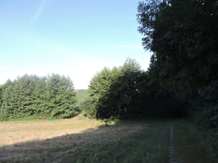
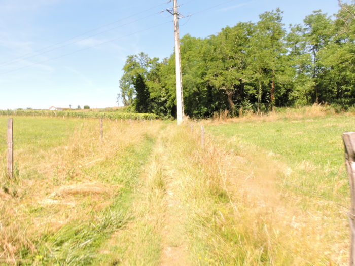
| Behind the corn silo, a dirt and grass lane leaves the countryside to descend into the arid undergrowth. | |
 |
 |
| It then spins on a gentle slope between the undergrowth and the meadows in the ash trees and in the oaks. | |
 |
 |
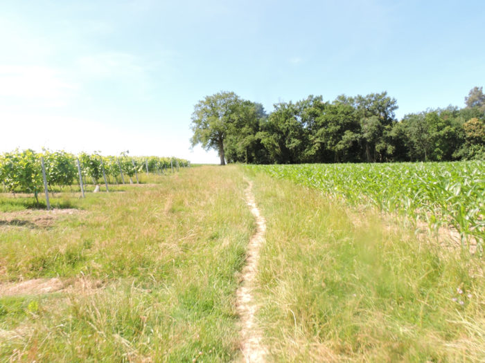
| Further down, you’ll walk in the corn fields. Corn loves water and you will see it flourish especially in the bottom of the dales where the humidity settles near the streams. | |
 |
 |
Section 2: The first serious corn fields of the Camino de Santiago.
General overview of the difficulties of the route: course without any difficulty.

|
Further on, the pathway arrives at the end of the small pit to cross Bergon brook, where the water does not flow at high level. |
|
 |
 |
|
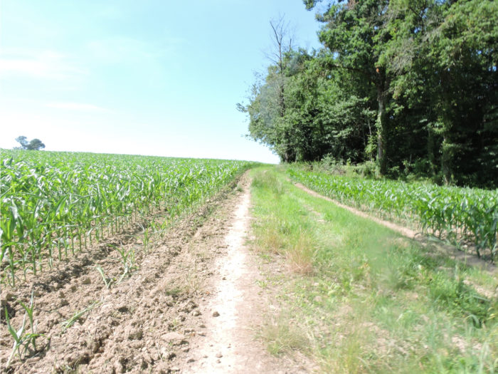
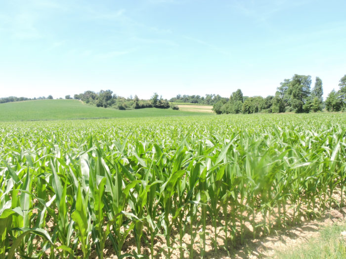
You then abandon the stream below to climb the ridge into the exuberance of huge cornfields. Usually the cornfields are trivial, but here, for once, they are magnificent, for the hill is vast and beautiful. Even if water does not flow in abundance in these small streams, it must be present in the water tables, because corn needs water. For 1 kilo of corn, you still need almost 500 liters of water. But for wheat, even more. If the maize lacks water, it is under water stress and the harvest is poor. |
|
 |
 |
|
The slope is quite tough here, until the lane abandons the corn for the undergrowth. |
|
 |
 |
|
Then a very narrow lane sinks into oaks, maples and hornbeam shoots in a thick undergrowth. The trees are chatting, the branches almost touch you. Brush, viburnum and heavy ferns line the track. |
|
 |
 |
 |
 |
|
Further afield, the pathway crosses a small agricultural road and continues to climb gently towards the top of the ridge, along the undergrowth. |
|
 |
 |
|
At the end of the undergrowth, the pathway finds the air again and the vines on the heights. Here it is no longer Gers of previous stages. You have long since left the great expanses of grain and sunflowers. By the way, the difference now is that there are also alternations of corn, undergrowth and vines which follow one another, with streams at the bottom of small dales. |
|
 |
 |
|
Then the vines parade again, one row behind the other, like battalions of soldiers, with, here too, fields of wheat which dare to point its nose, which almost disturb. |
|
 |
 |
|
From the top of the ridge, the GR65 is back to the asphalt road and gently descends into the countryside towards Le Riguet. Do not think that farmers play roulette to know what to plant. Admittedly, they often tend to behave like the neighbors, but they have no doubt tried everything. Why does the wheat grow better here? They may not have turned to soil scientists to find out, but they know how to do. So, they plant the wheat here, and the vines beyond. |
|
 |
 |

|
The road then crosses the ridge between vines, crops and meadows. |
|
 |
 |
|
It flattens a few hundred meters, before taking a pathway branching off again into the vines. Between the vines, the pilgrims share their life with the tractors of the winegrowers. |
|
 |
 |
|
A little further, beyond the vines, here is the corn again. It is not a surprise. The pathway will descend to dip its feet in a small stream at the bottom of a new dale. |
|
 |
 |
|
It’s dancing again in the middle of the tall grass under oaks, hornbeams, ash trees, country maples and wild chestnuts. |
|
 |
 |
|
And the cycle repeats. There the pathway will cross Hittère brook, and as it has become accustomed to, it will slope up in small bends in the corn shoots. |
|
 |
 |
|
Here the climb is less steep and shorter than in Bergon dale. |
|
 |
 |
|
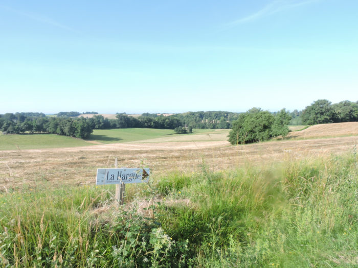
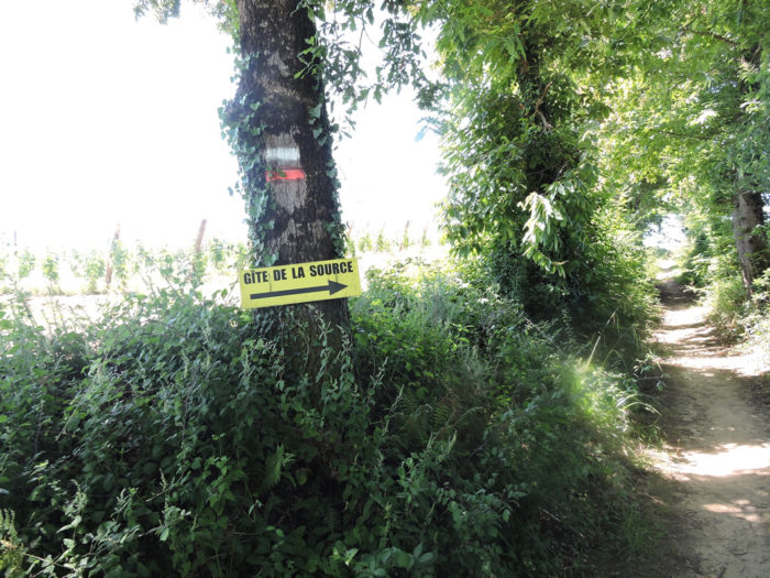
At the top of the ridge, the route gets to La Hague crossroads. There, two steps out of the way, you can find accommodation and meals. |
|
 |
 |
A charming and varied stopover awaits you at the Chalet du Bonheur. In this surreal atmosphere, you will no doubt enjoy stopping for a moment.

|
Beyond La Hague crossroads, the dirt road climbs a little further through the corn fields towards the undergrowth. Here you have left the vines and the ground is only sand. |
|
 |
 |
There is little doubt here. The Musketeers may be watching you in the undergrowth. Yes, you are still in Gascony.

|
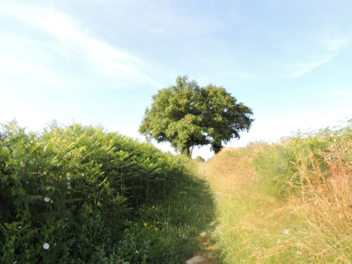
Beyond the ridge, the GR65 descends, on a fairly steep slope, in a ground white as sand, to find the vines again. |
|
 |
 |
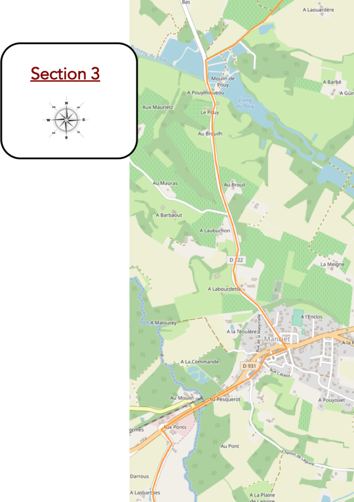
Section 3: Passing through the beautiful Pouy pond.
 General overview of the difficulties of the route: course without any difficulty.

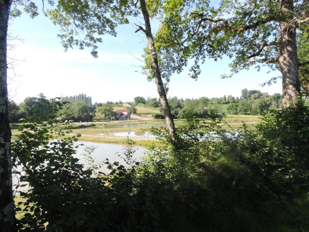
On the white dirt the GR65 then crosses the vines to find itself quickly towards the ponds of Pouy, where the hardwoods soak their feet.
 |
 |
|
Ponds are plentiful here, and sometimes the pathway straddles the fields. |
|
 |
 |
It is magical and beautiful here.
|
Pouy ponds, arranged in a cascade, are fed by the Pouy stream, a tributary of the Douze River. These are old and beautiful ponds inherited from the Middle Ages and fish ponds. The humid natural habitat is quite exceptional, with its vegetation floating in stagnant green water, amid swamps, rushes, reeds and alders. The large oaks that line the banks welcome, depending on the time, a host of migratory birds that nest here. |
|
 |
 |
The ponds contain a lot of silt, as Manciet watershed above the ponds is very cultivated. Some ponds are dormant, but apparently the majority of them are used for fish farming. Fish were introduced there. Don’t pass here with your fishing rod. It is not advisable! On the other hand, the cormorants and crayfish which pass through here enjoy the generosity of the patrimonial associations of the ponds for free.

For your pleasure…
Wait for the video to load.
The GR65 then joins a paved road that runs around the ponds.
 |
 |
|
Further afield, it heads to the place called Le Moulin du Pouy, which overlooks the ponds. |
|
 |
 |
From here you can take one last look at these spectacular bodies of water. May you remember it as you’ll walk through the tasteless corn hedges.

|
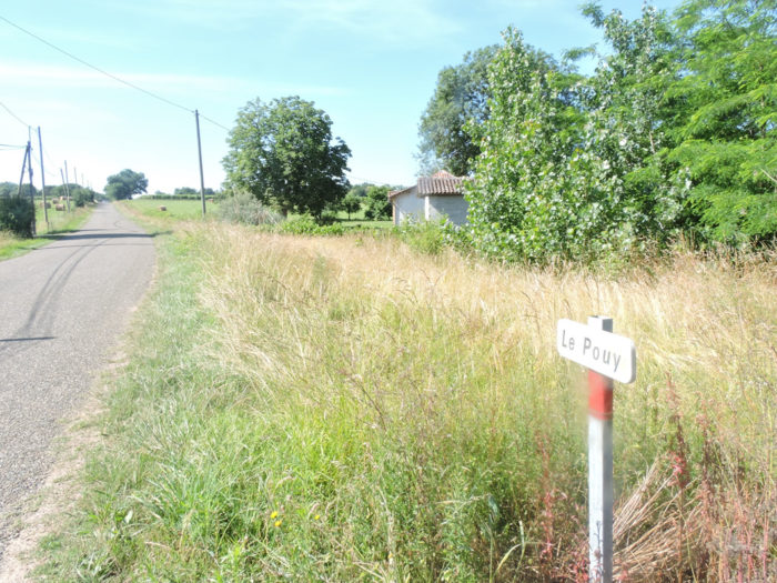
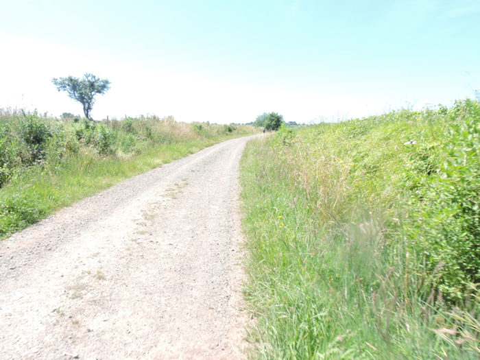
Further up, the GR65 returns to harsh reality and slopes up gently on the tarmac. The road heads through the countryside to Le Pouy. |
|
 |
 |
|
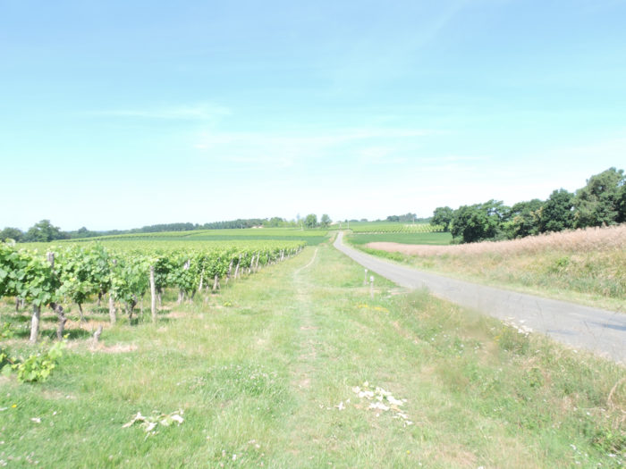
Further on, the road passes over a small plateau. It is again large vineyards that furnish the side of the hill. |
|
 |
 |
|
Rare and beautiful stone houses are sometimes hidden under the trees, at the edge of the vineyards. |
|
 |
 |
|
You are getting closer to Manciet. Nature is incredibly bucolic, serene. People must live in peace on a hill where small houses perched on the heights are scattered, almost dipping their feet in the water lilies, where the hissing of the dogs rival the bellowing of the cows. |
|
 |
 |

|
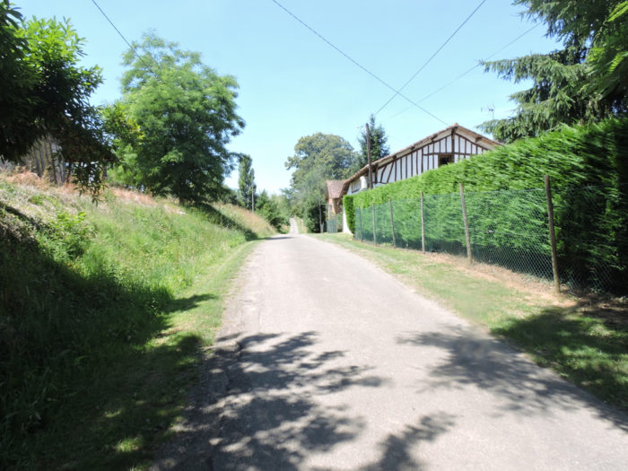
Manciet is a large village in the countryside. Here once passed the railway line which crisscrossed the Gers, the same one you followed before arriving in Eauze, and which went, among others, from Condom to Aire-sur-L’Adour. |
|
 |
 |
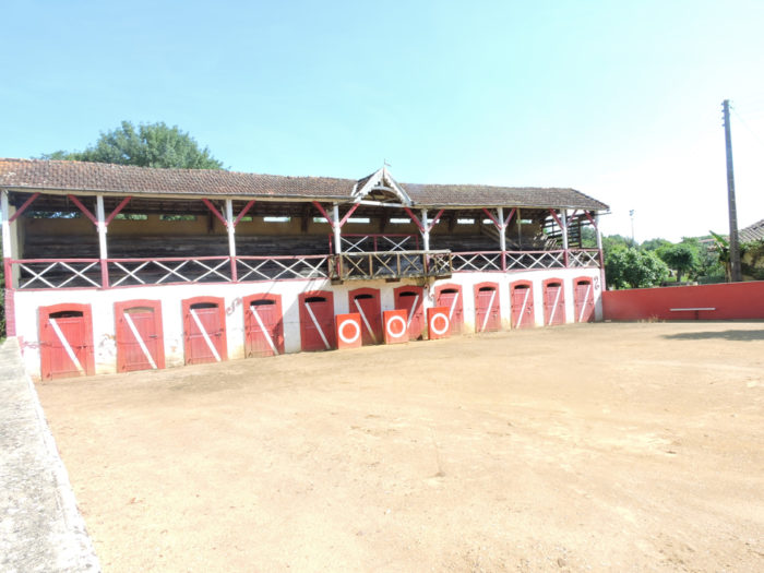
In Gers and Landes departments, the arena also called “plazza” is the pride of large villages and towns. The Landes race is part of the Gascon cultural heritage. It is practiced especially in Landes , Gers, a little in the Pyrenees. This is not bullfighting. The animals are all females, in fact the females of the bullfighting bulls. These cows are raised by “ganaderos”, especially in the Landes, between Dax and Aire-sur-L’Adour. Each breeding has its colors, its toreros. There is no killing of cows, neither during nor after the race. It’s all about the art of jumping and spreading. The game takes place with several teams. At the end of the race, the jury announces the individual results of each actor. He designates the three best spreaders in the race who will have the privilege of going up the “escalot” to get their reward.
|
A Virgin, as usual, watches over the village, in a small square next to the arena. The bulk of the village is located across the D931 departmental road, a fairly busy road. There is food and accommodation here. |
|
 |
 |
|
Manciet (770 inhabitants) has a long history, even if today it is no more than a place of passage on the Camino de Santiago. Roman station in Antiquity, it was taken over by the Templars in the 12th century and their estate transformed into a hospital for pilgrims a little later. Belonging to the sovereigns of Béarn, the castle was destroyed in the incessant wars which opposed Catholics and Protestants. The village is crossed right through by a fairly narrow street, with some old half-timbered houses adorning the street. The Notre Dame de la Pitié church was built around 1545, then damaged by the Protestants. Subsequently, the church was enlarged and restored. The steeple of this massive church was destroyed by lightning at the end of the 19th century. |
|
 |
 |
|
On leaving the village, the track follows the D931 departmental road, where the old pilgrims’ hotel from the Middle Ages must have nestled, before crossing the Douze, muddy like all the rivers of the Gers. Pilgrims of the time were exempt from paying the toll to cross the river. You too! |
|
 |
 |
|
Quite quickly, the GR65 leaves the large departmental road for the small D153 departmental road. |
|
 |
 |
|
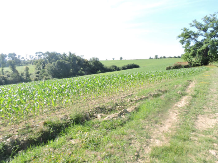
It is a small road that wanders between deciduous hedges and gigantic corn fields. |
|
 |
 |
Section 4: Passing through Hospital Church.
 General overview of the difficulties of the route: course without any difficulty.
|
On the road, in Las Barthes hamlet, geese and ducks splash around. These lucky ones will not go to the pan in the following days. |
|
 |
 |
|
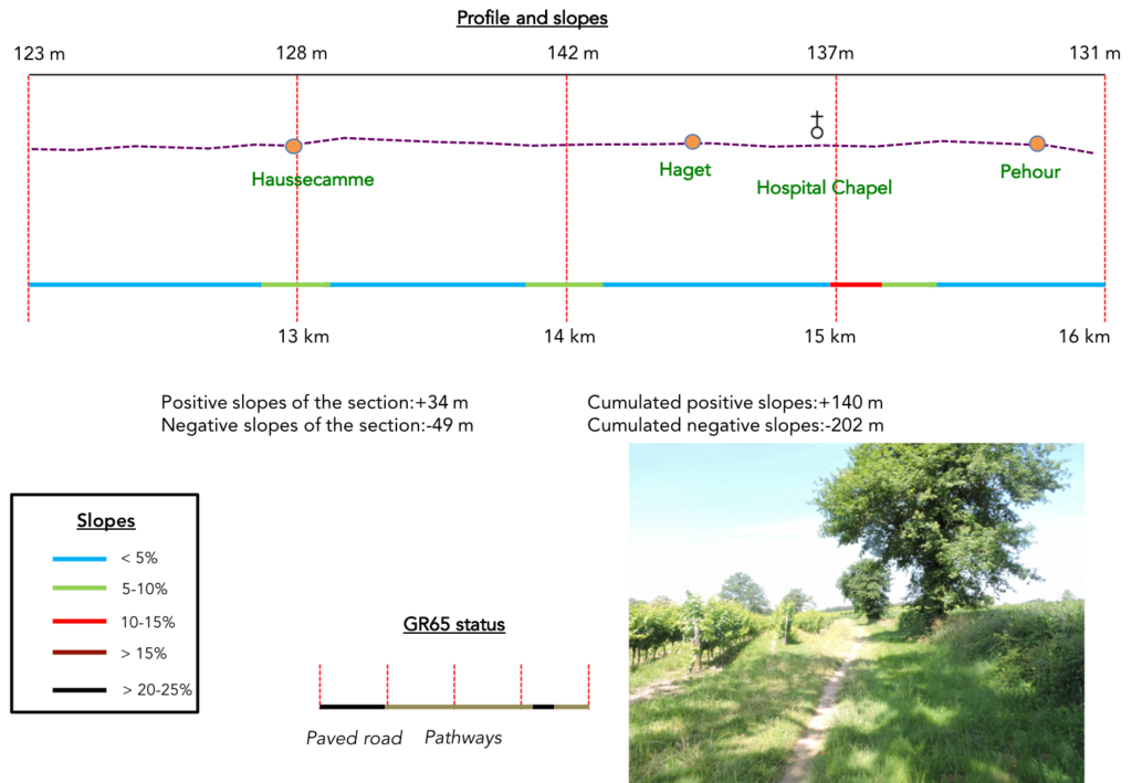
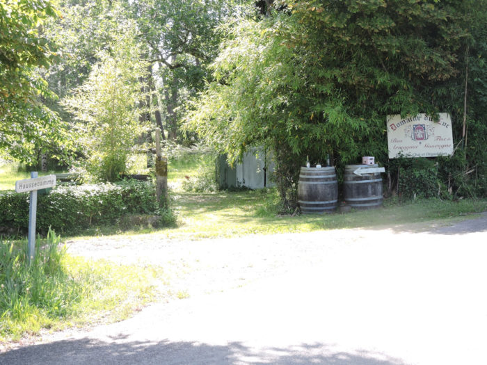
A little further on, the road passes through Haussecame hamlet, near a small lake. The pilgrim hardly stops on the way to taste the Armagnacs and drink a little splash of floc. Born from a Gascon recipe in the XVIth century, floc de Gascogne (“Lou Floc”, the bouquet of flowers in Occitan) is the marriage between fresh grape juice and the vigor of young Armagnacs. It is drunk here for any occasion, from aperitif to dessert, in white or red. It has its staunch defenders. Others find it quite common. It’s up to you to get an idea. |
|
 |
 |
 |
 |
|
Beyond Haussecame, a small narrow lane climbs through the tall grass alongside the vines. |
|
 |
 |
| Strangely, farmers reversed the crops, because up it is corn that you meet, when the pathway joins a small tarred road under the oaks. | |
 |
 |
|
Further ahead, the course follows the road for a while before returning to a small dirt road, still in the middle of vines and corn fields. |
|
 |
 |
|
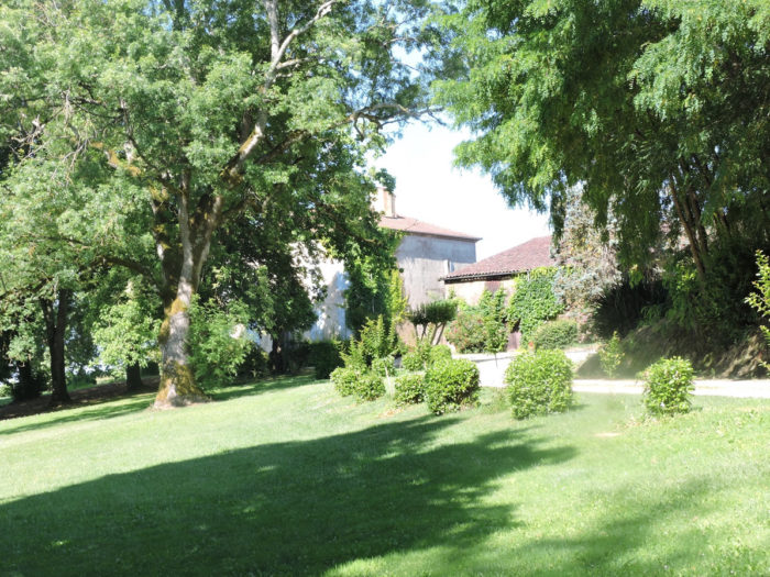
Further up, but it hardly slopes up, the little game of alternation between cultures lasts until you land on a very large plateau, in the middle of the fields, where the gigantic and beautiful domain of Haguet sits. You can also stay there. |
|
 |
 |
 |
 |
|
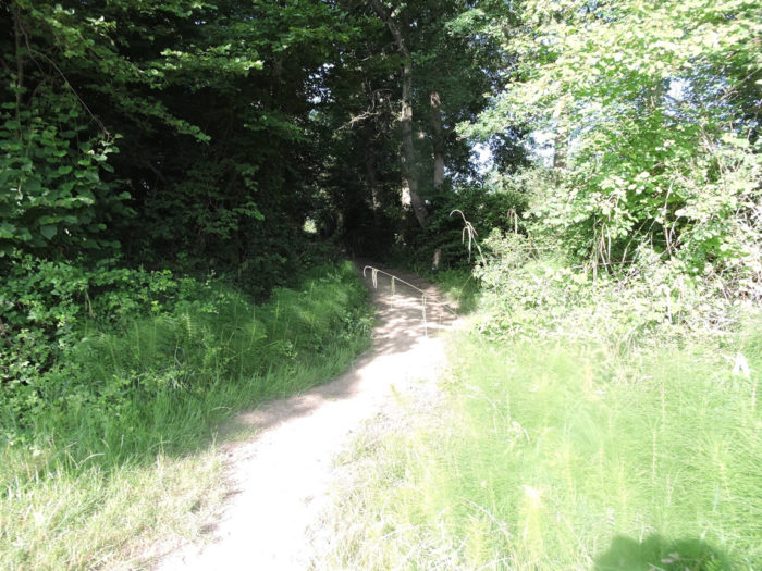
Shortly beyond the farm, a dirt road leads through the undergrowth to Hospital Church. |
|
 |
 |
|
Beyond a dark undergrowth, the chapel bursts with its beautiful light. But inside, everything is dark, like a tunnel. There is also a water point there. With the stages, all pilgrims know that near churches, chapels and cemeteries fresh water is needed for flowers. This chapel also has a long history. This is where one of the Order of Malta’s many commanderies was located, that of St. Christine’s Hospital. The pilgrim could rest there, eat, receive treatment. The commandery was also destroyed during the Wars of Religion. Protestants were formidable iconoclasts during these times. All that remains is this elegant brick chapel, all in height, lost in nature, now dedicated to Ste Claire. |
|
 |
 |
|
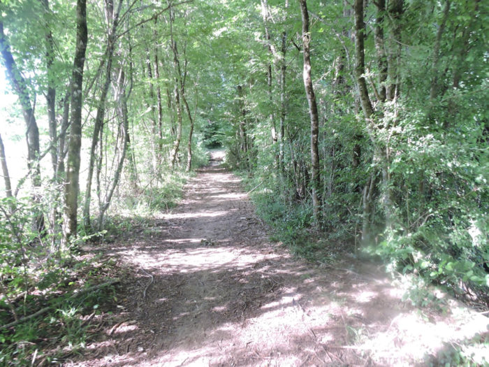
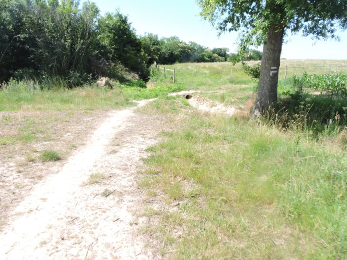
Behind the chapel, the pathway returns to the undergrowth. |
|
 |
 |
|
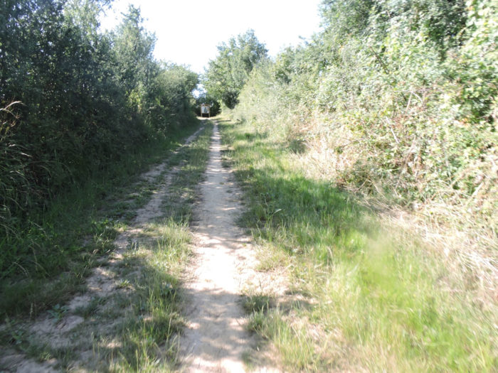
The dirt road continues its course in zigzags in a sometimes-dense undergrowth, sometimes sparser. Under your shoes, there is clay, real clay. The light here shines in the chiaroscuro playing on the tender greens of oaks, ash trees, maples and chestnuts. |
|
 |
 |
|
As the wolf comes out of the woods, Santiago track also comes out, taking a slight climb to find again the vines. |
|
 |
 |
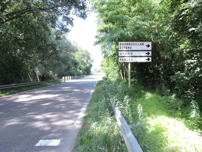
The GR65 then approaches the departmental D522 road, which it runs along for a few hundred meters, heading towards the hamlet of Pehour.
 |
 |
 |
 |
Section 5: You’ll arrive in Nogaro, alas, without your Ferrari.

General overview of the difficulties of the route: course without any difficulty.

|
Beyond Péhour, the landscape in front of you looks a little hillier. A wide, fairly gravelly pathway climbs a little further to the top of the ridge, before sloping down back into the vines. |
|
 |
 |
|
The pathway will descend to the bottom of the dale, it is almost written. You salivate in anticipation. You won! So, the corn makes you hedges of honor to accompany you to the bottom of the descent. |
|
 |
 |
You can take a dip in the waters of Midouzon brook at your leisure. You won’t risk drowning here. But, in bad weather, who knows?

|
Here you are walking in the corn again. The ducks should not be far away, as indicated by the presence of the silos. |
|
 |
 |
|
A stream almost always flows at the bottom of a dale. This is its fate. So, yours is to climb up the side of the valley on the other side. And, in the region, when you slope up along the hillsides, it is always the inevitable corn and the undergrowth. The slope is quite marked, more than 10%. |
|
 |
 |
 |
 |
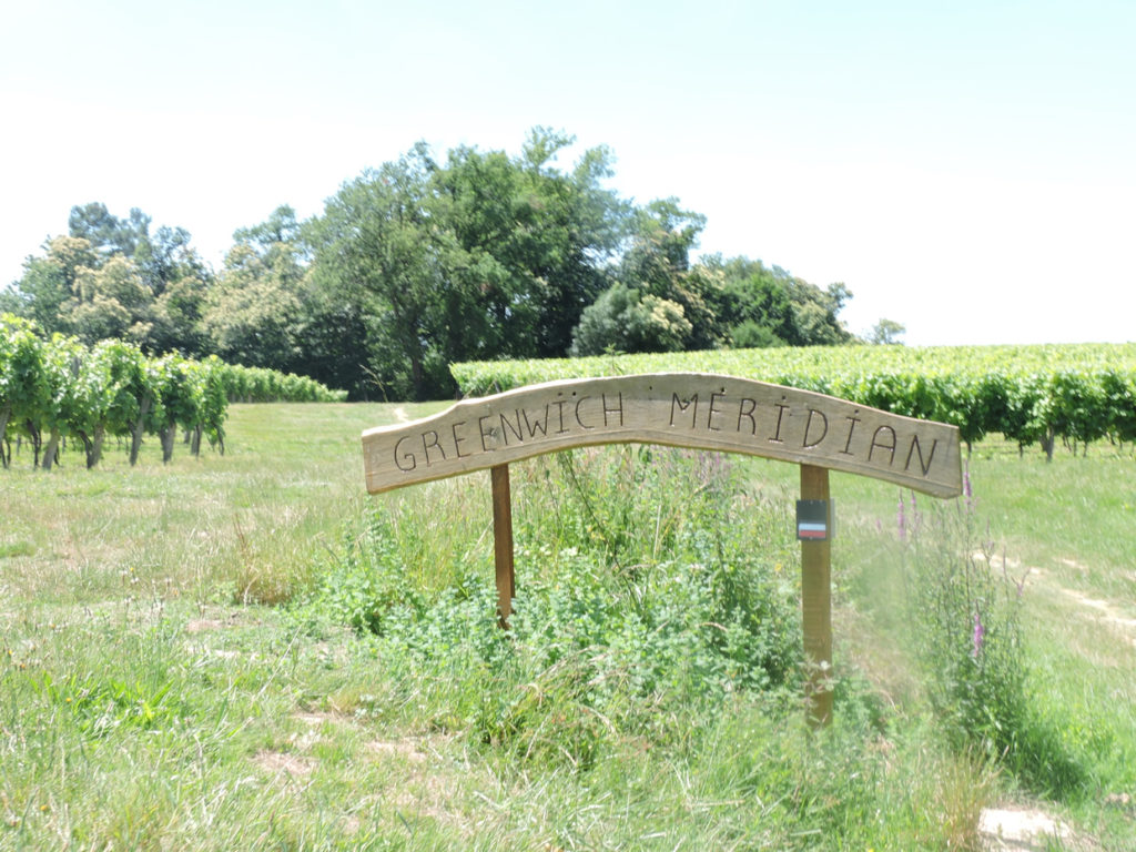
Further up, the pathway crosses Greenwich meridian, where you automatically check the time on your watch.
|
Is the meridian a natural border? Who knows? But the track starts again in search of a new small stream. The pathway then descends into the undergrowth, on a very steep but short slope, to quickly find a small asphalt road and skirt the corn fields. The slope is sustained, but not tough. |
|
 |
 |
|
At the bottom of the descent, in the undergrowth, the road crosses St Aubin brook, which you can hardly guess, hidden as it is by thick foliage, before sloping up gently towards Villeneuve hamlet. |
|
 |
 |
|
The road runs along the scattered houses of the hamlet among corn fields. |
|
 |
 |
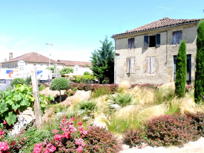
Here you are almost within rifle range of Nogaro, that can be seen on the horizon. Behind the budding sunflowers, the city seems very compact and homogeneous, in its pink and ocher colors, and its red-tiled roofs.

|
Further on, the road, which ends in cul-de-sac, gives way to a pathway which steeply slopes down into the vineyards. |
|
 |
 |
|
At the bottom of the descent, the pathway crosses corn and sunflowers fields in a small plain. |
|
 |
 |
|
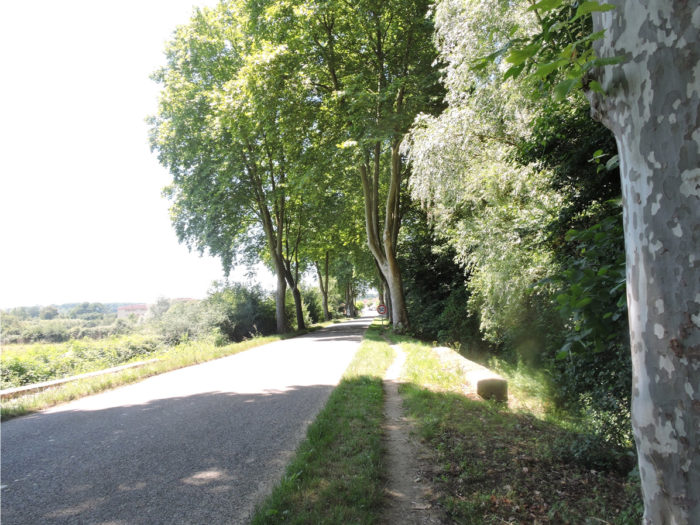
You’ll then get at the place known as Pouy de Bouit, in the suburb of Nogaro, where the route joins the D522 departmental road, under the large plane trees. |
|
 |
 |
|
Along the wide alley that leads to Nogaro, you’ll cross the Midour River, and its unappealing waters, at least today. The limestone of the region delights wonderfully in its waters. |
|
 |
 |
Section 6: In Nogaro.
|
You arrive at Nogaro (2,000 inhabitants). You might be lucky enough to get there on a full day, in the chirping of birds. |
|
 |
 |
|
 |
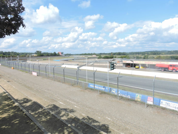
But in Nogaro, a huge park, where sometimes people crowd at weekends, adjoins Paul Armagnac racing circuit. One year we have been here was a round of the European Heavyweight Championship.

|
So, the small town, usually calm, fills up with thousands of engine lovers, clad in leather. Bikers, motorists, and even collectors of vintage vehicles flock to attend their mass. The huge park and all the suburbs of the city are covered with trailers and caravans. The spectators come here to spend the weekend and it is not the limited number of accommodations here that will welcome them. People grill sausages in the park and near the caravans. It hums dully everywhere, it honks with stamping and jubilation. Sometimes the din is so intense it feels like you are on a battlefield. |
|
 |
 |
|
Yet there are quieter, more humane days and nights on and around the circuit. So, everyone takes his little car and plays to scare each other by screeching his tires a little in the turns of the circuit. At least, it was so, the last time we went here. |
|
 |
 |
|
At the bottom of the town, there is the Landes racing arena, where the world is bustling near a large crossroads with a hotel and a restaurant. |
|
 |
 |
|
A sloping street leads to the center, where another small, more charming square houses restaurants under the trees. |
|
 |
 |
|
Further up, at the exit of the town, is the St Nicolas collegiate church. Romanesque church consecrated in 1060, it was one of the oldest fortified churches in the region with its cut stone buttress, its loopholes, Alas, it suffered a lot of damage and alterations, even being at one time a coal warehouse. Then the church was lengthened and raised. It is nonetheless classified in the register of Historic Monuments for some frescoes and remains from the Romanesque period. |
|
 |
 |
Local gastronomy
The AOC Armagnac appellation is produced in three departments: Gers, Landes, and Lot-et-Garonne. There are Armagnacs of different ages. Aging is at least 2 years. Several mentions exist. They refer to the age of the youngest grape variety entering the blend. So:
- An Armagnac XXX or VS brings together different Armagnacs, the youngest of which has aged at least 2 years
- An Armagnac VSOP will have an aging of at least 5 years
- For Armagnac XO, aging is at least 6 years.
To discover an even richer and more complex aromatic palette, it is then necessary to move towards 15 and 20 years of age, or even older products. There are also vintage Armagnacs. In this case, it is Armagnac from the only harvest mentioned on the label. Hors d’Âge, Vieille Réserve, or English abbreviations like VS for Very Special, VSOP, etc. can be explained by the historical pre-eminence of the British market for cognacs. Not all Armagnacs use the aforementioned labels. Some are content with the regional appellation, such as Bas Armagnac AOC. They are no less good for that. But all serious Armagnacs will tell you their age.
Armagnac is obtained by distillation of white grape varieties. It is not like Italian grappa which is obtained by distilling grape skins after pressing. For Armagnac, you first have to make wine, called “vino da caldaia”. Only white grape varieties are vinified. The grapes are destemmed, crushed, then pressed. The must is then put into fermentation, without adding sugar or sulphur. At the end of fermentation, the coarse lees are eliminated, and the wine is kept on fine lees, which adds aromas. The wine remains cloudy. There is no settling or fining to make the wine crystal clear. The wine obtained is of low alcohol content (7.5-12%), with high acidity. The distillation of this wine to make an Armagnac takes the place of traditions and high technology. For all other Armagnac eaux-de-vie other than Blanche, aging in oak barrels is essential and mandatory. It transforms the translucent aspect of the white Armagnac, as it comes out of the still, into reddish brown, a color resulting from the dissolution of the oak components of the barrel. It is the same process that operates for cognacs or whiskeys. In addition to the color, the aging in barrels allows the appearance of new aromatic compounds coming from the oak wood which increases the aromatic power of the eau-de-vie. Everyone knows the fundamental importance of vanillin and tannins in the aging of wines in barrels. Moreover, the same aging favors the reduction of the degree of alcohol of Armagnac by evaporation. This is called the “angels’ share”. The sale of Armagnac is only authorized when the eau-de-vie is slightly over 40% vol. This can also be obtained by blending, i.e. small additions of “small waters”, consisting of a mixture of water and Armagnac. Arrival naturally or by blending between 40 and 48% vol. of alcohol, the eau-de-vie is then stored in a metal vat. It can also be stored in an old cask that has lost all its tannins or in a glass carboy. From then on, the armagnac no longer ages, but it will very slowly oxidize and continue to lose alcohol. It can be bottled in the year of sale (the year of bottling is sometimes indicated).
Armagnac is most often a blend of different grape varieties, but also from different years. In great years, vintages are produced, with wines from the same year. Armagnac is then more expensive, as for Champagne. Ugni blanc is the most widespread of the grape varieties used in the blend of Armagnac (nearly 60%). A grape variety originating from Italy, it is also the king of Cognacs. The Colombard gives very pronounced and spicy fruity aromas. It is the most cultivated grape variety in the Gers. But here, it is used more for white country wines, Côtes-de-Gascogne, than for Armagnac blends. Folle Blanche (crazy, because it is very vigorous) produces large volumes of acidic, low-alcohol wines. This grape variety represented the base of the grape varieties before the phylloxera crisis. The difficulty of grafting it and the susceptibility to disease have made it rarer. However, its quality has earned it a presence in the vineyard (2% of Armagnac blends). The Baco Blanc, a hybrid of Folle Blanche and an American plan, gives a fruity but foxed aroma (wild reason of the foxes), a little harsh (35% in the blends). Nowadays, Armagnac is therefore made mainly from ugni blanc and baco blanc. The other grape varieties, relics of the multitude of South-West grape varieties distilled in the past, are now only anecdotal. But, the great Armagnac connoisseurs fight to have old bottles of Folle Blanche, whose secrets no one knows.
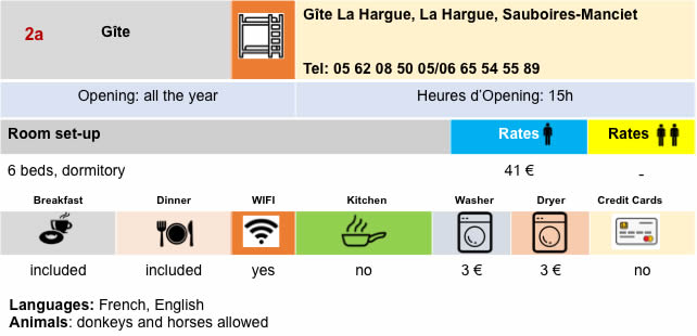
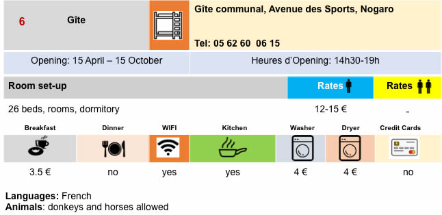
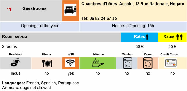
Lodging


 |
 |
 |
 |


 |
 |
 |
 |
 |
 |
 |
 |

Feel free to add comments. This is often how you move up the Google hierarchy, and how more pilgrims will have access to the site.
 |
Next stage : Stage 28: From Nogaro to Aire-sur-Adour |
 |
Back to menu |