Along the Garonne River canals by the sport route
DIDIER HEUMANN, MILENA DALLA PIAZZA, ANDREAS PAPASAVVAS
We divided the course into several sections to make it easier to see. For each section, the maps show the course, the slopes found on the course, and the state of the roads. The courses were drawn on the « Wikilocs » platform. Today, it is no longer necessary to walk around with detailed maps in your pocket or bag. If you have a mobile phone or tablet, you can easily follow routes live.
For this stage, here is the link:
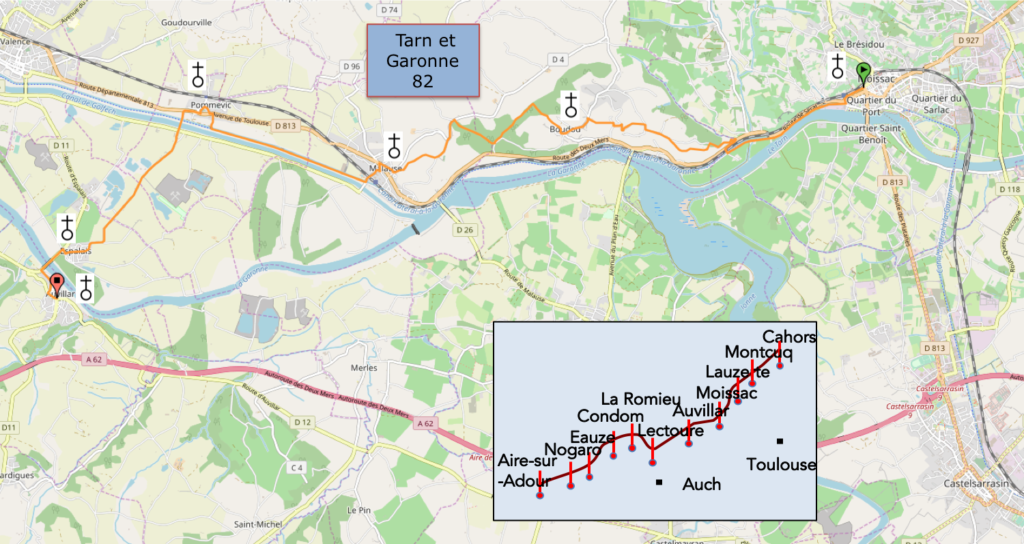
https://fr.wikiloc.com/itineraires-randonnee/de-moissac-a-auvillar-par-le-gr65-30515206
It is obviously not the case for all pilgrims to be comfortable with reading GPS and routes on a laptop, and there are still many places in France without an Internet connection. Therefore, you can find a book on Amazon that deals with this course. Click on the book title to open Amazon.
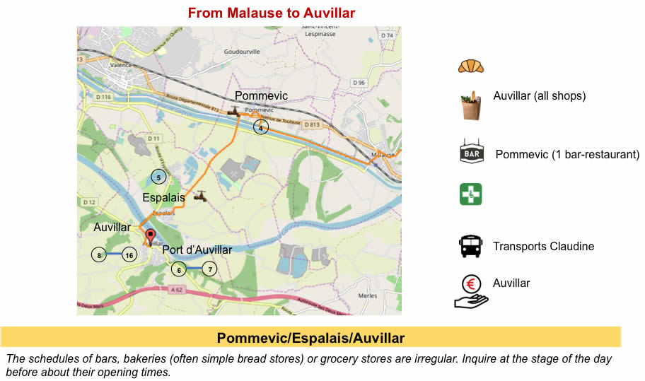
If you only want to consult lodging of the stage, go directly to the bottom of the page.
Today, our route is still in Tarn-et-Garonne, between Bas Quercy and Lomagne. The creation of this department is a long story. The people of Lot and Tarn-et-Garonne lived in a large province called Quercy. Their origin was Celtic. In the 5th century, the country was invaded by hordes of Vandals, Suevi and other Visigoths, before being driven out by Clovis, then invaded again by the Normans. Quercy subsequently passed into the pay of the English. During the Wars of Religion, a great rivalry arose between the Catholics of Haut Quercy, the people of Cahors, and the Protestants of Bas Quercy, around Montauban. Napoleon I cut the knot by detaching Bas Quercy to create Tarn-et-Garonne, and limiting Lot to Haut Quercy.
In 1681, the Canal du Midi between Sète and Toulouse was completed. The idea was obviously to extend the canal towards the Atlantic to transport goods. But Louis XIV having emptied the coffers of the kingdom, the project was therefore abandoned, for lack of means. And for another two good centuries, the good old Garonne and its perilous navigation were used for river transport to Bordeaux. When due to heavy flooding or drought, depending, the Garonne no longer became navigable, people passed through Gibraltar. But it was necessary to brave the storms and the attacks of the pirates. With the industrial revolution, the project was revived. The Canal du Midi, “Atlantic side” was inaugurated in 1856. This canal runs along the Garonne River for 193 kilometers. 53 locks allow pleasant navigation. Nowadays, these canals are only used for pleasure craft. The banks have been converted into greenways. They are the delight of an army of hikers and cycle tourists who frolic in the shade of plane trees and century-old poplars.
The Canal des Deux Mers runs for more than 450 km. It is listed as a UNESCO World Heritage Site, with its locks, bridges, aqueducts and dams. It is not deep, 2 meters deep, causing problems for bigger boats. In the 1970s, large sums of money were invested on the Canal du Midi to modernize the network, increase the size of the locks to allow the passage of barges. Then came the oil shock of 1973. River traffic fell by 50%. And then was inaugurated the highway of the Two Seas. This signaled the death warrant for the river traffic of goods on the canal. In 1989, the last barge delivered its cargo of wines to Bordeaux. The state stopped funding future work. The last commercial trip took place in 2000. Here the canal is baptized by several names. Some call it the Garonne Canal, others simply the Lateral Canal. Its official name is the Canal lateral to the Garonne. But as it is the extension of the Canal du Midi, which connects Toulouse to the Mediterranean, the whole also forms the Canal des deux Mers, (Two Seas Canal) since it connects the Mediterranean and the Atlantic.
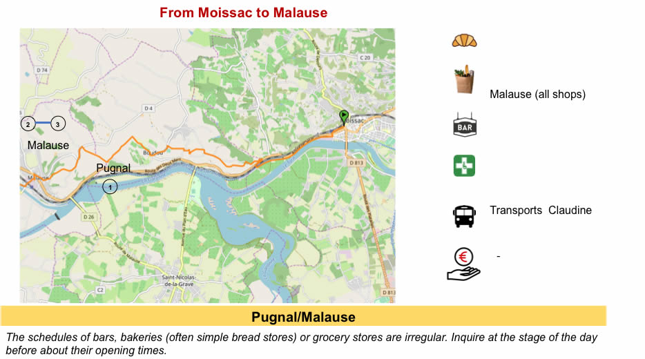
There are two ways to reach Auvillar. The first way is, we will put it this way: “the official way“. The route follows the canal, but also the heights above the Garonne River and the canal. This route is sportier than the variant, which is content to follow the canal, avoiding heights. But it’s not the Himalayas.
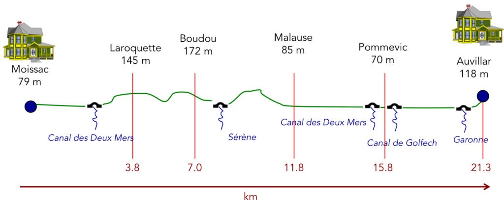
Difficulty of the course: Slope variations (+346meters/-311 meters) are low today. In terms of the difficulties of the course, it is a very quiet day for those who choose the variant along the Canal des Deux Mers to Pommevic. For the others, the two bumps that lead to Boudou and Malause hide serious difficulties. On the Camino de Santiago, nothing is really out of reach. It is a track for all.
The routes on paved and dirt roads are equivalent today. But, it all depends on what you call tar. The route along the canal is only asphalt, but there is no vehicular traffic. So here, we have assimilated it to a pathway:
- Paved roads: 10.9 km
- Pathways: 10.4 km
Sometimes, for reasons of logistics or housing possibilities, these stages mix routes operated on different days, having passed several times on Via Podiensis. From then on, the skies, the rain, or the seasons can vary. But, generally this is not the case, and in fact this does not change the description of the course.
It is very difficult to specify with certainty the incline of the slopes, whatever the system you use.
For « real slopes », reread the mileage manual on the home page.

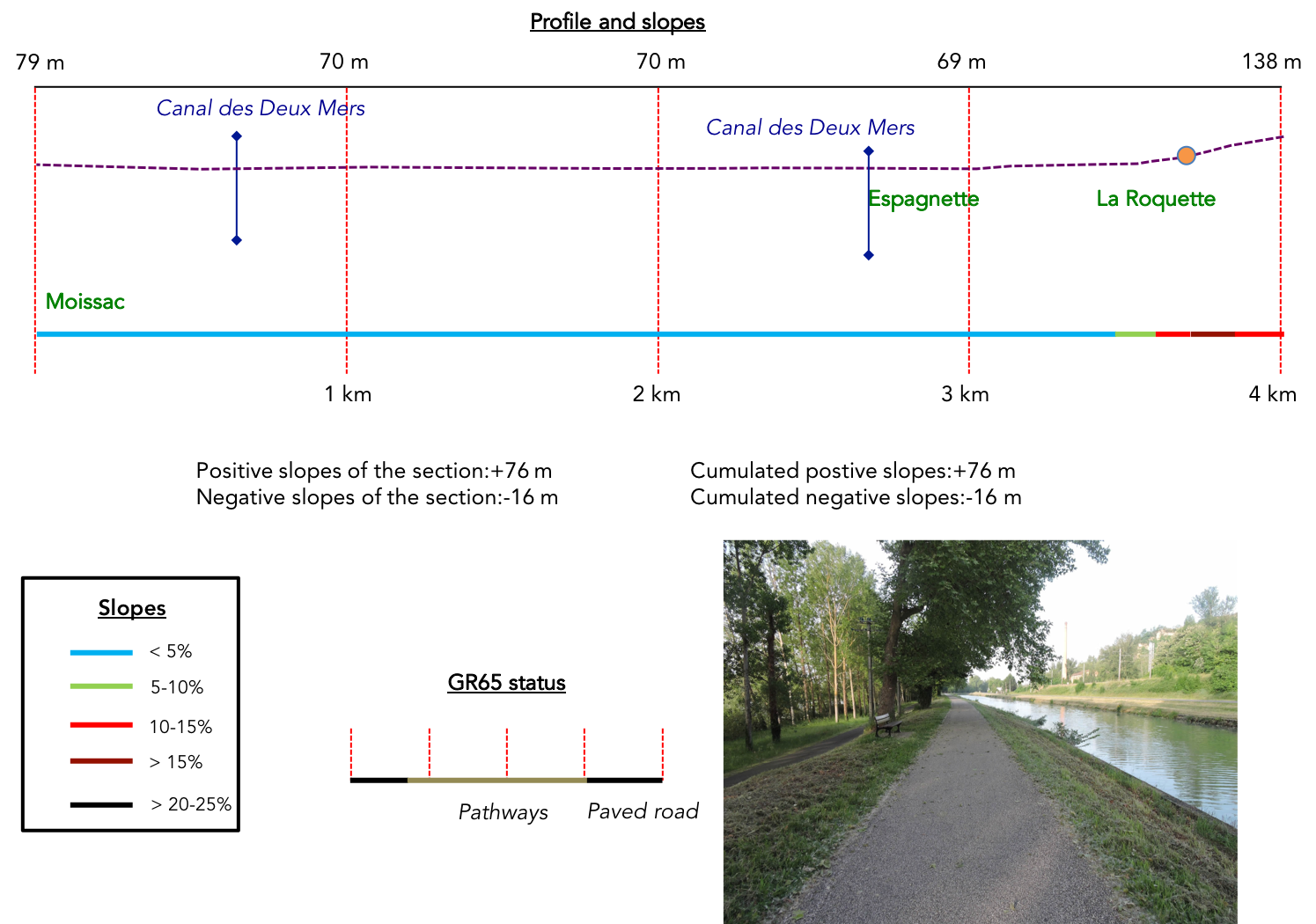
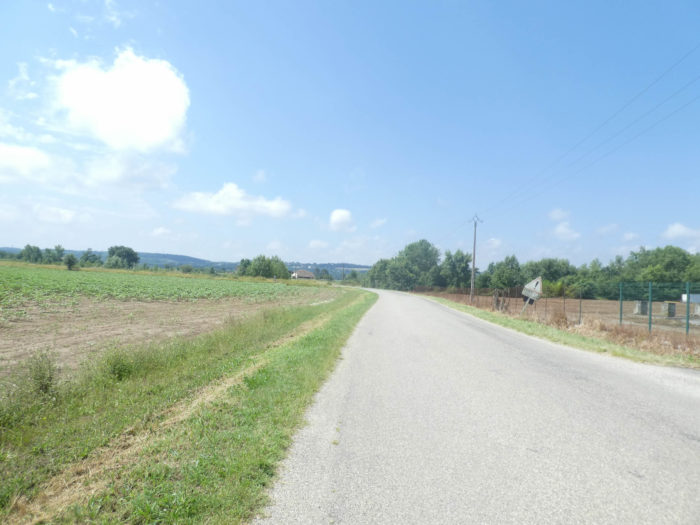
Section 1: A beautiful walk on the Canal des Deux Mers.
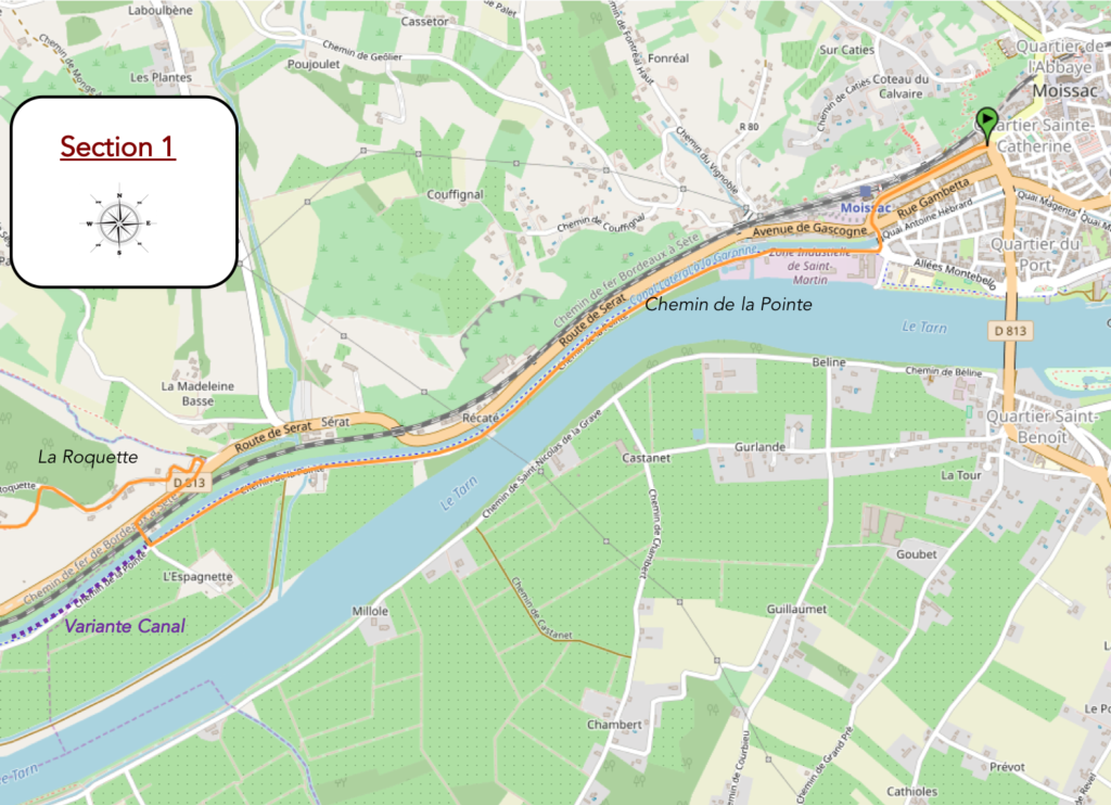
General overview of the difficulties of the route: without difficulty, before the climb to La Roquette.

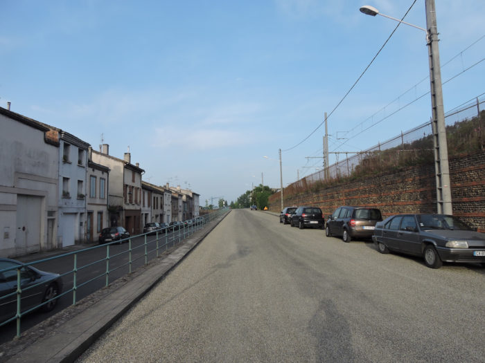
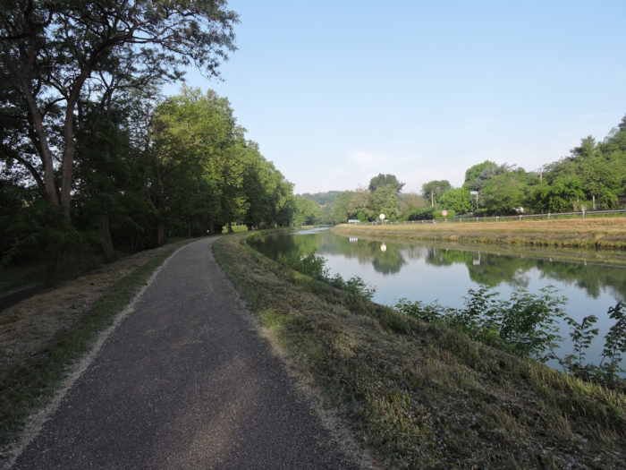
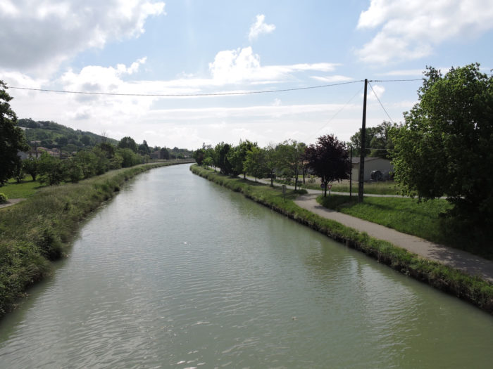
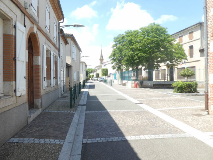
| The GR65 leaves Moissac near the station and quickly joins the Chemin de la Pointe on the long channels that run alongside Tarn and Garonne Rivers. |
 |
 |
|
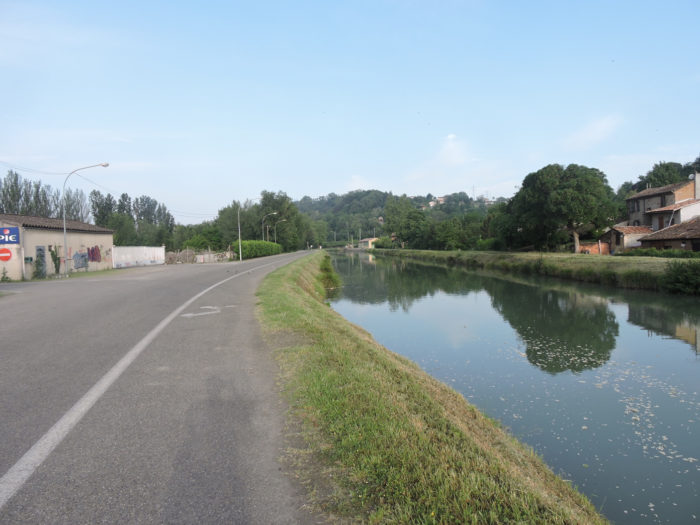
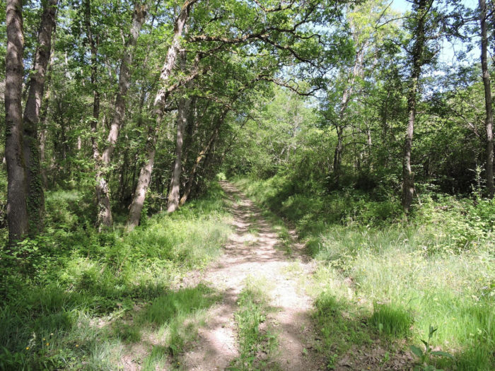
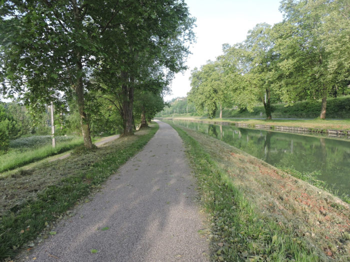
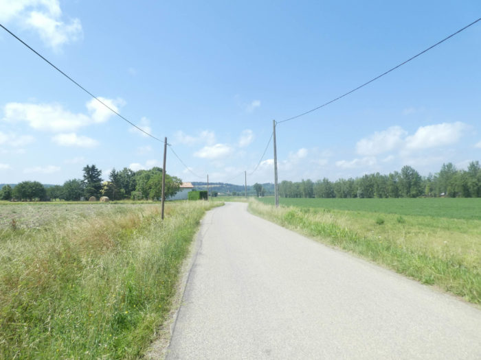
It then enters the Véloroute des Deux Mers (cycle path), which it will follow for many kilometers. Calm and serenity reign here under the large plane trees. For the sake of presentation, we will say here “pathway” when it is actually tar.
|
 |
 |
|
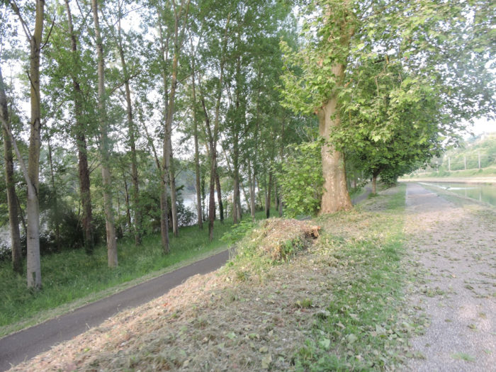
Initially, the pathway runs along the Tarn River on your left, but for a very short time.
|
 |
 |
|
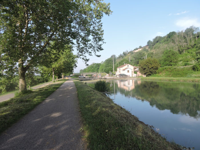
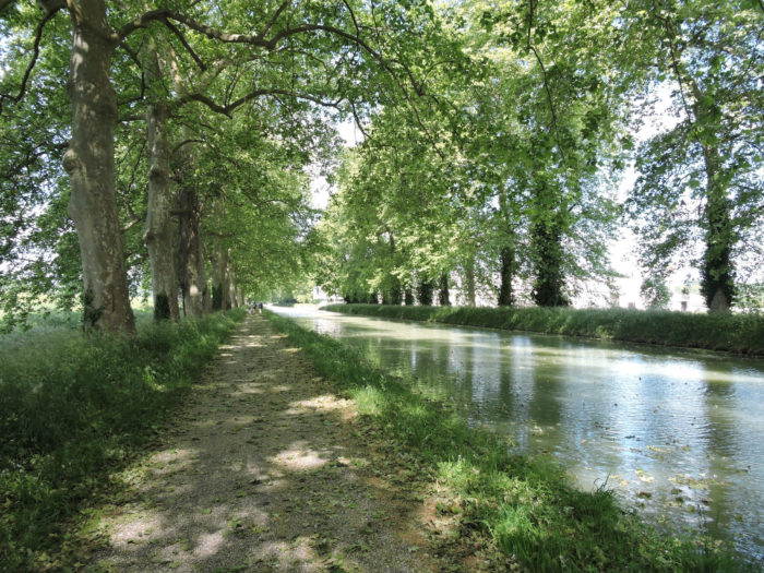
The canal stretches like a long ribbon, in a palette of greens punctuated by sentinels that are sometimes light, sometimes dark, that are the majestic trees. The large plane trees, like ship masts, with enormous trunks, seem to applaud the pilgrim who passes by. Slender like giraffes, supple to the quivering winds, they swing their branches, a blow to the right, a blow to the left. It’s impressive lightness, despite their immense size. Other, rarer trees, such as ash and maples, also stand guard along the canal, intermingling their branches to form a cathedral vault, maternal and protective.
|
 |
 |
|
And yet, this miracle of nature could not be eternal. Further down, on the Canal du Midi, a nasty mushroom gnaws at the plane trees, several hundred years old. The only current treatment is the chainsaw, creating filthy holes in this arrangement so harmonious. To be continued, because there may be an antidote, but nothing is certain. So, other species have been replanted. Since 2006, of the 42,000 plane trees in the Canal du Midi, 25,000 have been cut down and burned, while 10,000 new trees, especially tunicate oaks, white poplars and hackberry trees, which grow rapidly but can live on over 500 years, have been replanted.
|
 |
 |
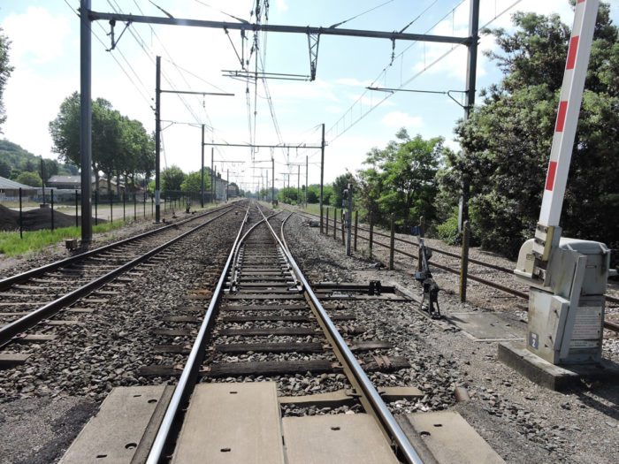
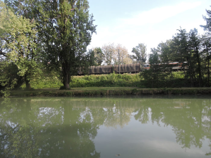
| You almost never see the Tarn River flowing parallel to the left of the pathway, sometimes with orchards or undergrowth. On the other side of the canal passes the railway line, where the rolling of the train sometimes echoes as it leaves for other horizons. |
 |
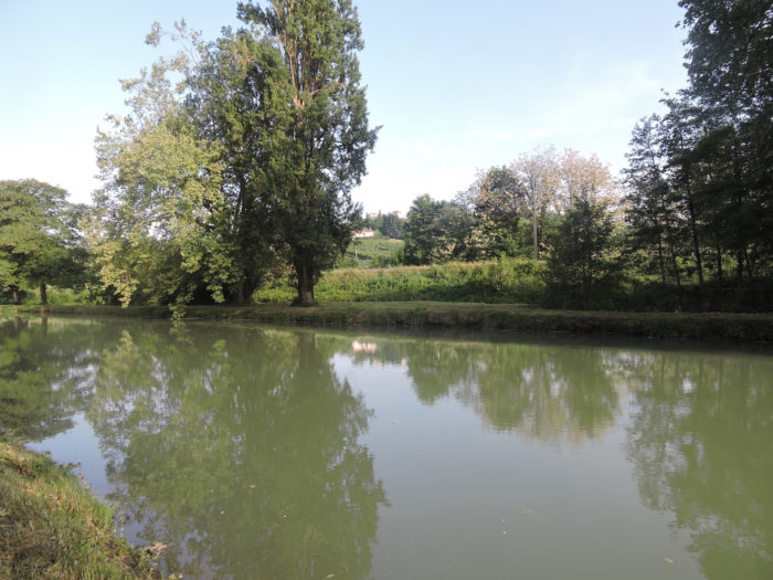 |
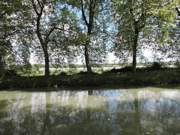
| The water in the canal is greenish in color throughout its length. We do not know if it sometimes turns blue. |
 |
 |
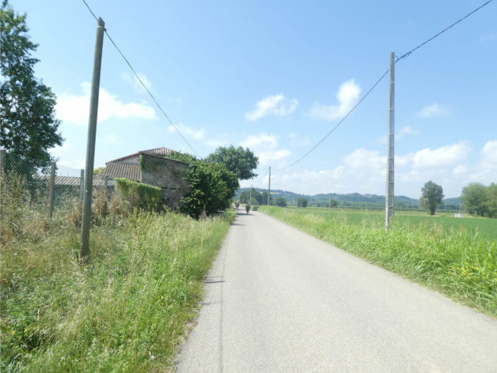
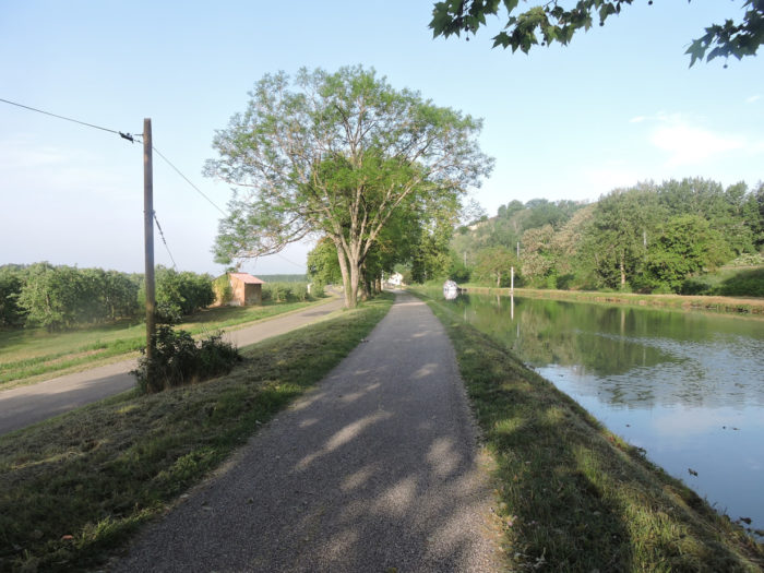
| Farms are present on the left bank of the canal, and agricultural activity seems fairly developed here, where the river land must be of good quality. On the right of the canal, there is only room for the departmental road and the railway track. |
 |
 |
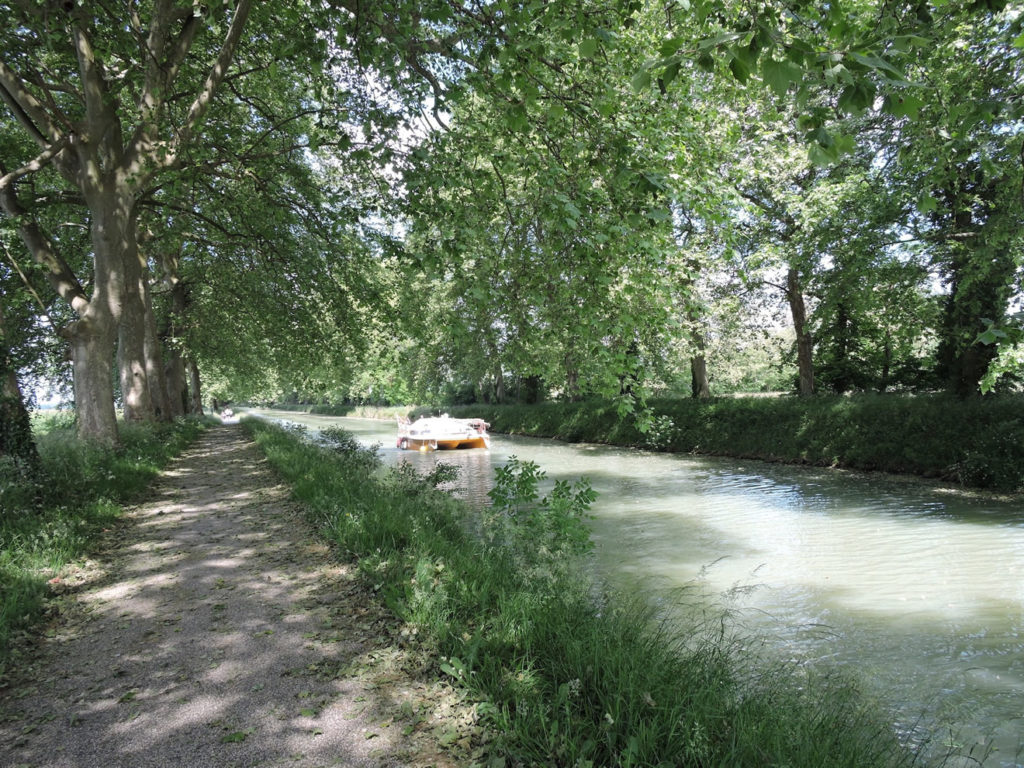
In this incredible play of light and water, sometimes boats pass, almost silent. They look like they are in slow motion. They have life ahead of them. They are small cruise ships.

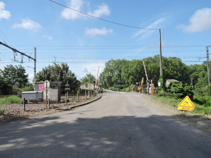
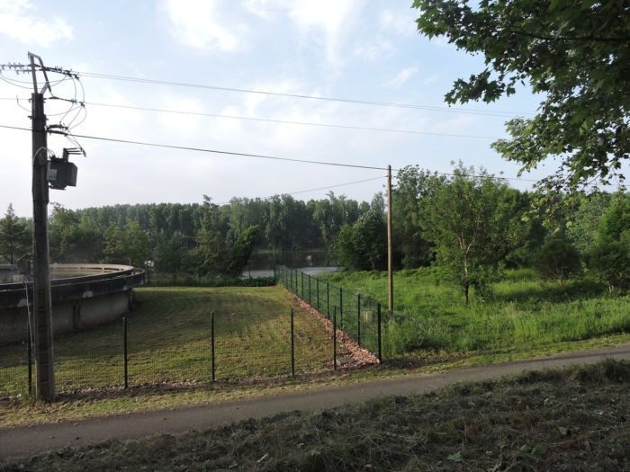
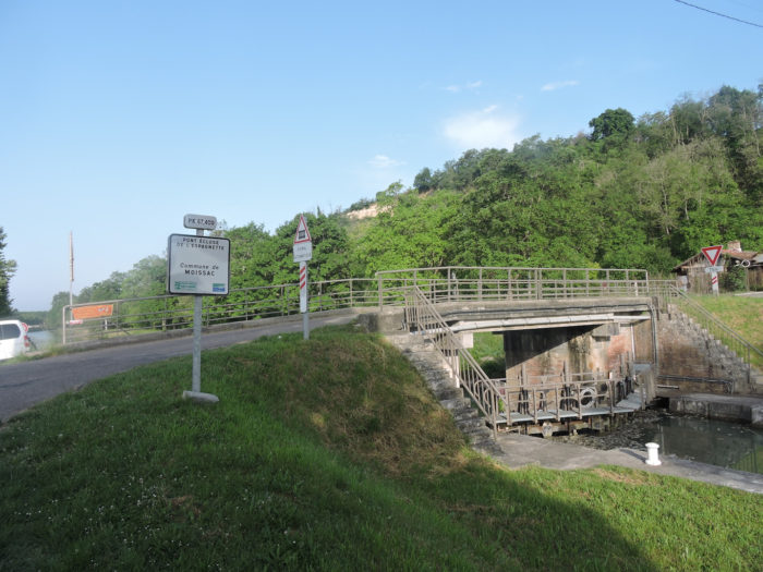
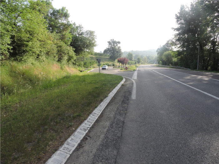
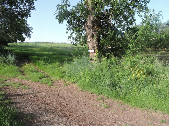
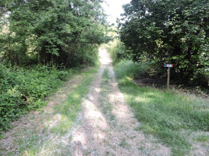
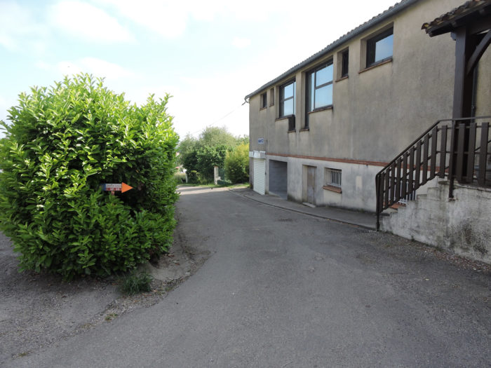
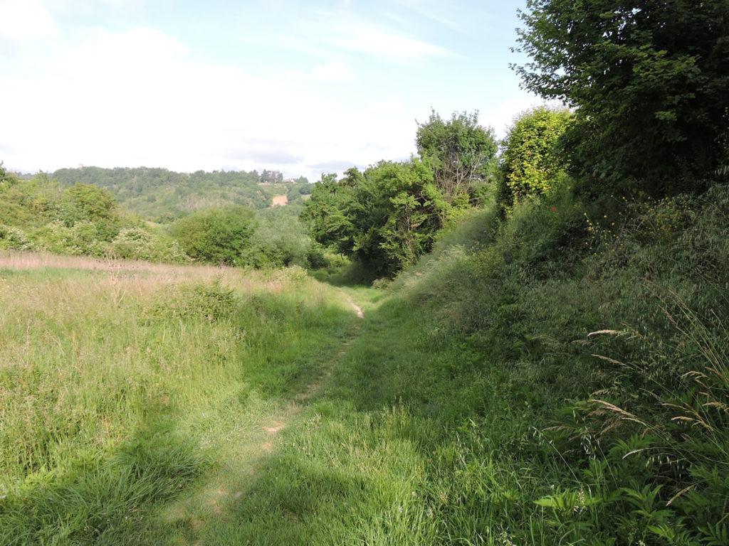
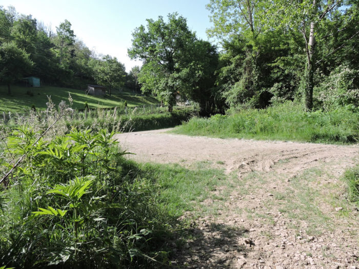
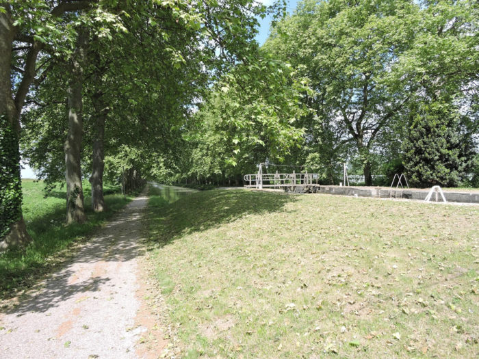
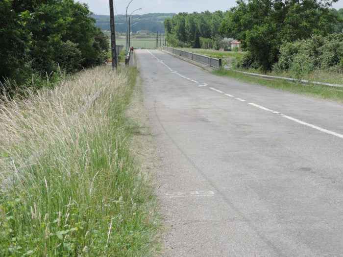
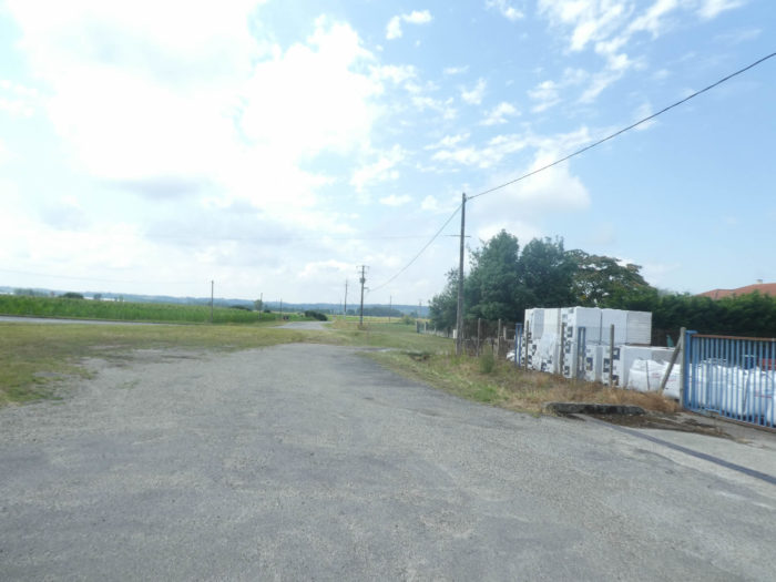
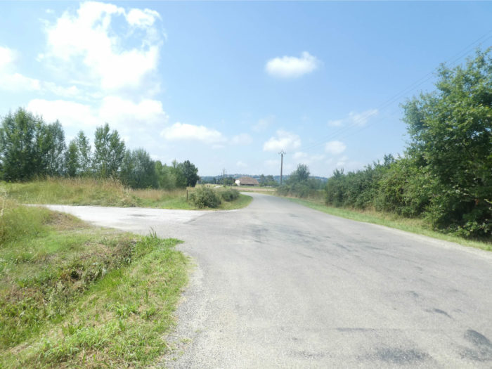
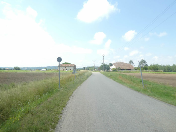
| The pathway then arrives at the Espagnette lock bridge. It is a strategic crossroads. Many pilgrims take GR variant which flattens along the canal. The most courageous then set off on the traditional GR path which will climb in the countryside above Tarn and Garonne Rivers. Here we will follow the GR65 for athletes. You can also read the route on the variant on the site. |
 |
 |
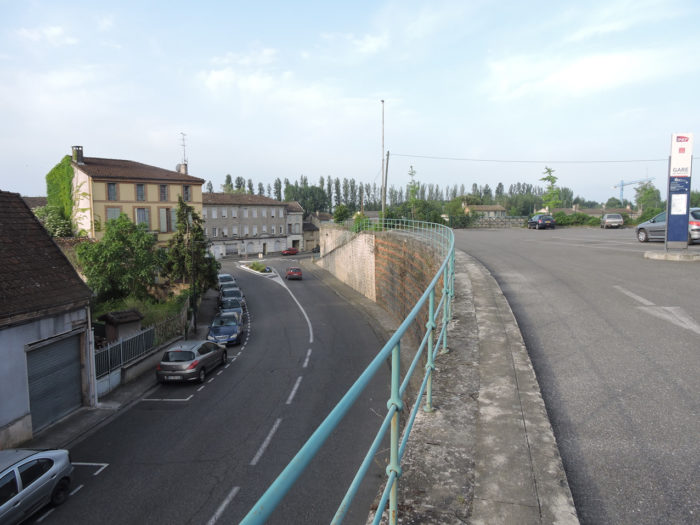
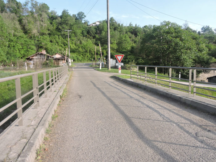
| The GR65 crosses the railway line, smoothens a little along the departmental road returning to Moissac. |
 |
 |
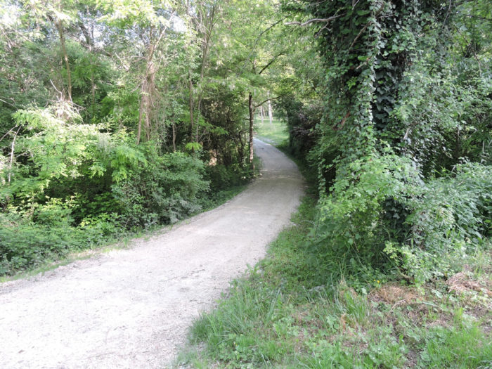
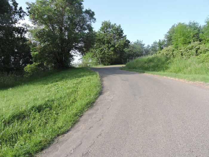
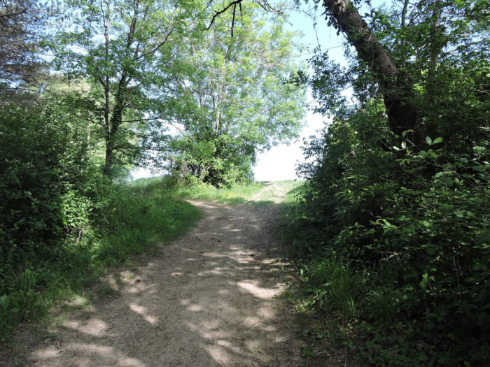
| At a crossroads, it leaves the main axis and begins the sloping switchbacks that lead above to La Roquette. |
 |
 |
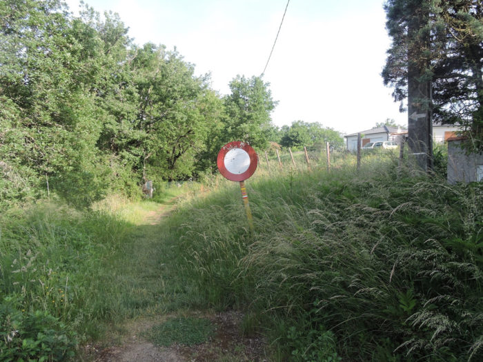
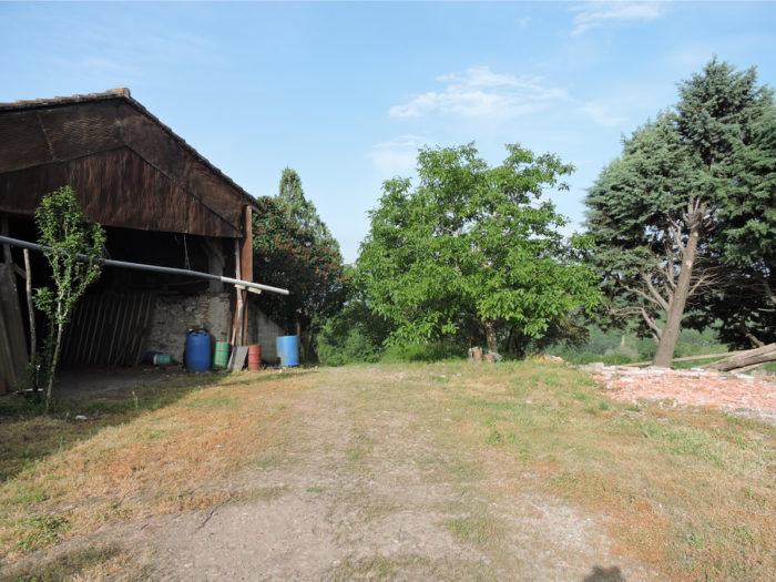
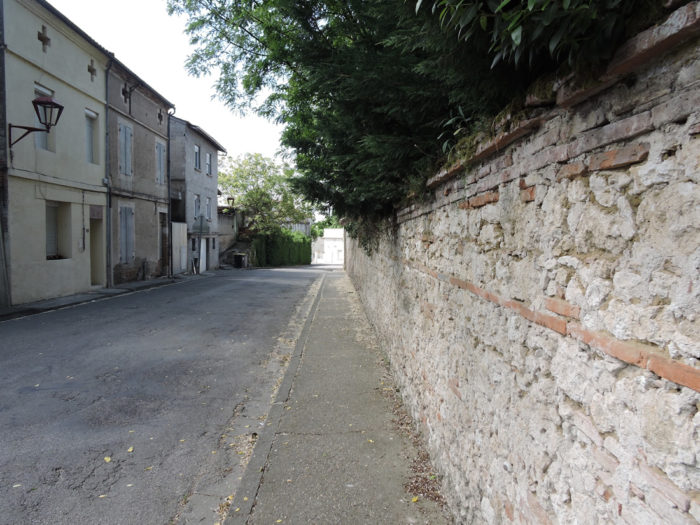
| You also understand here that some inhabitants of Moissac have taken up residence on the hillside, far from the floods of tourists and pilgrims who crisscross the city. |
 |
 |
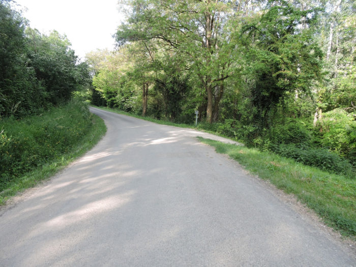
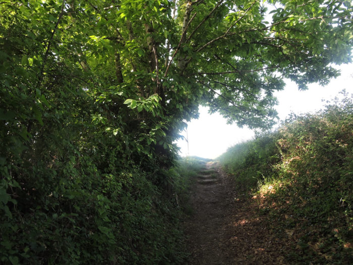
| The GR65 then follows the road a little longer before turning onto a lane which climbs steeply up the hill. |
 |
 |
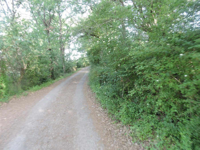
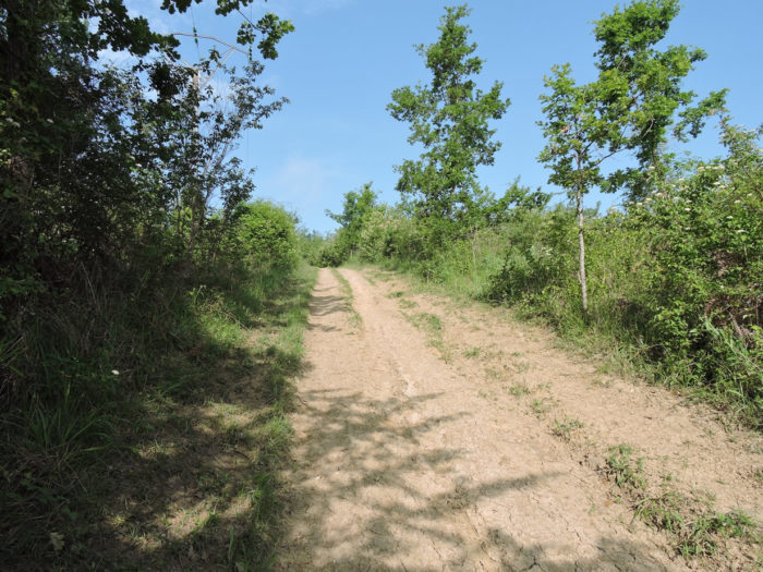
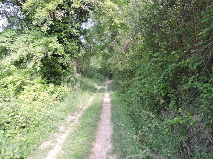
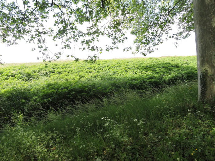
| Oaks reign in the undergrowth, but you can also see some hornbeams shoots and maple trees. Further up, the pathway leaves the undergrowth to reach the moor at the top of the hill. |
 |
 |
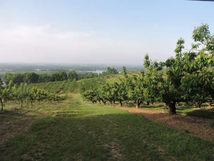
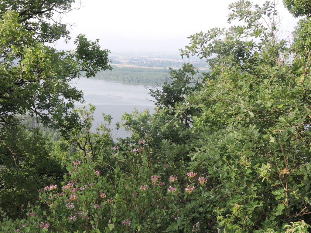
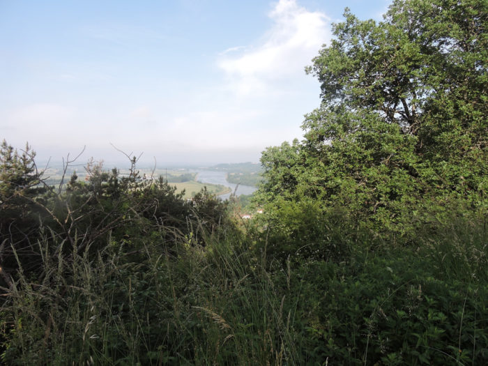
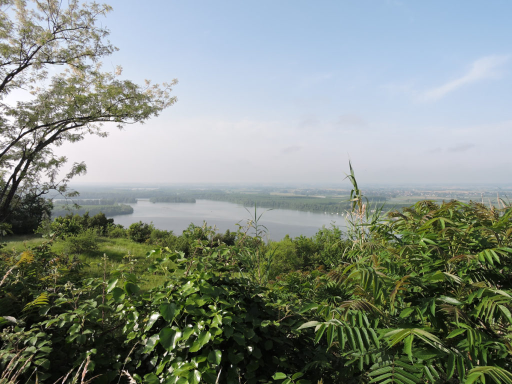
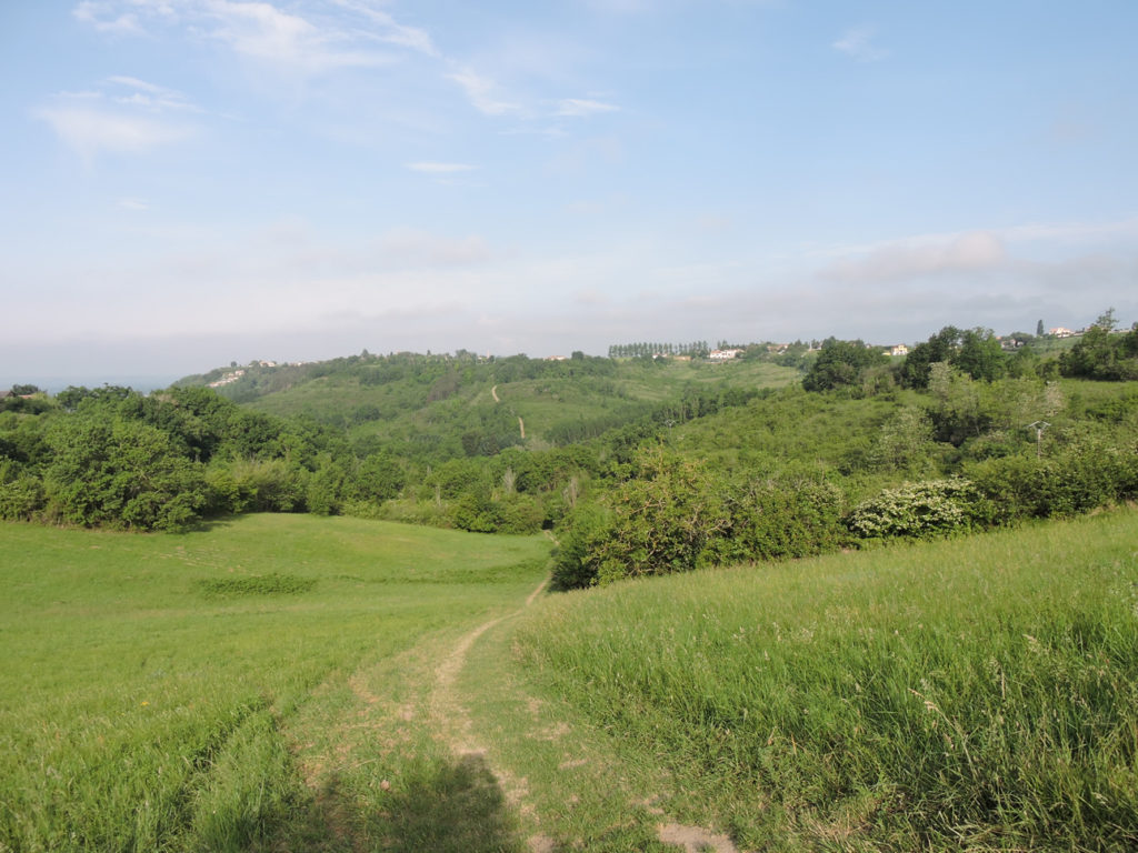
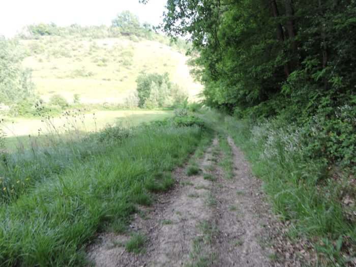
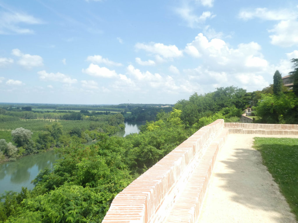
From up there, the panorama is superb, incredible. The Tarn River flows below and will soon join the Garonne River, which runs through a plain that stretches to infinity.

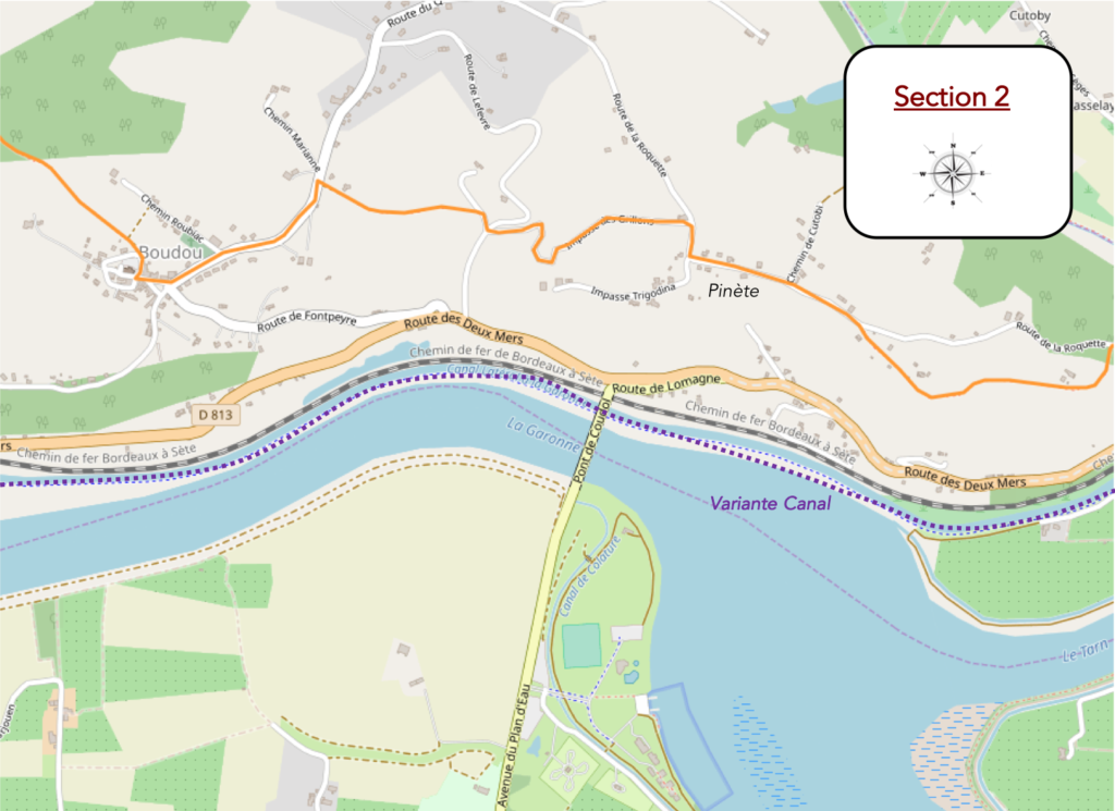
Section 2: Well above the junction of Tarn and Garonne Rivers.
General overview of the difficulties of the route: tough gymkhana with slopes often clearly greater than 15%, both uphill and downhill, sometimes with flat passages.

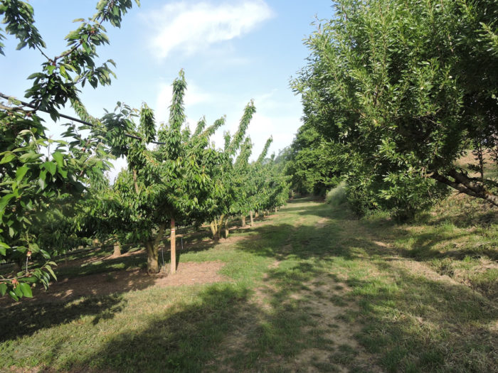
| Here the hillsides are smiling. Orchards and Chasselas vines benefit greatly from the sun, and undoubtedly from the autumn mist, so generous before the harvest. |
 |
 |
It is good to savor the scent of honeysuckle here, so sensual and dazzling. Below, behind the oaks and the honeysuckle, Tarn and Garonne Rivers mingle their waters, unite forever.
| How can you take your eyes off such a spectacle? Yet, the reality of the pathway is quite different. Beyond the orchards, the undergrowth reappears, and the lane climbs to the top of a small hill. |
 |
 |
| Further up, the pathway lands on a small plateau near the farms and villas of Pinète. |
 |
 |
A last look at the ballet offered by the two rivers, of which you do not really know which is the mother, which is the daughter, the waters are so mixed up. On the horizon stretches the vast plain of the Garonne River.
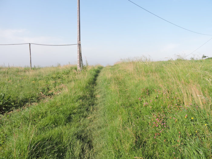
| A paved road here follows a ridge for a while where small hamlets and isolated villas have grown over time. |
 |
 |
How not to feel like a dwarf in front of this gigantic lime tree?

| The road then descends a little between villas and countryside. In the country people worship roses and cover the facades of their homes with them. Near a farm by the side of the road, GR path leaves the paved road for the dirt road. |
 |
 |
Opposite, you can already guess that you’ll have to climb up on the other side of the dale. The track looks there like a “little wall of China” that gets lost on the horizon.
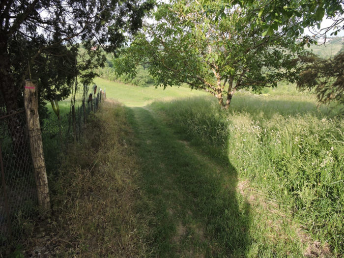
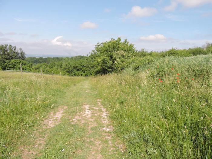
| Orchards and vines are behind you. A grassy lane then slopes down between meadows and undergrowth. The slope is sustained. Almost every time the Camino de Santiago descends towards a stream, the weeds and the thick bushes increase in strength. |
 |
 |
| The pathway slopes down to the bottom of the dale where it becomes a dirt track, after passing a short time on a road, which must reach one of the many hamlets perched on the ridges. |
 |
 |
| As anticipated, the climb up the hill is worth its share of sweat. |
 |
 |
For your pleasure…
Wait for the video to load.
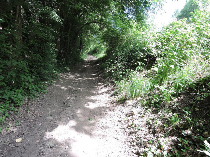
| The soil must be thankless in these little valleys. No more magnificent orchards, but the thick luxuriance of the bushes arranged in disorder, along the moor, on a demanding slope. Oaks are almost the only species of trees that grow in these arid lands. |
 |
 |
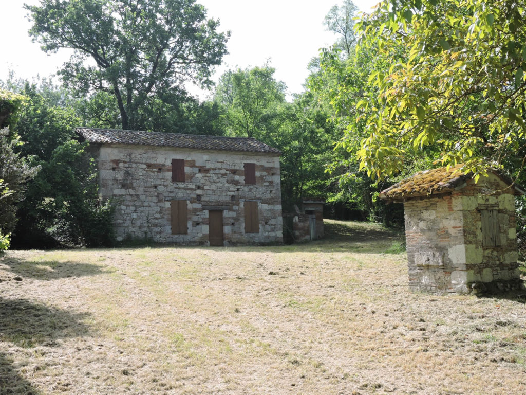
| The climb ends in the hamlet of Delbrel, near the Boudou bowls pitch, where there are so many bowl courts that they could organize the world petanque championships. |
 |
 |
| Boudou is located just below on the road. |
 |
 |
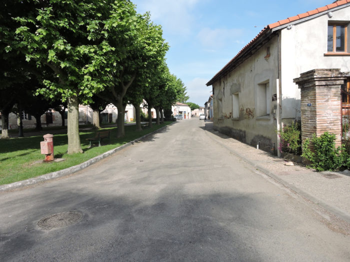
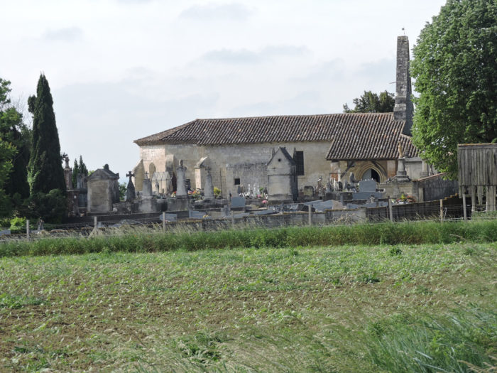
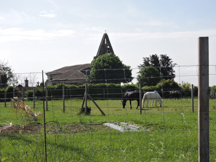
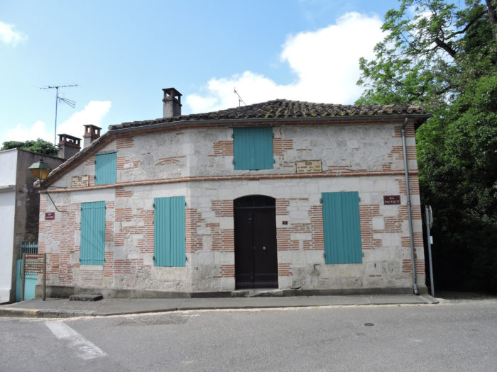
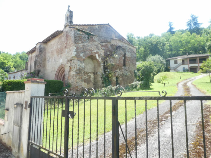
| The activity is mainly agricultural in this small village grouped around the Church of St Pierre, with its bell tower. Boudou has been known since the dawn of time for having been an essential stopover on the Camino de Santiago. There was a pilgrim hospital here, which has now disappeared, like everywhere on the Camino de Santiago. |
 |
 |
| The GR65 leaves at the corner of the village. |
 |
 |
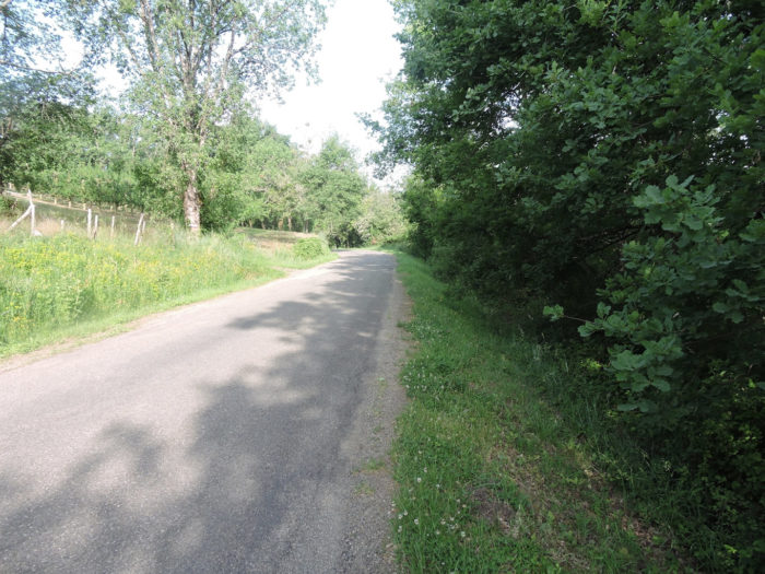
| The pathway finds again a moment the orchards and their almost geometric implantation. The ground must be generous here, synonymous with beautiful fruit. |
 |
 |
| This contrasts easily with the jumble of copses that the pathway finds further down. |
 |
 |
Section 3: Ups and downs above the plain.

General overview of the difficulties of the route: another nice ramp here beyond Pugnal.

| The pathway slopes down until you find the Sérène brook, which you can only guess in the thickets. |
 |
 |
| After crossing the small stream, the pathway climbs back up the other side of the dale for a short time. |
 |
 |
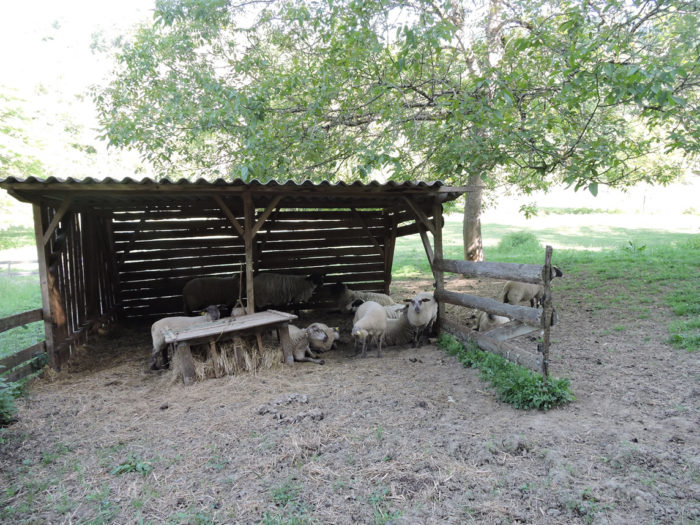
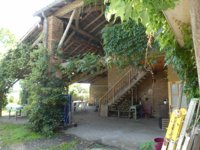
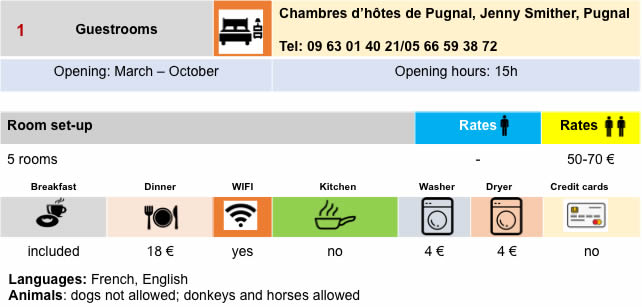
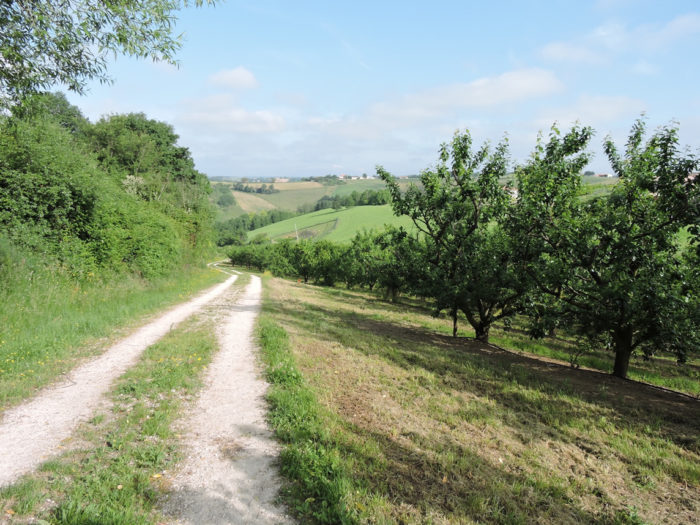
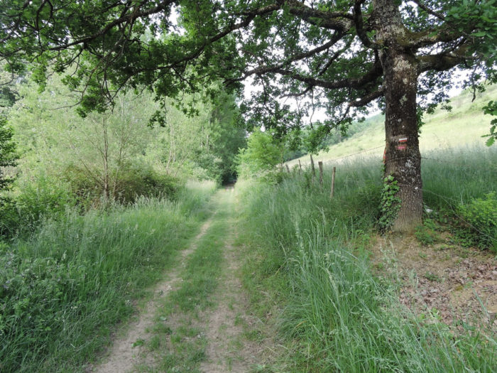
| A wide dirt road then flattens through the undergrowth of oaks and chestnut trees to the large farm of Pugnal, where you can find accommodation, under the trees. The setting is quite exceptional, bucolic it must be said, with these sheep which, under the large trees, make hedges of honor for you. |
 |
 |
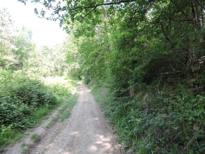
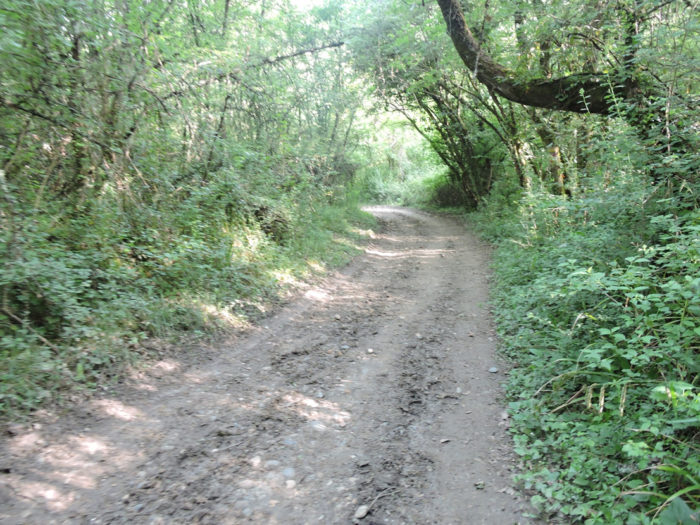
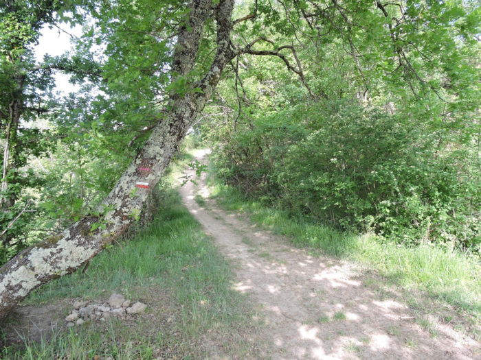
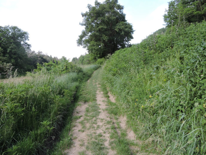
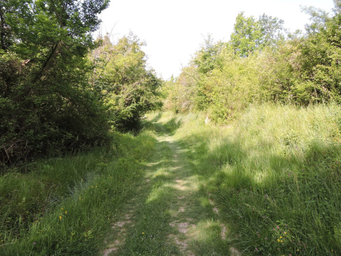
| Beyond Pugnal farm, a dirt road will climb steadily through the undergrowth. Quickly, you find yourselves in the ruts left by the tractors on the ocher ground. You can guess that here in rainy weather, the climb must be quite difficult. This must most likely be the case, as a parallel track, less bogged down, has developed in places over time. Pilgrims, unlike wild boars, like to avoid mud. |
 |
 |
| In the woods grow oaks, but also maples, hornbeam shoots and chestnut trees. When you cross the center of France, you have the feeling of living in a large forest of oaks, among wild boars. And the naive to imagine that France is Paris, with a few moors around! |
 |
 |
| The climb is quite long, almost a kilometer over pounded dirt, hardwoods and brush. Sometimes the pathway is almost clay, a real treat in rainy weather. |
 |
 |
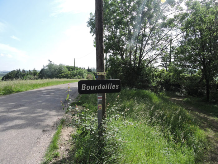
| Further up, at the top of the hill, the pathway joins a paved road near the place called Bourdailles. |
 |
 |
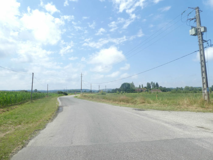
| Further afield, a small departmental road slopes down into the countryside, in the direction of Malause. |
 |
 |
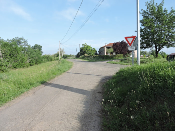
| A little further down, another road takes the direction of Ste Rose. Cvilization is taking back its rights here. Yet, you do not meet on the way hardly any native. There is nothing but pilgrims walking alone or in groups, silent, engulfed in their thoughts. |
 |
 |
| You’ll see from here the Garonne plain. |
 |
 |
| Beyond Ste Rose, the GR65 crosses the wheat fields, then begins to descend onto the grass in the thickets and undergrowth, where the smell of honeysuckle is still present. |
 |
 |
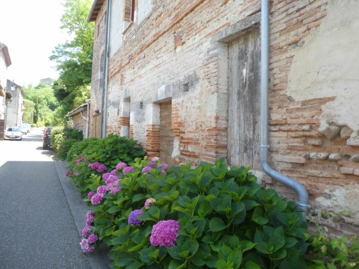
Along the way, the pathway passes near a magnificent farm that can sometimes be found in the region, with its characteristic architecture, where narrow red bricks, jointed with lime or cement, mingle with limestone rubble. The closed shutters speak for an abandonment.
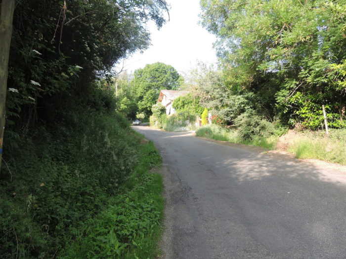
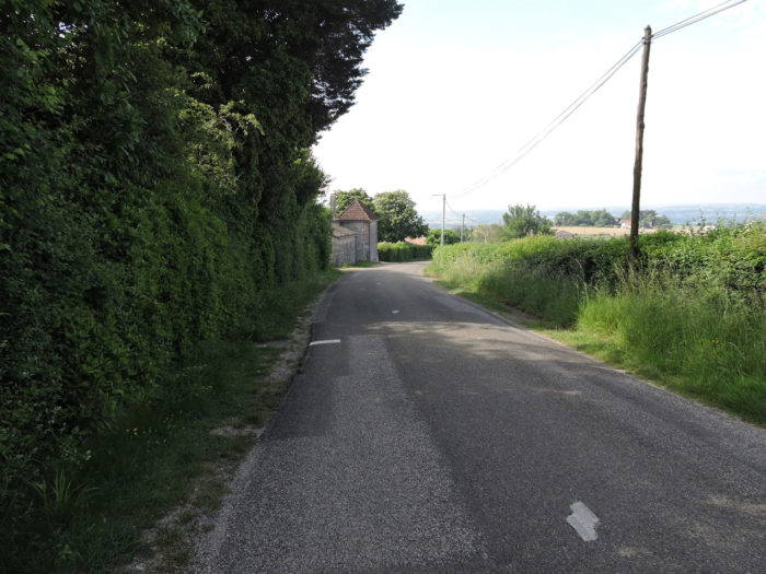
| Malause is within gunshot, just below. A small road leads to the village. |
 |
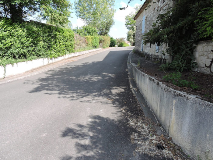 |
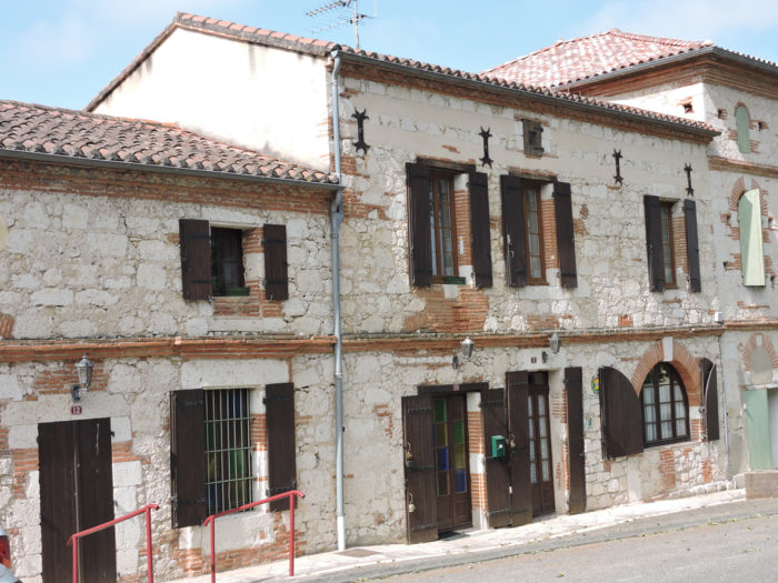
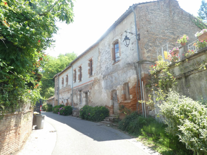
| Grouted bricks can be found in some houses in the village. The church of St Jean Baptise, in neo-Romanesque style, is of fairly recent construction (XIXth century). |
 |
 |
Section 4: Return along the magnificent Canal des Deux Mers.

General overview of the difficulties of the route: course without any difficulty.

| The GR65 then slopes down to the bottom of the village … |
 |
 |
| … until you cross the railway tracks. |
 |
 |
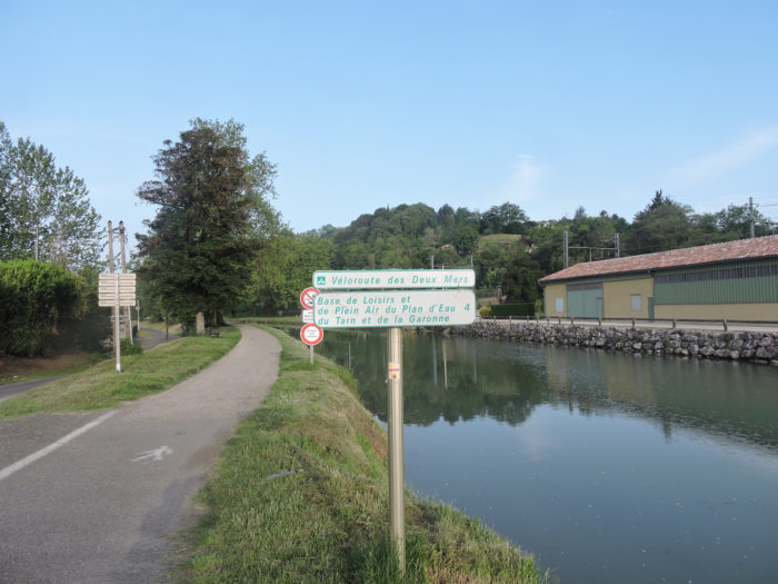
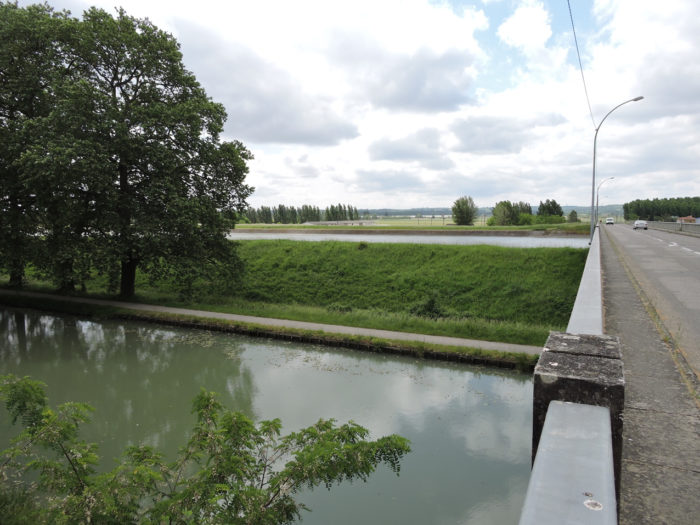
| On the other side of the bridge, the course joins the GR variant which also arrives here along the Canal des Deux Mers. Seeing the large number of pilgrims who walk there, most of them neglect the beauties of the hillsides and prefer flattening along the variant of the canal. Each according to their tastes, or rather according to the state of their joints! |
 |
 |
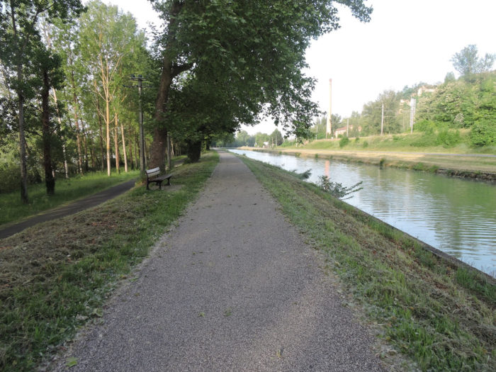
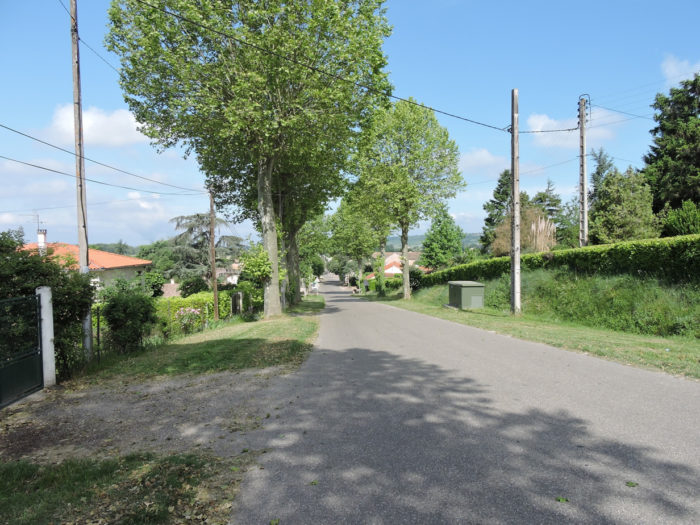
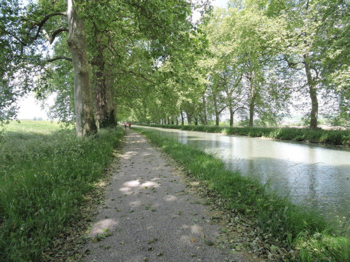
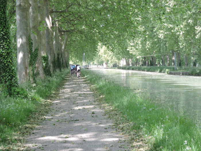
| The pathway quickly finds its bearings under the majestic plane trees and poplars. |
 |
 |
Sometimes a small boat passes on the canal.
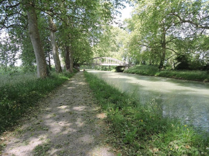
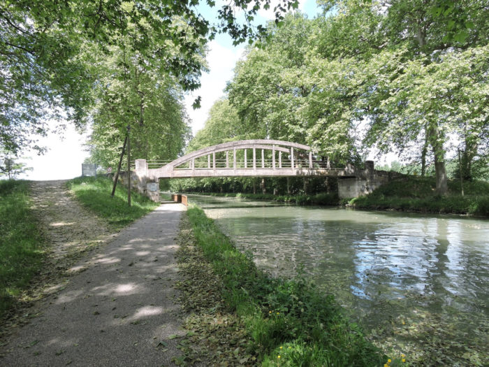
| A first bridge, the Captain’s Bridge appears on the canal. These bridges are a bit like lighthouses at sea, marking the advance of the track. |
 |
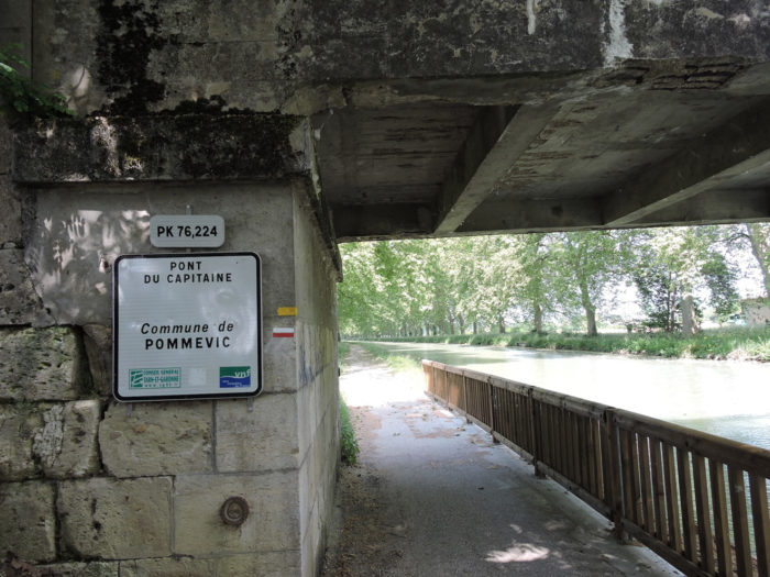 |
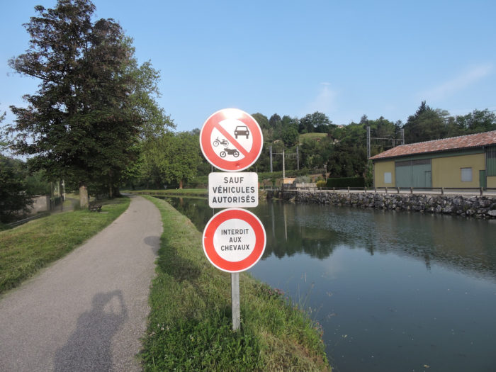
| The pathway belongs to walkers, cyclists and pilgrims. Sometimes you can hear the bells of amateur cyclists behind you announcing their imminent arrival and marching past one after the other on the axis. There is not a minute to waste when riding a bike, equipped like a pro. The pilgrim takes his time, dawdles, his nose in the air. |
 |
 |
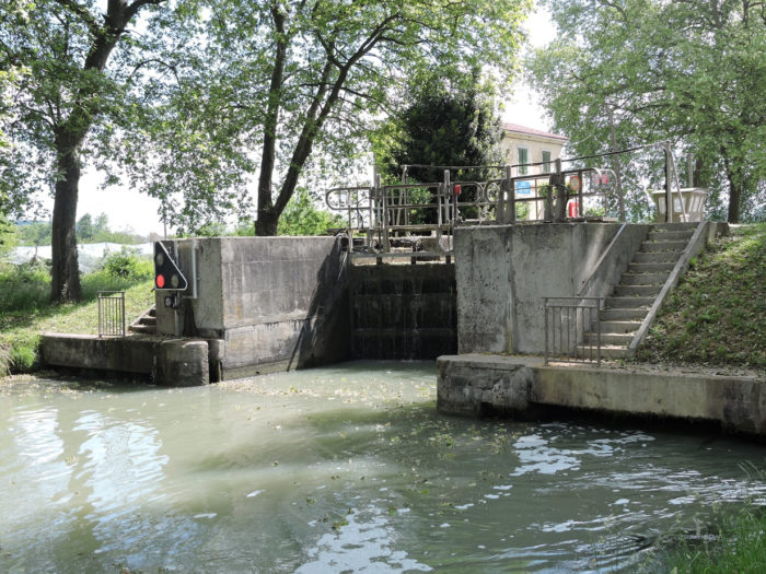
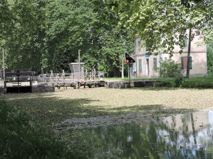
| A lock here cuts the canal. Apparently, no lock keeper is handling the traffic here. Maybe in the summer some idle students do the job. But any amateur boater knows how to use the hydraulic cylinders on both sides of the lock to open or lock the doors, to bring water in or out of the lock. Pilgrims often act as spectators of the ballet or help with the maneuver. According to your technical means! |
 |
 |
| On both shores, agricultural and present activity, especially in oilseed fields. |
 |
 |
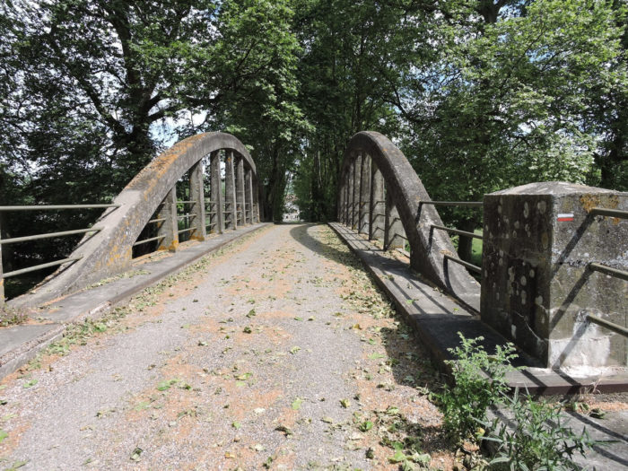
| Further ahead, the pathway arrives at the last bridge, where you will have to leave this marvelous landscape. You arrived at Pommevic Bridge. |
 |
 |
| The GR65 then crosses the canal and reaches Pommevic on the paved road. |
 |
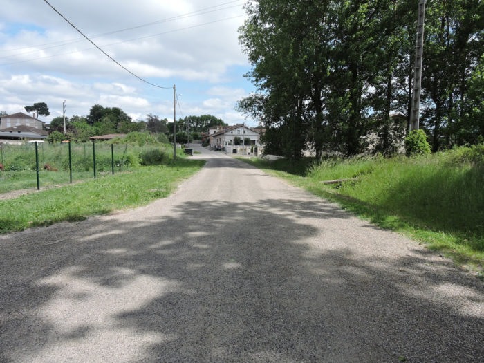 |
| It joins the large departmental road which crosses the village right through. |
 |
 |
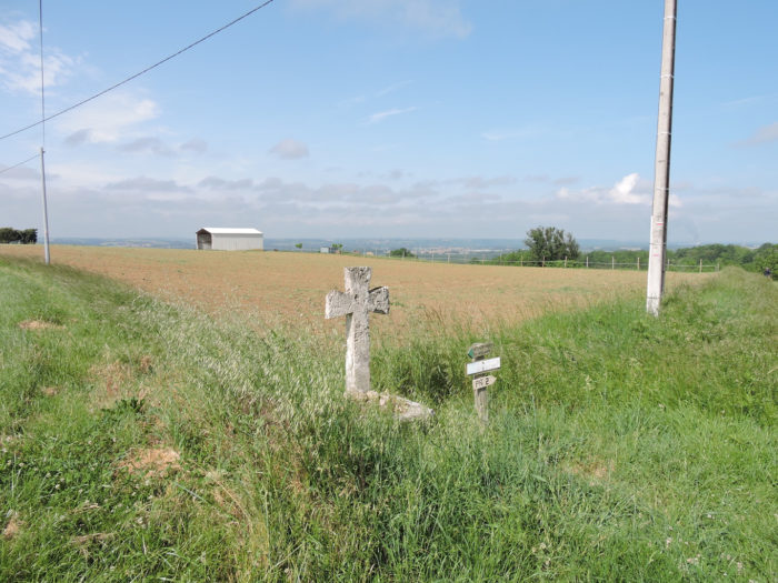
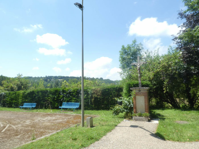
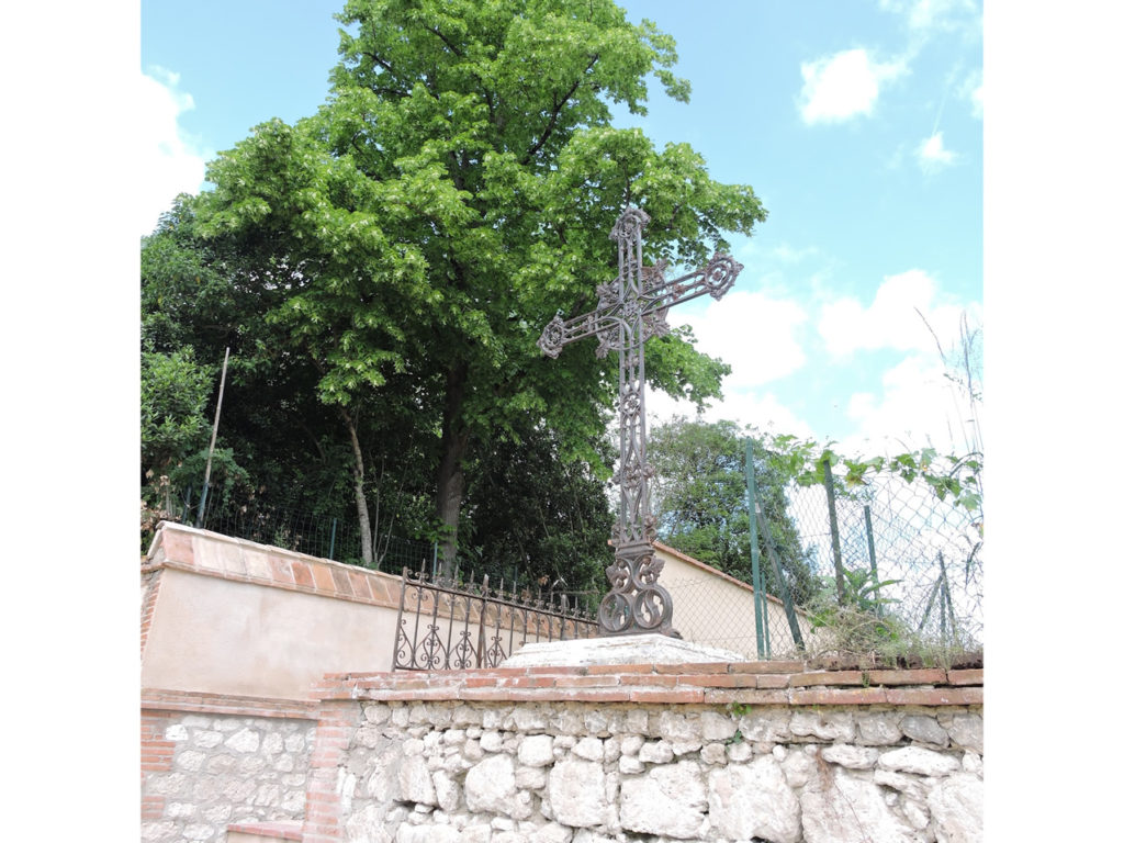
A large metal cross signals a small detour through the village.
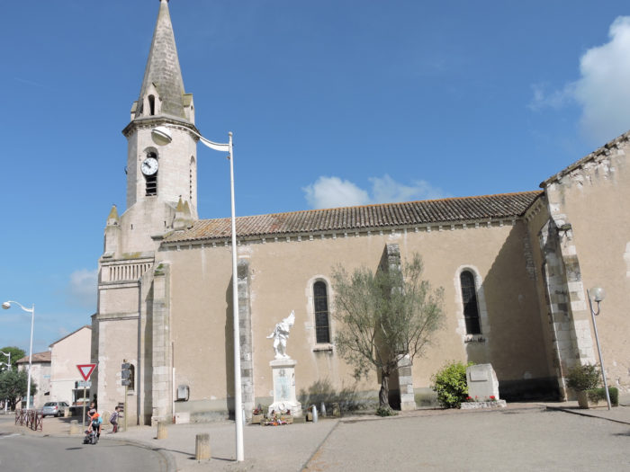
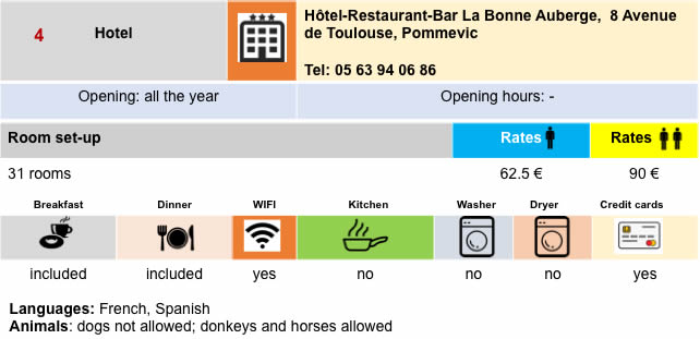
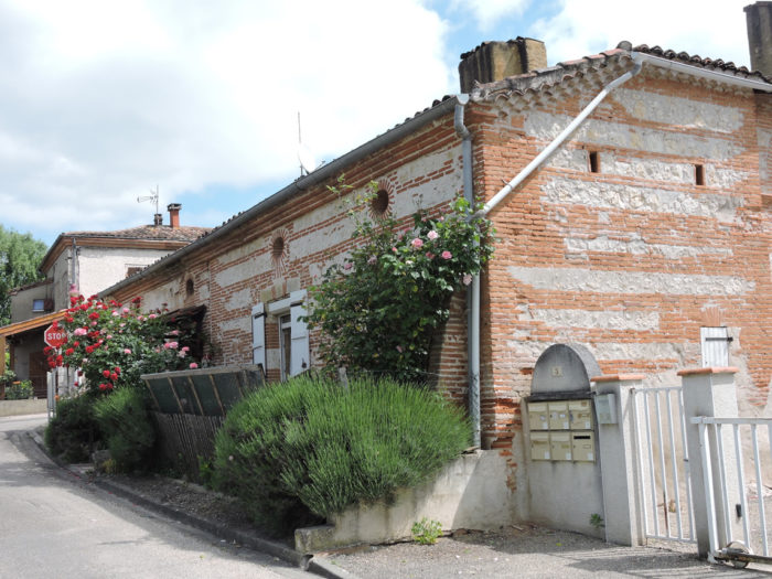
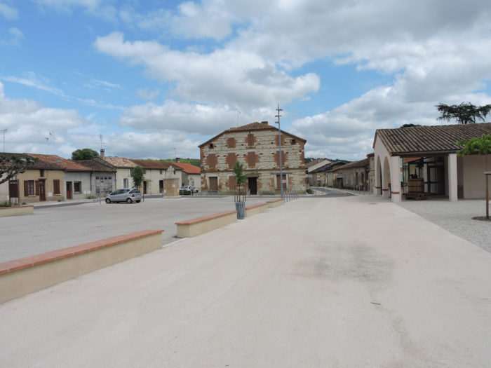
| This is to go and view the brick houses, the castle tower and the church. The XIth century church of St Denis only preserves a section of the wall, the base of the bell tower and the apse. There is nothing very exciting around here. In Pommevic, you can find accommodation and food. |
 |
 |
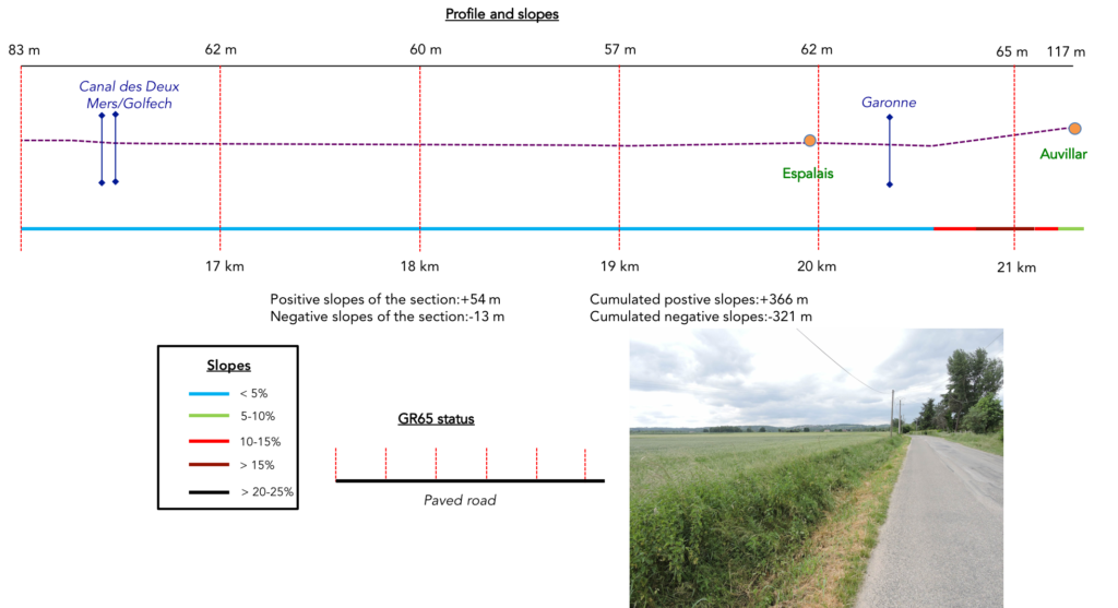
Section 5: On the dull plain of the Garonne River before Auvillar.
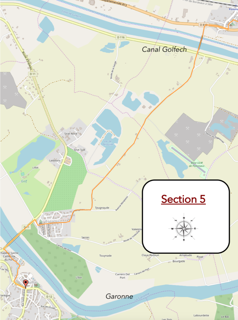
General overview of the difficulties of the route: without difficulty, except for the ramp to Auvillar.
| Beyond Pommevic, GR path returns to the other side of the canals. |
 |
 |
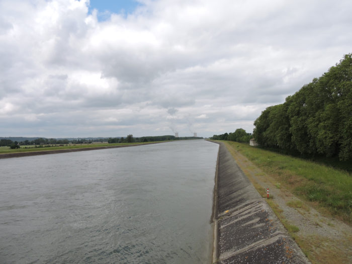
| It first crosses the Canal des Deux Mers and then the Golfech canal, a diversion of the Garonne that goes to the nuclear power plant. |
 |
 |
As the weather turns to rain, from here we will describe the route to Auvillar on a sunny day. Unlike our last visit here where the weather was gloomy, the weather was still fine in the region. But that will not change the punishment, because it is obviously difficult to go from the sublime of the canal to the banality of the flat countryside, where nothing happens.
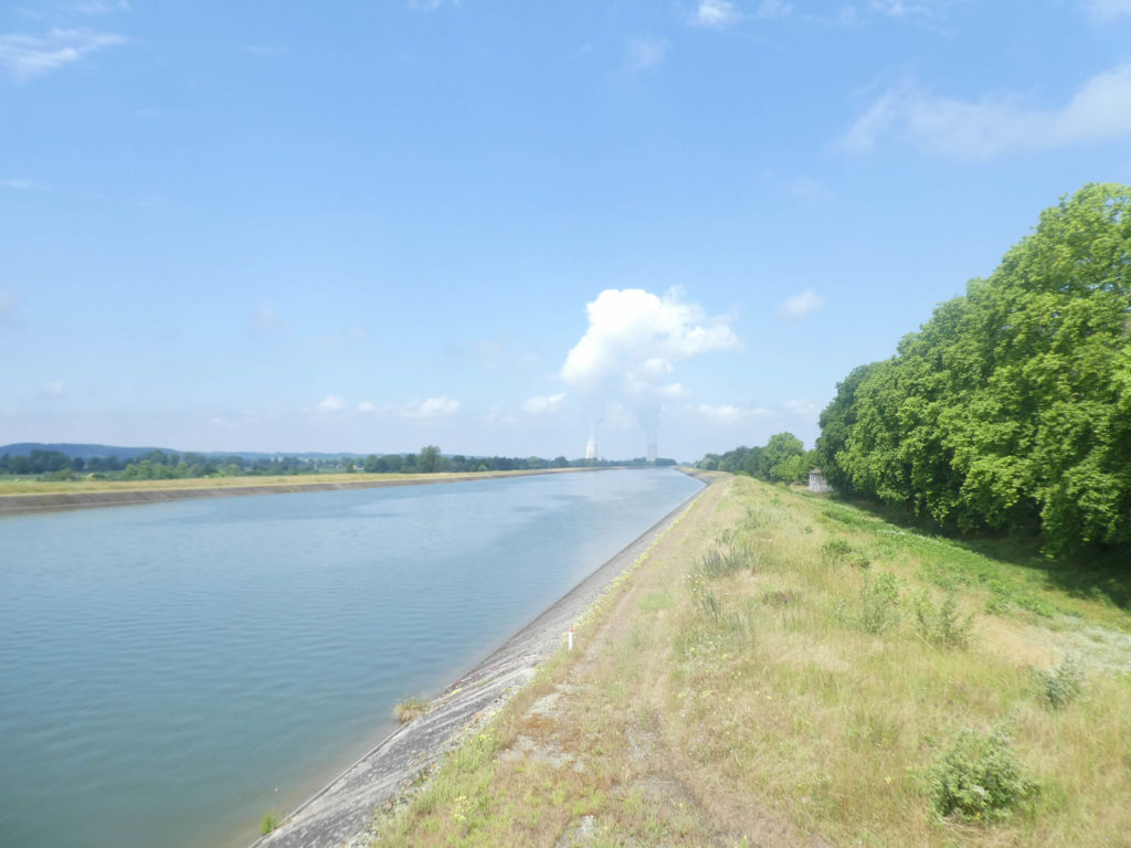
In a not very distant horizon appear the monstrous towers of the Golfech nuclear power plant. Monstrous is saying a lot. This site with two nuclear reactors has the tallest refrigeration towers in Europe, reaching a height of 170 meters. Across the country, as soon as you climb to the top of a hill, you only see these two huge warts and their string of water vapor disfiguring the landscape. Come on! A wind turbine is hardly more elegant, unless it is lined up along barren hills, like in Spain.
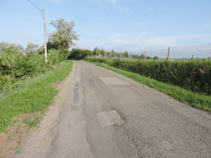
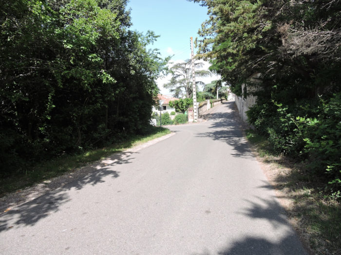
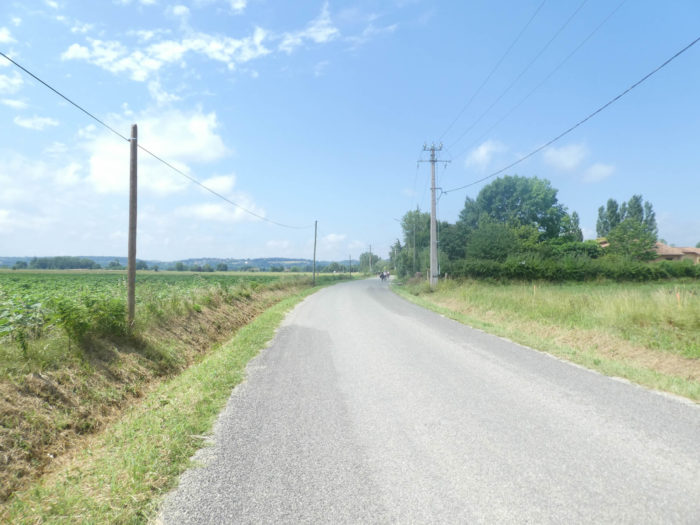
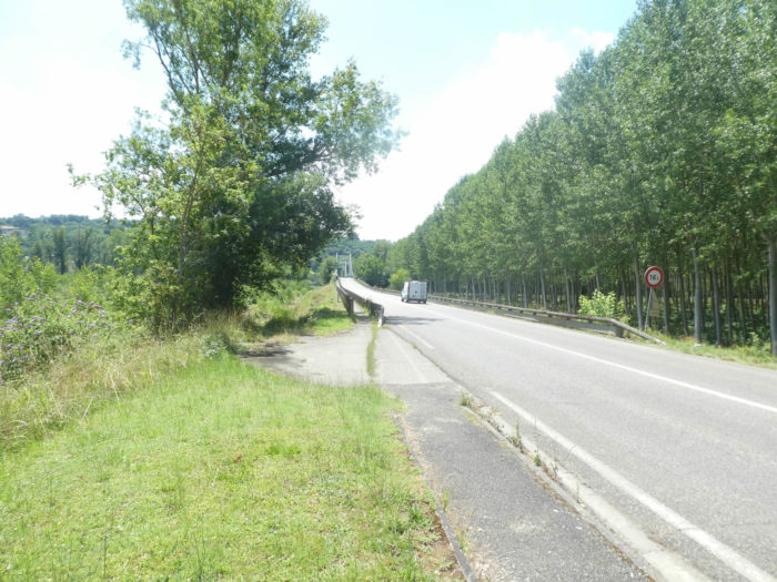
| Until Espalais, it is not a joy for walkers. You just have to follow a small asphalt road through the countryside that flattens for many kilometers. |
 |
 |
| Today, it is sunflowers and corn that cover the fields. Another time, it might be wheat. |
 |
 |
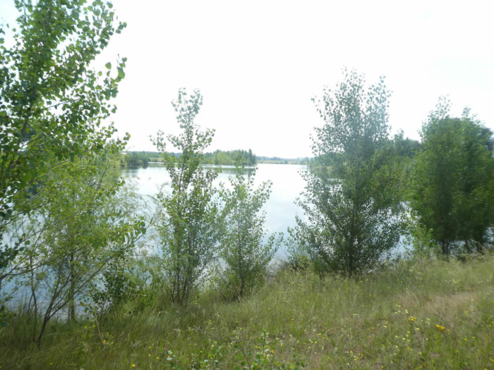
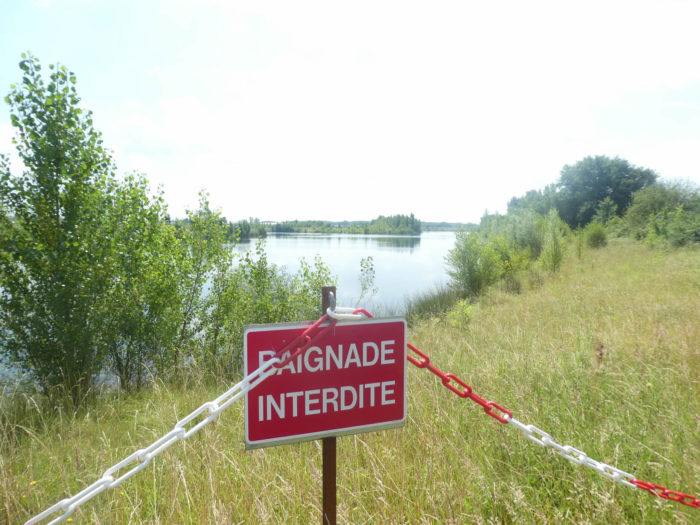
| A little further on, the organizers of the track drew a pathway a few hundred meters in the grass, probably to allow us to graze a small lake. Many lakes and ponds dot the plain, well-watered here. |
 |
 |
| But you won’t make old bones here. There is no place for a picnic or to go soak your feet in the water, and the GR65 immediately finds tar back. |
 |
 |
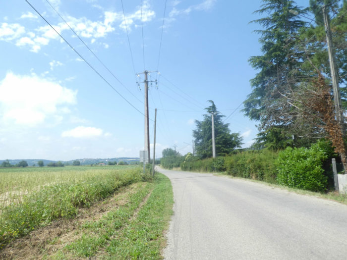
| In this wide plain which runs through the middle of oilseeds and cereals, market gardening is also an important part of agricultural work. But pilgrims do not linger to admire the scenery. |
 |
 |
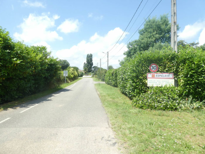
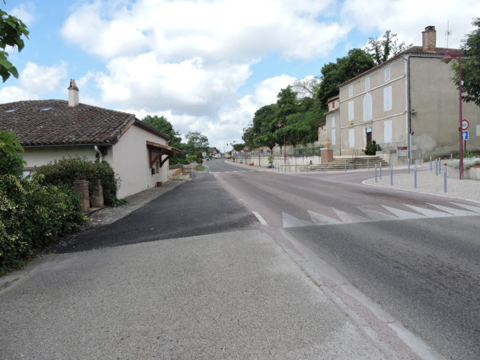
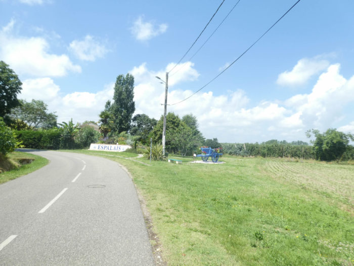
| The paved road gradually approaches Espalais. Up there, in front of you, Auvillar points over the hill, above the bleak plain. Espalais is expected as a sort of deliverance. |
 |
 |
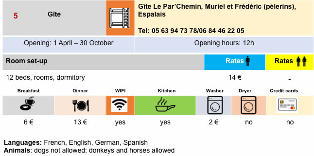
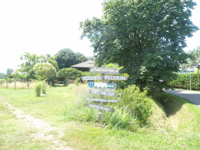
| At the entrance to the village, you can stop or stay at the Par’Chemin, one of the most beautiful gîte, if not the most magnificent, on the Camino de Santiago. The welcome and atmosphere are out of this world. |
 |
 |
| In Espalais, neither a sheet nor a piece of paper is lying around. You may eat on the road. It’s a safe bet that the EDF, to be forgiven, is giving valuable subsidies here. Many nuclear power plant employees must live here. The factory employs a thousand people. The church of St Orens is relatively recent. Many pilgrims stop in the small park adjoining the church. May the Virgin and Christ protect the people here from a hypothetical nuclear problem! |
 |
 |
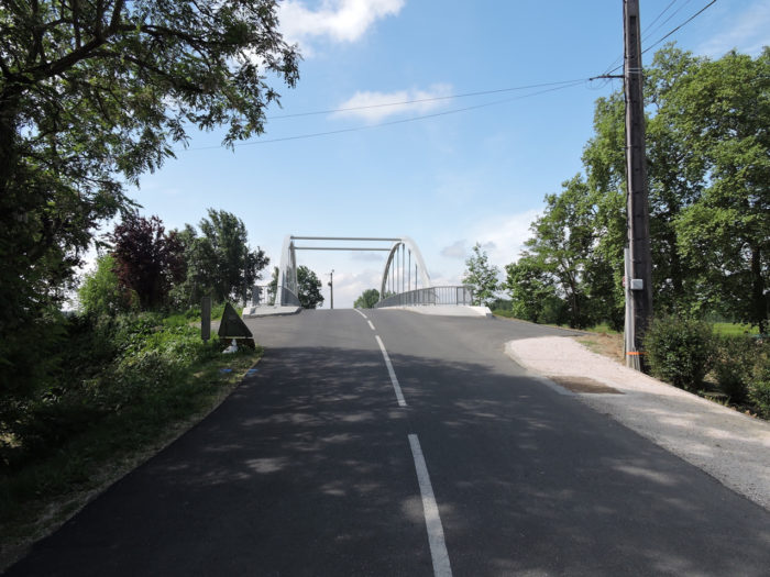
| On leaving the village, the GR65 heads to Garonne Bridge. |
 |
 |
| Auvillar is just across the bridge, across the river. From the bridge, the view is breathtaking over the Golfech power station. The steam from the power station rises in the azure firmament like a prayer to Heaven. |
 |
 |
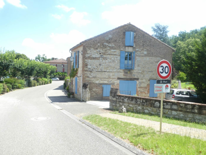
| The road arrives at the bottom of the village of Auvillar, near the port, passes near the old chapel of Ste Catherine du Port. The origin of the port of Auvillar goes back a long way, when it was known how to organize transport on rivers. There was the presence of a toll before the XIIth century, and boatmen were numerous. The inns were also to flourish there because the toll was compulsory. |
 |
 |
| In the Middle Ages, the boatmen had built in all the toll cities chapels dedicated to Ste Catherine, patron saint of the people of the river and of the philosophers. The church here almost certainly dates back to Carolingian times, so well before the Xth century. Although the dates are unclear for this building, it was partially rebuilt in the XIVth century on the orders of Pope Clement V. The fact remains that with the state of the walls, it does not date from the last century. However, it bears the imprint of the brick constructions of the region. A curious fact to note: the presence of the driveway of the villa which adjoins the building, curious and anachronistic, right? |
 |
 |
| As with the chapel, near the port there are many houses with the brick architecture of the region. |
 |
 |
| The climb to the center of the city is very severe here. |
 |
 |
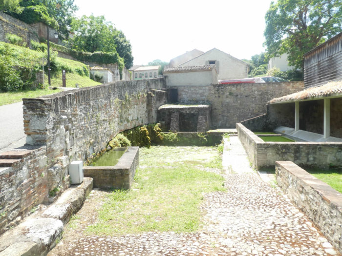
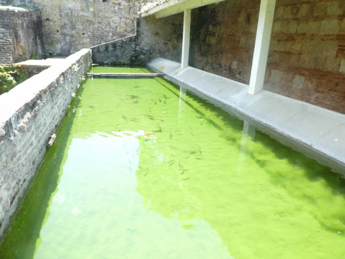
| On the road, you will come across a very beautiful site, as if hanging from the wall. It is an old wash house, which was partly restored a few years ago. |
 |
 |
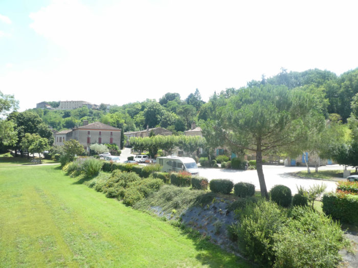
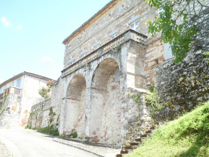
| At the top of the steep climb, the road passes under the magnificent building of the communal gîte, and through narrow and cobbled streets arrives at the center of the large village along high walls and houses from another age, whose colors hesitate between the yellow, pink, white and ocher. |
 |
 |
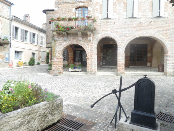
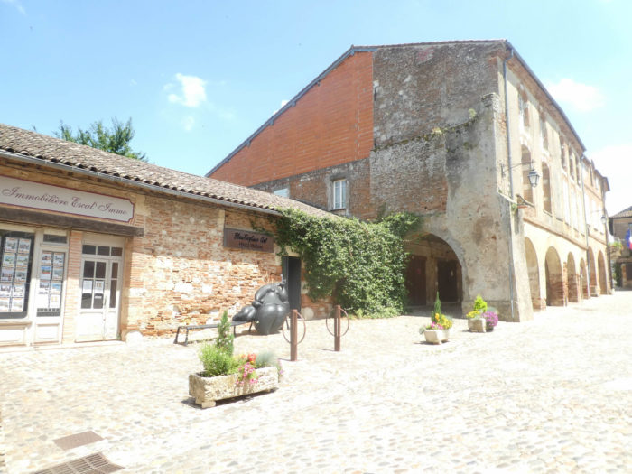
| Auvillar (1,000 inhabitants) is part of the category of the most beautiful villages in France. And with good reason, because there are many villages which are also entitled to the appellation, but which do not present the overall unity and charm of the latter. In the middle of the cobbled central square stands a magnificent circular market hall dating from 1825, a real gem, undoubtedly the most beautiful market hall in the southwest region, which has many. Harmony reigns supreme here. |
 |
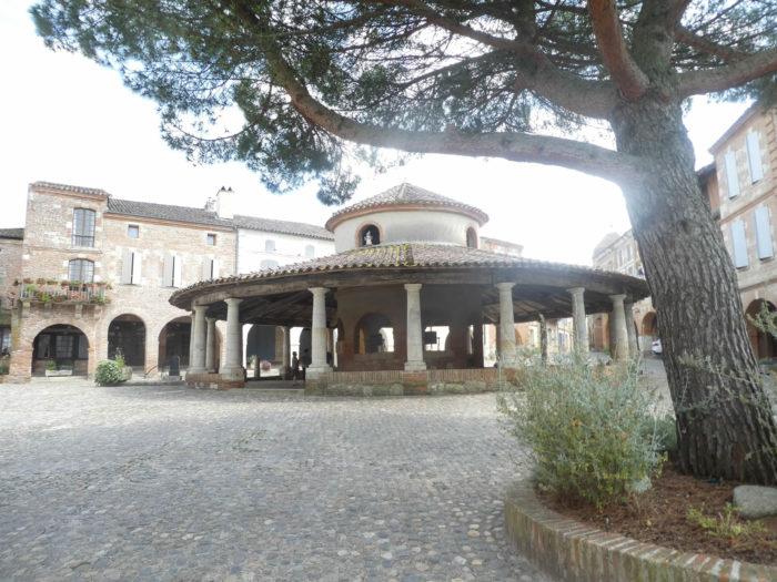 |

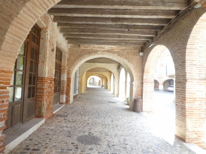
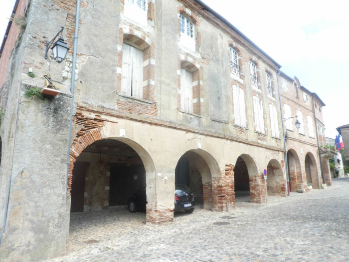
| All around the square are the beautiful brick and lime houses under the arcades, which date back centuries, even if they were not born in the early Middle Ages. |
 |
 |
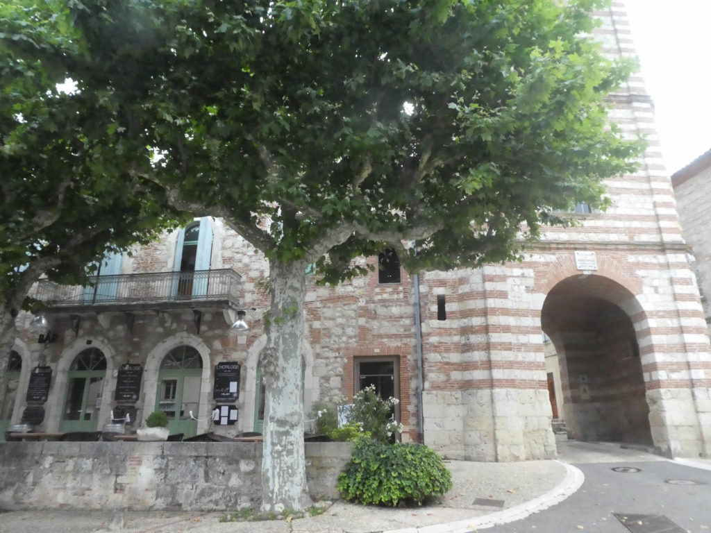
| Opposite the market hall stands the beautiful Clock Tower, a monumental gate dating from the XVIIth century, which marks the entrance to the old town. In an adjacent lane, a small museum presents a collection of earthenware, which made the reputation of the place in the XVIIIth and XIXth centuries. Boats left the port to deliver the precious dishes. |
 |
 |
And what more can be said than to celebrate the majesty of the Hôtel de l’Horloge which adjoins the tower?

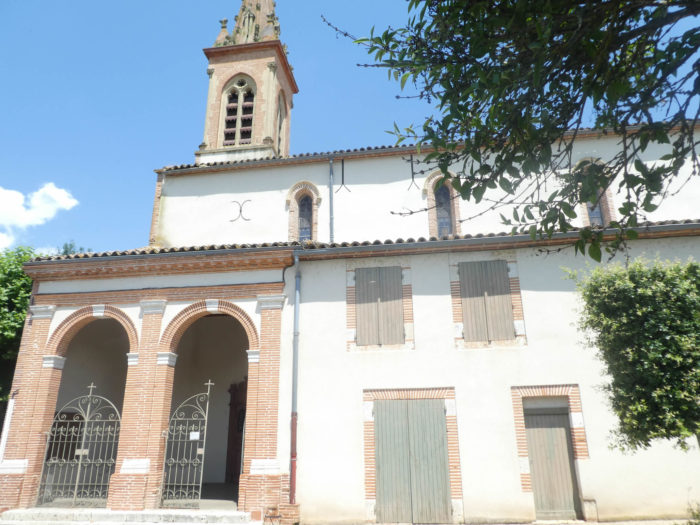
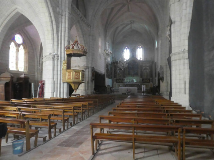
| Saint-Pierre Church, a former XIIth century Benedictine priory, later restored, is a mixture of Romanesque and Gothic art. Here, the architects respected the additions of red bricks so present in the region. The church is beautiful and quite bright. |
 |
 |
All you have to do is stroll through the alleys and take a look at the Garonne River which runs through the plain towards Bordeaux and the Gironde, and which you will never see again for the rest of the course.
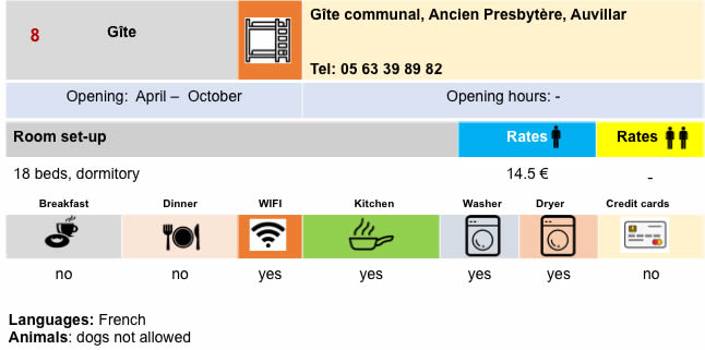
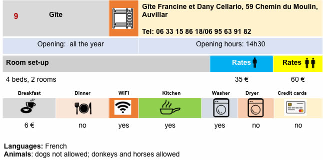
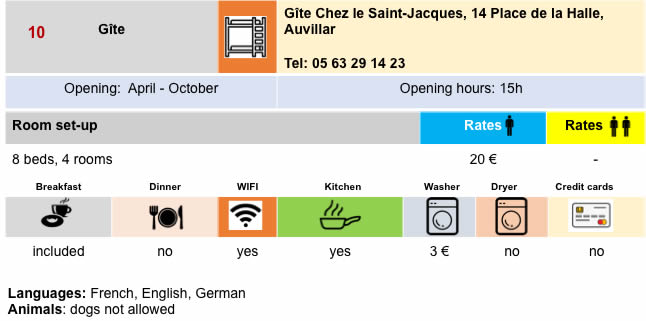
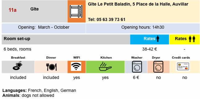
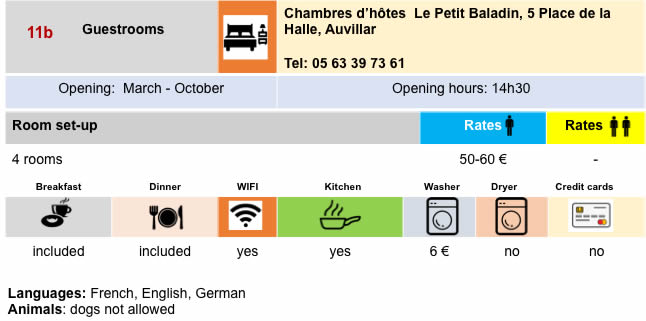
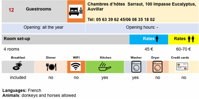
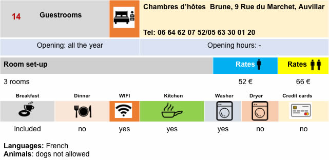
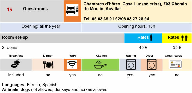
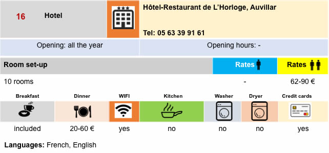
Lodging
Feel free to add comments. This is often how you move up the Google hierarchy, and how more pilgrims will have access to the site.
|
 |
Next stage : Stage 20b: From Moissac to Auvillar (GR65 variante) |
|
 |
Back to menu |
Sentiti libero di aggiungere commenti. Questo è spesso il modo in cui sali nella gerarchia di Google e come più pellegrini avranno accesso al sito.
|
|
Tappa prossima : Tappa 20b: Da Moissac a Auvillar/variante GR65 |
|
|
Torna al menu |