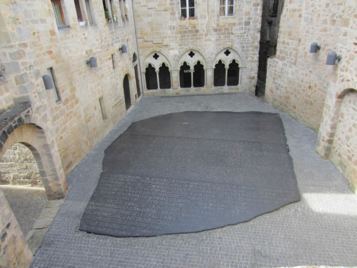
The Rosette Stone is an engraved plaque found in 1799, near the city of Rosette in Lower Egypt. This granite stele carries a decree of 196 BC. J-C of Pharaoh Ptolemy V, composed of 3 scripts: hieroglyphics, demotic and Greek. It is exhibited at the British Museum London. It is well known that the deciphering of this stele was established by Jean-François Champollion (1790-1832), said Champollion the young, native of Figeac, in the street of Boudousquairie, the seventh and last child of a father bookseller and of a mother weaver.
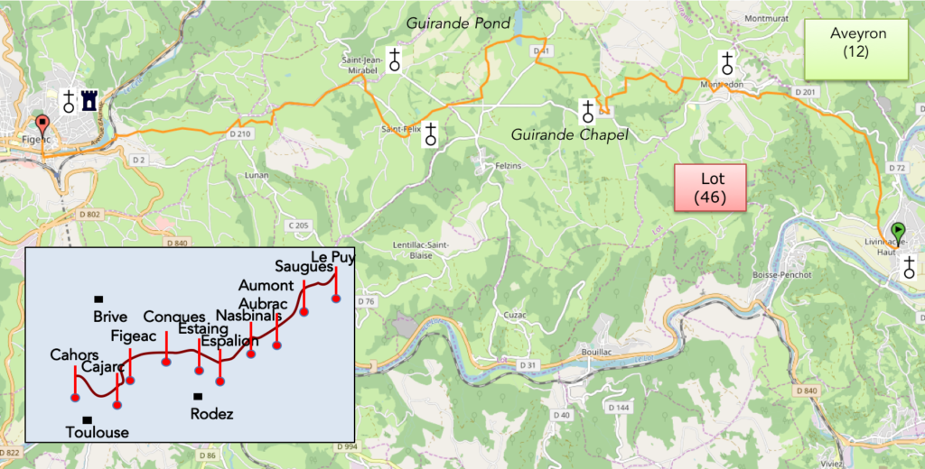
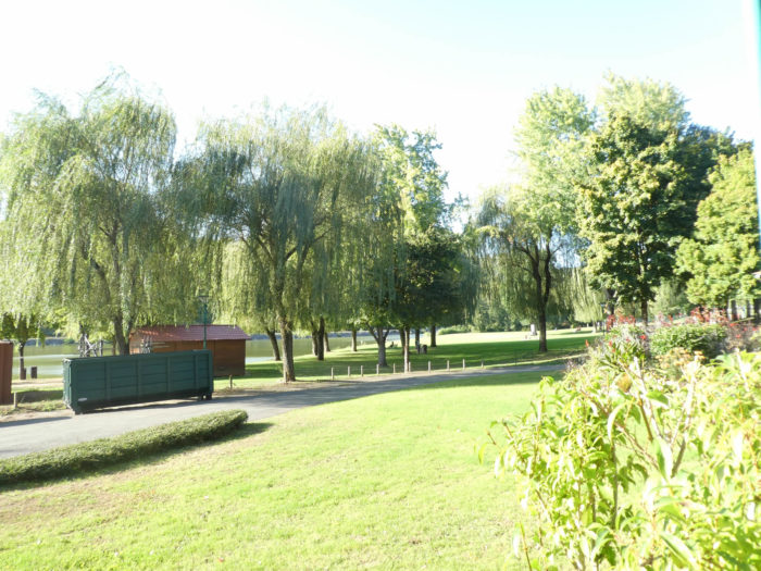
Let’s situate the stage on the general map of Via Podiensis. The first part of the route is in the Aveyron department, which you’ll leave soon for Lot department. The stage of the day therefore passes without transition from the Ségalas area to the Limargue region. The stage ends in Figeac, the town of Champollion, on the edge of Célé River. This stage has been modified in recent years, but that does not really change the geography of the stage, except that the course of formerly lost more than 3 kilometers.
|
Today you are located between the Ségalas and Limargue. These territories are quite contrasted. |
 |
The subsoil of the Ségalas, which rests on the granite of Massif Central, is often transformed into metamorphic rocks such as gneisses and schists. The resulting soils are acidic, poor and unproductive for agriculture. This is why this region called ségala is named after the fact that the farmers could only grow rye (seigle in French) here, not wheat. Only the bottoms of the valleys, with the deposit of alluvium, allowed better crops. Of course, over time, many lots have been amended. However, on the slopes of the valleys nothing has really changed. The forest still largely covers the slopes exposed south of oaks and chestnuts forming copses or beeches and conifers on the slopes facing north. Sometimes a meadow appears on a shelf, at the edge of a stream, where there is alluvium. Remains of moors with broom, ferns and heather still remain largely. The symbolic tree of the entire region is undoubtedly the chestnut tree, which has been the basis of local food for hundreds of years. If they have disappeared from the valleys, they still remain in number on the non-cultivable slopes, where they can even form almost impenetrable coppice. In contrast, Limargue is sedimentary rock (limestone, marl, sandstone). These rocks provide a rich and fertile soil. The Limargue is a country of gentle green hills. It houses Figeac.
Difficulty of the course: Slope variations today (+476 meters /-488 meters) are very reasonable for a long-enough stage, even if, between Lot and Célé rivers, the day promises a few bumps to climb, although quite bearable. The first that leads to Montredon is not light. The rest of the course is ups and downs from paved road to dirt road, again and again, with pathways often muddy in case of rain. A long descent along the hills leads you to Figeac.

The stage of the day takes place much more on the tar than on dirt roads, as it is often the use on Santiago track:
- Paved roads: 14.5 km
- Dirt roads: 9.0 km
Sometimes, for reasons of logistics or housing possibilities, these stages mix routes operated on different days, having passed several times on Via Podiensis. From then on, the skies, the rain, or the seasons can vary. But, generally this is not the case, and in fact this does not change the description of the course.
It is very difficult to specify with certainty the incline of the slopes, whatever the system you use.
For « real slopes », reread the mileage manual on the home page.

Section 1: Back to the high plateau.

General overview of the difficulties of the route: some rather tough slopes on the course before Pérols and Feydel-le-Haut, otherwise the course is without problem.

|
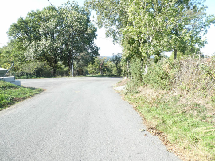
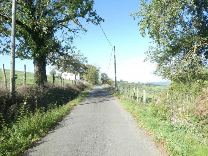
The GR65, which is also the GR6 during the stage, flattens out of Livinhac-le-Haut on a paved road reaching a crossroads in the periphery.
|
 |
 |
| There, you’ll walk on a small departmental road for a few hundred meters. |
 |
 |
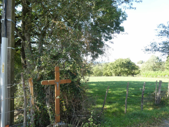
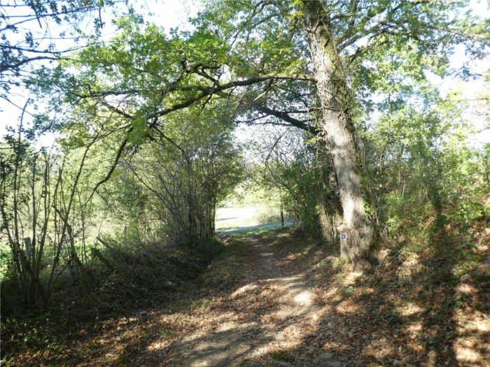
| Yet, in the first place called La Planque, near a small cross, you’ll leave the paved road and the few cars. |
 |
 |
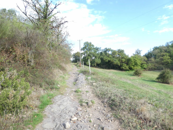
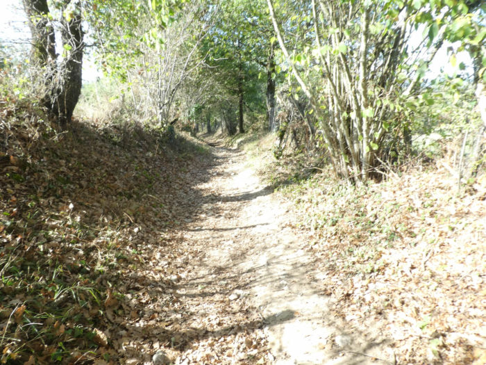
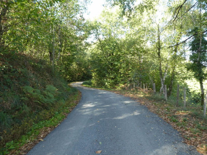
| A bad little stony pathway begins to climb at the edge of the undergrowth and the countryside, in the scrub, under the great oaks and ash trees. The climb is demanding, it must be said, and sometimes the pathway is a real battlefield. |
 |
 |
It toughly climbs, for sure …
Wait for the video to load.
| At the top of a first hill, the slope is somewhat reduced in the meadows, but it remains close to 10%. |
 |
 |
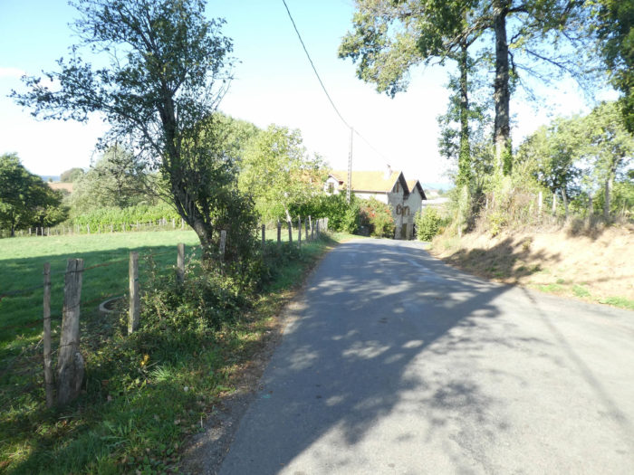
| The pilgrim takes his breath a little up, when the pathway reaches the hamlet of Pérols. The whole hamlet was revisited not so long ago. It is now a large cottage with apartments, rather a holiday hamlet. Pilgrims do not go there. |
 |
 |
| But the climb is not over yet. A small paved road, steep, leads a bit higher to a housing estate of new villas in Puech del Soyt. Well-off people often build on heights, right? |
 |
 |
Below, the Lot River flows in the plain.

| Further up, the villas disappear and the road continues steep climbing, under the ash trees, hornbeams, beeches and chestnuts. |
 |
 |
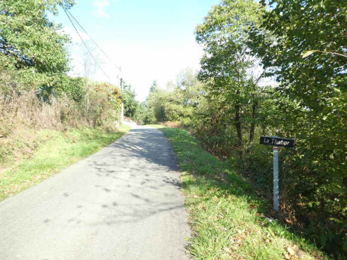
| At the place called Le Thabor, climbing is over for a while and the GR65 will run for a long time on the dirt, on a very gentle slope. |
 |
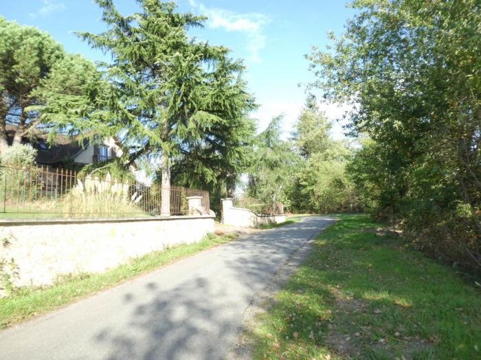 |
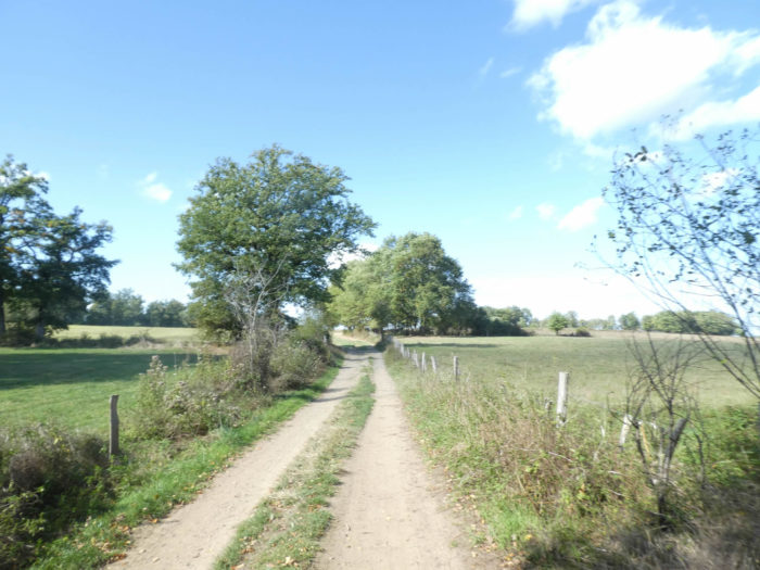
| The pilgrim gets what he wants, the type of pathway that makes him happy, the wide dirt road in the shade of the hedges or along the stakes to contain the cattle. |
 |
 |
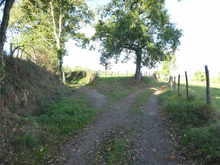
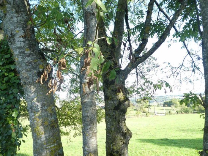
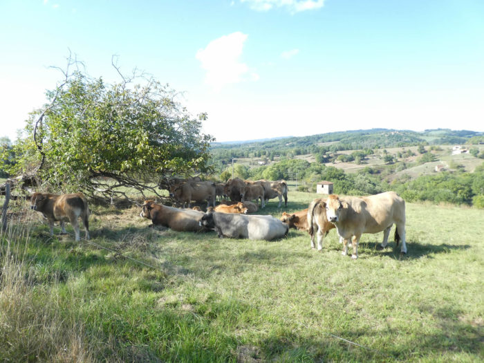
| You’ll see birches, beeches, chestnuts, but here the oak becomes the dominant tree, because we are fast approaching the “causses”, where there will soon highly prevalent. The oaks often impose their massive trunks, like to divide themselves into master branches under a gigantic canopy. Aubrac cows always have the same languid look to see the pilgrims going by. |
 |
 |
| Rare are on the Santiago track passages with so much serenity, in the happiness of trees, on a wide pathway that breathes softness. |
 |
 |
| A little further, the beautiful pathway reaches the place known as La Treille. |
 |
 |
| Further afield, the dirt road approaches the paved road running from Livinhac-le-Haut to Montredon, but does not go there. Everything always happens under chestnut trees, oaks, sometimes with some ashes, bordering the edges. |
 |
 |
| Then the pathway narrows and begins to climb in the countryside, in the middle of the brush. |
 |
 |
| Soon, under the ash trees and chestnuts, you’ll see Feydel-le-Haut above. In the region, the trunks of chestnut trees, most often brown in color, here often resemble the white trunks of birches. |
 |
 |
| The pathway crosses a small paved road and continues to climb gently. Sometimes a lonely chestnut loses itself in the blue of the sky, remembers the good old days when they were legions, when their fruits represented the staple food of the peasants of the region. Here a pilgrim has abandoned his shoes. |
 |
 |
| The pathway reaches the farms of Feydel-le-Haut. Here is the countryside, the countryside as you may love it, intact, true, never distorted. Montbéliarde cows strike in the meadows or under the oaks and chestnuts. |
 |
 |
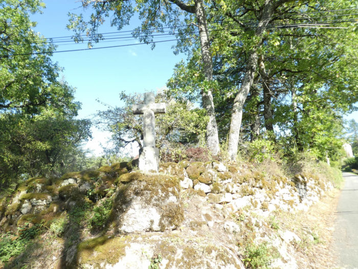
Just above, stands the new Cross of the Three Bishops. It is curious, but on Santiago track, the crosses sometimes go by three, as we saw for the Bishops of Aubrac. The cross has a long history. It had been lost, then found in part. The three neighboring villages, Montredon for Lot, Montmurat for Cantal and Livinhac for Aveyron, decided to redo in sandstone the original, exported on other lands. Today, the cross stands proud between heaven and earth, back to its original site dating back to the XVII century.

Section 2: Over hill and dale on the high plateau.

General overview of the difficulties of the route: ups and downs without difficulty.

| Beyond the Cross of 3 Bishops, you’ll leave Aveyron department for Lot department and you are approaching Montredon. |
 |
 |
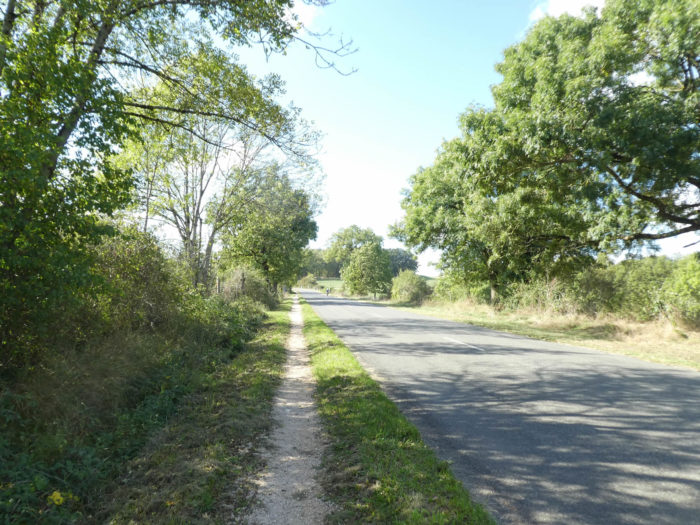
| The slope has become much softer, and the GR65 runs on the paved road, sometimes in the shade of large walnut trees to the hamlet of Cagnac, at the edge of the road. |
 |
 |
| Further ahead, the road crosses a fairly dense undergrowth where the oaks and chestnuts crowd, sometimes with some spruces. |
 |
 |
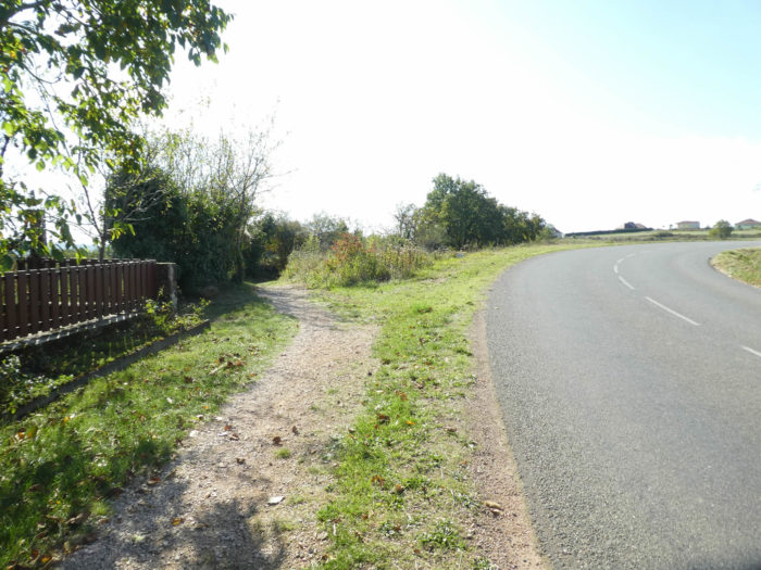
| Shortly after, the GR65 hesitates a bit between the meadows and the undergrowth … |
 |
 |
| … before reaching the D21departmental road, coming from Livinhac-le-Haut, at the Montredon entrance. |
 |
 |
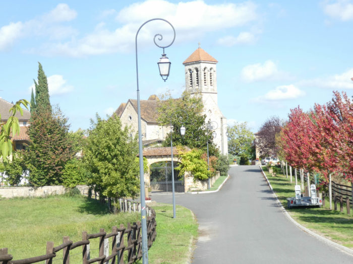
| A small church, at the bottom of the village, at the crossroads of roads, serves as a place of worship. Montredon means “rounded mount” and that’s true. This picturesque little village is stepped on a small hill dominated by St Michel Church. You have to climb to get to the village, at the top of the hill. the GR65 runs there, then slopes down again on the other side of the village. |
 |
 |
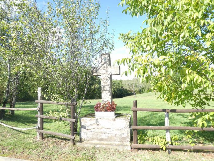
| At the bottom of the village, near a wooden cross, it gets to a small paved road that slopes down into the countryside. |
 |
 |
| The slope is relatively tough here, under oaks and chestnuts. |
 |
 |
| The road reaches Lalaubie crossroads, where a large farm goes up to invade the road. |
 |
 |
| The paved road then gently climbs along the farm until turning at right angles in the countryside. |
 |
 |
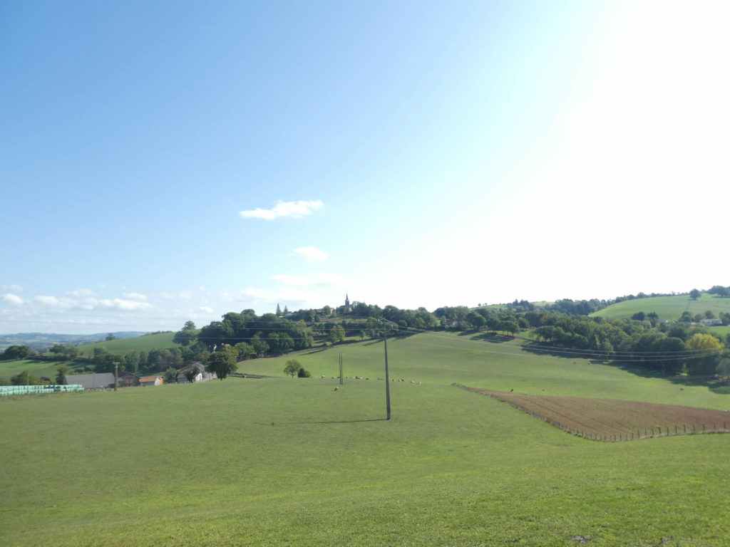
As you turn back your look towards Montredon, you cannot help but notice that nature is really beautiful, especially in good weather. And all those little steeples that go beyond villages, you would have trouble doing without them.
| Nature never plants with great precision before the man decides to change it. Along chestnuts hedges, the peasants poured asphalt to let the tractors pass. |
 |
 |
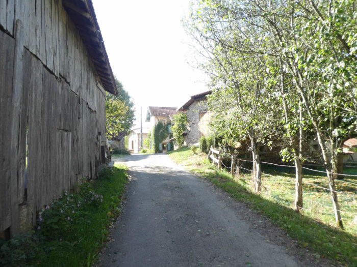
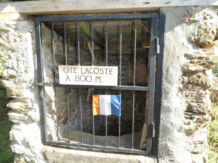
| The road soon arrives at Tournié, a charming little agricultural hamlet, compact, in the middle of the fields where the good taste of the grass smells. There is even an old well, which may still have to be used, given the recent appearance of the rope. Happy region, where the vernacular heritage is still sometimes present! They added a little advertising. Everyone has to live. |
 |
 |
| The road runs through the village amidst the farms. The Camino de Santiago likes side roads, and that’s why you may like it. To large cities, preference is given to remote hamlets, where the life of the past is long preserved. Here you do not see flowering these modern estates that disfigure the countryside today. |
 |
 |
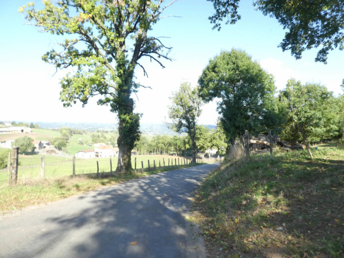
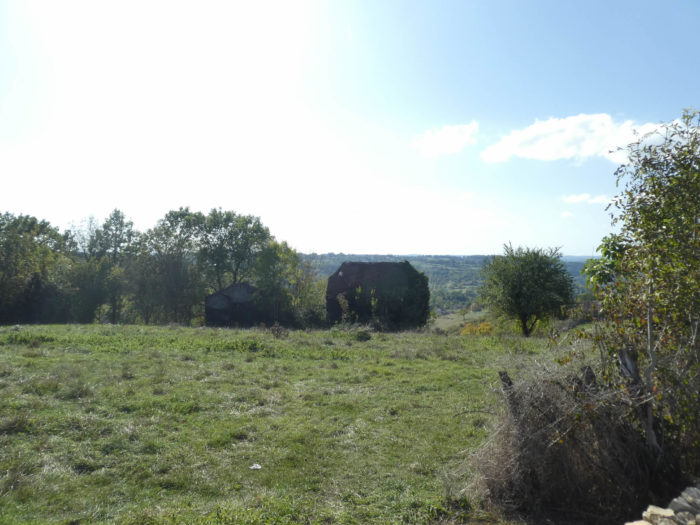
| At the exit of the village, the paved road slowly slopes down in the countryside towards Lacoste. Sometimes, in the distance, the eye lingers on a lost hamlet, sometimes only a few isolated houses or farms. You are approaching Limargue area. The landscape is sweeter, the hills smaller and welcoming. In this great countryside, cows working in the meadows sometimes pause at the foot of oaks and chestnuts. Can we ever say enough about the charm of these poles lined up along a brook or on the croup of a hill? |
 |
 |
| The road soon gets to Lacoste. The hamlet is imbued with the same old philosophy of stones and old woods. |
 |
 |
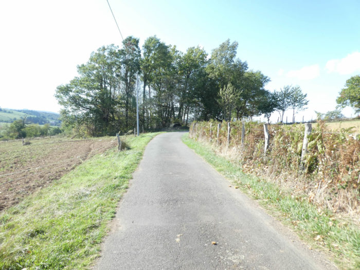
| Beyond Lacoste, a dirt road flattens in the fruit trees, towards the undergrowth. |
 |
 |
Section 3: Lights ups and downs through the beautiful pond of Guirande.
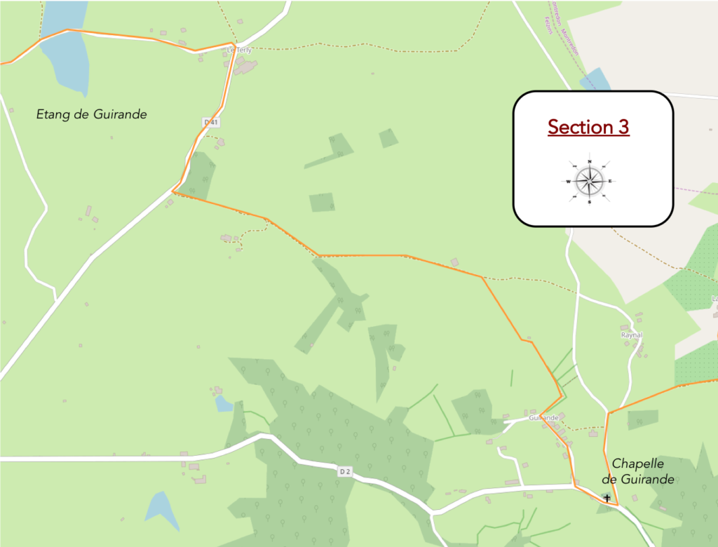
Overview of the difficulties of the route: without difficulty, if not in the undergrowth before Guirande Chapel in bad weather, a course that can be tricky on pebbles.

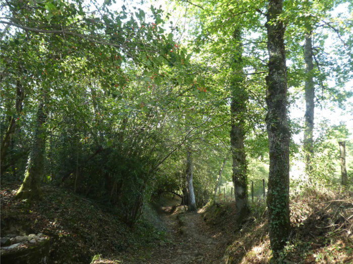
| A small lane descends first in the grass, then between dirt and pebbles towards the undergrowth. |
 |
 |
| It’s a bad little way sneaking down in the thickets. Under the oaks, shrubs, holly, and stunted chestnut trees entangle their branches in a disorderly clutter, where the light of day hardly passes. The step is less secure and the foot often steals on the big stones. In rainy weather, it’s a real pleasure to wade through the mud! |
 |
 |
It doesn’t sound like much, but it is very leg-breaking…
Wait for the video to load.
| Fortunately, the passage is not too long, and soon, the pathway opens when it reaches down a small paved road that leads to Guirande Chapel. |
 |
 |
| Sainte-Marie de Guirande Chapel stands at the edge of the road. Built in the 12-13th century, backed by a small cemetery, it is listed in the Historical Monuments, not for its characterless exterior, but for its remarkable 16th century wall paintings. |
 |
 |
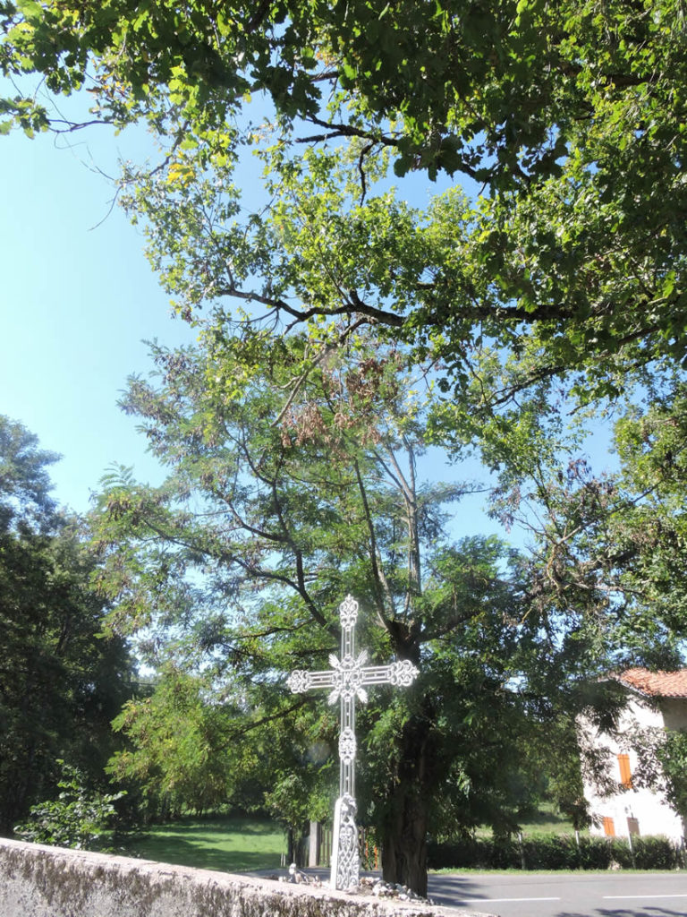
The GR65 leaves the chapel and its magnificent iron cross planted under the large oaks.
| It follows a few moments the D2 departmental road, which goes to Figeac, before cutting at right angles and sloping up to Guirande hamlet. |
 |
 |
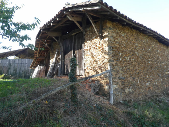
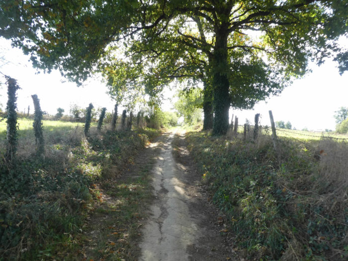
| A paved road gently climbs to Guirande and its old stone rubble houses. It is almost always so, at least for many hikers. The more the stones have reached the age limit, the more the charm blossoms. At the exit of the village, the pathway flattens under the big oaks and the beautiful chestnut trees. |
 |
 |
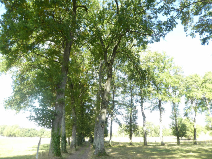
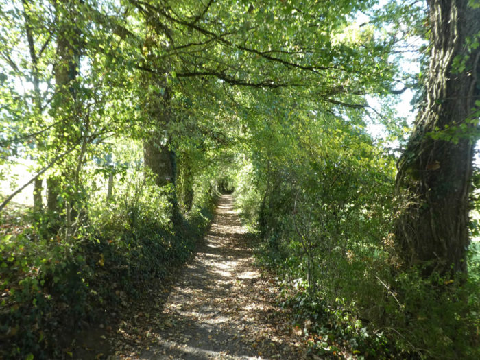
| The trees are majestic here, in this alley of sweet countryside. |
 |
 |
| At the end of the alley, a wide dirt road smoothens on gentle hills across the meadows and fields sometimes peppered with small undergrowth where the oaks abound. |
 |
 |
| The pathway strolls long enough in the gentle countryside. |
 |
 |
| Further afield, you are back on a paved road to join below the D41 departmental road. |
 |
 |
| Then, the GR65 follows the D41 road to Terly hamlet. At the end of a few stages, the pilgrim becomes more placid, fatalistic, and does not get angry at the paved road ahead. He has to live with it, resign himself! He is only a stowaway of a world he has not drawn, which men have transformed not for their pleasure but for their commodities. He can nevertheless, while going up, take a look on the pond of Guirande below. |
 |
 |
| In Terly, the GR65 leaves the departmental road and another small paved road slopes down to Guirande pond. |
 |
 |
| It is a calm water, a real paradise that the floodable pathway crosses from one side to the other. This little haven of peace, between heaven and earth is a parenthesis of serenity where it must be good to stroll. On the shores, rare fishermen come to tease trout or roach. Only sometimes the cry of a wild duck breaks the silence. |
 |
 |
On our last visit, the pond was almost dry on one side of the road. Drought or something else? In a previous visit, there was water on both sides of the road…
Wait for the video to load.
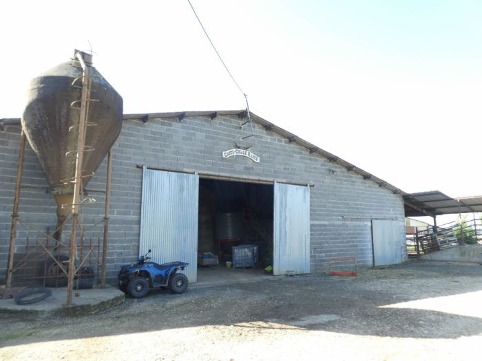
| The road leaves the pond and passes right up by farms near tall trees. |
 |
 |
Section 4: Light ups and downs between countryside and undergrowth.

Overview of the difficulties of the route: course without difficulty.

| It is quickly here the pleasure to find back the dirt running under the chestnut trees and the oaks. |
 |
 |
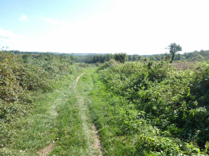
| Further on, the trees are scarce and the pathway cuts at a right angle and climbs a little in a sort of confused steppe, in the middle of bushes, rosehips and brambles. |
 |
 |
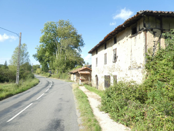
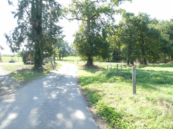
| Further up, the pathway reaches Bord village, at the edge of a small road. In the past, there was an establishment here where you could find something to eat. It is now closed. |
 |
 |
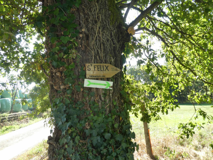
| Here the route has been changed, which used to run in the fields and undergrowth, towards La Cipière. Now, the GR65 comes out of the hamlet on your left, following the road before forking further to the right, towards St Félix, 25 minutes from here. |
 |
 |
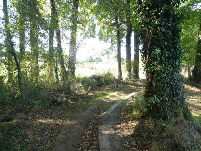
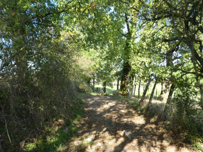
| A forest pathway then leaves at the edge of the undergrowth under oaks and chestnuts. |
 |
 |
| At the exit of the wood, the pathway runs at the limit of a large field and returns along the D2 departmental road again.
A little point here to explain all the gymnastics of the way. By the greatest chance, we met the person of the Friends of St Jacques who manages the pathways of Figeac, a charming lady who has more than 5’000 kilometers of tracks of Compostela to his meter. In Bord village, the peasants no longer wanted to have a pathway running in their meadows. But here, a generous peasant has made available a bunch of his fields. This is how things are done and always change the way. And the naive pilgrims who believe they are walking in the footsteps of their ancestors are completely wrong. Just think that you spend hours in the forest and that most of the French forests are private. Without the agreement of all these owners, never the Santiago track would have passed through France. |
 |
 |
| At the end of the field, the GR65 crosses the departmental road and runs to St Felix by the road. Here too, the GR65 was modified. In the past, a small pathway followed the river in the undergrowth. Now it’s the road, and that’s … you know why. |
 |
 |
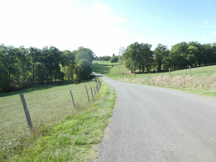
| The road gently slopes down across the meadows, in the middle of Salers cows, to cross Donazac brook and then climbing towards the village under the oaks. |
 |
 |
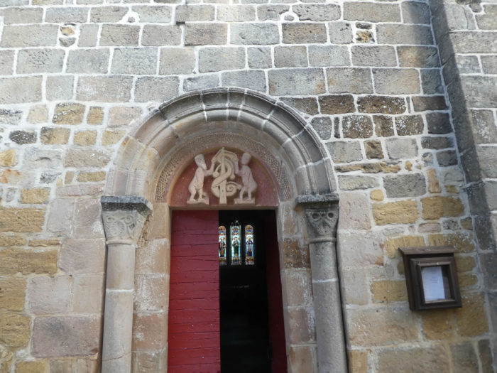
| The road arrives at the village. The Romanesque church of Ste Radegonde is very beautiful, luminous, and houses a tympanum of the 11th century representing Adam and Eve. |
 |
 |
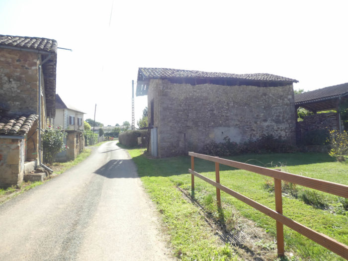
| St Félix is made of stone houses that breathe tradition and whisper confidences of the past. There is an inn here. We have never seen it open yet, but here we were told that we have not had a chance.
The pathway leaves the village under the place of the inn. |
 |
 |
| A narrow lane then steeply climbs along the hillside and skirts around the oaks around it. |
 |
 |
| On the other side of the hill, a paved road meanders in a more residential area. |
 |
 |
| Further afield, the GR65 leaves the paved road for a pathway back into the undergrowth. |
 |
 |
| This little breathing along the hedges, under the oaks and chestnuts, is not eternal, and quickly tar is back again. |
 |
 |
| The GR65 then climbs very long on the paved road in what must be one of the suburbs of Figeac, to the village of St Jean Mirabel. It must be said too. The approach of the cities often put a damper on the happiness of the one who walks in the grove, dreams along the stones of the mansions of the past, which seem to him almost eternal. So, he comes back to earth, remembering that he also sometimes lives, as here, in modern estates of buildings without great character, with these tasteless thuja fences that hide him from his neighbor. |
 |
 |
Section 5: Long course on the paved road.

Overview of the difficulties of the route : course without difficulty.

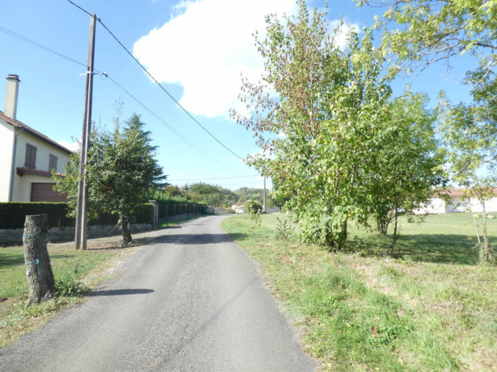
| This long uphill climb on a straight line will probably seem endless, in the middle of the villas, sometimes with some cows that bring a note of color to the banality of these places. |
 |
 |
| Yet, a little up, hope is reborn with a pathway that sinks into the undergrowth. |
 |
 |
| But this is just unmet hope, because the way is back to tar, crossing again the D2 departmentalroad, sloping uphill to the cemetery and the water point of St Jean-Mirabel. |
 |
 |
| Up there, on the esplanade of St John the Baptist Church, near the watering point, sit the statue of Joan of Arc and a magnificent purple bicycle, erected in honor of Montcoutié, a Lot cyclist, who won a stage in the region during the Tour de France 2004. |
 |
 |
| Beyond the esplanade, a paved road slopes down back to the departmental road. Here begins a section of more than 2 kilometers climbing on the paved road. The view is so clear that you can easily see the pilgrims advancing, in front and behind, like rosary beads, bent under the weight of their sacks. The cars that circulate also remind you that you are not at Mass. |
 |
 |
| Two kilometers is long, boring, tasteless and without any interest. Our organizer has been trying for years to get through the forest trails from St Félix to Figeac. But right now, in vain. Perhaps you will have the privilege one day to put on a new track? |
 |
 |
| At a place called Bel-Air, a resident who thinks about the physical pain endured by the pilgrims, scribbled on his mailbox a small section of the track, and engraved on the wall a message of encouragement and faith. It is necessary, because climbing on the paved road is not completed yet. We must say it too. In a rather general way, with a few exceptions, there reigns on the track a communion of fact between the inhabitants and the pilgrims who pass. |
 |
 |
| Suddenly, deliverance! At the place called Panacard, the GR65 leaves the paved for a small lane sloping down along the hedges. |
 |
 |
| For a while you are back to a pathway that dawdles under the oaks, chestnuts and wild grasses. |
 |
 |
| But it does not last long. People need paved roads to go home with their cars. Thus it will be paved road again to go near the Crouzets. |
 |
 |
| A small road then descends along the hedges, before finding again a pathway. |
 |
 |
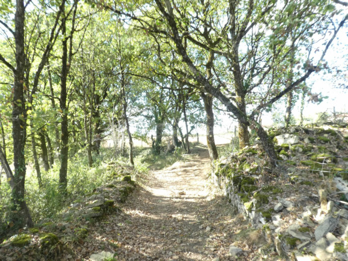
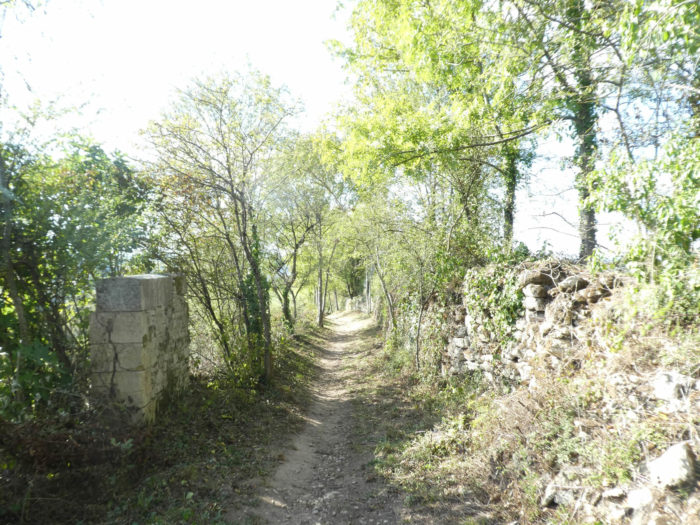
| Here the pathway in the undergrowth is longer than before. There are always majestic oaks, chestnuts a little more sluggish, and also ash trees. The edges of the pathway are often embellished with stone walls covered with moss. |
 |
 |
| When you arrived once at the end of the pathway, the route went down to Pipy, where to avoid Figeac, you could take the GR6, which went directly to the Cassagnole. But you had to be in a hurry to do it. Figeac is well worth a long visit. So, the course, which was quite chaotic, was changed again, to go directly back to D2 departmental road. |
 |
 |
| So, turn backward, and now you are back on the paved road. The life of the pilgrim is thus made. After the rain, the good weather, after the dirt road, a bit of tar. Here the GR65 runs backward on the D2 road, until the crossroads of the Pierre Levée. It’s pretty chaotic like course, right? We sincerely hope that our organizer can get her ideas across and concoct a pleasant and nice track in the forest. |
 |
 |
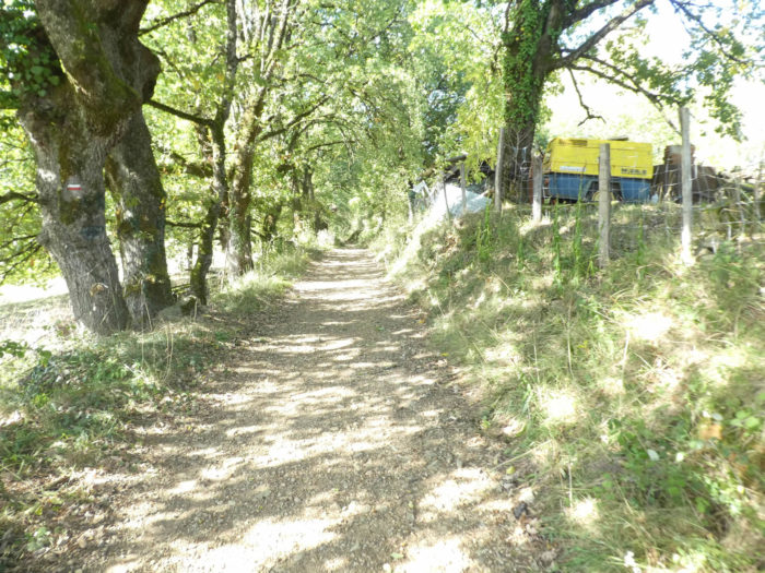
| From there, no problem, it’s straight to Figeac. First on a wide gravel road, under the chestnut trees, ash trees, and walnut trees, very numerous in the area. |
 |
 |
Section 6: Between pathways and roads in the vicinity of Figeac.
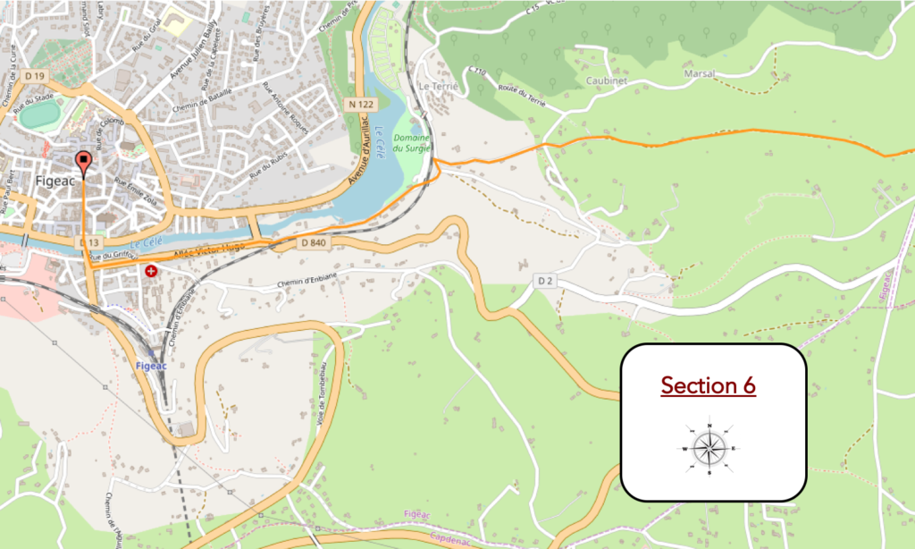
General overview of the difficulties of the route: course without any difficulty, before the final descent on Figeac, really very steep.

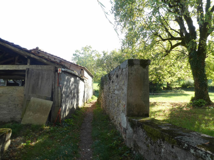
| Further ahead, there are no more cars or tractors. The dirt replaces the tar, at the foot of the stone walls. |
 |
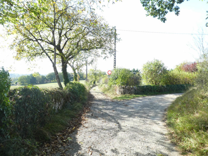 |
You are getting closer to Figeac. At the bend of the road stands a curious little tower. These towers are reminiscent of the “chibottes” that were found near Le Puy in the Dolaison. There are dozens of vernacular terms for these dry-stone huts. Here, in the Lot, they are often given the name of “caselles”. That of “gariotte”, even if it is the most popular, is only used around Cahors. These shelters, whatever the name, are little more than two centuries old. Land clearance was a necessary practice to avoid disturbing crops. The stones were harvested to make the “caselles”, which were intended to shelter the shepherds in bad weather, to store the tools. If you follow GR651 variant of the Célé Valley from Figeac, you will see several dozens. Today abandoned, they are the subject of many local safeguarding projects.

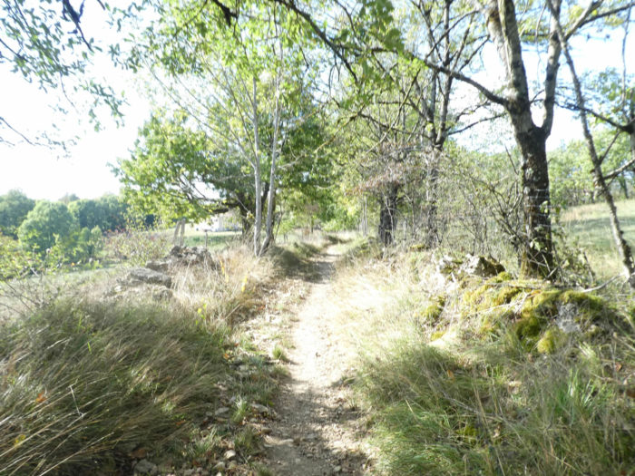
| The dirt road begins to descend, heading to the antenna of television, under the oaks, the chestnuts and the ash trees, along the low walls of stone. Already Figeac appears, so typical in his red clothes. |
 |
 |
| Further afield, the pathway then crosses a wild area, which suggests that there are still, luckily, some places where real estate agencies have not yet invested. Close to the city! |
 |
 |
| Leaving the thickets, the pathway arrives at the end of the ridge, where rest some Aubrac cows. When we consider these cows, we find that they spend more time napping than really working. It is true that they are not usually asked to make milk, but rather meat. |
 |
 |
| From here, sloping down becomes tough, between 10% and 15% of slope. |
 |
 |
| Further down, a paved road takes the place of the dirt road. Rapidly, you’ll see the first houses of the high periphery of Figeac. |
 |
 |
| Further afield, the slope rises to almost 20% decline, under many oaks, but also in the chestnut trees and some ash trees. |
 |
 |
It’s quite steep, yes…
Wait for the video to load.
| However, you are still quite far from the city center. Figeac must be earned. It is here that the slope is the toughest, until reaching the railroad track. |
 |
 |
| Then the road progressively leaves the dense forest, runs under the railroad track to reach Surgié campsite, on the edge of Célé River. You see the entrance sign of the city, but the city center is still 1 and a half kilometers from here. |
 |
 |
| You’ll then follow the banks of the river, beautiful near the campsite. |
 |
 |
| Further on, the paved road runs for a long time under the big trees at the entrance crossroads of the city, at the beginning of Allée Victor Hugo. |
 |
 |
| Victor Hugo Alley, which is actually the departmental D840 road, is endless. Follow it until you find the bridge to the city center. |
 |
 |
Section 7 : In Figeac.
| Figeac, with its 10,000 inhabitants, is a beautiful medieval city, which was born from a Dominican abbey that was found here, and which flourished because of the pilgrimages of Santiago track. It was an obligatory stop on the way between Conques and Cahors. Legend or reality also wants Figeac draws its no from a Latin expression Fige acum. Pilgrims were often lost in the many forests around Figeac. An abbot would have answered: Fige acum, which translates as “Plant a needle”. This explains at least the presence in the region of monuments called needles, obelisks planted in the field to indicate the direction.
In the Middle Ages the merchants become so powerful that they oppose the abbot. The king then intervenes and puts the country under the supervision of a manager, called here viguier. The rest of the story is the Great Plague, the Hundred Years War, a new development of the city where beautiful mansions are being built, which still remain. Unfortunately, the takeover by the Protestants holds back the momentum. Instead, churches are destroyed rather than built. But, fortunately for us, the city has preserved very beautiful remains.
The Tourist Office distributes small leaflets. Just follow the keys in the city and the little guide tells the history of the monuments. The feeling here is to meet again at the time of the Benedictine abbey. There are often only pilgrims who visit the city. Times do not change much!
So, a little tour in Figeac, right? Champollion, the genius decipherer of hieroglyphics was born in Figeac, in 1790. Actually, he never lived here, except in his infancy. Yet, the city has transformed his beautiful birthplace into a museum. Close to the museum, embedded in medieval buildings is the Place des Écritures, an immense replica of the Rosette stone, carved in black granite from Zimbabwe by the American Joseph Kosuth. It is best to climb the hanging garden to admire this work inaugurated in 1991. |
 |
 |
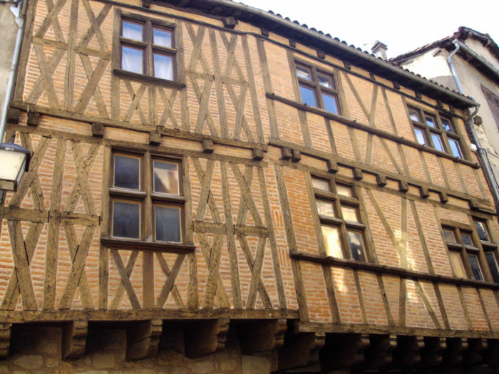
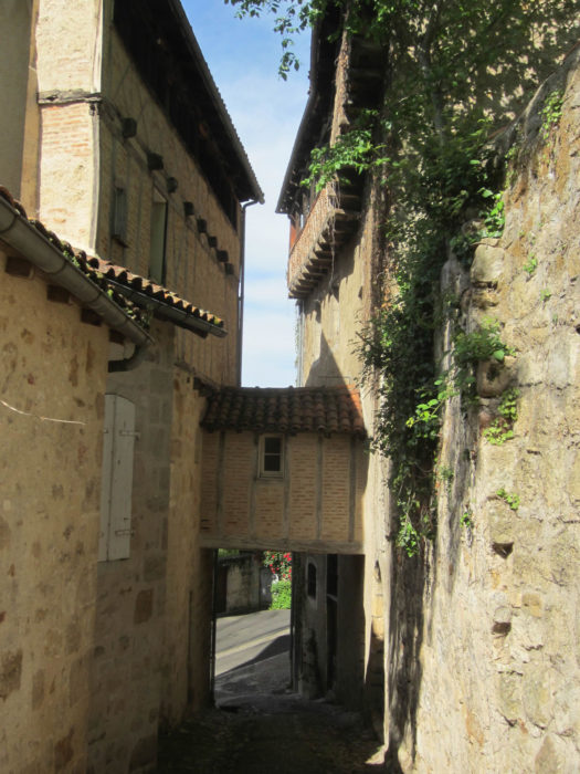
| The Célé River cuts the city in two, but the medieval town is on the right bank of the river. Throughout the city stand half-timbered houses, with corbels, windows in network. Some still have a solheio, a type of open-air attic that was used to dry skin or preserve food. |
 |
 |
In some alleys, the buildings climb to the sky, with their solheio, all upstairs under the roof.

| Have not the architects here made the trip to Italy several times to reproduce in several places in the city the Bridge of Sighs? |
 |
 |
| St Sauveur Church dates back to the 11th century, but it was amended over the centuries. It contains beautiful wood paintings and beautiful stained-glass windows. |
 |
 |
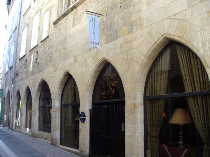
| L’hôtel de la Monnaie (The Mint), recently transformed inside, houses the Tourist Office. Some wealthy pilgrims might stay the night at the magnificent Viguier hotel in the city center. The luxury hotel has just reopened after many years of closure. |
 |
 |
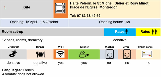
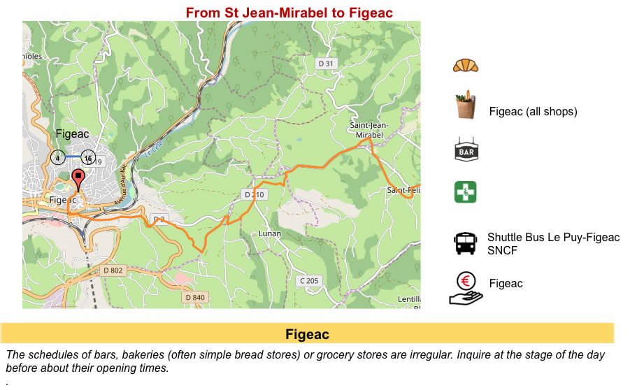
Lodging