Good morning Mister President
DIDIER HEUMANN, MILENA DALLA PIAZZA, ANDREAS PAPASAVVAS

We divided the course into several sections to make it easier to see. For each section, the maps show the course, the slopes found on the course, and the state of the roads. The courses were drawn on the “Wikilocs” platform. Today, it is no longer necessary to walk around with detailed maps in your pocket or bag. If you have a mobile phone or tablet, you can easily follow routes live.
For this stage, here is the link:
https://fr.wikiloc.com/itineraires-randonnee/de-st-come-dolt-a-estaing-par-le-gr65-51268933
It is obviously not the case for all pilgrims to be comfortable with reading GPS and routes on a laptop, and there are still many places in France without an Internet connection. Therefore, you can find a book on Amazon that deals with this course. Click on the book title to open Amazon.
 |
The Camino de Santiago in France / V. From Puy-en-Velay to Cahors (Via Podiensis) on GR65 track |
If you only want to consult lodging of the stage, go directly to the bottom of the page.
| The motivations of the pilgrims diverge. Some walk with their heads down, anxious to know where to set foot on often difficult tracks. Others walk with their heads high, sensitive to the charm or the banality of landscapes, ravishing in front of the flowers that nature offers along the way. Actually, the pilgrim walks all day in quite diverse areas.
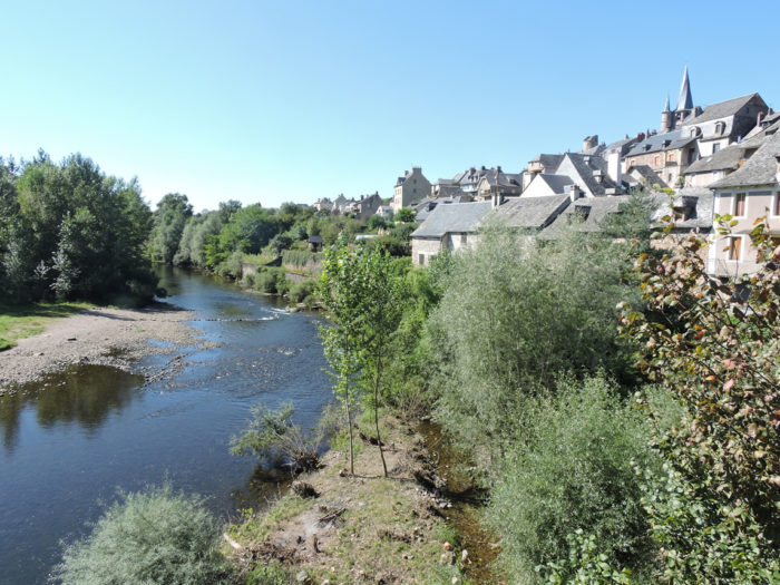
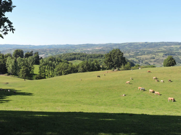
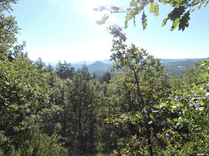
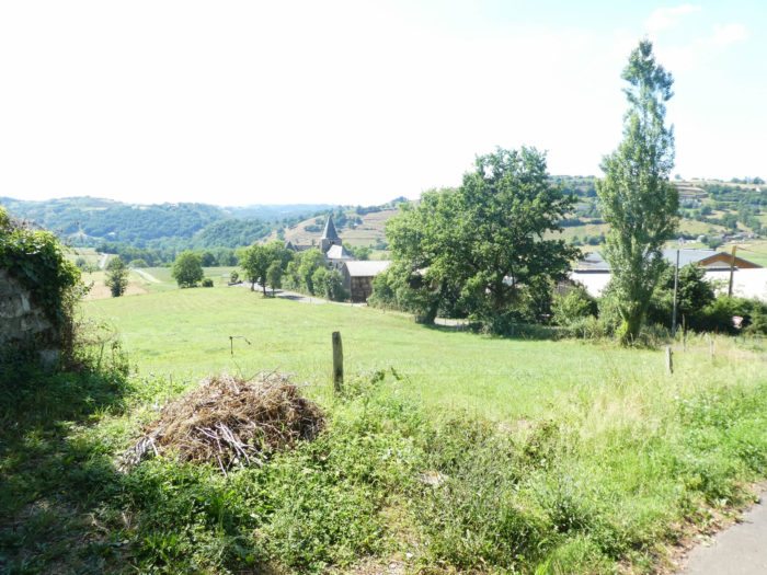
You are in Haute Rouergue, in the north of Aveyron, where the Lot River, the central axis, has carved out narrow gorges, which sometimes open into large basins. The river flows , overlooked by high plateaus, sometimes schist, sometimes volcanic, sometimes limestone. Today there are no large fields to get under the pupil. These will mostly be forests and pastures. Because, on the northern slopes, it is often the forests of oaks, beeches and old chestnuts that dominate. When you observe the Lot River, you sometimes have the feeling that the water is not moving. And the river flows precisely to Estaing, a name that will doubtless remind you of someone you know. Today is the first time that the route runs north. |
|
Since the track today crosses quite diverse areas, let’s say a word about the geological peculiarities of the region. |
 |
| So far, you have crossed volcanic basaltic soils and rocks in Velay region, then granite in Margeride. Aubrac plateau is already more complex. The base is granite, but the surface is rather basalt. Aubrac is made of a relatively old volcanic massif compared to the great volcanoes of Auvergne, which are much more recent. But here, unlike in Auvergne, the lava flows broke out and the volcanoes disappeared, decimated by erosions. Yet, the glaciers also came here, allowing the formation of moraines, deposits of alluvium or the presence of erratic granite blocks that you’ll see often on the Aubrac plateau.
In geology, it is almost always so. Under pressure, the granite is transformed into so-called metamorphic rocks, which are often shales or gneisses. Thus, a portion of the Aubrac granitic basement has transformed into this type of rock. This is seen at the exit of Aubrac, in this region which descends from St Chély towards Espalion, in the country where the boraldes, small torrents or rivers, have cut the shales and the gneisses. Further downstream, near Espalion and Estaing, in Lot Valley, you’ll walk near tender rocks, namely sandstones and limestones, which are marine deposits, when the sea arrived here, well after the granitic burst of the mountains. Here are the main rocks that you are called to meet in the next few days.
|

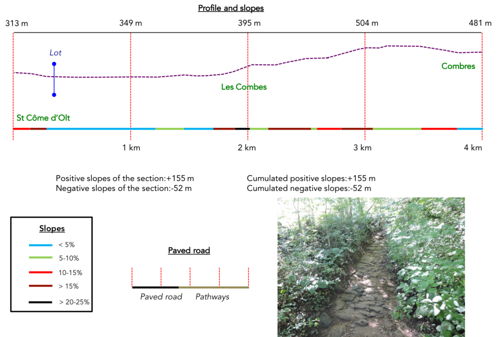
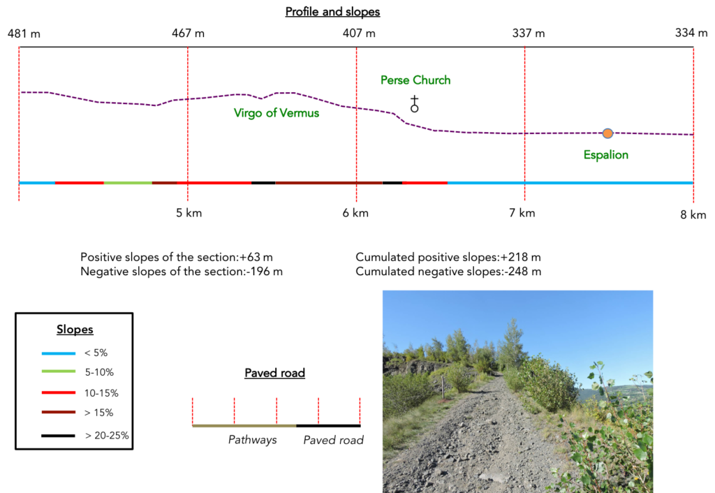
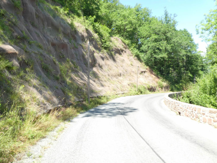
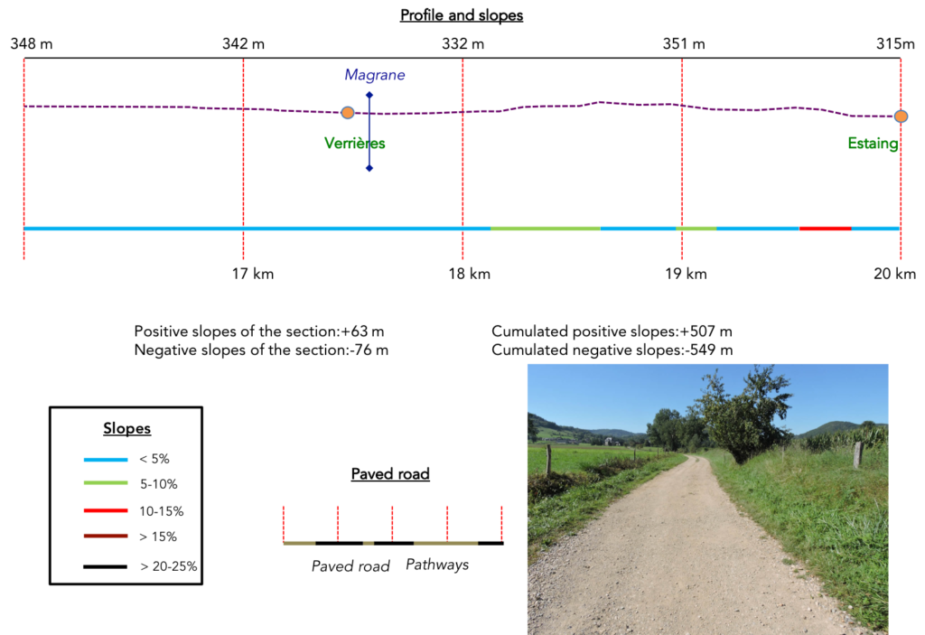
| Difficulty of the course: Slope variations today (+507 meters /-549 meters) suggest a fairly difficult stage, for a short stage of 20 kilometers. That is a rather tough stage. Obviously, it’s not insurmountable, but the track runs up and down all day. In fact, there are only two bumps, but both are difficult, the climb to the Virgo of Vermus, at times 30% of slope, at the beginning of the stage, and beyond St Pierre, a small climb of more than 25% slope for less than 1 kilometer. The descent to Estaing from Le Briffoul can also be difficult in rainy weather.
|
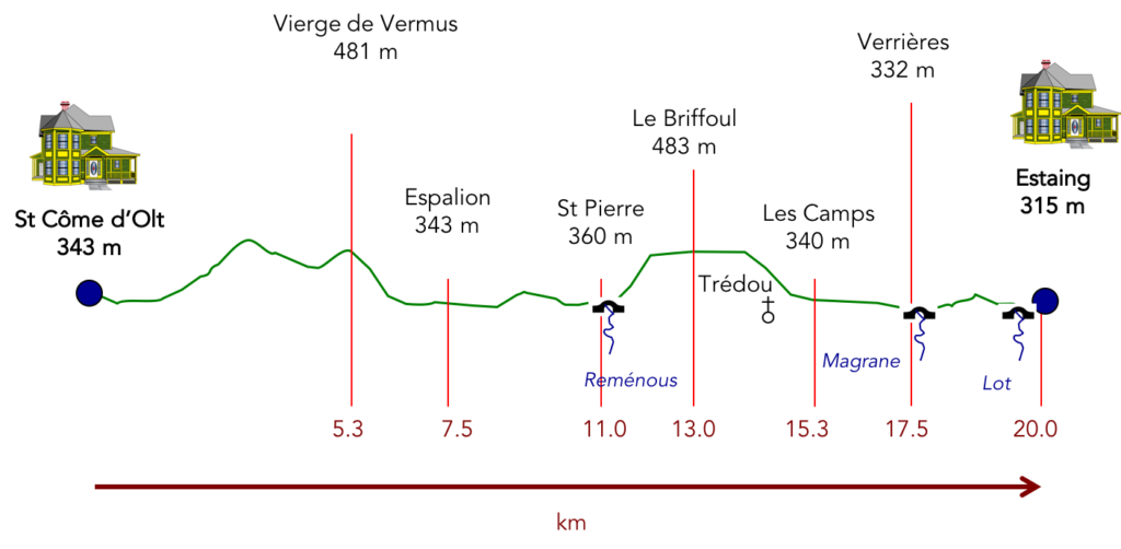
The stage of the day is a mix of passages on dirt or paved roads:
- Paved roads: 10.8 km
- Dirt roads: 9.2 km
Sometimes, for reasons of logistics or housing possibilities, these stages mix routes operated on different days, having passed several times on Via Podiensis. From then on, the skies, the rain, or the seasons can vary. But, generally this is not the case, and in fact this does not change the description of the course.
It is very difficult to specify with certainty the incline of the slopes, whatever the system you use.
For “real slopes”, reread the mileage manual on the home page.

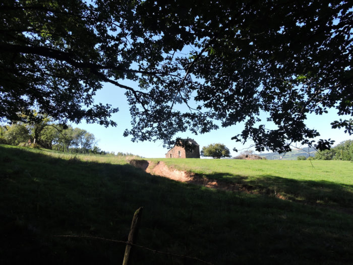
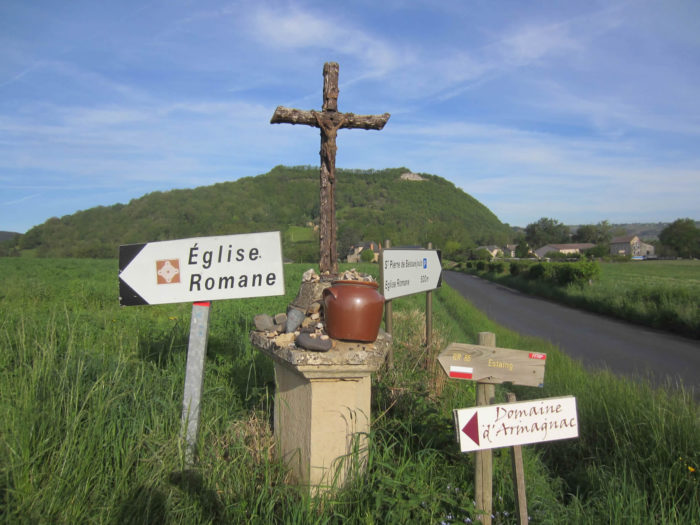
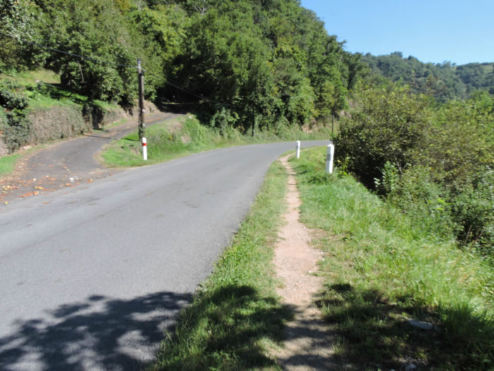
Section 1: The GR65 finds the Lot River again, before reaching the heights again.
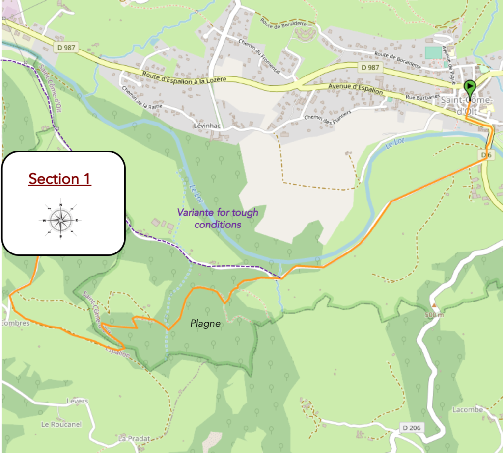
General overview of the difficulties of the route: easy route along the Lot River, before facing the first severe twisting lanes in the forest towards the Virgo of Vermus.
|
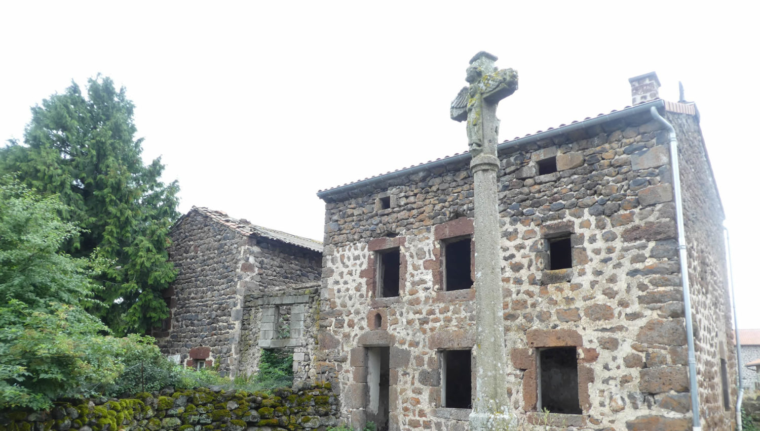
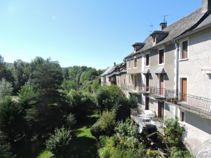
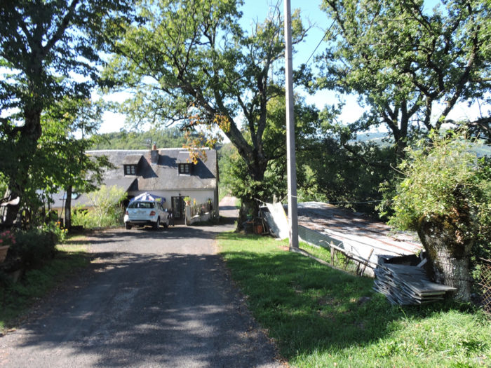
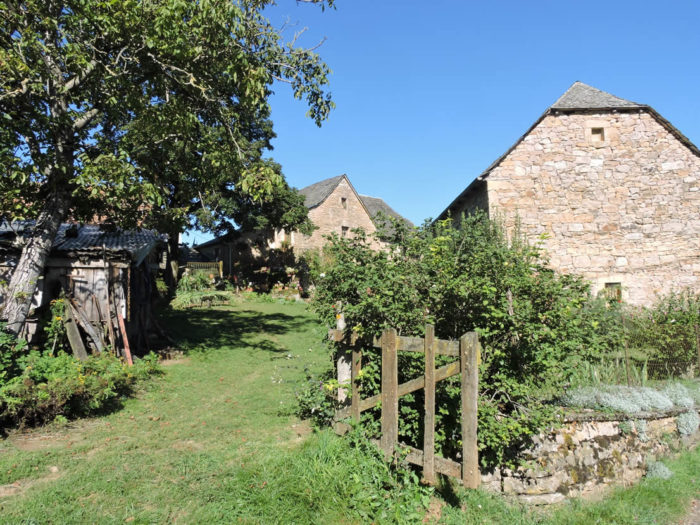
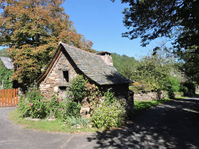
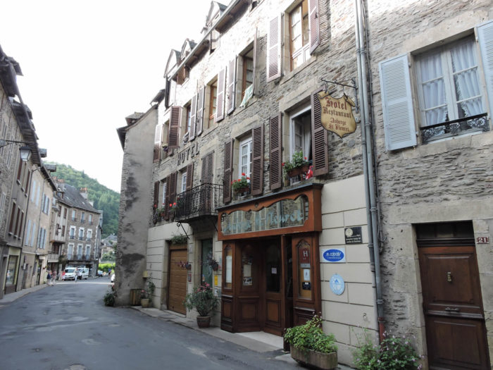
On leaving St Côme d´Olt, the houses on the banks of the Lot River are really charming, with the village clinging to the hill at the foot of the water. |
|
 |
 |
The GR65 crosses the river on an old stone bridge. Direction Espalion, 6 kilometers from St Côme d´Olt.

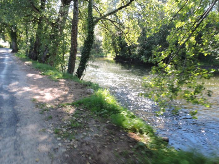
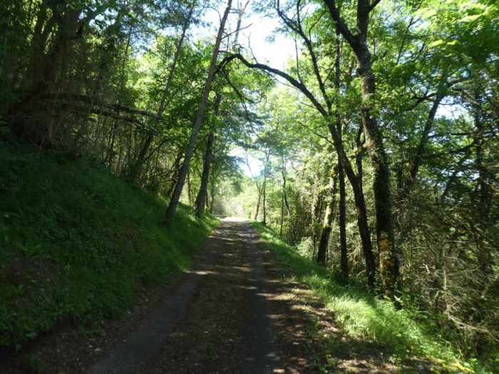
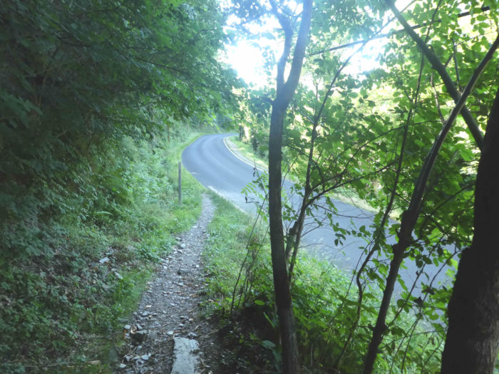
| It then follows the river and its large trees for a while, on a small asphalt road. You’ll find the full panoply of deciduous trees, especially alders, oaks, chestnuts, some maples. | |
 |
 |
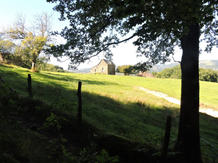
| Further afield, the road climbs gently in the trees. Halfway up the hill, the pilgrim has the choice of reaching the heights to pass on the Puech de Vermus and its Virgin which dominates the city, or to follow the river on the paved road. The passage by the bank will save you at least an hour, but you will miss part of the track classified as World Heritage by UNESCO. If you run straight on the bank of the river, you will walk comfortably until you reach Espalion. | |
 |
 |
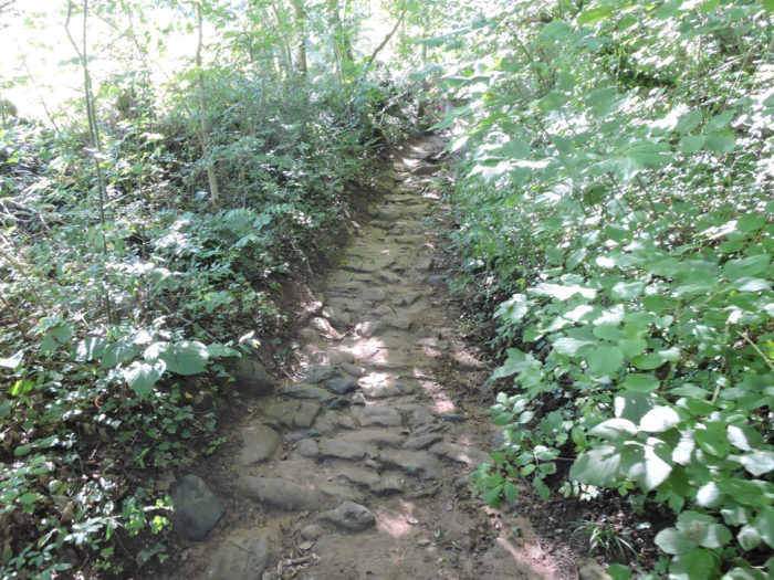
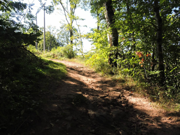
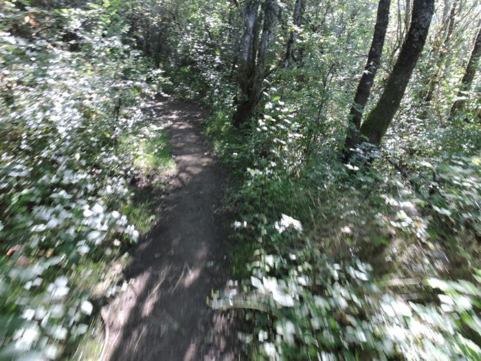
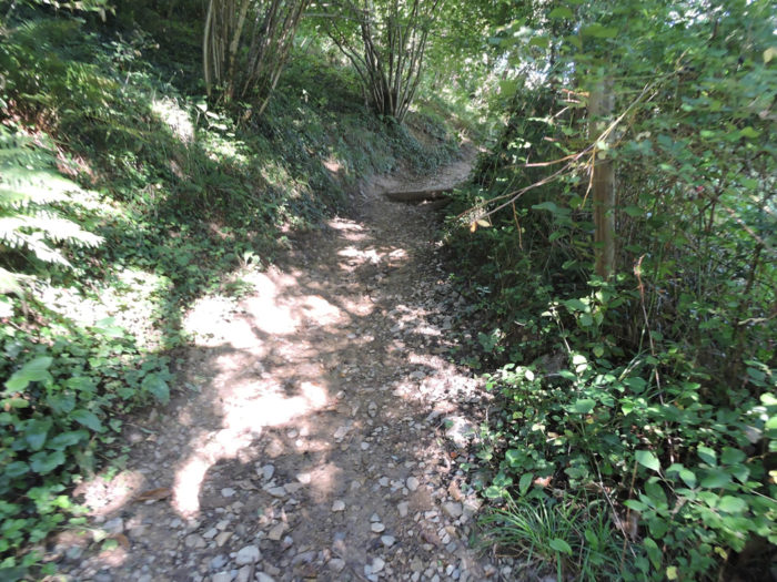
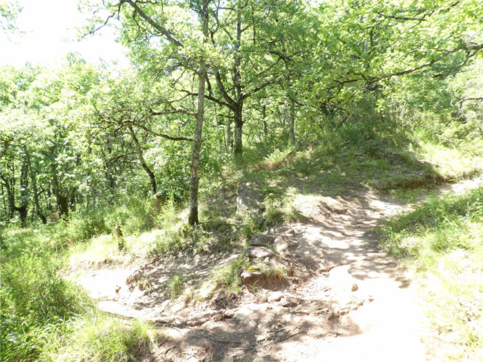
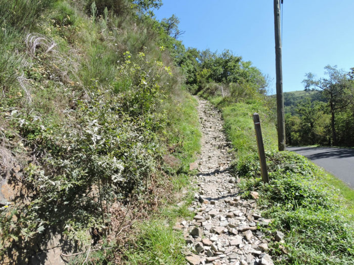
| The choice is difficult, and depends a lot on the weather conditions. Look at the state of the track, and wisdom will impose a choice on you. Everyone is shouting it from the rooftops and on the billboards: “Do not run up to the Virgin in wet weather, it is dangerous”. Come on! It’s not dangerous at all. Let’s be brave and maybe get into the mud, sliding over stones and roots among beeches, oaks, chestnuts, hazelnuts and brambles. Here is the menu: bumps, more bumps in the undergrowth. The cornice overlooks the Lot River. In dry weather, it’s easier, but the track climbs all the same. It is still more than 200 meters of climb to get to the Virgo of Vermus!
You quickly understand your happiness when leaving the asphalt road. A bad little lane winds its way up a steep slope into a wood, where small shrubs and wild grasses form inextricable thickets. |
|
 |
 |
| You quickly notice that it should hardly be practicable not to slip on large stones after a heavy rain. The vegetation closes around the water, which weaves its way through roots, thickets, washed out stones and brambles. Vegetable odors, humus and honeysuckle caress the nostrils of the pilgrim whose breath is shorter. | |
 |
 |
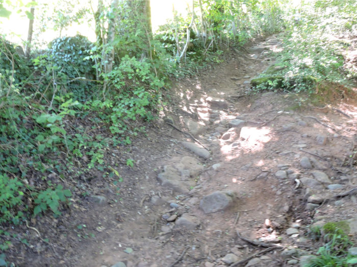
There are rare open spaces on the pathway, but most of the time the pathway looks like a real obstacle course, on a steep slope.
Wait for the video to load.
| When it is not the rocks, it is the roots that get in the way, and often both. | |
 |
 |
| After a steep climb between clay, large slippery pebbles and winding roots invading the narrow pathway, a clearing opens up on the small Plagne plateau, halfway up the hill. The view of St Côme d´Olt is magnificent. | |
 |
 |
A little up, you even have to face the harshness of a staircase, with more than 50% incline, among the chestnut trees.

| Yet, the climb is not over, in the lush jungle. The undergrowth becomes quieter and quieter. Sometimes a thin stream of water gushes out from the bowels of the soil. Here the slope softens markedly. | |
 |
 |
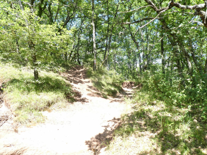
| But good things always come to an end. There inevitably comes a time when you cannot climb higher! So, the pathway begins to nod along the ridge. | |
 |
 |
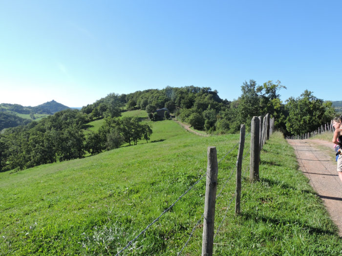
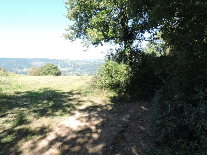
| Yet there is something that seems to be wrong. We did a nice climb and at the top of the hill and we don’t see the Virgo of Vermus! Only cows on the green grass. And now the route gently waves through the hedges. | |
 |
 |
| Because the Way of St James is facetious, you have been told it often. It will descend to a handful of farms, to pass over the Combres hamlet. Oaks dominate here the landscape. | |
 |
 |
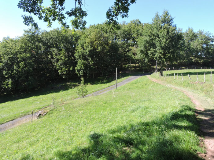
| A small paved road slopes down even lower, nearly 50 meters of vertical drop, crossing first through undergrowth and then through the countryside. | |
 |
 |
Section 2: The Virgo of Vermus is high above Espalion.
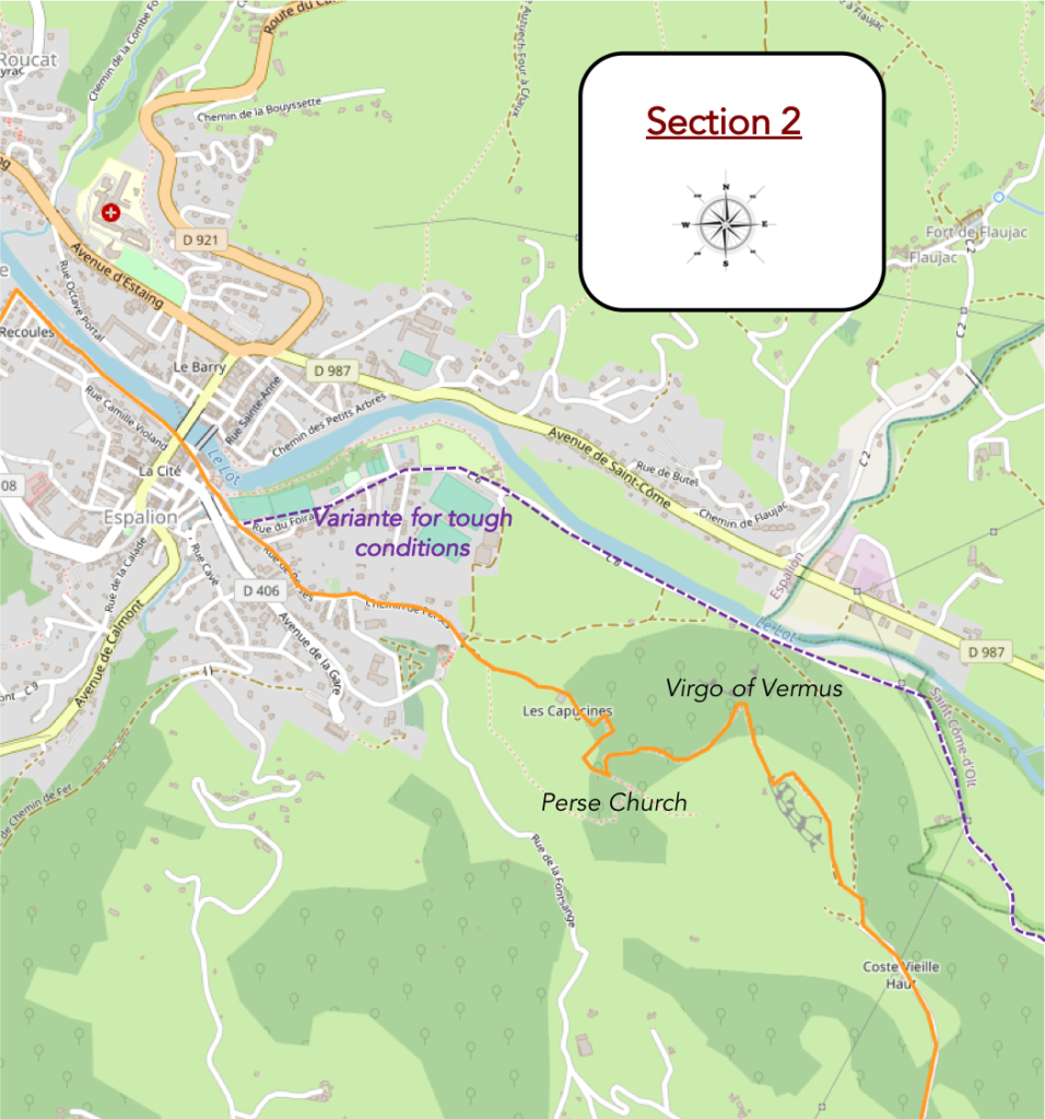
General overview of the difficulties of the route: the Virgo of Vermus has to be earned, both uphill and downhill.
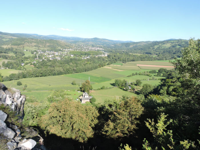
| From there above, you can see the fortress of Calmont on the horizon above Espalion. On the other hand, no trace of the Virgin of Vermus yet! Would it have been stolen forever?
|

| The road descends again to an isolated house before a pathway takes over and undulates on the ridge. | |
 |
 |
| At the end of the ridge, the GR65 cuts at a right angle to start climbing the hill again, until you come across a gravel pit. | |
 |
 |
| A Virgin has to be earned. Seen from here, you can measure the sweat you put in to get here, remembering that you climbed even higher than here, before descending, and then climbing back up again. And you are not yet at the end of the effort. | |
 |
 |
Forward march!
Wait for the video to load.
The Virgin is up there, a little above the quarry. Courage!
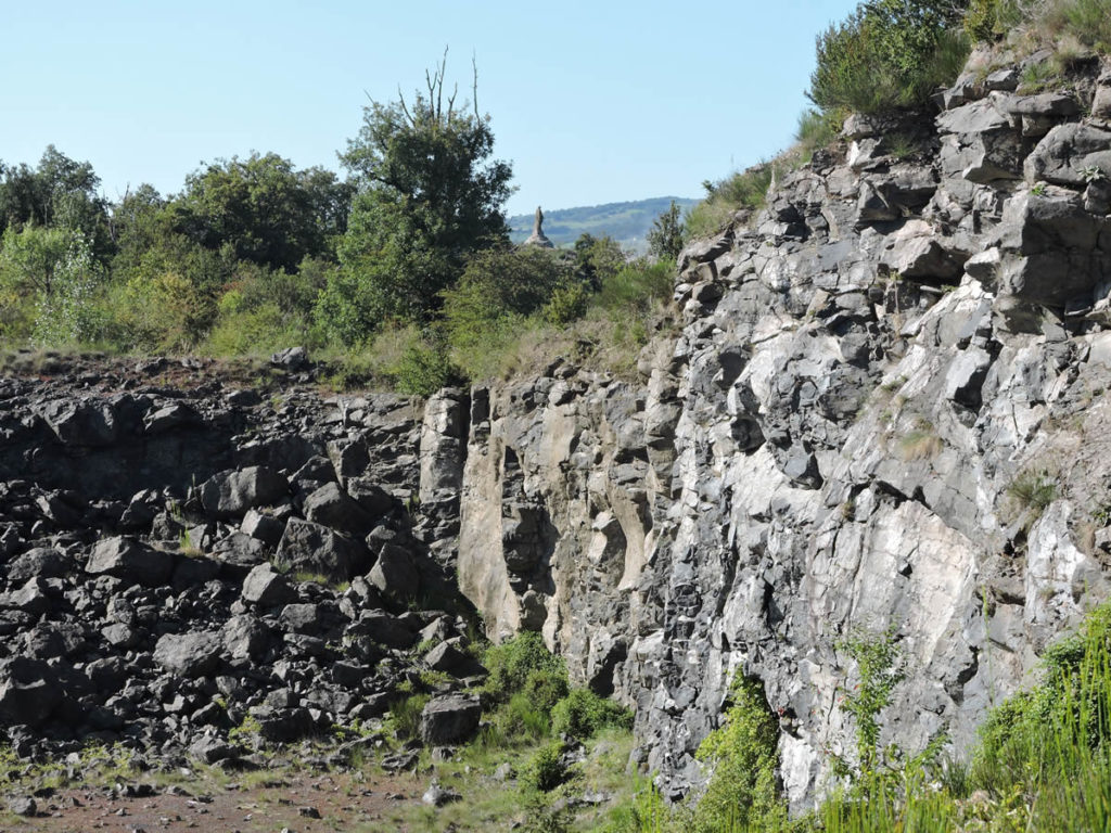
| You’ll still have to cross the gravel pit, climb a pathway covered with large gray basalt stones on an extreme slope. May you pass here without facing bad weather! | |
 |
 |
 |
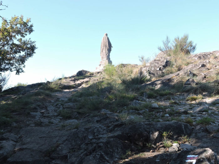 |
Finally, here it is, immense, grandiloquent! Behind the basalt quarry.
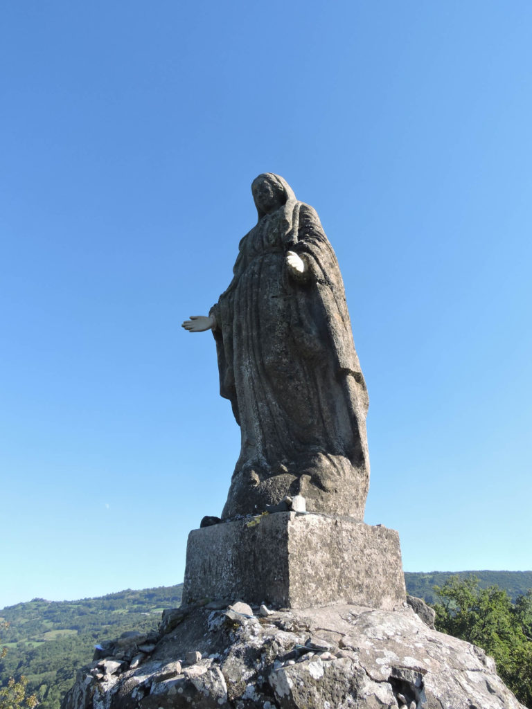
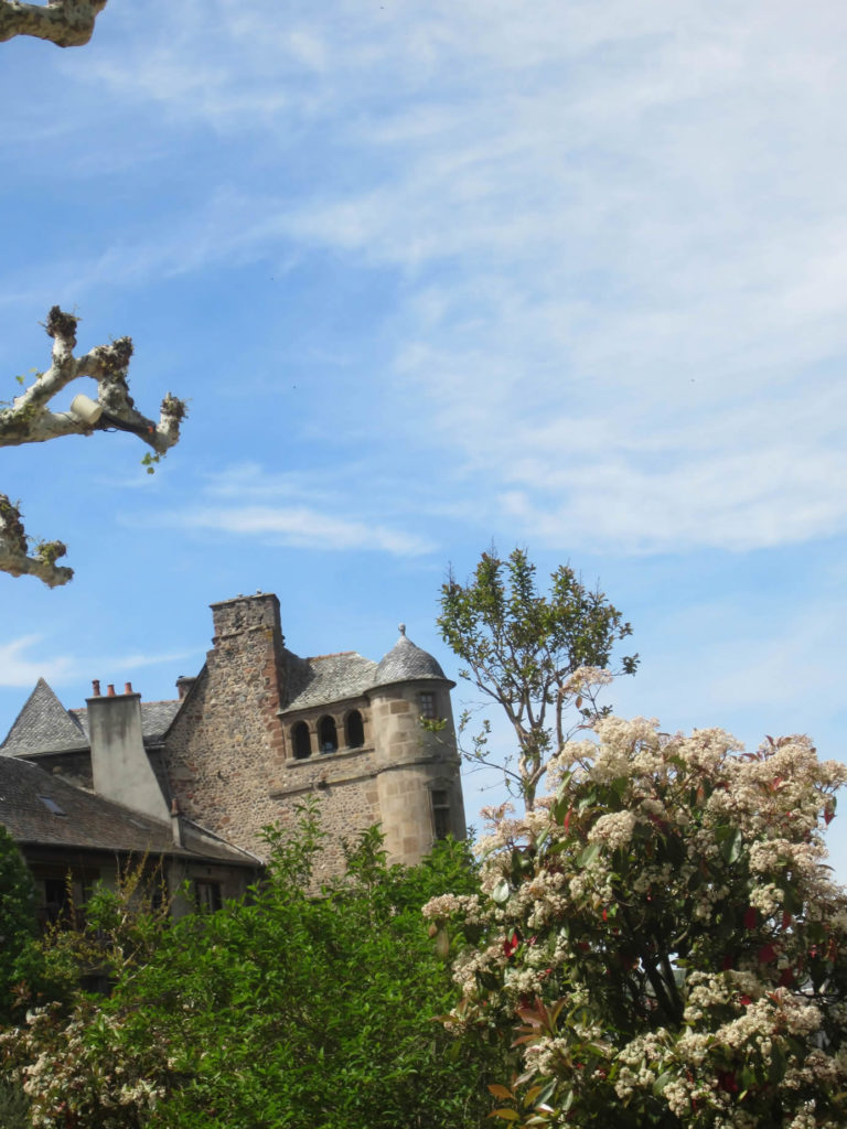
| From up there, on the volcanic cone that bears the Virgin Mary, the view is beautiful over St Côme d´Olt on one side and Espalion on the other. The Virgin, 2 m 60 high, was created by the sculptor Louis Castanié, a citizen of Aveyron. It was erected in 1862. The inhabitants of St Côme and Espalion wanted the gaze of the Virgin to be turned towards their respective municipalities. The problem was resolved by directing the gaze of the Madonna, halfway towards Aubrac, between the two communes.
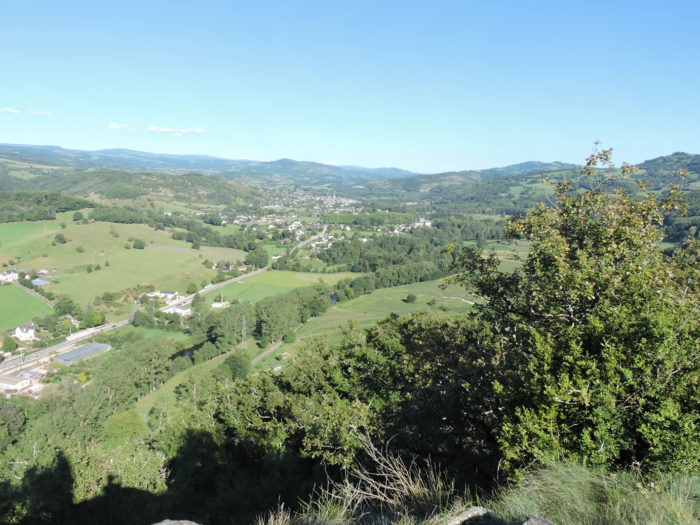
In the direction of Espalion, you will see St Hilarian cemetery below, where you will have to get off. |
|
 |
 |
| You will imagine that sloping down here in the brushwood will not be a highway of pleasure. You will have to grapple with the weeds, on a bad little lane, very narrow and very stony, on an often-extreme slope, in the forest of stunted oaks. What happiness, of course! With a billhook, it would sometimes be easier to pass. | |
 |
 |
Forward march!
Wait for the video to load.
| Further down, the pathway widens and leaves the weeds and bushes, on a slope that has finally become very reasonable. | |
 |
 |
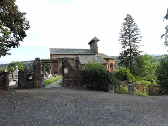
| The GR65 then reaches Espalion, passing under the Church of Perse, a sanctuary very frequented by pilgrims of the Middle Ages, in their race for relics. The church dates from the 11th century, erected on a place where St Hilarien was beheaded by the Saracens. For a long time, the parish church of Espalion, today it is no more than a cemetery chapel. The church is made of red sandstone, under its arcaded bell tower.
Hilarian, born around 760 in a hamlet near St Come d’Olt, became a priest of the Church of Perse. It is said that he crossed Lot River, between the hamlet where his mother lived and the church he served, on his coat, which he used as a boat. A real miracle! The Saracens, then present in Rouergue, seized him and cut off his head. Hilarian then took his head in his hands and brought it back to his mother. |
|
 |
 |
| Beyond the cemetery, you have several choices to reach the center of the city. The easiest way is to follow down the small road that goes down below the church.
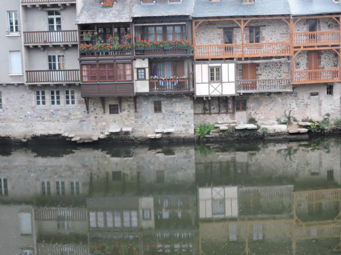
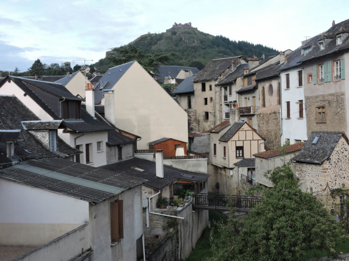
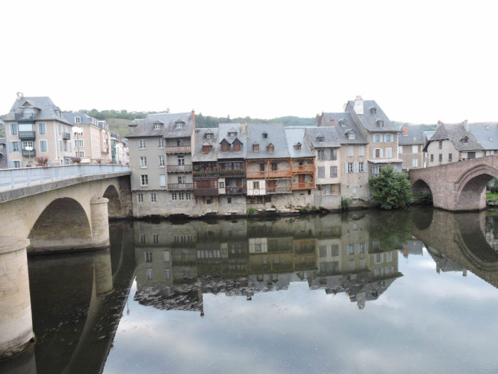
Espalion, a small town of 5,000 inhabitants, is the main town of North Aveyron, still a place of passage and markets today. It is the first rather important city encountered by pilgrims from Le Puy. The city has always been like a smile from the South for pilgrims coming from the North by austere roads. In the past, tanneries plunged their slabs into the Lot River and the skins were wet and tanned directly in the river. Many corbelled houses are still present. There are traces of the “calquières”, these old tanneries, whose stones plunged into the river. Espalion once had a railway line. This was definitively abandoned in 1987. The town is dominated by Calmont Castle perched on a basalt peak overlooking the Lot valley. This castle, which had great importance in the Middle Ages is one of the oldest castles in Rouergue. The barons, masters of the fortress, disappeared towards the end of the 17th century. |
|
 |
 |
One of the traditional images of the city is the 16th century Renaissance palace, with its intricate architecture and its “pepper pot” tower stuck to the wall, which rises above the Pont-Vieux (Old Bridge) and the city.
| But the most famous image is still that of the Pont-Vieux (Old Bridge), in pink sandstone with four arches, which dates from the Middle Ages, and which is a UNESCO World Heritage Site. Unfortunately, the new bridge, right next door, disfigures its charm a little. | |
 |
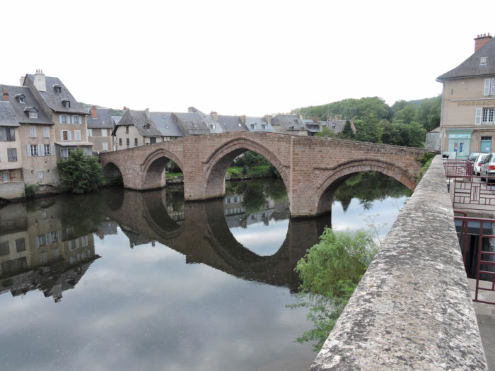 |
| You’ll leave Espalion and the banks of the river, via the magnificent Pont Vieux, this magnificent pedestrian pink sandstone bridge. Here it is not fun, because you must first cross the rather insignificant suburbs of the village. | |
 |
 |
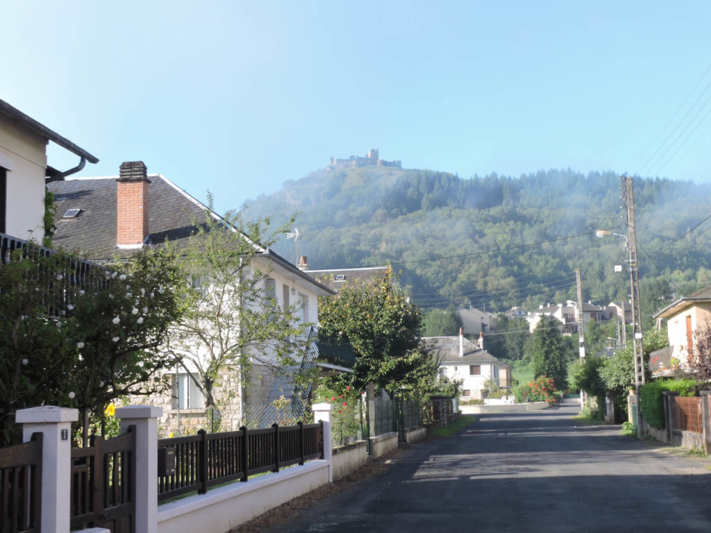
| Admittedly, the route opens fairly quickly to the countryside. All the same, you have to walk along the meadows that the neighborhood of the city has swollen with new houses, turn your gaze towards Calmont Castle, very far up on the hill. |
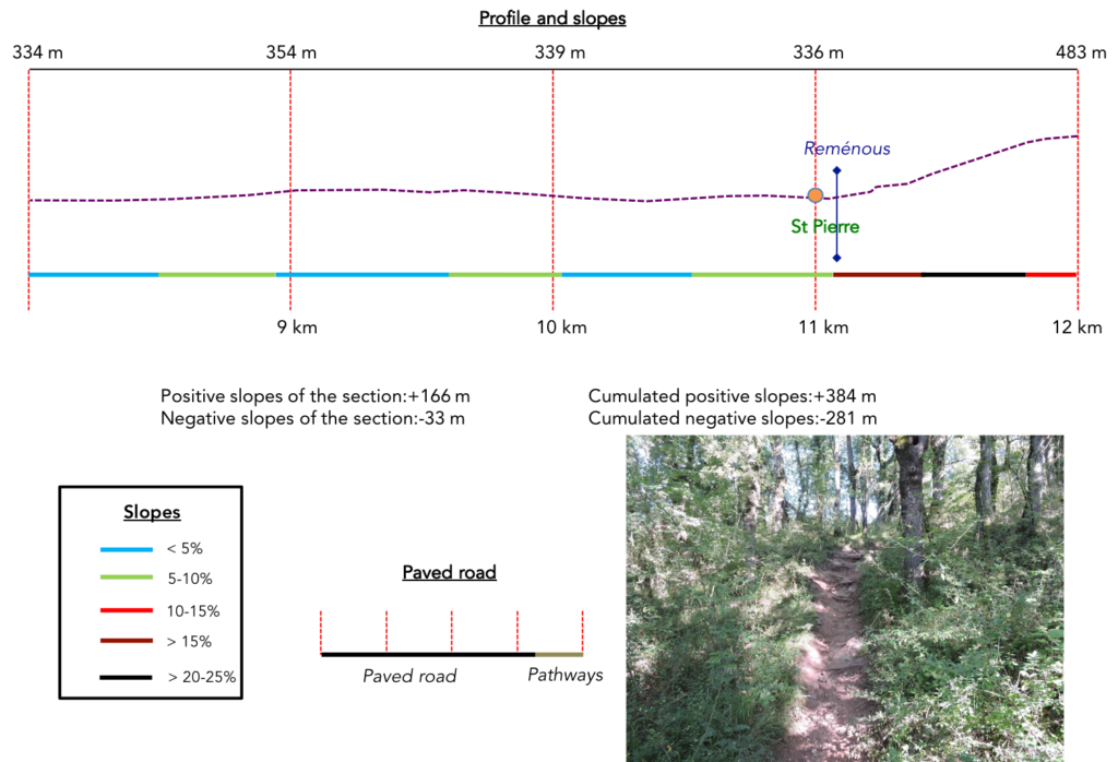
Section 3: A great adventure potentially awaits you here.
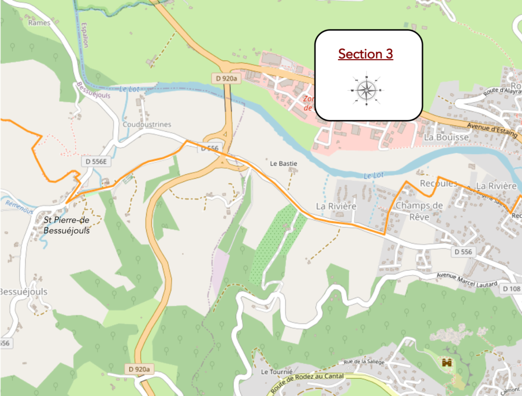
General overview of the difficulties of the route: no problem until St Pierre before tackling the climb to Briffoul, but from there it climbs seriously.
|
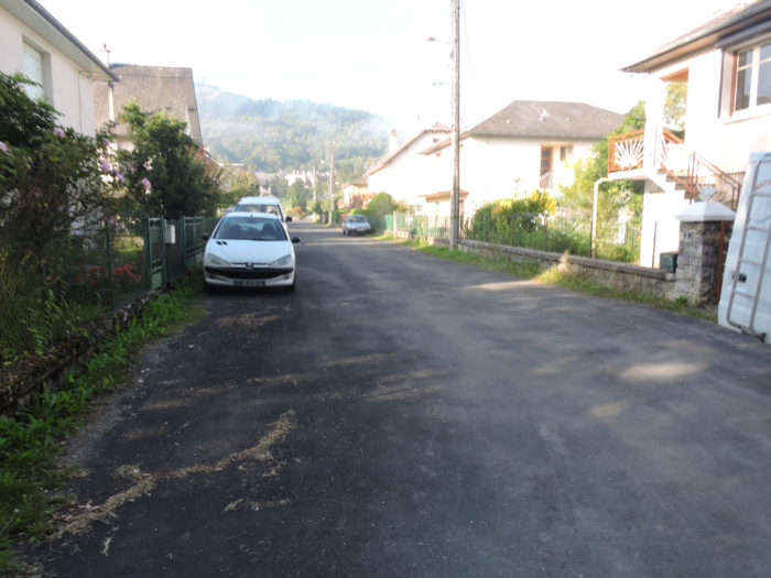
Here the GR65 draws long lines at an angle, first on the tar, then on the dirt, in the middle of the villas. Gradually, you’ll abandon the castle which is often present in front of your eyes on the hill. Very few must be the hikers who run up there. |
|
 |
 |
 |
 |
|
Further on, there is a small, very stony pathway to make you believe that you have left civilization, but you are not. |
|
 |
 |

|
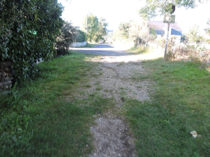
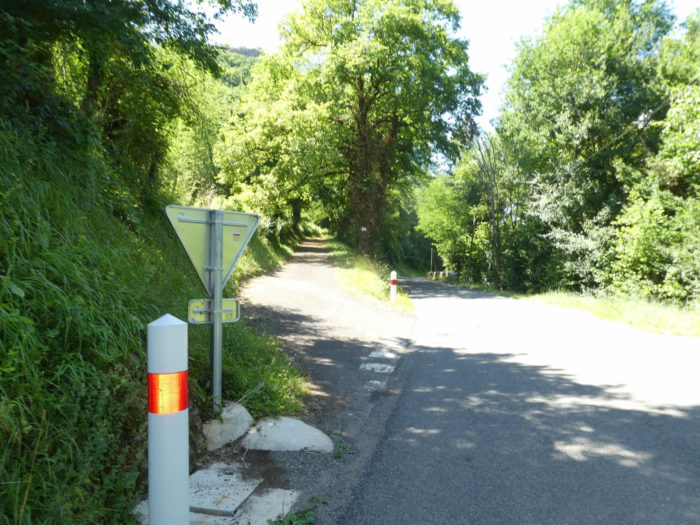
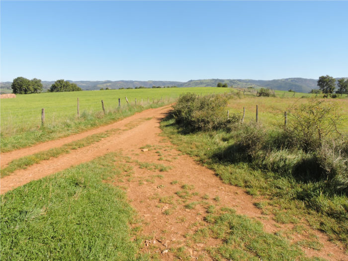
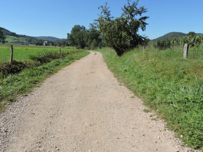
Further ahead, the dirt road soon reaches a paved road. |
|
 |
 |
|
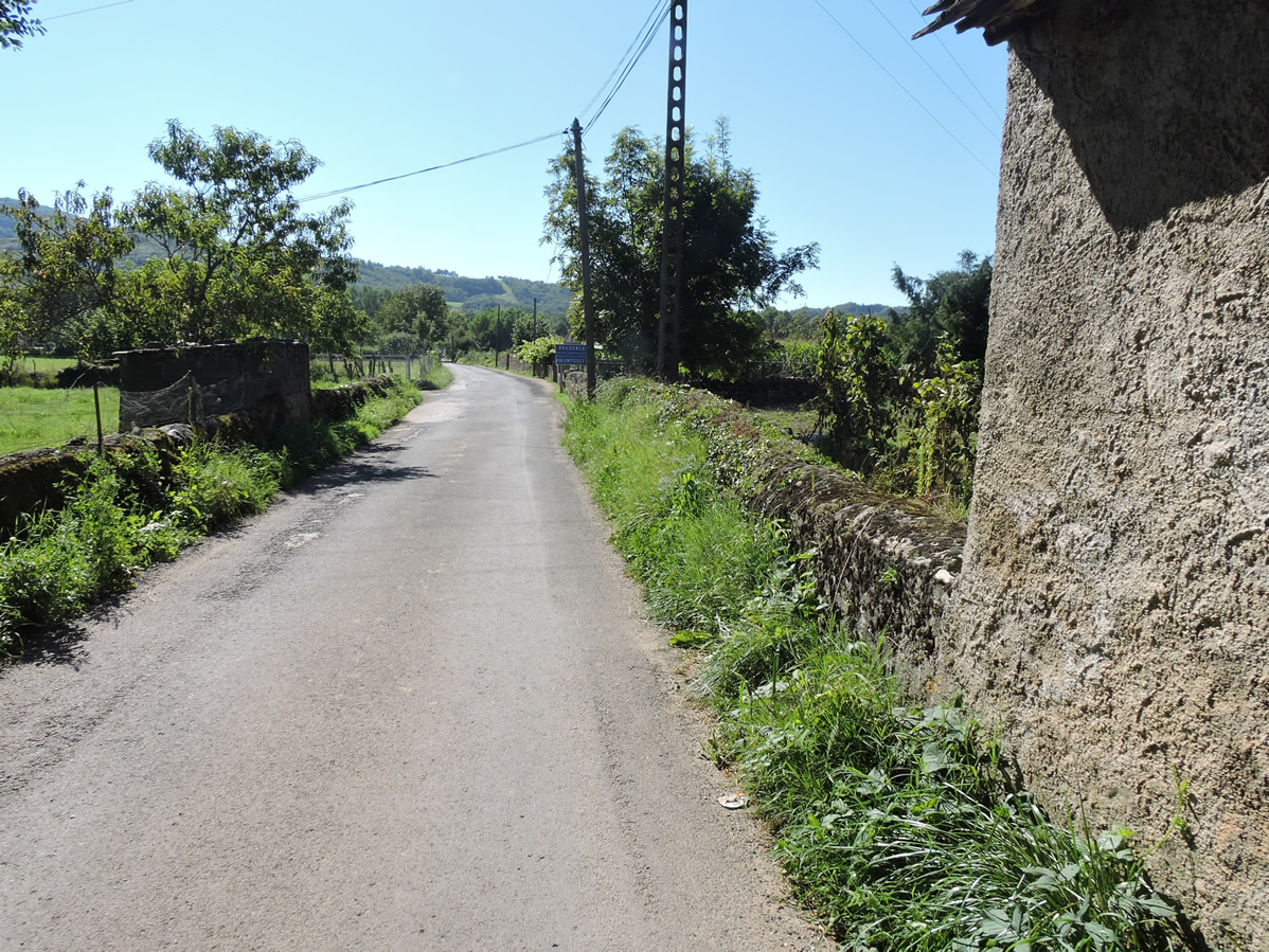
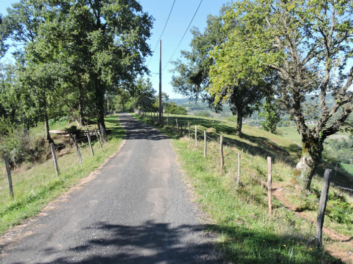
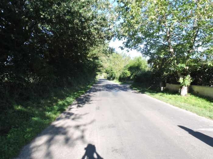
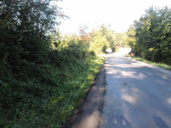
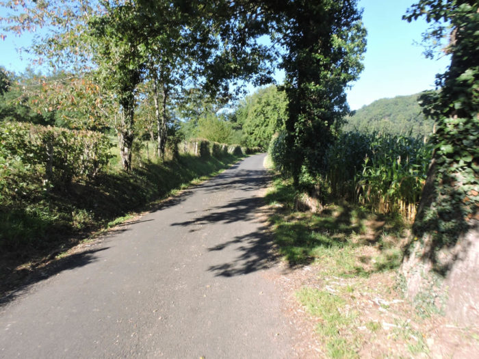
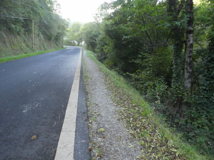
You have to follow the small asphalt road for quite a long time. Admittedly, it is not the county road that leads from Espalion to Estaing, but vehicles circulate constantly. |
|
 |
 |
|
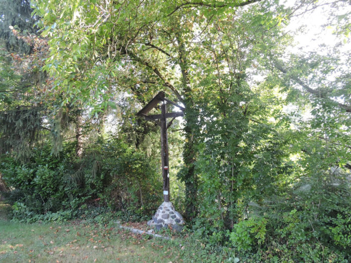
The ordeal, if we dare say it here, lasts until a small crossroads that leads to St Pierre de Bessuéjouls, a former seigneury, whose castle is now in ruins. Here advertising makes a curious household with religious symbols. After a long dose of paved road, it is always a pleasure to find a passage which again offers recreation of the undergrowth and the countryside. |
|
 |
 |
|
The GR65 climbs up the gently sloping road towards the village church. |
|
 |
 |
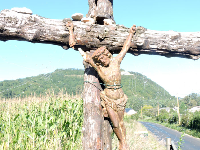
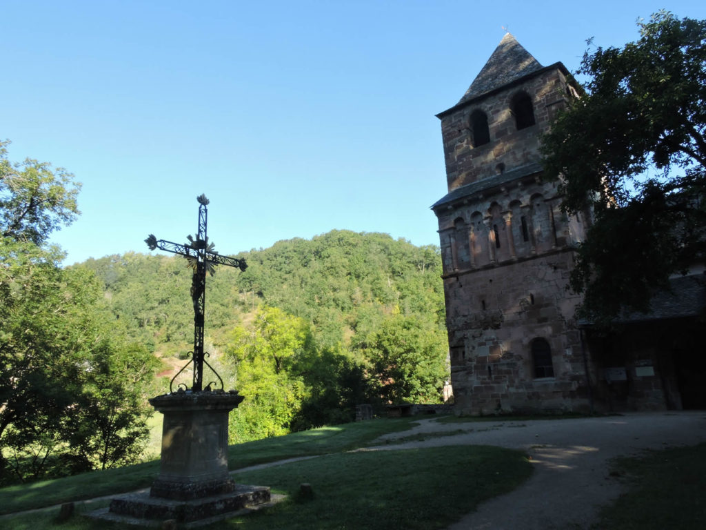
| The pink sandstone of St-Pierre church gives a subtle touch in a very beautiful green site. You have to climb the bell tower, if you are not too claustrophobic, to see the aerial chapel, follow a narrow staircase with threadbare steps, to go and kneel on the slab at the foot of the statues of St Gabriel and St Michael.
|
|
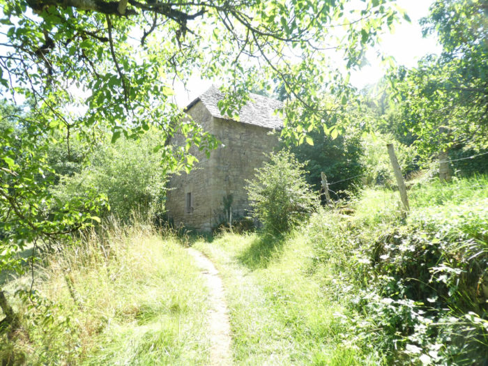
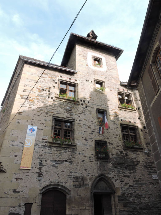
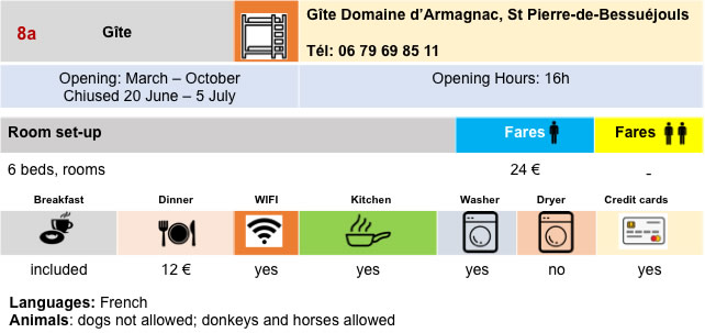
Not far from the church, renovated buildings make up the domain of Armagac, once a convent run by sisters for the education of poor young girls. Now renovated, the building is a remarkable accommodation. |
|
 |
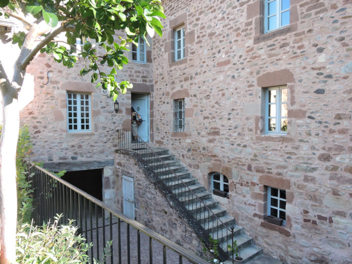 |
|
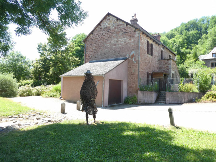
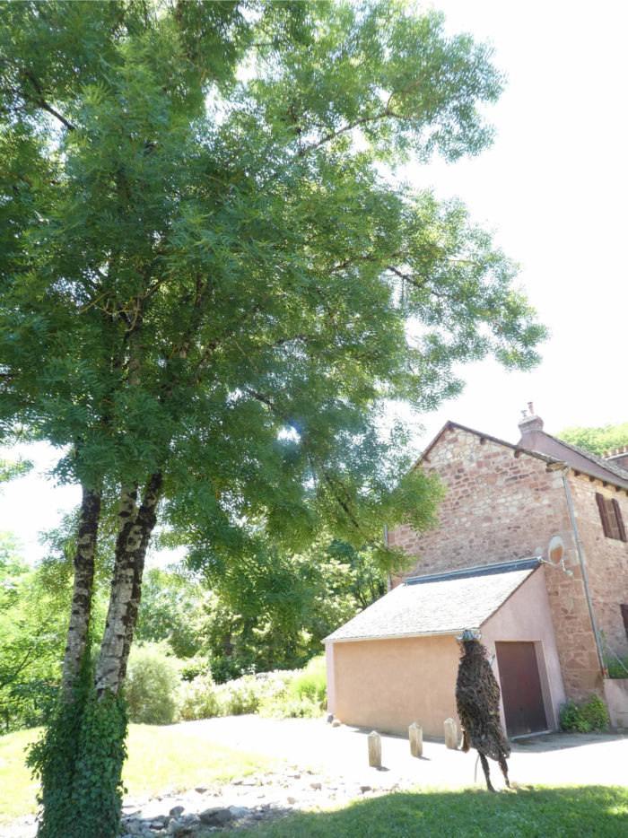
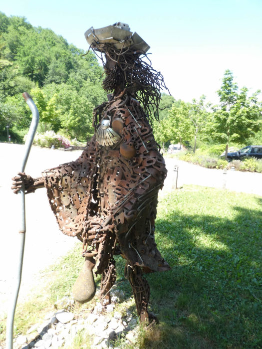
An iron pilgrim, at the foot of a large ash tree in the town hall garden, guards the place, facing the church at the foot of the large sequoia. |
|
 |
 |
 |
 |
|
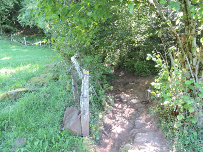
The GR65 exits on the road to St Pierre and follows the Rémenous stream, as colored red as the hill. |
|
 |
 |
|
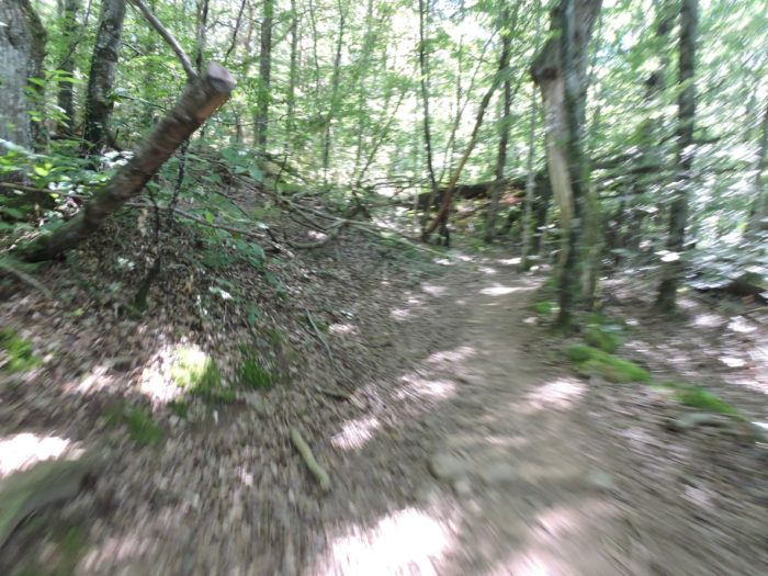
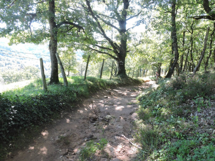
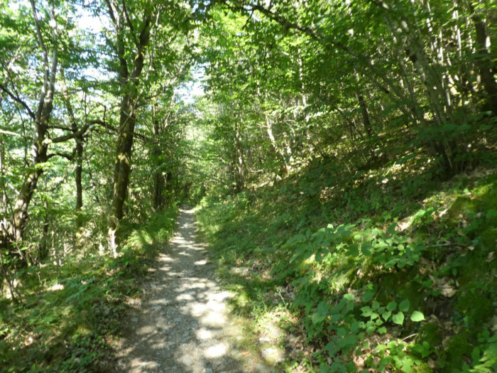
But here it is, the second bump of the day, and this one is worth it. You have undoubtedly enjoyed the climb at Escluzels above Monistrol d’Allier at its fair value. This does not yield to it in any way. It is almost as demanding: 150 meters of vertical drop over 800 meters of route. However, in the first turns, the game is relatively easy. A wide pathway leaves the paved road and climbs into the undergrowth. In these forests, chestnut trees compete for space with ash, maple, beech and oak. |
|
 |
 |
|
The pathway then leads to some beautiful stone farms in a clearing. |
|
 |
 |
|
Further up, in this wooded and green valley, it is now time to tackle a fairly steep slope. Sometimes the ground is ocher, even reddening. Sometimes small banks of rocks emerge. |
|
 |
 |
 |
 |
|
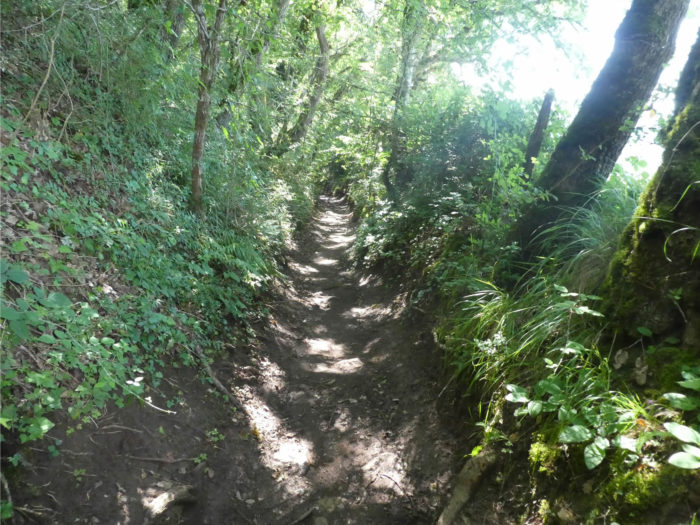
The higher you walk, the narrower the lane, and the more the slope increases. |
|
 |
 |
| Of course, some athletes will be impatient here to swallow this slope, to go around the moss-covered rocks planted at the corner of the pathway, to progress in this way, agile like real ibex. But the retirees who are making the journey, and there are many, will rather wait for the adventure to end as quickly as possible.
|

| If you walk here in rainy weather the climb will be very strenuous. You will not be able to avoid the mud. Sometimes you will have to hang on to the bushes and shrubs so as not to slip on a ground, where the pebble constantly rolls under the foot until it reaches the plateau above. The roots, sometimes huge, intersect, almost to bar the way. The rocks are sometimes taken by lianas as in a mortal embrace. Real fun, for sure. We passed here once, on a fine day, but after a terrible period of bad soil degradation. We can assure you that then it is perhaps the most arduous passage of the whole way to Santiago. May you pass here on a fine day. |
As if you were there, or almost …
Wait for the video to load.
|
But let’s resume our route for the day. There are still some nice passages for retirees. |
|
 |
 |
|
In the last hundreds of meters, the slope is less demanding. The ocher dirt road gradually comes out of the woods to reach a sort of scrub where a few puny pines also grow in the bushes. |
|
 |
 |
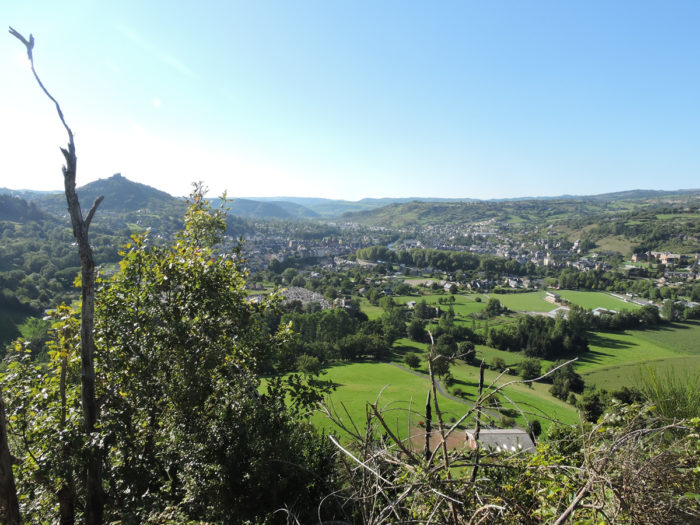
From here you can still see Calmont Castle above Espalion.
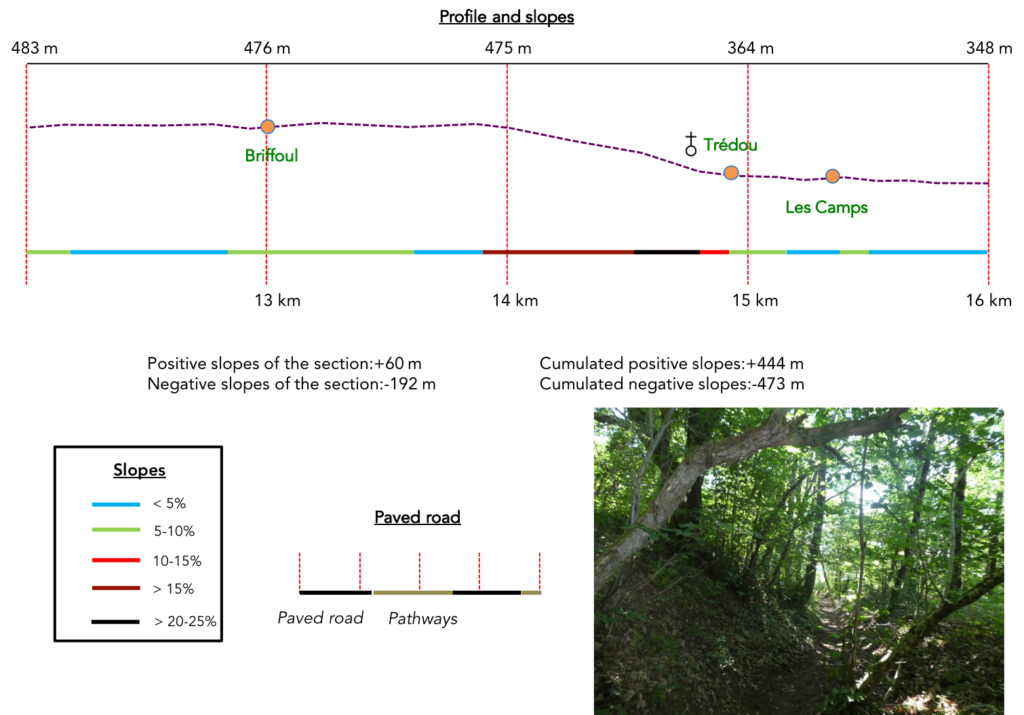
Section 4: The descent is almost as fun as the climb, in bad weather.
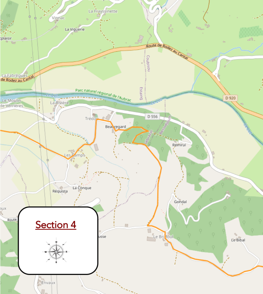
General overview of the difficulties of the route : once arrived at Le Briffoul, the track prances around, often also with slopes of more than 20%, on stones, towards Beauregard.
|
The GR65 then reaches a plateau on the paved road. For many pilgrims, the Briffoul plateau, overlooking the Lot River, is welcomed as a deliverance. |
|
 |
 |
|
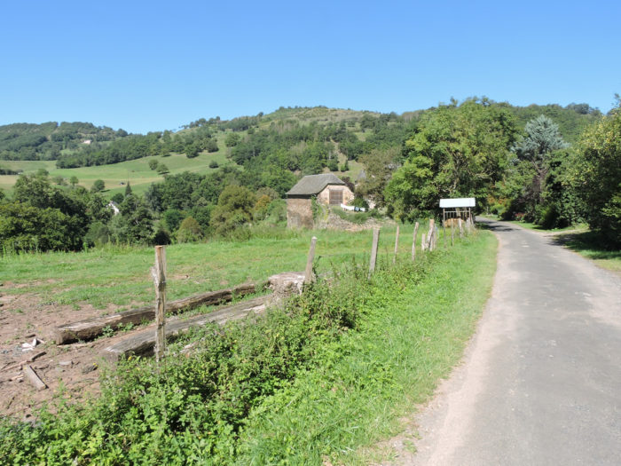
The paved road then heads to Le Briffoul and its farms. A gigantic farm dominates the plateau. |
|
 |
 |
|
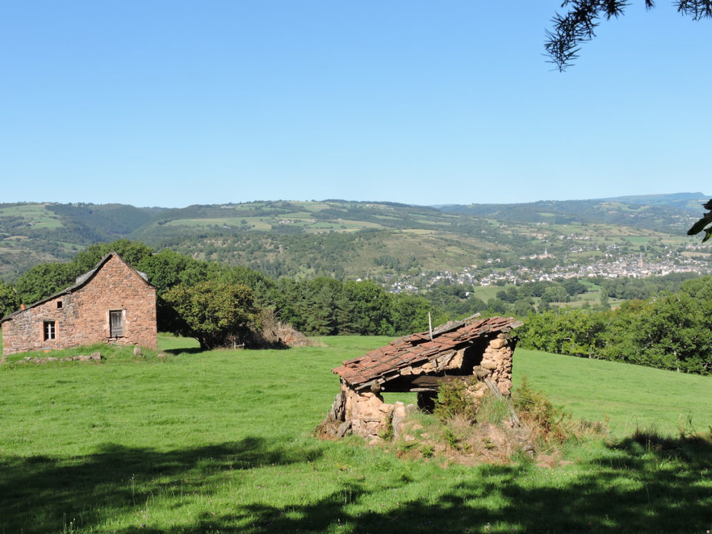
Le Briffoul, with its beautiful houses carved out of raw limestone, is a stone’s throw away. Here is the countryside in all its grandeur. |
|
 |
 |

|
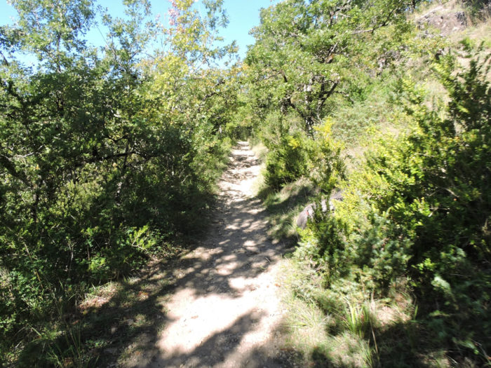
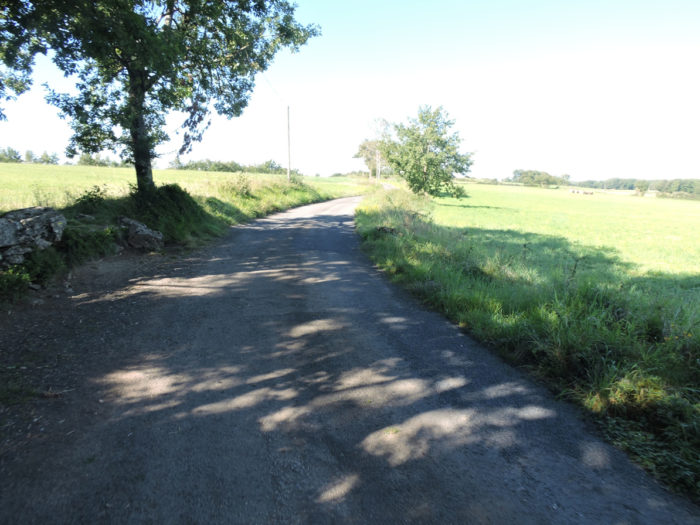
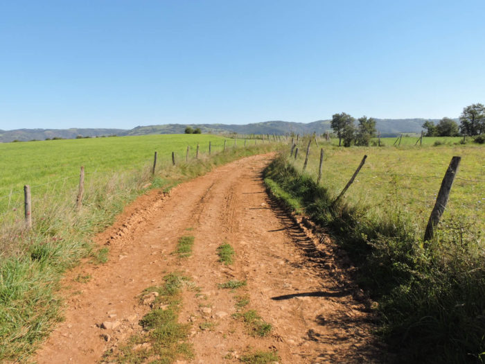
On leaving Le Briffoul, the pathway wanders for a moment on the ocher ground of the plateau. The pathway runs with the monotony of large undulating waves, along meadows and a few small cultivated fields. The horizon stretches solitary, up to the canopy of the sky, at the far end of the horizon. |
|
 |
 |
|
Further on, the wide pathway soon reaches the end of the plateau, on the edge of the forest. |
|
 |
 |
|
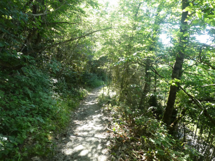
As you have climbed, you must slope back down. This is the Camino de Santiago program. The track tumbles down the plateau. The descent is no less vertiginous than the climb, most often on a narrow pathway. |
|
 |
 |
|
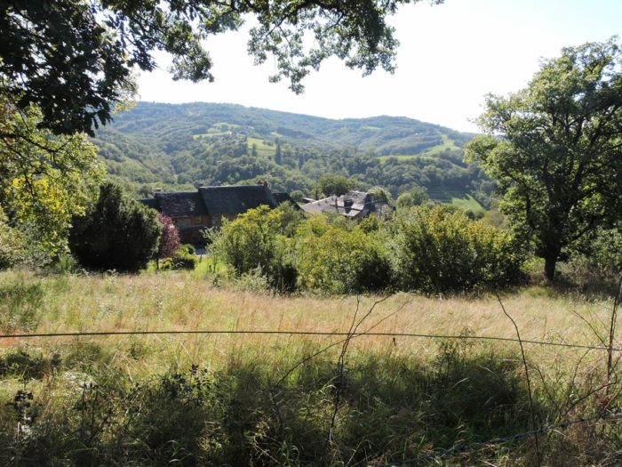
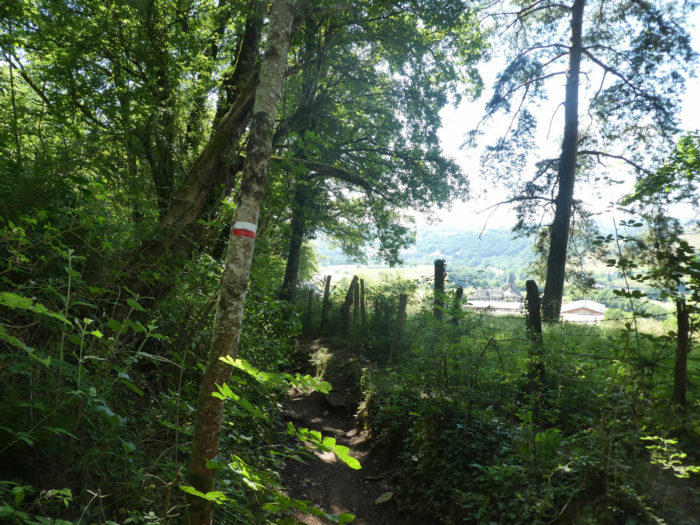
The lane plunges into the thick undergrowth, in the midst of which you can recognize maple, oak and chestnut trees, but where the sun hardly penetrates. Beeches have replaced hornbeams. In good weather, apart from the slope, this route is no problem. In bad weather, it is quite another thing. The pathway becomes torrential and the foot slip on the wet stones. You will only want to get out of it. The castle of Beauregard, below, will be there like a deliverance, out of the woods. |
|
 |
 |
|
The slope sometimes decreases a little, but more often it is between 10% and 20%. Here the ground, under the large stones, is almost black. Towards the end of the descent, under the ash trees, you can see the church of Trédou below. |
|
 |
 |
|
The pathway comes out of the forest near Beauregard Castle. While the house may be uninhabited, the estate makes wine, one of the appellations of Estaing wines. |
|
 |
 |
|
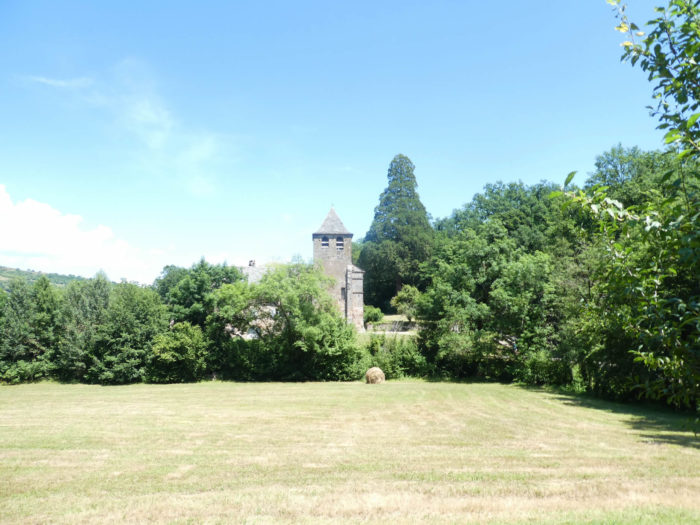
In a rural landscape, where you can see chestnut trees and many ash trees. Further ahead, the GR65 reaches the plateau on the paved road near the church of Trédou. |
|
 |
 |
|
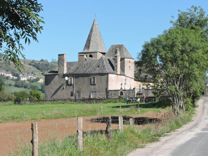
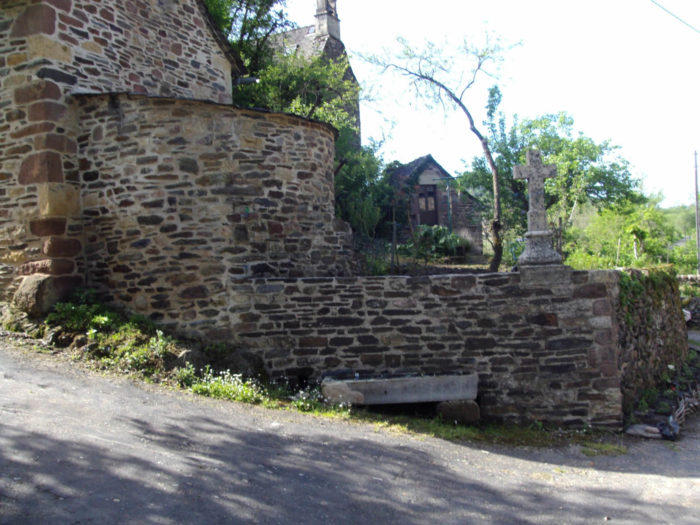
The church, with its curious bell tower, which appears outside the church, is a former priory mentioned since the 16th century, which has undergone renovations throughout its history, the last works dating back to ten years. The church is closed, but when you walk around you get the impression that people live here. |
|
 |
 |
|
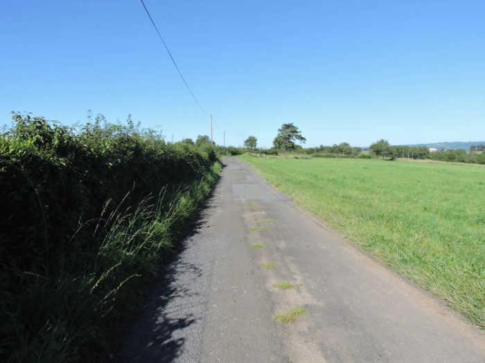
Beyond the church, a paved road slopes downhill into the countryside under tall trees, running soon near beautiful stone houses in Les Camps hamlet. |
|
 |
 |
|
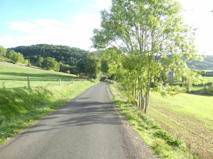
At the bottom of a short descent, the universe opens up on a small asphalt road that seems to lead you towards infinity. Happiness, right! |
|
 |
 |
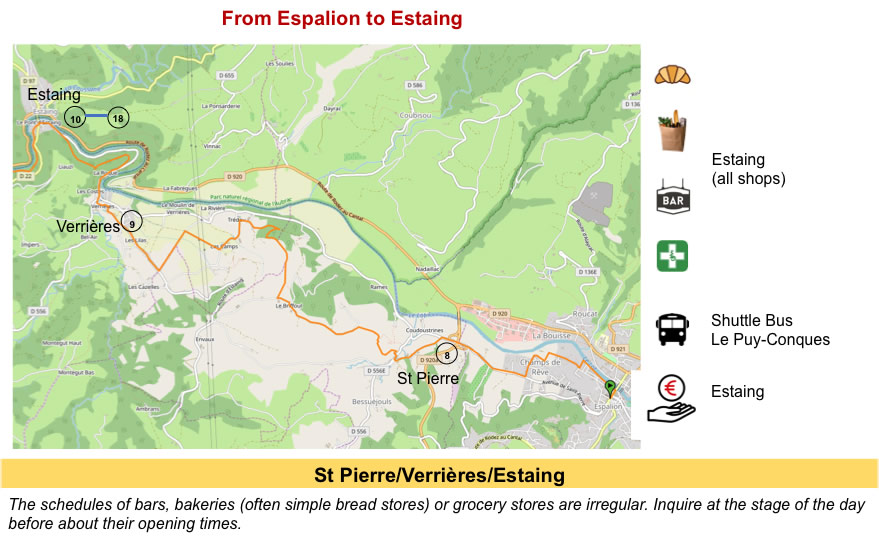
Section 5: On the way to the beautiful Estaing village.

General overview of the difficulties of the route: flat, then ups and downs without difficulty.
|
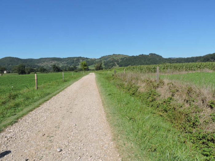
Here are endless stretches, first on the tar, then on the gravel, across fields. The pilgrim, like the soldier, it cannot be said enough, is not a real tourist. He has no right to constantly demand the sublime. At the very most, he will not dawdle on the way and accelerate his pace to shorten this tedious walk which seems so long to him. |
|
 |
 |
|
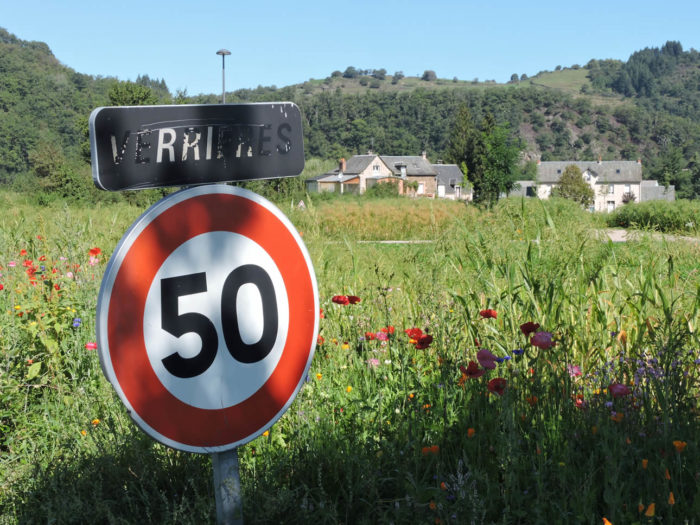
Much further, the GR65 arrives on the paved road in Verrières, almost on the banks of the Lot River. |
|
 |
 |
|
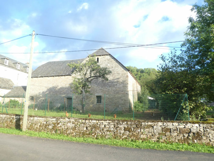
The village is home to remarkable freestone houses. It is a village full of good life, which is also an appellation for the wines of the region. |
|
 |
 |
 |
 |
|
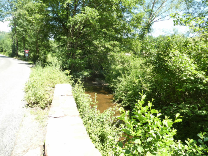
The GR65 soon crosses the small Magrane brook to join D100 road, a small county road that runs along the Lot River. |
|
 |
 |
|
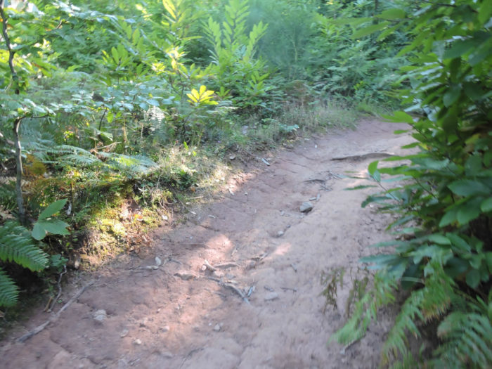
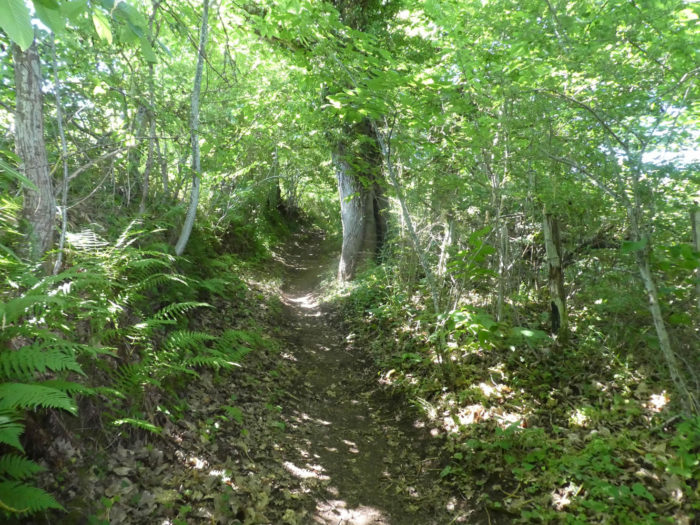
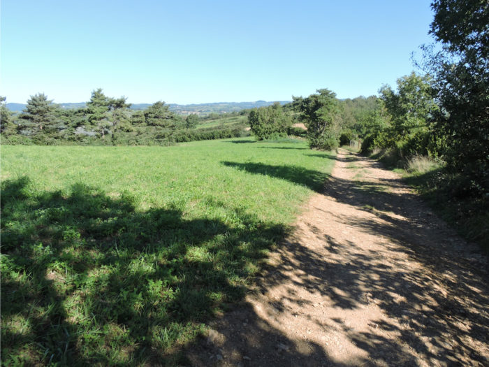
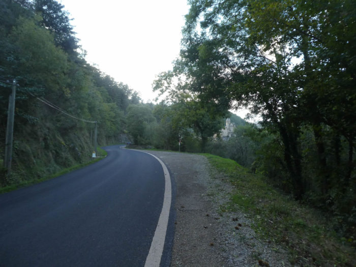
It follows the uncrowded road for a while on the side of the road. Yet, the GR65 hates departmental roads. It only goes when it has to. As soon as an opportunity is present, it leaves with pleasure in the forest on a narrow stony lane. |
|
 |
 |
|
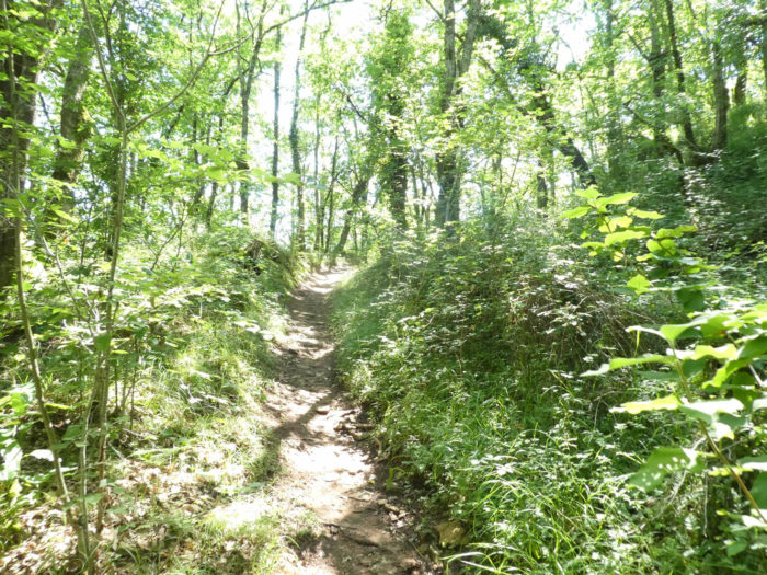
Before arriving in Estaing, just a little fun in bumps over the woods. Here the forest is dense, in the middle of maple trees, beeches, oaks and chestnuts. |
|
 |
 |
|
The pathway quickly narrows, and sloping down, you’ll see a paved road below that runs along one of the loops of the Lot River. |
|
 |
 |
|
Further afield, the pathway joins the road along the river. Here the valley is deep, dark. |
|
 |
 |
 |
 |
|
Estaing is two steps down the road. |
|
 |
 |
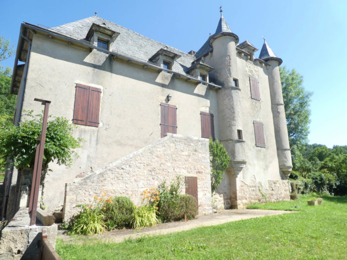
| Estaing is a village with little more than 600 inhabitants. Estaing owes its name to the Latin stagnum, which means pond. The village, on its rocky outcrop on the banks of the Lot River, dates from the Gallo-Roman period. The emblem of Estaing is undoubtedly the castle, the imposing home of the Counts of Estaing.
|

|
The Estaing are an illustrious family from Rouergue, who gave France many soldiers and religious: a cardinal, many bishops, admirals, and even a president of the French Republic. The first stones of the castle were laid in the 11th century, and the castle was remodeled many times. Promoted national property during the French Revolution, it was taken over by the nuns of St-Joseph, to become their mother house. In 2000, it moved to the commune of Estaing. In 2005, the Valéry Giscard d´Estaing Foundation bought the castle. The local baker tells us that Giscard sometimes came to buy bread at her house, including her famous “Bonjour, Madame”. But,he didn’t come every week. Far from there! Estaing is still quite lost, in the middle of France. He came every year to the Fête de St Fleuret, where, with his wife, he showed the castle. Giscard recently passed away. For tourists, Estaing may be summed up to the castle and the main street where hotels and shops are located. The parish church of St Fleuret, built on a crypt, built in the XVth century recently renovated, is a little on the height in a village with medieval character, where schists dominate. A very beautiful XVIth century building houses a rejuvenated Tourist Office in a beautiful vaulted cellar. |
|
 |
 |
|
But Estaing is also the majestic Gothic bridge, a UNESCO World Heritage Site. It bears in its center the Estaing cross, which in itself symbolizes Aveyron. A little further on the bridge, the statue of François Estaing, the bishop of Rodez. Many accommodation possibilities are offered here. Moreover, many pilgrims stop at Estaing. |
|
 |
 |

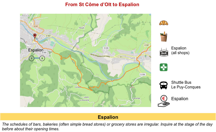
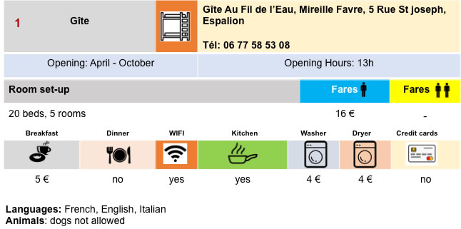
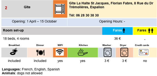
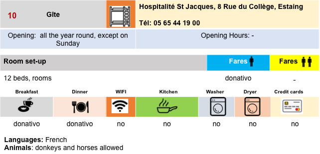
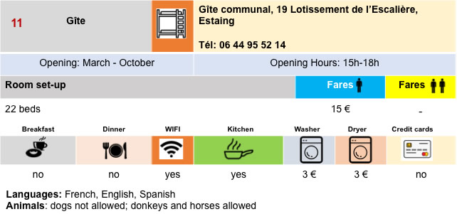
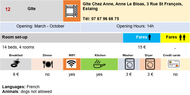
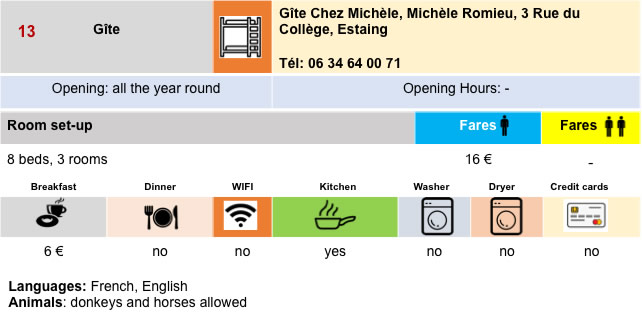
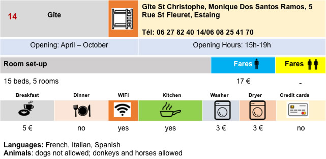
Lodging
 |
 |
 |
 |
 |
 |

 |
 |
 |
 |
 |
 |
 |
 |
 |
 |
 |
 |
Feel free to add comments. This is often how you move up the Google hierarchy, and how more pilgrims will have access to the site.
 |
Next stage : Stage 9: From Estaing to Golinhac |
 |
Back to menu |