St Cirq-Lapopie, the favorite village of the French
DIDIER HEUMANN, ANDREAS PAPASAVVAS
We divided the course into several sections to make it easier to see. For each section, the maps show the course, the slopes found on the course, and the state of the route (paved or dirt roads). The courses were drawn on the “Wikilocs” platform. Today, it is no longer necessary to walk around with detailed maps in your pocket or bag. If you have a mobile phone or tablet, you can easily follow routes live.
For this stage, here is the link:
| This is obviously not the case for all pilgrims, who may not feel comfortable reading GPS tracks and routes on a mobile phone, and there are still many places without an Internet connection. For this reason, you can find on Amazon a book that covers this route.
If you only want to consult lodging of the stage, go directly to the bottom of the page. |
 |
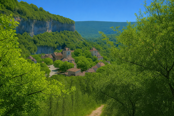
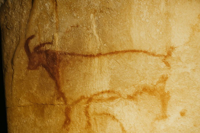
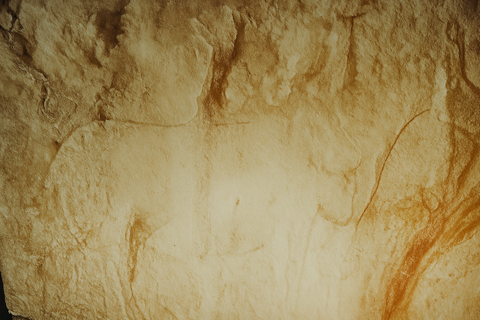
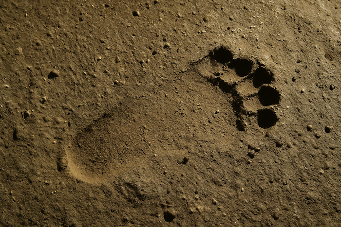
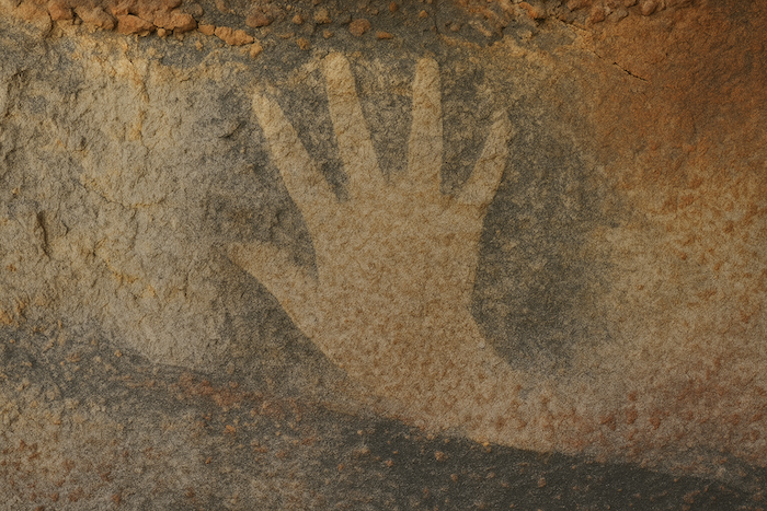
The limestone, so fragile in this region, has carved a true natural labyrinth. Caves, galleries and countless cavities intertwine, drawing secret corridors through the rock. Since prehistoric times, humans have used these spaces as shelters and workshops, whether troglodyte dwellings or natural hollows. Pech Merle is undoubtedly the most striking example of this union between nature and human memory. There, mammoths, bison and horses still dance across the walls, while handprints and footprints more than twenty thousand years old bear witness to a humanity both fascinated and respectful. The cave becomes a gallery of prehistoric art where time seems to stand still and where the stone tells the earliest stories of humankind.
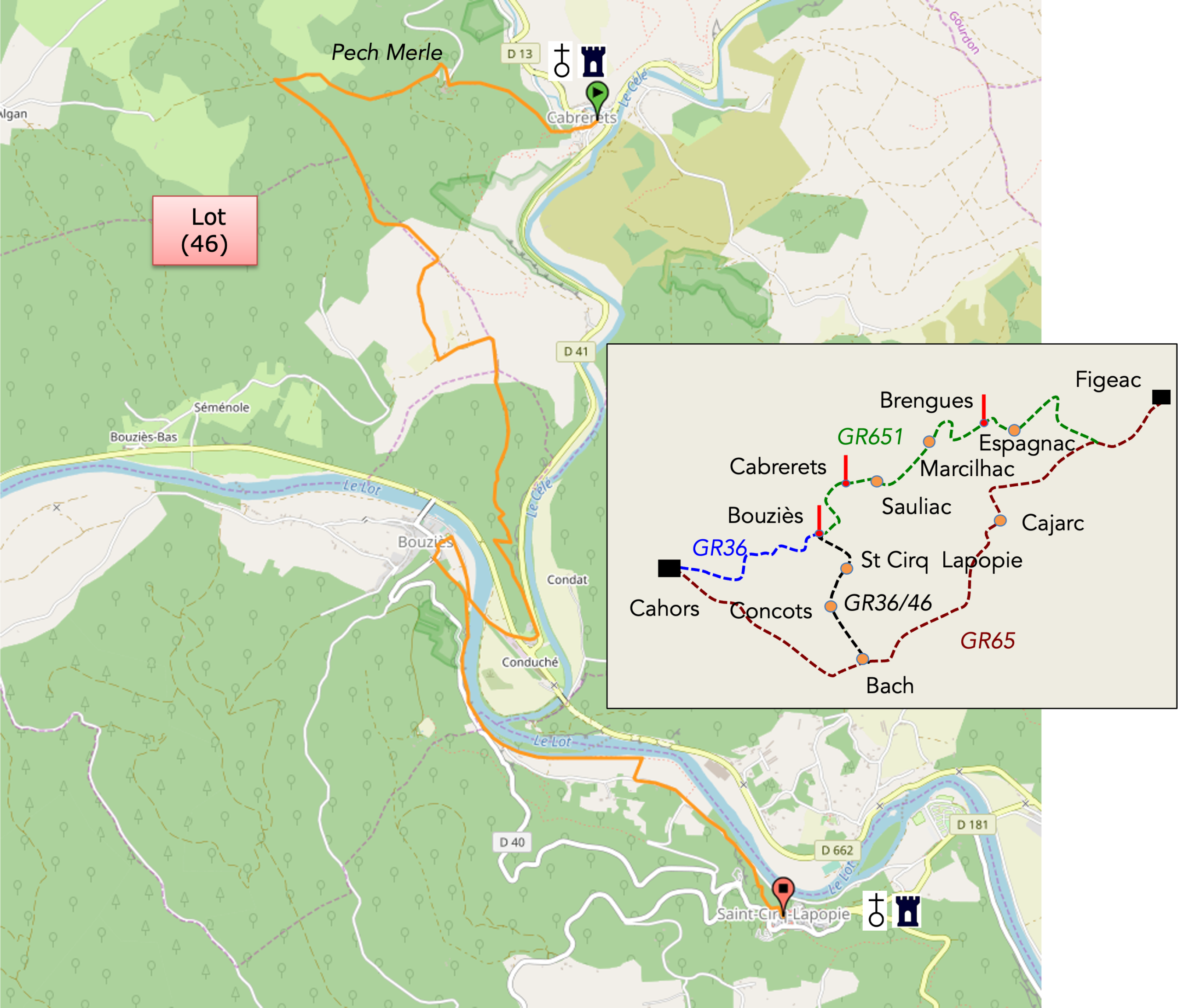
Pilgrims who follow these routes between Figeac and Cahors have many options. It is not our intention to define which route is the best. Each person decides according to their own wishes. In truth, for some pilgrims S Cirq-Lapopie is not a detour but a natural stop, almost an inevitable one. At Bouziès the choice becomes a matter of temperament. Two routes are available to the walker to reach Cahors, and whichever one is chosen it will require two days of walking, two full days at least for a hiker of peaceful rhythm. The first itinerary, the GR46, runs through Vers. But one should not be mistaken. This route is far from easy. To reach Vers you must once again face the causse, the harshest and most arid of the region. The path clings stubbornly to the hillsides beneath the stubborn oaks. It is a demanding walk, stripped down, almost ascetic. From Vers the route continues for a long distance across the plain, away from the Lot. The landscape opens out but loses a little of its soul. The horizon stretches without surprise. Nature becomes calmer, less wild, still beautiful but without the roughness that makes the heart of the Causse beat. It is an itinerary that soothes but rarely moves the soul. It is also in Vers that the Rocamadour variant joins the route, the other itinerary between Figeac and Cahors used by those who follow the great thread of the pilgrimage paths. Yet for those who seek wild beauty the breath of the Lot is not at its most inspiring here. If your heart inclines toward it, prefer the GR36 route, the one that runs through St Cirq-Lapopie, Concots and Vaylats. There the journey comes alive again. It is the path of poets, dreamers and lovers of light. Saint-Cirq, a jewel suspended above the river, watches over this road like a lighthouse over time.
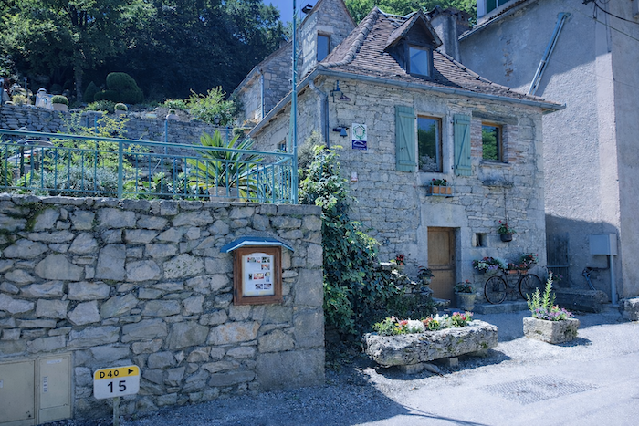
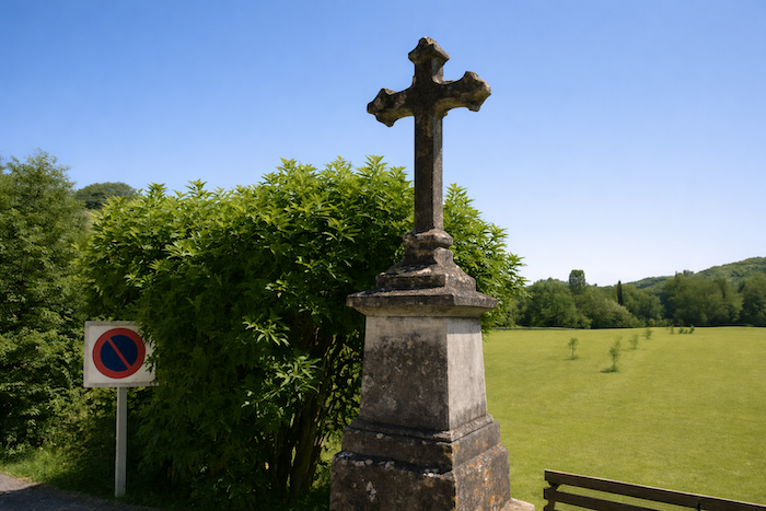
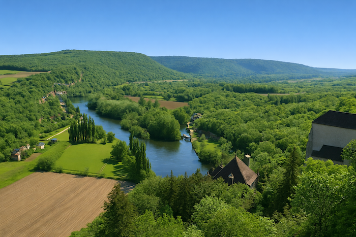
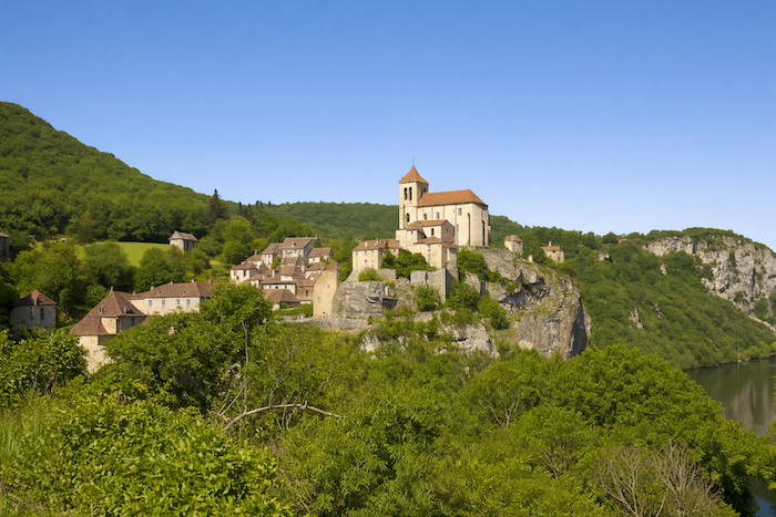
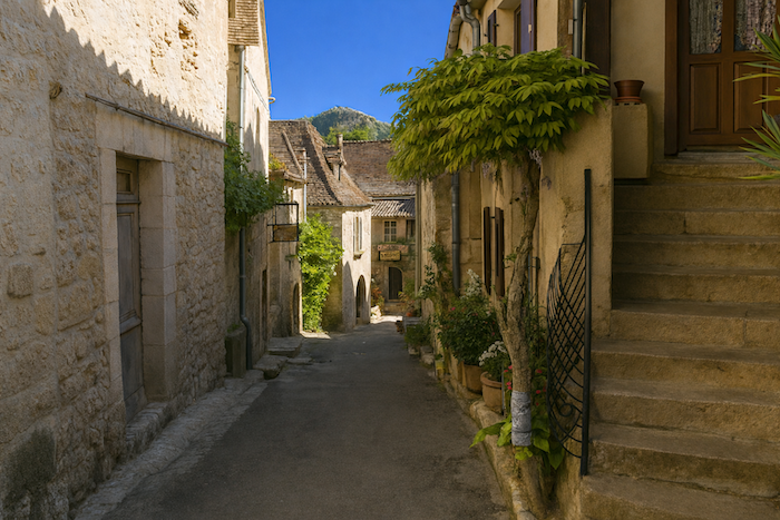
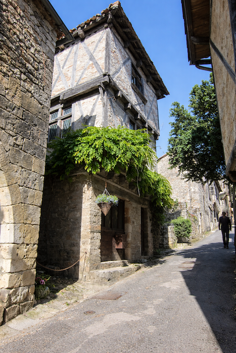
In Bouziès you turn your back on the Célé River for the Lot river. Yet only a few steps from the bridge across the Lot lies the small jewel of St Cirq-Lapopie. If you have never been there, go. André Breton, the great French writer, said of this village: “Beyond many other sites, in America and in Europe, St Cirq has exerted over me the only enchantment that endures forever. I have ceased to wish myself elsewhere. Its roofs, that is you. The enumeration of its other resources is very far from exhausting this secret.” For those who have never walked its cobbled streets or climbed its steep lanes, one of the most beautiful villages in France offers a rare opportunity to arrive on foot, which ninety five percent of the tourists who gather there never do. Perched on its cliff above the meanders of the Lot, it is one of the absolute masterpieces of the Middle Ages. Critics will say that St Cirq-Lapopie is not Conques, and they are right. In Conques there reigns a hushed and almost religious atmosphere. Here the merchants of the temple have spread their webs more widely. Yet this takes nothing away from the magic of a unique place, a place of deep serenity. Visiting St Cirq is all the more worthwhile because from Bouziès one reaches it by the famous “Chemin de Halage” path.
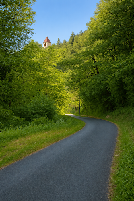
Today we therefore invite you to make a small detour toward St Cirq-Lapopie, so close to Bouziès that it would almost be unforgivable not to take a look. Clinging to its cliff, this village, ranked among the most beautiful in France, seems to defy gravity. Its medieval houses with sharp gables, brown tile roofs and finely molded mullioned windows align in a perfect choreography. The arcades of the small shops and the paved lanes, where the gutter once carried away rainwater and refuse, wrap themselves around the fortified church. At every turn history rises from the walls, and each lane climbs toward a rocky spur from which the eye embraces the Lot, peaceful, gliding like a ribbon of light through the valley.
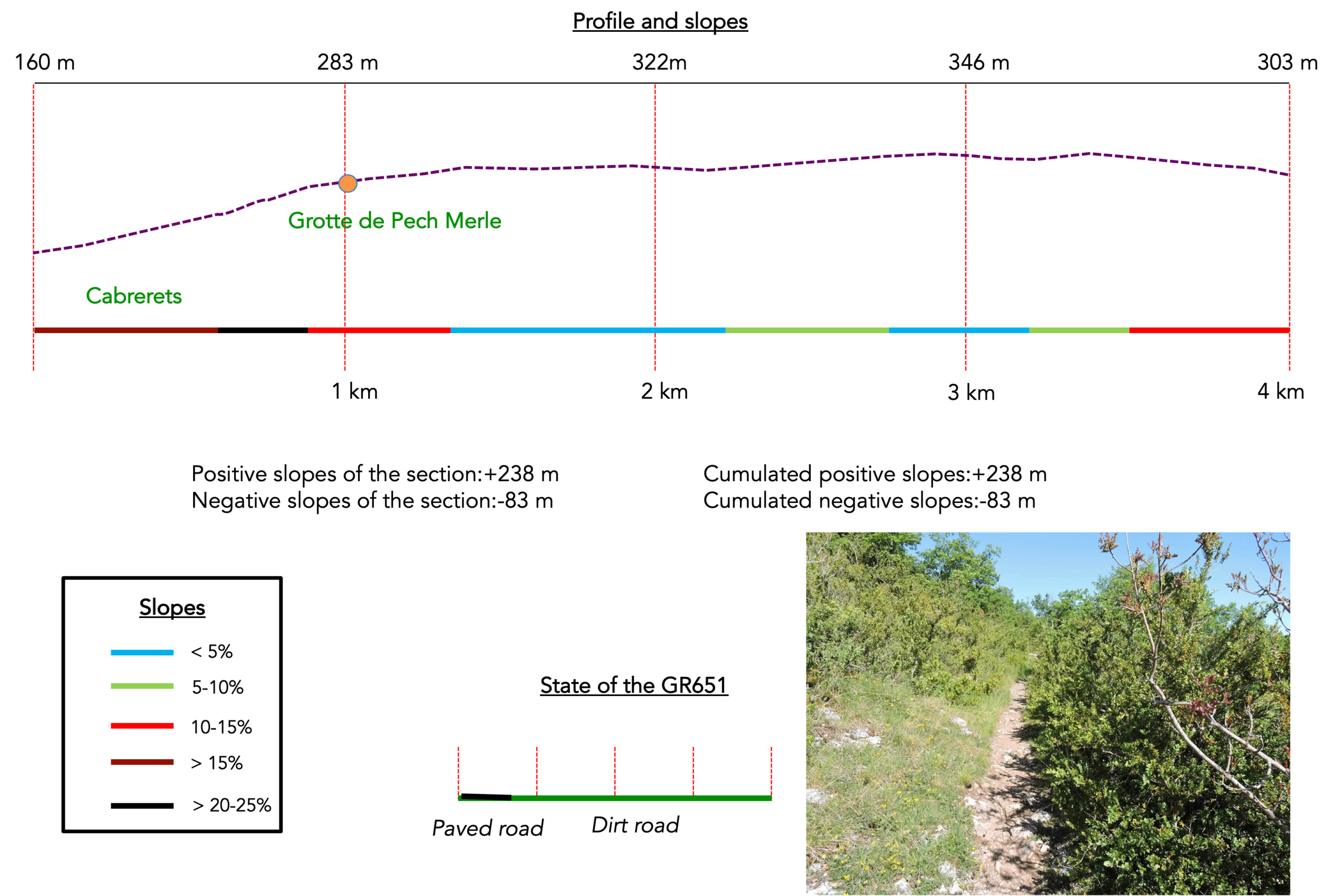
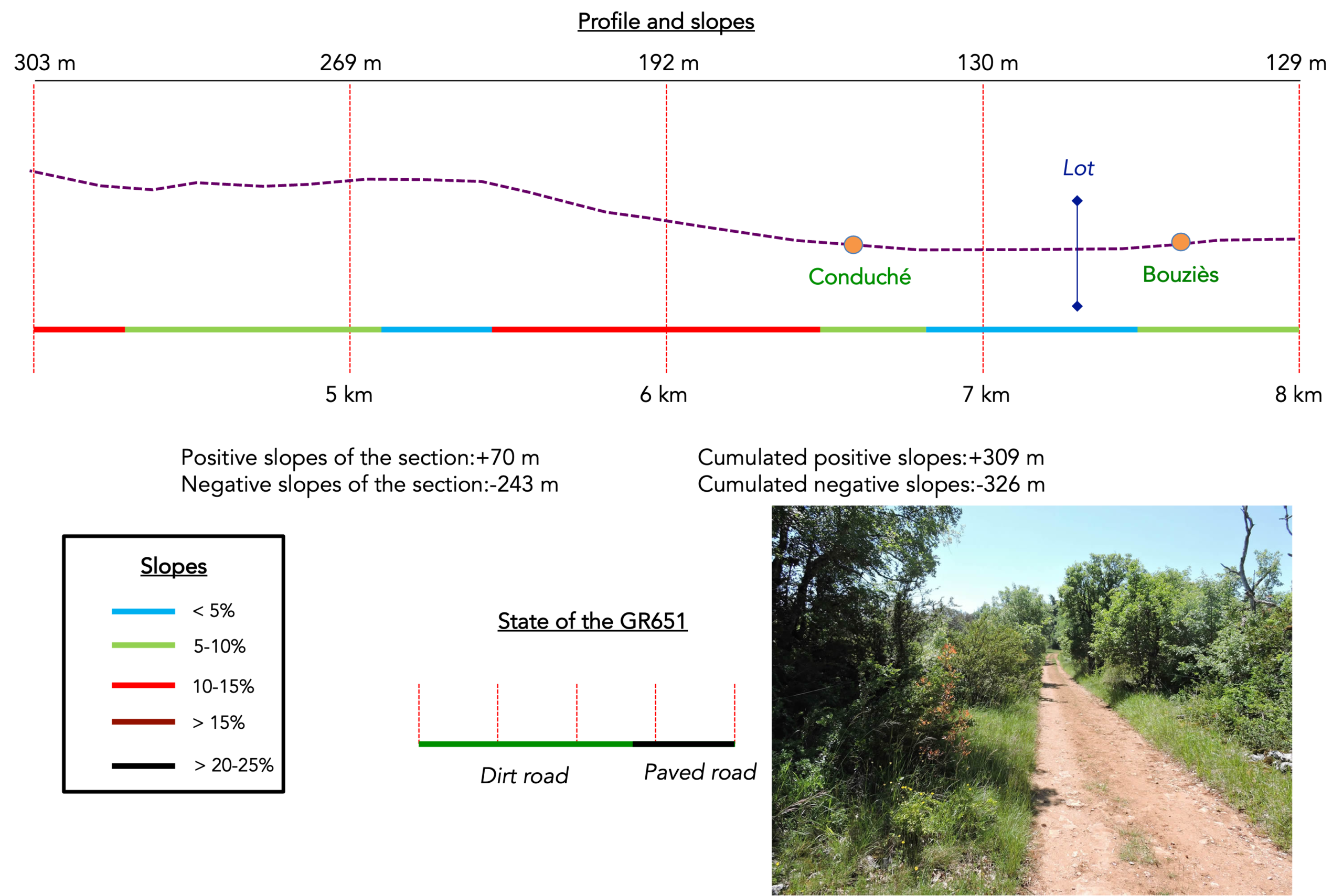
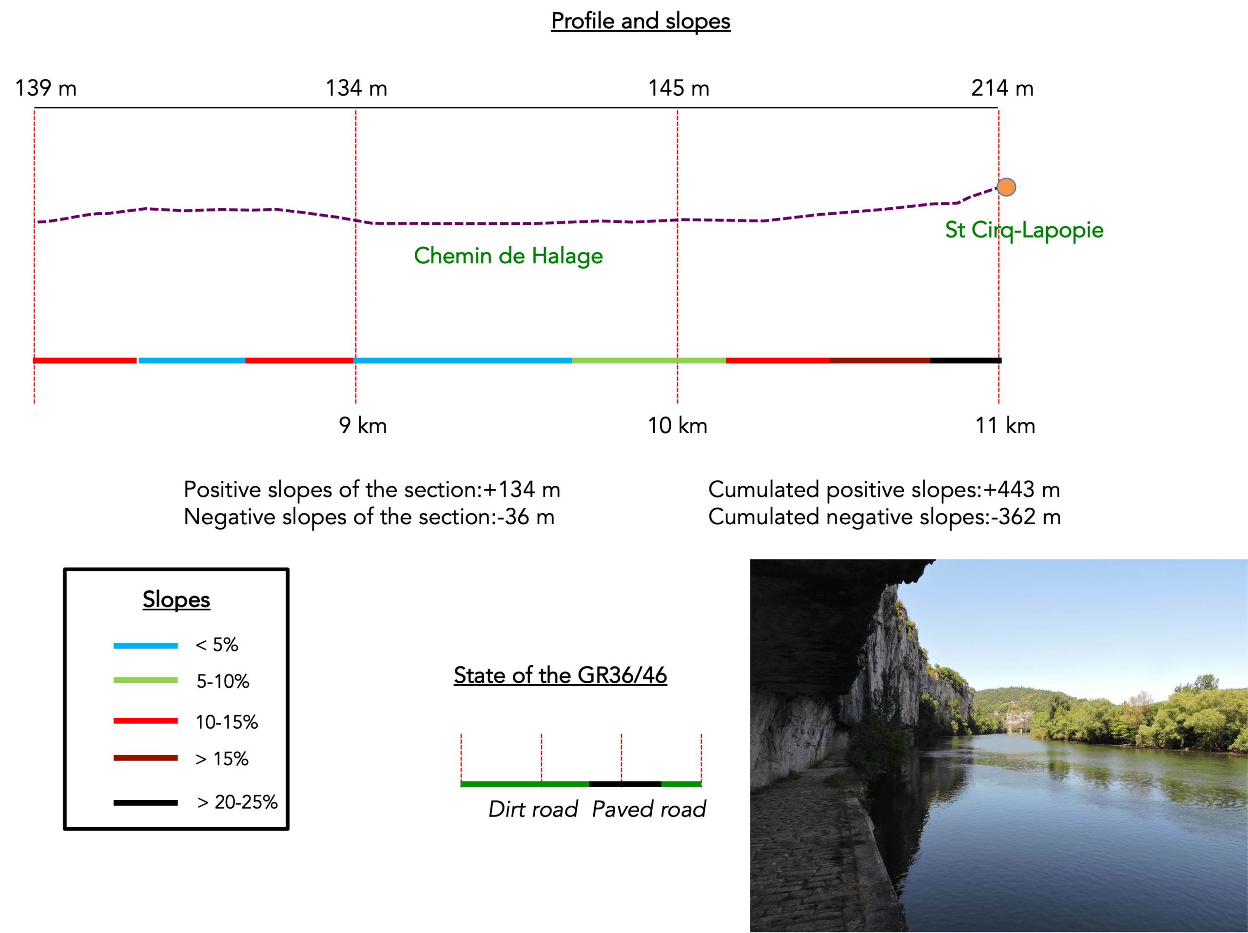
Difficulty level: This stage is very short with little elevation gain (+443 meters/−362 meters). However, two sections are quite demanding, first the steep climb to Pech Merle, then the ascent to St Cirq-Lapopie.
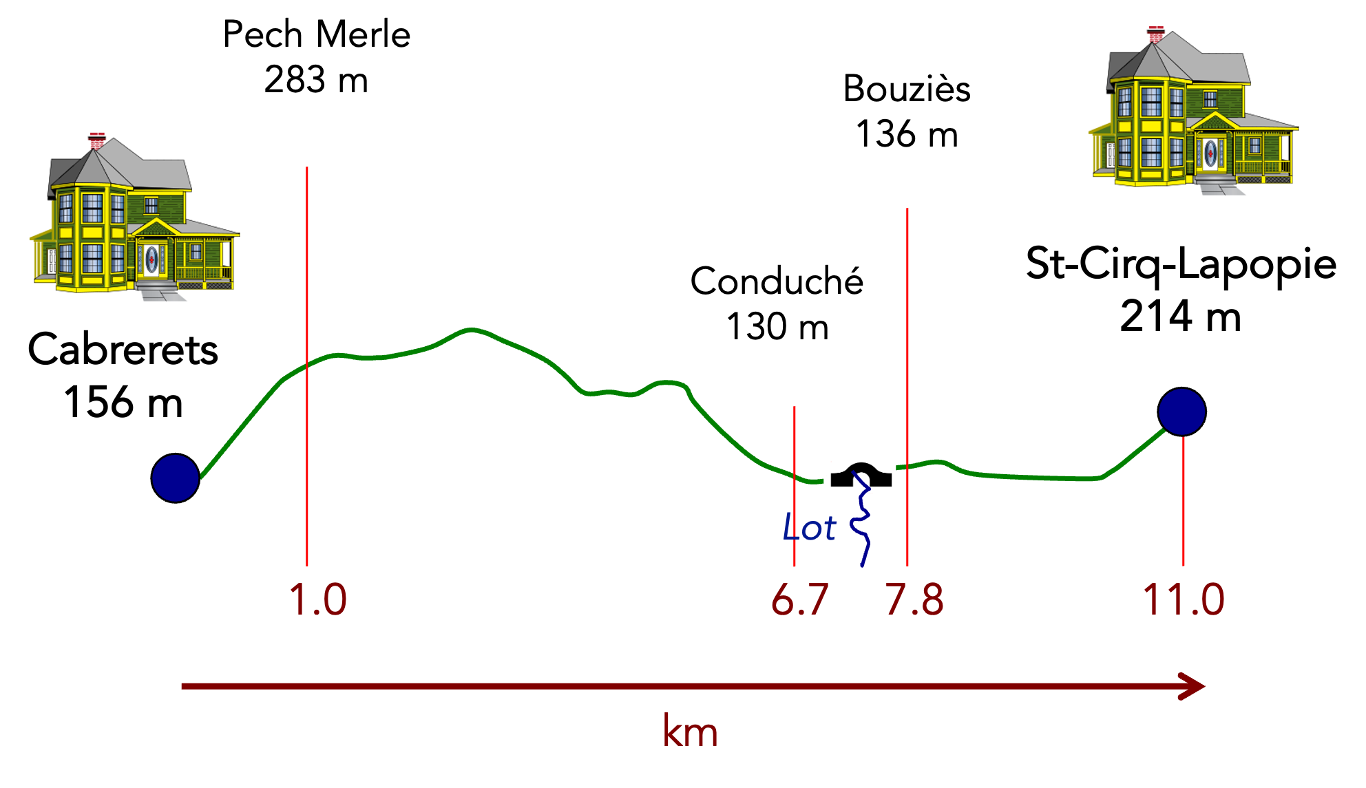
State of the route: Here the walk takes place mostly on paths, and in some places even on old railway tracks:
- Paved roads: 2.5 km
- Dirt roads: 9.5 km
Sometimes, for reasons of logistics or housing possibilities, these stages mix routes operated on different days, having passed several times on these routes. From then on, the skies, the rain, or the seasons can vary. But, generally this is not the case, and in fact this does not change the description of the course.
It is very difficult to specify with certainty the incline of the slopes, whatever the system you use.
For those seeking “true elevations” and enthusiasts of genuine altimetric challenges, carefully review the information on mileage at the beginning of the guide.

Section 1: A first demanding ascent onto the causse toward Pech Merle

Aperçu général des difficultés du parcours : une partie sportive de l’étape, à près de 15%-30% de pente par endroits sur le premier kilomètre, puis parcours sans problème.
|
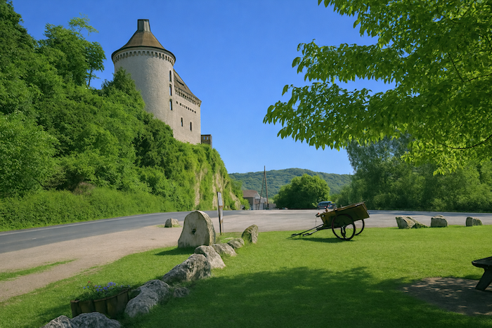
Let us leave Cabrerets behind, its Château de Biron and the magnificent mill beside the river. The river stretches like a ribbon of silver. |
|
 |
 |
|
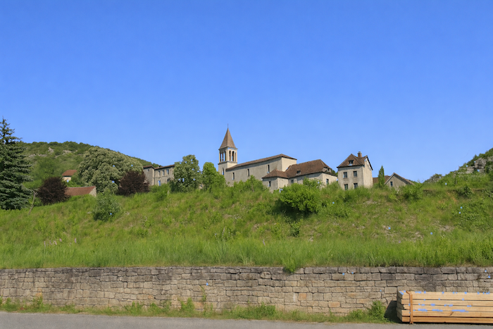
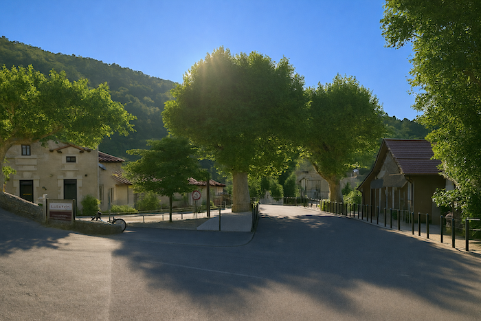
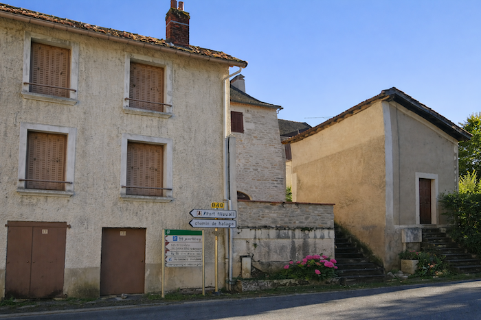
The center of the village of Cabrerets is not beside the river, but a little higher on the hill near the church. An asphalt road leads there, winding gently along the hillside. |
|
 |
 |
 |
 |
|
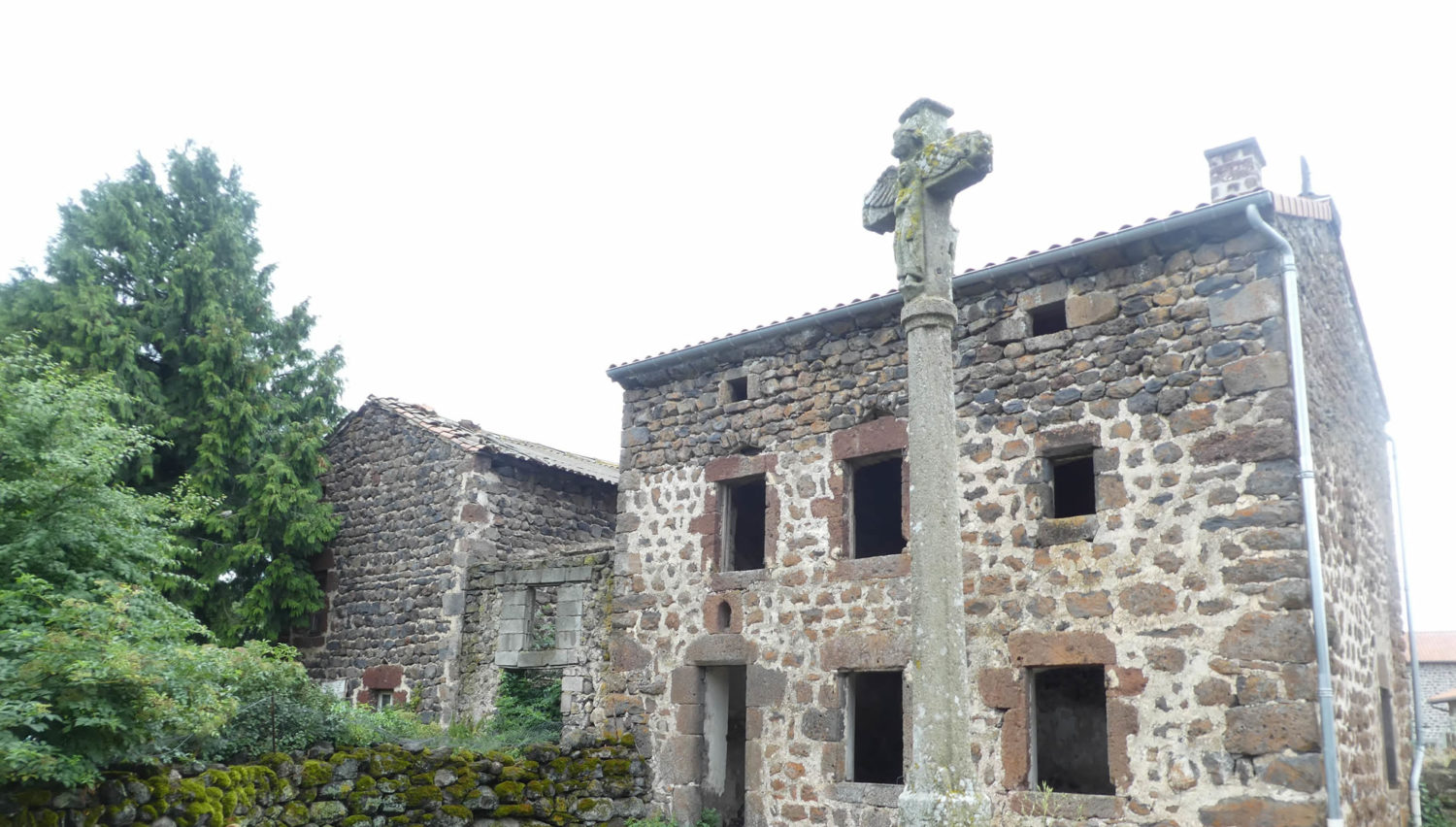
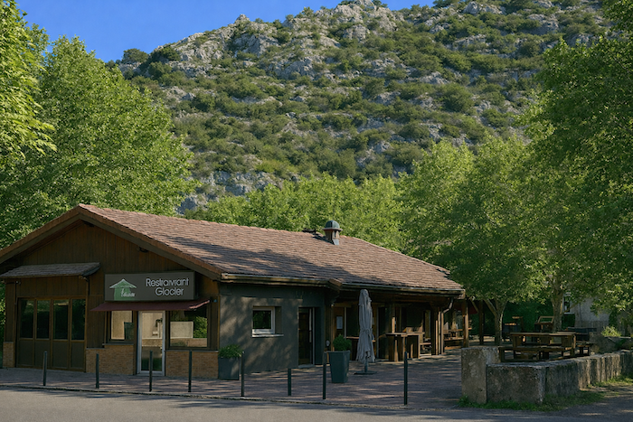
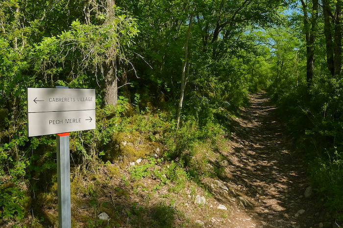
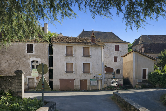
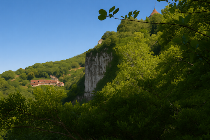
In Cabrerets, most visitors to Pech Merle stop for a break. The restaurants stand in a neat row around the square. The village stretches along the hillside like an old book, each house seeming to tell a story to anyone who knows how to look. |
|
 |
 |
|
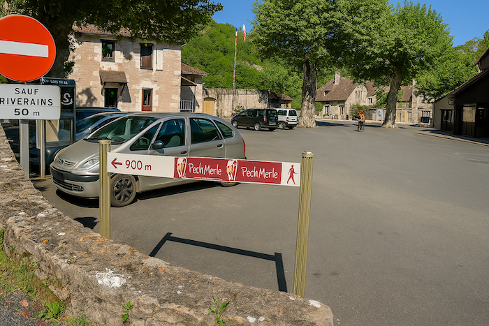
For pilgrims and hikers, the trial begins in the square. Less than a kilometer to reach the cave, that seems nothing, does it not? The route appears modest, almost trivial. Yet every step along this short distance is an initiation, a prelude to the discovery of an underground world where time has stood still. The air is brisk and the heart, almost despite itself, opens to the promise of mystery. |
|
 |
 |
|
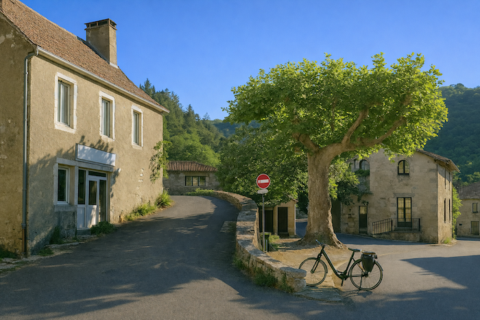
As a kind of appetizer, here comes a short steep climb to reach the cemetery at the top of the village. The site of Pech Merle lies less than a kilometer from here. The ascent takes place along a narrow and wild trail, like a line of ink drawn across the hillside. |
|
 |
 |
|
At the top of the first slope, the cemetery unfolds like a silent theatre, guardian of ancient souls and witness to the passing centuries, a majestic prelude to the cave that awaits you. |
|
 |
 |
|
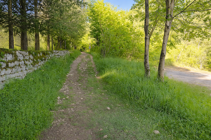
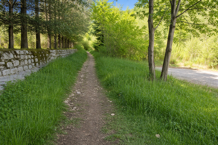
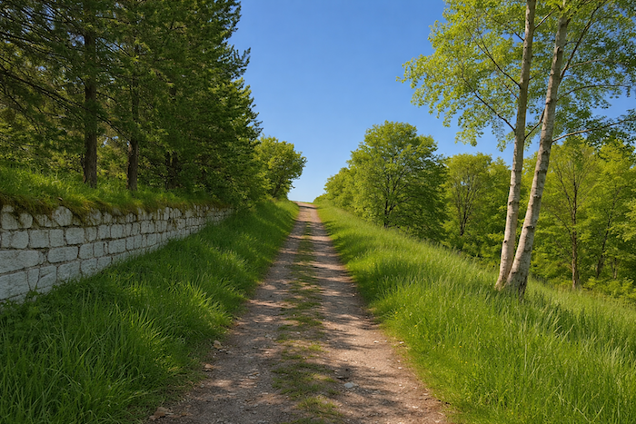
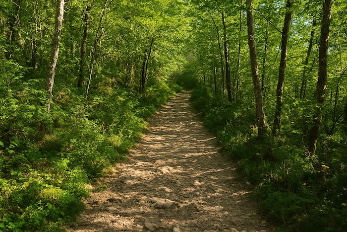
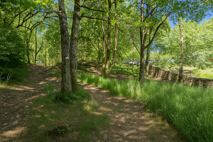
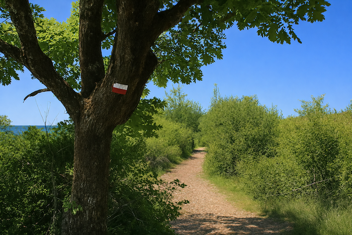
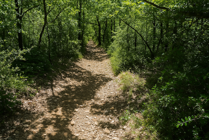
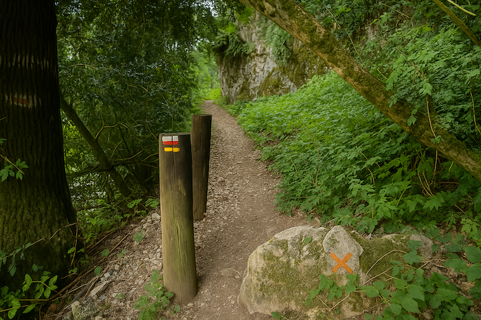
At the far end of the cemetery, the slope continues into a light woodland dotted with oaks and boxwood. It is impossible to lose the way. The trail goes straight ahead, steep and rough, along a poor rocky path through the boxwood scrub beneath the shaded arch of the oaks. You will notice that you are walking along a GR route, marked with its red and white stripes. It is still the GR651 as far as Bouziès. |
|
 |
 |
 |
 |
|
Below, Cabrerets grows smaller and gradually disappears behind the foliage. The trail becomes almost a secret corridor where light plays hide and seek among the leaves. The boxwood smells of sun and dry earth, while the oaks raise their knotted arms as if to protect us. Down below the village shrinks into a simple backdrop, a miniature toy lost within the green setting of the valley, while your steps move forward toward the unknown. |
|
 |
 |
|
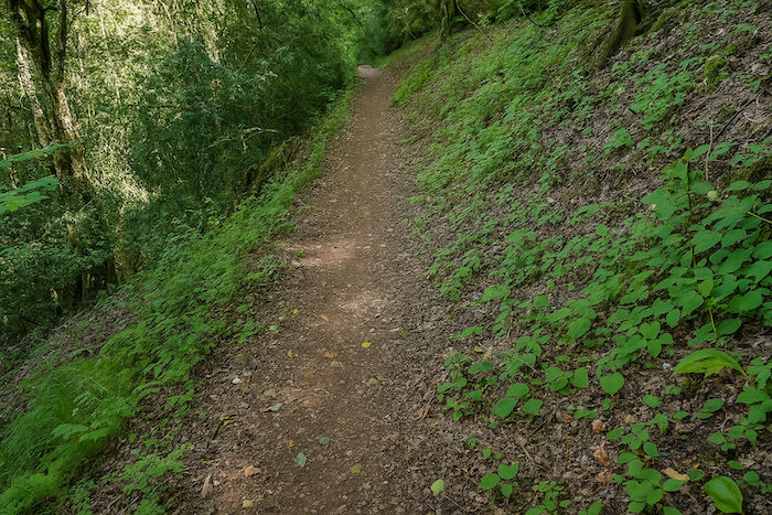
The steep trail then disappears into the boxwood above Cabrerets. The heart opens gladly to the impressions of both gentleness and wildness that the landscape inspires. Stones roll beneath the feet, breathing grows deeper, and the eyes already search for the distant line of the valley. |
|
 |
 |
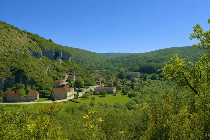
The view extends over the surroundings better than words can describe. As you climb through the woodland, a beautiful perspective appears. The village can be seen below, leaning against the thick forest. The valley forms something like an amphitheater, enclosed between cliffs on both sides of the village. The horizon is closed by forests that continue beyond the hills. Each bend reveals a new scene. Colors intertwine, shadow and light dance across the stones and the leaves. The valley, shaped like a natural amphitheater, holds the village like a stage, while the distant forests stretch away, mysterious and deep, silent guardians of the secrets of time.
|
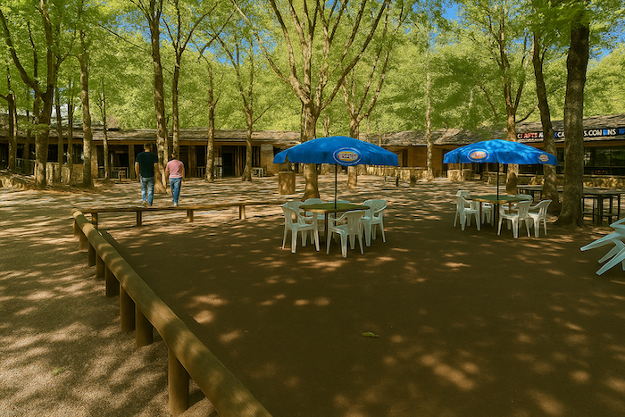
One kilometer is not the end of the world, is it? Here the path turns around the hillside and soon reaches the parasols and ice cream sellers, those high places of tourism so loved by visitors. You have arrived at Pech Merle. The path opens gently, welcoming walkers like an outstretched hand. The colorful parasols scatter bright touches across the landscape, while the air carries the scent of ice cream and childhood memories. Yet behind this light animation, the cave reminds you of the grandeur and mystery of the underground world where time has stopped and where every stone tells an ancient story. |
|
 |
 |
|
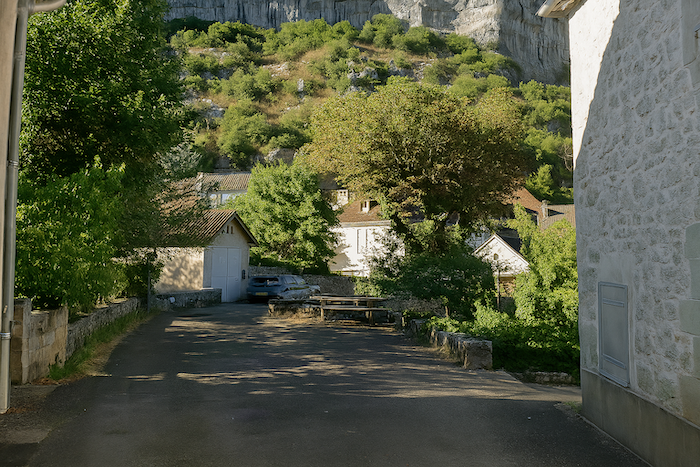
Pech Merle deserves a visit. The caves are exceptional and an excellent educational museum stands on the site. The hills of Pech Merle are riddled with cavities that remain inaccessible to the public, true sanctuaries of shadow and silence. Pech Merle is an exception, for here the earth has opened like a memory and has brought to light the intact splendor of prehistoric art that is twenty-nine thousand years old. It is a natural gallery of art, a mineral cathedral shaped by time and water, composed of seven chambers extending for more than one kilometer. On the walls, mammoths, bison, spotted horses and negative handprints answer one another in an inhabited silence. The ochre and black pigments still vibrate as if the artist had only just left his stone workshop. Among the draperies of calcite and the strange shapes of stalactites and stalagmites, the visitor moves carefully as if walking inside a dream. Electric lamps reveal a fragile beauty that seems almost unreal. Suddenly, in hardened clay, the footprint of an adolescent appears, sealed there for millennia, a moving signature of humanity. This simple and naked imprint connects our lives today with those of yesterday and for a moment abolishes the abyss of time. Each chamber opens like a living book where the memory of humans and animals is written without words. The walls covered with figures and signs reveal a sensitivity both delicate and mysterious. Here stands a spotted horse, there a human silhouette, elsewhere a cluster of handprints blown with ochre powder like a breath of soul fixed upon the stone. Geologists admire the slow formation of the concretions, archaeologists read there the first intuition of symbol. Pech Merle is the rare union of natural sublimity and human genius. Pass this way if you can before the flow of tourists arrives in its turn. Enter the half-light, listen to the discreet sound of water still shaping the rock, allow yourself to be drawn into the eternity of the place. Pech Merle is not merely visited, it is experienced, breathed and dreamed. |
|
 |
 |
 |
 |
|
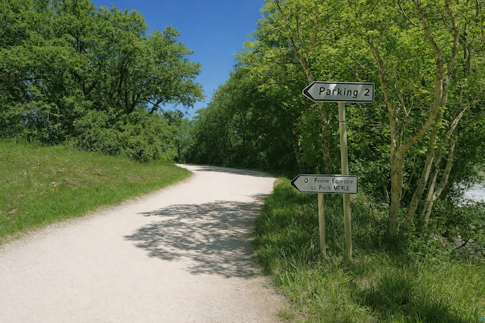
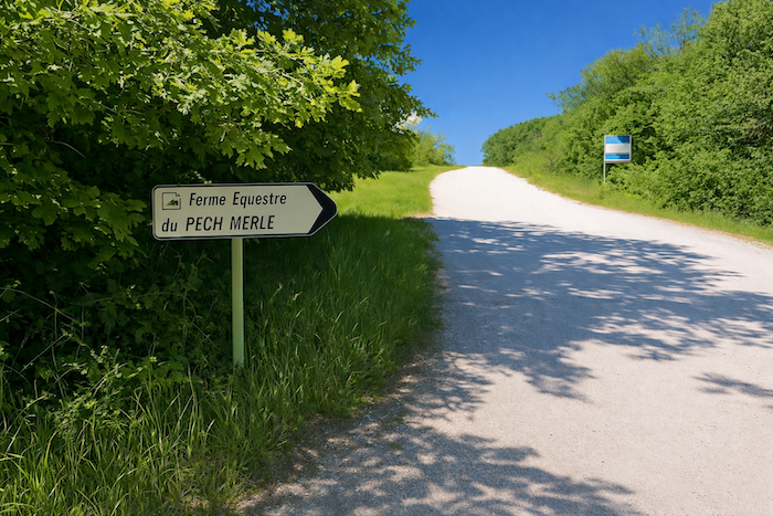
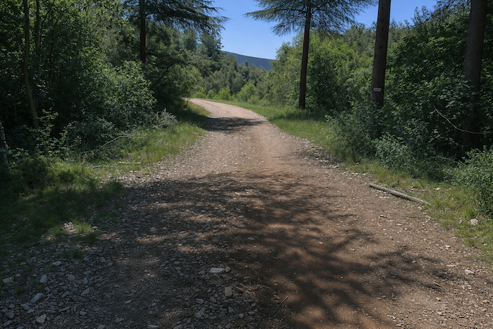
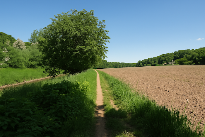
The GR651 crosses the asphalt surface of the car parks of civilization above the caves in order to reach the causse. This is the direction of the riding farm. The route follows the gravel road toward the farm for almost one kilometer. The transition between the crowd and nature takes place gently. Car parks give way to gravel, asphalt fades away like a curtain, and the gaze rediscovers open space, the wind and the song of birds. The causse appears, vast and open, promising silence and freedom. |
|
 |
 |
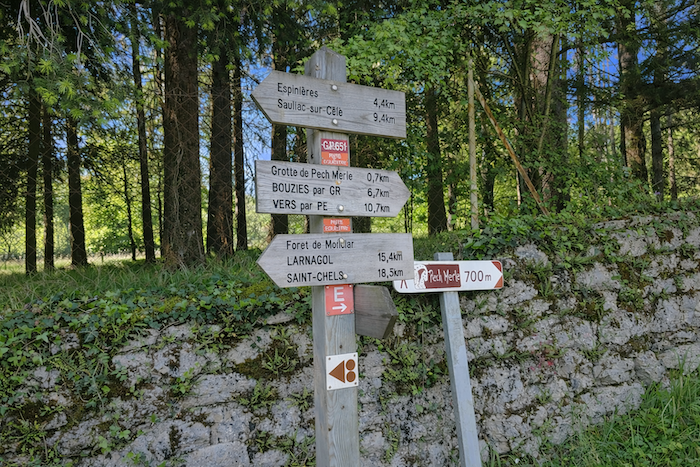
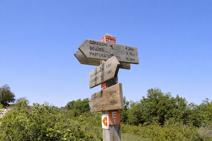
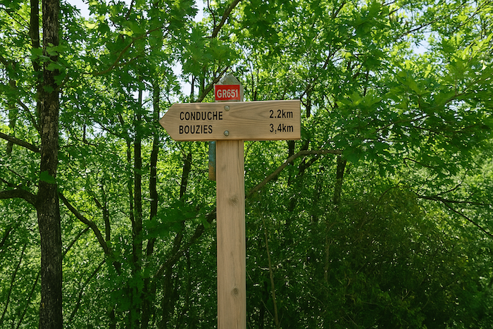
Soon afterwards the route leaves this axis. A sign indicates Conduché at four kilometers.
|
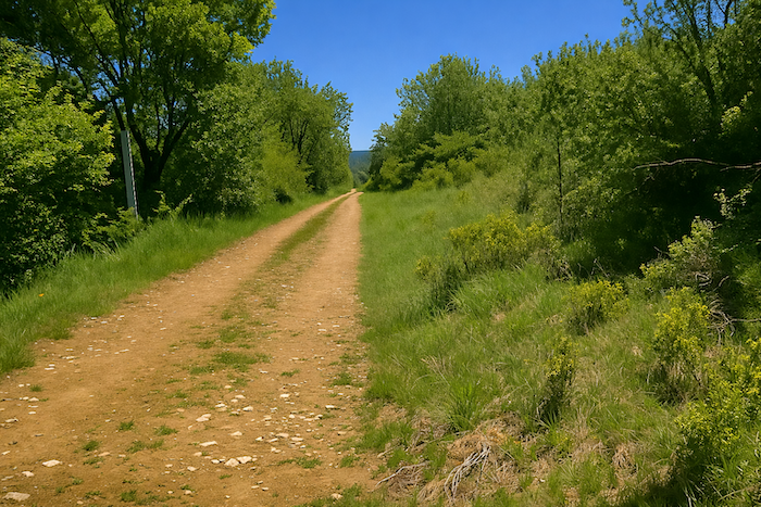
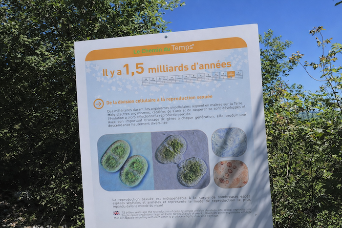
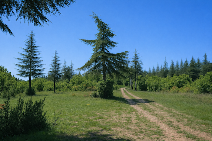
The path then runs out across the heath, winding between grasses and bushes as the horizon gradually widens. Each step seems lighter, carried by the simple and wild beauty of the countryside. A magnificent and very wide stony dirt path that undulates and winds through the heath accompanies you almost as far as Conduché in the plain. The GR651 follows for a section an educational trail called the “Chemin du Temps”. It is sometimes pleasant to have the story of the universe told while walking in nature. The wide stony path becomes an invitation to dream. It winds like a ribbon of light across the heath, while the “Chemin du Temps” murmurs the history of the world, revealing geology, plants and the centuries buried beneath your feet. Nature here becomes both teacher and guide. |
|
 |
 |
|
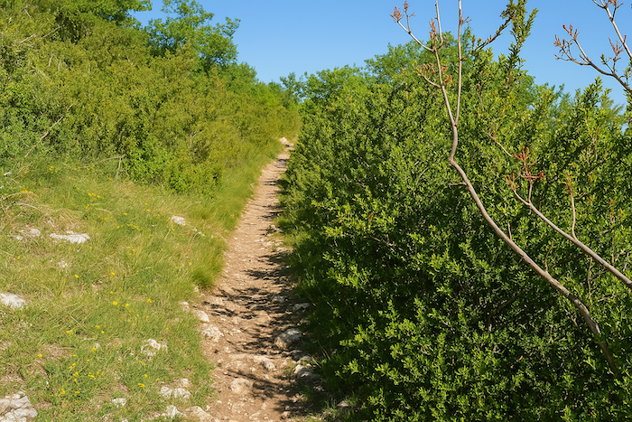
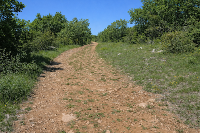
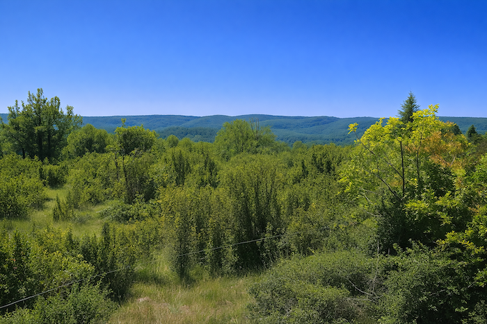
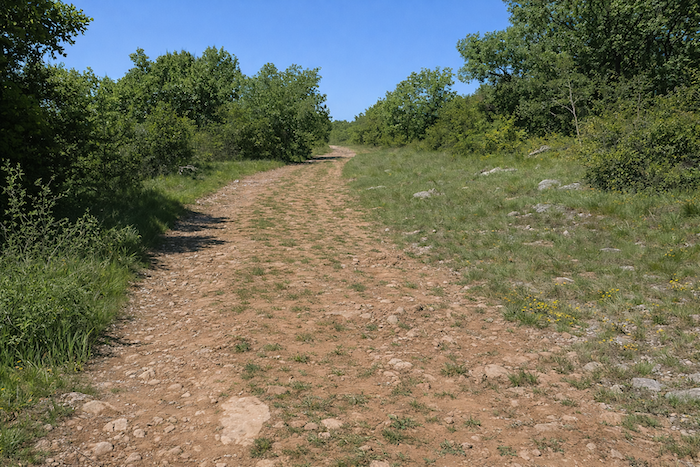
The path then follows the ridge. It runs up and down gently in a whirl of colors. The red earth contrasts with the green of the boxwood, with their vivid colors, low branches and twisted trunks sometimes split with age, forming intricate arabesques. The horizon is barred by the depth of forests spreading along the undulating line of the hills. Each crest reveals a changing picture, a symphony of tones and textures. The bright red earth contrasts with the dark green of the boxwood, while the trees, shaped by time, form arabesques that seem guided by an invisible hand. The deep forests in the distance give a sense of mystery and infinity, and the soul of the walker gladly surrenders to it. |
|
 |
 |
Section 2: Downhill to the Lot River
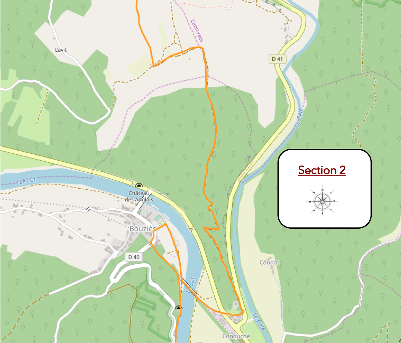
Overview of the route’s challenges : a few fairly steep slopes descending toward the plain, but nothing particularly demanding.
|
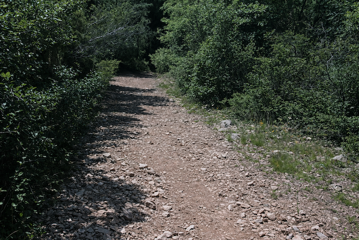
Soon afterwards, the path changes character for a few hundred meters. The path, once smooth, turns into a field of ochre stones amid more exuberant vegetation. |
|
 |
 |
|
The landscape is so captivating that time and kilometers pass unnoticed. Before long, you arrive two kilometers from Conduché. |
|
 |
 |
|
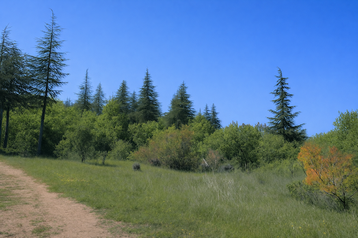
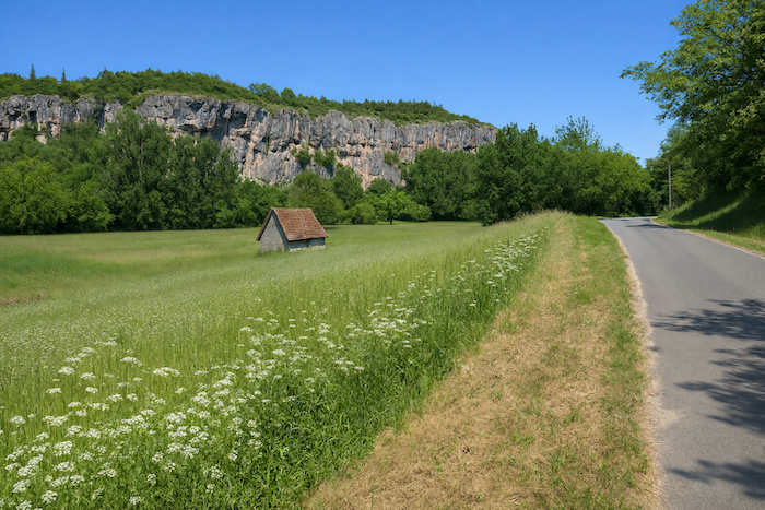
Then the causse opens again, magnificent, first in low vegetation that feels almost Mediterranean. |
|
 |
 |
|
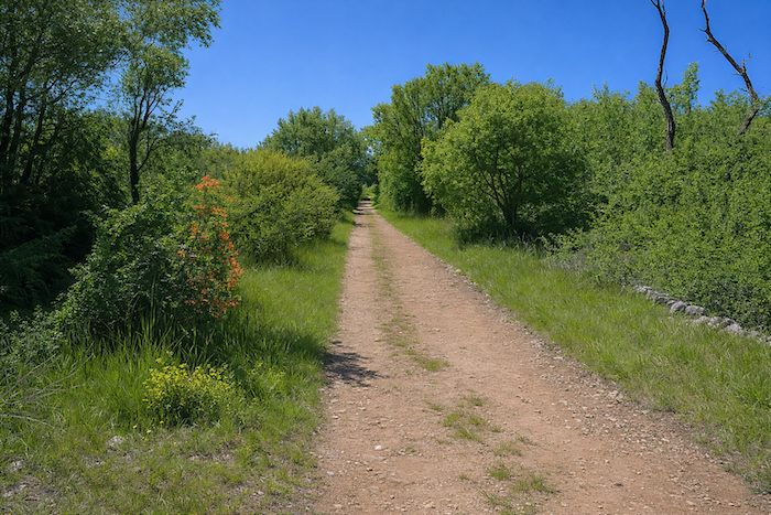
Farther on, across long gentle gradients, spruce trees sometimes mark the landscape. The generous oaks seem to have granted them passage. They take advantage of it by spreading their branches like broad umbrellas over the silence. |
|
 |
 |
|
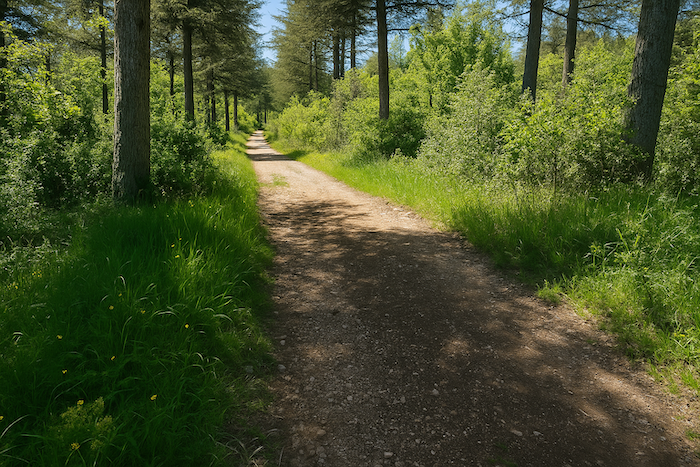
Farther on, the path gradually enters woodland that becomes denser. |
|
 |
 |
|
Yet you must descend from the causse. The descent here is steep and long. It takes place among boxwood and oaks along a narrower path. Stones accompany the walker most of the way. |
|
 |
 |
|
At the bottom of the descent, a pause at Conduché is announced. |
|
 |
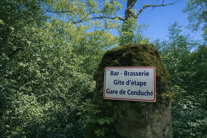 |
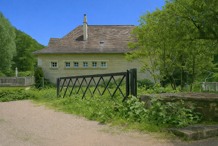
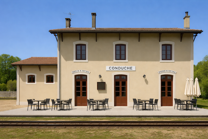
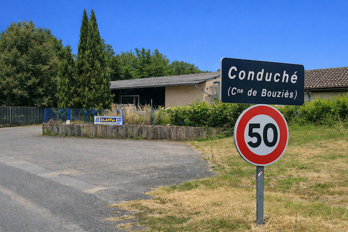
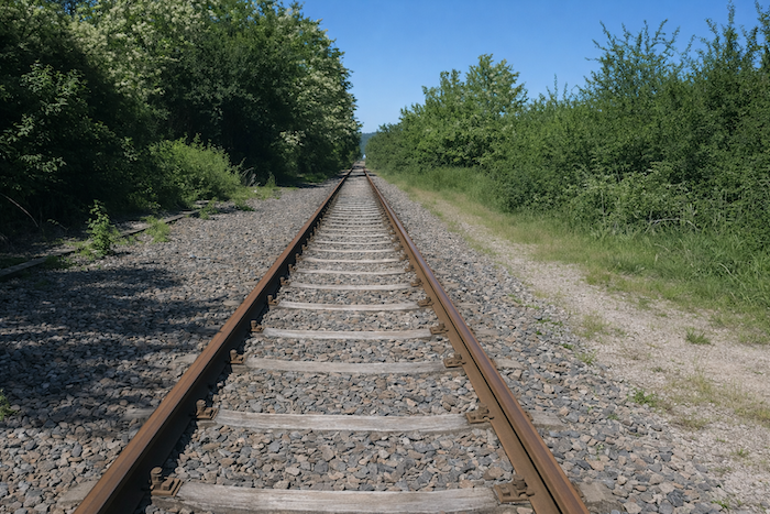
The path leaves the forest and reaches the station of Conduché in the coolness of the small valley on the plain. Conduché belongs to the commune of Bouziès. It once formed part of the railway network linking Cahors to Decazeville. The line was permanently closed to traffic in 2011. The station has been converted into a guesthouse.
|
To reach Bouziès, unfortunately there is only one option, which is to walk along the main axis of the D662, the departmental road that runs from Cajarc to Cahors. |
|
 |
 |
|
It is not long, barely a kilometer. Yet in season this road is very busy and there is no pavement. |
|
 |
 |
|
At the end of this tedious stretch, the route turns left to cross the Lot. |
|
 |
 |
|
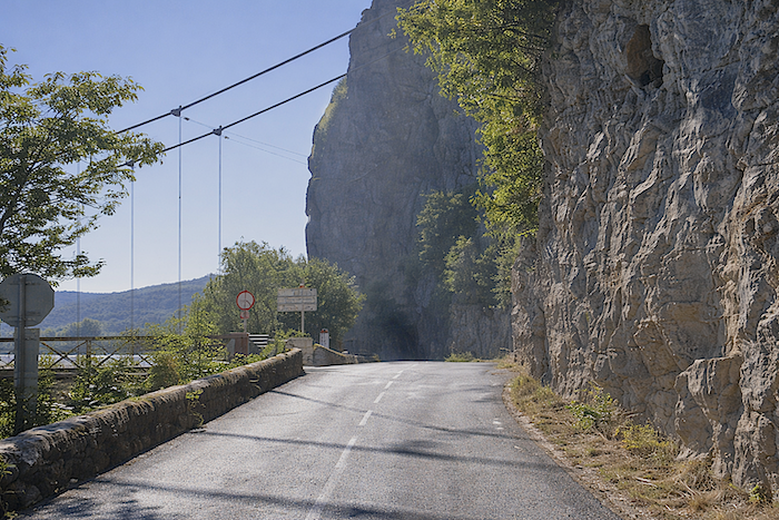
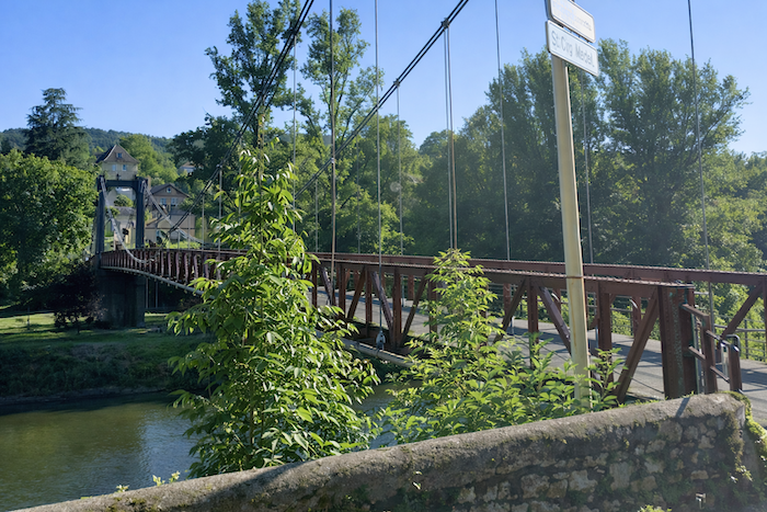
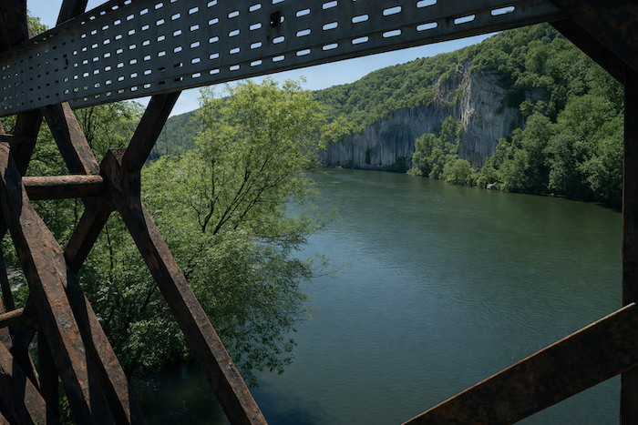
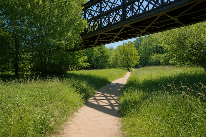
On an iron bridge the route crosses the majestic river toward Bouziès. |
|
 |
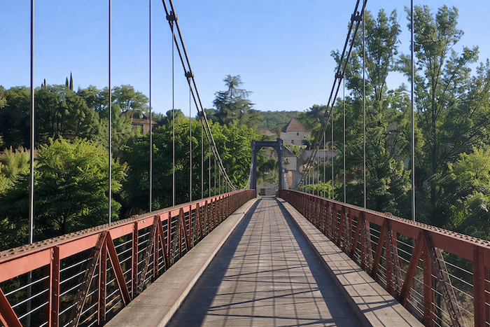 |
The site here along the river has incredible charm.
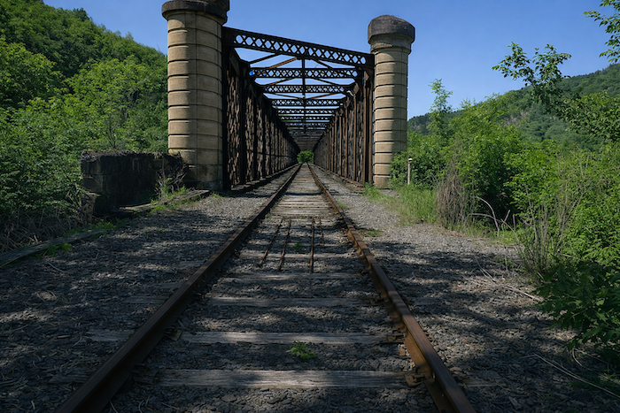
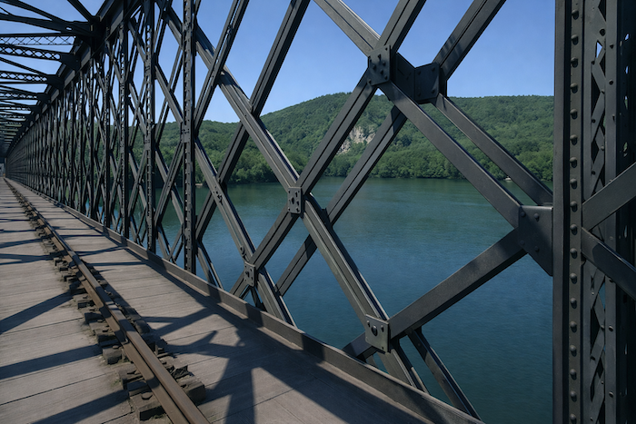
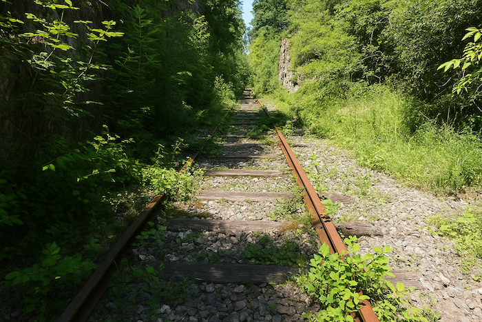
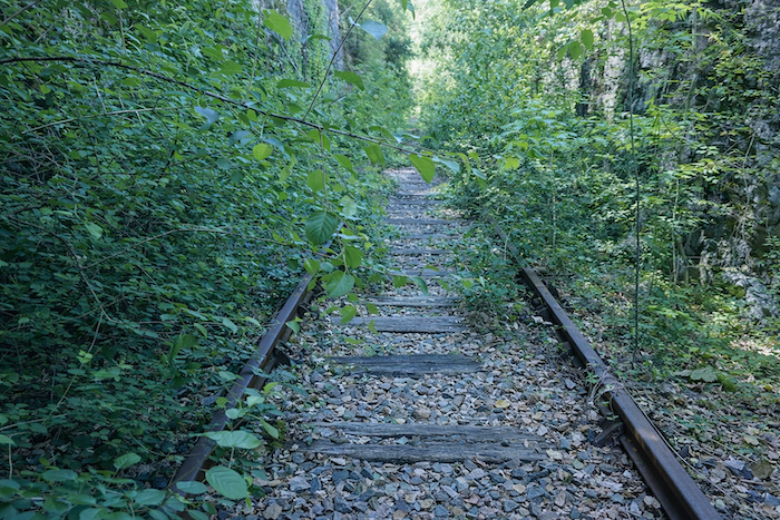
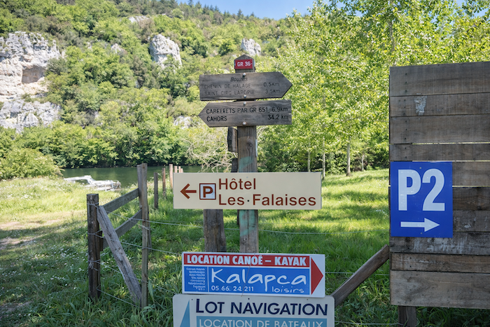
At Conduché it is also possible to choose an alternative solution known to well informed walkers. One simply takes the abandoned railway line that runs from Conduché to Bouziès. However, we passed this way almost ten years ago, so it is not certain that the passage is still possible. You can ask about this at the guesthouse in the station. You may still be able to walk a hundred meters or so to discover the charm of the iron bridge over the Lot. Let us take the train, or rather what remains of it. Forward!
|
Quite quickly the railway line reaches the bridge over the Lot. There are places along the path where magic still happens, and this is one of the finest examples. With your feet on the oak beams that slowly rot among the tangle of ironwork, the walker has time to lose himself in the unforgettable sight of the Lot flowing slowly and tirelessly, as the song says. This green and placid water, contrasting with the rust of the bridge, is a little like the smile of children that makes life more beautiful. |
|
 |
 |
 |
 |
|
On the other side of the bridge, scrub had begun to invade the railway line, although it was not yet completely overgrown. That will come, inevitably, if nothing is done. Nature always wins its battles. |
|
 |
 |
|
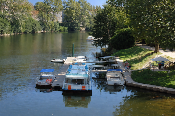
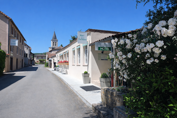
Bouziès is not far away, a very small commune with fewer than one hundred inhabitants. Bouziès is also a small port on the Lot with a certain level of river activity. Accommodation can be found there. |
|
 |
 |
Section 3: Walk along the Lot River toward the wonderful village of St Cirq-Lapopie
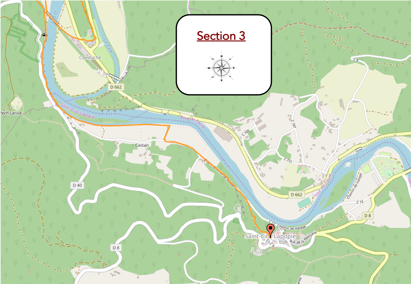
Overview of the route’s challenges : a pleasant walk until the steep climb toward St Cirq-Lapopie.
|
The GR651 ends here. You now leave the Célé valley for new horizons. As mentioned in the introduction, we will pass through St Cirq-Lapopie and will not follow the direct route toward Cahors. From this point the GR36/46 takes over. |
|
 |
 |
|
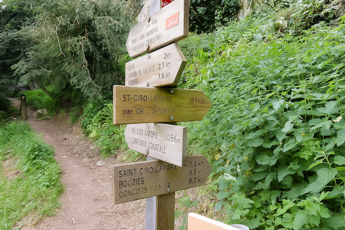
Many tourists arrive here in Bouziès to follow the famous “Chemin de Halage”, that mythical ribbon leading to the foot of St Cirq-Lapopie. |
|
 |
 |
|
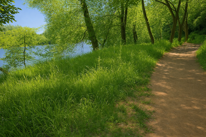
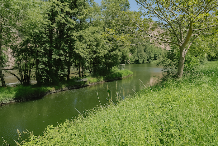
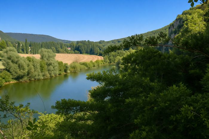
Barely four kilometers separate the two places, yet what a journey. A small dirt road runs flat, faithfully following the course of the Lot. It passes beneath the old railway line, the same one you may have walked earlier while braving the bushes from Conduché along the rails, as if the past itself leaned down to greet the walkers of today. The Lot here is navigable. The water glides slowly, carrying throughout the day the changing reflections of cliffs and clouds. Small river cruises move quietly upstream and downstream, leaving a silver wake upon the water. |
|
 |
 |
|
The path briefly enters woodland, following the river in a humid silence. Gradually the cliff approaches, raising before the walker its limestone wall shining brightly in the light. |
|
 |
 |
|
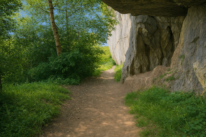
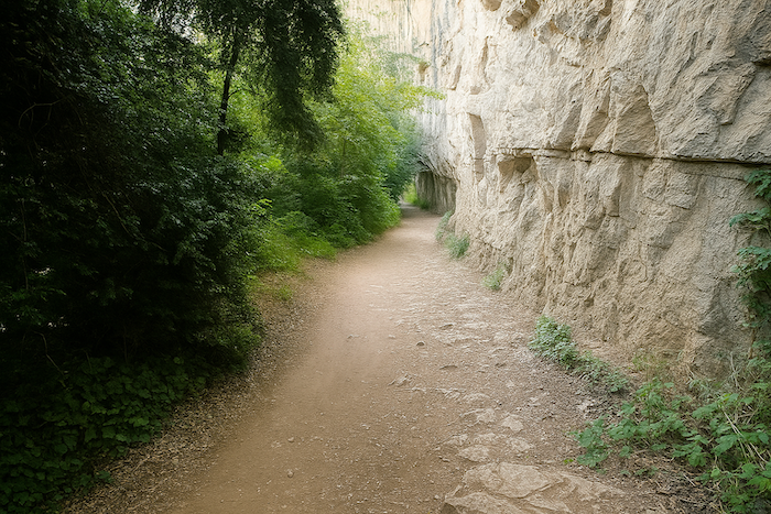
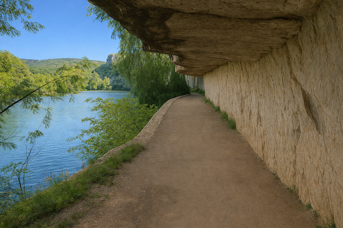
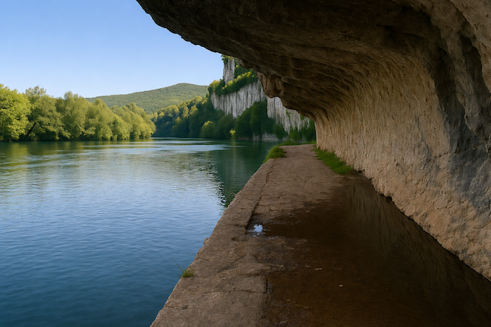
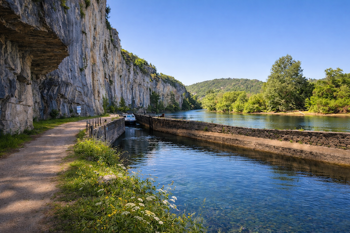
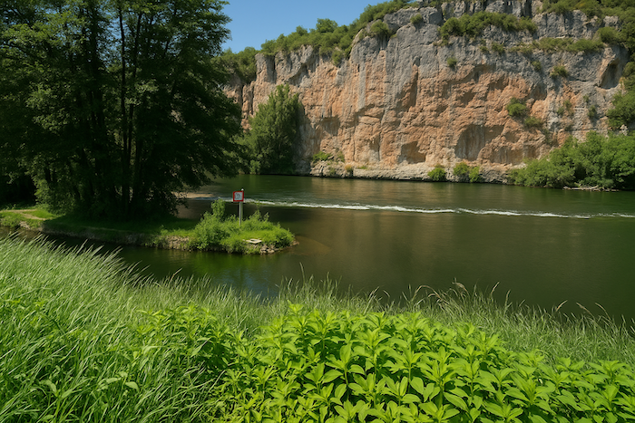
Suddenly comes the revelation, the extraordinary encounter with the polished paving stones of the “Chemin de Halage”. They wind beneath the cliff, following its folds and its shades of grey, ochre and blue until they almost merge with the water itself. The towpath, built in 1845, once allowed horses to pull heavy cargo boats loaded with goods such as Cahors wine, barrel fittings and dried plums. The echo of their steps still seems to vibrate beneath the invisible hooves of the animals. . |
|
 |
 |
|
The beauty of this site overwhelms anyone who lingers here. One remains silent, struck by an ancient sense of wonder. And yet it is not listed as a UNESCO World Heritage site. Perhaps an oversight, perhaps simply an omission of youth in the classification. |
|
 |
 |
|
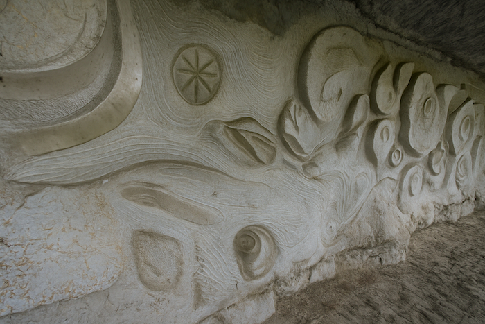
It is here that the modern sculptor Daniel Monnier left his mark. Large bas reliefs carved into the limestone wall celebrate the fossil life of the place, shells, fish, ferns and traces of ancient tides. Art merges with the stone in a mineral whisper. |
|
 |
 |
| A little farther on a lock appears, modest and beautiful, a piece of old engineering that still allows boats to overcome the whims of the Lot. | |
 |
 |
|
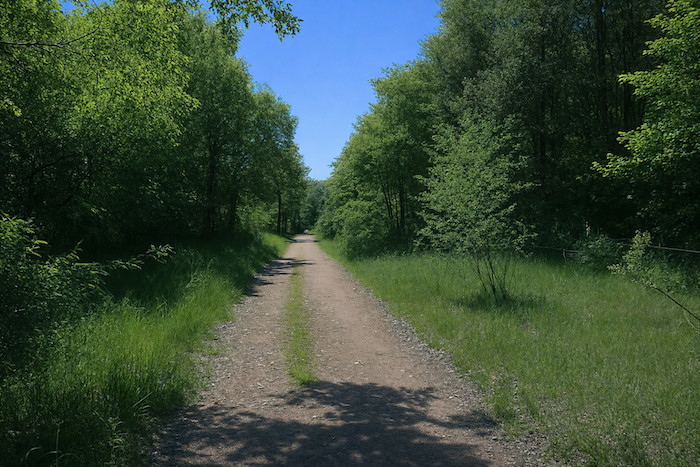
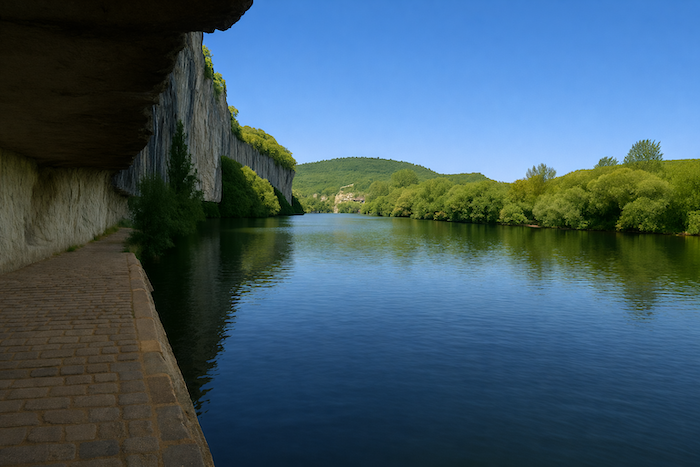
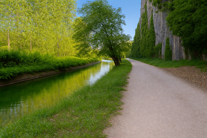
At the end of the “Chemin de Halage” the path returns to open countryside. It continues to follow the river, a faithful companion beneath the shadow of the cliffs, as if reluctant to leave it. |
|
 |
 |
|
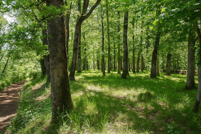
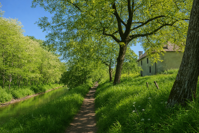
In places it moves away slightly to follow the diversion canals. Here the river has its moods, sudden rises, retreats and unpredictable currents. The locks are its patient guardians. The walker then follows a corridor of vegetation, silver poplars, twisted Robinia, black alders, graceful ashes and tall reeds bending in the wind. Sometimes the trunks lean over the water as if dipping their leaves into the river. |
|
 |
 |
Then the path gently leaves the riverbank and reaches asphalt again among open fields.
|
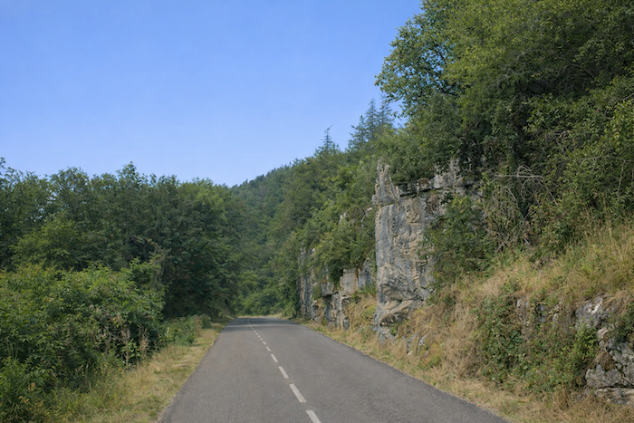
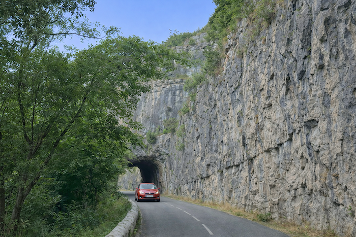
The road now unfolds its ribbon beneath the cliff. The rock walls flow with shadow and light, giving walkers the sensation of being very small at the foot of these great ramparts. |
|
 |
 |
Then comes a junction. Two options appear. One can follow the road and climb more gently farther on toward St Cirq-Lapopie with the flow of tourists coming up from the parking areas at the base of the village. Or one can take the more athletic trail, steep and vibrant, more direct. Those who have faced the steep ups and downs of the GR651 in the Célé valley will recognise the rhythm. The slope here will not frighten them.
|
Let us follow these bold walkers. The trail clings to the cliff and climbs in tight zigzags through dense woodland. The air becomes cooler, greener and more humid. The slope is steep but the eye forgets the fatigue. At each opening a ray of light slips through and the scent of moss rises from the ground. There is no danger here, only the pure pleasure of effort. |
|
 |
 |
|
In these funnels of greenery, the walker suddenly discovers far below the Lot where the small river cruises glide, and high above the jagged outline of the houses of Saint-Cirq-Lapopie. Stone and water, sky and time unite in a single view. |
|
 |
 |
|
The trail becomes narrower and more winding before finally delivering hikers onto the heights of the village. Others, the tourists arriving by road, reach the village from the opposite side, often from the parking areas below. Their steps are less breathless, yet their wonder is no less great. |
|
 |
 |
|
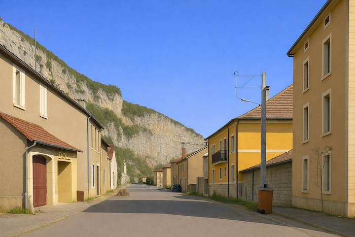
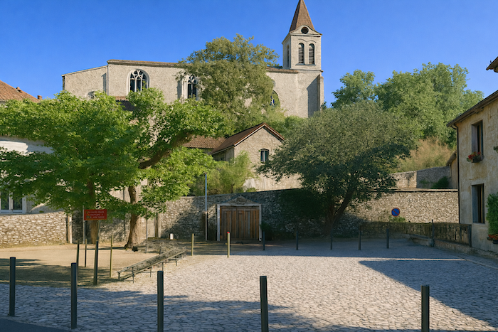
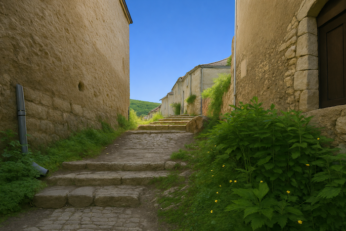
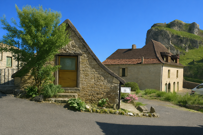
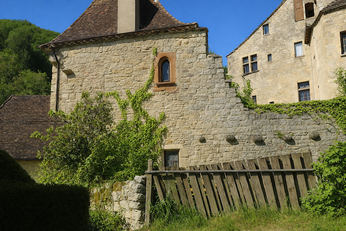
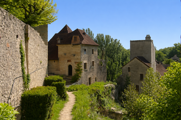
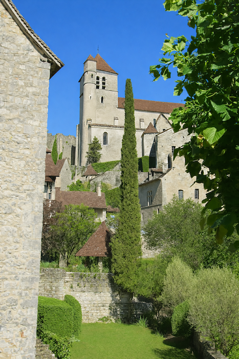
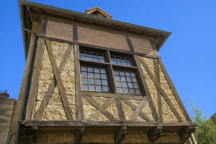
And here is Saint-Cirq-Lapopie. Words become unnecessary. The village reveals itself like a painting already familiar though never before seen, brown roofs, paved lanes, façades with narrow windows, the warm evening shadows resting on the tiles. Nothing more needs to be said. One simply looks, breathes and listens. Thanks to this strategic position the site was probably occupied from the Gallo Roman period, although the village developed mainly from the ninth and tenth centuries. During the Middle Ages it became an important fortified place in the Quercy region, divided among several powerful families, notably the Lapopie, the Gourdon and the Cardaillac, who built castles and fortified houses at the top of the rock. The village prospered through craft activities and trade connected with navigation on the Lot where goods and materials circulated. It later endured difficult periods during the Hundred Years War in the fourteenth and fifteenth centuries and again during the Wars of Religion in the sixteenth century. Some fortifications and buildings were damaged, yet the village preserved much of its medieval architecture. During the nineteenth century the population declined together with economic activity. In the twentieth century the site was rediscovered by artists and writers drawn by its spectacular landscape and its medieval atmosphere. Today Saint-Cirq-Lapopie is considered one of the most beautiful villages in France and remains a major tourist site of the region. |
|
 |
 |
 |
 |
 |
 |
 |
 |
 |
 |
Listed accommodations on the Célé Way
- Gîte-Camping Mas de Nadal, Sauliac-sur-Célé; 05 65 31 20 51; Gîte, chalet, dinner, breakfast, cuisine
- Gîte O cœur des Sens, Sauliac-sur-Célé; 06 31 05 28 02; Gîte, dinner, Breakfast, cuisine
- Gîte-Chambres d’hôtes d’Espinières, Espinières; 05 65 21 43 36/06 63 01 16 64; Gîte and Guestroom, dinner, breakfast
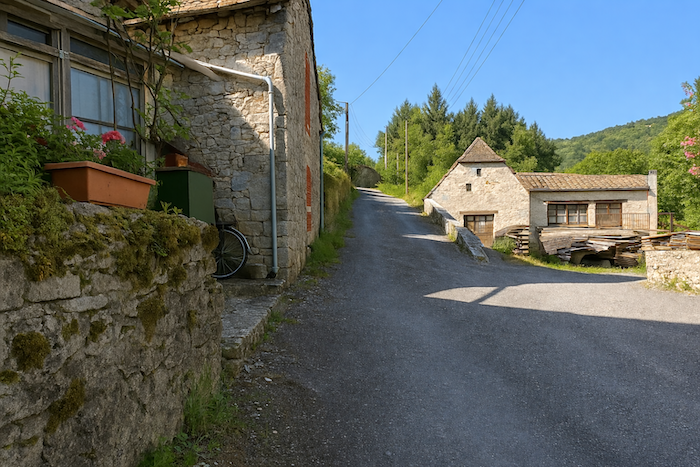
- Chambres d’hôtes atypiques, Le Bout du Lieu/Cabrerets; 05 65 21 48 97; Guestroom, dinner, breakfast
- Un Jardin dans la Falaise, Le Bout du Lieu/Cabrerets; 07 84 11 91 15; Guestroom, cuisine
- Camping municipal, Cabrerets-Rivière; 06 42 64 01 58; tents
- Refuge du Célé, Cabrerets-Rivière; 06 65 31 20 15; Gîte and Guestroom, dinner, breakfast
- Hôtel-restaurant des Grottes, Cabrerets-Rivière; 05 65 31 27 02; Hotel, dinner, breakfast
- Gîte-restaurant du Barry, Cabrerets- Village; 07 88 62 81 18; Gîte and Guestroom, dinner, breakfast, cuisine
- Gîte de la Flèche bleue Les Granges /Cabrerets; 05 65 23 36 72/06 32 31 97 09; Gîte, dinner, breakfast, cuisine
This information was updated in 2026. If you access this site later, it may no longer be accurate. Along these routes, some establishments open every year while others close. One solution is to purchase, among other resources, Miam Miam Dodo, the essential guide for eating and accommodation, which also lists places to stay off the route. For our part, we will only include accommodations located directly on or very close to the route. There are also other options, such as guidebooks or the internet, which also lists Airbnb accommodations. However, even though the valley is a tourist area, Airbnb options are rare. No application is as well documented as Miam Miam Dodo, especially since the small book, available online, is updated every year. If you do not have Miam Miam Dodo, we recommend booking in advance and checking directly with accommodation providers about the details of their services (meals, sheets, toilets, showers, and other amenities). Likewise, inquire at the previous stage about the opening hours of grocery stores and bars, which are often closed during parts of the day or week. On the Célé variant, accommodation options are very limited, but only a few pilgrims pass through here. However, there are also hikers. Therefore, book in advance if possible. Finding a bed at the last minute can sometimes be a matter of luck. It’s better not to rely on that every day.
During this stage, accommodation along the route is very limited, to say the least. Several establishments have closed in recent years. You will need to go as far as Sauliac to find two options, both slightly off the route. However, in the Cabrerets area, there should not be major difficulties finding a place to stay, except during peak tourist season. The Pech Merle cave and Saint-Cirq-Lapopie are very close by. In Cabrerets, you can find accommodation, meals, and supplies. There are no water points along the route. For those who wish to have their luggage transported, or to be transported themselves, La Malle Postale or Transport Claudine are good options.
Feel free to add comments. This is often how you move up the Google hierarchy, and how more pilgrims will have access to the site.
 |
Next Stage : Stage 5: Fom St Cirq Lapopie to Vaylats |
 |
Back to menu |