In the serenity of La Romieu Abbey
DIDIER HEUMANN, MILENA DALLA PIAZZA, ANDREAS PAPASAVVAS

We divided the course into several sections to make it easier to see. For each section, the maps show the course, the slopes found on the course, and the state of the roads. The courses were drawn on the “Wikilocs” platform. Today, it is no longer necessary to walk around with detailed maps in your pocket or bag. If you have a mobile phone or tablet, you can easily follow routes live.
For this stage, here is the link:
https://fr.wikiloc.com/itineraires-randonnee/de-lectoure-a-la-romieu-par-le-nouveau-gr65-55420209
It is obviously not the case for all pilgrims to be comfortable with reading GPS and routes on a laptop, and there are still many places in France without an Internet connection. Therefore, you can find a book on Amazon that deals with this course. Click on the book title to open Amazon.
 |
The Camino de Santiago in France. VI. From Cahors to St Jean-Pied-de-Port (Via Podiensis) on GR65 track |
If you only want to consult lodging of the stage, go directly to the bottom of the page.
Gers is a very large countryside, but the department has less than 200,000 inhabitants. If the Gers, at first glance, may seem fairly uniform, it in fact includes several regions which are distinguished above all by the cultures that are developed.

Do you like duck or goose? So, you may know more or less where Gers is situated. You are a fine blade, an emulator of d’Artagnan or the Musketeers, so you also remember these guys were Gascon. So, Gascony, a department or another business? Today, Gascony is no longer an administrative region, but a cultural and linguistic area. It is a former province straddling the departments of Gers, Landes, and Hautes Pyrénées, extending even in part towards the Gironde. It is above all its cultural identity that characterizes it, in particular its language, Gascon, one of the dialects of Occitan. Gers is one of the bastions of Gascony. In the imagination of Alexandre Dumas, it is from here that the famous musketeers leaved to Paris. A recent statue shows them in action near the cathedral of Condom.
Today you’ll cross Lomagne, straddling Gers and Tarn-et-Garonne, at the north-eastern end of Gascony. You are more particularly in the Lectourois, grouped around Lectoure, the historical and cultural capital of Lomagne. It is a round, rich and limestone land, with wide valleys and hills, an open landscape dominated by the uniformity of large earthy expanses, with few groves, where intensive agriculture is in full swing. Cows have almost disappeared here, and small cultivated plots are becoming increasingly scarce. In the north, grains and oilseeds dominate. In the south, vines and corn take over. There are mainly cereals, wheat in particular (45%). Oilseeds cover 25% of agricultural land. Gers is the leading producer of sunflower and soybeans in France. The vines, including the famous Armagnac, represent only 5% of cultivated land. The meadows are discreet and the breeding of cattle and sheep is quite limited here. On the other hand, they breed 5 million fat ducks (few geese), the second largest department in France after the Landes in this particular type of exploitation.
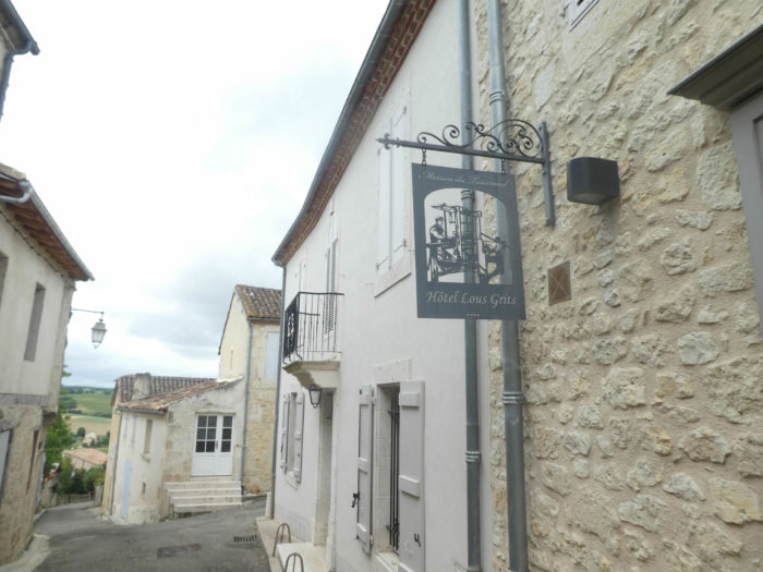
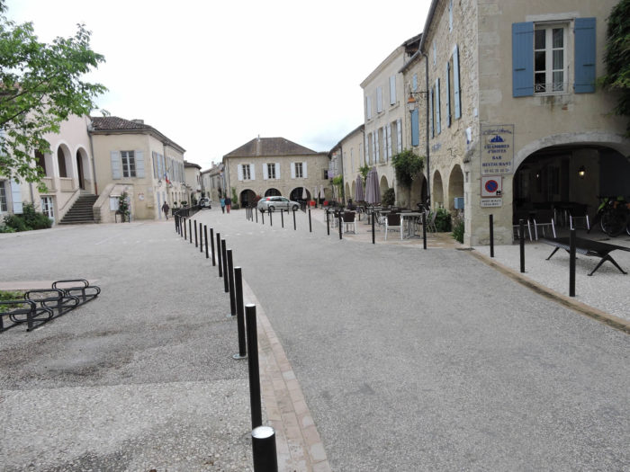
The section between Lectoure and Condom is a World Heritage Site, as is the Collegiate Church of Saint-Pierre de La Romieu, one of the flagships of the heritage. The name of La Romieu comes from roumieu which designates a pilgrim in Rome, and by extension all pilgrims. The St Pierre collegiate complex is a must-see, both for its single-nave church, its cloister, its two towers, one of which contains a secret passage with a double-spiral staircase. The medieval village, built largely on the relics of the abbey, is magnificent. You will also meet the famous cats of Angeline and her legend. But there! Many pilgrims skip the stage from La Romieu to go directly to Condom, as the stage from Lectoure to La Romieu and that from La Romieu to Condom are short. They win one day, but miss a great wonder.
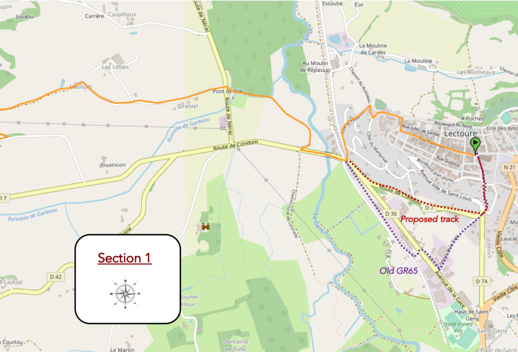
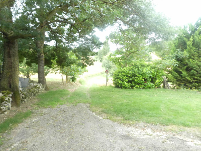
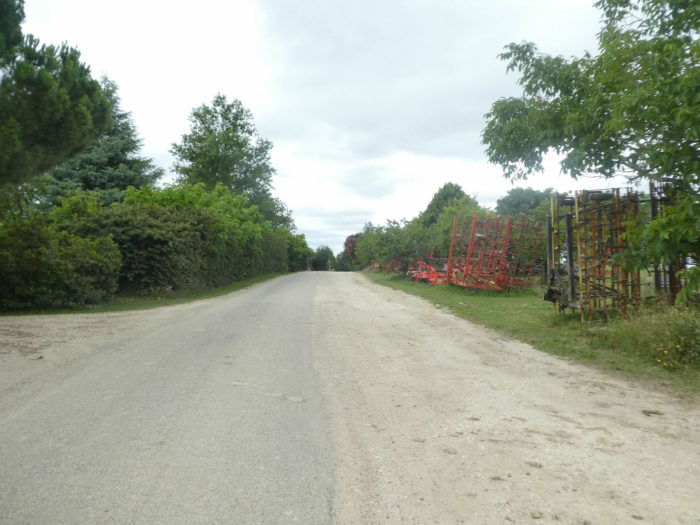
Here, too, the organizers of the trail have changed the course in recent years. This is definitely a habit. Formerly, the track descended along the walls of the citadel, and reached the industrial zone, before crossing the Gers River. Today, it crosses the city and at the end of the city, slopes down by small roads to the bridge over Gers River. It is understandable that they wanted to avoid walking along the industrial area, which is not particularly attractive. Yet, by practicing this way, they hid a beautiful part of the city. Where is the problem? Because the pilgrims come from the other side, and if they don’t have a detailed guide, they don’t know that there is something to visit on this side of the walls. So, they don’t go. And the next day they just follow the signs for GR path to find themselves on Gers Bridge.
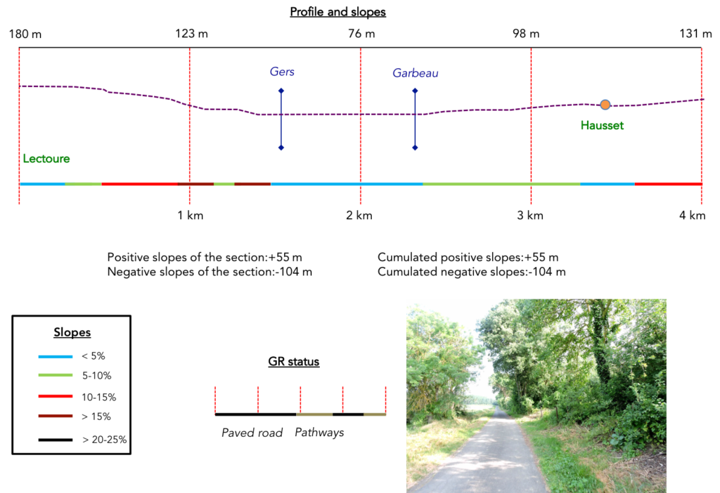
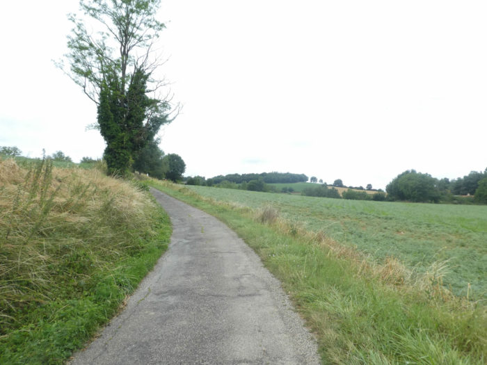
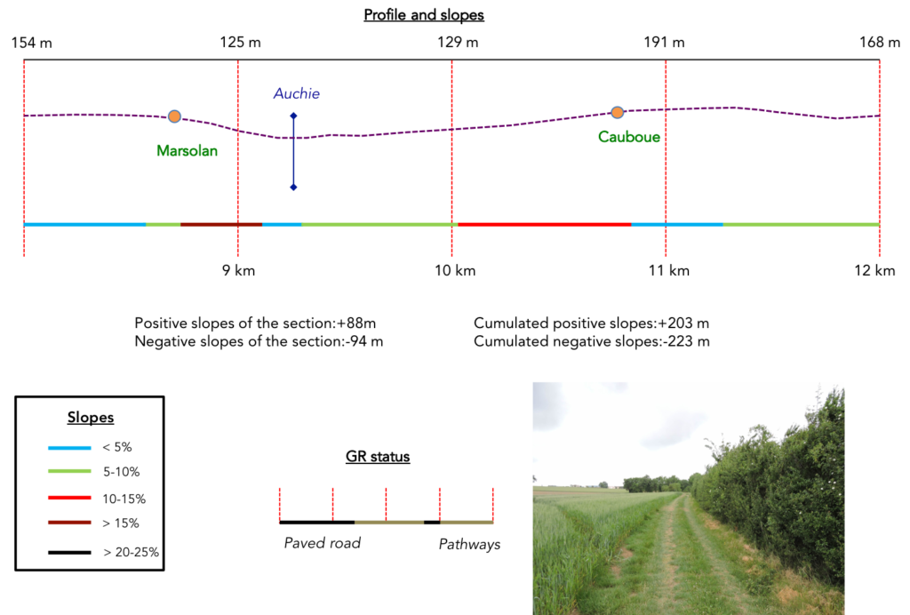
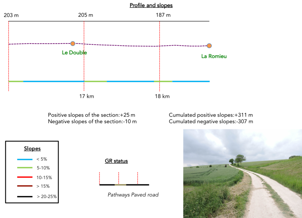
Difficulty of the course: In terms of the difficulties of the course, it is a quiet day, so to speak without difficulty, with slight slope variations (+311 meters/-307 meters), almost a ride on a very light ups and downs. There is little to report, other than the descent from Lectoure and a few more steep stream crossings.
Today there are more asphalt roads than dirt roads, as is often the rule on the Santiago track:
- Paved roads: 9.7 km
- Diet roads: 7.9 km
Sometimes, for reasons of logistics or housing possibilities, these stages mix routes operated on different days, having passed several times on Via Podiensis. From then on, the skies, the rain, or the seasons can vary. But, generally this is not the case, and in fact this does not change the description of the course.
It is very difficult to specify with certainty the incline of the slopes, whatever the system you use.
For “real slopes”, reread the mileage manual on the home page.

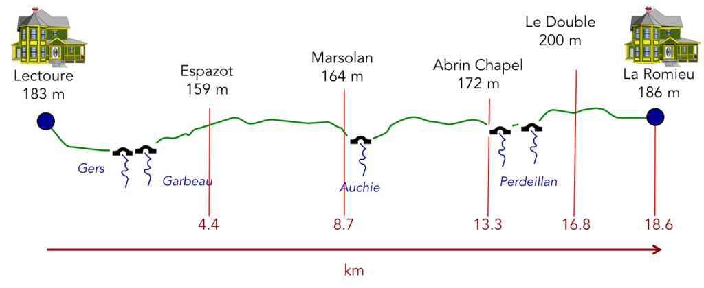
Section 1: In the plain where the Gers River flows.
 General overview of the difficulties of the route: steep descent from the citadel to the plain, then without any difficulty.
|
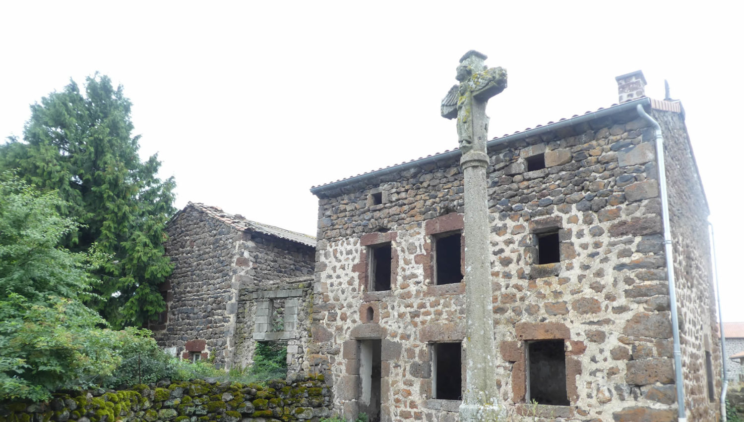
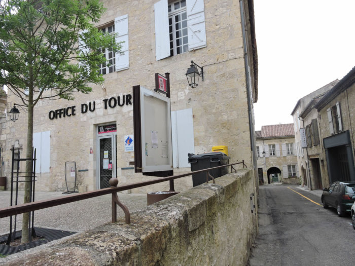
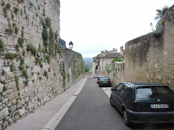
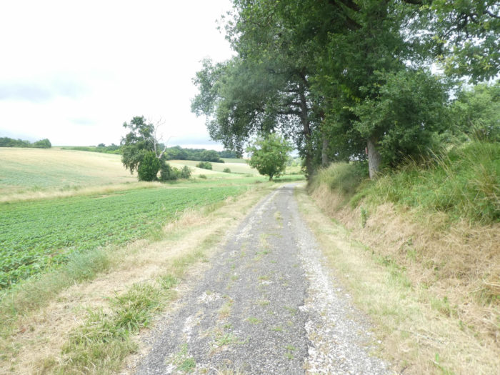
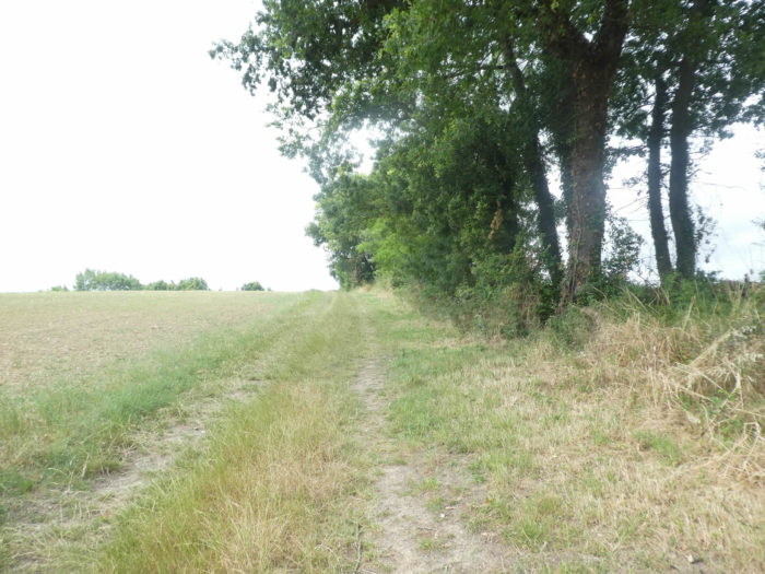
We therefore will not go on the new GR65 which crosses the city and which descends to the Gers Bridge, and we will follow the old GR65, the very beautiful part, that the organizers of the new track should never have deleted. This will, we hope, give future pilgrims who visit our site the idea that it would be good to use this track, if they did not get here the day before. In the old version, GR path left Lectoure behind the Tourist Office and descended from the citadel along the ramparts. The buildings are sumptuous here, integrated into the fortifications. |
|
 |
 |
 |
 |
The town of Lectoure, on its rocky outcrop, was the capital of the Counts of Armagnac in the Middle Ages. Declared a royal city in the XVth century, the city then became a stronghold. It is from these periods that the fortifications that surround the upper town date. The ancient fortress stretches down the hill through an interweaving of terraces, alleys and staircases along the imposing freestone ramparts.

| At the end of the ramparts, at the bottom of a staircase, between very high walls, there is access to a basin covered with a barrel arch, ribs, protected by an ironwork grid with fleur-de-lys tips, resting on a marquee. It is the beautiful fountain of Diana, dedicated since Antiquity to some deity, perhaps to Diana, perhaps to another deity, who knows? The fountain is listed in the register of historical monuments. Its current appearance dates from the XIIIth century. The fountain is fed by an abundant spring, which provided water, until the installation of running water networks, the artisans of the district, in particular the tanners located below. The water flows through two large taps and the overflow from the basin drains into a drinking trough under the ramparts. | |
 |
 |
| Then the GR65 runs in front of the old royal tannery, just below. All the buildings signify the opulence of the city at a certain time. | |
 |
 |

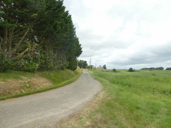
| It descends even lower to a crossroads at the foot of the citadel, where you can take a last look at the town perched above the citadel. Formerly, the route descended into the industrial zone. | |
 |
 |
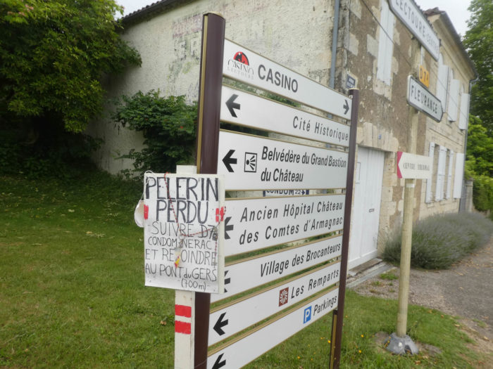
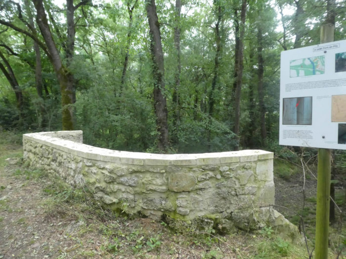
| Here a panel is indicated for the use of “lost pilgrims”. That still means that some pilgrims get lost, right? For the latter, just follow the small departmental D7 to join the current GR65 at the bridge over the Gers River. Going through here, you will have done a little more distance than the current course, but almost nothing. On the other hand, you will have seen one of the most beautiful sites of the city. | |
 |
 |
| Passing through this variant, you will walk above the industrial zone and join new GR path at the level of the railway. | |
 |
 |
| Right next, flows the Gers River in its troubled waters, with its swings in flow during the seasons. The river takes its source on the high plateaus of the Hautes Pyrénées, to flow further into the Garonne. It is not a very large river, but a fairly large river since it gives its name to the department it crosses. | |
 |
 |
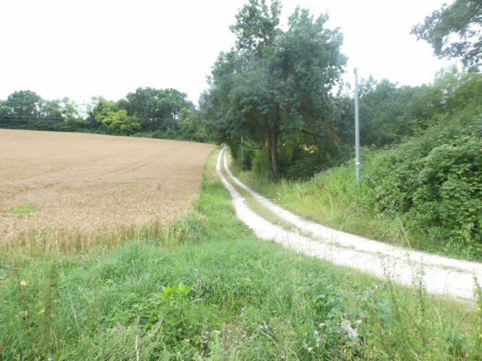
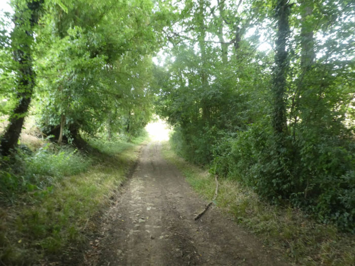
| Then quickly, beyond Gers Bridge, the track leaves for the undergrowth. | |
 |
 |
| It is a dark pathway, where the vegetation is dense, almost inextricable. It is dark and cool there. It’s like a piece of virgin forest, in a swampy, flood-prone area. Here flows in a diffuse way, the Garbeau brook. | |
 |
 |
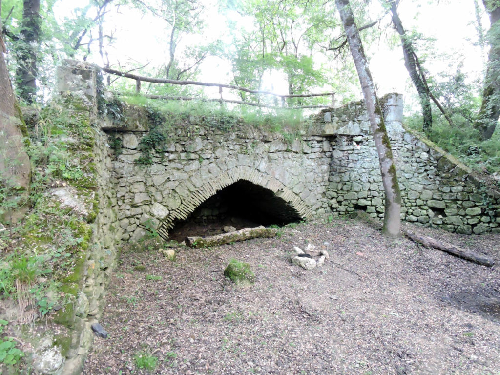
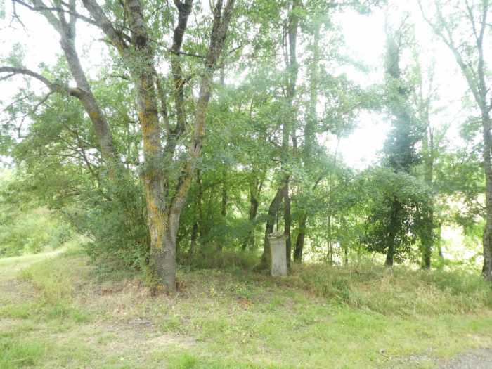
| An old stone bridge, known as the Petit-Pont-de-Pile, was thrown here to span the capricious stream that winds through the marsh, near the Gers River. It must be said that the pilgrim of yesteryear had to undergo the worst perils to cross this hostile undergrowth, no doubt dangerous in the early times. | |
 |
 |
Of unknown date, it is so named to differentiate it from the large bridge which spans the Gers River, a hundred meters before. They get lost in conjectures to know where the pathway went here earlier. The limestone stone bridge has since been walled up, and fundamentally restored, to appear almost new. It has lost all the charm he had a few years ago. Pity!
| In this wood where water oozes under the clay, the oaks are no longer the kings of the forest. Above all, in dense, bushy vegetation, you can see maple trees, hornbeam and ash trees, and some chestnut trees. Here, there is only a haste to rush out of the woods, harassed as you may be by an army of efficient mosquitoes. | |
 |
 |
 |
 |
| At the end of the marshy undergrowth of the small plain where the Gers River flows, thew GR65 joins and crosses the departmental road. | |
 |
 |
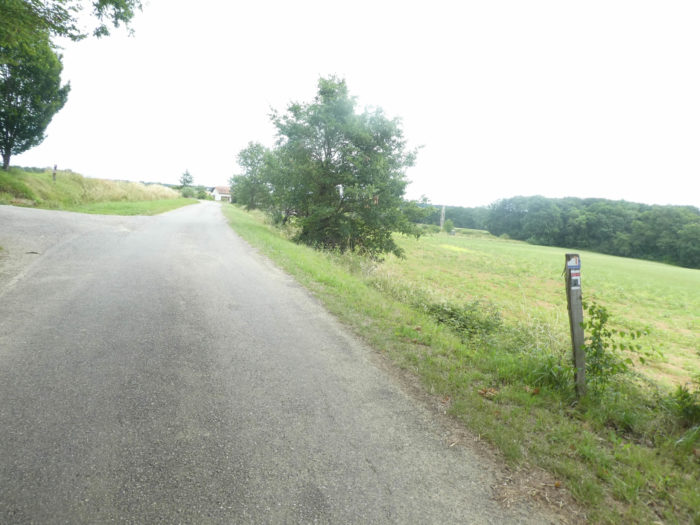
| The pilgrim then spreads a little air and height while climbing on a bumpy asphalt road in fields of sunflowers and fields of cereals. | |
 |
 |
 |
 |
| At the top of a fairly long but gentle climb, the road arrives in Hausset hamlet and its rare houses. | |
 |
 |
| Further on, the GR65 leaves the tar for a pathway that slopes up a hill in the grass. | |
 |
 |
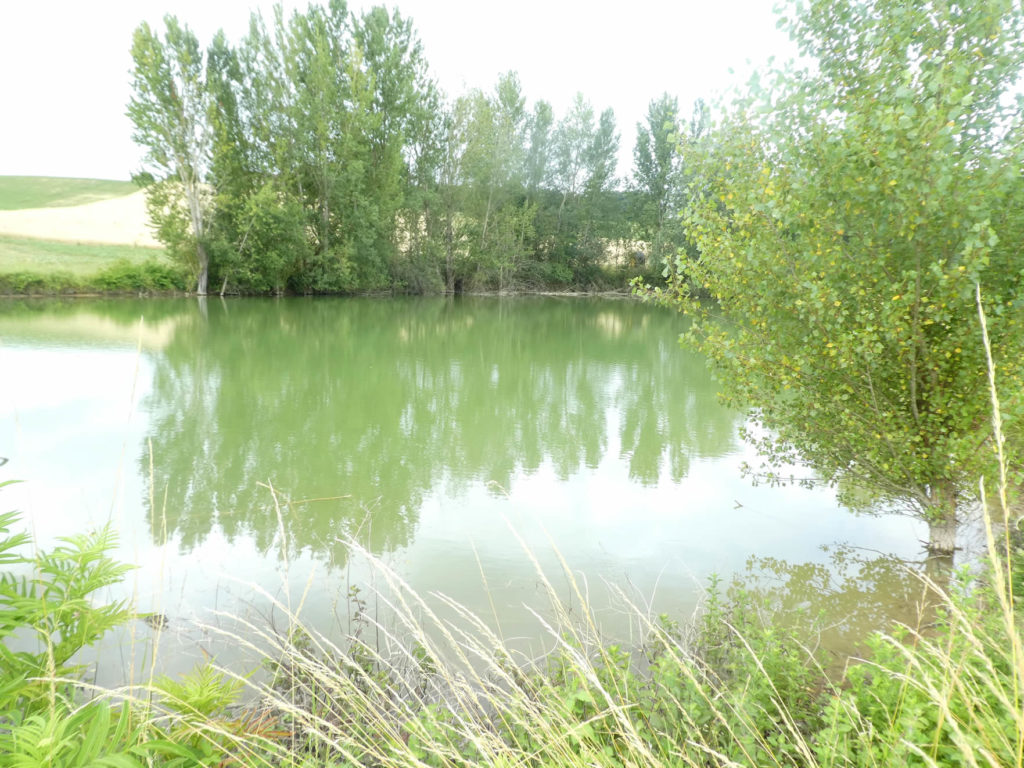
It skims a small lake with greenish water. You never know if these little lakes are natural or if they are water reserves, man-made to irrigate the fields.

| Further on, the slope increases in sunflowers, soybeans and cereals, under the poplars and ash trees, which are numerous in the region. In spring and early summer, when life awakens, buds burst and the first tender leaves are born and stretched out, nature sometimes seems a little thin, empty, even ungrateful. To this nascent fleece, some will prefer the proud sunflowers which defy the sun or the tired flowers which bow their heads heavy with seeds in autumn. | |
 |
 |
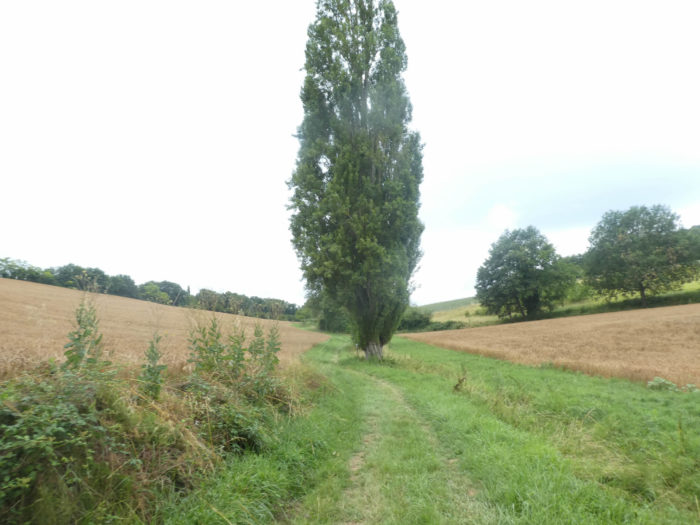
Shortly after, after passing through dense hedges, the GR65 joins a dirt road. These often-dead-end roads lead to isolated farms.
 |
 |
Section 2: In the wheat and sunflowers on the hill.

General overview of the difficulties of the route: without any difficulty, with a slightly steeper slope near Espazot and Marides.

| The dirt road then climbs steadily under oaks and maples towards Espazot hamlet. | |
 |
 |
| In these houses, with large rubble of light limestone, where life seems to have seriously melted away, not to say disappeared, sometimes the shutters open to offer hospitality. Wouldn’t you stop here to give your donkey a drink or find a place to stay for the night? | |
 |
 |
| From here a paved road climbs gently through fields. | |
 |
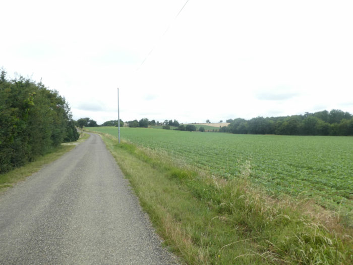 |
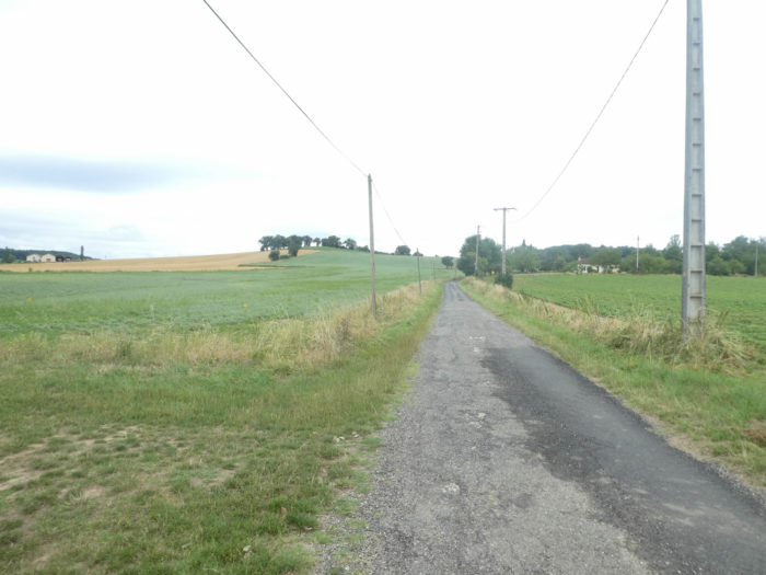
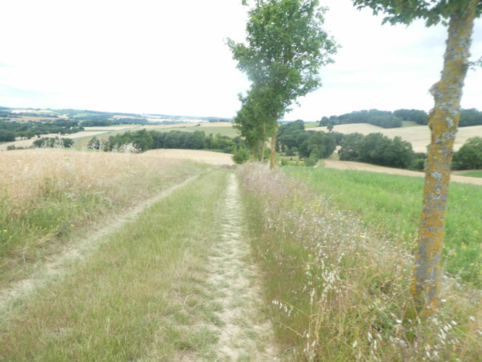
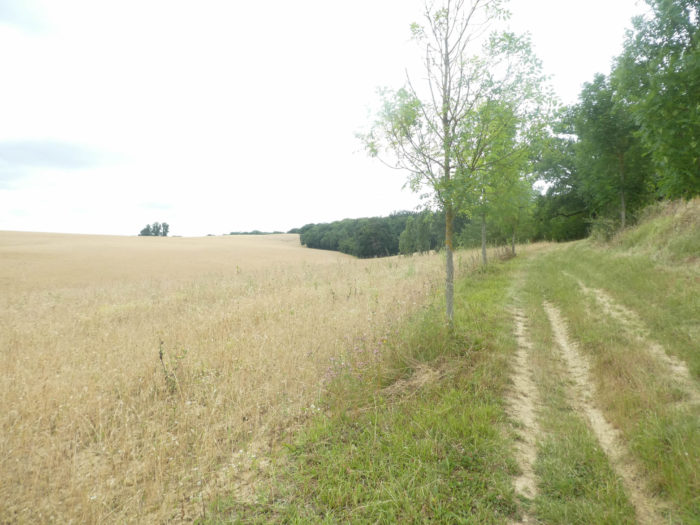
| The long road, sometimes almost straight, crosses fields as far as the eye can see, inhabited only by solitude. So, the pilgrim has time to daydream or to detail the cultures that he meets on his way. They are above all cereals, sunflowers and soybeans. But sometimes beets or beans are also grown to feed livestock. Maize is not widespread in the region. Along the way, the road crosses Marides farm where you can stay. | |
 |
 |
Further up, the slope eases further, and on the horizon you see Marsolan and the church tower pointing up.

| Sometimes even, but it is rare here, the vine grows under the oaks. Yet, above all, you’ll see large fields of cereals and sunflowers. | |
 |
 |
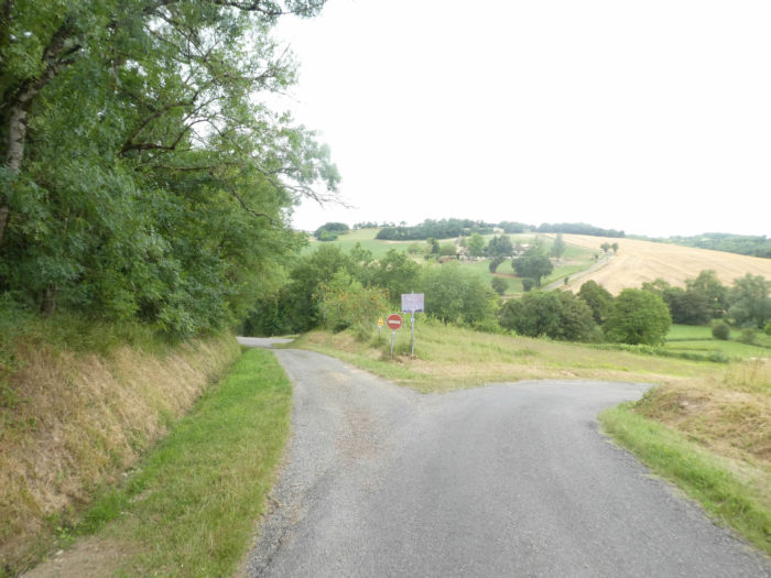
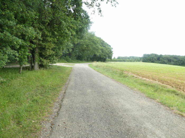
| Further afield, GR path gets at a crossroads, Verduzan fork, and here the road slopes gently down into the fields. | |
 |
 |
| Yet, the descent is short, and the road again flattens in the fields. Here, the sunflowers have already shown their heads. Were they planted earlier or are we further south? | |
 |
 |
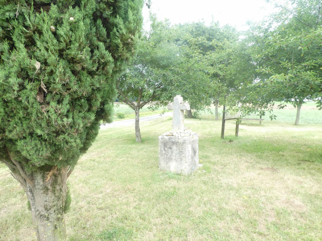
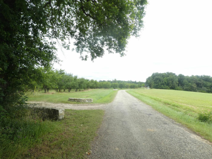
At this crossroads, the road continues straight towards Marsolan. But the organizers have planned another track for you. At La Croix de la Justice, near the magnificent stone cross, you are not very far from Marsolan. We don’t know which local St Louis, sitting under an oak tree, did justice here, but the site also serves as a picnic spot.
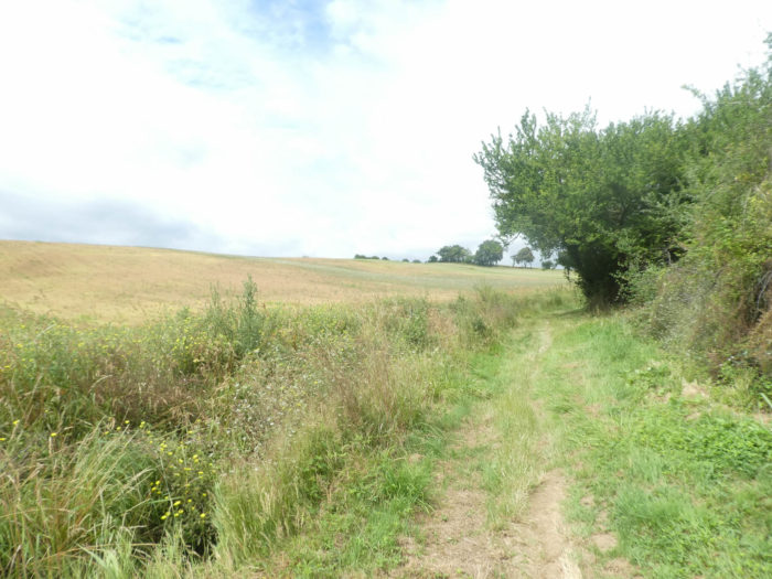
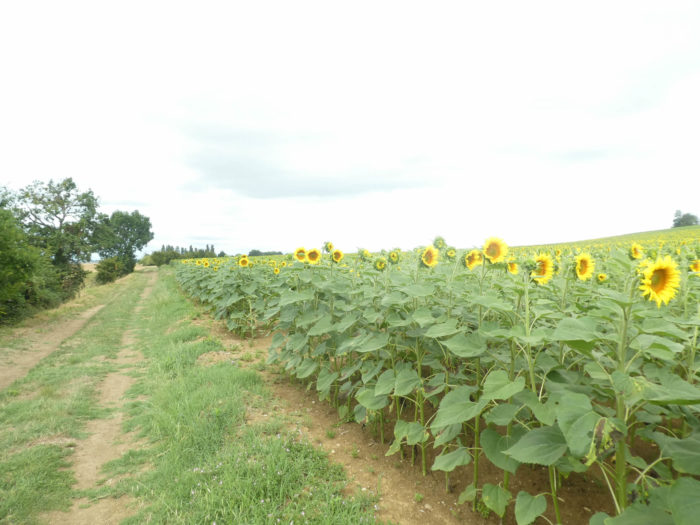
| The GR65 then sets off again on a grass and dirt road through fields, along the hedge of ash and oak trees. Sunflowers always compete for space with cereals. Here the wheat has been cut and only gigantic fields of oats remain. | |
 |
 |
| The pathway skims a large complex of farms and sheds where sunflowers flourish. Sometimes the pathway cuts through a small undergrowth, but it is to immediately emerge into the infinity of fields. | |
 |
 |
There are fewer crosses here than further north on the Way. Yet Marsolan stands out, for a few hundred meters further on, another cross stretches out its arms amidst wheat and sunflowers. Where did they go to find granite, which does not exist in the region?

| Sometimes the fields are so vast that they disappear into the sky, like in the Spanish Meseta, where runs the track to Santiago. | |
 |
 |
| We are at the end of June, and the wheat has already been harvested. There should be no shortage of bread in the region. | |
 |
 |
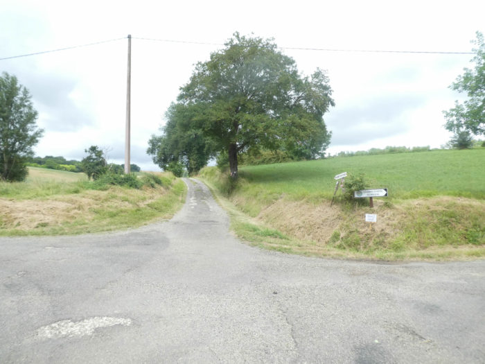
| And at the end of this infinite universe of grains, the pathway arrives near a small road. | |
 |
 |
Section 3: Stop at Marsolan, a small, quiet village full of character.
General overview of the difficulties of the route: steep descent to the Auchie stream, then marked climb to Cauboue.
| Here a straight road awaits you on a plateau that never ends, towards recent houses which loom on the horizon. | |
 |
 |
| In front of you, the bell tower of the church of Marsolan is gradually approaching. | |
 |
 |
| The road quickly reaches the center of the village. | |
 |
 |
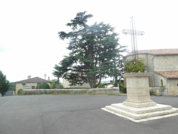
| The Church of Our Lady of the Rosary stands in the center, a church rebuilt in the 16th century, and even later, with a particularly rococo interior and a very celebrated organ. Its bell tower, planted on a small hillock in the middle of cedars and plane trees, dominates the village. Next to the church, a multi-service grocery store concentrates the interests of the local population and pilgrims. | |
 |
 |
 |
 |
As in all the villages of the region, hides the traditional grain hall, hardly more modest than elsewhere.

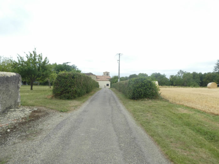
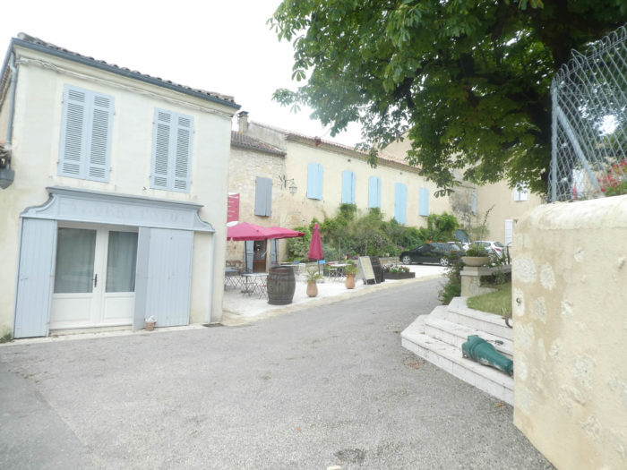
| The GR65 crosses down the small village street, all in stone. Houses are most often grouted. It is also in one of these small alleys that there is a charming **** establishment, which few pilgrims could afford! You can also find food and accommodation here, in more modest establishments. | |
 |
 |
| The slope is very steep, more than 15% at the bottom of the village, on a bad asphalt road. | |
 |
 |
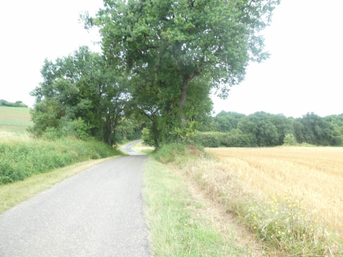
| Further down, the road that descends from the village and plunges to the bottom of a small dale, joins and crosses the departmental road, under large oaks, gigantic ash trees and maple trees. Here they are already advertising to visit La Romieu. | |
 |
 |
| The road then crosses the small Auchie stream, which flows gently at the bottom of the dale. On the other side of the valley, the road climbs again. From here it is possible to reach accommodation off the track. | |
 |
 |
Quite quickly the GR65 plays the alternation, as it does every day, releases the tar for a grassy pathway which climbs on the side of a hill.
 |
 |
| In the hedges grow wild plum and walnut trees. In season, these fruits are free. For the nuts, it’s still a bit early. | |
 |
 |
| Then the slope grows, to nearly 15%, in the monotony of grains and oilseeds. Further up, the pathway climbs up stairs cut into the ground, in the weeds. | |
 |
 |
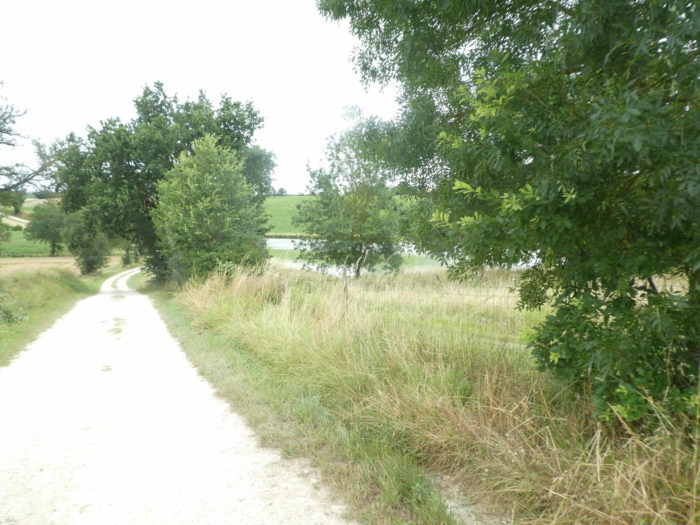
Here a small lake cuts the monotony of the sunflowers. The peasants have not always upset natural landscapes. They have always respected the presence of water, which is also vital for them. Perhaps this water reserve was also created here.
| At the level of the lake, the pathway runs a little through plowed sand under maple trees and oaks … | |
 |
 |
| … before emerging soon after in the grass amidst the vast expanses of grain and sunflowers. | |
 |
 |
| It’s vast here. It looks a bit like the Meseta on the Spanish Way. However, there is a difference. The Spanish peasants cut off their trees, the French let the oaks and ash trees survive on the edge of their properties. | |
 |
 |
| At the top of the ridge, the GR65 joins a road near the small hamlet of Cauboue, in a landscape that does not change one iota. You will have to get used to it. Wheat, sunflower, and further on corn will become your favorite pastime for a good ten days. | |
 |
 |
 |
 |
| After a short passage on the tarmac road, GR path finds a wide pathway back that leads into the grass in the countryside. Here too young maples were planted to mark the way. | |
 |
 |
| The countryside is still as vast, as generous, in the fields of oats not yet harvested. Further on, the pathway begins to slope down gently towards an undergrowth. | |
 |
 |
| Further afield, the pathway nods under the oak hedges along the fields. Here the sunflowers have put on their formal attire. No need to take out your compass to see where the setting sun is. Below, soybeans were planted in a huge field. Usually, soybeans are the last to be planted. Here they barely lift. | |
 |
 |
 |
 |
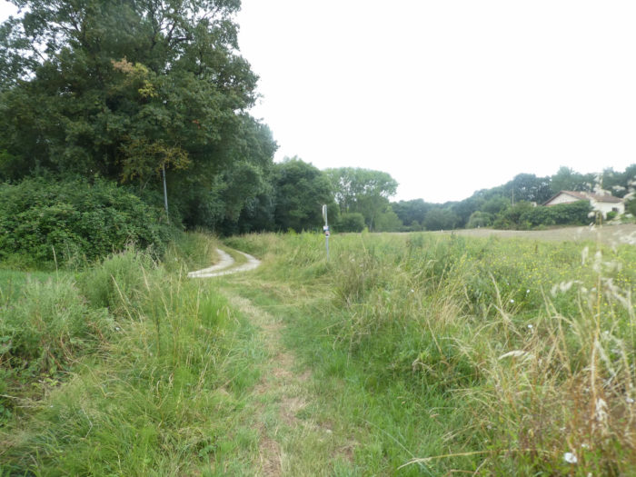
Section 4: Walk in the fields.

General overview of the difficulties of the route: course without any difficulty.

|
But the campaign is not always so generous. An open dump cuts the pathway, where bundles of stubble and stubble rotting, amid the disgusting heavy-duty tires that end their lives here. |
|
 |
 |
|
Little more elegant are the dumpsters and the agricultural park which adjoins the pathway. |
|
 |
 |
|
You then find signs of the presence of men, which we had not seen for a long time. It is quite a common fact, you rarely see people on the way, except the pilgrims. Here the GR65 flattens along a paved road which leads to Castelnau-sur-L’Auvignon, a village that will be found the next day. |
|
 |
 |
|
The road soon runs through Batsurguère hamlet, near a small pond. |
|
 |
 |
|
At the end of the hamlet, along corn fields that you have rarely encountered north of Gers, the road comes to a fork where the track will change direction. |
|
 |
 |
You are now at the Chapelle d’Abrin. The chapel, built in the 11th century, adjoined a guesthouse run by the Knights of Malta on the road that went from Puy to Rocamadour. Restored at the end of the 20th century, desecrated, it is now private property.
You have to choose at La Chapelle d’Abrin: either continue straight on the road towards Condom, or turn right towards La Romieu. Pilgrims are also encouraged to reach La Romieu, as there is no sign indicating the direction of Condom. And yet, many pilgrims skip the trip to La Romieu. To win one day, they say! But one day on what? On to infinity, in a hurry that they would be in Santiago early! So whatever the old stones that the older generations have given us at La Romieu.

|
On the GR65, a wide dirt road descends gently to the bottom of a dale, today in wheat, now harvested. |
|
 |
 |
|
Two jewels of small lakes decorate the grove here, under oaks, maples and ash trees, linked by the Perdeillan stream. |
|
 |
 |
|
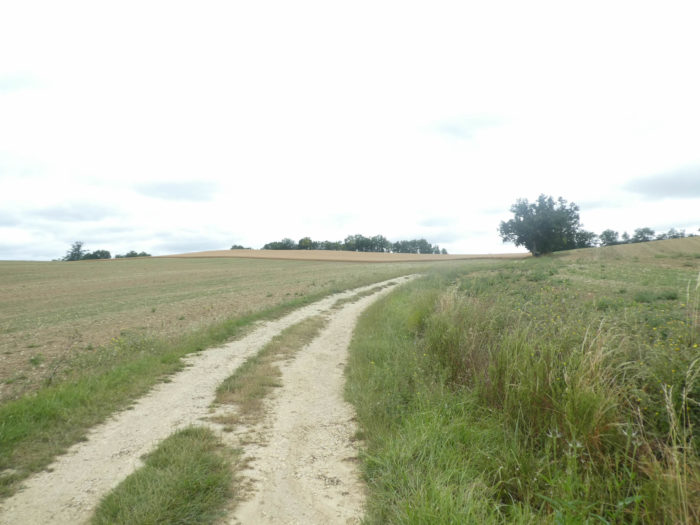
Further afield, the wide dirt road climbs gently up from the bottom of the dale, in a profusion of sunflowers. |
|
 |
 |
|
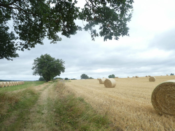
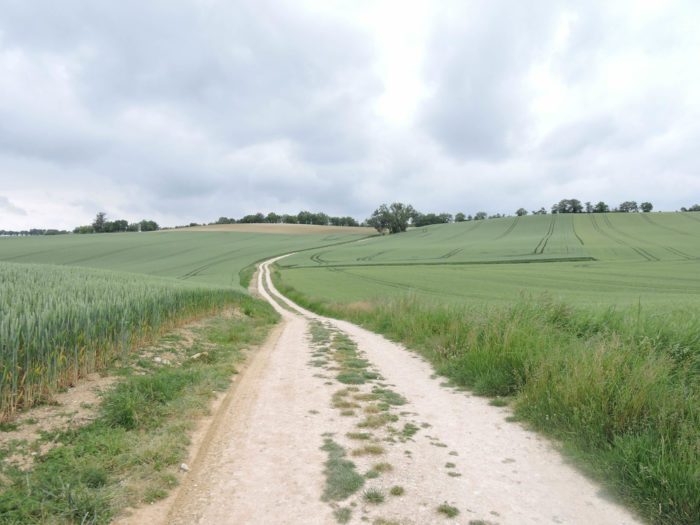
On this gentle hill, today cereals, harvested or not, mingle with fields of sunflowers, barely rising soybeans, and fallow land. |
|
 |
 |
|
When you walk in Gers, the landscapes change every year according to the law of alternation, which is also charming, and may also surprise people who walk here regularly. When we passed here a few years ago, we thought that the peasants always offered their best lands for the blessed wheat. Poor sunflower, poor corn, who must tell about so little! But this is not the case. However, can we never say enough about the serenity engendered by these geometric lines drawn by tractors as they sow seeds to the millimeter? Who will say the loneliness of these millions of ears of wheat which undulate in the peace of the trade winds? It’s more beautiful to contemplate than the fallow fields, right? If you are a wheat lover, you should go to Gers at the end of spring. If you prefer sunflowers, go later. |
|
 |
 |
|
The slope is quite steep here, and the pathway runs from dirt to grass, today amidst oats and sunflowers. |
|
 |
 |
|
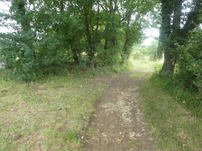
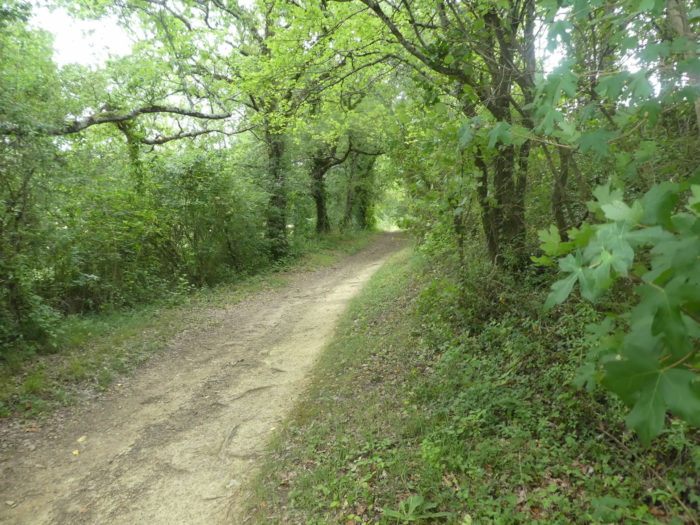
But now the landscape is changing. A forest is pointing its nose. Almost a revolution in the landscape architecture of the region. So, the pathway alternates between countryside and undergrowth, between grass and dirt, always with these regiments of maple trees that have been planted in the region by the wayside. |
|
 |
 |
 |
 |
|
Further afield, the pathway enters the Bois de la Ville, a large, denser forest, dominated, here again, by oaks and maples. |
|
 |
 |
|
The trees are particularly plucked in this forest, of which you can hardly see anything but poles. This must be more practical for hunting wood pigeons, those wood pigeons with succulent flesh that people tear off. There are more than 100,000 hunters of this species in the southwest. Do not naively believe that the infrastructure you see here is made for bird watching or ground pilgrim shelters. All this panoply is the hunting device, with these palombières, watchtowers that are used to attract birds in flight, then by various stratagems, lure them to the ground where they are captured alive in nets, or pulls them to the ground. A wood pigeon, it is quite naive, is stupidly caught by decoys. A living wood pigeon sells for more than a dead wood pigeon. It’s a real sport, played as a team. Another technique, more rudimentary, is this kind of shelter, not for pilgrims but for hunters, called talenquière, a shelter made of wood and leaves, installed at regular distances. The hunters hidden behind wait for the flight to pass to shoot the birds. Yet, as it is a sport and a passion, there is a certain ethics. In this type of hunting, you cannot use lures. |
|
 |
 |
|
On leaving the forest, the trees regain their plumage and the countryside its cereals. |
|
 |
 |
The GR65 then finds the grass and the hedges of undergrowth until the intersection of a small road.
 |
 |
Section 5: Towards La Romieu, another beautiful gift from the Middle Ages.

General overview of the difficulties of the route: course without any difficulty.
|
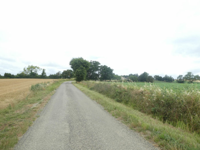
From here a paved road flattens in the countryside, along the undergrowth. |
|
 |
 |
|
Soon, you’ll see fruit trees appear. |
|
 |
 |
|
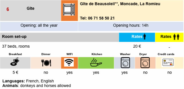
Further afield, the GR65 arrives near the place called Le Double, near Moncade. A stone’s throw away is the magnificent Beausoleil gîte. If you want to see plum trees lined up as if to go to war, stop here a little out of the way. Here farmers cultivate and dry the prunes, as in Agen. |
|
 |
 |
 |
 |
|
Later on, a gravely dirt track then leads fairly quickly to Romieu through plum orchards and other fruit trees. In the distance, you can see the steeple of the abbey. |
|
 |
 |
 |
 |
Further afield, in this gentle wooded countryside, the route becomes tarred, and passes in front of the Jardins de Coursiana arboretum, very popular with tourists who visit the village.
 |
 |
|
A wide alley then leads to La Romieu, under majestic hornbeams. |
|
 |
 |
|
Two beautiful small lakes brighten up the landscape at the entrance to the village and the abbey church appears in all its majesty. |
|
 |
 |
 |
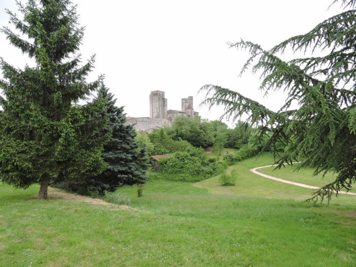 |
|
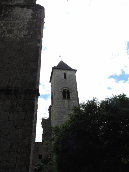
La Romieu (570 inhabitants) is above all the magnificent St Pierre collegiate church, dating from the 14th century, listed as Historical Monuments, of Gothic construction, with its long and high nave and polygonal apse. In the tower of the Sacristy, magnificent frescoes adorn the ceiling. |
|
 |
 |

|
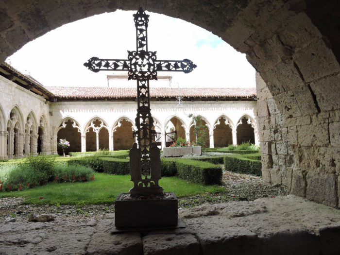
The church is flanked by several towers, including the Tower of the Sacristy and the Square Tower. In the latter, a staircase leads to the roof of the church. This staircase is very particular, it has a double revolution, an axis for the climb, an axis for the descent. |
|
 |
 |
|
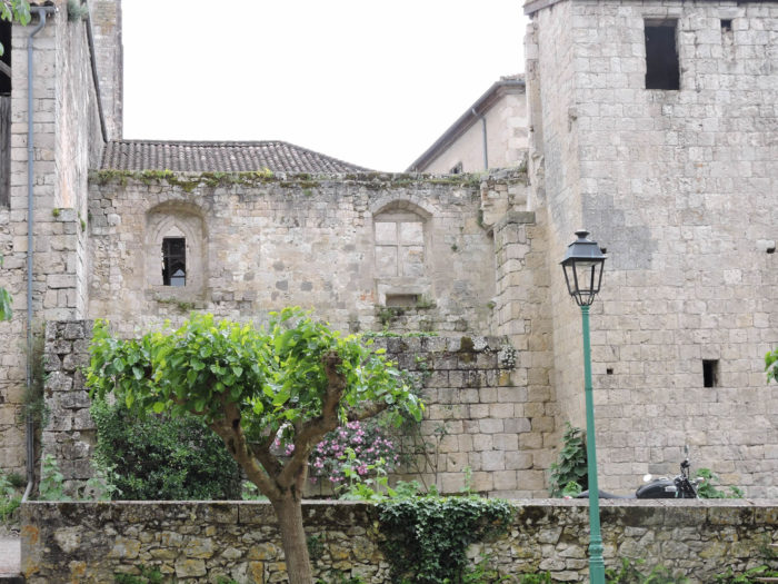
The cloister was probably built after the church and originally had two floors. The cloister was burnt down in 1569 by the Protestants and the wooden floors were destroyed. The capitals of the cloister, less precious than those of Moissac, are decorated with foliage and figurines. Animals are often associated with a character or floral decoration. We owe the collegiate church and the citadel to Arnaud d´Aux, a native of the village, who was in charge of the Templars and became cardinal. He added a palace to the collegiate church, intended to accommodate the apartments of the cardinal and his suite. The palace gradually disappeared over the centuries, during the wars that crossed the country. It was bought as national property during the French Revolution, then sold largely as a stone quarry. The walls of the palace are still used today for some residential houses behind the collegiate church. |
|
 |
 |
|
Fortunately, there are still many magnificent remains of all this building, such as the Cardinal’s Tower, also preserved as a historical monument. |
|
 |
 |
|
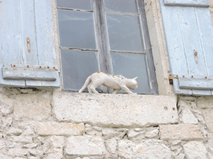
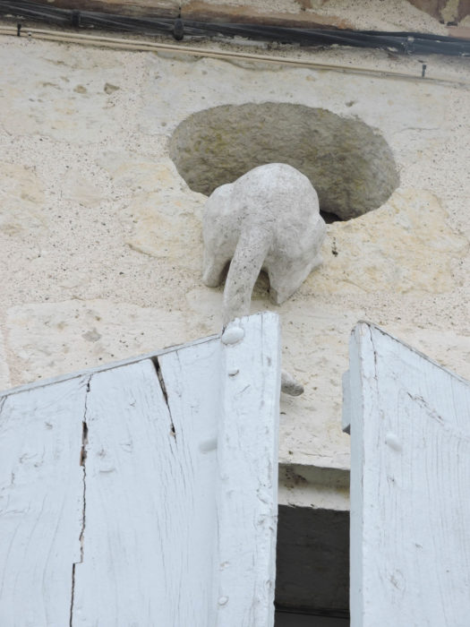
Village life is concentrated in a small square near the collegiate church. This is also where you will meet Adeline’s cats, who according to legend saved the village from a great famine. So here is the legend, as it is told here (text taken from La Romieu Tourist Office): “In the year of grace 1338, in a Gascony village called LA ROMIEU, famous for its beautiful collegiate church built for 20 years, Vincent and Mariette lived happily. He was a lumberjack, and his wife often accompanied him in the forest to make the bundles. They worked hard, but with the poultry, the pig, the vegetables and the fruits from the garden, the table was garnished. They had been married for 3 years, when Mariette gave birth to a little girl whom they called Angéline. Alas Vincent was crushed by a tree which he felled. Mariette, inconsolable, allowed herself to waste away and two months later she was found dead, holding Angeline in her arms. The little girl was taken in by a neighbor, and grows up with her children like their sister. Angeline showed a great attraction for cats. There were always 2 or 3 around her who, at night, slept in her bed. She often shared her bowl with them. Angeline over the years, became a strong young girl who helped her adoptive parents well with the work in the fields, always accompanied by her cats. The year 1342 and the two following years, the winter was harsh, and the spring and summer so rainy that it was not possible to sow the fields. A great famine ensued and despite the distribution by Lord Arnaud d’Aux of the reserves of the Collegiate Church, the inhabitants of LA ROMIEU soon had nothing to eat. They then thought of the cats, so numerous in the village, and turned them into gibelotte. Angeline’s parents, knowing how much she loved cats, agreed to keep two cats, on condition that they were well hidden, because the neighbors only wanted to wring their necks. Angeline therefore locked the 2 kitties in the attic during the day, and at night let them go out to hunt. But the famine worsened and many villagers died. Angeline and her parents struggled to survive, collecting roots in the woods, sometimes mushrooms, but it was poor food. Very diminished, they were nevertheless able to overcome this sad period and more lenient times finally allowed them to harvest a living. But in LA ROMIEU, where the cats had disappeared, the rats had proliferated to the point of threatening the crops. Angeline, with infinite precautions, had been able to hide her cats and they had had several litters. It was about twenty clerks frolicking in the attic. Fortunately, the house was isolated. The villagers lamented the damage caused by the rats. It was then that Angeline announced that she was going to release about twenty kittens that the inhabitants could adopt. The rats quickly disappeared and that is how Angeline saved LA ROMIEU from a new misfortune. Legend also says that Angeline’s face, over the years, looked more and more like a cat and that her ears turned into cat ears ”. It was while listening to a grandmother tell her grandchildren the legend of Angeline’s cats that a sculptor from Orleans, Maurice Serreau, had the idea of reviving her by placing sculptures of cats around the place. Here, visitors are advised to look up to list the number of cats that the sculptor has positioned in the town. Here are some samples. |
|
 |
 |
 |
 |
 |
 |
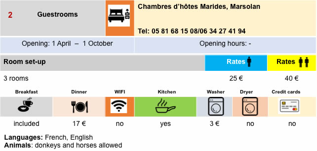
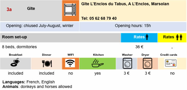
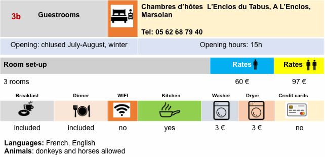
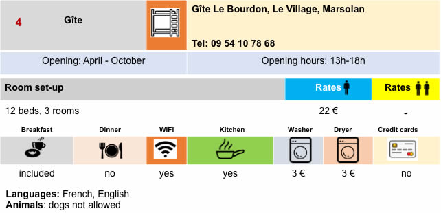
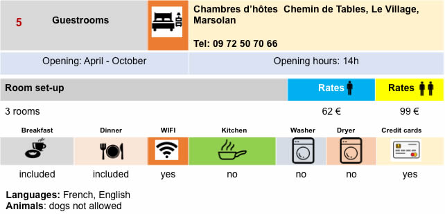
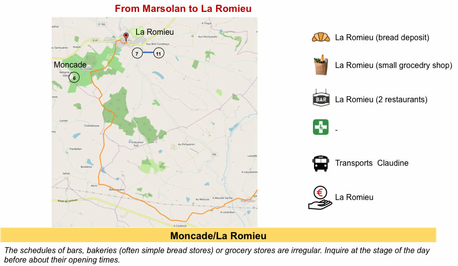
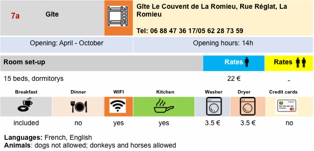
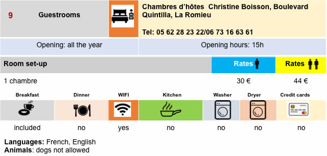
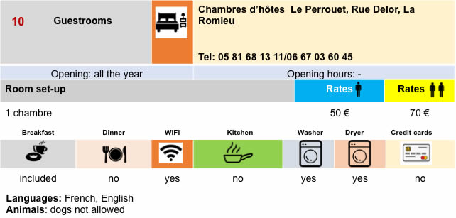
Lodging

 |
 |
 |
 |
 |
 |
 |
 |
 |
 |
 |
 |

Feel free to add comments. This is often how you move up the Google hierarchy, and how more pilgrims will have access to the site.
 |
Next stage : Stage 24: From La Romieu to Condom |
 |
Back to menu |