A day in Lomagne
DIDIER HEUMANN, MILENA DALLA PIAZZA, ANDREAS PAPASAVVAS

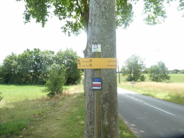
We divided the course into several sections to make it easier to see. For each section, the maps show the course, the slopes found on the course, and the state of the roads. The courses were drawn on the « Wikilocs » platform. Today, it is no longer necessary to walk around with detailed maps in your pocket or bag. If you have a mobile phone or tablet, you can easily follow routes live.
For this stage, here is the link:
https://fr.wikiloc.com/itineraires-randonnee/de-auvillar-a-lectoure-par-le-gr65-30586915
It is obviously not the case for all pilgrims to be comfortable with reading GPS and routes on a laptop, and there are still many places in France without an Internet connection. Therefore, you can find a book on Amazon that deals with this course. Click on the book title to open Amazon.
If you only want to consult lodging of the stage, go directly to the bottom of the page.
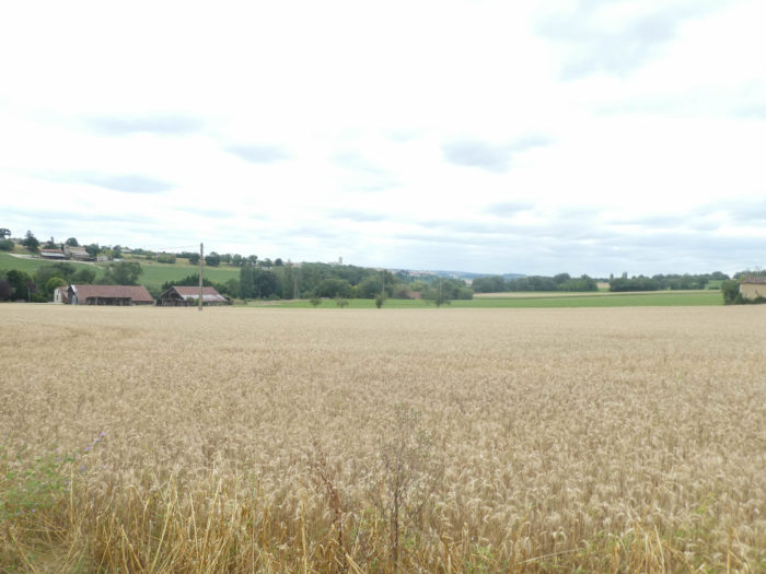
Today, you are crossing a good part of Gers Lomagne, the northernmost territory of Gers. Gers Lomagne is characterized by wide valleys which have carved out a vast limestone base, with also wide slopes topped by ridges and small plateaus. The landscape often resembles large barren expanses, with here and there a few white limestone outcrops and a few scattered groves, where oak still dominates, which are called here “canteros”. Lomagne lands are very fertile, the limestone having enriched the clays, giving tremendous land for wheat.
The old buildings are often made of rubble, most of the time hidden under the lime which only reveals the beautiful cut stones of the door and window frames. Bastides, such as Lectoure, Flammarens, Miradoux or Auvillar, seem frozen in time. Strongly medieval in appearance, they are perched on strategic promontories. Towers, ramparts, ditches, walkways, everything is there. But these towns and villages have clearly suffered from the rural exodus and are now largely deserted. Often, the urban tissue has deteriorated, many houses remain vacant or in ruins. Grouped around Lectoure, the historical and cultural capital of Lomagne, Lectourois is in itself a concentrate of Lomagne landscapes.
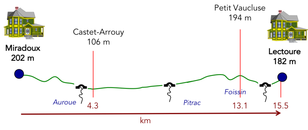
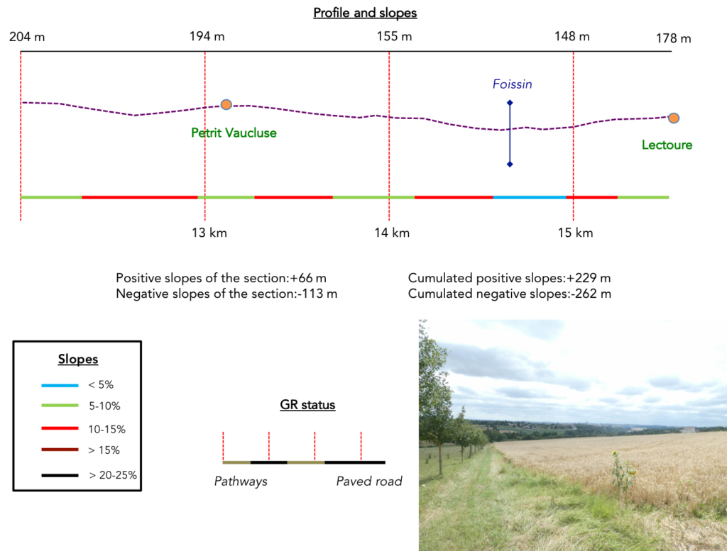
Difficulty of the course: The day’s slope variations (+229 meters/-262 meters) are still very low, especially since we have chosen to cut the long stage that some pilgrims make between Auvillar and Lectoure. Because, in Lectoure, it is claimed that the pilgrims arrive here on their knees, given the length of the stage and the last climb to the village. Today’s stage offers no great difficulty of route. You will hardly exceed 200 meters in altitude, and only a few small climbs or descents mark the course. You cross a large countryside dotted here and there with small groves.
The routes of the day are clearly to the advantage of the dirt roads, although they are sometimes pathways drawn along the roads:
- Paved roads: 3.8 km
- Dirt roads: 11.7 km
Sometimes, for reasons of logistics or housing possibilities, these stages mix routes operated on different days, having passed several times on Via Podiensis. From then on, the skies, the rain, or the seasons can vary. But, generally this is not the case, and in fact this does not change the description of the course.
It is very difficult to specify with certainty the incline of the slopes, whatever the system you use.
For « real slopes », reread the mileage manual on the home page.

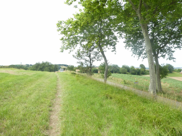
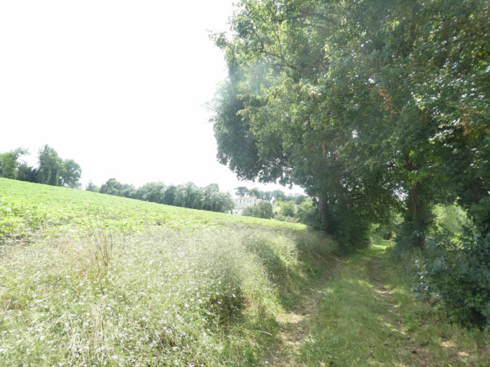
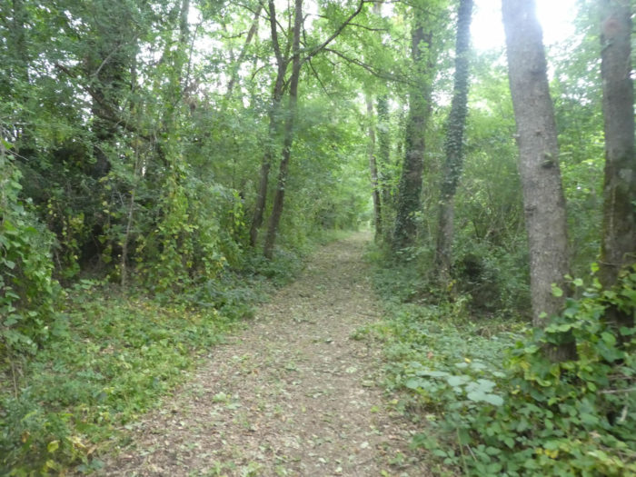
Section 1: In the Lomagne countryside.
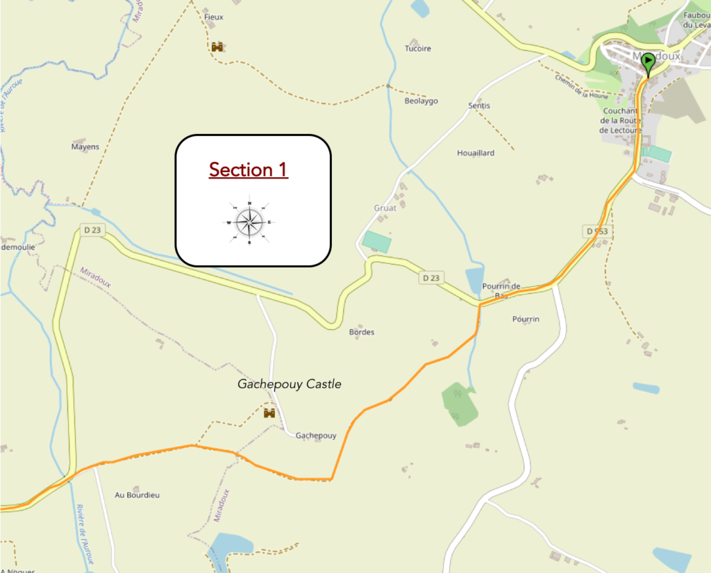 General overview of the difficulties of the route : course without major difficulty.
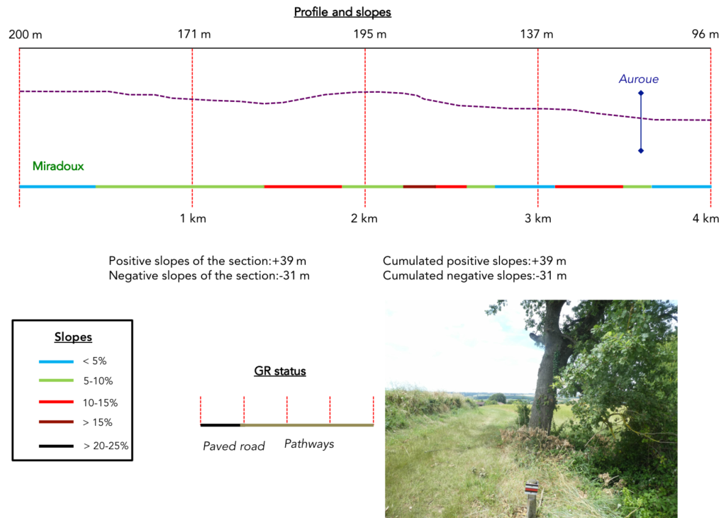
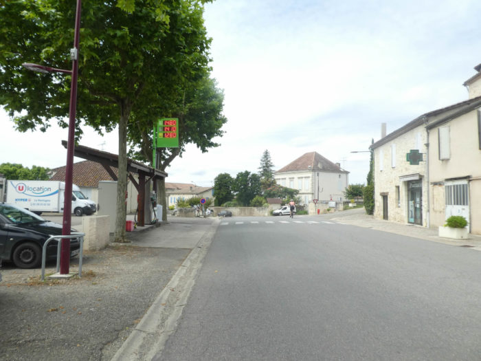
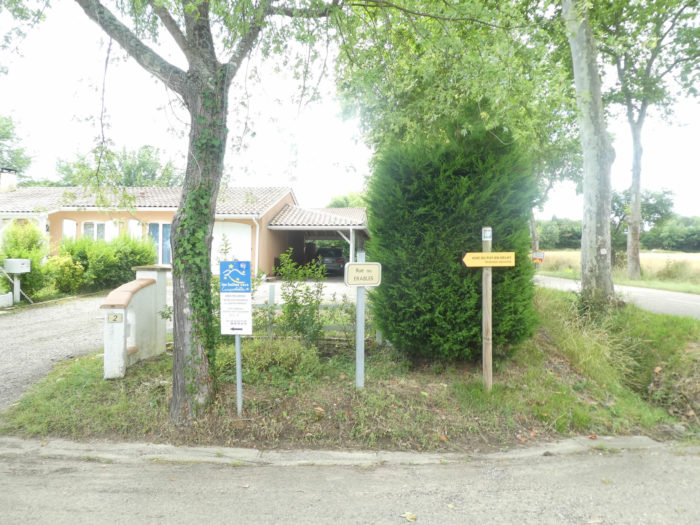
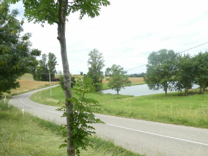
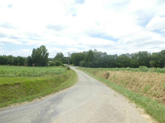
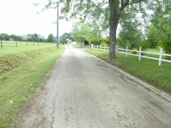
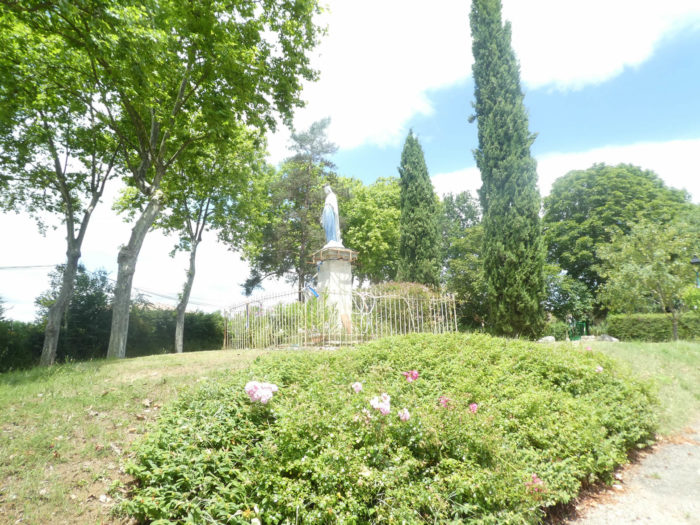
The GR65 leaves Miradoux from the small shops square, near the church where the usual Virgin is enthroned, all dressed in blue and white.
|
It slopes down along the departmental road.
|
 |
 |
|
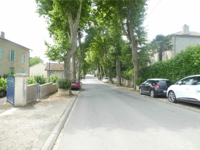
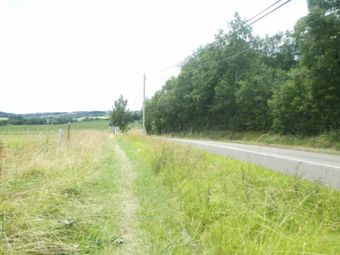
Then, on leaving the village, it runs along the departmental road in the grass, under the young maple trees which have been planted in numbers in the region.
|
 |
 |
|
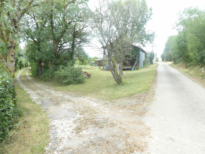
Pay attention here! The track has been changed. Previously it followed the road. Now it shifts to a small road to the hamlet of Caouze.
|
 |
 |
|
This at least gives you the opportunity to still admire the vast and beautiful Gers countryside and the mill which sits on the hill, which must not be idle here.
|
 |
 |
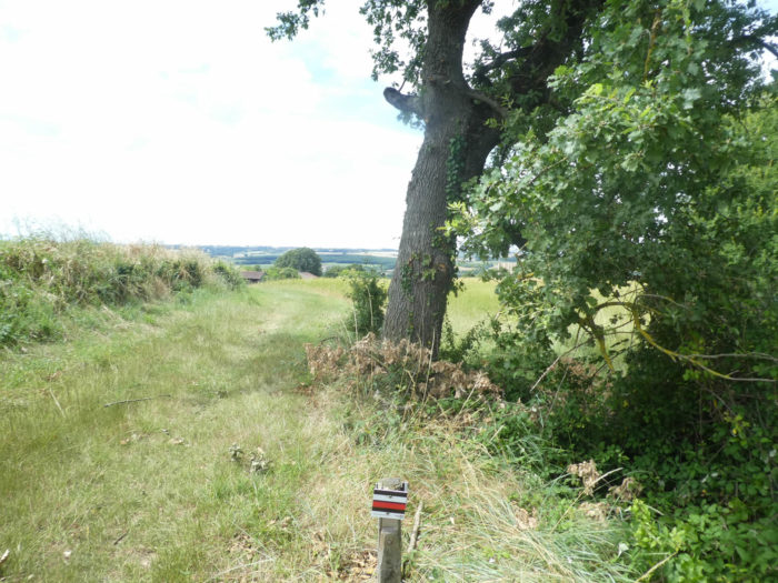
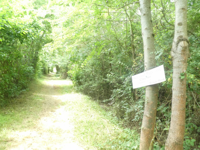
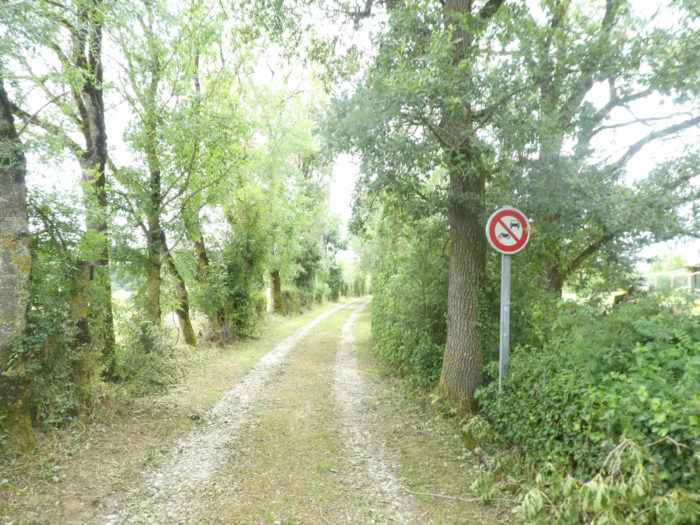
| However, do not let yourself be too absorbed by the landscape which scrolls under the alleys of oaks. There is a very discreet sign here, on your right, telling you not to go any further. It’s often in this kind of place that you get lost, if you are not careful. |
 |
 |
| Indeed, there is a sign indicating the pathway on your right, a pathway that heads to the fields. |
 |
 |
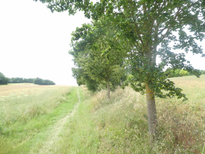
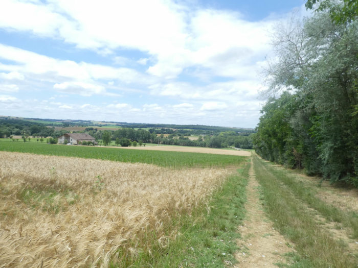
| The pathway runs along wheat fields, today harvested, and a hedge of oak, maple, walnut and wild blackthorn trees, until it reaches the departmental road. All that for this! Yet, as you well know, the organizers of the trail hate to see pilgrims walk on the departmental roads. |
 |
 |
| The GR65 then descends from its little country getaway to reach a crossroads of departmental roads, and continues along the departmental road, which heads towards Castet Arrouy, on a small grassy bank, parallel to the road. |
 |
 |
| It is going to do it, in the shade of ash and maple trees until reaching a small reserve of water, before leaving, resolutely this time, for the fields. |
 |
 |
| Further afield, a wide pathway climbs through the grass, at the edge of the grain fields, on a hill where a water tower stands. |
 |
 |
| The slope is steep, along the young country maples that have been planted, no doubt to mark a track that is made to last. |
 |
 |
| Halfway up, you can shade yourself under venerable lime trees, whose age you never know and whose beauty you will never tire of boasting. |
 |
 |
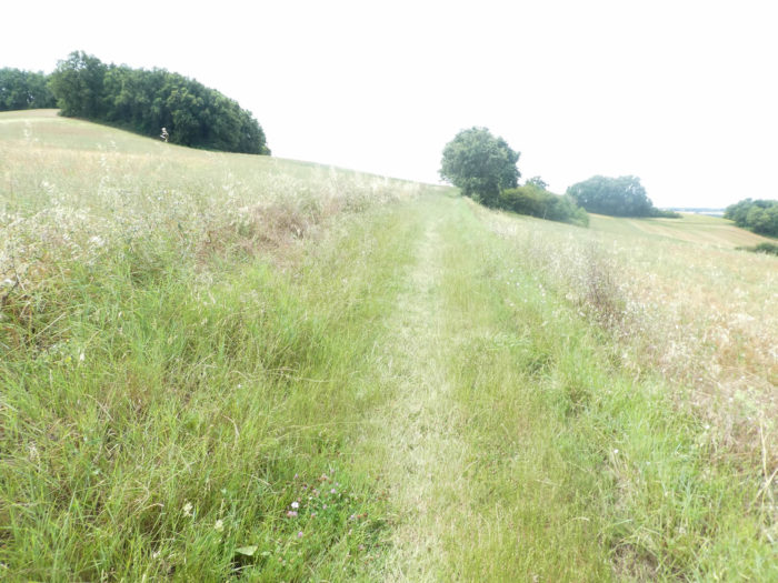
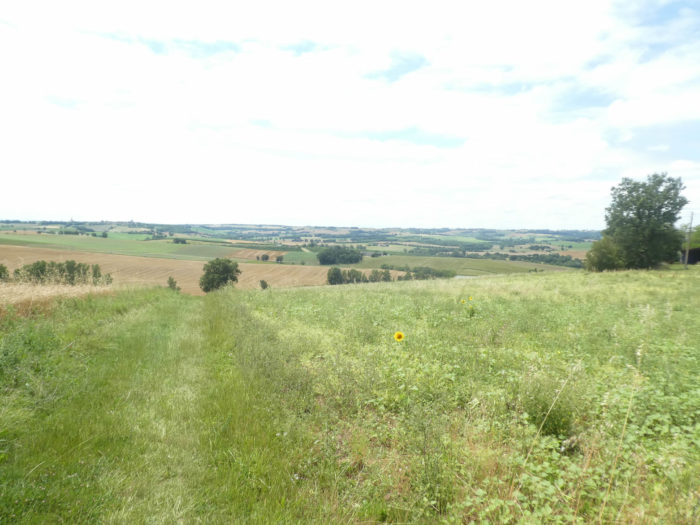
| You’ll then keep on climbing up the hill, today in the tall grass of the fallows. |
 |
 |
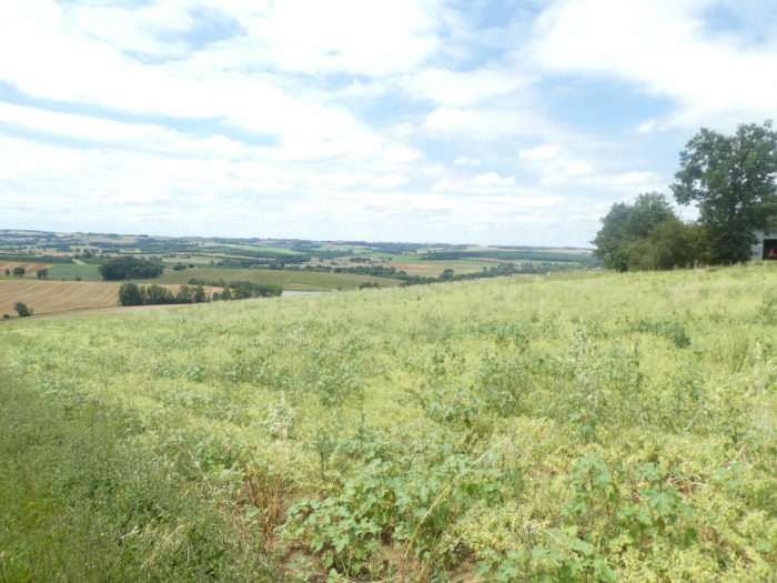
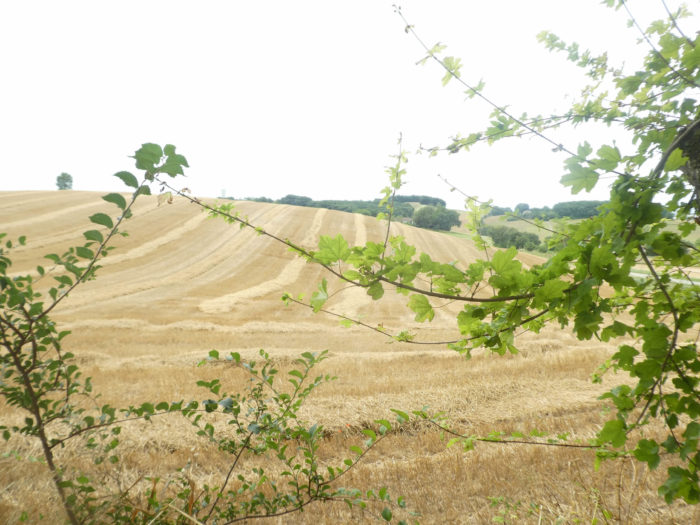
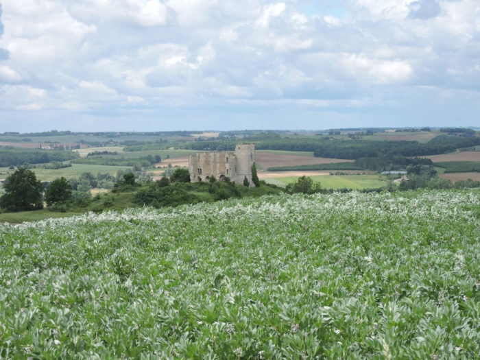
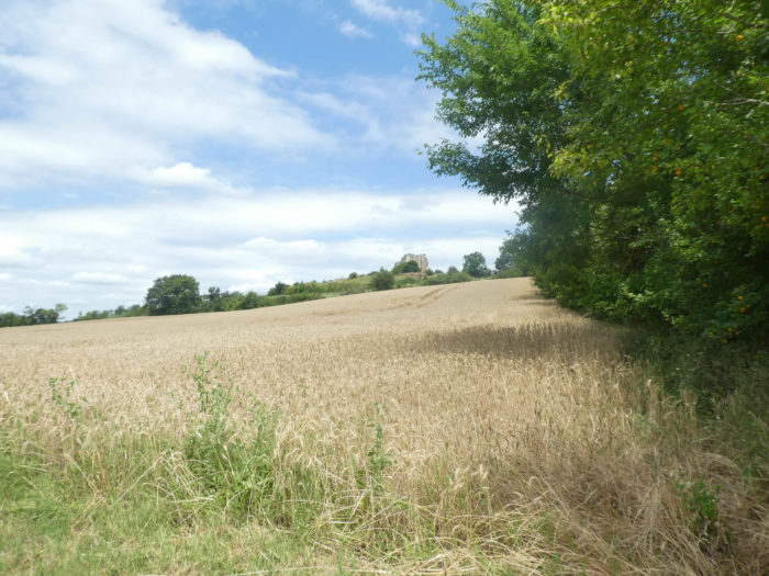
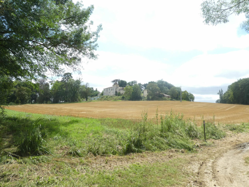
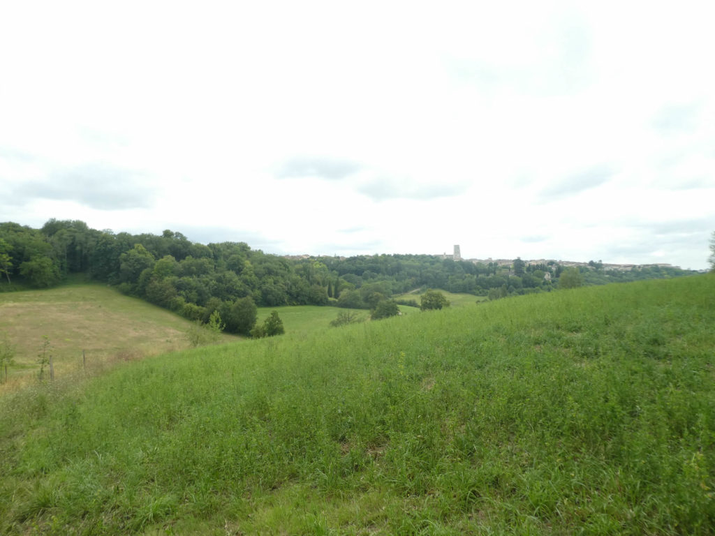
| At the hilltop, the horizon opens up onto the vastness of the Gers countryside. Before your eyes stands a castle that you have not finished walking around, but from a distance. This is the Château de Gachepouy, a name coming from the Gascon gachar, meaning to watch, and pouy, designating a height. This castle would have been built in the XIVth century, for defensive purposes. It passed thereafter in many families, was arranged over the centuries to be still inhabited at the beginning of the XXth century. It was abandoned during the First World War, and today it is nothing more than a heap of ruins, the stones of which were recovered over time. |
 |
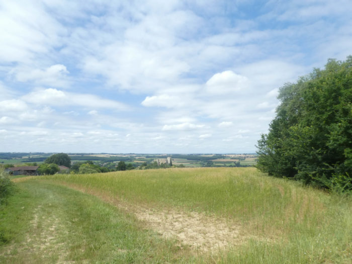 |
| Here, a few farms brighten up the round hill, in the middle of the wheat. The country is so vast and so depopulated, that only a few rare farms are scattered along the way. It is said here that many peasants cultivate more than 150 hectares of land. Miradoux is the least populated and the most agricultural region of the Gers. But you will no doubt be surprised to hear English spoken in the villages. British retirees have moved there, at low cost, as in general in the South West. |
 |
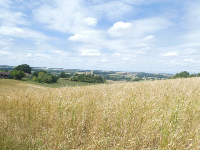 |
| We have already said it many times, every year, or almost every year, the peasants change the landscapes with their cultures. So here are two images from a previous trip in the spring. In the previous climb, now fallow, it was wheat, and here in front of the castle, it was soy. |
 |
 |
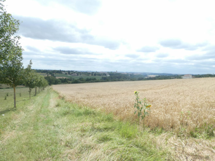
| A wide pathway descends between the fields of cereals and the fallows. A water reservoir below cuts the monotony of a landscape that never stops dragging itself through the fields. The fields undulate smoothly, like waves, caressed by the breeze. What if it was happiness? Come on! The countryside is very beautiful and relaxing here. |
 |
 |
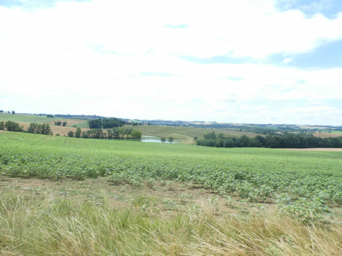
| The descent from the hill is long. In the distance, with practice, you’ll almost manage to give names to these cultures, which emerge as a patchwork of wavy surfaces, of different colors. The pathway goes around the castle on the other side, which remains all alone up there on the hill. |
 |
 |
| From one hedge to another, from a sunflower field to a wheat field, you’ll gradually approach the bottom of the descent, near the water reservoir, which is supposed to irrigation of fields. |
 |
 |
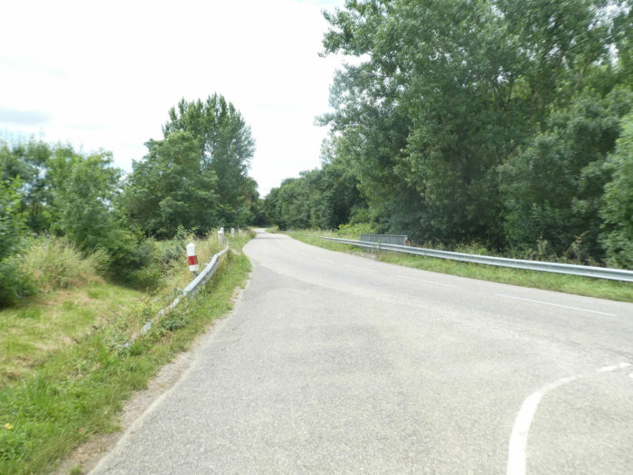
| The descent ends on a small asphalt road which joins the departmental road. |
 |
 |
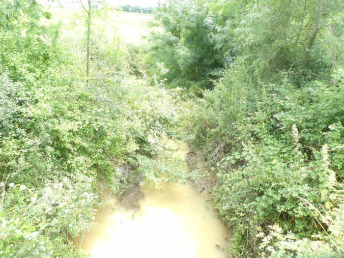
| Here the GR65 crosses the small Auroue River, with cloudy water lost in the weeds. |
 |
 |
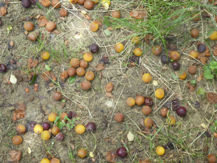
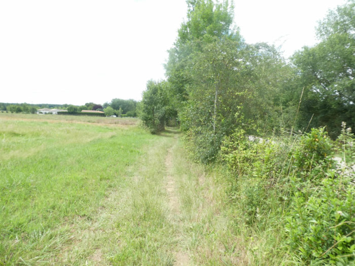
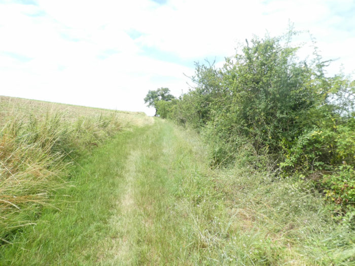
| It then plunges into the brush on a small lane, parallel to the road. If you walk here for the right time, you can gorge on wild plums, which are quite abundant in the region. |
 |
 |
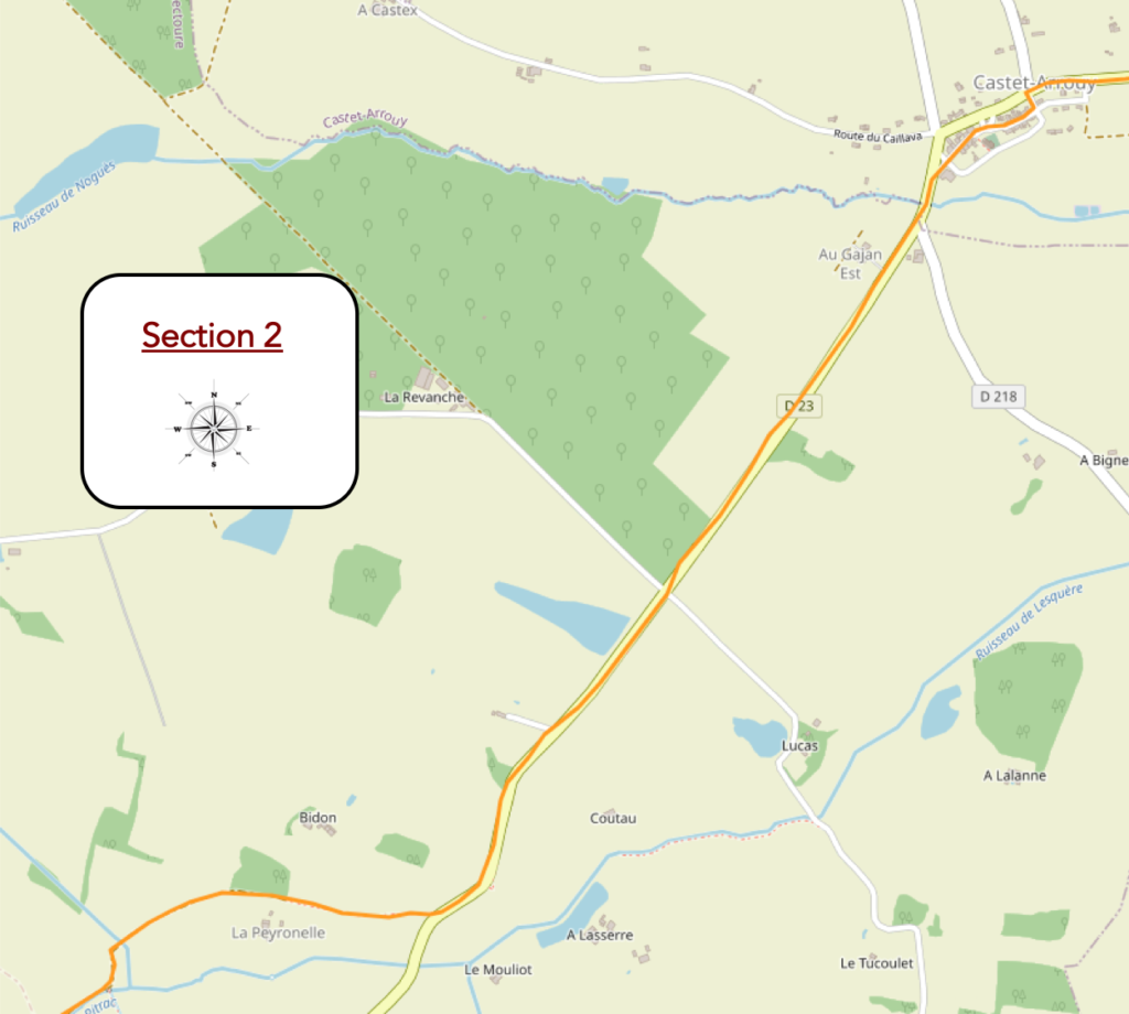
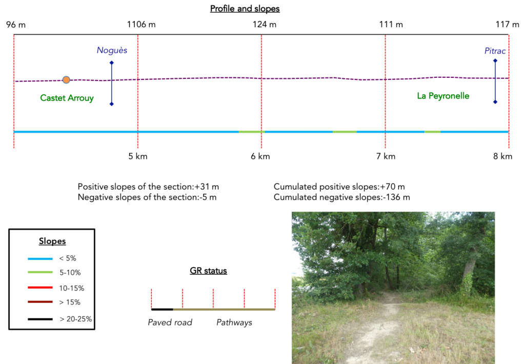
Section 2: Long travels near the departmental road.
General overview of the difficulties of the route: course without any difficulty.
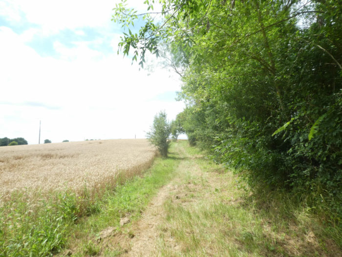
| The pathway will still visit some fields of cereals to arrive in the meadows on the outskirts of Castet Arrouy. |
 |
 |
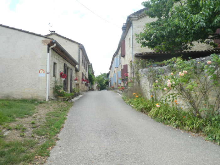
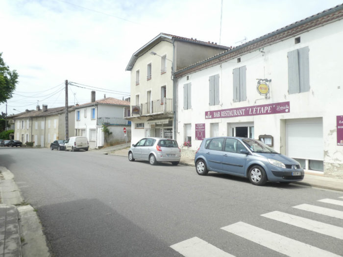
| A small road wanders through the outlying districts, before entering the village of Castet-Arrouy (180 inhabitants), crossed by a charming street. |
 |
 |
| In the charming and welcoming Church Square, the restaurant is often taken over by pilgrims. |
 |
 |
| The 16th century church of Ste Blandine, which has since been altered, very dark and a little too busy, has a pretty octagonal bell tower. |
 |
 |
| At the exit of the village, the road crosses at a crossroads a Virgin, who also watches over the village. Decidedly, in all these villages, the statues are identical, as if they had been made by the same author, all dressed in the same blue and white uniform, conforming. |
 |
 |
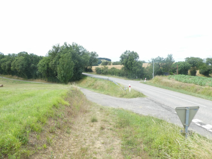
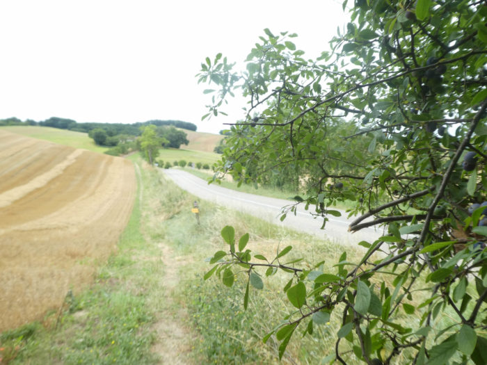
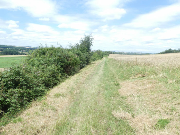
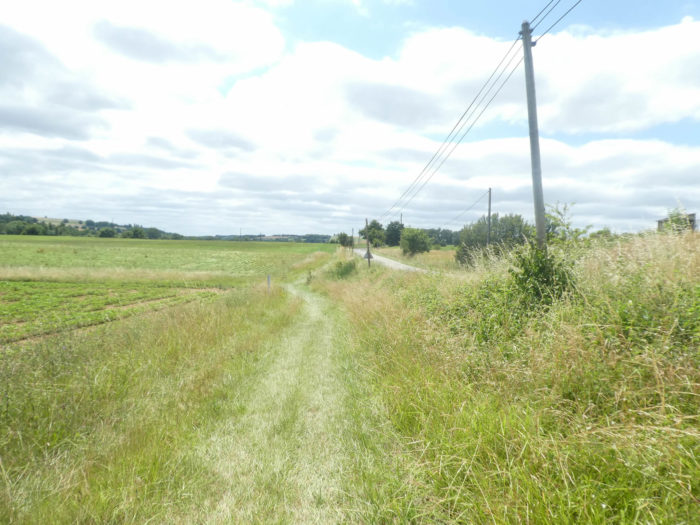
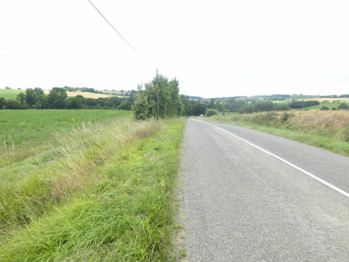
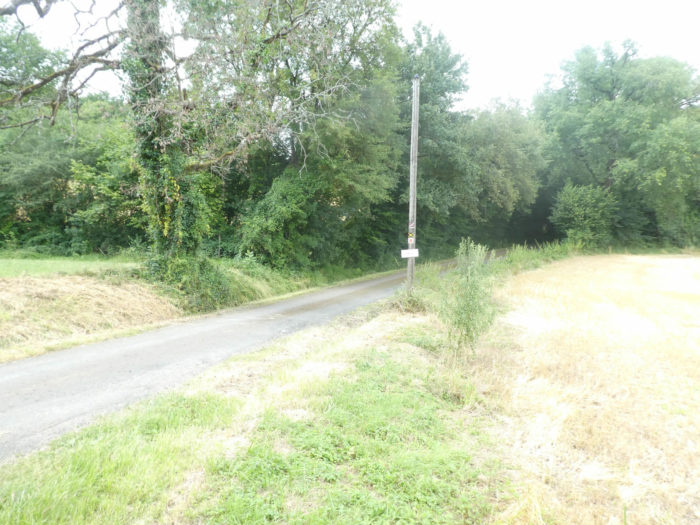
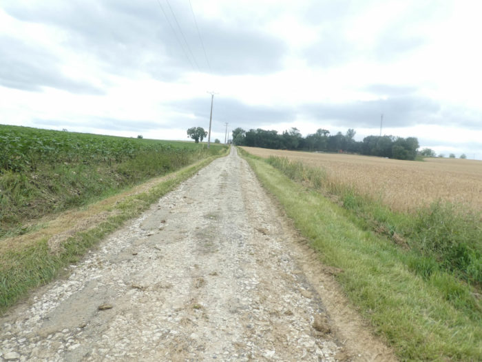
| From here you will enter a part of the track that is unlikely to generate much enthusiasm. You are 10 kilometers to Lectoure, and the GR65 flattens on the grassy strip along the departmental road. |
 |
 |
| The game consists of passing alternately from one side of the road to the other. Dangerous to cross the road, you’re kidding! A vehicle must pass here every quarter of an hour. The pathway is a long artery in the brush. |
 |
 |
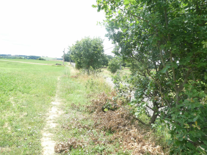
| Nothing happens here, except to take a look at the brush on a long straight line. Suddenly a little wood twisting in the oaks and maples, that will change, right? |
 |
 |
| Yes, this is the signal that the pathway will pass to the other side of the road, near a small lake at the place of Ste Marie du Gajan. Here the crops seem less gigantic, and often a few meadows stick their noses, where the land is probably less fertile. |
 |
 |
| Nothing changes in the monotony of the landscape, except that now the sunflowers have taken the place of the brush in what appears to be quite marshy terrain. The road stretches through a countryside as flat as a pancake, alternating sunflowers, and fallow fields, covered with green manure. |
 |
 |
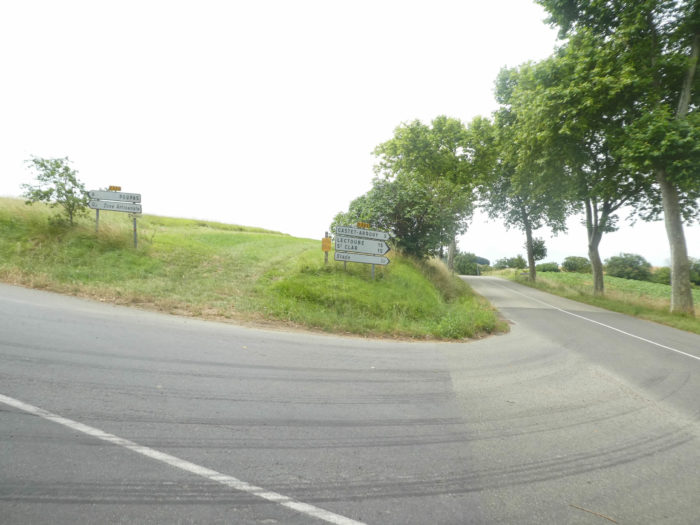
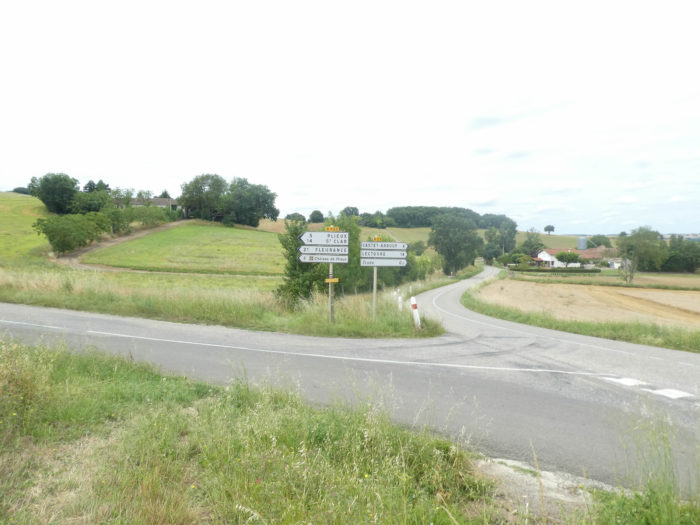
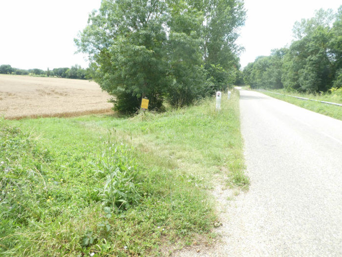
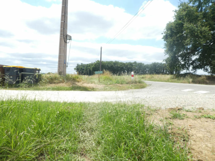
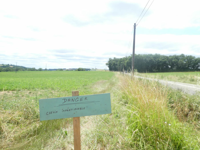
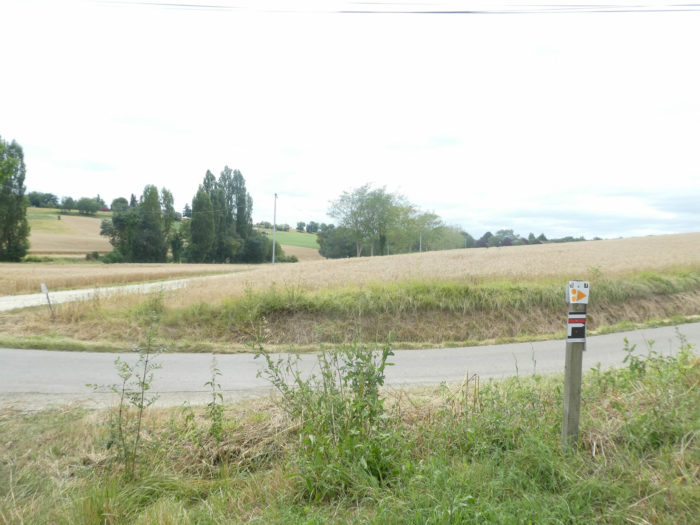
| Then, suddenly at the intersection of a country road, here is a sign urging you to leave the track, because of danger. There was a strong thunderstorm two days earlier and the whole region was ravaged, with the Pitrac stream overflowing in many places. The message had already been given in Miradoux, and they advised you there to follow the road. With such messages, some pilgrims obeyed the instructions and many have made the departmental road, from here for more than 8 kilometers to Lectoure. But not all, of course. Some pilgrims have no qualms wading through the mud. Just wash your shoes at the end of the stage. Danger, there is nothing dangerous. Pilgrims are often mistaken for school children. But at least they are warned. Moreover, the organizers of the trails are vigilant, since they have placed this warning sign here, in direct time. Well done and thank you for them! |
 |
 |
| The last time we passed by here it was pouring rain. So, a little more mud wasn’t going to change the face of the universe. We did get out of the grassy path for a while to pass on the road. Who knows? Anyway, a few hundred yards further, the track seemed perfect. |
 |
 |
| We therefore, at our own risk, continued on the pathway that leaves the departmental road. There was no sign here either. Why? You understand the difficulty of signaling the tracks in direct time. The great and generous volunteers, who organize these tracks, are not always available. |
 |
 |
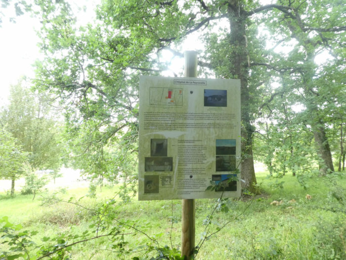
| The GR65 continues on its way to climb a gentle slope, through maple trees and oaks, to a place called La Peyronelle. A sign at the edge of the grove tells the story of this former XIIth century country hospital, of which some remains of masonry and small columns remain, included in a large farm on the hillside. |
 |
 |
| The pathway crosses the undergrowth, then continues through the sunflowers towards the Pitrac brook. Should we expect the worst today? |
 |
 |
Section 3: Over hill and dale along the Pitrac stream.
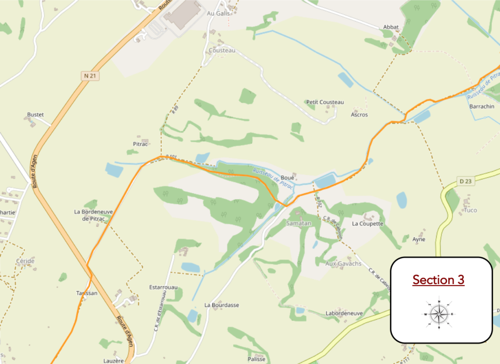
General overview of the difficulties of the route: a little climbing, all the same, but nothing difficult, at least in good weather!

| And here, we swallowed unpleasant track for almost a mile. Not only had the stream overflowed into the fields, but the storm had washed away the loose soil. Granted, the muddy ground was no higher than the ankles, but the difficulty was not to lose his shoes in the sticky mud. |
 |
 |
| It was no easier to walk in the spongy grass than on the flooded ground of the fields. In places, the stream, usually so quiet and that you can hardly see, formed real little lakes, useful in any case for partially unclogging his shoes, which had become heavy, as if bundled up by real stumps of sticky dirt. It’s not our habit to complain. Most of the time, we show you stages made in good weather. But, everyone knows, this is not the customary reality of the track. It is for this reason that, for once, we are describing a track that is not always paved with roses. Today it took us a good quarter of an hour to scrub and wash our shoes, which weren’t dry the next day. |
 |
 |
| Here the pathway runs along the undergrowth of the stream, with fields all around. The difficulty when walking here in difficult conditions is that there are no big stones in the way. Because, the latter are then very useful, to put down your shoes, in paths that turn into streams in heavy rain. |
 |
 |
| Further on, the pathway begins to climb the hill. So, in our misfortune of the day, it heralded a potential decrease in the risk of a possible, but unlikely, stagnation. |
 |
 |
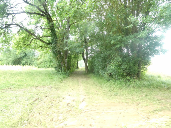
| The pathway then reaches a pretty little lost lake, under the ash trees, in the reeds and tall grass, where the stream flows. |
 |
 |
Further up, the pathway runs below a very beautiful mansion, which plays the castles, perched on the hill. Now the mud is gone.
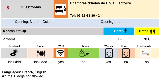
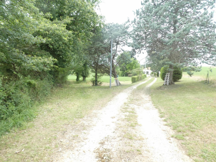
| Shortly after, GR path joins a dirt road, where there is a direction for Boué, where a gîte is available. |
 |
 |
| But it does not follow for long the road which becomes a dead end. Immediately a stony lane climbs into the undergrowth where today we see some devastating signs of the recent storm. |
 |
 |
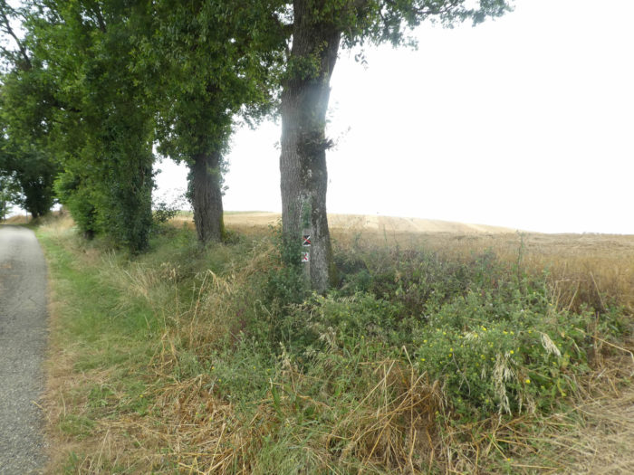
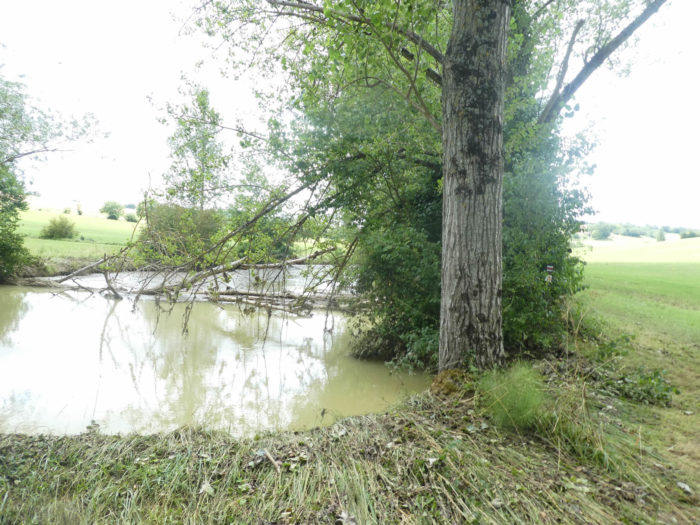
| Further afield, the pathway climbs a little more steadily through oaks, chestnuts and hornbeam shoots. |
 |
 |
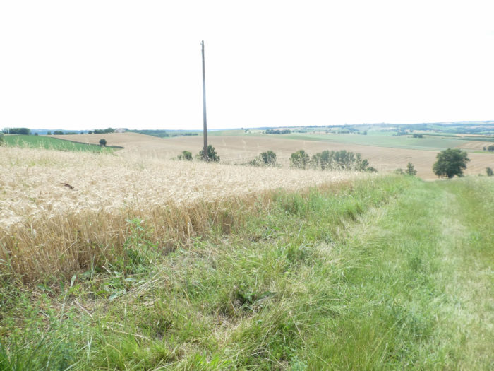
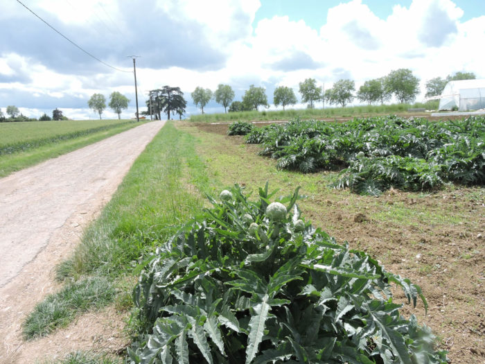
| Coming out of the woods, a wide stony road climbs up to a slope of almost 15%, today between sunflowers and wheat. Further up, the pathway crosses a large vegetable farm. We came here recently during a bad outbreak, and crops were at a minimum. |
 |
 |
| When we passed here under normal conditions it was full of veggies and berries including strawberries, zucchini or even artichokes. Yet, Gers is very far from Brittany! |
 |
 |
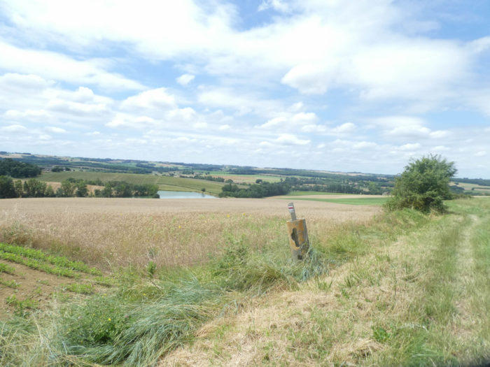
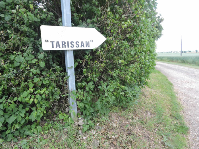
| Beyond the farm, the pathway crosses N21 national road, the road coming from Agen, going south through Lectoure. Here the track heads to a a locality known as Tarissan. |
 |
 |
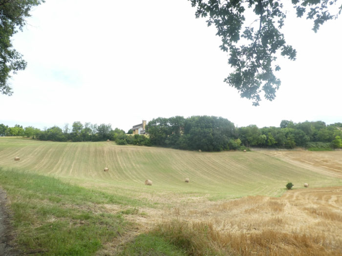
The GR65 will then flatten or very slightly slope down on a large plateau. From here you will see Lectoure and the nearby cathedral bell tower. Do not be fooled, this is just an illusion. You appreciated Lauzerte’s endless approach. Here it is even longer. You will still have to walk about 5 km to reach Lectoure. Just increase the zoom of the photos to promote the illusion of a near deliverance. It is not the same for the feet!
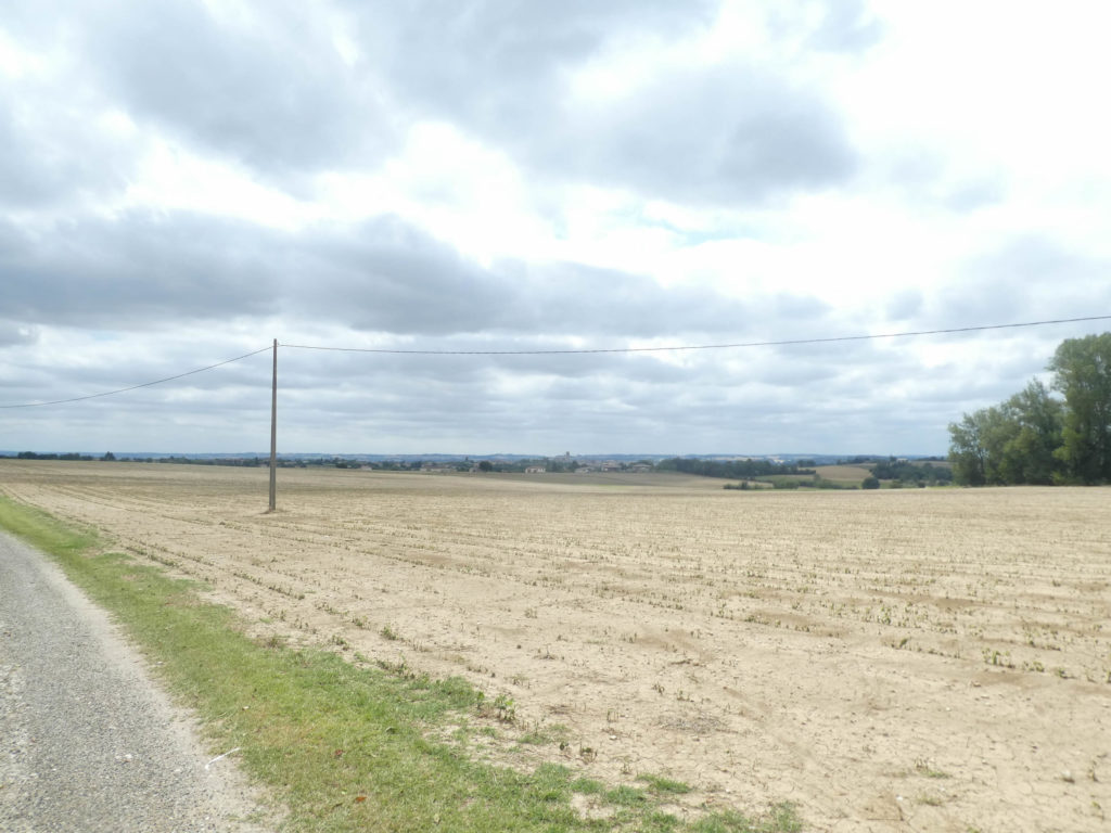
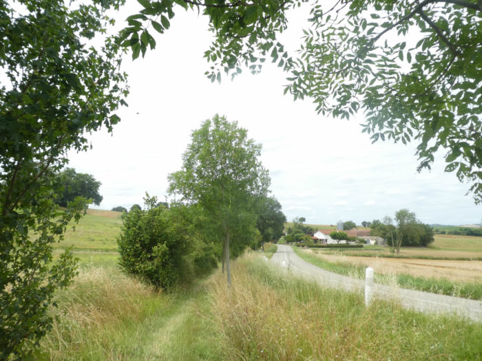
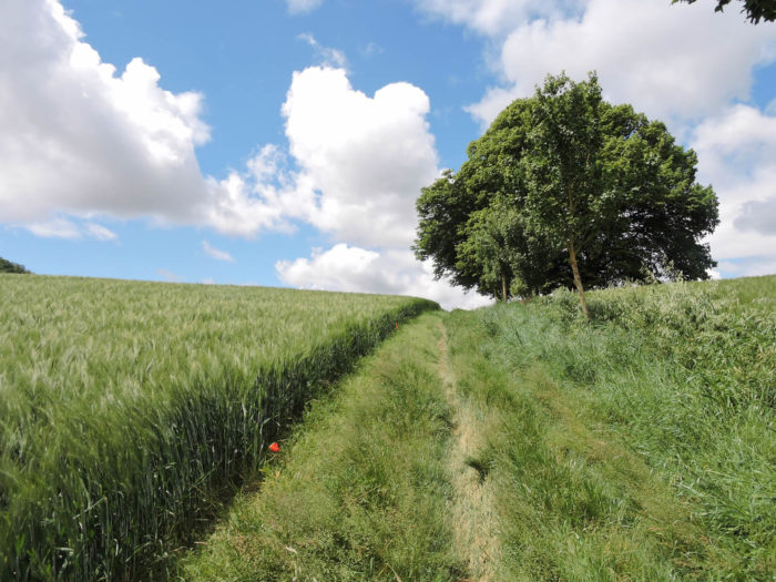
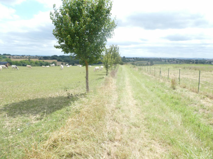
| You’ll then walk in the grass, on the edges of fields and meadows, along young maples planted to mark the way. There are even cows here, which is rare in Gers. Gers is no longer a breeding department. |
 |
 |
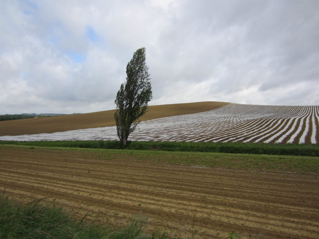
If you walk through these regions on another day, you might have very different cultures, for example crossing cultures of Charentais melon, one of Lectoure’s great specialties. If it weren’t for the tarpaulins, you could say you are in the dunes of a desert. Here, the melons are cultivated in a “tunnel ”or in “chenille” protected under hoops or plastic sheeting, or fabric canvas. Others are grown in the open field, depending on the season.
Section 4: Through the large fields of Lectoure.
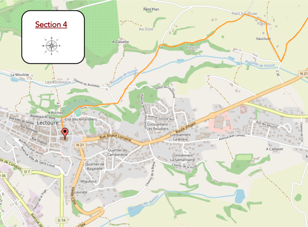
General overview of the difficulties of the route: easy course before the rather tough slope that leads to the citadel.
| Shortly afterwards, the pathway descends steadily, now through wheat fields and green manure-covered fields, another year perhaps through sunflowers and soybeans. There is little corn in the Gers. The corn is for later on the way, but you will see it until nausea. Wait a bit … |
 |
 |
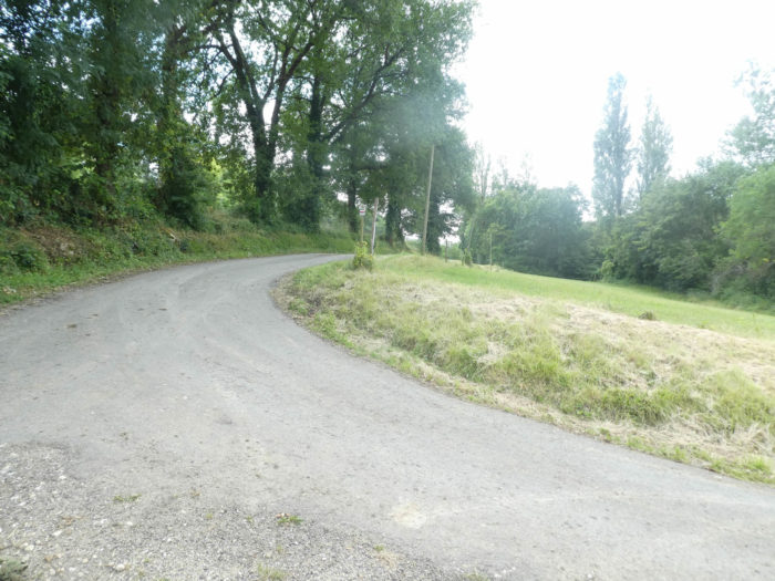
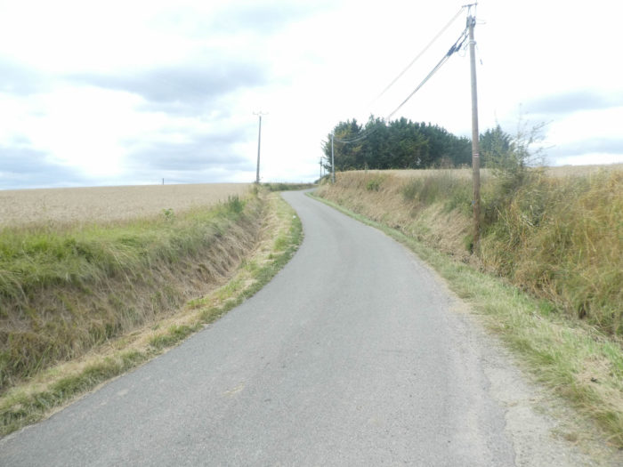
| At the bottom of the dale, GR path finds a paved road that climbs back, also steadily, in the cereal fields on the hill. |
 |
 |
| The road crosses farms and housing estates. You get closer to Lectoure, which you’ll see standing on a distant hill. You’ll quickly guess that you’ll have to slope down in the dale, then climb to the city. |
 |
 |
| Which is indeed the case. Immediately, the GR65 leaves the paved road for a dirt route sloping down into a deciduous undergrowth, where oaks and maples still dominate. Here wild walnut trees have replaced chestnut trees. |
 |
 |
| But it is not a dense undergrowth, it is rather hedges which border the fields, where the cereals remain on the heights and the sunflowers at the bottom. |
 |
 |
| The pathway then follows the hedges, where you can measure the intensity of the recent storm, by seeing the chopped leaves on the track. |
 |
 |
| At the end of the dirt road, the GR65 joins a small asphalt road which descends to the bottom of the dale. |
 |
 |
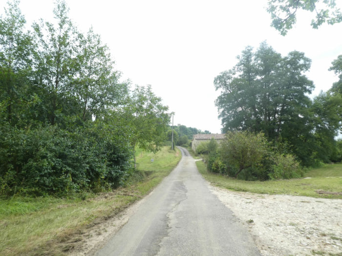
Further down, a lane, fond of these unnecessary detours, takes you to visit the undergrowth again, to join the paved road a hundred meters further. You can continue comfortably on the road. From here you have Lectoure in front of you, getting closer and closer. You’ll eventually get there.
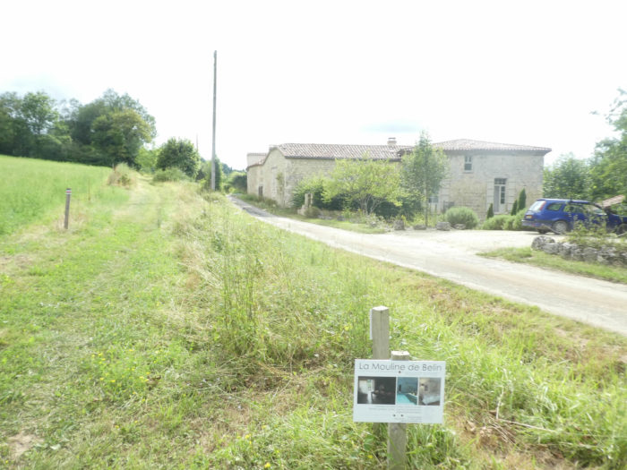
| At the bottom of the dale, the road passes to La Mouline de Belin, where you can find accommodation. Here you are under the town of Lectoure. No matter how much you look up, the city walls above are still invisible. |
 |
 |
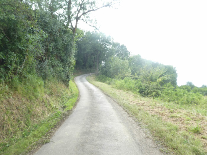
| Here too, an unnecessary lane has been drawn in the grass above the house so as not to let hikers pass on the road. Yet, there is no traffic. You can stay on the road. Moreover, GR path does not take long, reluctantly, to immediately join the small road. And the road climbs here, almost 15% incline. The coast is tough, fortunately not very long. In Lectoure, it is often claimed that the pilgrims who come from Auvillar in one stage, more than 20 miles from here, arrive there on their knees. |
 |
 |
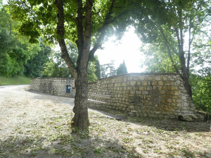
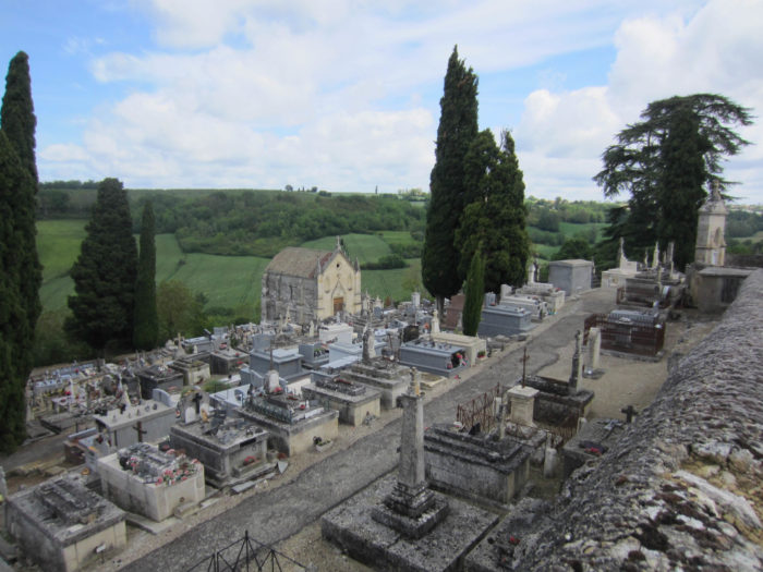
| The deliverance is a small bench next to a magnificent cemetery that gets lost on the way down the hill. |
 |
 |
For your plasure…
Wait for the video to load.
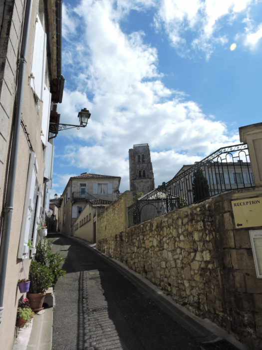
| Lectoure is just above the cemetery, behind its walls. Lectoure is then yours. |
 |
 |
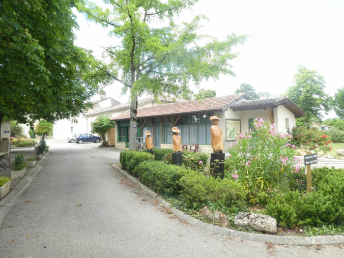
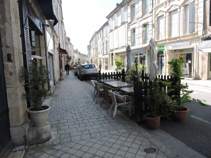
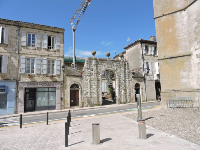
| The city of Lectoure (3,700 inhabitants) is crossed right through by the Route Nationale, a former royal and imperial street, where here and there you can see beautiful mansions dating from the 17th-18th century. The city is surrounded by ramparts, but the access gates have all disappeared today. The city seems livelier than the one we have visited in recent days. |
 |
 |
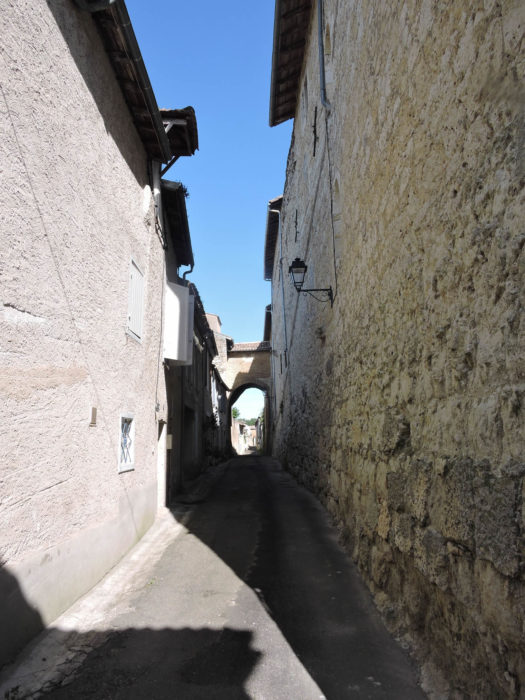
| From the Rue Nationale start small dark alleys that go to the ramparts all around the city. |
 |
 |
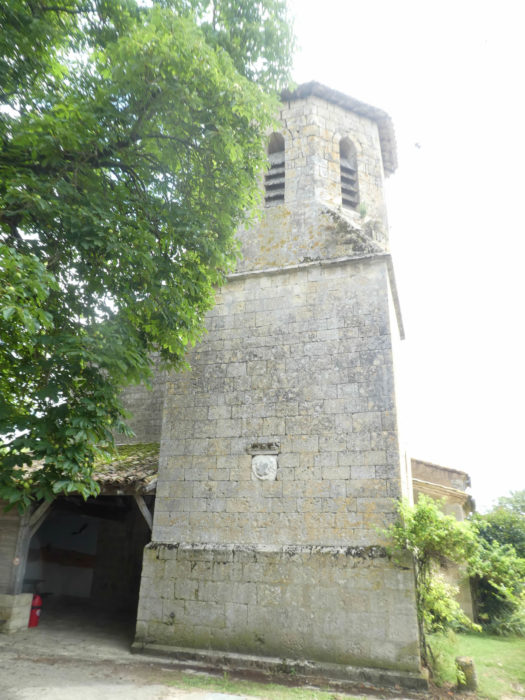
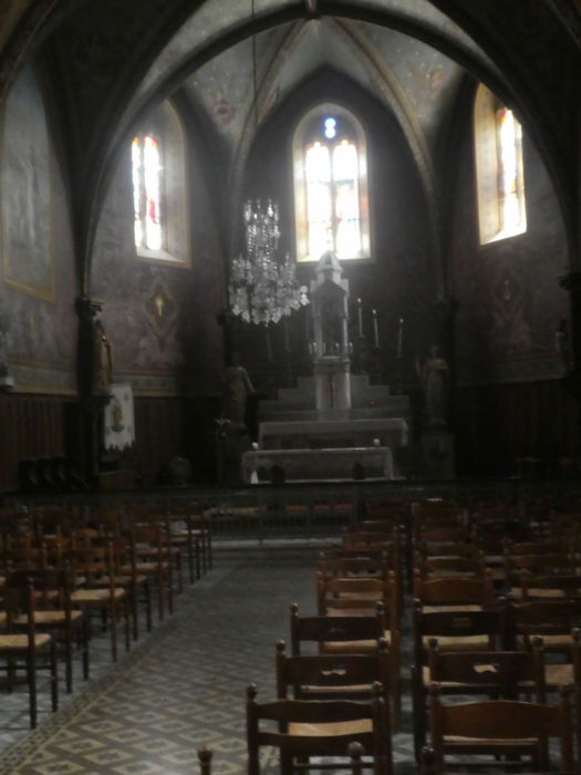
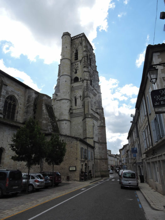
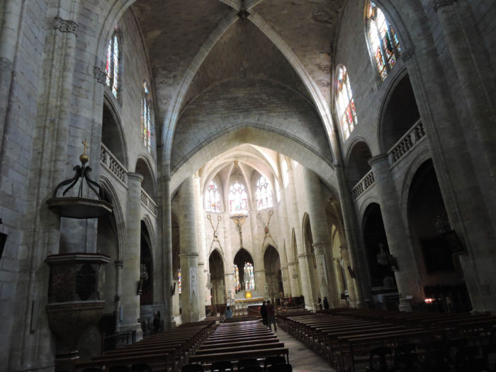
| St Gervais and St Protais Cathedral has a long history. The Romanesque nave has been altered over time to match the Flamboyant Gothic style. The octagonal tower, planed over time during the Revolution, unfortunately no longer has a steeple. The church preserves the relics of St Clair of Aquitaine, Bishop of Albi and Lectoure. |
 |
 |
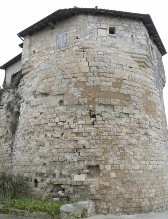
| Note also in this beautiful city the 16th century Executioner’s Tower, the only original tower preserved, and the Carmel, which still houses some Carmelite nuns.
There are still some wonders going down the walls, which you will visit in the next stage. |
 |
 |
Local gastronomy
Yes, you are in the Gers, therefore in the South-West. The Gers network includes over thirty farms producing poultry, geese and ducks, especially foie gras. All the same, more than 500,000 birds go to the pan each year, or 1,300 per day! Enjoy your meal! So, you are going to eat duck, that’s obvious. This is the staple food of the Southwest. In aiguillettes, in foie gras, in gizzard salads, with cassoulet, most of the time in confit.
But, in Lectoure, in season, don’t forget to taste the melon. For many connoisseurs, it is finer and sweeter than Cavaillon melon, whether eaten plain or with a dash of floc, a liqueur produced from neighboring Armagnac. Another great local specialty is white garlic. So, of course, let’s go with it for a sautéed foie gras with Limogne garlic!
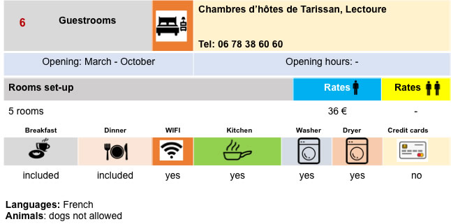
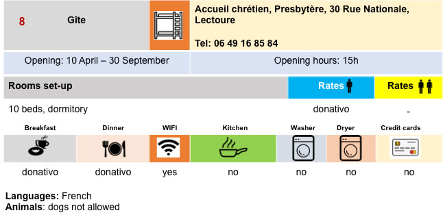
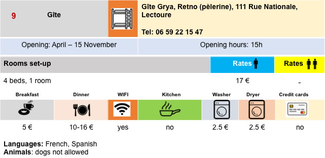
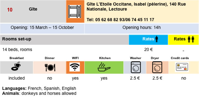
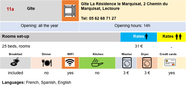
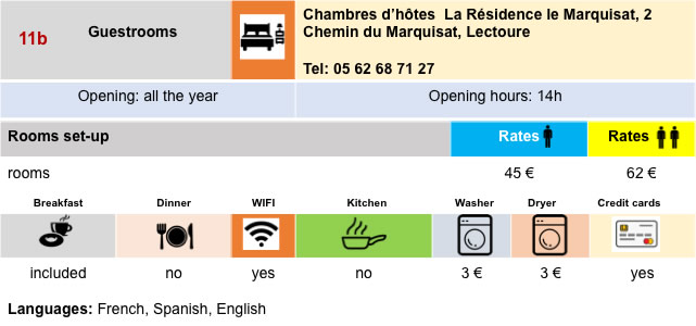
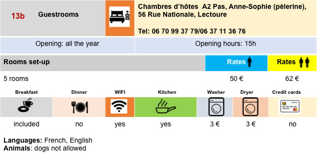
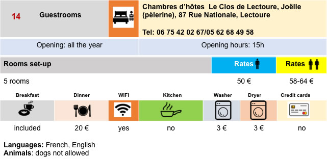
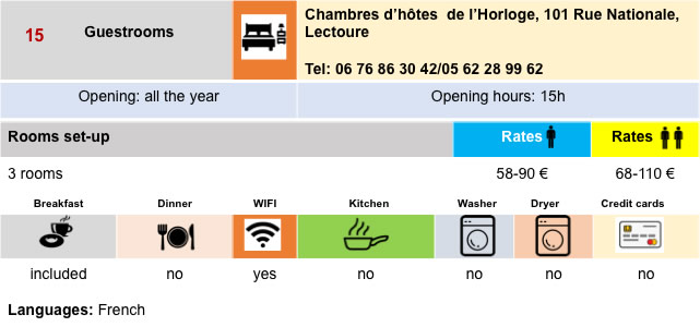
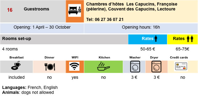
Lodging


Feel free to add comments. This is often how you move up the Google hierarchy, and how more pilgrims will have access to the site.
|
 |
Next stage : Stage 23: From Lectoure to La Romieu |
|
 |
Back to menu |