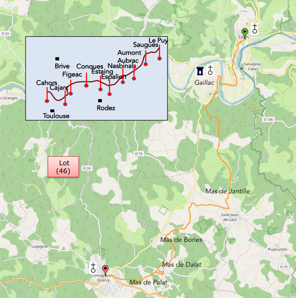
Somewhere in the vernacular heritage of the vast Causse de Limogne
DIDIER HEUMANN, MILENA DALLA PIAZZA, ANDREAS PAPASAVVAS
We divided the course into several sections to make it easier to see. For each section, the maps show the course, the slopes found on the course, and the state of the roads. The courses were drawn on the “Wikilocs” platform. Today, it is no longer necessary to walk around with detailed maps in your pocket or bag. If you have a mobile phone or tablet, you can easily follow routes live.
For this stage, here is the link:
It is obviously not the case for all pilgrims to be comfortable with reading GPS and routes on a laptop, and there are still many places in France without an Internet connection. Therefore, you can find a book on Amazon that deals with this course. Click on the book title to open Amazon.
 |
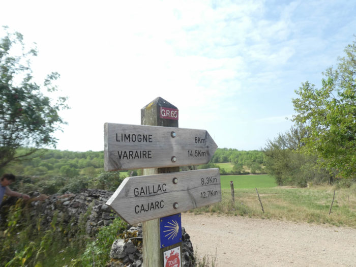
The Camino de Santiago in France / V. From Puy-en-Velay to Cahors (Via Podiensis) on GR65 track |
If you only want to consult lodging of the stage, go directly to the bottom of the page.
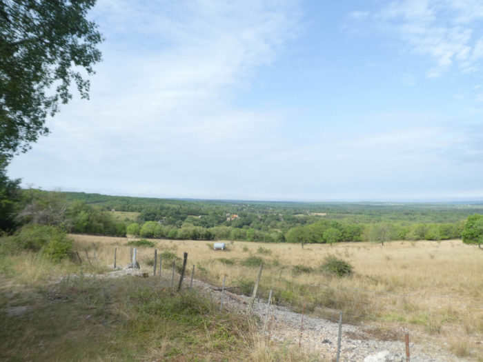
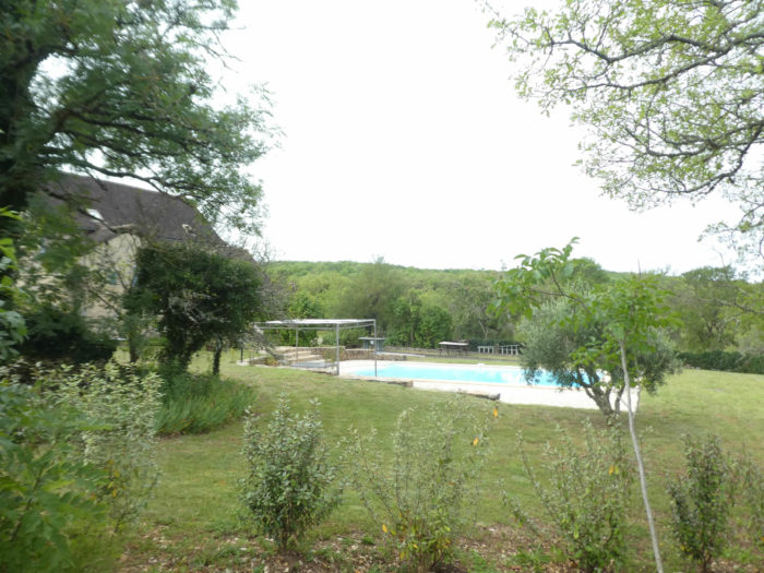
Today’s stage takes place in the Causse de Limogne, which is also part of the Causses du Quercy Regional Nature Park. You leave the verdant Lot Valley to get in touch with the aridity of the causse. In this kingdom of stone and oaks, truffles sometimes grow here at the foot of the dolmens. Today the track falters Lot River, heading towards the south of Lot department. Here, no mountains on the horizon, just the majesty of the causse.
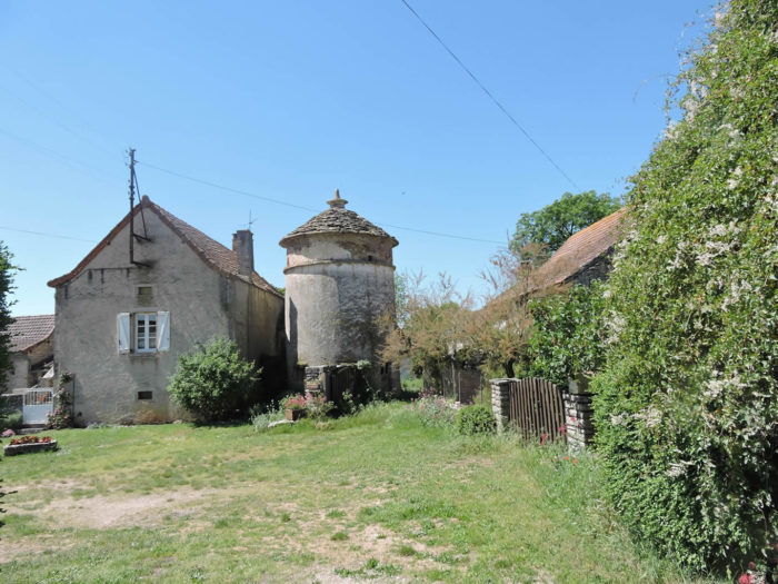
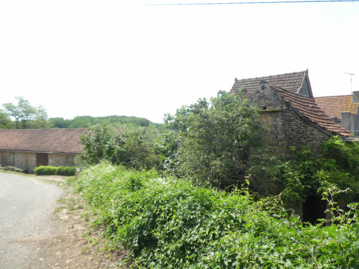
The vernacular heritage is present everywhere on the stage. The countryside is strewn with dry stone walls along the tracks, called here “cayrous”, more numerous than the “caselles” or “gariottes” that you now know well. As with the “caselles”, the “cayrous”, cayrous originate from the stone removal of fields to allow sowing. But these stones were also used to build curious villages of flat stones. Near the water points appear curious wash houses, called “butterfly wash houses”, used for washing clothes until the 20th century. The magnificent dovecotes, which compete in style and composition, cannot be overlooked. Formerly called dovecotes, they were used to attract pigeons, which provided valuable fertilizer. Here, owning a dovecote was the outward sign of wealth. But now, time has passed. Many dovecotes and many dry-stone buildings are abandoned or in a serious state of disrepair. This is also what makes the charm of the causse. Here, no big villages, but islands of grouped houses, which they call here mas. There is more than a dozen such hamlets in the region.
Here again, in recent years, the route has been modified near Gaillac. But, this is a minor change, which only adds a kilometer, which will be said to be unnecessary, to the previous course.
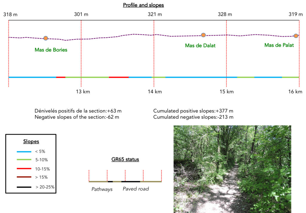
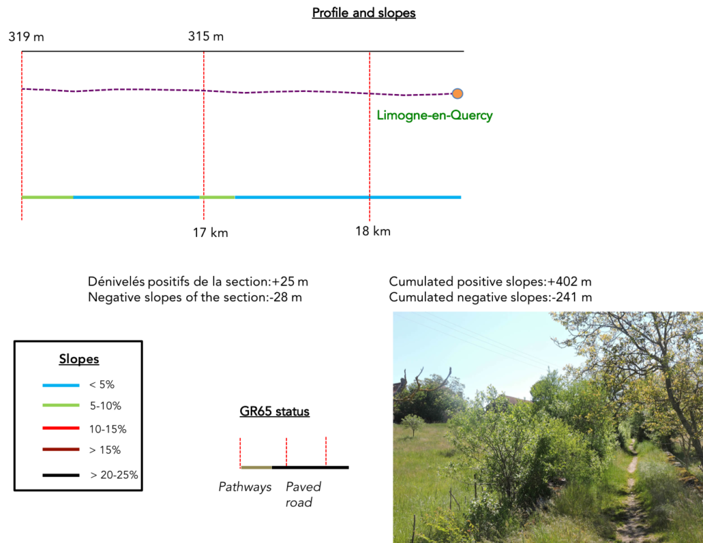
Difficulty of the course: Slope variations (+402 meters /-241 meters) are quite reasonable, but the stage is short. As is often the custom on the Camino de Santiago, the stopover towns are in the plain and the route gets lost on the heights. Today’s stage is no exception. You have to leave the Lot plain and climb to arrive on the causse. Thereafter, the route undulates in ups and downs without big difficulties.

Here is a stage where you will walk as much on the tar as on the dirt:
- Paved roads: 0.0 km
- Dirt roads: 9.4 km
Sometimes, for reasons of logistics or housing possibilities, these stages mix routes operated on different days, having passed several times on Via Podiensis. From then on, the skies, the rain, or the seasons can vary. But, generally this is not the case, and in fact this does not change the description of the course.
It is very difficult to specify with certainty the incline of the slopes, whatever the system you use.
For “real slopes”, reread the mileage manual on the home page.

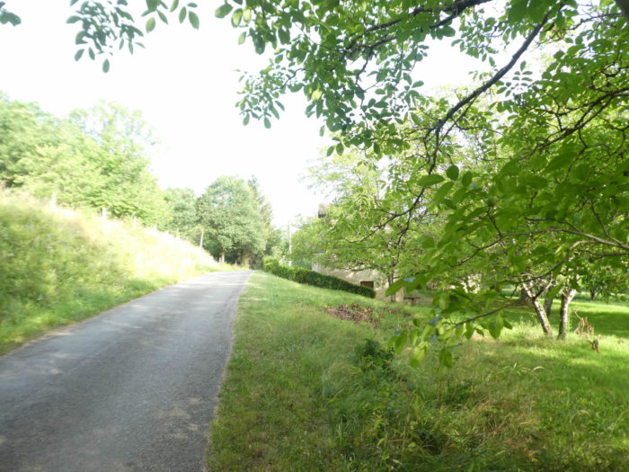
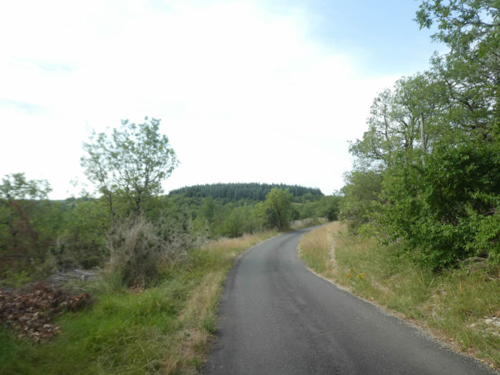
Section 1: A short trip around the Lot loop.
![]()
General overview of the difficulties of the route: generally, a gentle slope to Gaillac, except for a few short steep paths before the chapel, on the way out of Cajarc.

|
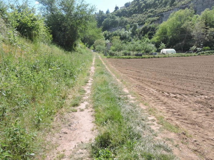
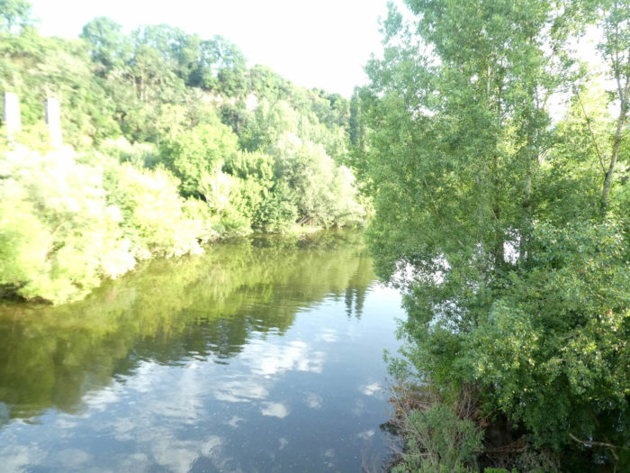
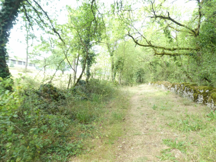
Out of Cajarc, the track does not cross the Lot River. It flattens along the bank of the river, passing through the fields. |
|
 |
 |
| Yet, on the Santiago track, everyone knows that after a few stages, you have to climb. At the end of the fields, a small steep lane leads you to the road that heads to Gaillac. | |
 |
 |
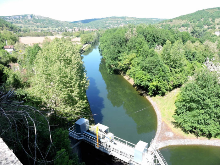
| On the way up, you can still see the old railway line, now disused, which linked Figeac to Cahors about fifteen years ago. The view of the Lot dams is breathtaking. There was a prosperous time in Cajarc, when there was intense river activity and the barges loaded with wine, phosphates or wood were to be seen heading towards Cahors. Gone are the days of the construction of a power station on the river. Navigation on the Lot is no longer possible here. The water level has been increased by a dam downstream from the entrance to a tunnel which once allowed boats to avoid a bend in Lot River. | |
 |
 |
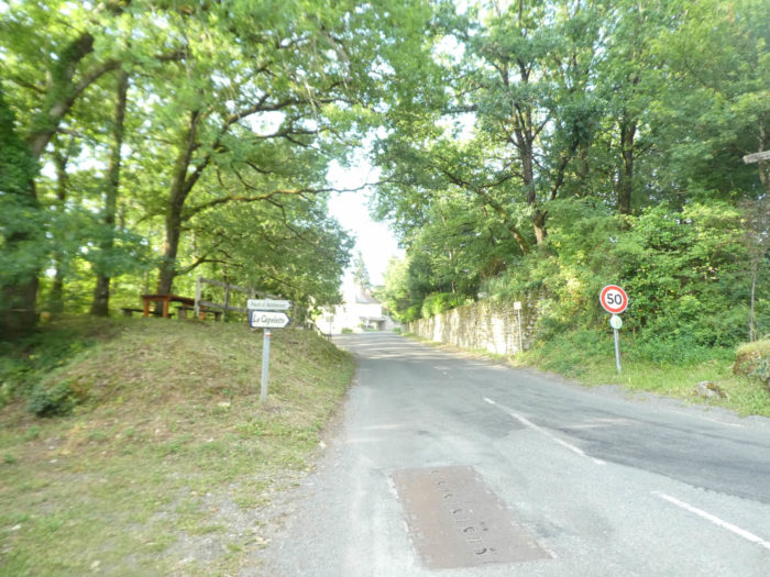
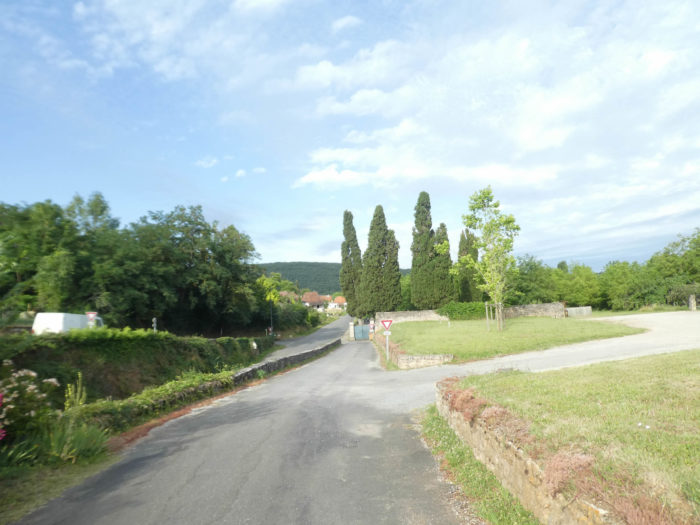
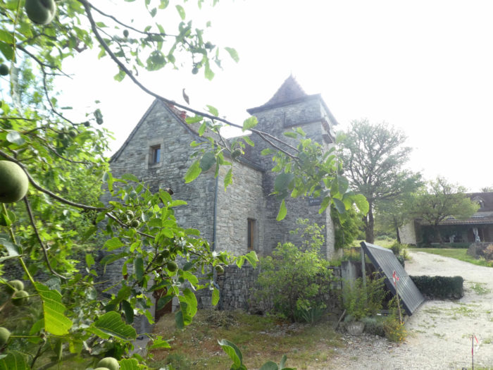
Immediately, a chapel stands at the edge of the road overlooking the Lot River: the chapel of the Madeleine, known as the Capelette de Cajarc. The 13th century leper colony, which was linked to it, gave hospitality to pilgrims crossing the causse.

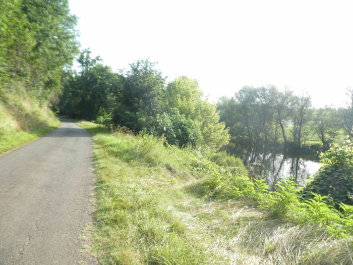
| The route continues to Andressac in a loop of the river, which has not finished behaving like this. The straight courses of the river can be counted on the fingers. This part of the journey is far from triggering the enthusiasm of the walker. It is, still on the tar, until arriving at the Bridge over Lot River. Near the picnic place at the chapel, therefore the GR65 takes the small road down to Andressac. | |
 |
 |
| The slope is gentle along the old and newer subdivisions, without much character. | |
 |
 |
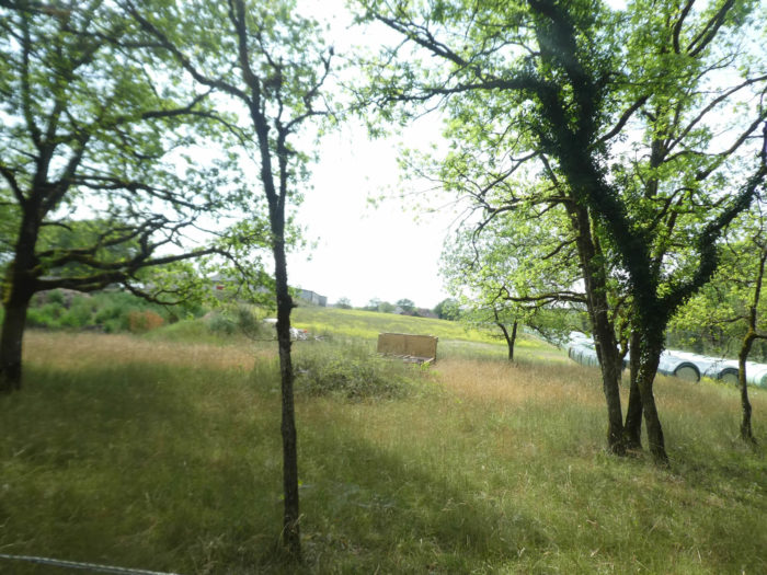
| At the bottom of the descent, the road joins the large cultivated plain where the Lot River flows. | |
 |
 |
| Cajarc has developed here, in the middle of the fields, a small industrial zone, without character, like all industrial zones in the world. | |
 |
 |
| You have to walk through this whole mundane area to find later a little soul. You’ll quickly see the Gaillac bell tower emerging above the hill. | |
 |
 |
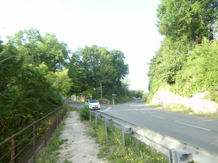
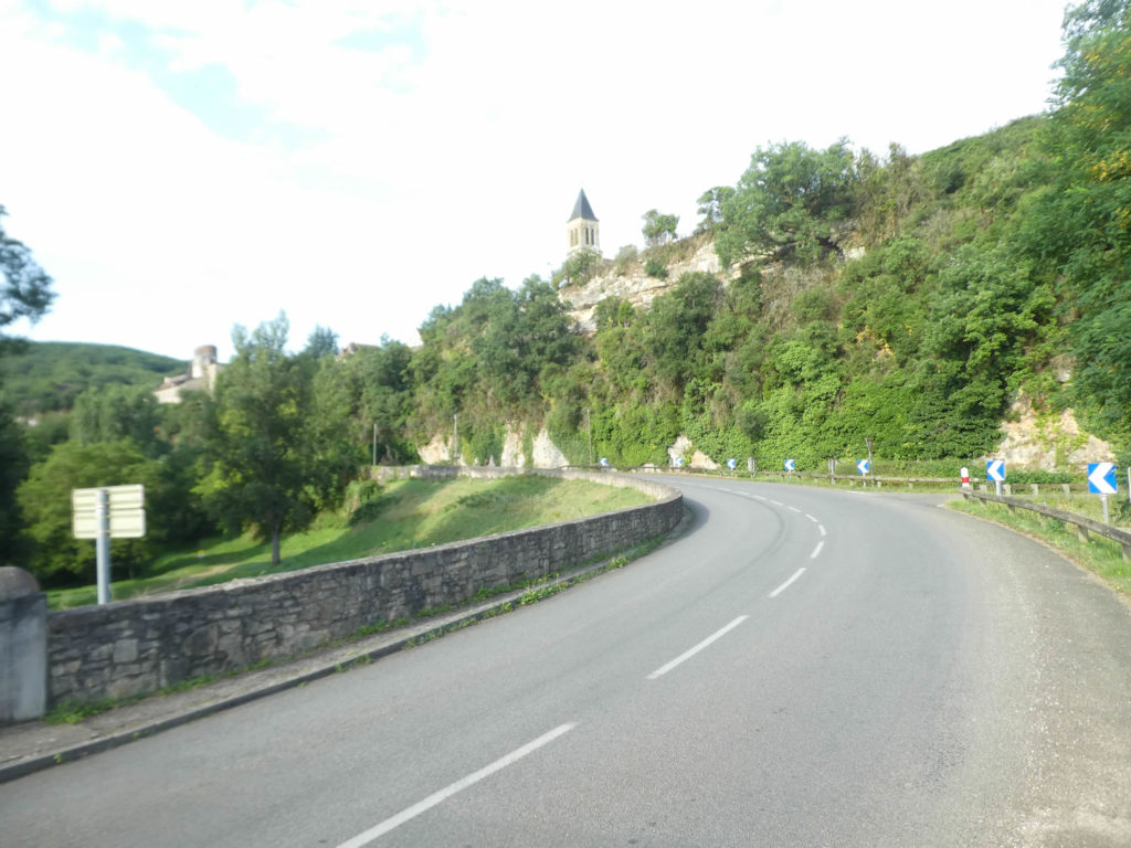
The road then approaches the piers of the old bridge.

| Shortly after, the river rolls peacefully its greenish blue flow, under the new bridge. | |
 |
 |
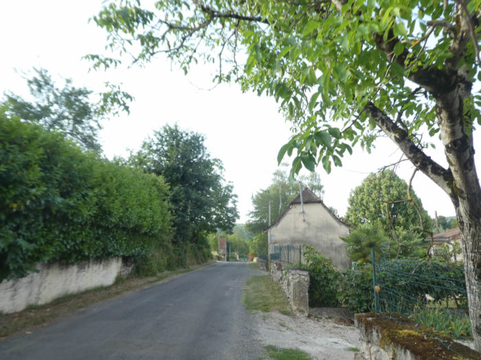
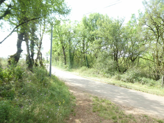
A stone’s throw away, just above in a cirque of hills, you can see the church of Gaillac from the bridge. In the past, after crossing the river, you had to follow the paved road that runs along the banks, slightly uphill to the outskirts of Gaillac. But now, the organizers of the trail have concocted a new program. A small detour of nearly 1 kilometer is offered to allow you to taste the charms of Gaillac. Certainly, in the minds of the organizers, departmental roads should be avoided as much as possible, even if the traffic is not extravagant here. Moreover, many pilgrims who read the map carefully before setting off are well aware that the track emerges from Gaillac higher up. They don’t care about the detour. As we are obedient in wanting to describe the entire track, we will take the detour to Gaillac.
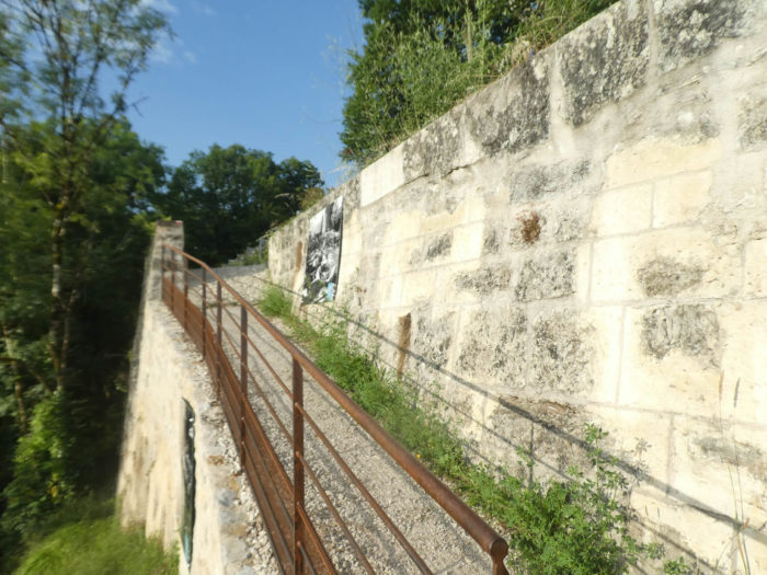
| On the detour, a small road runs back under the cliffs, along the river. | |
 |
 |
| Further on, the road begins a big bend to return to the village, in the middle of deciduous and abundant walnut trees here. | |
 |
 |
| The slope is nearly 10% to reach the first houses of the village. | |
 |
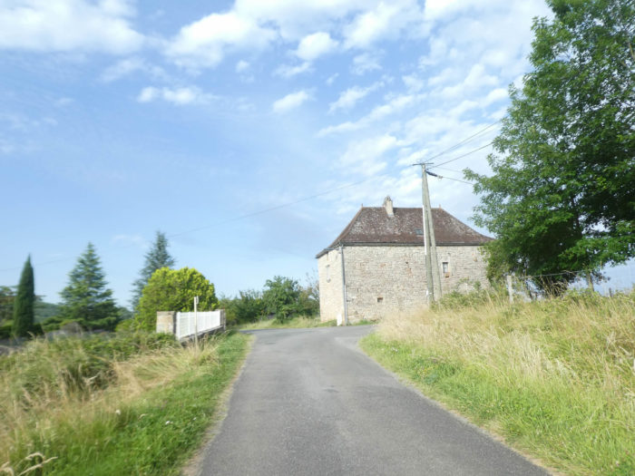 |
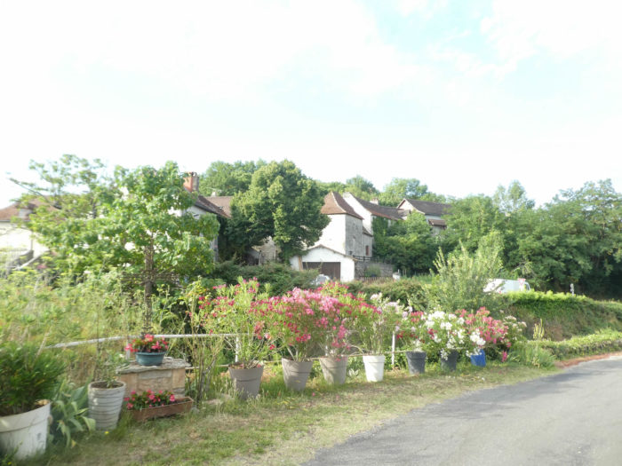
| The road crosses a fairly large village, passes in front of the church, without much character, will say it thus. | |
 |
 |
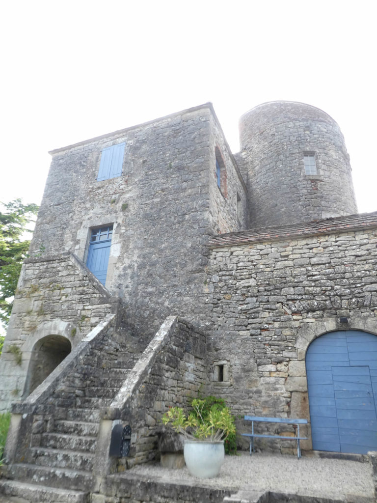
The village is home to the castle of Salvagnac-Cajarc, an austere building, dating back to the origins of the 13th century, deeply transformed into a dwelling house.
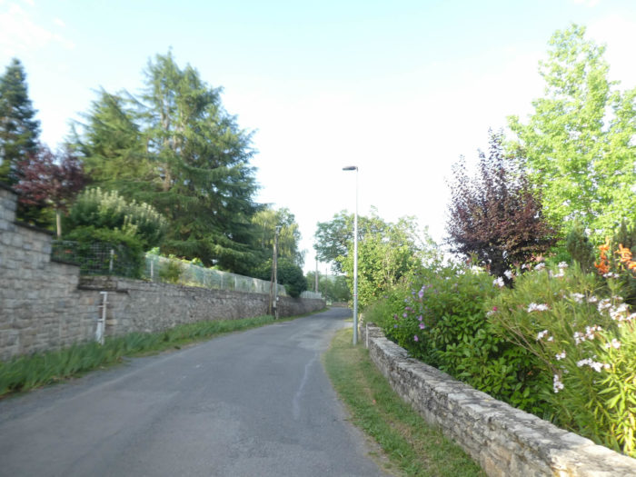
| Flower beds brighten up the village, cut in two, as the departmental road passes through the middle of the village. | |
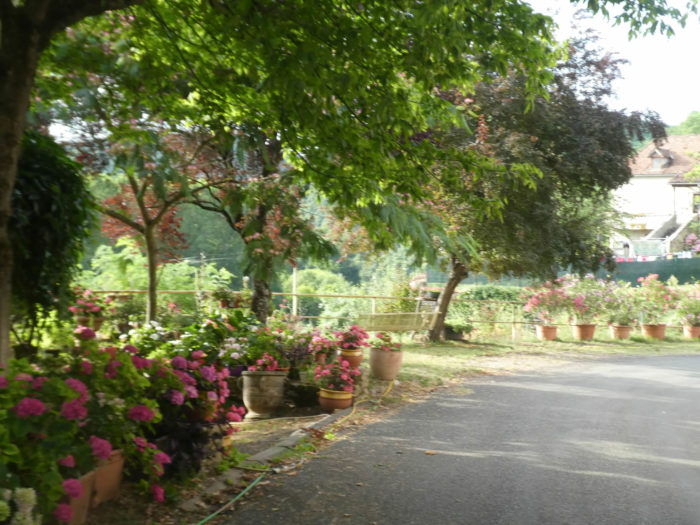 |
 |
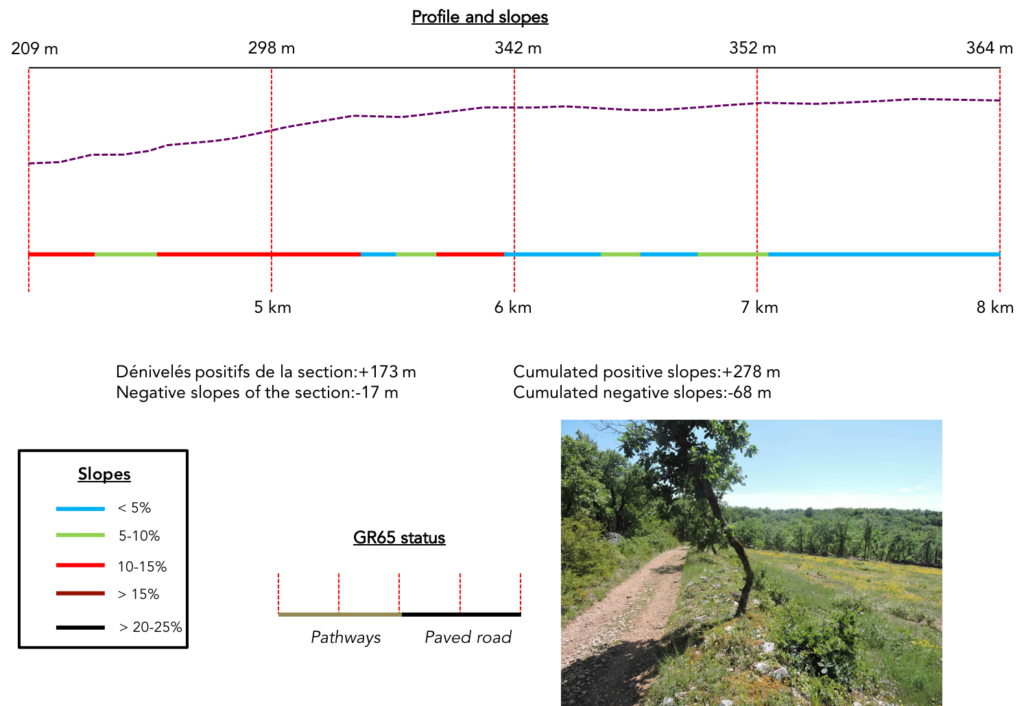
Section 2: A causse, as you may like them.
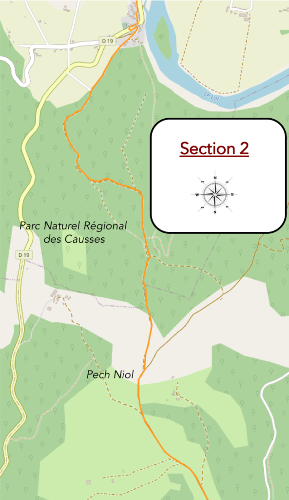
General overview of the difficulties of the route: slopes, often more than 10% to climb the causse (almost 150 meters of vertical drop in just over a kilometer), then unimportant ups and downs.
| Further ahead, the GR65 slopes down to cross the departmental road, to join the old GR route and gently slope up in the other part of the village. Judge for yourself if the detour is worth it. For us, frankly no. | |
 |
 |
 |
 |
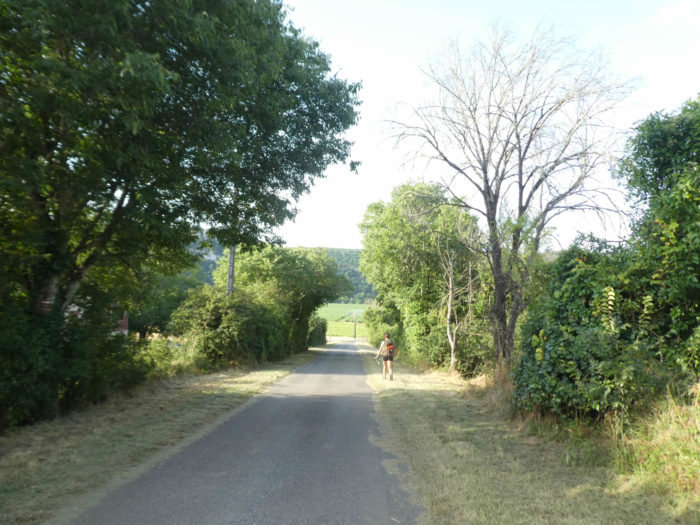
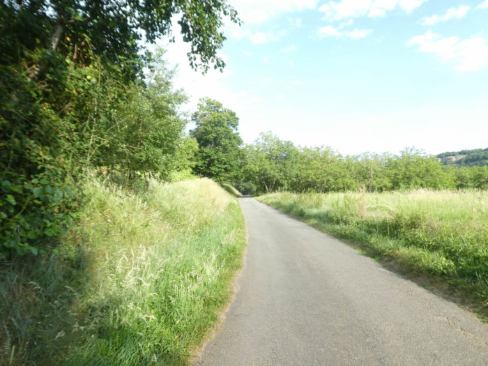
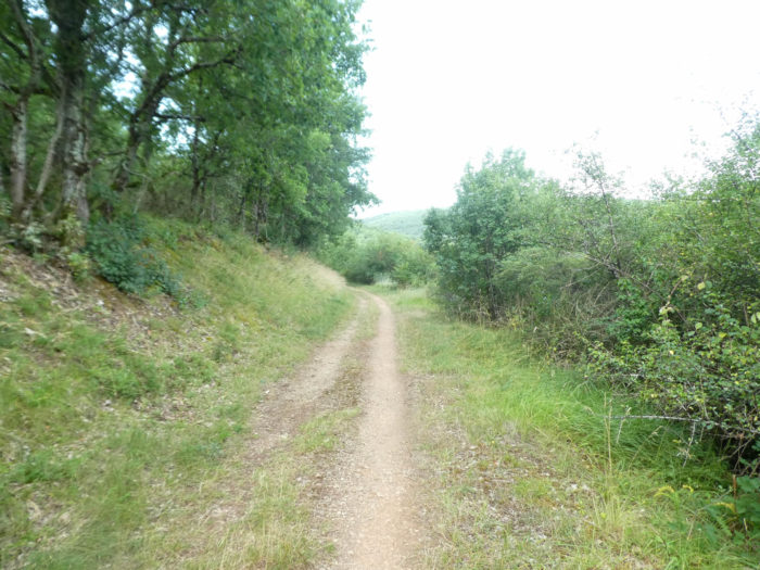
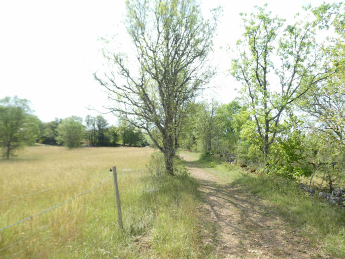
| On leaving the village, a wide dirt road slopes very gently along the undergrowth. | |
 |
 |
Montpellier maple, with its three-lobed leaves, is present in abundance.

| Little by little, the track approaches the forest of Pech Bézet, at the start of the causse. | |
 |
 |
|
Here the pathway will slope up without saying a word. It is a fairly wide pathway, very stony, which zigzags quite toughly. |
|
 |
 |
|
Sometimes it’s a veritable pavement of glossy shale. |
|
 |
 |
|
A few boxwoods, dogwoods, junipers or wild grasses, sometimes lavender in the rockery, complete the vegetation almost exclusively made up of oaks. The oaks, which here as elsewhere in the region, perish of old age and not by the hand of men, usually stand straight, tight, sometimes twist in the way, sweeping the air with their skeletal branches. The other plant species, small hornbeams, country maples and Montpellier maples complete the crew. |
|
 |
 |
|
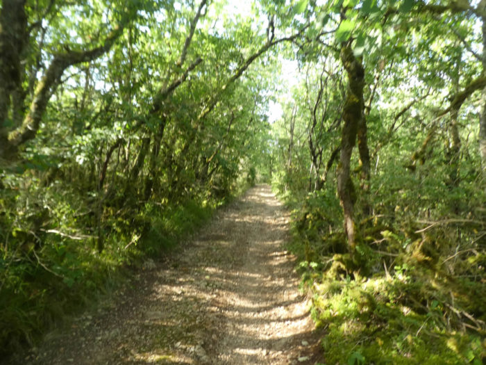
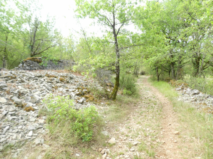
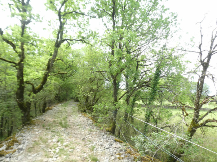
It must be said that the climb on the causse is no small joke. Starting at an altitude of 150 meters on the banks of the Lot River to get there, at around 340 meters, this is the program. Sometimes the ocher ground is almost as smooth as a penny, but more often it is lined with small sharp stones. The stones roll more and more on the pathways covered with limestone. |
|
 |
 |
|
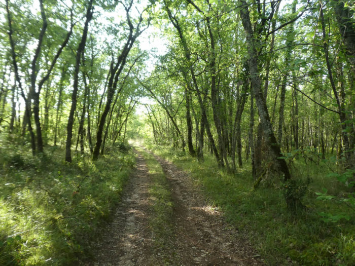
The pathway soon leaves the forest and arrives at the top of the causse in the open nature. |
|
 |
 |
As if you were there, on a bright day…
Wait for the video to load.
|
Today the sky is a bit hazy and the light less favorable. We also passed here at the end of spring, on a dizzying clear day. So, there are places where the magic happens, where the light and the landscape come together to take your breath away. Even more so when the walker comes to the end of a long climb. Then time stands still and the gaze never ceases to contemplate these magnificent moors, with these forests which are lost in an endless horizon. |
|
 |
 |
|
Yet, to keep a certain unity of presentation of the stage, we will continue with the somewhat hazy light of this summer day. Soon after, the GR65 smoothens along the low walls of the causse. |
|
 |
 |
|
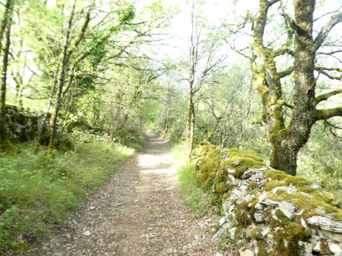
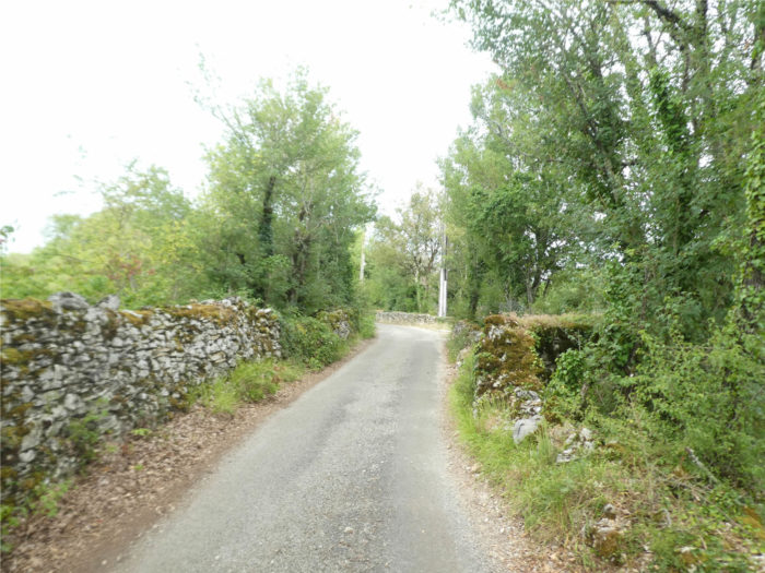
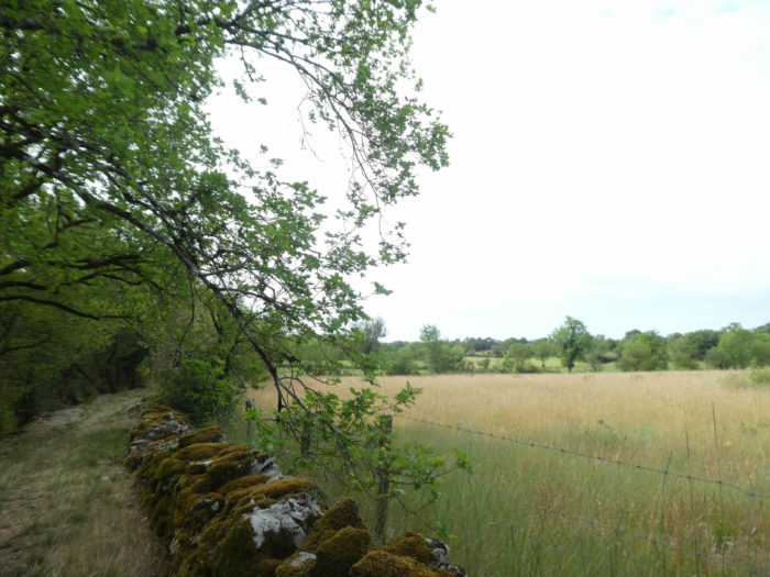
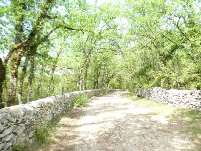
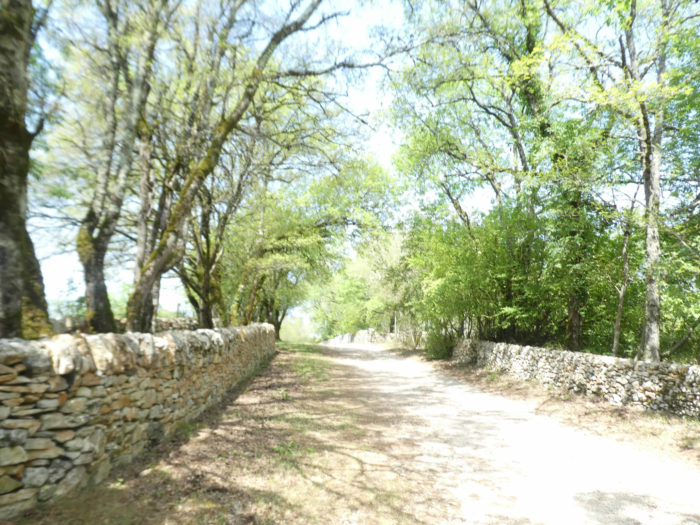
Very beautiful stone walls delicately dressed in thick moss line the pathway, in the shade of oaks and Montpellier maples, until you reach a paved road further on. |
|
 |
 |
|
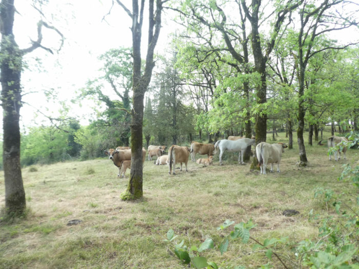
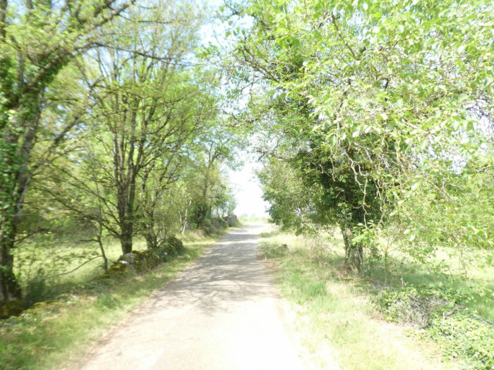
The tar ribbon will accompany you for more than a kilometer to Mas de Jantille on very ups and downs and false flats. The road continues to climb a little, to reach the top of the causse, somewhere near Pech Niol, at an altitude of 370 meters. Aubrac cows still wonder who these strange animals are with a bag on their back. |
|
 |
 |
|
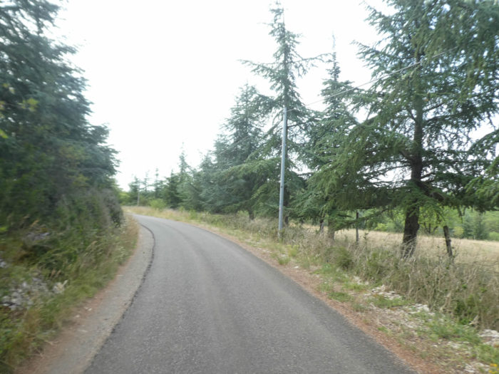
Sometimes white firs were planted en masse along the road. |
|
 |
 |
|
Only the breeding takes place, in a few lean meadows that the forest has generously spared for the good of men. Cows and sheep roam freely in the meadows, in the total absence of shepherds. Although you are already quite far from the Aubrac plateau, Aubrac cows remain the masters of the causses. |
|
 |
 |
Section 3: In the vernacular heritage of the Causse de Limogne.

General overview of the difficulties of the route: course without any difficulty.

|
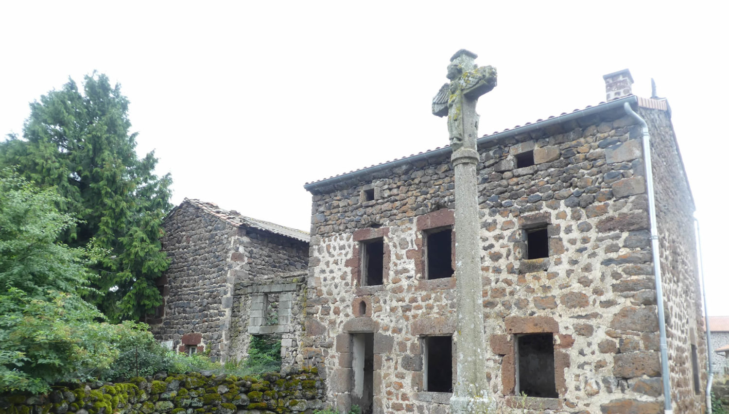
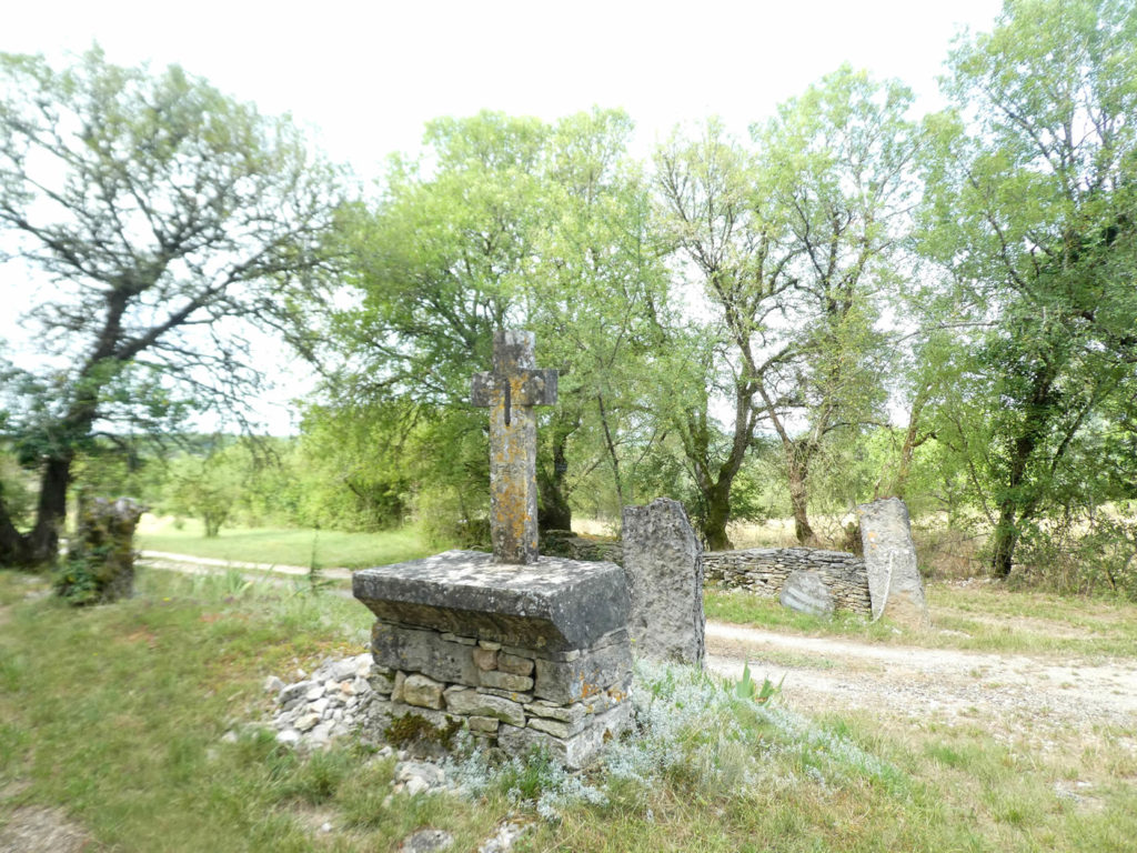
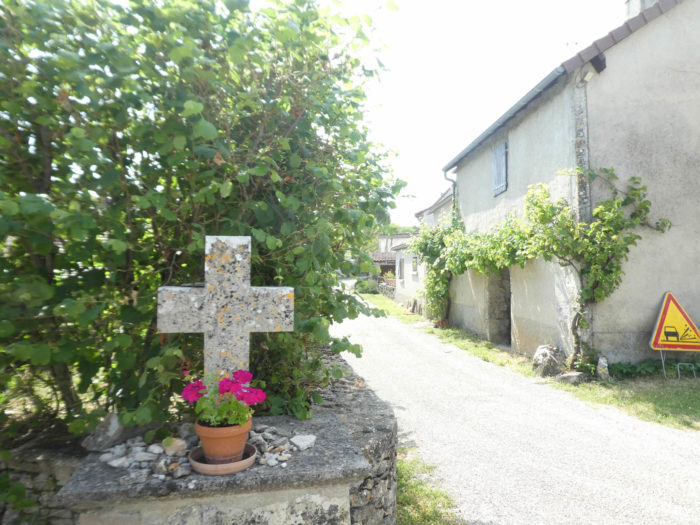
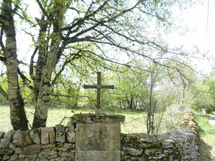
Further on, the white firs have taken over the hill. And the road runs by, from low walls to clumps of trees, until you find a dirt road that slopes down to the Mas de Jantille, near a beautiful stone cross from the middle of the 17th century. The marks of recognition left by the pilgrims on the passage mark the landscape. Religious signs are numerous on the track. |
|
 |
 |
|
The pathway descends along the stone walls. Before your eyes nestle the many Mas that the track will cross in gentle hills. |
|
 |
 |
|
The pathway soon reaches the Mas de Jantille, hidden under the walnut trees, where you can find accommodation. |
|
 |
 |
|
A wide dirt road dotted with grass then descends along hedges, stone walls or limestone slopes, where moss and heather run. All over the region, lizards meander, fleeing between the stones at the slightest alarm. |
|
 |
 |
|
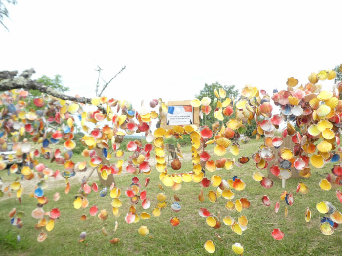
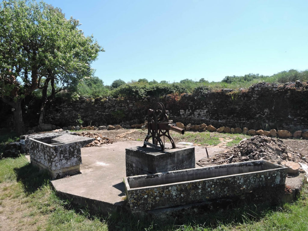
The pathway soon arrives at a water point, now adorned with a refreshment bar, the most beautiful on the Camino de Compostela. When the walker arrives in this place, fullness and happiness flood his face. Water, yes, fresh water to fill his often-half-empty gourd! It is also a small refreshment bar where pilgrims congregate. A garland of small flags and shells waving in the wind reminds you of the party places you can see in South America. |
|
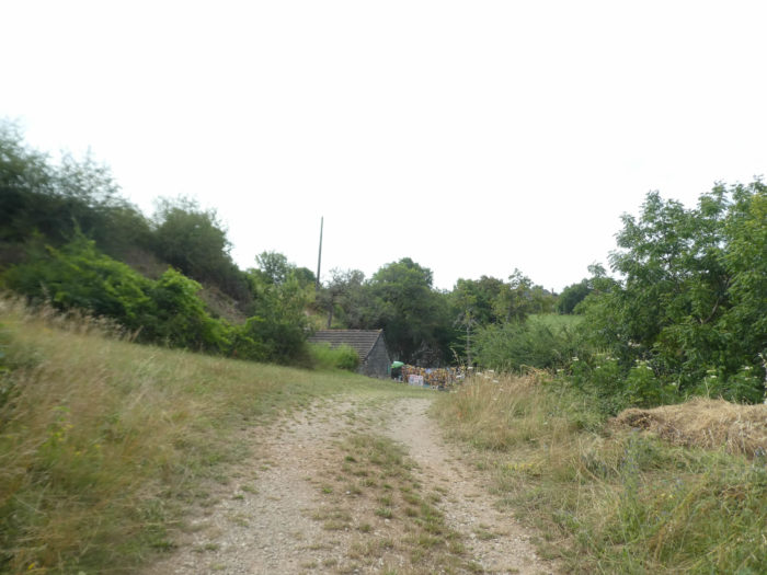 |
 |
|
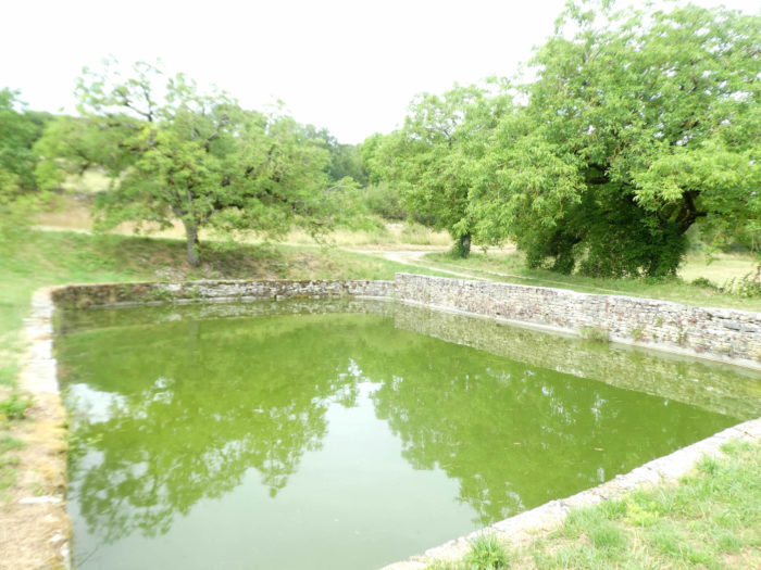
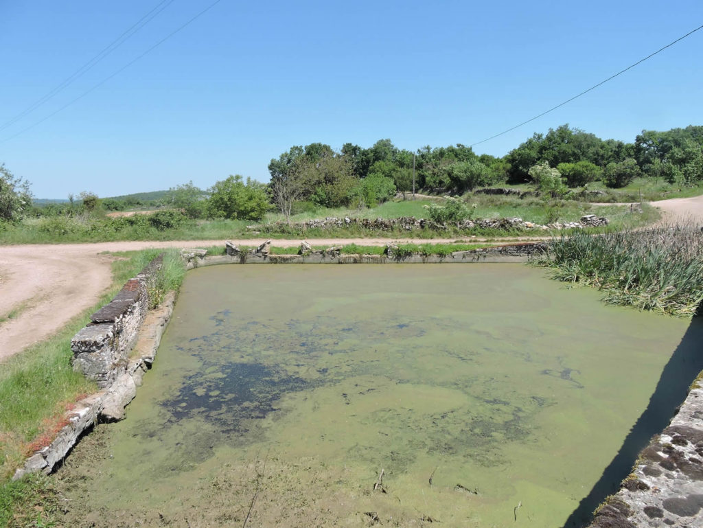
And then, in the shade of the oaks, under the small wall, nestles a delicious “butterfly wash”. Before washing machines, washhouses have always been an integral part of the lives of housewives. On the Causse de Limogne, the pond and butterfly wash house are like so many mirages that recall a distant past forever. What was the practice? Several times a year, housewives went to the laundry for the “big laundry”. Previously, they had laundered the laundry at home, bleaching it in boiling water mixed with ash. They then loaded all the equipment and left for the washhouse, with chats and hard work in perspective. The washerwomen had to scrub, beat the laundry, rid it of the grayness of the ash. The stones of the washhouse, placed face to face (butterfly), allowed the washerwomen to lean against them to chat. Then, the silent carps of the basin replaced the housewives. |
|
 |
 |
The green, stagnant water of the pond, which only the croaking of toads in spring brings to life, continues to have its share of mystery. In recent years, butterfly pond carps have migrated here.
|
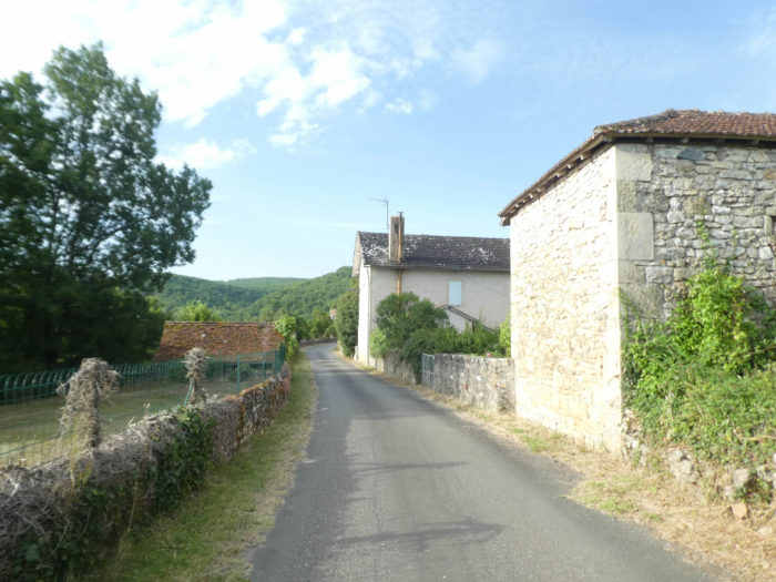
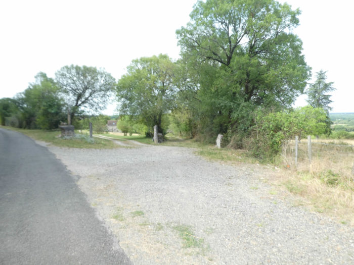
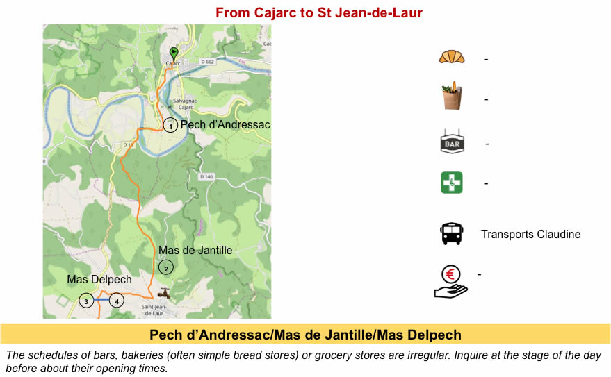
Nearby, St Jean-de-Laur is a small village of 200 inhabitants, with its beautiful stone houses and dovecotes. The region was inhabited very early on, as the presence of tumuli and dolmens indicates. Life gradually disappeared from the region. In the past, there were phosphate mines and vineyards here. There is little more than the truffle and the breeding of lambs to awaken the pride of these small villages. The GR65 does not pass through St Jean-de Laur. It runs on a small paved road to Mas de Mathieu. Nearby, at Mas del Pech, you can find accommodation. |
|
 |
 |
|
The paved road then crosses these hamlets which are often conceived only as clusters of simple stone houses, sometimes more opulent dwellings hidden under the trees. |
|
 |
 |
|
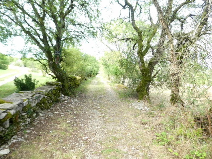
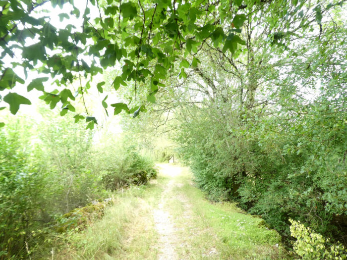
From here, The GR65 will dawdle for a long time on a small lane that hesitates between stones and grass, well in the spirit of the causses, under the oaks, with many country or Montpellier maples, and clusters of dogwoods along the way. |
|
 |
 |
|
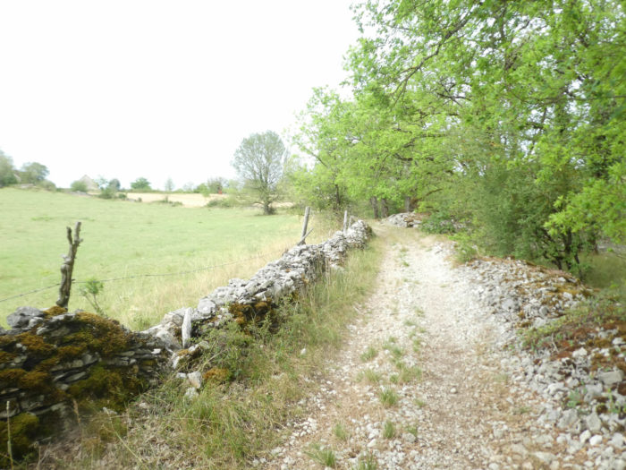
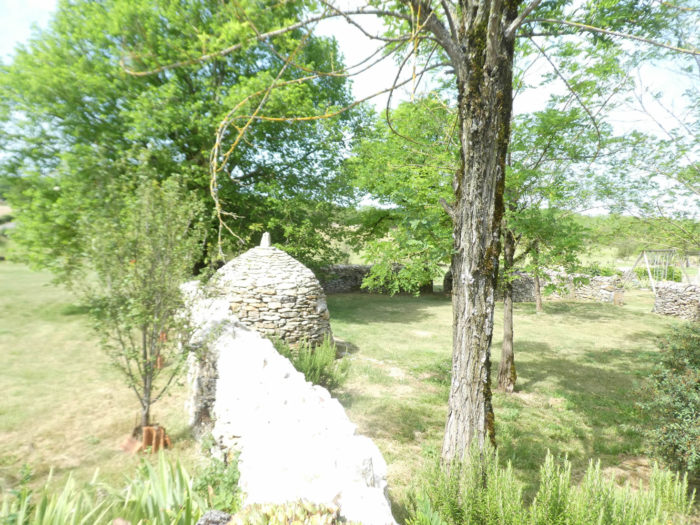
Stunted hardwoods, low walls where the eye is always lost, meadows on which the activity of men hardly spills over, this is the program of celebrations. The stones are not only the base of these magnificent low walls, the “cayrous”, as they say in the region, which are like so many sentries along the roads. Stones are also the basic material of the often abandoned “caselles”. |
|
 |
 |
|
And always these piles of stones, organized or not, that the tractor has taken out of the ground, to allow planting here and there a little grain in this barren soil. And then, flies everywhere, which sometimes send a sign to the solitude of the walker. |
|
 |
 |
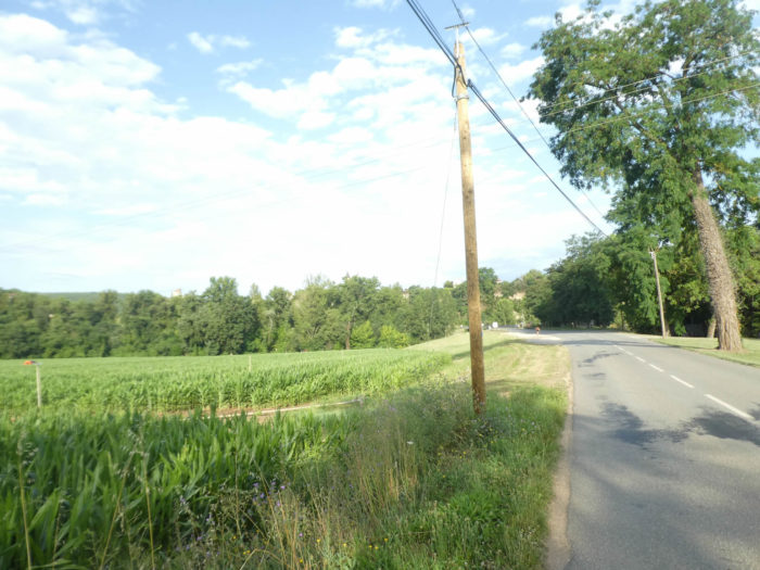
Wild beauty bursts forth everywhere in the causses, whose origin hesitates between the word hot and the word rock. These are the two that make up the whole. Everywhere, limestone is exposed to the surface, in the houses, on the stone walls. Rainwater quickly seeps into the soil, rarely stagnates. The soils are poor and sheep often graze only a short steppe. The cows are a little more fortunate, and they are sometimes assigned beautiful pastures, between the oak groves.

Section 4: From one “Mas” to another.

General overview of the difficulties of the route: course without any difficulty.
|
At the end of this very long pathway in the undergrowth the GR65 gets at the bottom of Mas des Bories. |
|
 |
 |
We are going to offer you here brighter images of this timeless heritage, taken in another period.
At the foot of the village, it is still the Middle Ages that remains by the wayside, with the vernacular heritage, in other words the small heritage, that which brings together wealth often neglected, the use of which is lost over time. Who would still use this butterfly wash house whose limestone has eroded over time and has become covered with fungi? What about that rusty water pump that probably no one could turn on yet?
Who would dare to go soak those feet in the stagnant water of the pond if it wasn’t for the toads in late spring?
|
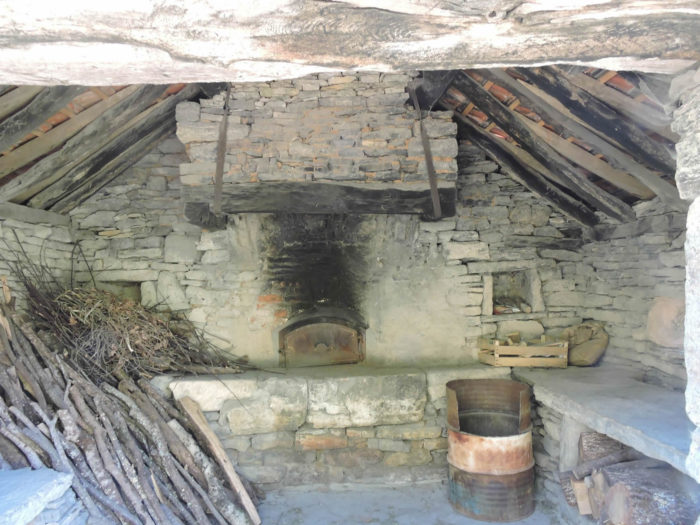
In the village, magnificent dovecotes, stone houses, low and almost flattened, brighten up the landscape. A few years ago, the communal bread oven was rebuilt. There are hamlets that are wasting less than the others. Houses age but do not die thanks to the good care of men. The hamlet is deserted, but life, you can guess. Here, in front of a door, you will find everything you need for milking the goats: a large-necked funnel, the skimmer, a mess of buckets. |
|
 |
 |
|
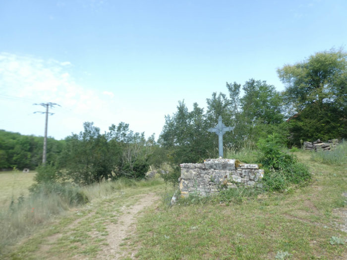
You leave the Mas des Bories and its cross. The crosses, whether they are Calvaries, mission crosses or reference crosses, or even oratories, are all reference points, religious or not, for the traveler on the way. Here you are 6 km to Limogne-en-Quercy. |
|
 |
 |
|
Beyond Mas de Bories, the GR65 sets off again on a gentle descent on the tar, along hedges populated with brambles, rosehips and dogwoods. There is hardly any boxwood around here. As elsewhere in the causses, dogwoods are the mimosas of the causses. For many, it is spring, the season of renewal, when the cycles begin again, the time of choice for hiking. Trees and bushes are disguised in all shades of fresh green. Others will prefer fall or summer, when sometimes the colors are duller and the flowers have faded until the new season. |
|
 |
 |
|
The road thus progresses under the trees. Over the causse, you never know if the stone huts are still functional or not. Who knows? Most of them are undoubtedly there only for the pleasure of your eyes, located under the leafy trees, between reality and dreams. |
|
 |
 |
|
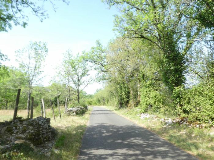
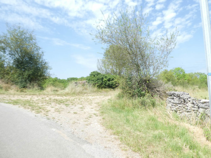
Today, you may sometimes meet a few dark heroes who patch up the walls. These kilometers of dry walls were built, stone after stone, especially in the 19th century, when the Lot department had twice as many inhabitants. The soil had been cleared of stones to increase arable land and pastures. So, each square meter gained in the woods was worth its sack of wheat or its grass for the cattle. Then it all faded away with the death of smallholder farming and the mass exodus to uncertain urban havens. Since then, the forest has regained its rights, gradually erasing all traces of humans. All that remains is the low walls which delight hikers and a few locals, in love with their land and their heritage. Some can no longer stand up, eaten as they are by ivy, moss, brambles and bad weather. |
|
 |
 |
|
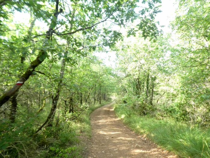
After a kilometer of road, the GR65 regains the flavor of the undergrowth. Everything is dry around here. There are so few streams, no rivers on the causse. |
|
 |
 |
|
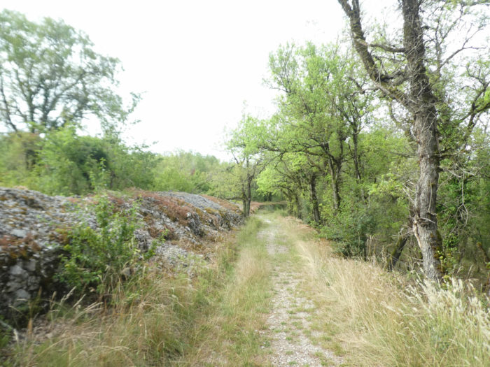
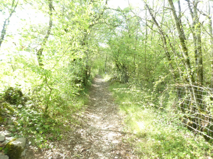
A narrow stony forest pathway first climbs quite steeply, then slopes more gently into the forest. On these rocky slabs and on these poor soils, plants proliferate quite resistant to drought such as lichens, junipers, privets, brooms, wild dogwoods, more rarely here boxwood, unless it has been recently decimated by the spirals. Lichens and mosses go so far as to line everything mineral here, sometimes even trees. |
|
 |
 |
Can you dream of a bed as soft as this carpet of moss offered by nature under the oaks as straight as Mikado’s baguettes? Well! There are not only oaks in the causses, even if they have taken power. Sometimes a maple succeeds in making its nest.

|
Further on, the pathway gradually leaves this paradise of trees and finds again some meadows. You’ll also see plantations of truffle oaks, which can be recognized by the dark stain that the mycelium makes around the trees. Limogne-en-Quercy is one of the bastions of the Lot truffles. Shortly after, you are walking on the paved road again. |
|
 |
 |
|
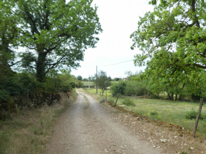
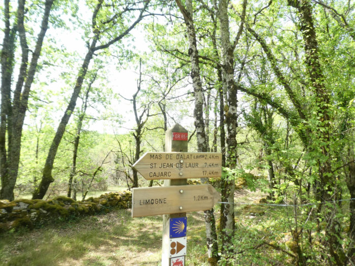
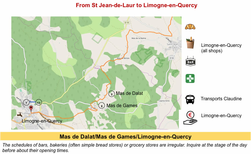
It is always a pleasure to walk around the causse, of course, but the tar, whether you like it or not, distorts the landscapes a little. Then the road slopes down, then up again towards the hamlet of Mas de Dalat. A beautiful granite cross rests at a crossroads in the village. As usual, near the villages, the peasants have planted ash trees. |
|
 |
 |
 |
 |
|
Only a few beautiful stone houses occupy the hamlet. One of them is a very beautiful stone house, where you can find accommodation. |
|
 |
 |
|
In Mas de Dalat, for the first time today, the view emerges over the open causse. A road leaves the village. There are even cereals growing here. |
|
 |
 |
|
Quite quickly, you’ll find again the traditional pathway and the vegetation of the causses. |
|
 |
 |
|
Momentarily, the causse is less beautiful here than before. It is also that man has dared to disorganize this wild nature. In fact, above the pathway, animals are raised in concrete boxes, maybe pigs. |
|
 |
 |
|
It is good that the peasants also live in this universe where a “caselle” still lives its beautiful death, leaning against the causse. |
|
 |
 |
|
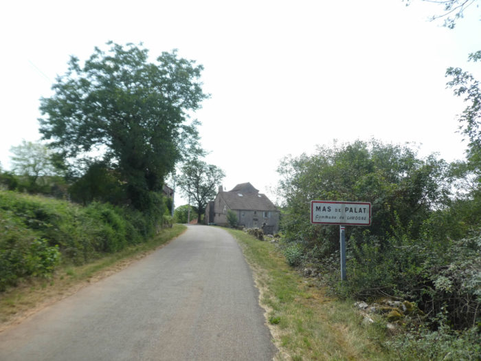
A small road then climbs towards Mas de Palat. |
|
 |
 |
|
A few gray sandstone houses make up the small hamlet. |
|
 |
 |
|
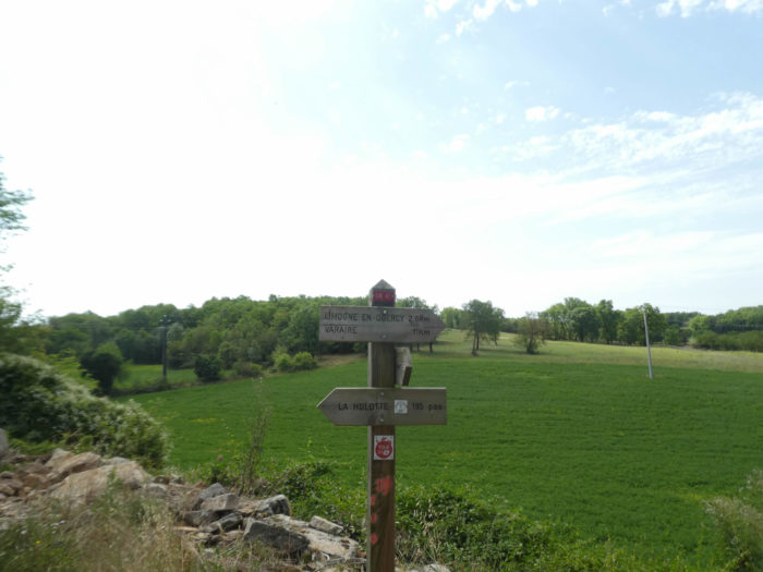
Accommodation can be found 195 paces from here. The road continues to descend a little under the hamlet, where a farm plays the local lords. |
|
 |
 |
Section 5: Limogne-en-Quercy, in the land of black truffles.
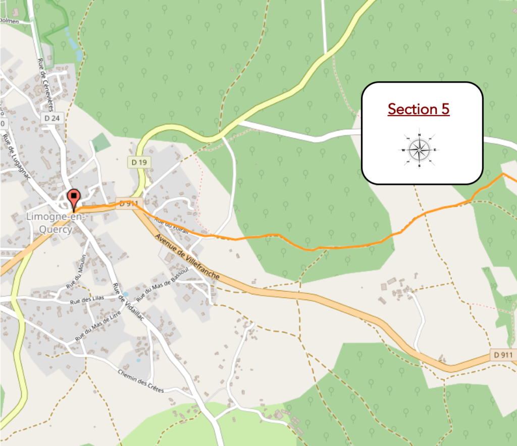
General overview of the difficulties of the route: course without any difficulty.
|
Near a metal cross, the GR65 finds again the pathways of the causses, oaks, dogwoods, along dry-stone walls, which are the true ambassadors of the causses. |
|
 |
 |
|
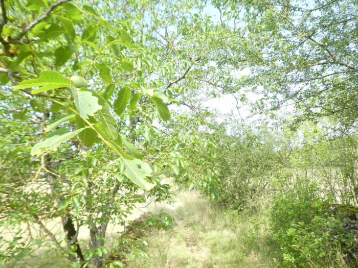
Fig trees, walnut trees and sloe trees, all wild, are lined up on the pathway here. For the nuts, it’s quite difficult to bite into them. But for figs and plums, it is still necessary to walk to the right period. Wild plum trees on the Causse de Limogne are however less abundant than on the Causse of Rocamadour. |
|
 |
 |
|
The pathway then undulates a little, on small vales and dales in the undergrowth. It is first a small grassy pathway, which gradually widens into a stonier track. Moss everywhere covers the stone walls. Here, as throughout the course, there is silence until you reach Limogne-en-Quercy, less than 2 kilometers away. |
|
 |
 |
|
And the round of mossy low walls and “caselles” lost near the woods starts again. The vernacular heritage is omnipresent in this stage. |
|
 |
|
 |
 |
|
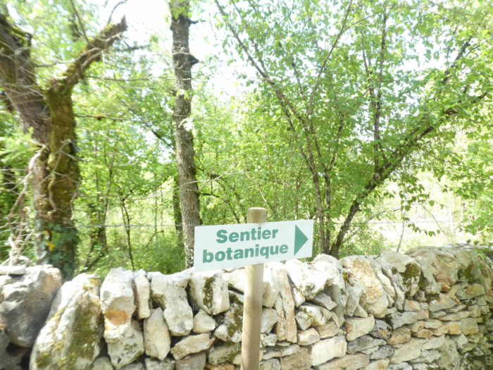
Shortly after, the GR65 joins a botanical track. |
|
 |
 |
|
Between the large walls, you can get a more precise idea of the trees and bushes you have encountered in the region. |
|
 |
 |
|
On this wide avenue of charm and poetry, you get closer to Limogne-en-Quercy. |
|
 |
 |
|
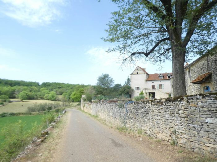
The pathway, after crossing a large park, arrives at the bottom of the village. |
|
 |
|
|
The departmental road crosses the village, passes in front of the communal gîte to reach the center where the shops are grouped. |
|
 |
 |
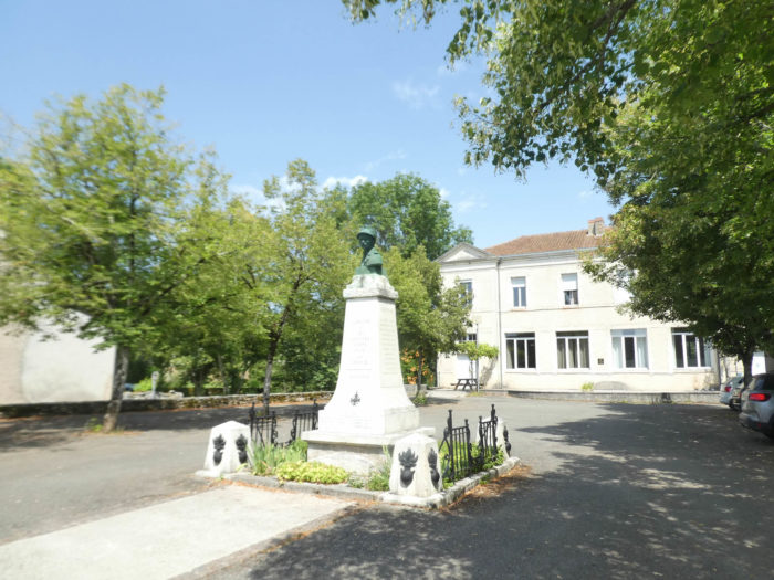
The village has less than 800 inhabitants. It is not just the pilgrims Compostela who stop here. There are lovers of the beauty of the landscapes of the causses, but especially lovers of truffles. There is an almost permanent truffle market, every Friday, from December to March, and from June to August. For truffles, the local competitor is Lalbenque, a little further on the track, closer to Cahors. Sunday in Limogne-en-Quercy is market day.

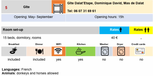
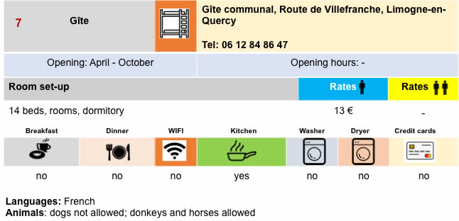
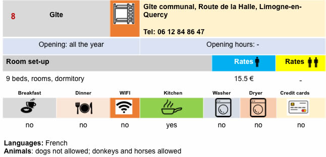
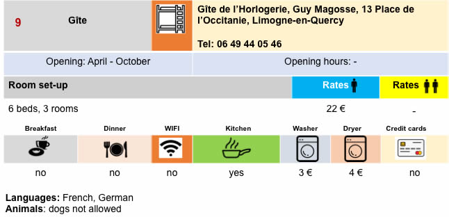
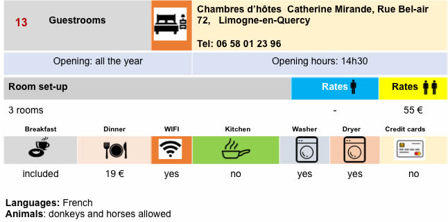
Lodging

 |
 |
 |
 |
 |
 |
 |
 |
 |
 |
 |
 |
Feel free to add comments. This is often how you move up the Google hierarchy, and how more pilgrims will have access to the site.
 |
Next stage : Stage 15: From Limogne-en-Quercy to Vaylats |
 |
Back to menu |